|
|
For the most recent reports from Nevis see this page.
- - - 2017 Hurricane Season - - -
|
- Distance at 11 am
|
- By "Harry W. Hallstrom" <hwh888 at gmail.com>
- Date: Tue, 5 Sep 2017 11:54:44 -0400
|
Greetings all,
Distances from Nevis as of 11 am data.............
INIT  05/1500Z 16.8N  58.4W  155 KT 180 MPH
 12H  06/0000Z 17.2N  60.3W  155 KT 180 MPH ----137 mi
 24H  06/1200Z 18.1N  63.0W  150 KT 175 MPH ---- 73 mi (moving away)
 36H  07/0000Z 19.1N  65.9W  145 KT 165 MPH
 48H  07/1200Z 20.1N  68.7W  140 KT 160 MPH

Reports from an Air Force Hurricane Hunter aircraft indicate that
the maximum sustained winds are near 180 mph (285 km/h) with higher
gusts.  Irma is a an extremely dangerous category 5 hurricane on the
Saffir-Simpson Hurricane Wind Scale.

Hurricane-force winds extend outward up to 60 miles (95 km) from the
center and tropical-storm-force winds extend outward up to 160 miles
(260 km).

The latest minimum central pressure reported by reconnaissance
aircraft is 931 mb (27.50 inches).
Harry
|
|
- 11 am Irma - Nevis
|
- By Frank Goodwill <nevis.storm at hotmail.com>
- Date: Tue, 5 Sep 2017 15:15:21 +0000
|
|
Good morning everyone,
The wind (breeze) has started to pick up a bit now over the last hour or so.
Hurricane Irma is starting to show up rain wise on the Guadeloupe/Martinique radars (see attached).
The long trial up to 11am AST this morning is interesting as it heads towards us. (See attached)
SUMMARY OF 1100 AM AST...1500 UTC...INFORMATION
-----------------------------------------------
LOCATION...16.8N 58.4W
ABOUT 225 MI...365 KM E OF ANTIGUA
ABOUT 230 MI...370 KM ESE OF BARBUDA
MAXIMUM SUSTAINED WINDS...180 MPH...285 KM/H
PRESENT MOVEMENT...W OR 270 DEGREES AT 14 MPH...22 KM/H
MINIMUM CENTRAL PRESSURE...931 MB...27.50 INCHES
The closest point the centre of hurricane Irma will pass Nevis continues to decrease. Before itt was 60 miles at 11:30 am on Wednesday, now it is 53.5 miles at 08:00 am Wednesday (Stormcarib app)
Regards,
Frank Goodwill
Pond Hill, Nevis Weather Station
weather Cams
Outlook for Android
Attachment:
Gandm 11 20170905.jpg
Description: Gandm 11 20170905.jpg
Attachment:
120644_wind_history.png
Description: 120644_wind_history.png
|
|
- Arrival times and message
|
- By "Harry W. Hallstrom" <hwh888 at gmail.com>
- Date: Tue, 5 Sep 2017 10:57:36 -0400
|
Greetings All,
As everyone should already know this....... Here is the 11 am msg from NHC.......
1. Irma is a potentially catastrophic category 5 hurricane and will bring life-threatening wind, storm surge, and rainfall hazards to portions of the northeastern Leeward Islands beginning later today and the Virgin Islands and Puerto Rico beginning tomorrow. Preparations should be rushed to completion before the arrival of tropical-storm force winds later today in the Leeward Islands and tomorrow morning in Virgin Islands and Puerto Rico.
Got my weather station back online, power off last night again (sign). See previous post for link.
Starting to see pickup of breezes, not winds mind you.
Harry |
|
- Nevis Warning ⚠️
|
- By "Harry W. Hallstrom" <hwh888 at gmail.com>
- Date: Tue, 05 Sep 2017 10:43:18 +0000
|
|
Greetings All,
Looking at at 5am data it appears the swing around the Atlantic hi is/will be later than modeled. IRMA is still tracking due west and we are now in the hurricane force zone. Winds at 150 mph. Be advised to expect winds well over 100 mph possible even max at 150. This is the most dangerous hurricane since Hugo of 30 yrs ago. I have a feeling power lines will be down with all the trees I see dangerous close to them & improperly supported poles. Simply put - expect the worst.
Harry --
Sent via IPhone.
|
|
- Nice Day pre-Hurricane Irma
|
- By Frank Goodwill <nevis.storm at hotmail.com>
- Date: Tue, 5 Sep 2017 04:44:32 +0000
|
|
Good night all,
The shops were busier than usual as folks stocked up on items and the sound of hammering was heard in the neighbourhood as windows were being boarded up. So the message was getting through.
A couple of photos showing that Monday evening was pleasent.
IOn Nevis if you haven't sorted yourself out It might be difficult due to early closures Tuesday.
Banks will be closing at 11am
TDC Group of businesses at 12 noon
RAMS closed all day Tuesday (their notice).
Valu mart IGA open weather permitting.
Other stores Supafoods, Bestbuy may be open.
All schools and government offices will be closed Tuesday and Wednesday
Inter island ferries started to wind down Monday afternoon so it may be doubtful if any are running Tuesday into Wednesday due to sea conditions.
Impact on air travel
See www.liat.com and www.winair.sx for their updates
British Airways have cancelled their Tuesday L/Gatwick - Antigua - Tobago and return flight
No decision has been made on the Wednesday L/Gatwick - Antigua - St. Kitts and return flight yet.
Contact the airline for further details.
Nevlec may turn the power grid off as winds increase due to safety reasons. So this may happen over Tuesday night. Restoration is dependant on any damage e.g. poles/lines down or tree branches falling on wires etc.
Make sure your cellphone is fully charged and prepaid topped up before Tuesday night.
For practice we had a power outage in the Pond Hill, St John's/Gingerland area from 7:30pm for an hour.
Regards,
Frank Goodwill
Pond Hill, Nevis Weather Station
weather Cams
Outlook for Android
Attachment:
20170904 sunset bs1.jpg
Description: 20170904 sunset bs1.jpg
Attachment:
20170904 sunset bs2 .jpg
Description: 20170904 sunset bs2 .jpg
|
|
- Update on winds
|
- By "Harry W. Hallstrom" <hwh888 at gmail.com>
- Date: Tue, 05 Sep 2017 01:13:38 +0000
|
|
Nevis is now in the 80-90 mph zone 1-minute sustained winds, expect higher in gusts.
Harry --
Sent via IPhone.
|
|
- Weather Station Info
|
- By "Harry W. Hallstrom" <hwh888 at gmail.com>
- Date: Mon, 4 Sep 2017 15:13:55 -0400
|
Here is a link to my weather station, live all the time.........Internet permitting.
|
|
- Nevis & IRMA
|
- By "Harry W. Hallstrom" <hwh888 at gmail.com>
- Date: Mon, 4 Sep 2017 14:59:30 -0400
|
Greetings All,
Gleaming latest data from NHC this is what I see for Nevis.............
 12H  05/0000Z 16.5N  54.8W  115 KT 130 MPH
 24H  05/1200Z 16.7N  57.1W  120 KT 140 MPH ---- 350 mi
 36H  06/0000Z 17.3N  59.6W  120 KT 140 MPH ---- 180 mi
 48H  06/1200Z 18.2N  62.4W  125 KT 145 MPH ----  80 mi (closest point)
72H 07/1200Z 19.9N 68.0W 120 KT 140 MPH ---- 400 mi (24 hrs later) Hurricane-force winds extend outward up to 35 miles (55 km) from
the center and tropical-storm-force winds extend outward up to 140
miles (220 km).
The estimated minimum central pressure based on data from an Air
Force Reserve Hunter aircraft is 944 mb (27.88 inches).
For sure Nevis will feel storm force winds. Storm force would mean below 75 mph.
I would still expect gusts above that just to be on the safe side, so plan accordingly.
It's close enough to be a major threat, if it deviates 20-30-40 miles closer it becomes even more dangerous.
Stay Safe everyone !!!!
Harry
|
|
- Latest 5pm data........
|
- By "Harry W. Hallstrom" <hwh888 at gmail.com>
- Date: Sun, 3 Sep 2017 17:38:55 -0400
|
No surprise here,
NHC reports a Hurricane Hunter Aircraft is flying at 5pm for accurate storm readings in the different quadrants.
HURRICANE IRMA FORECAST/ADVISORY NUMBER  18
NWS NATIONAL HURRICANE CENTER MIAMI FL       AL112017
2100 UTC SUN SEP 03 2017

CHANGES IN WATCHES AND WARNINGS WITH THIS ADVISORY...

THE GOVERNMENT OF ANTIGUA HAS ISSUED A HURRICANE WATCH FOR THE
ISLANDS OF ANTIGUA... BARBUDA... ANGUILLA... MONTSERRAT... ST.
KITTS... AND NEVIS.

THE GOVERNMENT OF THE NETHERLANDS HAS ISSUED A HURRICANE WATCH FOR
THE ISLANDS OF SABA... ST. EUSTATIUS... AND SINT MAARTEN.

THE GOVERNMENT OF FRANCE HAS ISSUED A HURRICANE WATCH FOR ST.
MARTIN AND SAINT BARTHELEMY.

SUMMARY OF WATCHES AND WARNINGS IN EFFECT...

A HURRICANE WATCH IS IN EFFECT FOR...
* ANTIGUA... BARBUDA... ANGUILLA... MONTSERRAT... ST. KITTS... AND
NEVIS
* SABA... ST. EUSTATIUS... AND SINT MAARTEN
* SAINT MARTIN AND SAINT BARTHELEMY

INTERESTS IN THE REMAINDER OF THE LEEWARD ISLANDS... THE BRITISH AND
U.S. VIRGIN ISLANDS... AND PUERTO RICO SHOULD MONITOR THE PROGRESS
OF IRMA. ADDITIONAL HURRICANE AND TROPICAL STORM WATCHES MAY BE
REQUIRED FOR PORTIONS OF THIS AREA ON MONDAY.

HURRICANE CENTER LOCATED NEAR 17.6N  49.8W AT 03/2100Z
POSITION ACCURATE WITHIN  15 NM

PRESENT MOVEMENT TOWARD THE WEST OR 260 DEGREES AT  12 KT
Here is what I calculate as of 5pm.............

 24H  04/1800Z 16.8N  53.5W  110 KT 125 MPH
 36H  05/0600Z 16.8N  55.8W  115 KT 130 MPH
 48H  05/1800Z 17.3N  58.2W  120 KT 140 MPH ----290 miles away
 72H  06/1800Z 19.1N  63.5W  120 KT 140 MPH ----147 miles away
 96H  07/1800Z 21.2N  68.8W  115 KT 130 MPH ----493 miles away
120H  08/1800Z 23.0N  73.5W  115 KT 130 MPH
|
|
- Watches and Warnings Hurricane Irma
|
- By Frank Goodwill <nevis.storm at hotmail.com>
- Date: Sun, 3 Sep 2017 20:57:38 +0000
|
|
As of 5pm AST
WATCHES AND WARNINGS
--------------------
The government of Antigua has issued a Hurricane Watch for the islands of Antigua, Barbuda, Anguilla, Montserrat, St. Kitts, and
Nevis.
The government of the Netherlands has issued a Hurricane Watch for the islands of Saba, St. Eustatius, and Sint Maarten.
The government of France has issued a Hurricane Watch for St. Martin and Saint Barthelemy.
SUMMARY OF WATCHES AND WARNINGS IN EFFECT:
A Hurricane Watch is in effect for...
* Antigua, Barbuda, Anguilla, Montserrat, St. Kitts, and Nevis
* Saba, St. Eustatius, and Sint Maarten
* Saint Martin and Saint Barthelemy
Interests in the remainder of the Leeward Islands, the British and U.S. Virgin Islands, and Puerto Rico should monitor the progress of
Irma. Additional Hurricane and Tropical Storm Watches may be required for portions of this area on Monday.
Regards,
Frank Goodwill
Nevis Weather
Get Outlook for Android
|
|
- IRMA Calculations
|
- By "Harry W. Hallstrom" <hwh888 at gmail.com>
- Date: Sun, 3 Sep 2017 10:25:09 -0400
|
Greetings All,
Here is what I calculate as for position/distance of the eye from Nevis based on NHC 5 am projected path
 36H  04/1800Z 16.5N  53.4W  110 KT 125 MPH ----- not calculated
 48H  05/0600Z 16.5N  55.7W  115 KT 130 MPH ----- not calculated
 72H  06/0600Z 17.8N  60.6W  120 KT 140 MPH  120 miles NE-NNE of Nevis
 96H  07/0600Z 20.0N  66.0W  115 KT 130 MPH  290 miles NW-NNW of Nevis
120H  08/0600Z 22.5N  71.5W  115 KT 130 MPH
It appears IRMA foward motion of path will speed up between 72 & 120 hrs as it moves away.
It's sti;; a tight packed storm but projected to grow as it moves closer with winds to 140 MPH.
I'm guessing Nevis will see 50 MPH Winds with gusts to 80 MPH, based on this projected path.
Will recalculate tomorrow am time again and compare to these figures.
|
|
- NOAA August Weather Date for Nevis
|
- By "Harry W. Hallstrom" <hwh888 at gmail.com>
- Date: Sat, 2 Sep 2017 10:07:21 -0400
|
Weather Station downloaded data file attached.
Attachment:
Aug 2017 - NOAA Weather Data.pdf
Description: Adobe PDF document
|
|
- Hurricane Irma
|
- By Frank Goodwill <nevis.storm at hotmail.com>
- Date: Fri, 1 Sep 2017 21:48:53 +0000
|
|
Good afternoon everyone,
Regarding Hurricane Irma, I think the US National Hurricane Center captures the key message on their discussion page:
"Irma is expected to be a major hurricane when it approaches the Lesser Antilles early next week, producing rough surf and rip currents. Irma could also cause dangerous wind, storm surge, and rainfall impacts on some islands, although it is too soon to specify
where and when those hazards could occur.
Residents in the Lesser Antilles should monitor the progress of Irma through the weekend and listen to any advice given by local officials."
The United Kingdom Foriegn and Commonwealth Office has just updated its travel advice to St. Kitts and Nevis concerning Hurricane Irma.
Similar advice has been issued for travel to other islands in the area.
We probably won't have a clear picture until Monday when Irma is forecast to change direction from the west-southwest to the northwest.
Also note that there is another area of disturbed weather that has recently left the African coast and has a 60% chance of developing within the next 5 days.
NOAA 5pm (AST) Hurricane Irma cone forecast graphic attached.
Regards,
Frank Goodwill
Pond Hill, Nevis Weather Station
Get Outlook for Android
Attachment:
205603_5day_cone_no_line_and_wind.png
Description: 205603_5day_cone_no_line_and_wind.png
|
|
- Irma strength !!!
|
- By "Harry W. Hallstrom" <hwh888 at gmail.com>
- Date: Thu, 31 Aug 2017 12:42:21 -0400
|
Greetings All,
Latest data from NC is predicting a category 4 strength before it even makes landfall somewhere in the Caribbean chain of islsnds. Right now it appears to be heading south of the Leeward Islands. Everyone needs to pay close attention to this storm because someone is going to feel the full force of 130+ MPH winds which is nothing to fool around with.
Harry Hallstrom |
|
- Irma heading in our direction
|
- By "Harry W. Hallstrom" <hwh888 at gmail.com>
- Date: Thu, 31 Aug 2017 00:33:28 -0400
|
Greetings All,
IRMA could be visiting our area late week-end.
NHC saying it should be pushed south of us as it nears but..........
Suggest everyone keep an eye on this.
Regards,
Harry Hallstrom
Attachment:
IRMA_cone_no_line_and_wind.jpg
Description: JPEG image
|
|
- Irma - A major hurricane?
|
- By Frank Goodwill <nevis.storm at hotmail.com>
- Date: Thu, 31 Aug 2017 04:22:50 +0000
|
|
Good night everyone,
The weak tropical wave that passed over us on Monday didn't give us any rain only a couple of showers on Tuesday.
The weather forecast up until Sunday.
Dry and stable conditions prevail across the region. It will be partly cloudy with a chance of a shower.
There is another weak tropical wave approaching us that may increase shower activity Saturday.
Temperatures: High: 34C (93F). Low: 27C (81F)
Winds: ENE-ESE at 15 to 28km/h (8 to 15 knots)
Seas: Moderate with waves 1.5m (5 feet)
TS Irma
The talking point is Tropical Storm (soon to become hurricane) Irma that is just west of the Cabo Verde Islands in the Atlantic. Early days yet but this seems to be tracking towards the Lesser Antilles. Added to that by about Sunday this is forecast to become
a major hurricane (Cat 3) that means sustained winds above 110 mph with the added effects of storm surge and rain/flooding. This far out the direction and intensity can change so the situation needs to be monitored by residents, etc in the Caribbean.
INFORMATION STATEMENT ON TROPICAL STORM IRMA:
The St. Kitts Meteorological Services along with the Antigua & Barbuda Meteorological Services are currently monitoring Tropical Storm Irma approximately 1850 nautical miles or 2100 statute miles East – ESE of St. Kitts & Nevis. TS Irma formed into a storm
earlier today (Wednesday 30th August 2017) and at 11am TS Irma had sustained wind speed of 50mph and moving in a Westerly direction at about 13mph.
Based on the EARLY projections from the models, it should be about 600 miles due east of us by Monday morning as a Hurricane. It is still some distance away but we at the St. Kitts Meteorological Services will be monitoring the progress of this system over
the upcoming days. Residents are therefore encouraged to continue listening for official reports from us, their local Met Services and NEMA on Tropical Storm Irma.
At this time there are NO watches/warnings or advisories in place for us here in St. Kitts-Nevis. This statement is to inform residents of the Tropical Storm Irma that is in the mid Atlantic Ocean.
Residents are reminded that the season calls for an above average level of activity and we are now in the peak months of the season. As such residents are encouraged to ensure that their hurricane preparedness is completed and to continue listening for updates
from the local Met Services and Disaster offices through the various media houses.
Regards,
Frank Goodwill
Pond Hill, Nevis Weather Station.
Get Outlook for Android
Attachment:
023826_5day_cone_no_line_and_wind.png
Description: 023826_5day_cone_no_line_and_wind.png
|
|
- Tropical Wave
|
- By Frank Goodwill <nevis.storm at hotmail.com>
- Date: Sun, 27 Aug 2017 13:58:16 +0000
|
|
Good morning everyone,
Nevis Weather Forecast
A passing Tropical Wave will result in cloudy skies and showers with a slight chance of thunderstorms across the island late Sunday into Monday. Otherwise, skies will be partly cloudy with a slight to moderate chance of showers on Tuesday and Wednesday. Forecast
rainfall total for the period is 13 to 25 mm (0.5 to 1.00 in).
Temperatures: High: 34C (93F) Low : 26C (79F).
Winds: Easterly at 11 to 22 km/h (6 to 12 knots) with the lighter speeds occurring Sunday and Monday.
Seas: Slight to moderate with heights not exceeding 1.5 metres (5 feet).
All seems quiet at the moment in the Eastern Atlantic with only a Tropical Wave showing at the moment.
Picture attached: Sunday morning view - a cloudy start to the day.
Regards,
Frank Goodwill
Pond Hill, Nevis Weather Station
Get Outlook for Android
Attachment:
NS1 August 27, 2017 at 0740AM.jpg
Description: NS1 August 27, 2017 at 0740AM.jpg
|
|
- Hot and Dusty
|
- By Frank Goodwill <nevis.storm at hotmail.com>
- Date: Thu, 24 Aug 2017 10:27:30 +0000
|
|
Good night everyone,
Things have settled down weatherwise for us here in Nevis, with the main action being to the west - Texas and Florida.
A weak Tropical Wave is forecast to move over the area late Friday into Saturday and may result in an increased chance of showers. Apart from that, a relatively stable atmosphere will restrict the formation of any significant weather over the islands for the
next four to five days at least.
High temperatures with little wind/breeze will make it feel hot. Added to this an area of dry dusty air (Saharan Air Layer) will be over the islands probably until the weekend.
No signs of any significant weather activity in the Eastern Atlantic at the moment.
Temperatures: High 34C (93F) Low: 26C (79F)
Winds: ENE at 22 km/h (12knots) moving to E-ESE on Saturday.
Seas: Slight to moderate.
Photos attached:
Two Nevis weather views from Thursday.
Saharan Air Layer (SAL) over the islands on Thursday.
Regards,
Frank Goodwill
Nevis Weather
Get Outlook for Android
Attachment:
20170823 sky1.jpg
Description: 20170823 sky1.jpg
Attachment:
20170823 sky2.jpg
Description: 20170823 sky2.jpg
Attachment:
20170823 sal.jpg
Description: 20170823 sal.jpg
|
|
- Our Good Fortune is Someone Else's Misfortune.
|
- By Frank Goodwill <nevis.storm at hotmail.com>
- Date: Thu, 17 Aug 2017 23:07:56 +0000
|
|
Good evening everyone,
We here in Nevis have managed to dodge Tropical Storm Harvey (previously IN91L). Our good fortune in these situations is someone else's misfortune, so to those down south I pray you are kept safe as the storm passes by.
Now we look towards the next weather disturbance IN92L as it moves towards our area.
The weather on Nevis today has been dry but mainly cloudy. Winds may pick up a bit overnight but nothing major, with the possibility
of a few isolated showers. Winds are forecast to be East to East-northeast at an average between 26 to 30 km/h (14 to 16 knots),
increasing to an average between 28 to 37 km/h (15 to 20 knots) over coastal waters.
Seas will be moderate to rough with a combination of waves and swells reaching (1.8 to 2.4 metres (6 to 8 feet).
A warning remains in effect for small craft operators; while sea bathers are advised to exercise caution.
A couple of weather photos for today are attached.
Noon time over Nevis Peak - cloudy.
We managed a visible sunset this evening.
Keep well, stay safe,
Frank Goodwill
Pond Hill, Nevis Weather Station
Get Outlook for Android
Attachment:
20170817 noon.jpg
Description: 20170817 noon.jpg
Attachment:
20170817 sunset.jpg
Description: 20170817 sunset.jpg
|
|
- St. Kitts and Nevis Flash Flood Watch
|
- By Frank Goodwill <nevis.storm at hotmail.com>
- Date: Wed, 16 Aug 2017 21:18:47 +0000
|
|
Wednesday 16th August 2017
St. Kitts and Nevis Weather Update:
Pond Hill,
Nevis Weather
Get Outlook for Android
|
|
- Interesting 7 days or so ahead.
|
- By Frank Goodwill <nevis.storm at hotmail.com>
- Date: Wed, 16 Aug 2017 01:47:48 +0000
|
|
Good night everyone,
It looks as if we will be in for some very unsettled weather for the next week or so.
Today (Tuesday) was partly cloudy with some gusty winds especially in the early hours of the morning, Gusts of 45km/h (24 knots) up in the Nevis Peak foothills.
Tomorrow (Wednesday) we will probably feel the effects of a weak tropical wave later in the day. Cloudy with occasional showers and possible thunderstorms.
Late Friday into Saturday it will be the turn of the low pressure/tropical wave associated with disturbance IN91L. This has remained disorganised and the US National Hurricane Center has dropped the odds over the last day or so from 60% to 40% to develop into
a cyclonic system within 5 days. Development will probably occur after passing the Lesser Antilles but that doesn't give us a get out of jail card. Large disorganised systems can still dump a lot of rain on us even though the winds are not at strength. So
thunderstorms and heavy showers are on the cards. This can result in flash flooding, hazardous driving conditions and interruptions to mains grid power.
As always keep tuned into local media for updates as conditions can change.
After that we may still feel the effects of the next area of disturbance IN92L that may track slightly north of Nevis.
With another Tropical Wave due to leave the African coast and providing another area of interest/disturbance, things are getting busy.
You may wonder why hotels have low rates and special offers this time of year in the Caribbean, now you know.
Nevis Weather summary:
Over the next few days, a series of tropical waves coupled with brisk trade winds will influence weather conditions over and around the area. Wednesday night into Thursday expect partly cloudy skies with periods of increased cloudiness and a good chance for
some widely scattered showers and isolated thunderstorms. This will be followed by another area of low pressure late Friday night into Saturday. Some showers could be locally heavy at times.
Temperatures: High: 31C (88F) Low: 26C (79F) and slightly higher on Friday during the day.
Winds: East to ENE at 26 to 41 km/h (14-22 knots) with stronger local gusts.
Seas: Moderate to locally rough, 1.5 to 2.1 metres (5 to 7 feet)
Weather pictures attached
High noon over Nevis Peak
Sunset in Nevis
Have a great week, have a safe week,
Frank Goodwill
Nevis Weather
Get Outlook for Android
Attachment:
20170815 noon.jpg
Description: 20170815 noon.jpg
Attachment:
20170815 sunset.jpg
Description: 20170815 sunset.jpg
|
|
- Just a heads up................maybe nothing, maybe something??? Projected path puts us in the cross-hairs.
|
- By "Harry W. Hallstrom" <hwh888 at gmail.com>
- Date: Mon, 14 Aug 2017 07:16:36 -0400
|
|
|
|
- The Busy Period Coming Up!
|
- By Frank Goodwill <nevis.storm at hotmail.com>
- Date: Sun, 13 Aug 2017 21:26:07 +0000
|
|
Good afternoon everyone,
As IN99L (now Tropical Storm Gert) passed by us on Thursday/Friday last week and the associated Tropical Wave had minimum impact on our weather. Now as we enter a new week we may have some cloudiness and a few showers on Monday as a weak Tropical Wave passes
us by.
Over in the Eastern Atlantic another Tropical Wave has left the African shores and has become of interest to the US National Hurricane Center. This area of disturbed weather has been designated IN91L. Early days yet to guarantee the tracking or development
into a storm at the moment. The environment in the Atlantic looks favourable for development as there are warm Surface Sea Temperatures and the Saharan Air Layer (dry air) presence is less.
IN91L needs to be monitored but it will be a few more days before we see a clearer picture. It is estimated to be in our area by Thursday/Friday this week.
As we approach September this becomes the busy time for Storm/Hurricane development in the Atlantic/Caribbean.
Weather Outlook for Nevis over the next few days:
A ridge of high pressure will be the dominant feature over the Northeastern Caribbean for the first part of the week. This will surpress the build up of any cloudiness and showers. However a weak tropical wave will increase the chances of party cloudy to cloudy
conditions and showers on Monday.
Temperatures: High 34C (93F) Low 27C (81F)
Winds: ENE-E at 13 to 31 km/h (7 to17 knots)
Seas: Moderate with heights 1.5metres (5 feet).
Nevis Weather pictures.
Saturday Sunset
Sunday high noon over Nevis Peak
Regards,
Frank Goodwill
Attachment:
gqBxp6apnJSnnZu2qJ1lppetmJqknpU=.jpg
Description: gqBxp6apnJSnnZu2qJ1lppetmJqknpU=.jpg
Attachment:
eaB1rJytnpS4qZqnqJ1lppesnJammJo=.jpg
Description: eaB1rJytnpS4qZqnqJ1lppesnJammJo=.jpg
|
|
- The Mysteries Of Weather Forecasting.
|
- By Frank Goodwill <nevis.storm at hotmail.com>
- Date: Wed, 9 Aug 2017 00:43:01 +0000
|
|
Good evening everyone,
Nevis missed the bad weather of the last couple of days that resulted from a passing Tropical Wave. The bad weather was to the north of us and had an impact on the British and US Virgin Islands.
Meanwhile it looks as if the dry air of the Saharan Air Layer has kept the lid on the next Tropical Wave also know as IN99L. That will pass us by on Thursday with a threat of cloudy skies, thunderstorms and showers. We shall see especially as a few days ago
it was more or less going to be a tropical cyclone knocking at our door. Though it looks as if it may develop after passing the Northeastern Caribbean.
Just goes to show that all those satellites and computer programmes can't forecast the weather that accurately seven days out.
I don't think they should be ignored but don't get to phased by the forecasts. If you have you hurricane plans and supplies in place there are no surprises.
Now where did I put my seaweed and pine cones?
The Nevis Weather Forecast To The Weekend
A tropical wave (IN99L) will likely cause cloudy skies, showers and thunderstorms across the area on Thursday. Otherwise, skies will be partly cloudy with, at most, a moderate chance of showers. Possible rainfall total for the forecast period is 10 to 25 mm
or 0.40 to 1.00 inch.
Temperatures: High: 34C (93F) Low: 26C (79F), Thursday may be a couple of degrees cooler.
Winds: The winds will be easterly at 9 to 24 km/h (5 to 13 knots) except on Wednesday night through to Friday, when they will be lighter or calm.
Seas: Seas will be moderate with heights less than 1.8 metres (less than 6 feet).
Attached photos of the evening weather view from Nevis.
Regards,
Frank Goodwill
Attachment:
1502238812918.jpg
Description: 1502238812918.jpg
Attachment:
1502238915104.jpg
Description: 1502238915104.jpg
|
|
- July 2017 NOAA Data for Nevis
|
- By "Harry W. Hallstrom" <hwh888 at gmail.com>
- Date: Sun, 6 Aug 2017 10:37:58 -0400
|
See attached...............
Attachment:
07_July 2017 NOAA Weather Data.pdf
Description: Adobe PDF document
|
|
- Sunny Weekend
|
- By Frank Goodwill <nevis.storm at hotmail.com>
- Date: Sat, 5 Aug 2017 18:23:35 +0000
|
|
Good day everyone,
IN99L -Eastern Atlantic
This area of disorganised weather activity is still rated by the US National Hurricane Center to become cyclonic over the coming week. The area of low pressure has been slow to develop as it has encountered some dry air just to the north (Saharan Air Layer).
Disorganized showers and thunderstorms continue in association with
an elongated area of low pressure that extends more than a thousand
miles southwest of the Cabo Verde Islands. Although this system
has failed to consolidate so far, environmental conditions appear
conducive enough to support some development while this system moves
west-northwestward across the tropical Atlantic Ocean at about 15
mph.
* Formation chance through 48 hours...low...30 percent.
* Formation chance through 5 days...medium...50 percent.
Graphic is attached.
Nevis Weather
Today (Saturday) and Sunday will be sunny and partly cloudy as high pressure will dominant the area. This will probably change on Monday and Tuesday as another weak Tropical Wave moves into the area bringing increased cloudiness and showers.
Temperatures: High 31C (88F) Low 24C (75F)
Winds: East: 18 km/h to 26 km/h (10 to 14 knots)
Seas: Slight to moderate 1.2 to 1.8 metres (4 to 6 feet)
Today's weather pictures attached.
Regards,
Frank Goodwill
Attachment:
two_atl_5d2.png
Description: two_atl_5d2.png
Attachment:
Midday 05082017.jpg
Description: Midday 05082017.jpg
Attachment:
sky_image.jpg
Description: sky_image.jpg
|
|
- How Quickly Things Change.
|
- By Frank Goodwill <nevis.storm at hotmail.com>
- Date: Thu, 3 Aug 2017 18:14:27 +0000
|
|
Good afternoon,
It's starting to look a bit busy now.
ZCZC MIATWOAT ALL
TTAA00 KNHC DDHHMM
Tropical Weather Outlook
NWS National Hurricane Center Miami FL
200 PM EDT Thu Aug 3 2017
For the North Atlantic...Caribbean Sea and the Gulf of Mexico:
1. A vigorous tropical wave accompanied by a broad low pressure system
is producing a large area of cloudiness and showers more than 300
miles south-southeast of the Cabo Verde Islands. Environmental
conditions are forecast to be conducive for gradual development, and
a tropical depression is likely to form by early next week over the
eastern or central tropical Atlantic Ocean. This system is forecast
to move toward the west or west-northwest at 10 to 15 mph for the
next several days.
* Formation chance through 48 hours...low...30 percent.
* Formation chance through 5 days...high...70 percent.
2. A strong tropical wave located over the southeastern Caribbean Sea
is producing a large area of cloudiness and thunderstorms, along
with tropical-storm-force wind gusts in squalls. Environmental
conditions are expected to become a little more conducive for
development by Sunday over the northwestern Caribbean Sea and by
early next week over the Bay of Campeche while the disturbance
moves westward or west-northwestward at 15 to 20 mph. This system
could produce brief heavy rainfall and gusty winds over Aruba,
Bonaire, and Curacao tonight and Friday. For additional information
on this system, see High Seas Forecasts issued by the National
Weather Service.
* Formation chance through 48 hours...low...10 percent.
* Formation chance through 5 days...low...20 percent.
High Seas Forecasts issued by the National Weather Service can be
found under AWIPS header NFDHSFAT1, WMO header FZNT01 KWBC, and
Forecaster Stewart
See attached graphic.
Regards,
Frank Goodwill
Attachment:
two_atl_5d0.png
Description: two_atl_5d0.png
|
|
- Trouble Out East?
|
- By Frank Goodwill <nevis.storm at hotmail.com>
- Date: Thu, 3 Aug 2017 12:12:03 +0000
|
|
Good morning everyone,
A bright and breezy start to the day here in Nevis.
Looking to the east a strong Tropical Wave leaving the African coast needs to be monitored.
ZCZC MIATWOAT ALL
TTAA00 KNHC DDHHMM
Tropical Weather Outlook
NWS National Hurricane Center Miami FL
800 AM EDT Thu Aug 3 2017
For the North Atlantic...Caribbean Sea and the Gulf of Mexico:
1. A large area of showers and thunderstorms centered about 500 miles
southeast of the Cabo Verde Islands is associated with a vigorous
tropical wave. Environmental conditions are forecast to be conducive
for gradual development, and a tropical depression could form by
early next week over the eastern or central tropical Atlantic
Ocean. This system is forecast to move toward the west or
west-northwest at 10 to 15 mph for the next several days.
* Formation chance through 48 hours...low...30 percent.
* Formation chance through 5 days...medium...60 percent.
Forecaster Stewart
Regards,
Frank Goodwill
Attachment:
two_atl_5d1.jpg
Description: two_atl_5d1.jpg
|
|
- Tropical Wave Passes By.
|
- By Frank Goodwill <nevis.storm at hotmail.com>
- Date: Wed, 2 Aug 2017 23:20:10 +0000
|
|
Good afternoon everyone,
The tropical wave passing over the area was a bit lively last night as a thunderstorm cell gave us some high winds and heavy rain around 3 am this morning. This resulted in a few small branches down. So for the rest of the day it has been cloudy with showers.
The tropical wave and it's associated low that the US National Hurricane Center highlighted yesterday in mid-Atlantic, has dissapeared off of their 'radar' due to adverse conditions preventing cyclonic development. The Saharan Air Layer (dry air and dust)
continues its good work.
What we like to see:
ZCZC MIATWOAT ALL
TTAA00 KNHC DDHHMM

Tropical Weather Outlook
NWS National Hurricane Center Miami FL
200 PM EDT Wed Aug 2 2017

For the North Atlantic...Caribbean Sea and the Gulf of Mexico:

Tropical cyclone formation is not expected during the next 5 days.

$$
Forecaster Stewart
NNNN
Nevis weather picures attached.
Regards,
Frank Goodwill
Pond Hill, Nevis, KN Weather Station:
https://www.wunderground.com/personal-weather-station/dashboard?ID=ISAINTGE418
Weather Webcams:
https://map.bloomsky.com/weather-stations/gqBxp6apnJSnnZu2
https://map.bloomsky.com/weather-stations/eaB1rJytnpS4qZqn
Attachment:
1501710772555.jpg
Description: 1501710772555.jpg
Attachment:
1501710792674.jpg
Description: 1501710792674.jpg
Attachment:
20170802_174631.jpg
Description: 20170802_174631.jpg
Attachment:
20170802_174524.jpg
Description: 20170802_174524.jpg
|
|
- Breezy Tradewinds
|
- By Frank Goodwill <nevis.storm at hotmail.com>
- Date: Tue, 1 Aug 2017 20:11:24 +0000
|
|
Good afternoon everyone,
It looks as if the Saharan Air Layer (dry and dusty air) over the Atlantic is still keeping the lid on cyclonic development. There are still Tropical Waves leaving the African coast and crossing on the "conveyor belt". The US National Hurricane Center
keeps highlighting area of interest and then they revert back to Tropical Wave status. Another area has now been highlighted at 2pm EDT, so we will see if this develops further or dissipates due to future adverse conditions.
As we start August the season moves closer to the peak period. I have heard some elderly locals say it feel like hurricane weather.
Tropical Weather Outlook
NWS National Hurricane Center Miami FL
200 PM EDT Tue Aug 1 2017
For the North Atlantic...Caribbean Sea and the Gulf of Mexico. A tropical wave accompanied by a low pressure system is producing a large area of cloudiness and disorganized shower activity several hundred miles southwest of the Cabo Verde Islands. Some
slow development is possible during the next few days while the disturbance moves westward at 10 to 15 mph. However, upper-level winds are expected to become less conducive for development by the weekend.
* Formation chance through 48 hours...low...10 percent.
* Formation chance through 5 days...low...20 percent.
Nevis Weather for the week.
A tropical wave is likely to cause cloudy skies and possibly showers across the island Wednesday and into Thursday. Otherwise, partly cloudy and
due to the Saharan Air Layer some hazy skies with, at most, a moderate chance of showers.
Possible rainfall total for the forecast period is 5 to 25 mm (0.20 to 1.00 in).
Temperatures:
High 32C (90F) Low 27C (81F)
Winds: The wind will be ENE to E at 19 to 31 km/h (10 to 17 knots).
Seas: Moderate to rough 2.1 metres (7 feet).
Caution: Small craft advisory in effect.
Nevis Weather view photos attached.
Regards,
Frank Goodwill
Pond Hill, Nevis, KN Weather Station:
https://www.wunderground.com/personal-weather-station/dashboard?ID=ISAINTGE418
Weather Webcams:
https://map.bloomsky.com/weather-stations/gqBxp6apnJSnnZu2
https://map.bloomsky.com/weather-stations/eaB1rJytnpS4qZqn
Attachment:
1501614923463.jpg
Description: 1501614923463.jpg
Attachment:
1501614955685.jpg
Description: 1501614955685.jpg
|
|
- Busy but Quiet
|
- By Frank Goodwill <nevis.storm at hotmail.com>
- Date: Thu, 20 Jul 2017 18:40:20 +0000
|
Good afternoon everyone,
A lot of “weather” has appeared and disappeared over the past week, so it has kept the forecasters and pudits busy. TS Don came on the scene quickly and disappeared as fast, so did a following disturbance IN96L,
the low pressure area of which appears to be moving to the north of the Leeward Islands.
At The moment the US National Hurricane five day forecast is:
Tropical Weather Outlook
NWS National Hurricane Center Miami FL
200 PM EDT Thu Jul 20 2017
For the North Atlantic...Caribbean Sea and the Gulf of Mexico:
Tropical cyclone formation is not expected during the next 5 days.
$$
Forecaster Beven
Looking at the Atlantic Tropical Waves continue to leave the African coast on the conveyor belt
See attached graphic.
Cyclone formation can be a complex mix with Saharan Air Layer (dry air), sea surface temperatures and wind shear all added to the mix. Early in the season so far so plenty to watch out for, as the peak months of September and October approach.
Nevis Weather Forecast for the next few days.
Partly cloudy to cloudy with a chance of a shower due to troughs passing through the area. Saturday is forecast to be particularly cloudy with a chance of increased shower activity.
Temperatures: High 33C (91F) Low 27C (81F) slightly lower temperatures forecasted for Saturday.
Winds: ENE at 19-31 km/h (10-17 kts).
Seas: Moderate with waves 1.5-1.8m (5-6ft).
Small craft operators should exercise caution.
Nevis Weather Picture
Picture attached
Regards,
Frank Goodwill
Sent from
Mail for Windows 10
|
Attachment:
tropical waves 170720.gif
Description: tropical waves 170720.gif
Attachment:
sky_image[399].jpg
Description: sky_image[399].jpg
|
|
- All Quiet On The Eastern Front
|
- By Frank Goodwill <nevis.storm at hotmail.com>
- Date: Tue, 11 Jul 2017 18:23:25 +0000
|
|
Good day everyone,
The Saharan Air Layer (SAL) has been back with us for a couple of days, adding hazy conditions to the cloudy/partly cloudy conditions. Ex-TD4 passed us by to the north and choked on the SAL dry air as it passed.
Back out in the Atlantic the National Hurricane Centre (NHC) was highlighting a possible development, but that has disappeared today. So all is quiet on the eastern front.
Tropical Weather Outlook
NWS National Hurricane Center Miami FL
200 PM EDT Tue Jul 11 2017

For the North Atlantic...Caribbean Sea and the Gulf of Mexico:

Tropical cyclone formation is not expected during the next 5 days.

$$
Forecaster Landsea
NNNN
Local forecast to the end of the week.
A moderate to fresh trade wind flow generated by a
ridge of high pressure, along with a weak trough will continue to transport pockets of
low level moisture across the islands
over the next few days. We can therefore generally expect partly cloudy to cloudy skies with occasional periods of widely scattered showers
during the next few days. Some showers could be moderate to locally heavy at times especially Wednesday
into Thursday morning.
Temperatures: High 31C (88F) Low 25C (77F)
Winds: Moderate 19 to 30 kph (10 to 16 kts), increasing to 26 to 37kph (14 to 20kts) from Thursday.
Seas: Slight to moderate with swells not exceeding 1.5m (5ft).
An afternoon weather view on Nevis looking north is attached:
For any that maybe interested. Not weather related, but could be stormy, a discussion concerning Brexit with representatives from the British Overseas Territories (BOTs) e.g. Anguilla, Montserrat, BVI, Cayman Islands, T&C Islands, Bermuda etc
al.)
.
http://parliamentlive.tv/Event/Index/4cf6edb8-d6b9-41ad-965f-044f41d9c882
Regards,
Frank Goodwill
Pond Hill, Nevis, KN Weather Station:
https://www.wunderground.com/personal-weather-station/dashboard?ID=ISAINTGE418
Weather Webcams:
https://map.bloomsky.com/weather-stations/gqBxp6apnJSnnZu2
https://map.bloomsky.com/weather-stations/eaB1rJytnpS4qZqn
|
|
- Nevis Nice-Nevis Humid
|
- By "Harry W. Hallstrom" <hwh888 at gmail.com>
- Date: Mon, 10 Jul 2017 18:51:20 +0000
|
|
Air is heavy today, lots of moisture in form of humidity and zero breeze. --
Oh Lord I'm a soul whose intentions are good.
Please don't let me be misunderstood.
Sent via IPhone.
|
|
- Tropical Disturbance 1
|
- By Frank Goodwill <nevis.storm at hotmail.com>
- Date: Mon, 3 Jul 2017 02:08:43 +0000
|
|
Good night everyone,
Some light showers this morning on Nevis as a tropical wave passed us by. Of more interest is what is on its way across the Atlantic.
The 5 day forecast for the disturbance in the Atlantic, issued by the US National Hurricane Center this evening, has been increased to 60% chance of a tropical cyclone forming.
Though it has dry air to the north that will inhibit formation, wind shear is low and it is slow moving, so giving it a better chance of Formation. That is why the 2 day forecast for formation is low (10%), but as the week progresses the environment it
will move into will improve the chances of successful formation.
If it continues on it's present track and speed there is a good chance of it arriving in the area of the islands on or about Saturday coming.
As I have said before early days but be prepared.
Tropical Weather Outlook
NWS National Hurricane Center Miami FL
800 PM EDT Sun Jul 2 2017

For the North Atlantic...Caribbean Sea and the Gulf of Mexico:

1. A broad area of low pressure has remained nearly stationary about
650 miles west-southwest of the Cabo Verde Islands. Although shower
and thunderstorm activity is disorganized, environmental conditions
are expected to become more conducive for some development of this
system later this week while the disturbance moves westward at 5 to
10 mph.
* Formation chance through 48 hours...low...10 percent.
* Formation chance through 5 days...medium...60 percent.

Forecaster Stewart
Graphic attached.
Regards
Frank Goodwill
Pond Hill, Nevis, KN Weather Station:
https://www.wunderground.com/personal-weather-station/dashboard?ID=ISAINTGE418
Weather Webcams:
https://map.bloomsky.com/weather-stations/gqBxp6apnJSnnZu2
https://map.bloomsky.com/weather-stations/eaB1rJytnpS4qZqn
Attachment:
two_atl_5d0 (1).png
Description: two_atl_5d0 (1).png
|
|
- June NOAA weather data attached
|
- By "Harry W. Hallstrom" <hwh888 at gmail.com>
- Date: Sun, 2 Jul 2017 09:03:51 -0400
|
|
Attachment:
06_June 2017 NOAA Weather Data.pdf
Description: Adobe PDF document
|
|
- Disturbance 1 Forecast
|
- By Frank Goodwill <nevis.storm at hotmail.com>
- Date: Sat, 1 Jul 2017 18:49:20 +0000
|
|
Good afternoon everyone,
It looks like Disturbance 15 day forecast by the US National Hurricane Centre has been cranked up a bit.
NWS National Hurricane Center Miami FL
200 PM EDT Sat Jul 1 2017
"A tropical wave located about 450 miles southwest of the Cabo Verde Islands continues to produce a broad area of disorganized showers and thunderstorms.
Environmental conditions are expected to be conducive for gradual development during the next several days while the disturbance moves westward at about 10 mph."
* Formation chance through 48 hours...low...10 percent.
* Formation chance through 5 days...medium...40 percent.
Graphic attached.
Early days but needs to be monitored by those in the Leeward and Windward Islands.
Regards,
Frank Goodwill
Pond Hill, Nevis, KN Weather Station:
https://www.wunderground.com/personal-weather-station/dashboard?ID=ISAINTGE418
Weather Webcams:
https://map.bloomsky.com/weather-stations/gqBxp6apnJSnnZu2
https://map.bloomsky.com/weather-stations/eaB1rJytnpS4qZqn
Attachment:
two_atl_5d0.jpg
Description: two_atl_5d0.jpg
|
|
- Monitoring A Disturbance
|
- By Frank Goodwill <nevis.storm at hotmail.com>
- Date: Sat, 1 Jul 2017 17:16:58 +0000
|
Good afternoon everyone,
It looks as if the Tropical Wave that was forecast to effect Nevis on Sunday is not going to now as it has tracked further south (Trinidad, Tobago and the south Windward Islands).
The Saharan Air Layer is back with us after a short break producing some hazy conditions due to the associated dust.
Out in the Atlantic a couple more Tropical Waves are on there way. The first one is being monitored
by the US National Hurricane Center and has been designated as 'Disturbance 1'. At the moment it looks like a slow developer.
NHC Forecast Text:
"A tropical wave located about 400 miles southwest of the Cabo Verde Islands is producing an area of disorganized showers and
thunderstorms.  Environmental conditions are expected to be conducive for gradual development during the next several days
while the disturbance moves westward at 10 to 15 mph."
* Formation chance through 48 hours...low...near 0 percent.
* Formation chance through 5 days...low...20 percent.
The graphic is attached.
As always it's early days regarding development but as they say "it only takes one".
As for the forecast for Nevis over the next few days.
The air mass across the area is relatively dry and stable with hazy conditions. This will keep cloudiness and showers to a minimum. By Tuesday
there maybe a build up of cloud over the island.
Temperatures: High 31C (93F) Low 25C (77F)
Slightly lower temperatures on Tuesday if there is a build up of cloud.
Winds: ENE-E at 10-15 kt, 19-28 km/h
Seas: Moderate with waves 1.5-1.8m/5-6ft.
Small craft operators should exercise caution against marginally safe seas.
Attached photos:
NHC 5 day view of Disturbance 1
Today's sky views of Nevis.
Regards,
Frank Goodwill
Pond Hill, Nevis, KN Weather Station:
https://www.wunderground.com/personal-weather-station/dashboard?ID=ISAINTGE418
Weather Webcams:
https://map.bloomsky.com/weather-stations/gqBxp6apnJSnnZu2
https://map.bloomsky.com/weather-stations/eaB1rJytnpS4qZqn
Attachment:
two_atl_5d0.jpg
Description: two_atl_5d0.jpg
Attachment:
sky_image.jpg
Description: sky_image.jpg
Attachment:
sky_image1.jpg
Description: sky_image1.jpg
|
|
- Tropical Waves
|
- By Frank Goodwill <nevis.storm at hotmail.com>
- Date: Thu, 29 Jun 2017 18:42:54 +0000
|
|
Good afternoon everyone,
Some pretty lively weather during the early morning with thunder, lightning and some heavy downpours of rain, as the forecasted Tropical Wave passed us by in Nevis. Things have quietened down this afternoon with some occasional light drizzle up in the
foothills of Nevis Peak.
The main road around the island looks pretty clear but Hermitage Road up from the main road to Hermitage Plantation Inn has suffered some wash out (yet again).
The next Tropical Wave is due to pass us by on Sunday so we will see what that brings. The conveyor belt continues to roll off the African coast.
Attached images:
Satellite view of the Tropical Wave as it approaches Puerto Rico with St. Kitts and Nevis under the centre of it.
A couple of sky views showing the cloud cover over Nevis.
Regards,
Frank Goodwill
Pond Hill, Nevis, KN Weather Station:
https://www.wunderground.com/personal-weather-station/dashboard?ID=ISAINTGE418
Weather Webcams:
https://map.bloomsky.com/weather-stations/gqBxp6apnJSnnZu2
https://map.bloomsky.com/weather-stations/eaB1rJytnpS4qZqn
Attachment:
4.jpg
Description: 4.jpg
Attachment:
sky_image.jpg
Description: sky_image.jpg
Attachment:
sky_image1.jpg
Description: sky_image1.jpg
|
|
- Tropical Waves and Saharan Dust
|
- By Frank Goodwill <nevis.storm at hotmail.com>
- Date: Tue, 27 Jun 2017 15:15:37 +0000
|
|
Good morning everyone,
The tropical wave conveyor belt continues to roll off the African coast and across the Atlantic to the Caribbean. Besides Tropical Storm Bret which passed to the south of us, they usually povide some additional cloud and showers. The next "weak" tropical
wave is forecast to pass by on Thursday this week. A stronger tropical wave is due to depart from the African coast soon and this has been picked up by the National Hurricane Center as a disturbance to monitor. Cyclonic development is rated low at 20% in 5
days and it is forecast it will move into an environment by the weekend that will not be favourable for development. So at the moment not a big threat, we shall see.
The Saharan Air Layer is back with us again with its dust and dry air that provides hazy conditions. Good for suppressing cyclone activity, but can be bad if you have breathing problems such as asthma.
Temperatures: High 32C (90F) Low 25C (77F). Forecast to be slightly cooler on Thursday.
Winds: E-ESE 22km/h (12 kts) strengthening on Thursday to ENE-ESE 28km/h (15 kts).
Seas: Moderate 1.5-1.8m (5-6ft)
I have attached a couple of sky views of this morning's weather. Somewhat cloudy.
Regards,
Frank Goodwill
Pond Hill, Nevis, KN Weather Station:
https://www.wunderground.com/personal-weather-station/dashboard?ID=ISAINTGE418
Weather Webcams:
https://map.bloomsky.com/weather-stations/gqBxp6apnJSnnZu2
https://map.bloomsky.com/weather-stations/eaB1rJytnpS4qZqn
Attachment:
sky_image.jpg
Description: sky_image.jpg
Attachment:
sky_image1.jpg
Description: sky_image1.jpg
|
|
- Another Tropical Wave Coming
|
- By Frank Goodwill <nevis.storm at hotmail.com>
- Date: Tue, 13 Jun 2017 13:09:10 +0000
|
Good morning everyone,
The weather on Nevis is presently partly cloudy with a chance of an isolated shower. This is due to an
an upper level trough over the Northeast Caribbean that will continue to provide some instability in the atmosphere. Shallow low level
moisture will increase the chance of some brief passing showers during the next two days.
By Thursday and continuing into Friday a tropical wave moving into the area is forecast to produce cloudy skies with
an increased chance of shower and thunderstorm activity.
The Atlantic conveyor belt continues to deliver its load of tropical waves to the Caribbean. Fortunately conditions are not quiet right to spawn a Tropical Storm
or Hurricane. As we progress further into the season the chances of such activity will increase.
Temperatures:
High: 32C (90F). Low: 24C (75F)
Winds: Easterly
to east-southeasterly moderate to fresh wind flow will prevail across the region. Speeds will range between 8 and 17 knots, 15 to 32 kph.
Seas: Seas
are forecast to be marginally safe throughout the next four days though on the Atlantic side of the island waves could peak to near 1.8 meters or 6 feet.
Pond Hill, Nevis Weather Station
https://www.wunderground.com/personal-weather-station/dashboard?ID=ISAINTGE418
Pond Hill, Nevis web cam pictures
http://map.bloomsky.com/weather-stations/gqBxp6apnJSnnZu2
http://map.bloomsky.com/weather-stations/eaB1rJytnpS4qZqn
Regards,
Frank Goodwill
Sent from
Mail for Windows 10
|
|
|
- Tropical Waves Rolling
|
- By Frank Goodwill <nevis.storm at hotmail.com>
- Date: Wed, 7 Jun 2017 15:19:08 +0000
|
Good morning everyone,
The Atlantic conveyor belt is back up and running as the ‘Hurricane Season’ officially started from the 1st June. We are now seeing those Tropical Waves travelling over the Atlantic to the Caribbean from the
African coast. Nothing violent at the moment but they can bring a day or two of overcast and showery weather with possible thunderstorms.
Over the next few days moisture and instability associated with two weak tropical waves will increase the chance of showers and thunderstorms mainly
on Thursday in Nevis. However, drier and a more stable atmosphere will start to dominate the weather over the weekend and it will inhibit shower activity and give partly cloudy skies.
Temperatures: High:
33C (91F) Low: 25C (77F)
Winds: An
easterly and east-southeasterly and gentle to moderate windflow will prevail. Speeds will range between 08-16 knots or 15-30 km/h.
Seas: Seas
will be pretty much normal for the entire forecast period. Heights will range between 1.2-1.5 meters or 4-5 feet.
Today’s weather view from Nevis is attached.
Regards,
Frank Goodwill
Sent from
Mail for Windows 10
|
|
|
- Nevis May NOAA Weather Report
|
- By "Harry W. Hallstrom" <hwh888 at gmail.com>
- Date: Fri, 2 Jun 2017 07:49:42 -0400
|
Weather data generated from station memory.
Attachment:
May 2017 Nevis Weather Data.pdf
Description: Adobe PDF document
|
|
- Dust Going, Tropical Wave Coming, NOAA Hurricane Forecast.
|
- By Frank Goodwill <nevis.storm at hotmail.com>
- Date: Fri, 26 May 2017 01:03:00 +0000
|
|
Good night everyone,
A trough moving over the area will bring some instability to the atmosphere. As there is some moisture available in the atmosphere, there is a high chance of isolated showers during the next 24 hours. This has been
born out today with some increase in cloud cover and an early evening shower over on the south side of Nevis.
The dusty and hazy conditions brought on by the Saharan Air Layer (SAL) should deminish over the next couple of days. Some significant showers, possibly accompanied by thunderstorms, are forecast to develop on Monday
as a tropical Wave starts to affect the area. -
Temperatures: High 33C (91F) Low 25C (77F) Partly cloudy.
Winds: An easterly and gentle to moderate windflow will prevail throughout the entire forecast. Speeds will
not exceed 28 km/h (15 knots).
Seas: Normal heights are expected in the waters around the islands. Waves will not exceed 6 feet.
The Latest Atlantic Hurricane Forecast for 2017 by the NOAA.
The latest 2017 Atlantic Hurricane season has been issued by the NOAA. See link below for details:
http://www.noaa.gov/media-release/above-normal-atlantic-hurricane-season-is-most-likely-year
“The outlook reflects our expectation of a weak or non-existent
El Nino, near- or above-average sea-surface temperatures across
the tropical Atlantic Ocean and Caribbean Sea, and average or weaker-than-average vertical wind shear in that same region,” said Gerry Bell, Ph.D., lead seasonal hurricane forecaster with NOAA’s Climate Prediction Center.
Another little reminder to be prepared for the season - "It only
takes one".
Graphic of forecast is attached.
Regards,
Frank Goodwill
Pond Hill, Nevis, KN Weather Station:
https://www.wunderground.com/personal-weather-station/dashboard?ID=ISAINTGE418
Weather Webcams:
https://map.bloomsky.com/weather-stations/gqBxp6apnJSnnZu2
https://map.bloomsky.com/weather-stations/eaB1rJytnpS4qZqn
Attachment:
FINAL 0523 Hurricane Graphic_pie chart-700x400.jpg
Description: FINAL 0523 Hurricane Graphic_pie chart-700x400.jpg
|
|
- Dry With A Possible Brief Shower
|
- By Frank Goodwill <nevis.storm at hotmail.com>
- Date: Sat, 20 May 2017 19:33:08 +0000
|
|
Good afternoon everyone,
After a showery day yesterday (Friday), dryer weather is back with us.
A deep trough will linger in the vacinity to the north of Nevis for the next couple of days and bring some instability to the
atmosphere over the area. An area of Saharan Air Layer (SAL) will help reduce the moisture
available in the atmosphere, therefore shower activity will be restricted to some brief passing
showers. Otherwise, with a dominating high pressure and stable dry atmosphere will result in little shower activity across
the island over the coming days. The associated SAL dust will also heighten hazy conditions at times during the coming week.
Temperatures:
High: 32C (90F) Low: 24C (75F).
Winds:
An easterly to east-southeasterly and gentle to moderate windflow will prevail across the islands. Speeds will drop to as low as 5 knots and peak to as high as 15 knots (9 to 28 kph).
Seas:
Tranquil and normal seas are expected throughout the forecast period. Heights are expected between or 0.9 to 1.5 meters (3 an 5 feet).
Weather picture on Nevis for today is attached.
Regards,
Frank Goodwill
Pond Hill, Nevis, KN Weather Station:
https://www.wunderground.com/personal-weather-station/dashboard?ID=ISAINTGE418
Weather Webcams:
https://map.bloomsky.com/weather-stations/gqBxp6apnJSnnZu2
https://map.bloomsky.com/weather-stations/eaB1rJytnpS4qZqn
Attachment:
sky_image.jpg
Description: sky_image.jpg
|
|
- Hazy, Dry
|
- By Frank Goodwill <nevis.storm at hotmail.com>
- Date: Tue, 16 May 2017 17:11:04 +0000
|
|
Good afternoon everyone,
Dry weather conditions are expected to continue across Nevis over the next few days, as a high pressure ridge remains dominant. With the Saharan Air Layer also in the vicinity, shower activity will be reduced, but it will produce noticeably hazy conditions
(dust). A moderate to fresh trade wind flow generated by the high pressure ridge could transport shallow pockets of low level moisture over the island. This may result in one or two brief passing showers, mainly during the early morning.
Winds: ESE-SE at 10-15kts (19-28 km/h) over land and increasing to near 17kts (31 km/h) over coastal waters.
Seas: Moderate to locally rough waves 1.5-2.1m or 5-7ft. A small craft advisory is now in effect for the waters on the Atlantic side of the Island.
A hazy sunny weather picture from Nevis is attached.
Regards,
Frank Goodwill
Attachment:
sky_image.jpg
Description: sky_image.jpg
|
|
- Severe Thunderstorm
|
- By Frank Goodwill <nevis.storm at hotmail.com>
- Date: Thu, 11 May 2017 23:02:22 +0000
|
|
Good afternoon everyone,
4pm this afternoon the rains arrived here in Nevis accompanied by thunder and lightning.
Loud thunder and multiple lightning ground strikes followed. We lost NEVLEC grid power for about 2 hours. Quite a firework display and nature's power is amazing and also a little frightening.
A flash flood warning is in place for St. Kitts and Nevis at the moment.
Though the violent part of the storm seems to be over it is still raining heavily.
Attached is the Meteo France radar picture with the band of rain at the top covering St. Kitts, Nevis, Antigua and Barbuda.
Also here is a short video taken during the storm. The lightning flash was nearby and the thunder can clearly be heard.
https://youtu.be/1841uXPaLCI
From a pretty soggy Nevis,
Frank Goodwill
Pond Hill, Nevis, KN Weather Station:
https://www.wunderground.com/personal-weather-station/dashboard?ID=ISAINTGE418
Weather Webcams:
https://map.bloomsky.com/weather-stations/gqBxp6apnJSnnZu2
https://map.bloomsky.com/weather-stations/eaB1rJytnpS4qZqn
Attachment:
QXC6815EB9Y.jpg
Description: QXC6815EB9Y.jpg
|
|
- Late Night Rain
|
- By Frank Goodwill <nevis.storm at hotmail.com>
- Date: Wed, 10 May 2017 18:43:38 +0000
|
|
Good afternoon everyone,
49.8 mm (2 inches) of rain fell late yesterday and overnight up in the foothills of Nevis Peak. This was accompanied by thunder and lightning during part of the night. One bonus was the Nevlec grid power stayed on during the bad weather, but it did go
off for a short period this morning.
The sun has broken through this afternoon with some interesting cloud cover (see attached photo).
Regards,
Frank Goodwill
Sent from my Galaxy Tab® A
Attachment:
sky_image.jpg
Description: sky_image.jpg
|
|
- Showery Weather On The Way.
|
- By Frank Goodwill <nevis.storm at hotmail.com>
- Date: Mon, 8 May 2017 16:20:54 +0000
|
|
Good morning everyone,
We have had low moisture levels and a stable atmosphere providing partly cloudy weather with an isolated shower recently. Today, Monday, has been a little overcast
with light showers due to being on the edge of some cloudy weather effecting the islands further south. Conditions will change into Tuesday as another trough moves into the area from the WNW. This will bring a significant amount of moisture and instability
with it, resulting in an increased chance of showers and thunderstorms. These conditions will remain with us until the end of the week as the trough passes through the area.
Winds: An ESE-SE and light to moderate windflow will prevail across the region. Speeds are not expected to exceed 15 knots or 28 km/h.
Seas: Slight to moderate seas are expected with waves/swells not exceeding 6 feet or 1.8 meters.
Pictures attached:
View from space as a trough (cloud band) moves into the area from the WNW
Today's weather picture from Nevis
Regards,
Frank Goodwill
Pond Hill, Nevis, KN Weather Station:
https://www.wunderground.com/personal-weather-station/dashboard?ID=ISAINTGE361
Weather Webcams:
https://map.bloomsky.com/weather-stations/gqBxp6apnJSnnZu2
https://map.bloomsky.com/weather-stations/eaB1rJytnpS4qZqn
Attachment:
1.jpg
Description: 1.jpg
Attachment:
sky_image.jpg
Description: sky_image.jpg
|
|
- A Fine Weekend
|
- By Frank Goodwill <nevis.storm at hotmail.com>
- Date: Sat, 6 May 2017 14:29:01 +0000
|
|
Good morning everyone,
After a showery start in the earlier part of the week things have settled down again. A dry and stable atmosphere in the area is expected to inhibit shower activity over the
weekend and into Monday. Skies are expected to remain fair to partly cloudy with a slight chance of an isolated shower. However, as we move into Tuesday another surface trough system is expected to cause some unsettled conditions, bringing occasional cloudy
skies with a moderate chance of showers. Possible rainfall totals for the next four days 1 to 10 mm (0.04 to 0.40 in).
Winds: East to Southeast at 9 to 26 km/h or 5 to 14 knots with the lower speeds taking place on Tuesday.
Seas: Moderate with heights generally less than 2.1 metres or less than 7 feet. Small craft operators and beachgoers should exercise caution.
Saturday morning weather picture attached.
Regards,
Frank Goodwill
Pond Hill, Nevis, KN Weather Station:
https://www.wunderground.com/personal-weather-station/dashboard?ID=ISAINTGE361
Weather Webcams:
https://map.bloomsky.com/weather-stations/gqBxp6apnJSnnZu2
https://map.bloomsky.com/weather-stations/eaB1rJytnpS4qZqn
Attachment:
sky_image.jpg
Description: sky_image.jpg
|
|
- A Fine Weekend
|
- By Frank Goodwill <nevis.storm at hotmail.com>
- Date: Sat, 6 May 2017 14:28:14 +0000
|
|
Good morning everyone,
After a showery start in the earlier part of the week things have settled down again. A dry and stable atmosphere in the area is expected to inhibit shower activity over the
weekend and into Monday. Skies are expected to remain fair to partly cloudy with a slight chance of an isolated shower. However, as we move into Tuesday another surface trough system is expected to cause some unsettled conditions, bringing occasional cloudy
skies with a moderate chance of showers. Possible rainfall totals for the next four days 1 to 10 mm (0.04 to 0.40 in).
Winds: East to Southeast at 9 to 26 km/h or 5 to 14 knots with the lower speeds taking place on Tuesday.
Seas: Moderate with heights generally less than 2.1 metres or less than 7 feet. Small craft operators and beachgoers should exercise caution.
Saturday morning weather picture attached.
Regards,
Frank Goodwill
Pond Hill, Nevis, KN Weather Station:
https://www.wunderground.com/personal-weather-station/dashboard?ID=ISAINTGE361
Weather Webcams:
https://map.bloomsky.com/weather-stations/gqBxp6apnJSnnZu2
https://map.bloomsky.com/weather-stations/eaB1rJytnpS4qZqn
Attachment:
sky_image.jpg
Description: sky_image.jpg
|
|
- Overcast Morning
|
- By Frank Goodwill <nevis.storm at hotmail.com>
- Date: Wed, 3 May 2017 15:59:41 +0000
|
|
Good morning everyone,
It looks as if the weather is not playing along with the forecast today. It looks as if a number of showers are heading in our direction looking at the Guadeloupe radar. So far this morning it has been cloudy with showers and some drizzle up in the foothills
of Nevis Peak.
The forecast for today and up to the weekend is:
A high pressure system, at the lower levels of the Atmosphere, will be around for most of the forecast period. Hence, mostly dry weather will prevail. Skies will be partly cloudy with, at most, a moderate chance of showers. Possible rainfall total for the next
four days is 0 to 10 mm (0 to 0.40 in).
Winds: The wind will be easterly at 11 to 26 km/h or 6 to 14 knots, with the higher speeds taking place during the second half of the forecast.
Seas: The seas will be moderate with heights not exceeding 1.8 metres or not exceeding 6 feet. Beachgoers should exercise caution, mainly on the windward side of the islands.
So we await the return of the sun.
Attached is a weather picture view.
Latest travel advisory from the UK Foreign and Commonweslth Office (FCO) for St Kitts and Nevis can be found here:
https://www.gov.uk/foreign-travel-advice/st-kitts-and-nevis
Regards,
Frank Goodwill
Attachment:
sky_image.jpg
Description: sky_image.jpg
|
|
- April Weather Data
|
- By "Harry W. Hallstrom" <hwh888 at gmail.com>
- Date: Wed, 3 May 2017 06:46:01 -0400
|
Greetings All,
Attached the data in NOAA format for month of April on Nevis.
Attachment:
Apr_2017 - Weather Data.pdf
Description: Adobe PDF document
|
|
- Changeable
|
- By Frank Goodwill <nevis.storm at hotmail.com>
- Date: Sat, 29 Apr 2017 20:19:11 +0000
|
|
Good day everyone,
After some persistent rain/showers during Friday night and into early Saturday morning, measuring about 24 mm (1 in), the rest of today has been mainly cloudy with breezy trade winds. These conditions have been due to a weather trough
moving through the area. The trough will continue to dominate conditions over the island during the weekend and into early next week. This will encourage the development of showers and rain over the weekend, Monday and possibly into Tuesday.
Photo attached: Today's weather view from Nevis.
Regards,
Frank Goodwill
Pond Hill, Nevis, KN Weather Station:
https://www.wunderground.com/personal-weather-station/dashboard?ID=ISAINTGE361
Weather Webcams:
https://map.bloomsky.com/weather-stations/gqBxp6apnJSnnZu2
https://map.bloomsky.com/weather-stations/eaB1rJytnpS4qZqn
Attachment:
sky_image.jpg
Description: sky_image.jpg
|
|
- Partly Cloudy and Sunny
|
- By Frank Goodwill <nevis.storm at hotmail.com>
- Date: Wed, 26 Apr 2017 19:49:25 +0000
|
|
Good afternoon everyone,
The forecast cold front didn't give us much trouble weatherwise on Nevis beside some additional cloud cover.
For the remainder of the week a ridge of high pressure along
with a stable atmosphere will give partly cloudy skies with little shower activity on Nevis.
Winds: An easterly and gentle to moderate windflow will prevail across the area with speeds not exceeding 16 knots or 30 km/h.
Seas: Normal and safe seas are expected for the entire forecast period. Waves will not go beyond 5 feet or 1.5 meters in height.
Photo attached: Sunny skies in Nevis
Have a pleasent week,
Frank Goodwill
Pond Hill, Nevis, KN Weather Station:
https://www.wunderground.com/personal-weather-station/dashboard?ID=ISAINTGE361
Weather Webcams:
https://map.bloomsky.com/weather-stations/gqBxp6apnJSnnZu2
https://map.bloomsky.com/weather-stations/eaB1rJytnpS4qZqn
Attachment:
sky_image.jpg
Description: sky_image.jpg
|
|
- Sunny Saturday
|
- By Frank Goodwill <nevis.storm at hotmail.com>
- Date: Sat, 22 Apr 2017 20:20:44 +0000
|
|
Good afternoon everyone,
Today, Saturday, has been sunny and complimented by a nice breeze from the trade winds, all due to a dry stable airmass suppressing shower activity across the islands.
All change by Tuesday next, as an area of low pressure is forecast to move into the vicinity and cause a significant increase in cloudiness
and shower activity thereafter. Some showers could be moderate to locally heavy at times and there's also a slight chance
of an isolated thunderstorm developing.
Photos attached:
Nevis - A pleasent view.
Nevis - Afternoon weather view.
Have a great weekend,
Frank Goodwill
Pond Hill, Nevis, KN Weather Station:
https://www.wunderground.com/personal-weather-station/dashboard?ID=ISAINTGE361
Weather Webcams:
https://map.bloomsky.com/weather-stations/gqBxp6apnJSnnZu2
https://map.bloomsky.com/weather-stations/eaB1rJytnpS4qZqn
Attachment:
20170422_135544.jpg
Description: 20170422_135544.jpg
Attachment:
1492890205766.jpg
Description: 1492890205766.jpg
|
|
- Wet, Wet, Wet!
|
- By Frank Goodwill <nevis.storm at hotmail.com>
- Date: Mon, 17 Apr 2017 15:01:14 +0000
|
|
A very good morning to one and all,
Here on the south side of Nevis, in the foothills of Nevis Peak, we have had a pretty wet morning. Around 71 mm (2,8 inches) of rain has fallen over the last 3 hours accompanied by gusty winds.
Looking at the Guadeloupe radar it looks as if we will probably get some more showers/rain.
Can't complain as it tops up the cistern. The joy of island micro-climates.
Picture attached looking out at the rain and cloud towards an invisible Saddle Hill.
It is one of those days for staying indoors and reading a book and drinking mugs of tea - for me anyway.
Regards
Frank Goodwill
Pond Hill, Nevis, KN Weather Station:
https://www.wunderground.com/personal-weather-station/dashboard?ID=ISAINTGE361
Weather Webcams:
https://map.bloomsky.com/weather-stations/gqBxp6apnJSnnZu2
https://map.bloomsky.com/weather-stations/eaB1rJytnpS4qZqn
Attachment:
20170417_104500.jpg
Description: 20170417_104500.jpg
|
|
- Colorado State University 2017 Hurricane Forecast (April)
|
- By Frank Goodwill <nevis.storm at hotmail.com>
- Date: Fri, 7 Apr 2017 15:41:54 +0000
|
|
Good day everyone,
The latest forecast from Colorado State University has been published (6th April 2017).
EXTENDED RANGE FORECAST OF ATLANTIC SEASONAL HURRICANE ACTIVITY AND LANDFALL STRIKE PROBABILITY FOR 2017
"We anticipate that the 2017 Atlantic basin hurricane season will have slightly belowaverage activity. The current neutral ENSO is likely to transition to either weak or moderate El Niño conditions by the peak of the Atlantic hurricane
season. The tropical Atlantic has anomalously cooled over the past month and the far North Atlantic is relatively cold, potentially indicative of a negative phase of the Atlantic Multi-Decadal Oscillation. We anticipate a below-average
probability for major hurricanes making landfall along the United States coastline and in the Caribbean.
As is the case with all hurricane seasons, coastal residents are reminded that it only takes one
hurricane making landfall to make it an active season for them. They should prepare the same for every season, regardless of how much activity is predicted. (as of 6 April 2017)"
"By Philip J. Klotzbach and Michael M. Bell In Memory of William M. Gray."
The next forecast is due to be issued around the 1st June 2017.
Link to full forecast PDF file:
http://webcms.colostate.edu/tropical/media/sites/111/2017/04/2017-04.pdf
Also attached is today's weather picture from Pond Hill, Nevis.
Regards,
Frank Goodwill
Pond Hill, Nevis, KN Weather Station:
https://www.wunderground.com/personal-weather-station/dashboard?ID=ISAINTGE361
Weather Webcams:
https://map.bloomsky.com/weather-stations/gqBxp6apnJSnnZu2
https://map.bloomsky.com/weather-stations/eaB1rJytnpS4qZqn
Attachment:
sky_image.jpg
Description: sky_image.jpg
|
|
- March NOAA Report
|
- By "Harry W. Hallstrom" <hwh888 at gmail.com>
- Date: Sun, 2 Apr 2017 07:40:43 -0400
|
Greetings All,
Attached weather data for Nevis - March 2017
Harry
Attachment:
March 2017 - Weather Data.pdf
Description: Adobe PDF document
|
|
- Dry and Sunny/Return of El Niño?
|
- By Frank Goodwill <nevis.storm at hotmail.com>
- Date: Sat, 1 Apr 2017 18:57:43 +0000
|
|
Good day everyone,
A low level ridge of high pressure will continue to inhibit shower activity over the next four to five days at least. This will produce partly
cloudy conditions with a possibility of some isolated shower activity over the period.
Temperatures:
High 30C (86F)
Low: 23C (73F)
Winds: East-southeasterly at 11 to 22 km/h (6 to 12 knots) with lighter spells overnight
Seas: Slight to moderate with mainly northerly swells of 1.0 to 1.5 metres (3 to 5 feet) today and 1.5 to 2.1 metres (5 to 7 feet) tonight, occasionally reaching 2.7 metres (9 feet).
Beachgoers should exercise caution against rising surfs, mainly on north-facing beaches.
These moderate to rough conditions are forecast to continue into Monday next week.
Attached is a Saturday afternoon weather picture in Nevis.
Article dated 28th March 2017 about the possible return of El Niño?
Good as it would probably reduce the number of hurricanes in the region. Bad as it could reduce rainfall adding to water supply problems in the Caribbean.
http://www.ipsnews.net/2017/03/caribbean-faces-forecast-for-prolonged-drought/
Regards,
Frank Goodwill
Pond Hill, Nevis, KN Weather Station:
https://www.wunderground.com/personal-weather-station/dashboard?ID=ISAINTGE361
Weather Webcams:
https://map.bloomsky.com/weather-stations/gqBxp6apnJSnnZu2
https://map.bloomsky.com/weather-stations/eaB1rJytnpS4qZqn
Attachment:
sky_image.jpg
Description: sky_image.jpg
|
|
- A Settled Week Ahead
|
- By Frank Goodwill <nevis.storm at hotmail.com>
- Date: Mon, 27 Mar 2017 22:06:56 +0000
|
|
Good afternoon everyone,
This week should be more settled with partly cloudy conditions and few showers.
Temperatures are forecast to range between:
High maximum of 33C (91F) and Low minimum of 22C (72F)
Though there have been some showers in the area they have stayed to the east of St. Kitts and Nevis today (Monday). Some instability in the weather conditions is affecting the area, but
due to low moisture levels this will restrict any significant build up of cloud and showers.
Winds: SE-S at 9 to 19 km/h (5 to 10 kts).
Seas: Moderate with waves 1.5m (5ft).
Regards,
Frank Goodwill
Pond Hill, Nevis, KN Weather Station:
https://www.wunderground.com/personal-weather-station/dashboard?ID=ISAINTGE361
Weather Webcams:
https://map.bloomsky.com/weather-stations/gqBxp6apnJSnnZu2
https://map.bloomsky.com/weather-stations/eaB1rJytnpS4qZqn
|
|
- World Met Day
|
- By Frank Goodwill <nevis.storm at hotmail.com>
- Date: Thu, 23 Mar 2017 17:43:44 +0000
|
|
Good afternoon everyone,
For those who maybe interested it is World Met Day today, 23rd March 2017.
A link to the World Meteorological Organisation web page marking the occassion.
https://public.wmo.int/en/WorldMetDay2017
Regards,
Frank Goodwill
|
|
- A Couple of Fair Days Then Unsettled Again
|
- By Frank Goodwill <nevis.storm at hotmail.com>
- Date: Wed, 22 Mar 2017 17:55:54 +0000
|
|
After a fine couple of days on Tuesday and Wednesday the effects of a weak weather trough will again bring unsettled conditions to St. Kitts and Nevis from Thursday and into the weekend. An increase in instability and moisture will heighten the chances
for cloudiness and showers later this week.
Tempeature range:
High 31C / 88F Low 22C / 72F
These are forecast to become lower by Friday:
High 28C / 82F Low 20C / 68F
Winds: E-ESE at 15-28 km/h / 8-15 kt
Seas:
Moderate to rough, 1.8m / 6 feet.
Small craft operators should exercise caution
By Friday the seas are forecast to be:
Rough, 2.4m / 8ft.
Small craft advisory will be in effect.
Todays weather picture is attached
Pond Hill Weather Station
https://www.wunderground.com/personal-weather-station/dashboard?ID=ISAINTGE361
Regards,
Frank Goodwill
Sent from my Galaxy Tab® A
Attachment:
sky_image.jpg
Description: sky_image.jpg
|
|
- Still Changeable
|
- By Frank Goodwill <nevis.storm at hotmail.com>
- Date: Sun, 19 Mar 2017 16:05:26 +0000
|
|
Good afternoon everyone,
Not such a 'Sunny Sunday' today.
A trough and associated cold front will continue to provide unsettled weather over St. Kitts and Nevis today, Sunday, and into Monday. This will result
in cloudy spells and some scattered showers over the two days. Chances of showers will reduce from Tuesday and for the rest of the week.
Temperatures are forecast to be in the range of a high of 27C (81F) and a low of 22C (72F)
The wind will be east to southeast at 9 to 24 km/h or 5 to 13 knots, with lighter spells on Sunday and Monday.
The seas will be moderate to rough with heights of 1.8 to 2.4 metres or 6 to 8 feet, occasionally reaching 3.0 metres or 10 feet on Monday. The seas are forecasted to subside on Tuesday to less than 2.4 metres or 8 feet.
A small craft advisory and cautions are in effect for Monday. Otherwise, beachgoers should exercise caution, due to above normal surfs.
Noon time picture attached.
Regards,
Frank Goodwill
Attachment:
sky_image.jpg
Description: sky_image.jpg
|
|
- Changeable
|
- By Frank Goodwill <nevis.storm at hotmail.com>
- Date: Mon, 13 Mar 2017 22:48:59 +0000
|
Good night everyone,
After the stormy conditions last week things have calmed down a bit but are still changeable.
Temperatures will be around a high of 28C (82F) and a low of 23C (73F)
Winds will be ENE to E at 19-33 Km/h (10-18 Kts)
A surface high pressure will result in some stability in the weather across St Kitts and Nevis over the next few days. There maybe an increase in shower activity on Wednesday and Friday due to passing troughs.
Sea swells continue to be moderate to rough especially to the North and East sides of the islands at 1.5m-2.1m (5ft-7ft).
An advisory is in place for small craft operators and bathers in those areas mentioned above.
The weather view for today - https://youtu.be/wqOA4c_FX0M
Regards,
Frank Goodwill
Sent from
Mail for Windows 10
|
|
|
- Cool and Breezy, Rough Seas
|
- By Frank Goodwill <nevis.storm at hotmail.com>
- Date: Tue, 7 Mar 2017 14:03:34 +0000
|
|
Good morning everyone,
Temperatures for the next couple of days will be on the cool side especially during the night.
High 28C (82F) Low 22C (72F)
This is due to a frontal trough together with fresh to strong trade winds. Some unsettled weather conditions will result during today and possibly up to Friday.
Seas are forecast to be very rough, with swells 2.4-3.4m or 8-11ft.
Rain showers since midnight up until 10 am today have given a rainfall total of 1.5 mm (0.6in).
Stern warnings are in place for small craft operators and sea bathers regarding dangerous sea conditions.
The inter-island ferry services may be interupted or uncomfortable for those travelling on them.
Regards,
Frank Goodwill
|
|
- Strong Winds With Possible Showers
|
- By Frank Goodwill <nevis.storm at hotmail.com>
- Date: Wed, 1 Mar 2017 19:50:01 +0000
|
|
Good day everyone,
A relatively tight pressure gradient associated with the mid Atlantic High Pressure will continue to keep the winds fresh to occasionally strong and gusty through the Thursday to
Saturday. As a result the weather will remain slightly unsettled and the seas rough and skies will continue to be occasionally cloudy with brief showers likely. Possible rainfall total for the next four days is 1 to 10 mm (0.04 to 0.40 in).
Temperatures will be in the range of:
High 28C (82F) Low 23C (73F)
The wind will be east-northeast at 22 to 37 km/h or 12 to 20 knots, gusting to 46 to 63 km/h or 25 to 34 knots.
The seas will be rough with heights of 1.5 to 3.0 metres or 5 to 10 feet, occasionally reaching 3.6 metres or 12 feet. A small craft warning is in effect; small craft operators should not venture far from port for, at least, for the next 48 hours.
Regards,
Frank Goodwill
https://www.wunderground.com/personal-weather-station/dashboard?ID=ISAINTGE361
https://www.wunderground.com/personal-weather-station/dashboard?ID=ISAINTGE418
|
|
- Some Changes to the Weather
|
- By Frank Goodwill <nevis.storm at hotmail.com>
- Date: Sun, 26 Feb 2017 19:30:12 +0000
|
|
Happy Sunday to all,
The nights have warmed up a little and the days have been sunny and partly cloudy. Some change may occur from Sunday sfternoon onwards as a weak trough passes through the area. Looking at the Guadeloupe radar it shows a number of isolated showers popping
up, but whether they bump into Nevis, a 36 sq mile island, is anyone's guess. In any case there will be some increase in cloud cover. Rougher seas are expected on Monday and Tuesday, otherwise settled weather expected during the coming week.
Average temperatures: High 28C (82F) Low 25C (77)
Regards,
Frank Goodwill
Attachment:
1488136980385.jpg
Description: 1488136980385.jpg
|
|
- Maybe A Shower Or Two......
|
- By Frank Goodwill <nevis.storm at hotmail.com>
- Date: Tue, 21 Feb 2017 03:15:12 +0000
|
|
Good night everyone,
A frontal trough will be moving through the Northeastern Caribbean over the next 24 to 36 hours. Tuesday will probably be more cloudy than in recent times with a chance of a few scattered showers over St. Kitts and Nevis.
After the trough has passed we will be back to 'normal' weather as high pressure moves into the area.
Temperatures over the period will be around a maximum of 28C (82F) 😎 and a minimum of 21C (70F). So still a little 'chilly' at night. 😨
Photo attached - some places are cooler than others at night (in centigrade)
Regards,
Frank Goodwill
https://www.wunderground.com/personal-weather-station/dashboard?ID=ISAINTGE418
https://www.wunderground.com/personal-weather-station/dashboard?ID=ISAINTGE361
Attachment:
sky_image.jpg
Description: sky_image.jpg
|
|
- Sunny Days
|
- By Frank Goodwill <nevis.storm at hotmail.com>
- Date: Wed, 15 Feb 2017 03:16:26 +0000
|
|
Good night everyone,
Wednesday and Thursday will continue bright and sunny as a dry and stable air mass continues to linger across the area. This will also result in little or no rain shower activity and light winds.
By tbe close of Friday into Satuday a weak trough is expected to move into the area and will result in an increase in cloud cover with possibe isolated shower activity.
Temperatures will be in the region of a high of 28C (82F) and a low of 22C (72F) during the period with light winds generally from an Easterly direction.
Regards,
Frank Goodwill
Weather Stations
https://www.wunderground.com/personal-weather-station/dashboard?ID=ISAINTGE418
https://www.wunderground.com/personal-weather-station/dashboard?ID=ISAINTGE361
|
|
- Weather Forecast for Sunday to Tuesday
|
- By Frank Goodwill <nevis.storm at hotmail.com>
- Date: Sun, 12 Feb 2017 21:33:44 +0000
|
|
Good day everyone,
The weather forecast for Sunday through to Tuesday will bring daytime maximum temperature of 31C (88F) and overnight temperatures of sub 20C (68F). Anove max and below min average temperatures for this time of year. Added to this light winds and little
shower activity and a mostly clear sky. Some cloud build up may occur on Tuesday
Some photos of Sunny Sunday afternoon attached.
Regards,
Frank Goodwill
Attachment:
20170212_170822.jpg
Description: 20170212_170822.jpg
Attachment:
20170212_170753.jpg
Description: 20170212_170753.jpg
Attachment:
20170212_170739.jpg
Description: 20170212_170739.jpg
|
|
- Sunday to Tuesday Weather
|
- By Frank Goodwill <nevis.storm at hotmail.com>
- Date: Sun, 12 Feb 2017 21:19:33 +0000
|
|
Good day eve
|
|
- January Weather Data
|
- By "Harry W. Hallstrom" <hwh888 at gmail.com>
- Date: Wed, 1 Feb 2017 17:41:30 -0400
|
Attached January's Weather Data formatted in NOAA format.
Attachment:
Jan 2017 NOAA Weather Data.pdf
Description: Adobe PDF document
|
|
- A little wet overnight
|
- By Frank Goodwill <nevis.storm at hotmail.com>
- Date: Fri, 27 Jan 2017 16:18:26 +0000
|
|
Good day everyone,
After some heavy showers overnight producing 32mm (1.26 inches) of rain overnight in the foothills of Nevis Peak, we are back to normal, sunny and partly cloudy weather.
Enjoy,
Frank Goodwill
Web Cams
https://map.bloomsky.com/weather-stations/eaB1rJytnpS4q6qi
https://map.bloomsky.com/weather-stations/gqBxp6apnJSnnZu2
Pond Hill, Nevis, KN Weather Station:
https://www.wunderground.com/personal-weather-station/dashboard?ID=ISAINTGE361
Attachment:
20170127_120342.jpg
Description: 20170127_120342.jpg
|
|
- December NOAA Report
|
- By "Harry W. Hallstrom" <hwh888 at gmail.com>
- Date: Sat, 14 Jan 2017 07:54:01 -0400
|
Greetings Everyone,
Sorry about being late on this report.
System crash forced me to rebuild & grab data manually. Back up and running normally now.
Attachment:
Dec 2016 NOAA Weather Data.pdf
Description: Adobe PDF document
|
|


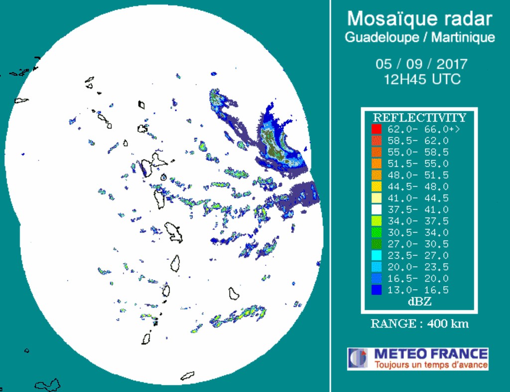
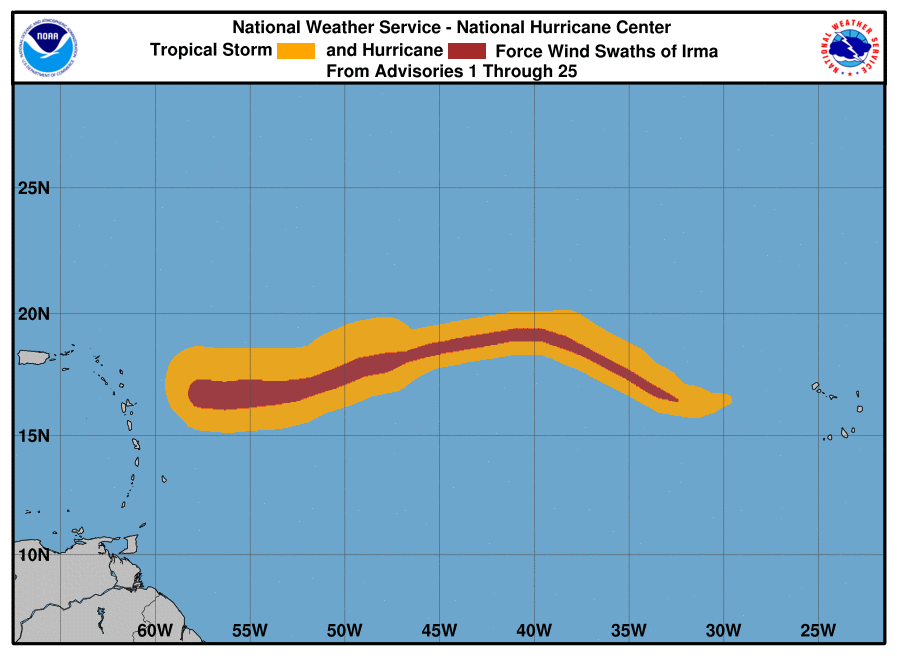
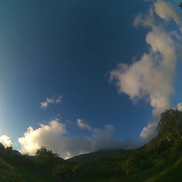
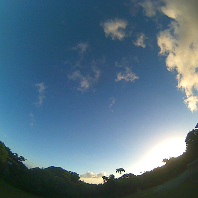
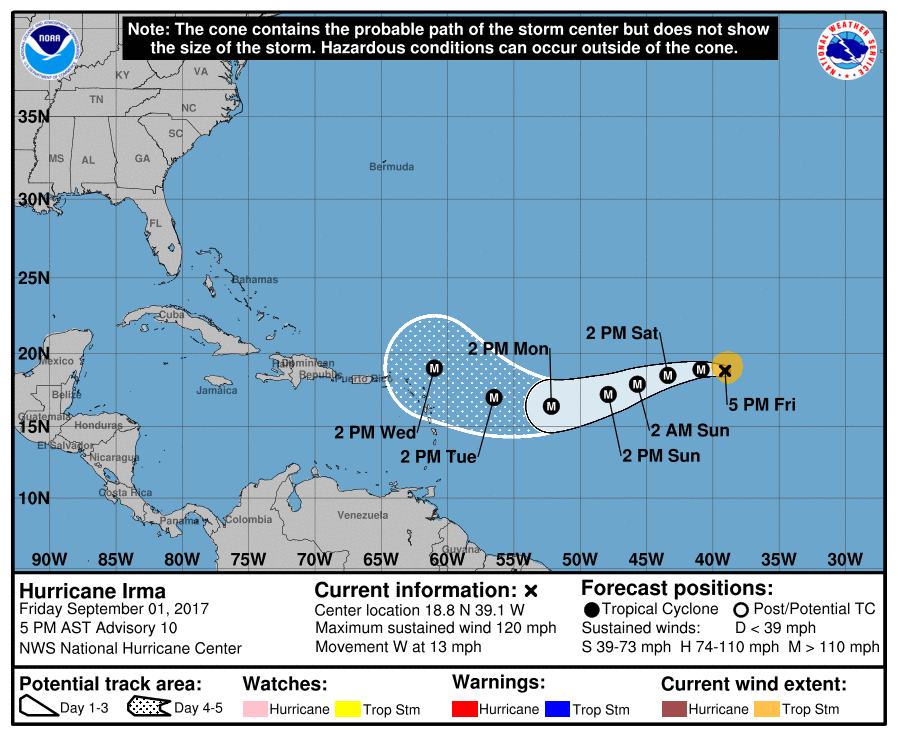
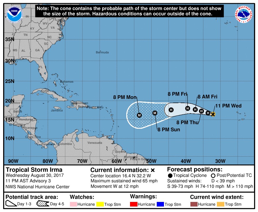
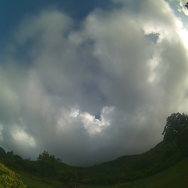
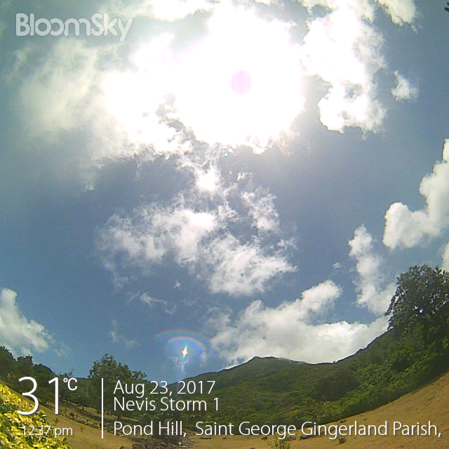
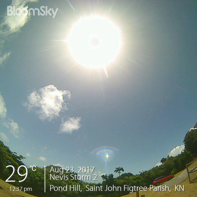
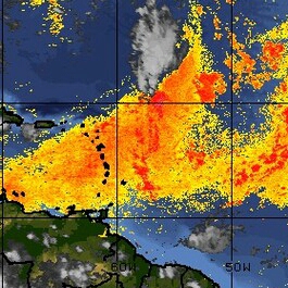
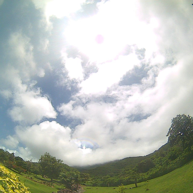
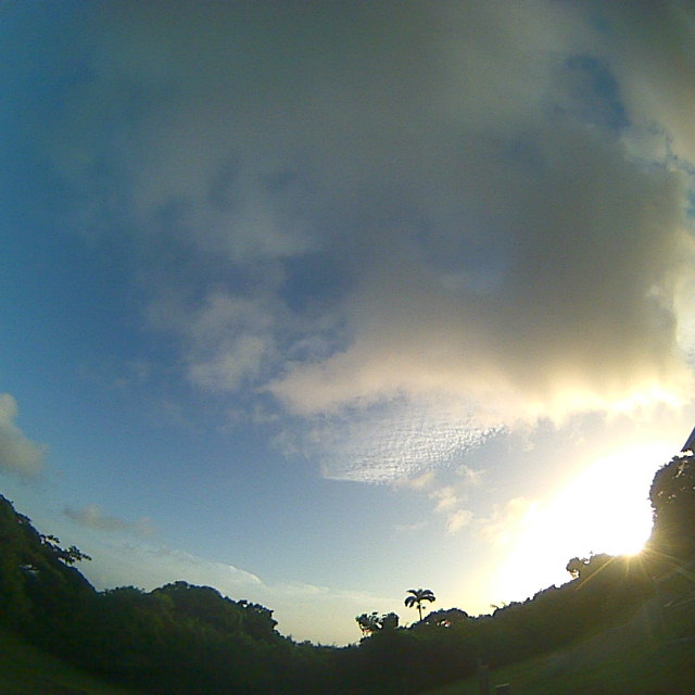
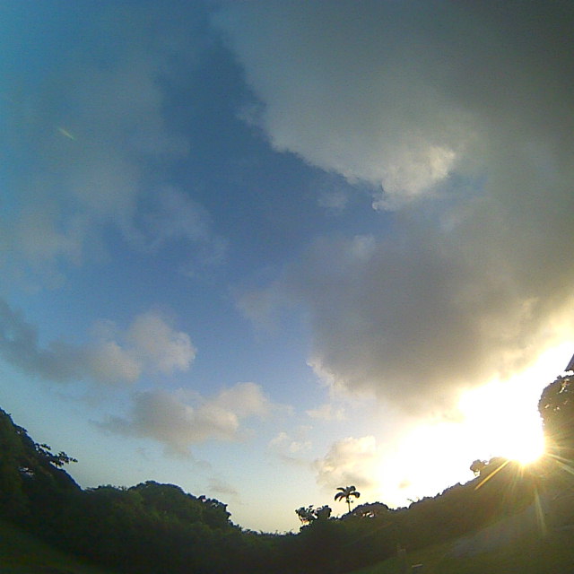
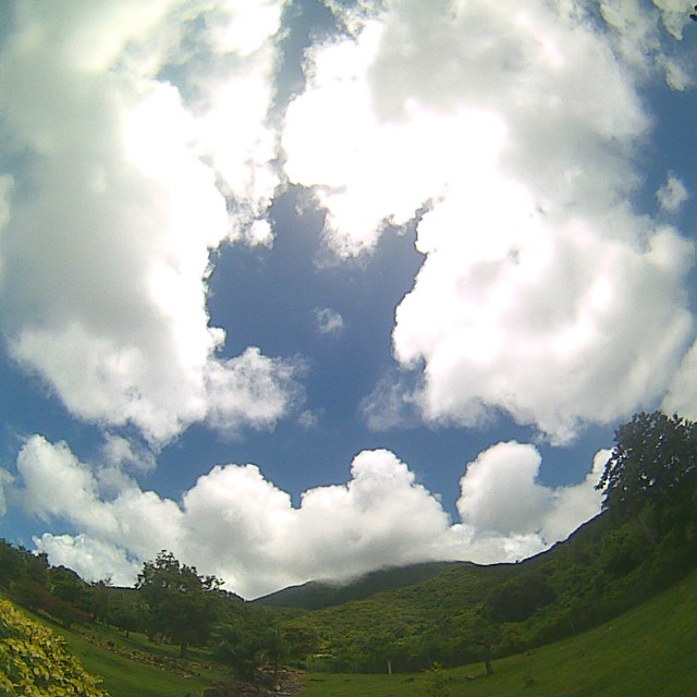
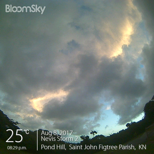
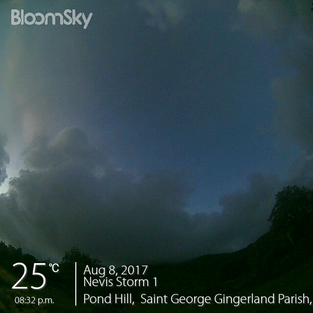
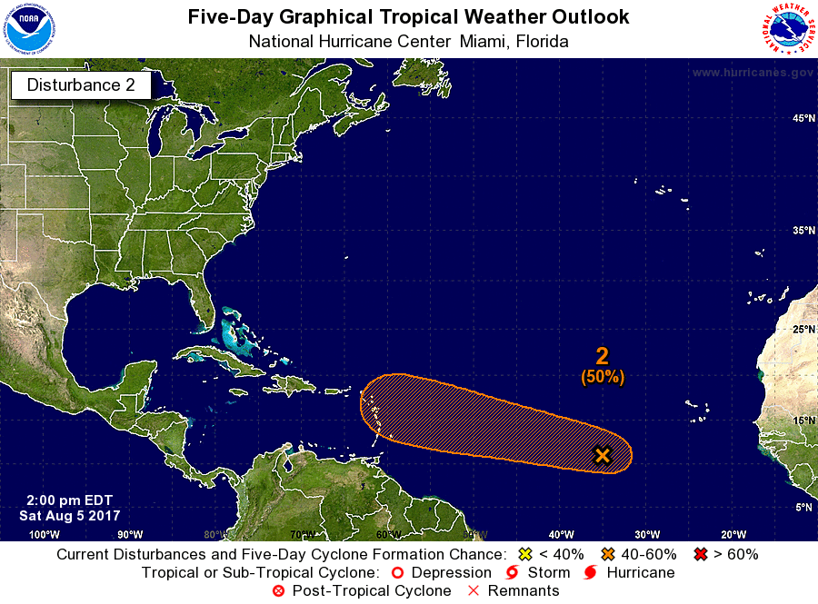
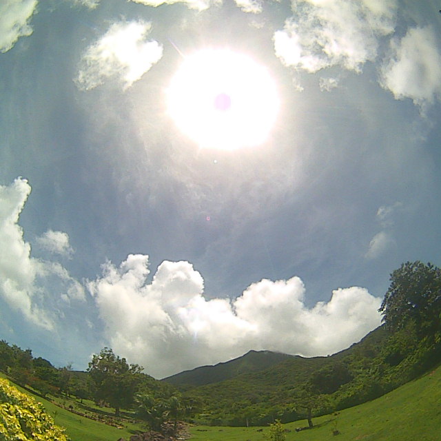
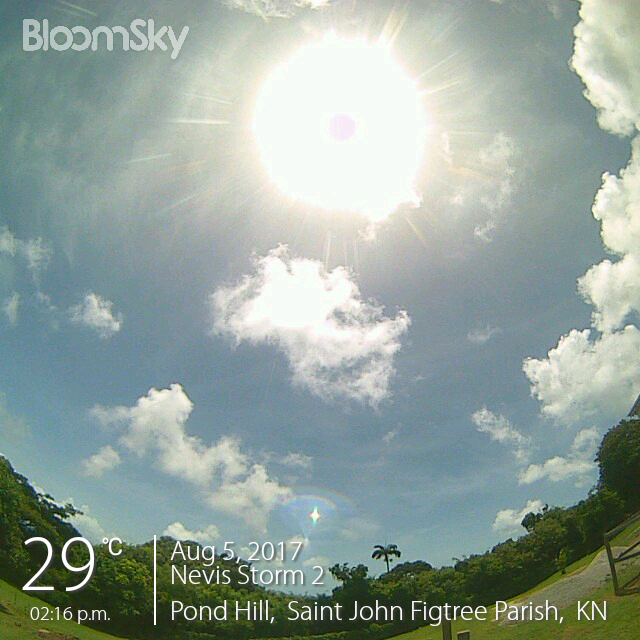
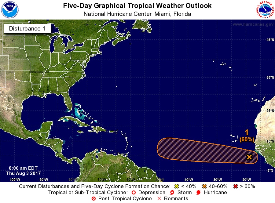
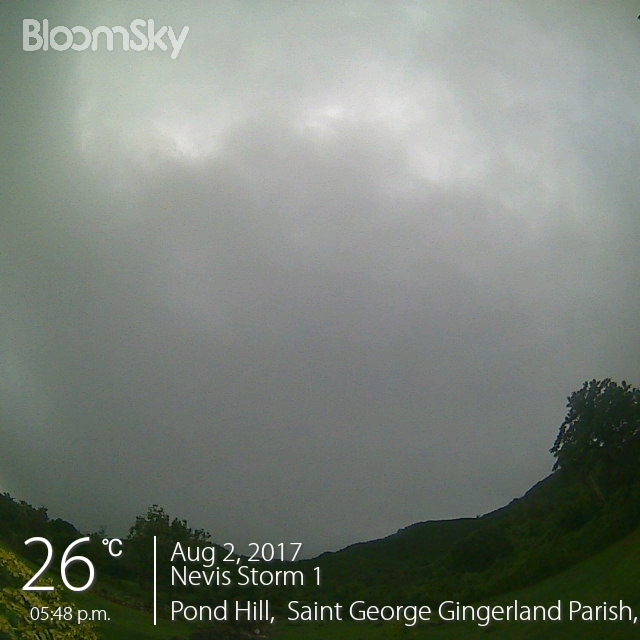
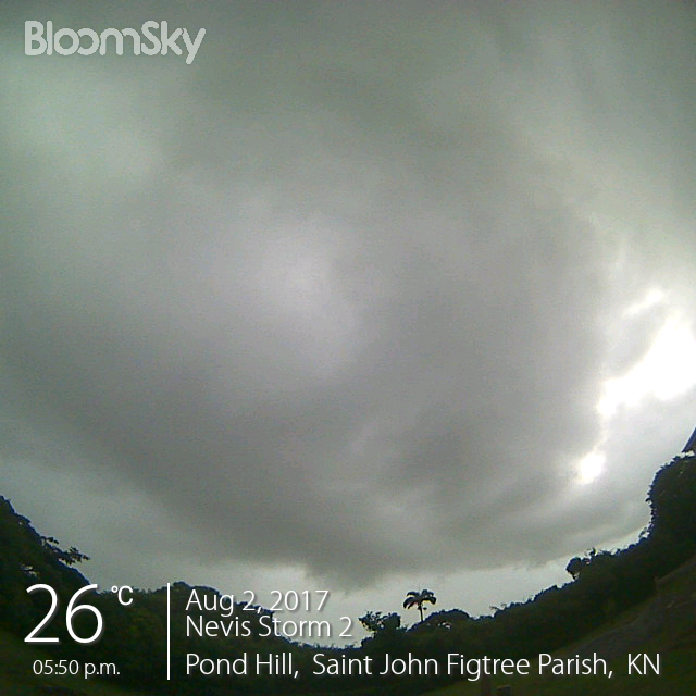
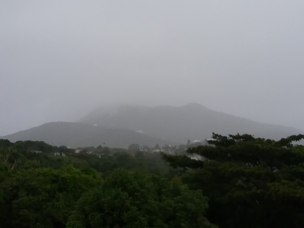
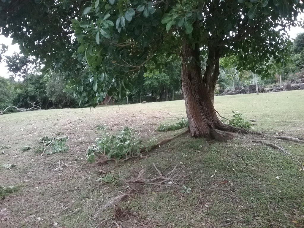
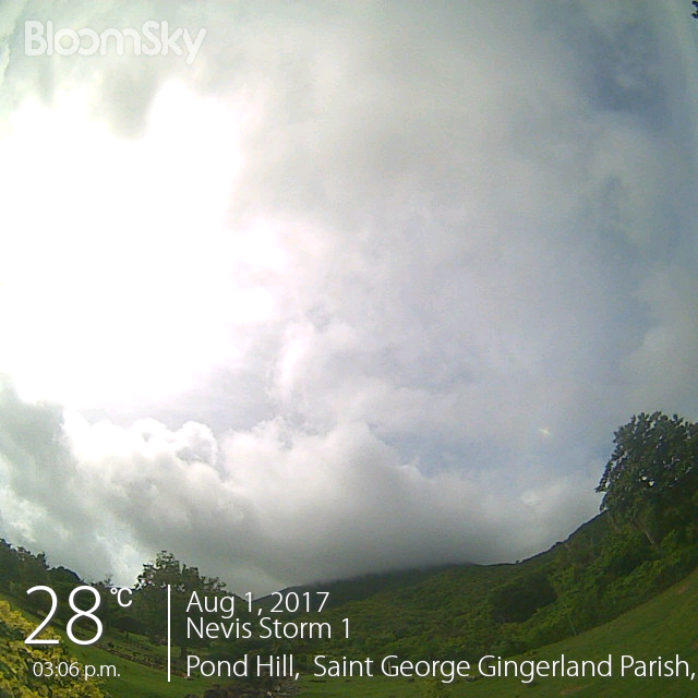
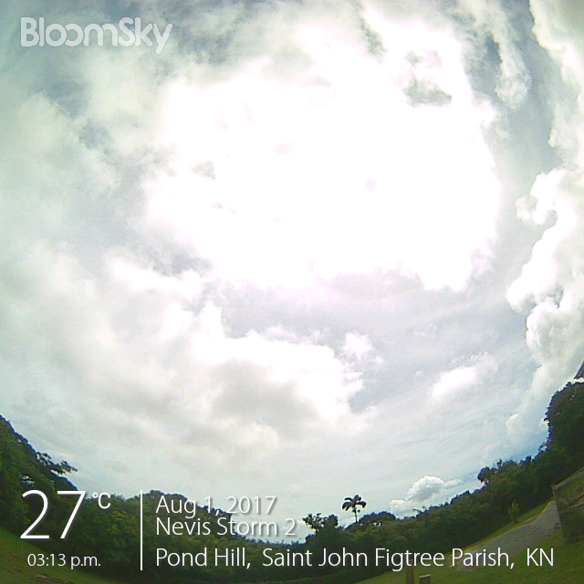
![sky_image[399].jpg](jpgumVdnrHniY.jpg)
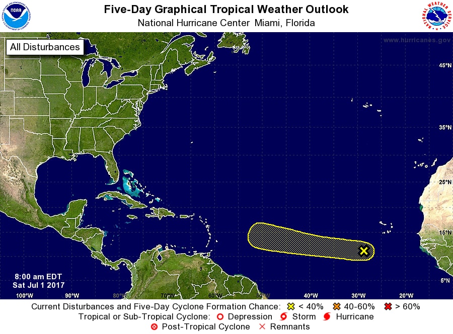
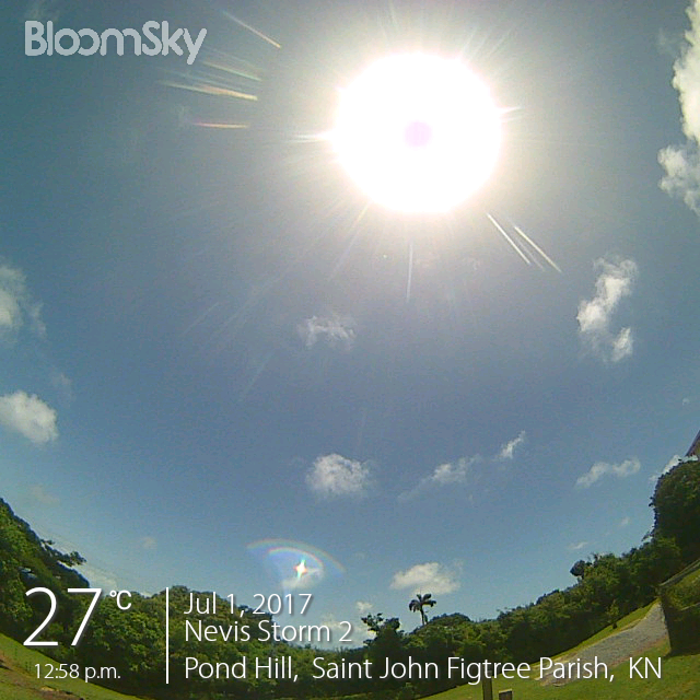
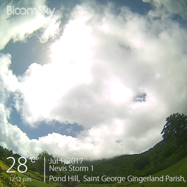
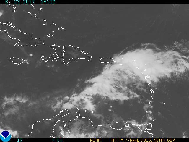
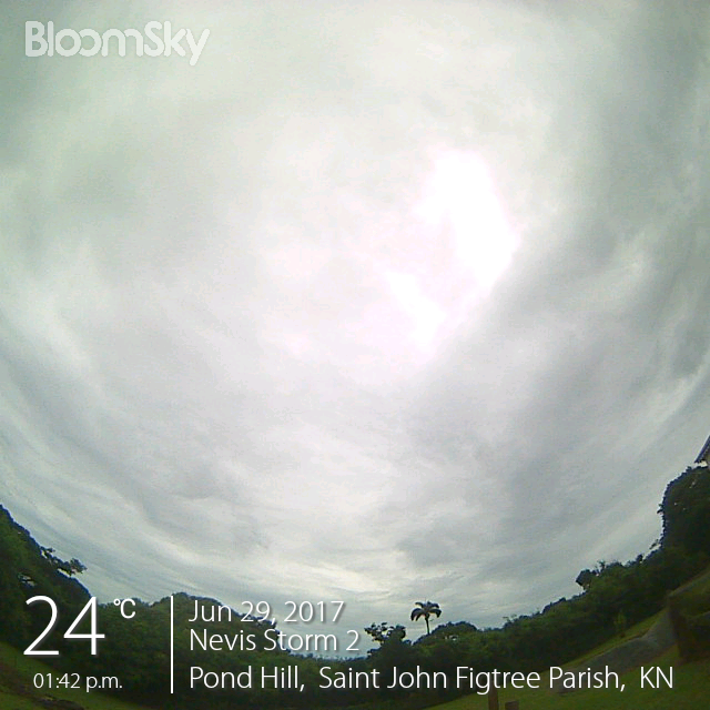
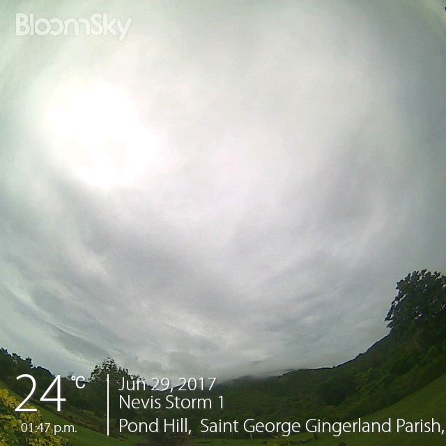
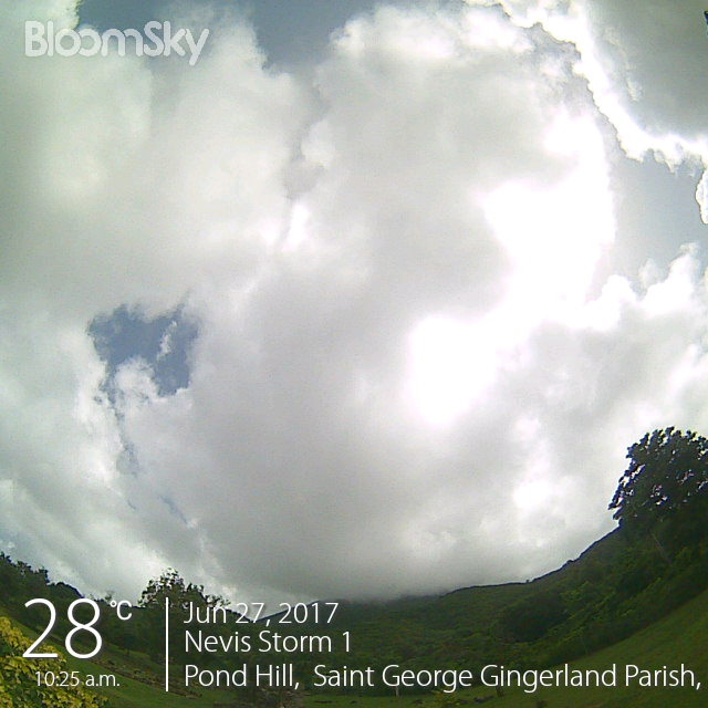
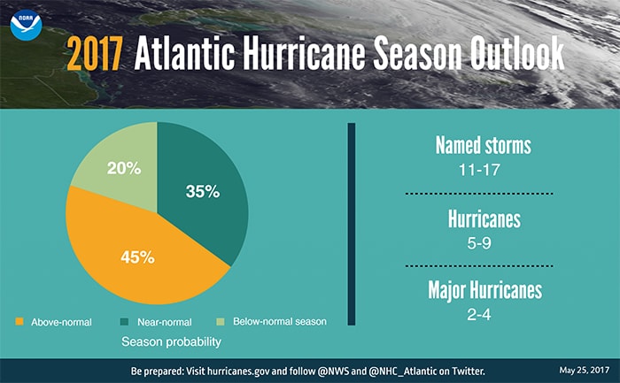
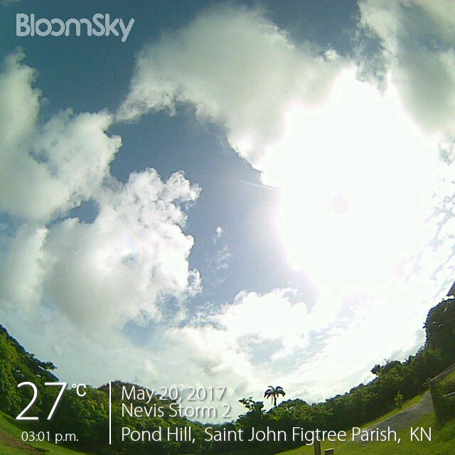
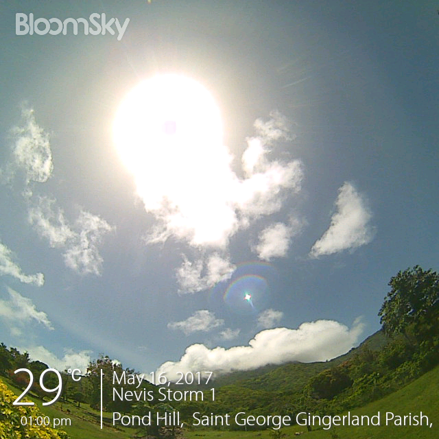
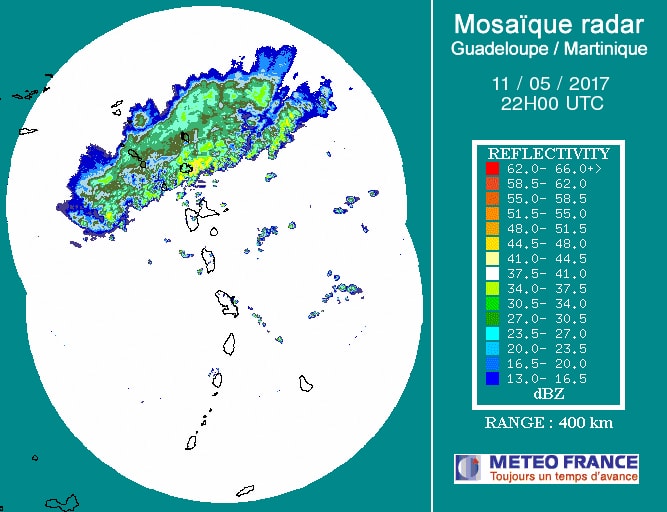
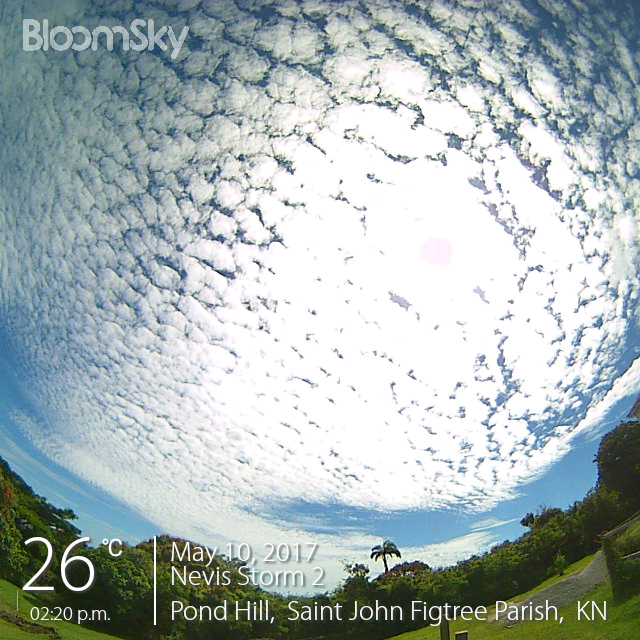
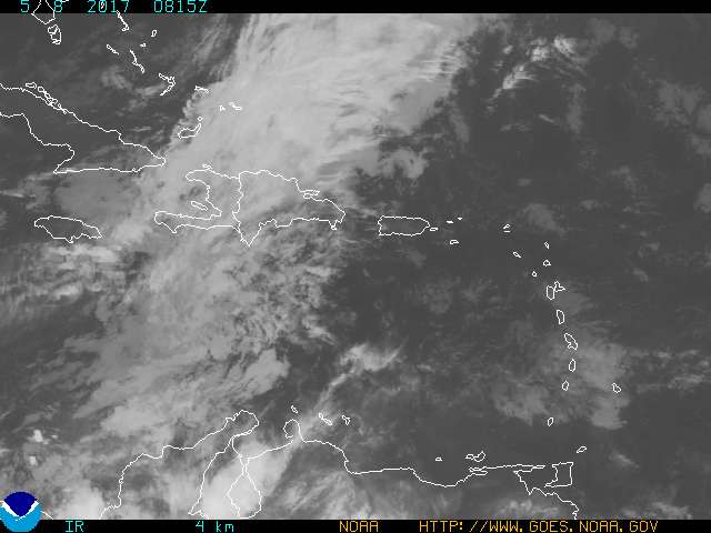
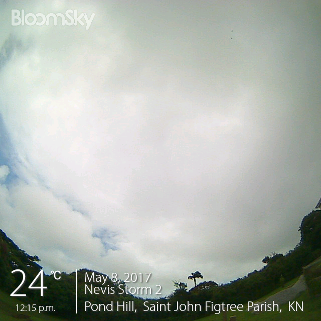
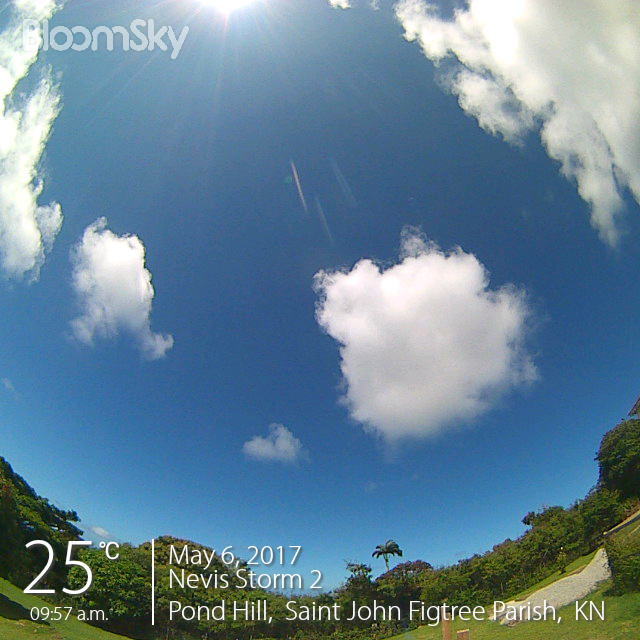
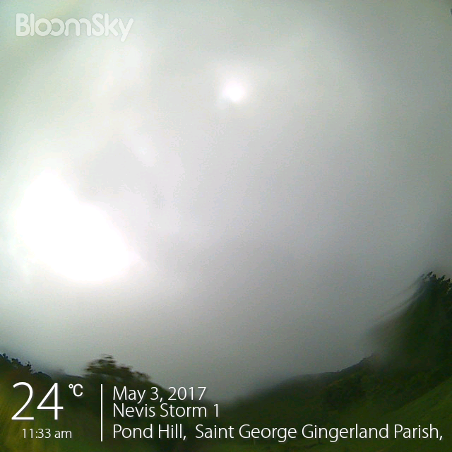
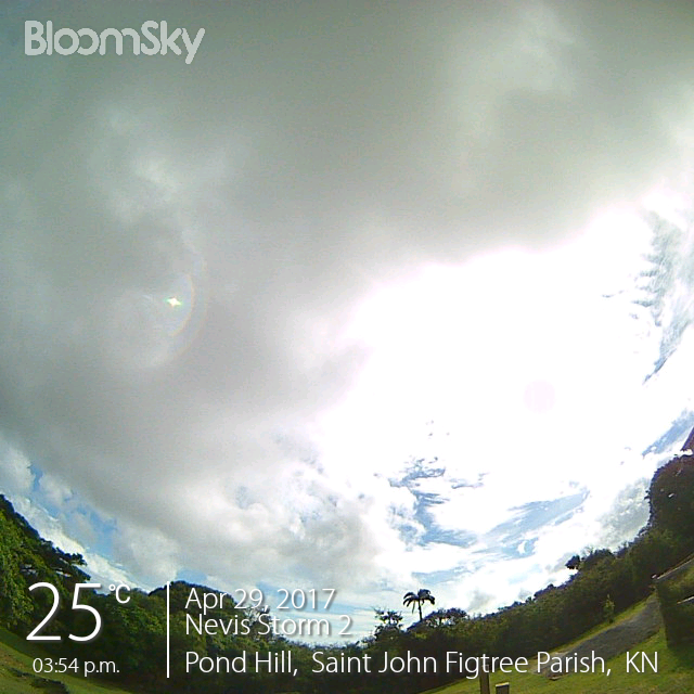
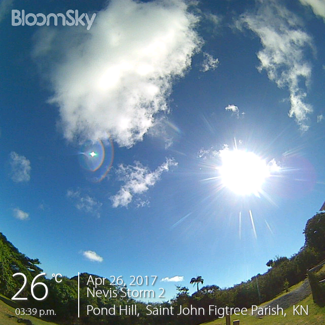
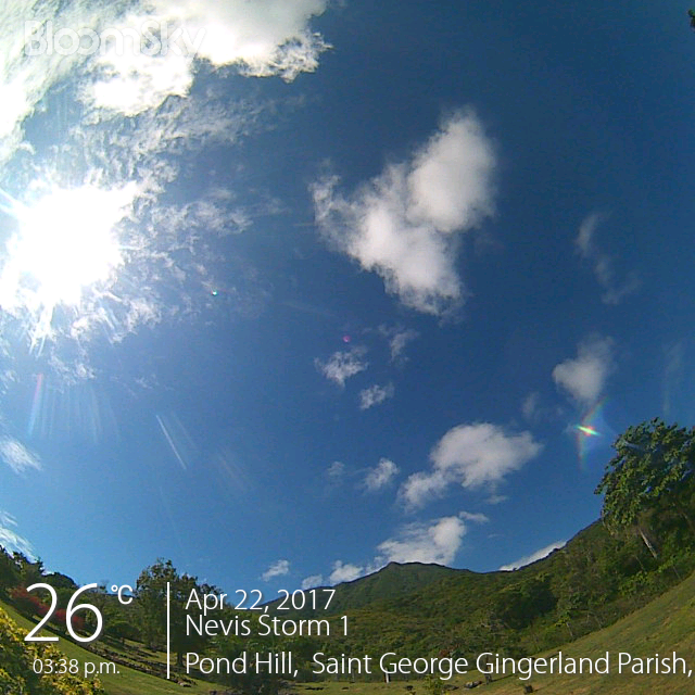
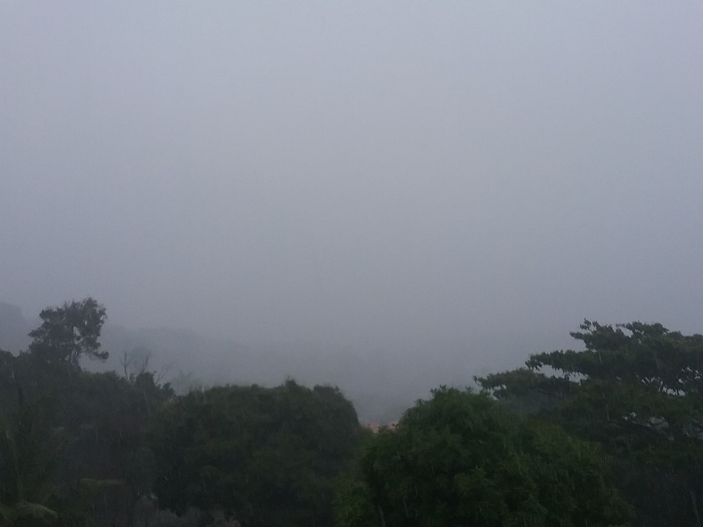
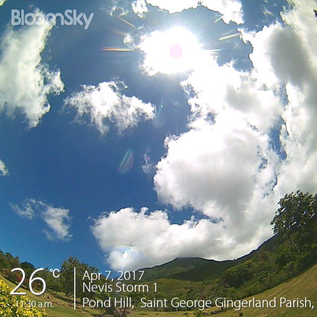
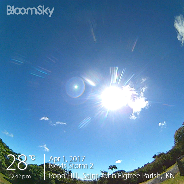
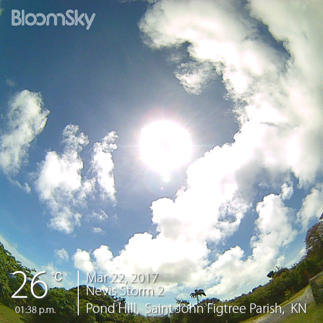
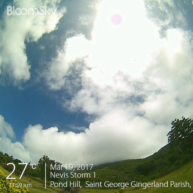
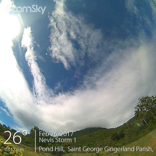
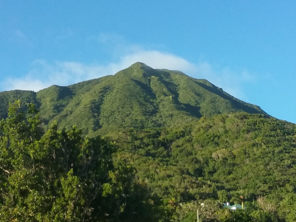
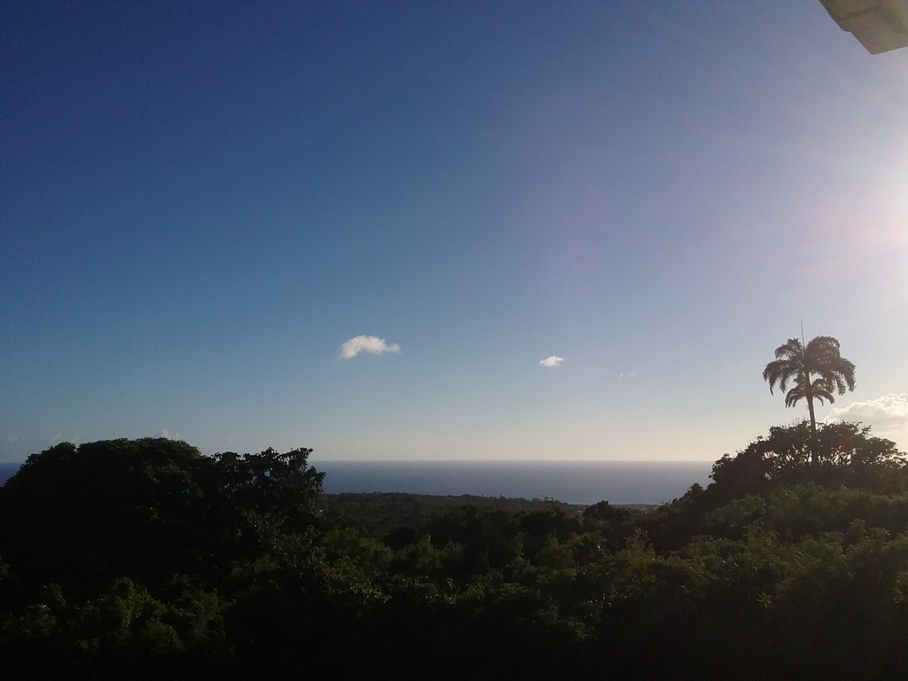
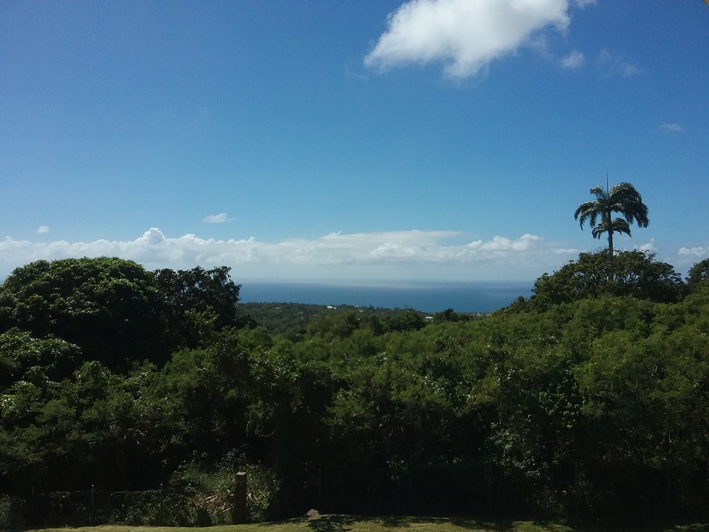