|
|
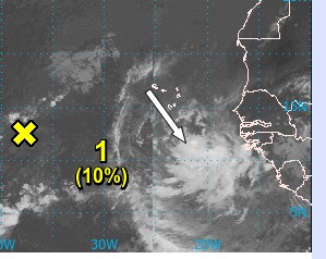
- - - 2020 Hurricane Season - - -
|
- Some missing months for 2020
|
- By "Harry W. Hallstrom" <hwh888 at gmail.com>
- Date: Tue, 27 Apr 2021 17:43:11 -0300
|
Greetings All,
It was discovered by a viewer of some missing weather date for Jun, Aug & Sep 2020. Thank you Carol !!
Unfortunately in the month of August I can't retrieve and format into a pdf file, several days are missing as I had a station malfunction and lost data for 2 weeks. The monthly summaries are extracted from macro's I've written and I can't go back and get what is there in the data file. I have the data file if someone wants to play around with it? Missing data from 8-Aug to 21-Aug.
Attachment:
06_Jun_2020 NOAA Weather Data.pdf
Description: Adobe PDF document
Attachment:
09_Sep_2020 NOAA Weather Data.pdf
Description: Adobe PDF document
|
|
- March Weather Data for Nevis
|
- By "Harry W. Hallstrom" <hwh888 at gmail.com>
- Date: Tue, 6 Apr 2021 09:10:18 -0300
|
Greetings All,
Attached station data for March for those interested.
Attachment:
03-Mar NOAA Weather Data.pdf
Description: Adobe PDF document
|
|
- Weather Station Reports Jan & Feb 2021
|
- By "Harry W. Hallstrom" <hwh888 at gmail.com>
- Date: Mon, 15 Mar 2021 20:55:27 -0300
|
Greetings All,
Just looking at Nevis Island and noticed Jan & Feb weather
station
data wasn't posted??? Will attempt this again, for those interested.
Attachment:
01_Jan_2021 NOAA Weather Data.pdf
Description: Adobe PDF document
Attachment:
02_Feb_2021 NOAA Weather Data.pdf
Description: Adobe PDF document
|
|
- Weather data for Dec 2020
|
- By "Harry W. Hallstrom" <hwh888 at gmail.com>
- Date: Thu, 14 Jan 2021 20:49:10 -0400
|
Greetings All,
Attached weather station data for the month of December 2020 for those interested.
Attachment:
Nevis Weather Data Dec 2020.pdf
Description: Adobe PDF document
|
|
- Nevis weather data for November - NOAA format.
|
- By "Harry W. Hallstrom" <hwh888 at gmail.com>
- Date: Fri, 18 Dec 2020 16:19:30 -0400
|
Greetings All,
Attached weather station data for the month of November.
Attachment:
Nov_2020 NOAA Weather Data.pdf
Description: Adobe PDF document
|
|
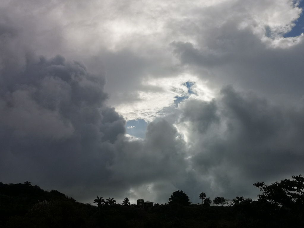
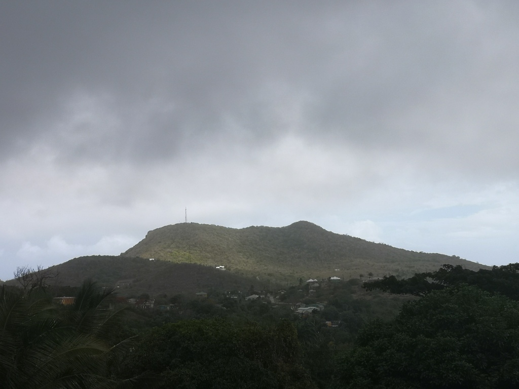
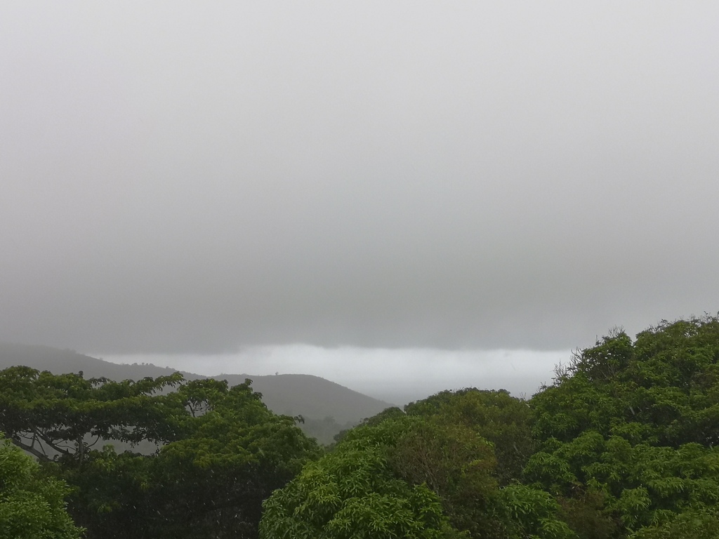
- Caribbean Calm
|
- By Frank Goodwill <nevis.storm at hotmail.com>
- Date: Mon, 07 Dec 2020 15:12:45 -0400
|
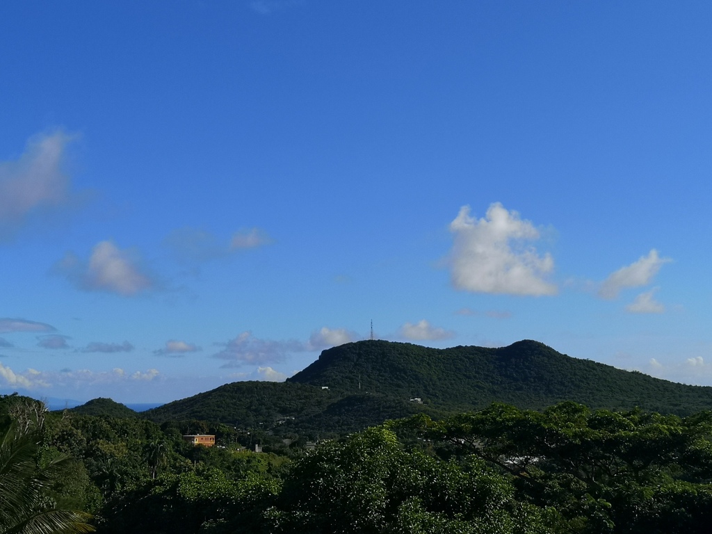
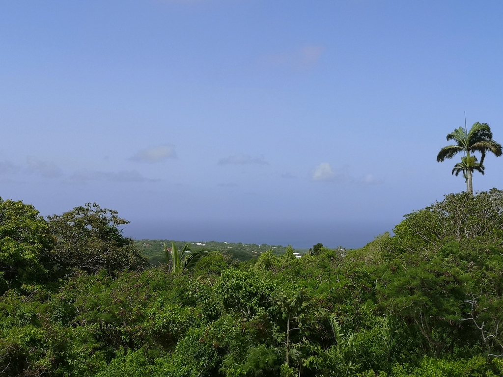
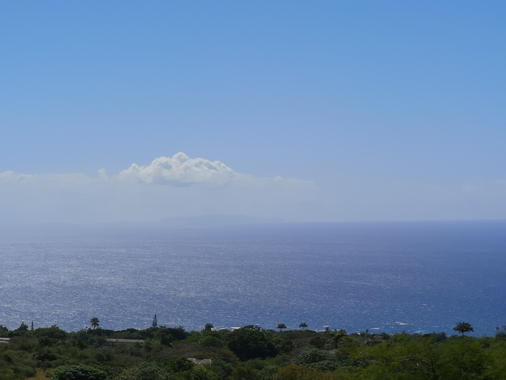
Dear all,
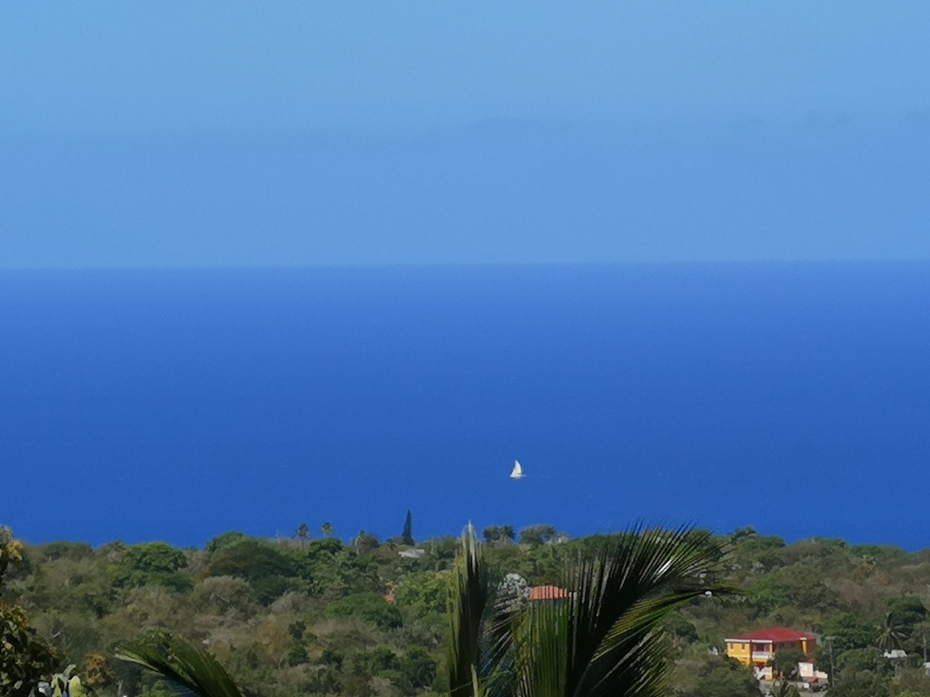
After a very active official hurricane 2020 season, we here in Nevis are thankful it was a quiet one for us. We did have a couple of "active" tropical waves that passed over us. They gave us some much needed rain but thankfully no major disruption.
Our borders have been open since 31st October so we have been receiving returning nationals, residents and tourists. Since reopening 6 people (incoming passengers) have tested Covid-19 positive. So far our quarentine protocols have worked and they were identified before mixing with the local community.
Very pleasent weather at the moment up in the Nevis Peak foothills. No storms or Saharan Dust.
A few pictures from my locale for your viewing.
Regards,
Frank Goodwill Pond Hill Weather Station, Nevis.
https://www.wunderground.com/dashboard/pws/ISAINTGE361
Weather CAM
https://assets1.webcam.io/w/9jBOB9/latest.jpg 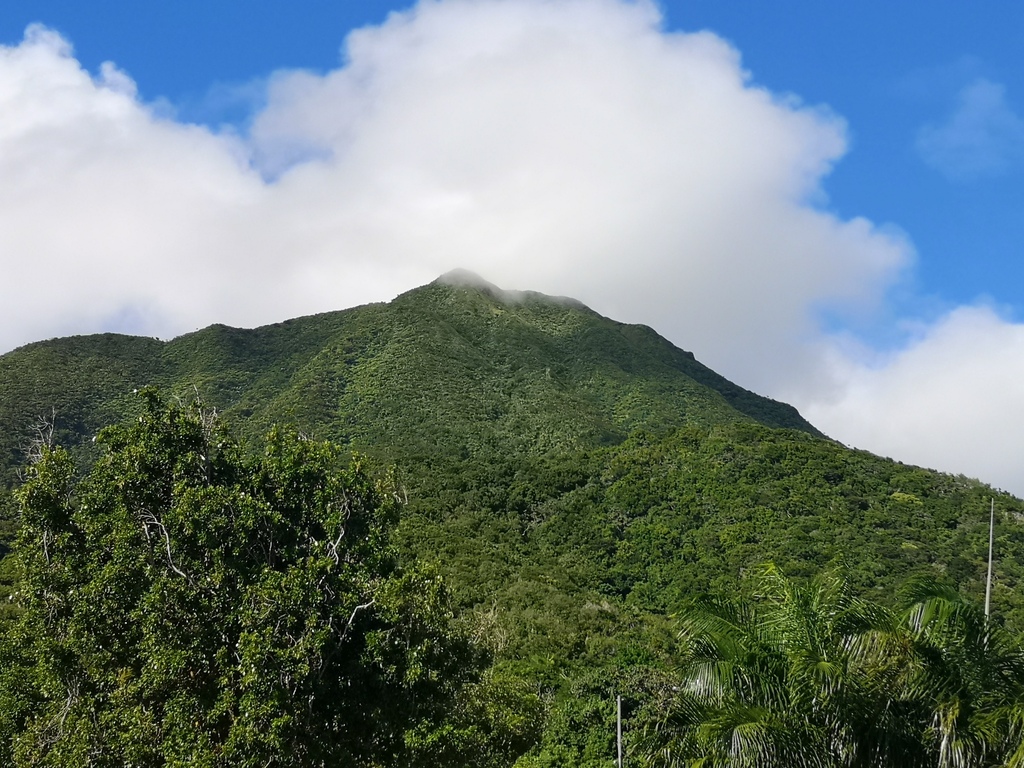
|
|
- Nevis October Weather Data......
|
- By "Harry W. Hallstrom" <hwh888 at gmail.com>
- Date: Tue, 17 Nov 2020 20:30:28 -0400
|
Greetings All,
Must have fallen asleep at the wheel. Never posted October weather data.
So here it is.
Attachment:
Oct 2020 Weather Data.pdf
Description: Adobe PDF document
|
|
- Landslip in St. Kitts
|
- By Frank Goodwill <nevis.storm at hotmail.com>
- Date: Fri, 13 Nov 2020 12:58:01 -0400
|
The wet weather has resulted in a landslip in the Frigate Bay area on Thursday. This has resulted in major structural damage to one property with others impacted. Added to that on Thursday morning there was a fire at the Needsmust Power Station at about 7:30pm. That resulted in an island wide power outage on St. Kitts. Power is being restored by area on Friday morning.
https://www.facebook.com/427277393956668/posts/5102830346401326/
https://www.instagram.com/p/CHiWZCeJ1mR/?igshid=lfoaeqkehlmw Regards,
Frank Goodwill
Sent from my Huawei phone |
|
- The Sun Is Back!
|
- By Frank Goodwill <nevis.storm at hotmail.com>
- Date: Thu, 12 Nov 2020 18:48:53 -0400
|
Thursday afternoon at 5 pm. It's not raining, the sun is out, a breeze is blowing, time to dry out. #Nevis #caribbean #oneandahalfacres #robinsoncrusoe #tropicalweather☀️☀️🌺🌺🌴🌴🌴 pica
https://www.instagram.com/p/CHgW4D7phv2/?igshid=4nfmjvb52syo
Regards,
Frank Goodwill
Sent from my Huawei phone |
|
- Thursday Day 4
|
- By Frank Goodwill <nevis.storm at hotmail.com>
- Date: Thu, 12 Nov 2020 10:58:34 -0400
|
Good morning all,
Thursday morning, day four, looks familiar😂 1 inch of rain in a couple of hours. Forecast is mostly cloudy skies at first with periods of light rain mixed with brief showers. Thereafter a gradual reduction in cloudiness and rainfall can be expected.⛅. #Nevis #Caribbean #oneandahalfacres #robinsoncrusoe #tropicalweather☀️☀️🌺🌺🌴🌴🌦️🌦️
https://www.instagram.com/p/CHfacE6JQwo/?igshid=1b30w9c5ou5qr
Regards,
Frank Goodwill
Sent from my Huawei phone |
|
- Rain! Rain!
|
- By Frank Goodwill <nevis.storm at hotmail.com>
- Date: Tue, 10 Nov 2020 15:59:34 -0400
|
What a grey day! Over two inches or 53mm of rain in the last 24 hours. This tropical wave is expected to develop into a tropical depression later this week or this weekend when it reaches the central or
western Caribbean Sea. #nevis #caribbean #storm #oneandahalfacres #tropicalweather☀️☀️🌺🌺🌴🌴🌦️🌦️
https://www.instagram.com/p/CHbCykkpq9M/?igshid=19siaa8e1510k Sent from my Huawei phone
Frank Goodwill |
|
- Active Tropical Wave Passing
|
- By Frank Goodwill <nevis.storm at hotmail.com>
- Date: Mon, 09 Nov 2020 20:43:57 -0400
|
Good night all,
A wet afternoon and night here in Nevis. The interaction of a tropical wave and a surface trough has resulted in unsettled weather across the area. Rainfall accumulations could total 25.4 to 76.2 mm or 1 to 3 inches.
So far up in the foothills of Nevis Peak we have had 42 mm or 1.65 inches of rain.
Flood watch has been issued for many islands. See attached
Regards,
Frank Goodwill Pond Hill Weather Station, Nevis.
https://www.wunderground.com/dashboard/pws/ISAINTGE361
Weather CAM
https://assets1.webcam.io/w/9jBOB9/latest.jpg 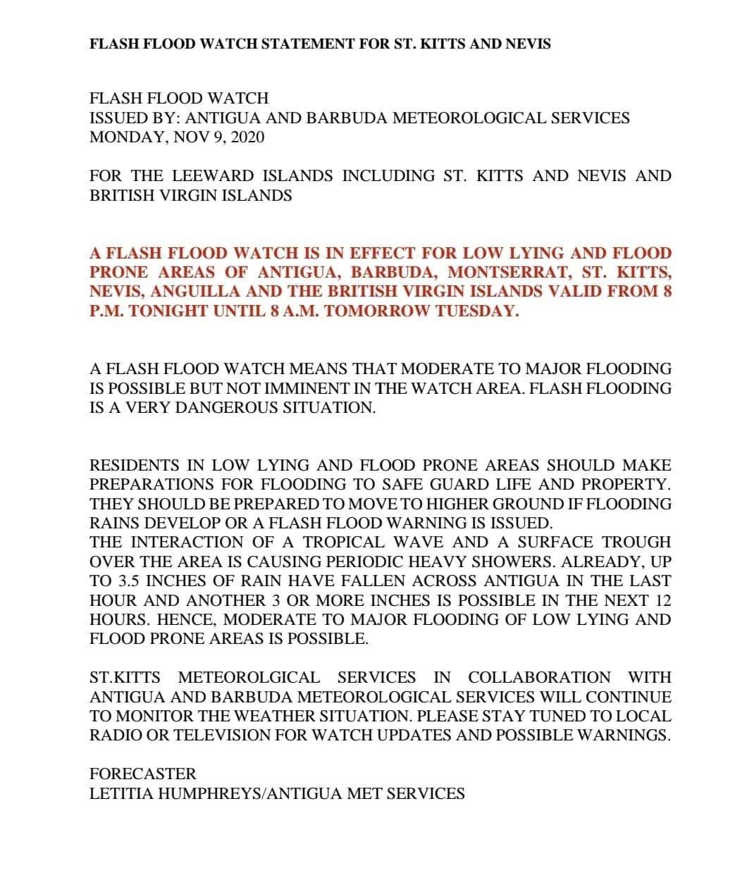
|
|
- A Break from Tropical Waves
|
- By Frank Goodwill <nevis.storm at hotmail.com>
- Date: Wed, 07 Oct 2020 20:27:34 -0400
|
The heat is on! Hot with blue sky and a little cloud. A break from the tropical waves. #Nevis #catibbean #tropicalweather☀️☀️🌺🌺🌴🌴🌴
https://www.instagram.com/p/CGDWPgTJkI5/?igshid=1ioqkns38rqwe Regards,
Frank Goodwill
Sent from my Huawei phone |
|
- A Wild Thursday
|
- By Frank Goodwill <nevis.storm at hotmail.com>
- Date: Thu, 01 Oct 2020 20:34:50 -0400
|
Thursday morning''s mini hurricane! Nevlec power off in the area. Those Tropical Waves keep rolling on in this week. #Nevis #Caribbean #tropicalweather☀️☀️🌺🌺🌴🌴🌦️🌦️ #oneandahalfacres #robinsoncrusoe
https://www.instagram.com/p/CFzGnyGJyhy/?igshid=178n7kqyn3dwd Slow afternoon temperature as well up in the Nevis Peak foothills.
Sent from my Huawei phone 
|
|
- Stormy Nevis
|
- By "Harry W. Hallstrom" <hwh888 at gmail.com>
- Date: Thu, 1 Oct 2020 18:23:35 -0300
|
Greetings All,
Hate to be the bearer of bad news but don't expect nice sunny weather for several days. The chain of islands is stuck in this "stuff" for several more days. Maybe even a week???
|
|
- Next one - Wilfred
|
- By "Harry W. Hallstrom" <hwh888 at gmail.com>
- Date: Sat, 19 Sep 2020 07:14:22 -0400
|
|
Greetings All,
So here we go again, next storm to the East named Wilfred. National Hurricane Center projection says it will dissipate into a depression as it drifts NW.
Air currents and wind shear will do its job once again this season for the Caribbean islands.
Will look again beginning of week to verify nothing has changed.
Harry --
Sent via IPhone.
|
|
- TD20 has a name now......
|
- By "Harry W. Hallstrom" <hwh888 at gmail.com>
- Date: Mon, 14 Sep 2020 23:44:59 -0400
|
|
Greetings All,
Since last post TD20 has become a named storm “Teddy”. Nothing has changed in its tracking, still projected to swing NW out into the open Atlantic. Well away from any land.
Harry --
Sent via IPhone.
|
|
- TD 20 moving NW
|
- By "Harry W. Hallstrom" <hwh888 at gmail.com>
- Date: Sat, 12 Sep 2020 17:16:26 -0400
|
|
Greetings All,
Tropical Depression 20 is expected to move NW out into the Atlantic well away from the Caribbean Islands. Following the same direction as earlier storms have done.
Another depression just off coast or Africa is also expected to move in a NW direction, following same pattern as several other storms.
Just a few more weeks to go, so everyone keep your fingers crossed.
Harry --
Sent via IPhone.
|
|
- Tropical Depression #3
|
- By "Harry W. Hallstrom" <hwh888 at gmail.com>
- Date: Fri, 11 Sep 2020 11:20:51 -0400
|
Greetings All,
A tropical wave south of Cabo Verde Islands is predicted to form into a storm. Based on location this looks to follow the southern trade winds pushing it to the Windward Islands or Leeward’s. Still to early to be more specific. It’s south enough to not track Northward out into the Atlantic. We’ll see what NHC models say in a few days. Bears watching closely, will post again Tue/Wed.
Harry
Sent via IPhone.
|
|
- Two TP off Africa
|
- By "Harry W. Hallstrom" <hwh888 at gmail.com>
- Date: Mon, 7 Sep 2020 07:46:24 -0400
|
|
Greetings All,
National Hurricane Center has put numbers and paths on both. TP17 & TP18 are projected to move in a Northwest direction out into the Atlantic well away from the Caribbean islands.
Harry --
Sent via IPhone.
|
|
- Sorry Updated every 15 minutes
|
- By "Harry W. Hallstrom" <hwh888 at gmail.com>
- Date: Mon, 31 Aug 2020 05:41:06 -0300
|
Clarification: Data uploaded every minute BUT link updated every 15 minutes.
|
|
- Nevis Weather Station Link (Updated every minute)
|
- By "Harry W. Hallstrom" <hwh888 at gmail.com>
- Date: Mon, 31 Aug 2020 05:37:45 -0300
|
|
|
|
- Rain Event☔☔
|
- By Frank Goodwill <nevis.storm at hotmail.com>
- Date: Sat, 22 Aug 2020 07:28:41 -0400
|
#TSLaura 7a.m. Not a wind event here in Nevis, but plenty of rain. Total measured up in the Nevis Peak foothills over the past 24 hours has been 2.60 inches. Still a lot of squally rain showers around, so a grey and damp start to Saturday morning.
#Nevis #Caribbean #tropicalweather☀️☀️🌺🌺🌴🌴🌦️🌦️
https://www.instagram.com/p/CEMJagAJTny/?igshid=174sxal2ci40
Regards,
Frank Goodwill
Sent from my Huawei phone |
|
- Rain!
|
- By Frank Goodwill <nevis.storm at hotmail.com>
- Date: Sat, 22 Aug 2020 01:39:46 -0400
|
#TSLaura 1 a.m. Woken up by a loud clap of thunder. Measured 3/4 inch of rain in the last hour. The picture of the rain radar shows why.
Winds have been fairly light. Average of 6mph with a gust of 22 mph.
Plenty more rain to come. Thunder and lightning stopped - sleep! I wonder.
#Nevis #Caribbean #tropicalweather☀️☀️🌺🌺🌴🌴🌦️🌦️
https://www.instagram.com/p/CELhdygpgFB/?igshid=ftnnl0mcboh4
Regards,
Frank Goodwill
Sent from my Huawei phone |
|
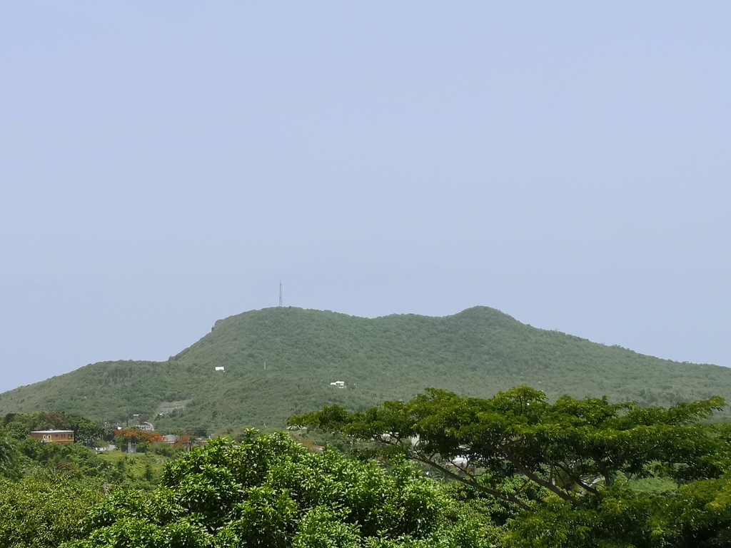
- Another shift to the south.
|
- By Frank Goodwill <nevis.storm at hotmail.com>
- Date: Fri, 21 Aug 2020 22:06:14 -0400
|
#TSLaura 9:45pm. Heavy showers starting up. Data from a "Hurricane Hunter" aircraft suggests the center of #Laura is tracking further south again, which could lead to another shift south in terms of the track. Rain radar highlighting the wet weather ahead. Rain measured so far today is 0.47 inches.
A couple of photos from earlier at 6pm as the sky had cleared for a hazy sunset.
#Nevis #Caribbean #tropicalweather☀️☀️🌺🌺🌴🌴🌦️🌦️
https://www.instagram.com/p/CELJPsuJpai/?igshid=1ggmlj65hnc9e
Regards,
Frank Goodwill
Sent from my Huawei phone |
|
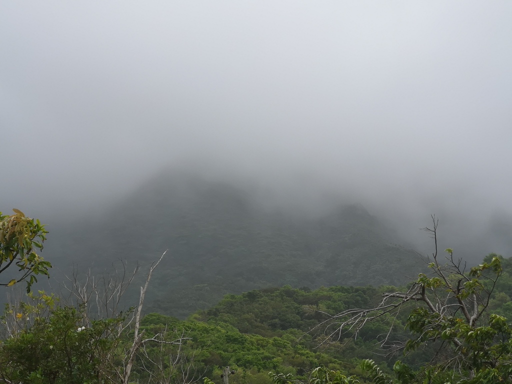
- Cloud/fog/rain
|
- By Frank Goodwill <nevis.storm at hotmail.com>
- Date: Fri, 21 Aug 2020 17:08:36 -0400
|
#TSLaura 5pm. Shrouded in low cloud/fog at the moment. Raining on and off. I have measured 0.24 inches of rain so far today. Looking at the forecast the centre of the TS will pass just to the north of us. Also the Storm Force winds look to be to the north of the centre. So we will probably not have high winds but plenty of rain. Possible flash flooding. We shall see things can change. #Nevis #Caribbean #tropicalweather☀️☀️🌺🌺🌴🌴🌦️🌦️ #rain
https://www.instagram.com/p/CEKnFqxp0dg/?igshid=1tngrk6irdnff
Regards,
Frank Goodwill
Sent from my Huawei phone |
|
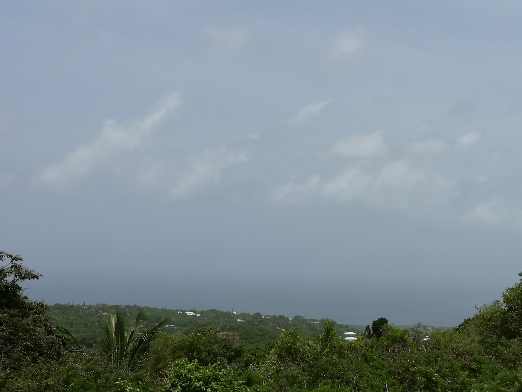
- First rains have arrived
|
- By Frank Goodwill <nevis.storm at hotmail.com>
- Date: Fri, 21 Aug 2020 15:15:36 -0400
|
#TSLaura 3 pm. The first rains have arrived. No wind though. The island is starting to shut down as government offices, shops etc start to close. Local Vervet Monkey troop are off to their roost. I have a Dove nesting in guttering attached to my water harvesting setup. Tucked in well with two eggs. Interesting to see how that goes. #Nevis #Caribbean #tropicalweather☀️☀️🌺🌺🌴🌴🌦️🌦️
https://www.instagram.com/p/CEKaK9EpEOz/?igshid=flau9r54o3xx
Sent from my Huawei phone |
|
- Lull before the storm
|
- By Frank Goodwill <nevis.storm at hotmail.com>
- Date: Fri, 21 Aug 2020 13:03:26 -0400
|
|
#TSLaura 12:30 pm. We are under a Tropical Storm warning now. Things are becoming very still, very little breeze and humid, similar to just before a thunderstorm breaks. Clouds thickening and #rain to the east. #Nevis #Caribbean #tropicalweather☀️☀️🌺🌺🌴🌴🌦️🌦️
https://www.instagram.com/p/CEKJDuppWFz/?igshid=jv0nuvyafl4e
Sent from my Huawei phone
|
|
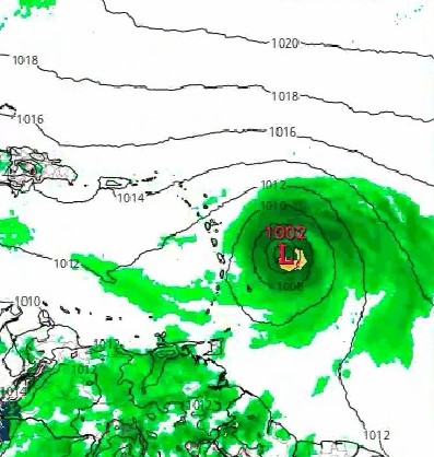
- TS Laura! - Just as you post things change!
|
- By Frank Goodwill <nevis.storm at hotmail.com>
- Date: Fri, 21 Aug 2020 09:28:27 -0400
|
Morning again,
A hurricane hunter aircraft has highlighted new data..
000
WTNT63 KNHC 211305
TCUAT3

Tropical Storm Laura Tropical Cyclone Update
NWS National Hurricane Center Miami FL       AL132020
905 AM AST Fri Aug 21 2020

...NOAA HURRICANE HUNTER AIRCRAFT FINDS THAT THE DEPRESSION HAS
STRENGTHENED TO TROPICAL STORM LAURA...

Data from a NOAA Hurricane Hunter aircraft indicate that Tropical
Depression Thirteen has strengthened and is now Tropical Storm
Laura with maximum sustained winds of around 45 mph (75 km/h). The
aircraft also found that the center of Laura is located south of the
previously estimated position. These changes will be reflected in
the track and intensity forecasts with the upcoming advisory that
will be issued at 1100 AM AST (1500 UTC).


SUMMARY OF 905 AM AST...1305 UTC...INFORMATION
---------------------------------------------------
LOCATION...17.0N 59.8W
ABOUT 230 MI...375 KM ESE OF THE NORTHERN LEEWARD ISLANDS
MAXIMUM SUSTAINED WINDS...45 MPH...75 KM/H
PRESENT MOVEMENT...W OR 280 DEGREES AT 21 MPH...33 KM/H
MINIMUM CENTRAL PRESSURE...1008 MB...29.77 INCHESRegards,
Regards, Frank Goodwill
Pond Hill Weather Station, Nevis.
https://www.wunderground.com/dashboard/pws/ISAINTGE361
Weather CAM
https://assets1.webcam.io/w/9jBOB9/latest.jpg |
|
- TD#13 Nevis
|
- By Frank Goodwill <nevis.storm at hotmail.com>
- Date: Fri, 21 Aug 2020 09:18:53 -0400
|
#TD13
8 a.m. To the west sunny skies, to the east a rain cloud rolling in. The weather system is struggling to to develop, which is good. This is due to dry air and some wind shear. We are under a Tropical Storm Watch though Antigua Met Services, who issue such things, are hinting that this maybe withdrawn due to the lack of development. The Radar picture shows rain on its way.
9 a.m. Starting to hear rumbles of thunder.
Regards,
Frank Goodwill
https://www.instagram.com/p/CEJp1acpSp0/?igshid=1ie9nd3tt6wmj
Sent from my Huawei phone |
|
- Wed 8pm update
|
- By "Harry W. Hallstrom" <hwh888 at gmail.com>
- Date: Wed, 19 Aug 2020 21:23:31 -0400
|
|
Greetings All,
Just had another look at 8pm location and did some plotting calculations based on advanced projections and wind pattern. This disturbance looks be be tracking about 285-290 degrees from present location extended out to Friday at noon. At that time it will pass approximately 230 miles to the NNE of NEV/SKB. Projected winds around a very small core in vicinity of 45-55 mph. National Hurricane Center is stating the Northern Leewards should continue to monitor. They still have not projected path or cone. Perhaps that will happen when they officially call it a storm with a name. Will look again tomorrow morning.
Harry --
Sent via IPhone.
|
|
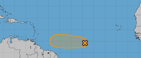
- Disturbance #2
|
- By "Harry W. Hallstrom" <hwh888 at gmail.com>
- Date: Wed, 19 Aug 2020 02:52:18 -0400
|
Greetings All,
The National Hurricane Center still has not plotted a cone or course of this weather pattern. Latest report mentions nothing of winds other than to label as a “broad area of rain showers”. They do say it has a 90% chance of develop into a storm. Most likely is will develope as it approaches the islands or passes, at present I see no development that will affect our location. Current winds are in the 20 mph range and wind pattern doesn't seem to favor development till past the islands. Will look again and post once NHC can be a bit more specific.
Harry
Sent via IPhone.
|
|
- Records
|
- By Frank Goodwill <nevis.storm at hotmail.com>
- Date: Fri, 14 Aug 2020 01:12:53 -0400
|
Good night all,
After the passing of a Tropical Wave on Wednesday, Thursday gave us a sunny and partly cloudy day with no rain.
The Tropical Depression to the east of us finally made it to Tropical Storm status - Josephine.
It is still forecast to pass to the north of us, therefore Sunday may be cloudy with some showers.
Tropical Storm Josephine is the tenth named storm of the season and has beaten the previous earliest "J" storm formation record. The previous record was held by Jose forming on the 22nd August 2005.
The 2020 season has so far produced the record earliest C, E, F, G, H, I and J named storms!
The record earliest K storm is Katrina, which formed on 24th August 2005.
So place your bets!
There is a broad low pressure over eastern North Carolina USA that could be a possible.
Covid-19
The last case in St. Kitts and Nevis has fully recovered, number 17,
The tourism industry in the region is starting to open up again. Eight of the smaller islands in the North Eastern Caribbean are working together to promote the product. They have produced a short video to start with.
Link following:
https://youtu.be/B2dvjRYG5oA
Regards,
Frank Goodwill Pond Hill Weather Station, Nevis.
https://www.wunderground.com/dashboard/pws/ISAINTGE361
Weather CAM
https://assets1.webcam.io/w/9jBOB9/latest.jpg |
|
- Tropical Depression 11 et al.
|
- By Frank Goodwill <nevis.storm at hotmail.com>
- Date: Wed, 12 Aug 2020 10:30:14 -0400
|
Good morning all,
A tropical wave is passing through the area today, so showery weather is expected. We had around 0.15 inches of rain overnight up in the Nevis Peak foothills. Most of the showers associated with the wave are located to the south of us over the Windwards Islands and also over the sea to the north.
We now have Tropical Depression 11 next up. It is forecast to become a Tropical Storm (Josephine) later today. It is predicted to pass to the north of us over the weekend.
Regarding the Covid-19 situation.
The government of St. Kitts and Nevis are planning to reopen our borders to commercial traffic during October 2020.
No definite date as yet.
Today's morning view attached.
Regards,
Frank Goodwill Pond Hill Weather Station, Nevis.
https://www.wunderground.com/dashboard/pws/ISAINTGE361
Weather CAM
https://assets1.webcam.io/w/9jBOB9/latest.jpg 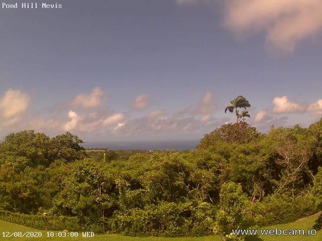
|
|
- Disturbance to the East......
|
- By "Harry W. Hallstrom" <hwh888 at gmail.com>
- Date: Tue, 11 Aug 2020 10:07:40 -0300
|
Greetings All,
Another look at what looked ominous at last post......... Now predicted by NHC to become a tropical depression but the good news is by Fri/Sat, as it nears the Leewards, will be blown apart by dry winds, Sarah dust and steering winds.
|
|
- Looks like the same footprint as Isaias
|
- By "Harry W. Hallstrom" <hwh888 at gmail.com>
- Date: Sat, 8 Aug 2020 12:49:58 -0300
|
Greetings All,
Looking at this wave just moving off Africa it seems to have a cloud band with a circular motion to it. Must like the beginnings of Isaias back a couple weeks ago.
We'll see what the National Hurricane posts about this in a day or two?
|
|
- Nevis NOAA Weather Data for July
|
- By "Harry W. Hallstrom" <hwh888 at gmail.com>
- Date: Thu, 6 Aug 2020 21:45:52 -0300
|
Greetings All,
Attached Weather Data for Nevis in NOAA format, for those interested.
Attachment:
July Nevis Weather Data.pdf
Description: Adobe PDF document
|
|
- Two waves to our east......
|
- By "Harry W. Hallstrom" <hwh888 at gmail.com>
- Date: Sat, 1 Aug 2020 07:59:05 -0400
|
|
Greetings All,
The two waves, one labeled #10 the other a tropical wave will be of no impact to the Caribbean. Both are being pushed well to our North and out into the Atlantic.
Harry --
Sent via IPhone.
|
|
- Potential Tropical Cyclone 9
|
- By Frank Goodwill <nevis.storm at hotmail.com>
- Date: Wed, 29 Jul 2020 15:01:37 +0000
|
Good morning everyone,
This one has been a “potential” for a long time.
Squally showers to start the morning off with and some strong gusts of wind. Things are starting to brighten up and the wind reducing in intensity. We still have some more showers
around in the area so I expect some squally conditions if they pass our way.
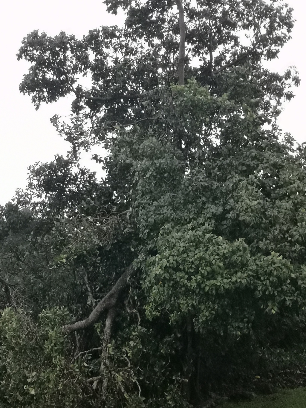
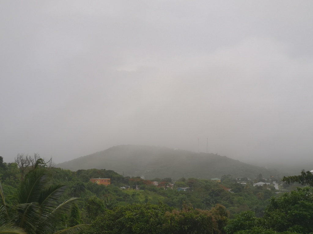
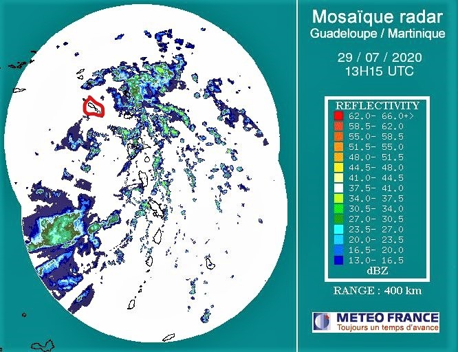
Attached some pictures:
- A casualty. Had a branch come down on a Cedar Tree.
- The view first thing this morning. Low cloud and showers. In the twilight zone.
- Guadeloupe radar at about 09:25 hours, showing St Kitts and Nevis (marked in red) in-between two areas of showers. The
one to the east moving towards us.
Wind measurements to give an indication of what we had up in the Nevis Peak foothills so far.
|
High
|
Low
|
Average
|
|
Wind Speed
|
20.0 mph
|
4.0 mph
|
12.3 mph
|
|
Wind Gust
|
34.0 mph
|
--
|
24.2 mph
|
|
Wind Direction
|
--
|
--
|
ENE
|
So far at my location the rain measure is 0.45 inches.
Regards,
Frank Goodwill
Pond Hill Weather Station
https://www.wunderground.com/dashboard/pws/ISAINTGE361
Pond Hill WeatherCAM
https://assets1.webcam.io/w/9jBOB9/latest.jpg
Nevis Weather
https://nevisstorm.blogspot.com/
Sent from
Mail for Windows 10
|
|
|
- On the lighter side
|
- By "Harry W. Hallstrom" <hwh888 at gmail.com>
- Date: Wed, 29 Jul 2020 09:29:54 -0400
|
|
Greetings All,
The storm has pass almost as quickly as it appeared. Skies lightening up, some wind and no more rain. Station reports .70” rain since midnight.
Harry --
Sent via IPhone.
|
|
- Flash Flood Watch including Nevis
|
- By Frank Goodwill <nevis.storm at hotmail.com>
- Date: Wed, 29 Jul 2020 05:02:56 +0000
|
FLASH FLOOD WATCH STATEMENT
TAPA
BULLETIN
FLASH FLOOD WATCH
ANTIGUA AND BARBUDA METEOROLOGICAL SERVICES
9:30 PM ECT TUE JUL 28 2020
...Flash Flood Watch in Effect for Antigua, Barbuda, Nevis and Anguilla...
The Antigua and Barbuda Meteorological Service has issued a flash flood watch for flash-flood prone areas of the above-mentioned islands. The flash flood threat level is moderate
and there is the potential for significant impacts in the watch area. To be safe, implement you flood plan.
Timing: Wednesday.
Synopsis: Heavy showers associated with Potential Tropical Cyclone Nine are expected
to move across the area. Rainfall rates of 50 mm (2 in) per hour or more will produce minor flooding and may produce moderate or worse flash flooding. One to three inches of rain is possible on Wednesday, with isolated higher totals.
Potential Impacts: Localised disruption to transportation; interruption of school hours;
localised population displacement; erosion; environmental degradation; localised damage to dams, embankment, irrigation and drainage facilities; high sediments transport into reservoir; localised disruption to communication; localised contamination of potable
water; localised loss of livestock; financial losses; injuries; temporary stoppage of health services and damage to infrastructure.
Precautionary/preparedness actions: A flash flood watch means that flooding is possible
but not imminent in the watch area. Residents in these areas should make preparations to protect life, property and livelihood against flooding and be prepared to move to higher ground, if heavy rains develop.
Stay tuned to updates coming out of the ABMS Met Office via antiguamet.com
FORECASTER
DALE DESTIN
Pond Hill Weather Station
https://www.wunderground.com/dashboard/pws/ISAINTGE361
Pond Hill WeatherCAM
https://assets1.webcam.io/w/9jBOB9/latest.jpg
Nevis Weather
https://nevisstorm.blogspot.com/
Sent from
Mail for Windows 10
|
|
|
- 6pm data
|
- By "Harry W. Hallstrom" <hwh888 at gmail.com>
- Date: Tue, 28 Jul 2020 18:12:32 -0400
|
Greetings All,
Pulled this very latest data from TCWP Site. Maybe a bit lower on winds for Nevis. Central pressure not dropping very fast which bodes well for not strengthening so far. Eleven pm will tell. The
At 1800 UTC, 28 July 2020, DISTURBANCE NINE (AL09) was located in the North Atlantic basin at 14.1°N and 54.9°W. The current intensity was 35 kt and the center was moving at 22 kt at a bearing of 285 degrees. The minimum central pressure was 1007
Stay safe.
Sent via IPhone.
|
|
- 11 am update
|
- By "Harry W. Hallstrom" <hwh888 at gmail.com>
- Date: Tue, 28 Jul 2020 13:56:48 -0400
|
|
Greetings All,
According to NHC 11 am report, a track and wind forcast has been published. They admit to a lot of uncertainties with this storm. It will be forming over the Leeward’s as it approaches and moves past. Looks like winds will be in the 40-50 mph range with lots of sideways blowing rain. Veranda furniture will get wet. So prepare as you will.
Harry --
Sent via IPhone.
|
|
- Tuesday A Bright Start
|
- By Frank Goodwill <nevis.storm at hotmail.com>
- Date: Tue, 28 Jul 2020 14:49:59 +0000
|
Good morning all,
My previous post shows the fine start to today (Tuesday). I got ahead of myself posting it.
Saharan Dust is back with us in a small way leading to some slightly hazy conditions. A little breezy up in the Nevis Peak foothills with an average windspeed of 9 mph and a gust of 24 mph.
AL92 seems to have sucked in some of that dry air over the past few days therefore slowing down its development into something more serious. A large area of showers is associated with it so we wait and see what arrives. The NHC have upped
the formation of a tropical cyclone to 80% chance in two days and 90% chance in five.
Pond Hill Weather Station
https://www.wunderground.com/dashboard/pws/ISAINTGE361
Pond Hill WeatherCAM
https://assets1.webcam.io/w/9jBOB9/latest.jpg
Nevis Weather
https://nevisstorm.blogspot.com/
Sent from
Mail for Windows 10
|
|
|
- Weather
|
- By Frank Goodwill <nevisislander at gmail.com>
- Date: Tue, 28 Jul 2020 09:55:31 -0400
|
|
Sent from my Huawei phone
|
|
- Tropical Depression still a Depression
|
- By "Harry W. Hallstrom" <hwh888 at gmail.com>
- Date: Tue, 28 Jul 2020 06:16:50 -0400
|
Greetings All,
National Hurricane Center still hasn’t plotted any course or envelope of this which sort of says it’s not anywhere near a potential hurricane. Lots of disorganized showers with possible heavy rain and gusty winds can be expected tomorrow (Wednesday) afternoon. Best guess is a tropical storm will develope in our neighborhood and move into the Caribbean Sea as a storm. After that a possible hurricane.
Still keep posted every few hours to be safe.
Harry
Sent via IPhone.
|
|
- AL92 Uncertainty.
|
- By Frank Goodwill <nevis.storm at hotmail.com>
- Date: Mon, 27 Jul 2020 14:47:23 -0400
|
Good afternoon all,
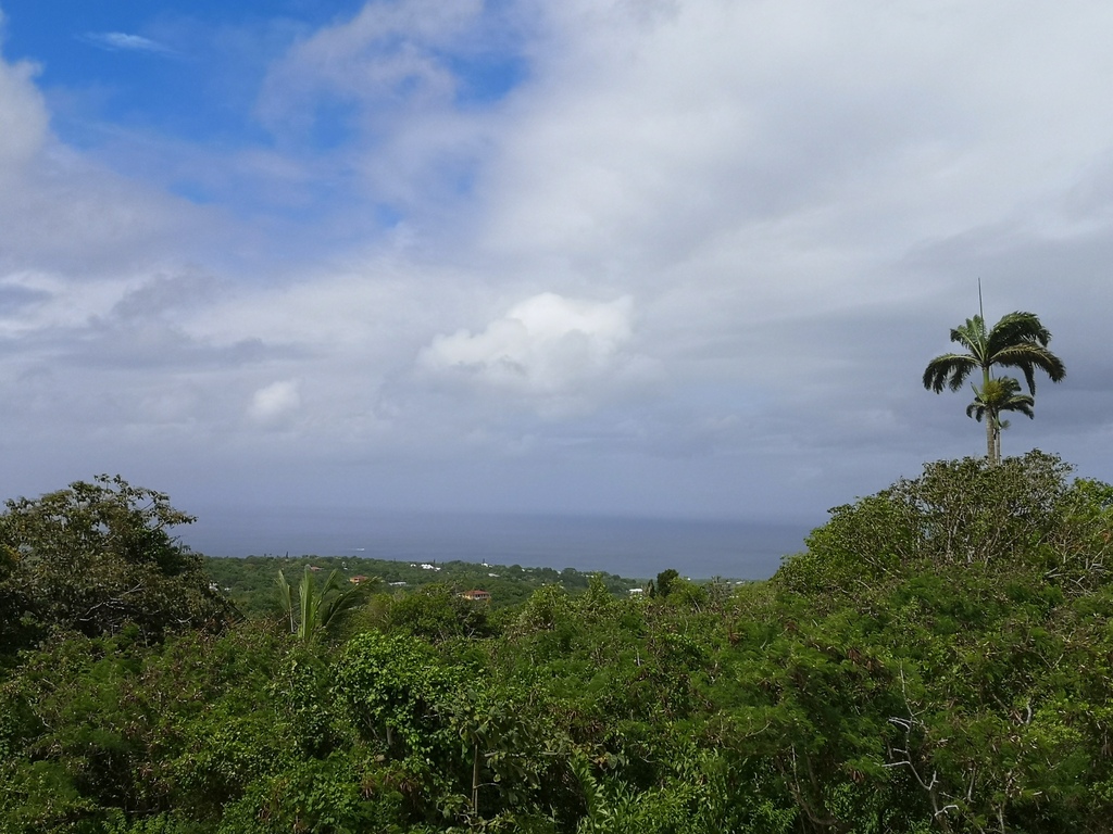
Today has been a Tropical Wave day, cloudy with some sunshine and a couple of light showers. A number of showers are on the Guadeloupe radar to the east of us as the wave passes. Small island in a big sea, they easily miss us.
A couple pictures of the view. Cloudy and sunny. Nevis Peak and a passing shower.
Meanwhile further to the east is disturbance AL92. A lack of development overnight looks as if it has prompted the NHC to downgrade cyclone formation by 10% at 2pm today.
Will the centre pass to the north (lighter winds) or the south (stronger winds)? We await nature to let us know.
Whether it remains an active tropical wave or becomes a Tropical Storms when it reaches us still means wind and rain.
So nothing for certain at the moment.
Prepare for the worse, but hope for the best. Don't leave it to late.
2 pm NHC forecast.
"Shower activity associated with a broad area of low pressure located about 1000 miles east of the Windward Islands has changed little in organization since this morning. Environmental conditions are
expected to become somewhat more favorable for development during the next few days and a tropical depression or tropical storm is likely to form during that time frame. The system is forecast to
move westward to west-northwestward at 15 to 20 mph and it could bring heavy rain to portions of the Leeward Islands by late
Wednesday, regardless of development. Interests in the Lesser Antilles should continue to monitor the progress of this system."
* Formation chance through 48 hours...high...70 percent.
* Formation chance through 5 days...high...80 percent.
Regards,
Frank Goodwill
Pond Hill Weather Station, Nevis.
https://www.wunderground.com/dashboard/pws/ISAINTGE361
Weather CAM
https://assets1.webcam.io/w/9jBOB9/latest.jpg
Blog
https://nevisstorm.blogspot.com 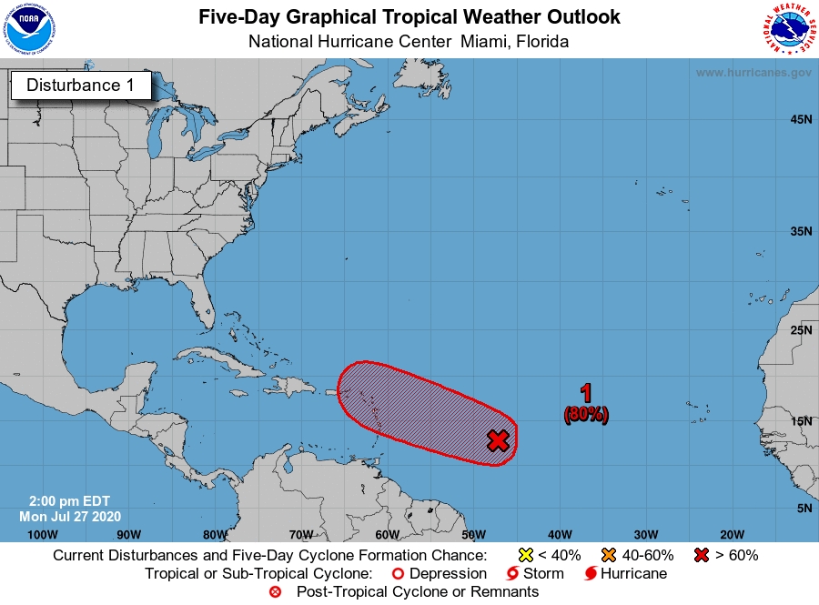
|
|
- Weather to the East ?
|
- By "Harry W. Hallstrom" <hwh888 at gmail.com>
- Date: Mon, 27 Jul 2020 08:34:49 -0300
|
Greetings All,
A disturbance east of the Caribbean Islands seems(?) to be developing. National Hurricane Center apparently is unsure of track and/or storm conditions as they have not published any information as to where it's heading. It does appear it will be somewhere near the Leeward Islands. One predictor places it passing NE of Nevis St. Kitts out beyond vicinity of Barbuda.
Maybe when NHC published paths & wind speed predictions we will have a more precise picture. In the mean time I would be prepared for rain and winds.
More later.
|
|
- Weather in Nevis... what's happening next week?
|
- By Frank Goodwill <nevis.storm at hotmail.com>
- Date: Fri, 24 Jul 2020 22:40:03 +0000
|
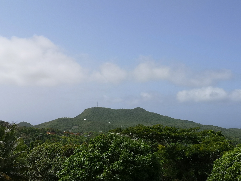
Good afternoon all,
The changing scene to the south of us has continued with TS Gonzalo. Always a problem with small sized storms, they can fluctuate up and down in strength a lot. So it looks as if it will remain as a Tropical Storm as it passes over the
Windward Islands on Saturday and not become a Hurricane.
Today in Nevis it has remained dry with the wind picking up during the day with average wind speed of 10 mph with a gust of 26 mph.
Maximum temperature for today was 84 F.
A health warning with this as you need to remember I am up in the foothills of Nevis Peak ( at 950 feet above sea level). You get different readings lower down towards the coast. <smile>
The Saharan Dust has been back with us so the view has been hazy all day (See attached Photos).
The weather forecast for Saturday and Sunday is sunny with a chance of a shower. Monday on the other hand is forecast to be showery with a chance of thunderstorms. We shall see.
Looking out across the Atlantic we have a tropical wave with a good chance of forming into a tropical cyclone. FROM MODELLING FORECASTS it seems it could be heading for our corner of the Eastern Caribbean. Last time I looked the 5pm NHC
forecast gave it a 40% chance of forming into a tropical cyclone. So the forecast has increased in percentage.
I had a look at some of the modelling that has given the NHC this forecast and have attached a couple of pictures the modelling has presented for later next week. AGAIN THIS IS ONLY A FORECAST MODEL.
It needs to be watched, it is a long way out and can change.
I have to keep reminding myself this is still July and not August. I wonder if this will be busy season similar to 2005?
We have been warned it would be an above average season by the forecasters, so we should be prepared. Prepared for the worst but hope for the best.
Regards,
Frank Goodwill
Pond Hill Weather Station
https://www.wunderground.com/dashboard/pws/ISAINTGE361
Pond Hill WeatherCAM
https://assets1.webcam.io/w/9jBOB9/latest.jpg
Nevis Weather
https://nevisstorm.blogspot.com/
Sent from
Mail for Windows 10
|
|
|
- Still another tropical wave.......
|
- By "Harry W. Hallstrom" <hwh888 at gmail.com>
- Date: Thu, 23 Jul 2020 22:13:14 -0300
|
Greetings All,
Another tropical wave just forming off coast of Africa.
This one looks to reach the Caribbean Islands a bit closer (further north tracking than Gonzalo) to Nevis & St. Kitts.
Will keep an eye on this one, with a better idea later this weekend. Stay tuned.
|
|
- Gonzalo Updated to Hurricane
|
- By "Harry W. Hallstrom" <hwh888 at gmail.com>
- Date: Thu, 23 Jul 2020 07:14:23 -0300
|
Greetings All,
Gonzalo has been upgraded to a hurricane this am. Will reach hurricane strength as to nears the Windward Islands. Tracking still the same, well below Nevis - St. Kitts.
|
|
- Storm Gonzalo
|
- By "Harry W. Hallstrom" <hwh888 at gmail.com>
- Date: Wed, 22 Jul 2020 18:26:05 -0300
|
Greetings All,
Looks like the first storm of the season will make a bee line for
Saint Vincent and the Grenadine. This puts Nevis & St. Kitts out of the picture. May not even get any showers from this.
|
|
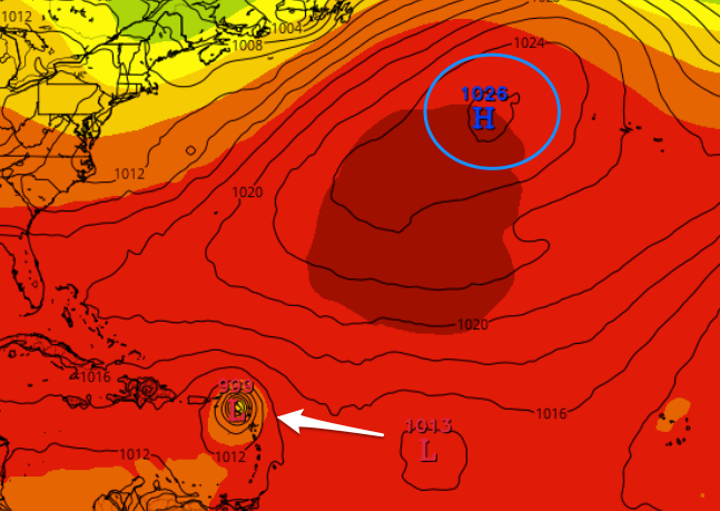
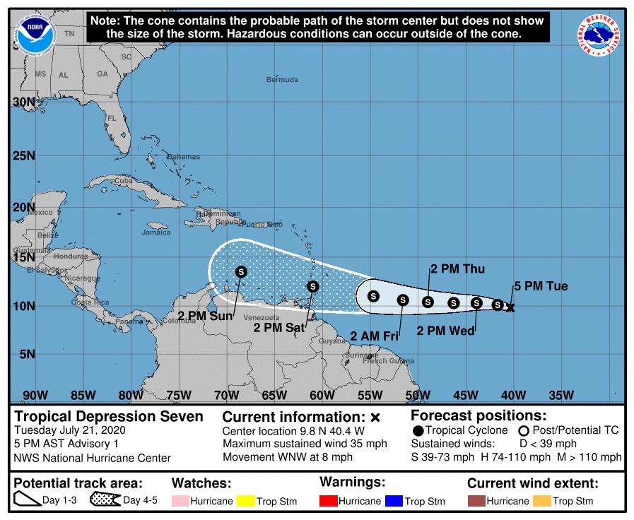
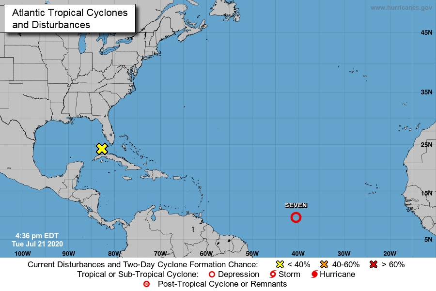
- IN99L now Tropical Depression 7
|
- By Frank Goodwill <nevis.storm at hotmail.com>
- Date: Tue, 21 Jul 2020 21:53:05 +0000
|
Good afternoon all,
The disturbance in the Atlantic (Invest 99L) has now been upgraded to Tropical Depression 7 by the NHC as of 5 pm AST.
Looks as if it will soon form into a Tropical Storm and will remain so as it passes over the Windward Islands this coming Saturday.
Needs to be watched in case things change.
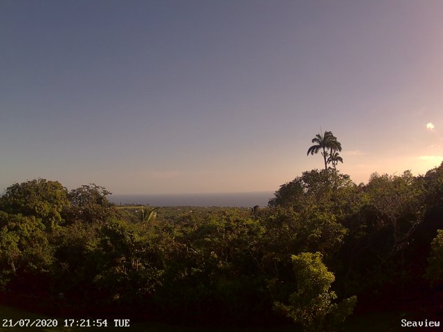
Today on Nevis the weather was bright and sunny as can be seen from the late afternoon view. There was a short shower in the early hours but nothing of great substance.
Regards,
Frank Goodwill
Pond Hill Weather Station
https://www.wunderground.com/dashboard/pws/ISAINTGE361
Pond Hill WeatherCAM
https://assets1.webcam.io/w/9jBOB9/latest.jpg
Nevis Weather
https://nevisstorm.blogspot.com/
Sent from
Mail for Windows 10
|
|
|
- Looking to the East
|
- By Frank Goodwill <nevis.storm at hotmail.com>
- Date: Tue, 21 Jul 2020 08:45:48 -0400
|
Good morning,
A tropical wave with a associated low pressure has caught the interest of the US National Hurricane Center. They are now giving it a 60% chance of developing into a tropical system. A jump from 20% overnight.
"Showers and thunderstorms have become better organized in association with a low pressure system located about midway between the west coast of Africa and the Lesser Antilles. Environmental conditions are expected to be somewhat conducive for development, and a tropical depression could form during the next day or two while the low moves westward at around 10 mph over the tropical Atlantic. By the weekend, however, less favorable conditions should limit additional development.
* Formation chance through 48 hours ...medium ...60 percent. * Formation chance through 5 days ...medium ...60 percent.
Though we are up to 6 named storms so far, none have been in our neck of the woods. One to watch in the coming days. Its progress across the Atlantic has slowed down since yesterday from around 15 mph to 10 mph.
Regards,
Frank Goodwill Pond Hill Weather Station, Nevis.
https://www.wunderground.com/dashboard/pws/ISAINTGE361
Weather CAM
https://assets1.webcam.io/w/9jBOB9/latest.jpg 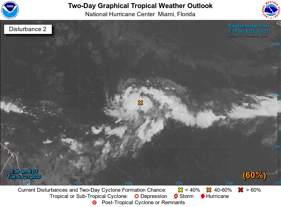
|
|
- Some Showers
|
- By Frank Goodwill <nevis.storm at hotmail.com>
- Date: Wed, 15 Jul 2020 07:48:28 -0400
|
Good morning all,
Saharan Dust was visible Tuesday morning, but by late Tuesday afternoon visibility had improved.
A trough of low pressure has approached the area. This, along with available moisture, had heightened the chances for cloudiness and showers across the area.
Up in the Nevis Peak foothills we have had about half an inch of rain early Wednesday.
Between today and Saturday there is a possibility of a few brief cloudy spells and a chance of showers developing.
Attached photos. Tuesday morning started a little hazy and a clearer view later on. Also a cloudy start to Wednesday.
Regards,
Frank Goodwill
Pond Hill Weather Station, Nevis.
https://www.wunderground.com/dashboard/pws/ISAINTGE361
|
|
- A Few Showers
|
- By Frank Goodwill <nevis.storm at hotmail.com>
- Date: Mon, 13 Jul 2020 00:01:50 -0400
|
Good night everyone 😀
The "active" tropical wave has passed, resulting in a few showers Saturday afternoon into Sunday morning. Up in the Nevis Peak foothills the rain total was 3 tenths of an inch.
We are now back to another surge of Saharan Dust for two or three days. The associated dry air will reduce show activity.
The next tropical wave is due late Tuesday but it is forecast to be a weak affair.
On the Covid-19 front we had our 17th confirmed case on Friday. A health worker who was in contact with case number 16.
123 students of Ross University have returned to St. Kitts to commence their studies. They are presently in quarentine in on campus student accommodation for 14 days. So we see how that goes.
Attached: Today's cloudy view.
Regards,
Frank Goodwill
Pond Hill Weather Station, Nevis.
https://www.wunderground.com/dashboard/pws/ISAINTGE361 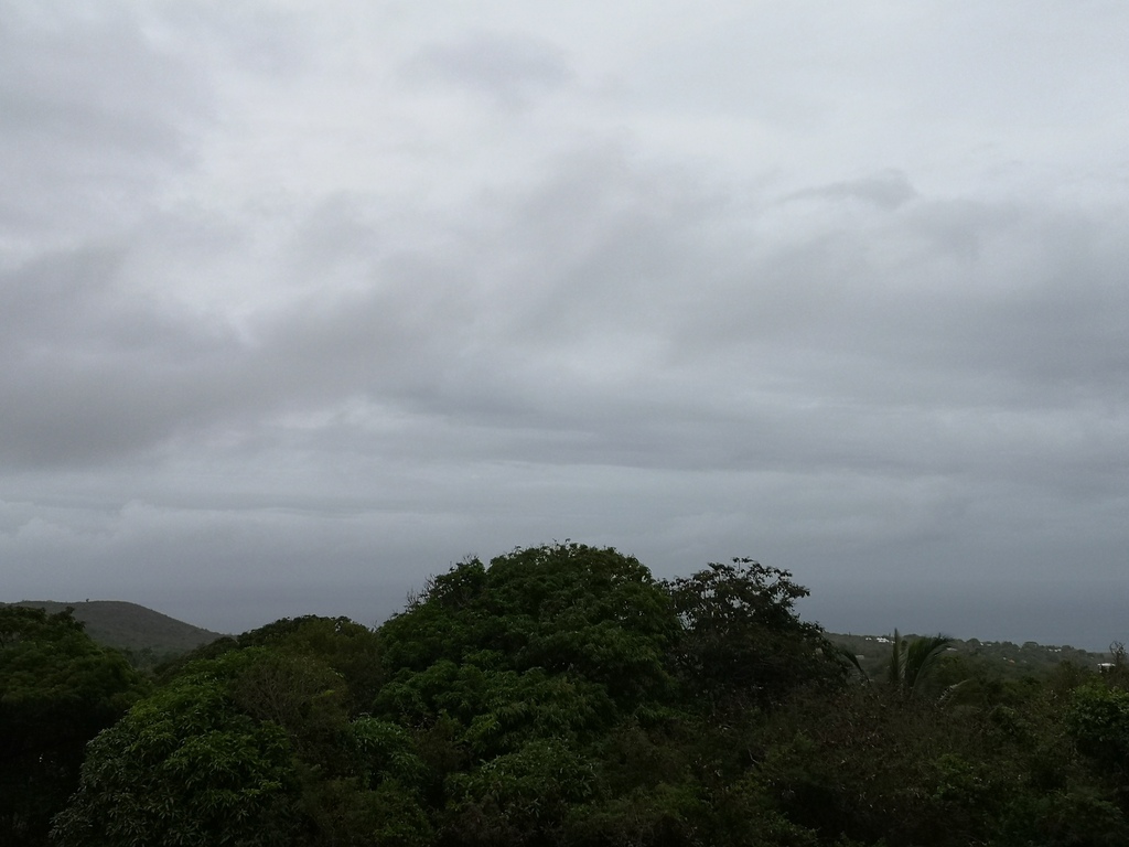
|
|
- Back to Dry
|
- By Frank Goodwill <nevis.storm at hotmail.com>
- Date: Wed, 08 Jul 2020 22:39:18 -0400
|
Good day all,
After yesterday's wet weather, today has been dry with hazy sunshine. So the effects of the tropical wave have passed us by. The hazy conditions are probably due to Saharan dust, but it is not as bad as we have recently experienced.
The next tropical wave is due to arrive on Saturday, so it will be interesting to see how it performs.
Colorado State University has upped it's prediction of named storms from 19 in June to 20 for the Atlantic hurricane season. Five so far, with none being strong or prolonged, but we press onward towards the peak of the season. Things can change so plan and prepare.
https://www.google.com/amp/s/amp.cnn.com/cnn/2020/07/07/weather/hurricane-season-2020-forecast-update/index.html
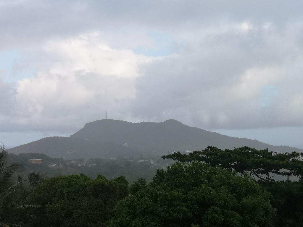
Photo attached is of Nevis Peak with its cloud hat.
Regards,
Frank Goodwill Pond Hill Weather Station, Nevis.
https://www.wunderground.com/dashboard/pws/ISAINTGE361 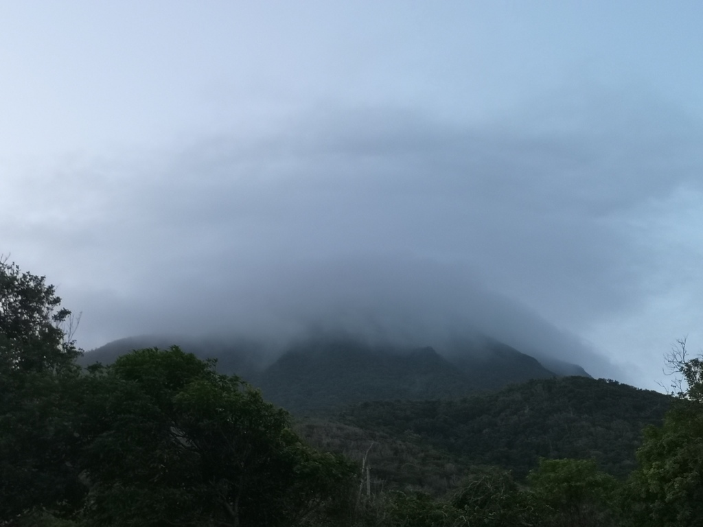
|
|
- Active Tropical Wave
|
- By Frank Goodwill <nevis.storm at hotmail.com>
- Date: Wed, 08 Jul 2020 00:15:08 -0400
|
Good day all,
The tropical wave arrived and gave us some showers, mainly during Tuesday afternoon. Up in the Nevis Peak foothills I recorded just over an inch of rain for the day. The showers were accompanied with rumbles of thunder and some gusty winds.
Some further showers are forecast for Wednesday - we shall see.
Photos attached of afternoon views.
Regards,
Frank Goodwill Pond Hill Weather Station, Nevis.
https://www.wunderground.com/dashboard/pws/ISAINTGE361 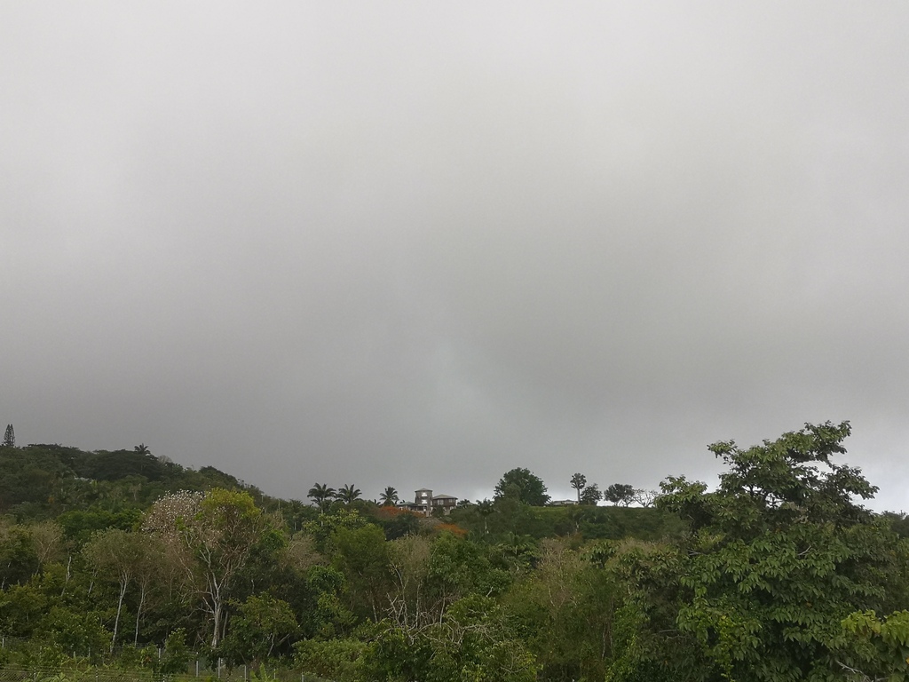

|
|
- Breezy
|
- By Frank Goodwill <nevis.storm at hotmail.com>
- Date: Mon, 06 Jul 2020 19:23:00 -0400
|
Good evening all,
We have had a short sharp shower over night, but it remains dry here A fairly active tropical wave is passing through the area and winds have become more gusty this afternoon. Here up in the Nevis Peak foothills winds have averaged about 9 mph with a gust measuring 27 mph.
Tomorrow's forecast indicates a moderate chance of showers, so we will see how much wet stuff that will bring. Hopefully something more than cloud cover
There is still some Saharan dust around so the view is a little hazy.
On the Covid-19 front the borders are still closed to commercial passenger arrivals. After 76 days of being case free, a returning national who came in from Washington DC, USA, has tested positive. This was at the end of their 14 day quarentine in St. Kitts. They have now been put into isolation and will hopefully make a full recovery.
Evening view picture attached
Regards,
Frank Goodwill Pond Hill Weather Station, Nevis.
https://www.wunderground.com/dashboard/pws/ISAINTGE361 
|
|
- Less Dust but with Showers
|
- By Frank Goodwill <nevis.storm at hotmail.com>
- Date: Wed, 24 Jun 2020 10:37:25 -0400
|
Good morning everyone,
The unhealthy plume of Saharan dust has weakened. As we now have a tropical wave passing over us. This has resulted in some welcomed showers this morning. No doubt it will clean out the atmosphere, so it will be interesting to see how much dust is deposited on the car. It is feeling fresher up here in the Nevis Peak foothills. Another plume of Saharan dust is forecast for the end of the week, so we will see how that goes.
Regards,
Frank Goodwill Pond Hill Weather Station, Nevis.
https://www.wunderground.com/dashboard/pws/ISAINTGE361 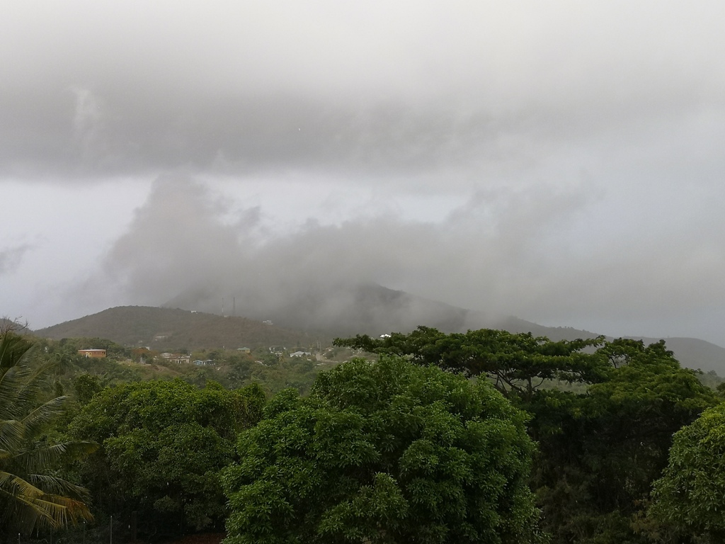
|
|
- Poor Air Quality
|
- By Frank Goodwill <nevis.storm at hotmail.com>
- Date: Sun, 21 Jun 2020 08:58:30 -0400
|
Good morning all,
We managed to get about a tenth of an inch of rain yesterday. Today is Saharan Dust Sunday with poor air quality and hazy conditions.
Regards,
Frank Goodwill Pond Hill Weather Station, Nevis.
https://www.wunderground.com/dashboard/pws/ISAINTGE361 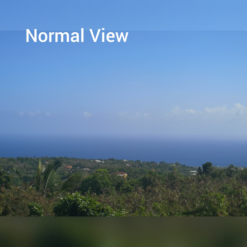
|
|
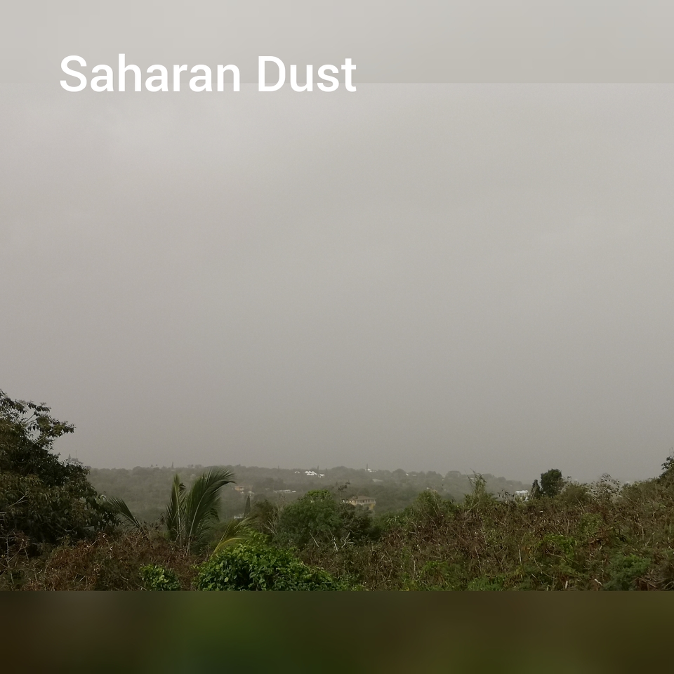
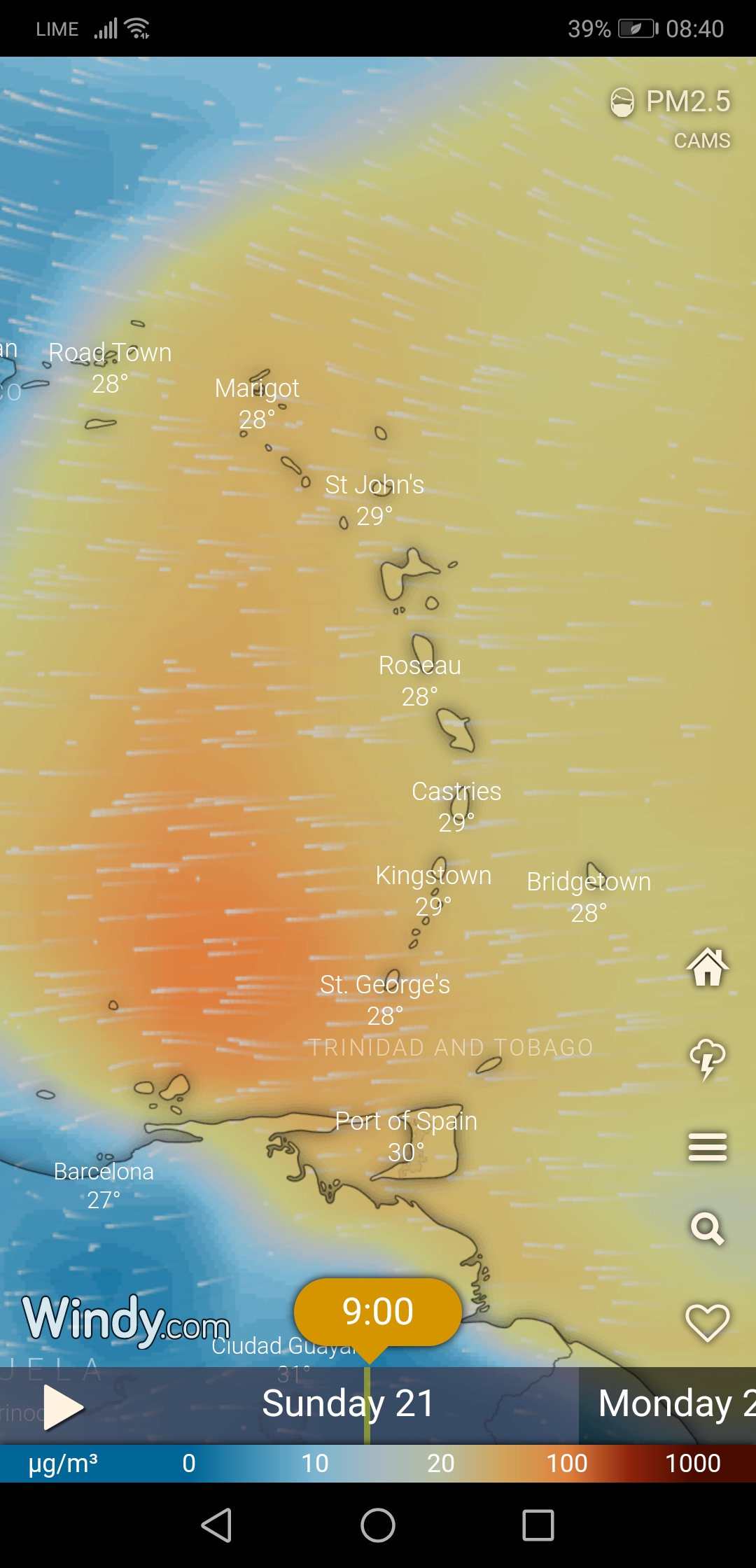
- Saharan Dust
|
- By Frank Goodwill <nevis.storm at hotmail.com>
- Date: Sat, 20 Jun 2020 17:04:26 -0400
|
Good day all,
As reported elsewhere on StormCarib we are being effected by dry air/Saharan dust. The tropical wave conveyor belt is up and running from Africa to the Caribbean, with a wave passing over us at the moment. We had a short shower/drizzle this morning with no major impact. The dry air is surpressing shower activity. Attached are a couple of pictures of the cloud and haze. Also a forecast graphic of the dust cloud.
Regards,
Frank Goodwill Pond Hill Weather Station, Nevis.
https://www.wunderground.com/dashboard/pws/ISAINTGE361 
Attachment:
saharan dust 202006.mp4
Description: video/mp4
|
|
- Some Wet Stuff Today
|
- By Frank Goodwill <nevis.storm at hotmail.com>
- Date: Sun, 14 Jun 2020 22:25:53 -0400
|
Good day all,
Today started off as a "Sunny Sunday" but as the morning turned into afternoon we had some light showers. No enough of the wet stuff to make a difference but it lowered the temperature and the breeze picked up a bit.
One advantage of being up in the Nevis Peak foothills is that it is a bit cooler anyway.
I managed to get the old weather station working again. More of a newer weather station now. Web link below
There were 15 cases of Covid-19 in St. Kitts and Nevis, all of whom recovered without any complications. There have been no further cases for over a month and this has led to the restrictions being eased skowly. We should wear a face mask/covering when in a public place. Going into a bank with a mask on is strange. Our borders are still closed to tourists and visitors at present
Attached are the present Covid-19 restrictions and a Nevis view.
Regards,
Frank Goodwill
Pond Hill Weather Station, Nevis.
https://www.wunderground.com/dashboard/pws/ISAINTGE361 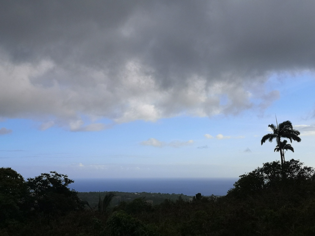


|
|
- Nevis May Weather Data
|
- By "Harry W. Hallstrom" <hwh888 at gmail.com>
- Date: Sat, 6 Jun 2020 21:54:29 -0300
|
Greetings All,
Attached May NOAA weather data for Nevis.
The drought continues here with little rain fall.
Attachment:
Nevis Weather Data May 2020.pdf
Description: Adobe PDF document
|
|
- Dry and Covid-19
|
- By Frank Goodwill <nevis.storm at hotmail.com>
- Date: Sun, 24 May 2020 17:23:09 -0400
|
Good day all,
Slight winds, dry and hot is the order of the day. The vegitation is starting to brown instead of being a lush green.
A little relief at 5pm with a short shower.
Due to the dry weather water rationing overnight started mid-May in Nevis.
Notice from the Nevis Water Department. 16 th May 2020.
The General Public is ask to take note of the following measures relating to the dry-spell currently being experienced. The water department has implemented a water rationing schedule which will continue. The areas to be affected are follows:
Butlers, Brickiln, Potworks,Burnaby, NewCastle, Camps, Nisbette Settlement, Lower Westbury, Cades Bay,Clifton Estate Zion village, Hanleys Road, Hichmans, Rices, Victoria Road, Upper Church Ground, Brownhill, Upper Hamilton, Cherry Gardens, Prospect, Bath Village,Bath Plain, Upper and Lower Stoney Grove, Charlestown. This interruption will occur between 10:00 pm and 4:00 am nightly.
This exercise would commence Saturday 16, May and will continue until further notice.
Covid-19
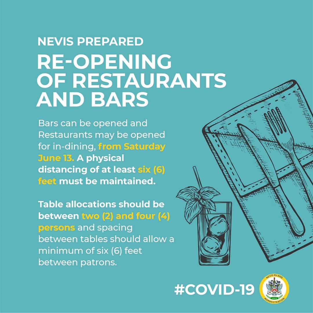
All of the 15 confirmed cases have now recovered with no major hospital intervention required. We have had no new cases diagnosed for. 30 days. We are still under curfew at night and mask wearing and social distancing is the order of the day.
Bars are closed to prevent social gathering and restaurants only provide takeaway/takeout service.
Airports and seaports remain closed to tourists and visitors. Only cargo, repatriation flights and emergency evacuations are allowed as well as returning nationals.
The 5th June is the Federal election on St Kitts and Nevis.
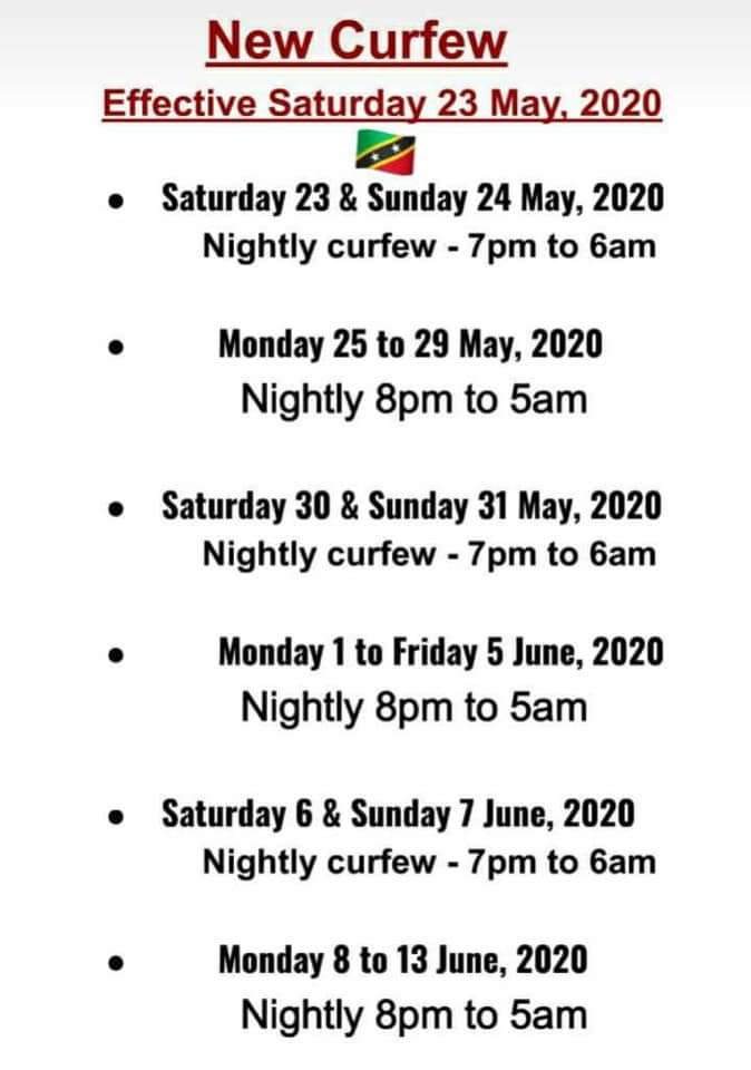
Attached is the present curfew times and the 5pm shower.
Stay safe stay well.
Frank Goodwill
|
|
- Another Season
|
- By Frank Goodwill <nevis.storm at hotmail.com>
- Date: Thu, 14 May 2020 12:48:47 -0400
|
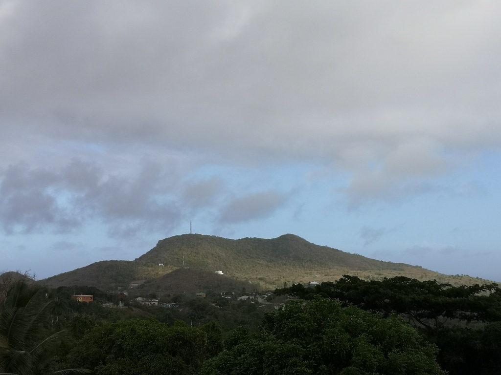
Good day all,
Another early start to the season in May. Invest 98L kicking things off between Florida and Cuba. Could result in a named storm #Arthur at the weekend.
Meanwhile blue sea and blue sky in Nevis, though a little hazy.
Regards,
Frank Goodwill
|
|
- Nevis April Weather Data
|
- By "Harry W. Hallstrom" <hwh888 at gmail.com>
- Date: Tue, 12 May 2020 20:58:55 -0300
|
Greetings All,
Seems I forgot to upload the weather data from station for last month. Been so busy sheltering in lock down.
Attachment:
April 2020 Weather Date for Nevis.pdf
Description: Adobe PDF document
|
|
- Nevis Weather Date for March
|
- By "Harry W. Hallstrom" <hwh888 at gmail.com>
- Date: Sun, 5 Apr 2020 10:29:33 -0300
|
Greetings All,
Hoping this post finds everyone safe and sound till the dust settles............. Attached the weather station data in NOAA format for those interested.
Attachment:
March Nevis NOAA Weather Data.pdf
Description: Adobe PDF document
|
|
