- Saint Thomas, VI undefined | Weather Underground
By Jane Higgins <jhigginswear at gmail.com>
Date: Fri, 28 Dec 2018 08:02:18 -0400
Active weather alert. Very windy, and carwash rain. The heirloom tomato plants
bent over. Just tucked some deck items in. Thinking of those thousands still
living under tarps. Not a good day for flying or sailing. Any kind of rainy
wind goes right to the gut.

https://www.wunderground.com/severe/us/vi/saint-thomas
- Christmas Eve Morning
By Jane Higgins <jhigginswear at gmail.com>
Date: Mon, 24 Dec 2018 10:07:39 -0400
Gorgeous day....80 degrees.   78% humidity, blue skies, perfect tomato
growing weather. We are so lucky. HAPPY HOLIDAYS
>>
How grateful are we? Getting thru storm season without a huge scare, and
knowing our favorite time of year in the Caribbean will bring us joy and bounty.
Happy Holidays dear Caribbean neighbors. Stay in touch.
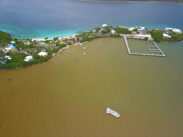
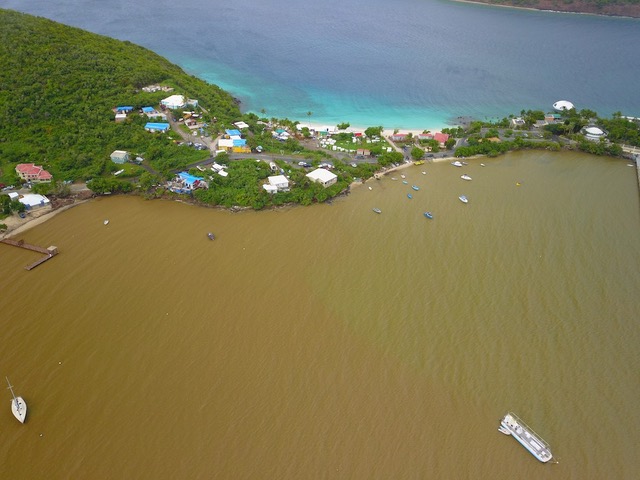
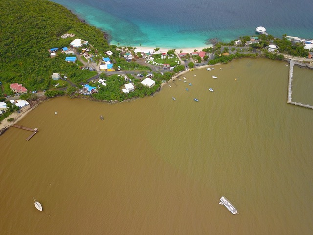
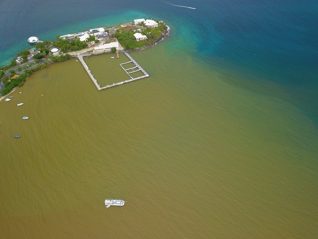
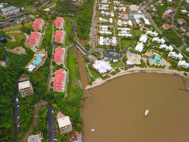
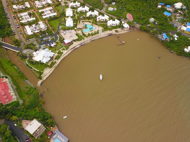
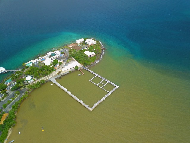
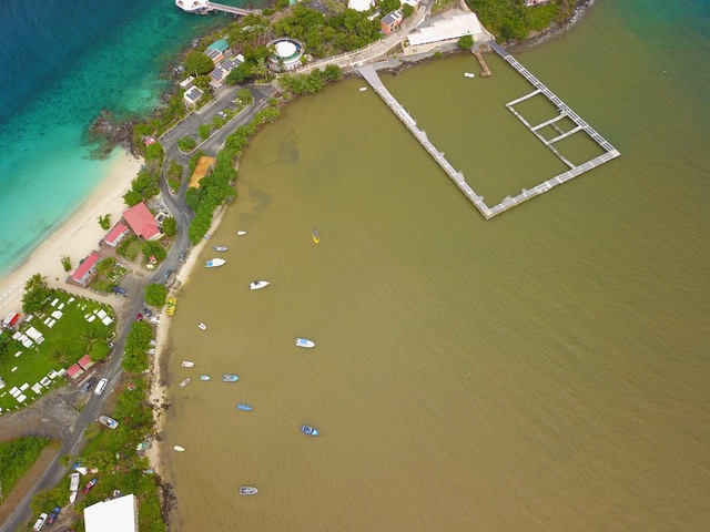
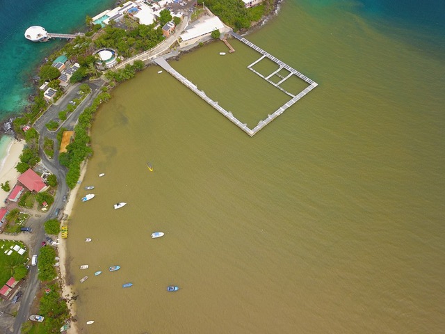
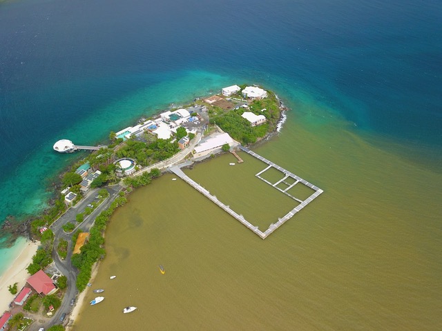
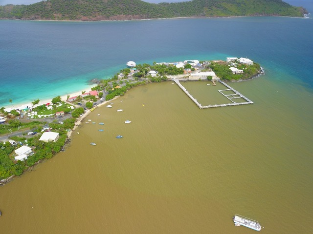
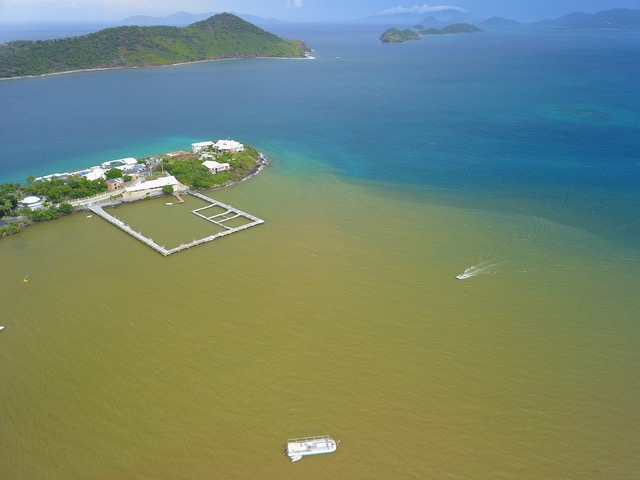
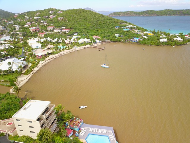
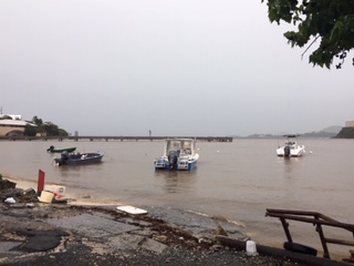
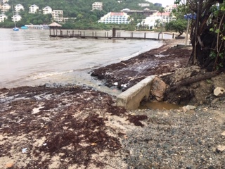
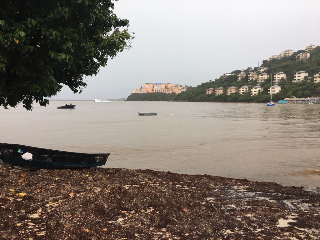
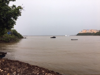
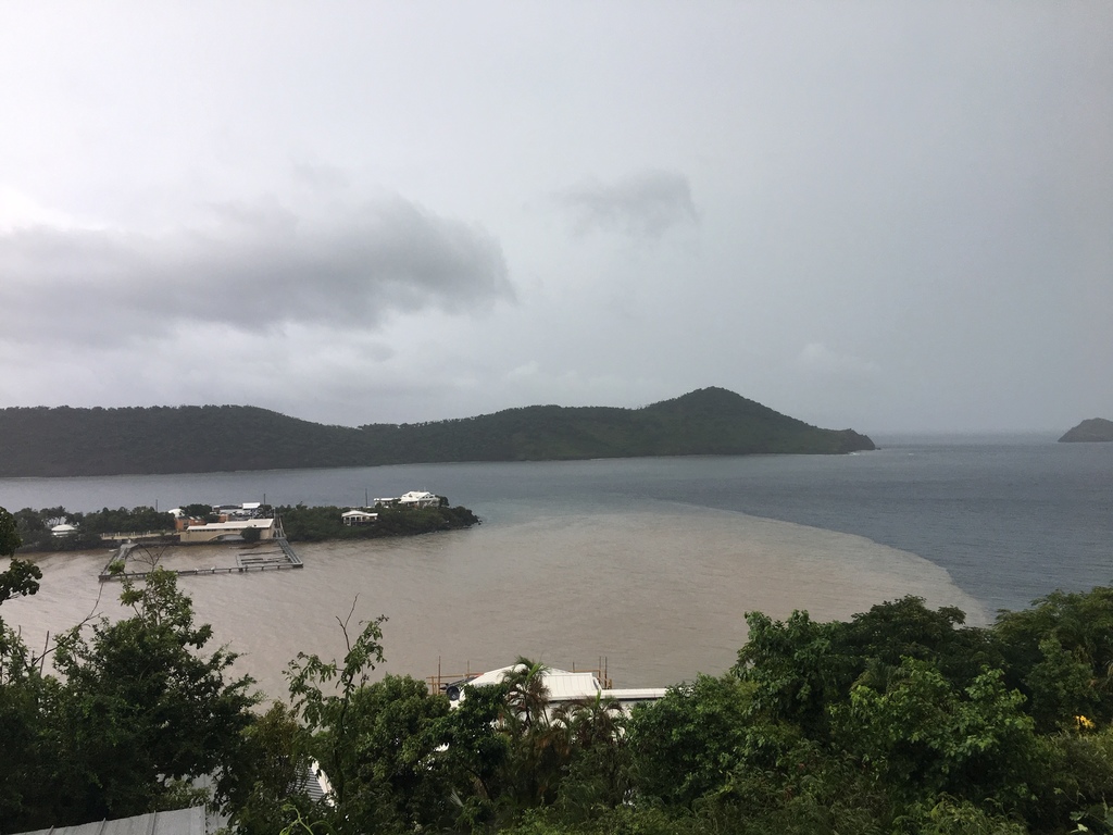
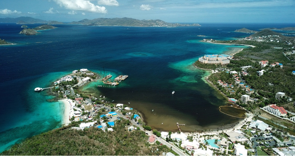
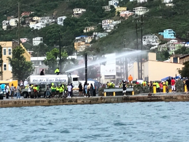
- St Thomas after downpour ,Water Bay- And The Dolphinarium Today
By Jane Higgins <jhigginswear at gmail.com>
Date: Thu, 8 Nov 2018 17:21:38 -0400
The pen in the water is for captive dolphins. This is what run off looks like
after a downpour. There is no mitigation, fence, or structure that can keep
the humans swimming with dolphins or the dolphins safe. Please say no to
captive dolphins on your islands and support your local environmental groups
to protect our bays. With permission from the photographer.

>>
>>
>>>
>>
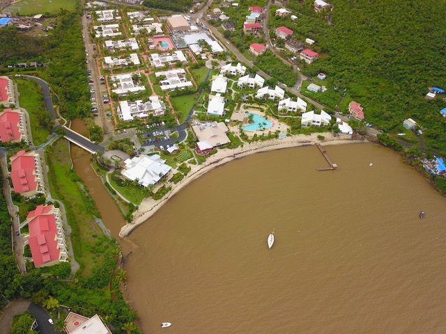
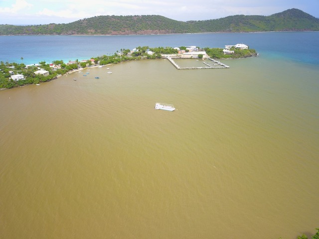
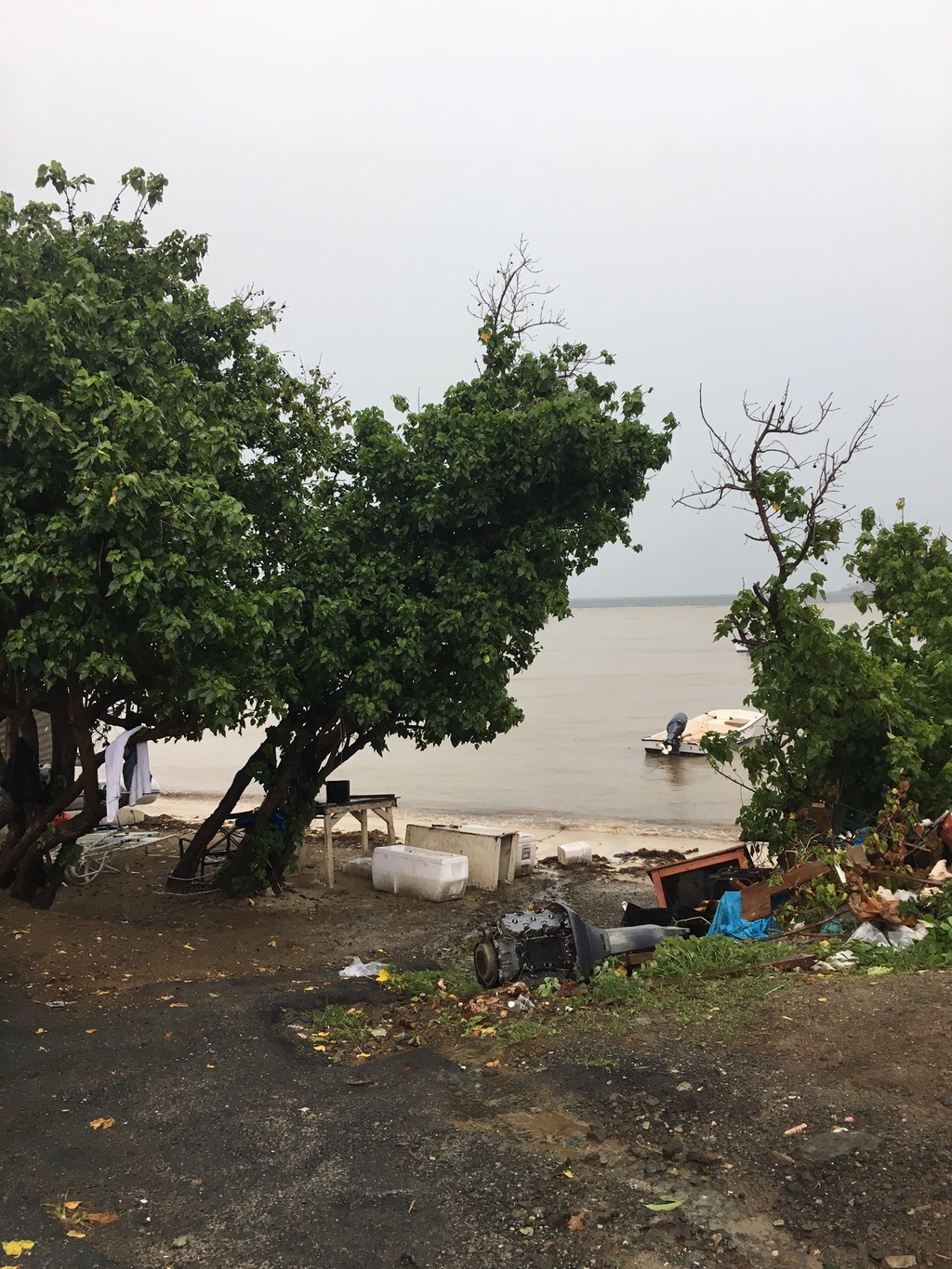
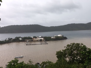
- Rainy Days Are Bad Days For Captive Dolphins -Water Bay , St Thomas
By Jane Higgins <jhigginswear at gmail.com>
Date: Thu, 8 Nov 2018 13:54:04 -0400
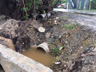
Rainy days mean sad days for the dolphininarium to come. Nicole Mynhier took pictures this morning of the runoff in Water Bay. We are in disbelief that permits were approved for this project. It is glaringly obvious this
is a terrible bay for acceptable water quality. And so
obvious that a dolphin enclosure does not belong in a tropical weather
region like the Virgin Islands.
This is the road leading to Water Bay, full of runoff as you can see.
This is the dolphin pen in the background
This is the filthy area on the shoreline of Water Bay.So much junk and trash.
This is the Margaritaville Beach and the drainage pipe from the street into Water Bay.
Water Bay, St Thomas
The drainage pipe
The dolphinarium pen in muck.
You can see the clean water outside of the Water Bay and how FULL the bay is of brown runoff.
Not fit for humans or dolphins.
We can still Save Water Bay and the dolphins.
Say no to dolphin captivity.
Jane Higgins,
The Committee to Save Water Bay
St Thomas
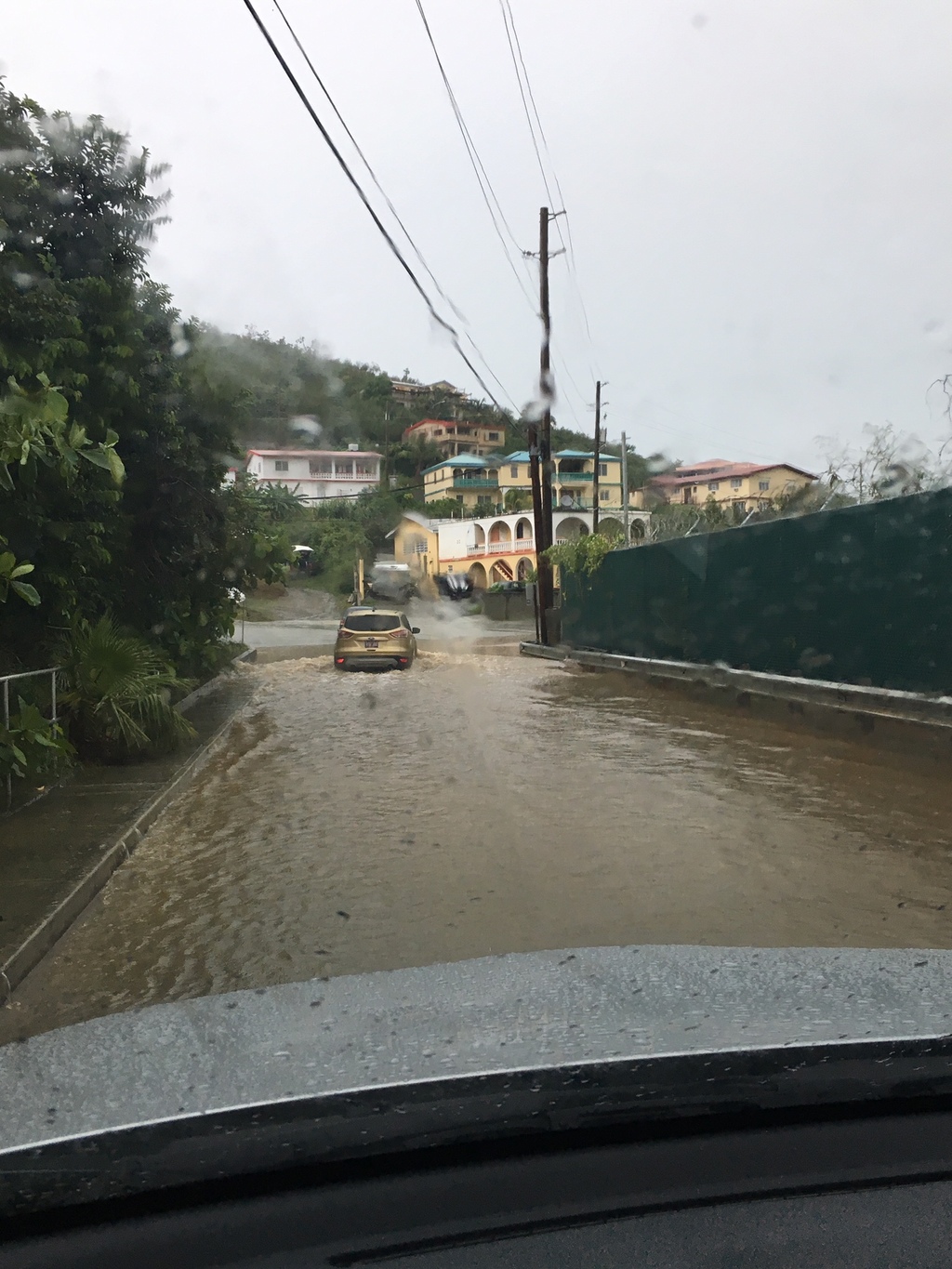
- Wild Morning in the Virgin Islands
By Jane Higgins <jhigginswear at gmail.com>
Date: Thu, 8 Nov 2018 13:46:01 -0400
Schools and government closed. Loads of rain, some gusts up to
33 mph on mountain top. This video was this morning above town.
Attachment:
IMG_5467.mov Description: QuickTime movie
Looks like the Spanish Virgin Islands are really in it this morning. In the
West
End of St Thomas we are under a blanket of grey, 77 degrees, little gusts up to
8mph, seas are steely, no horizon. We off the gridders are looking for
some solar boost.
https://www.wunderground.com/weather-radar/united-states/pr/san-juan/jua/
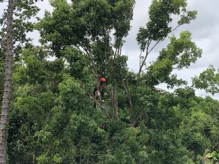
- Trees and Weather
By Jane Higgins <jhigginswear at gmail.com>
Date: Fri, 19 Oct 2018 07:41:31 -0400
Trimming and felling trees around the house is also part of storm
preparedness. We know what damage a tree can do when the winds come.
This huge genip is getting topped off to let more sun come thru to the
solar panels; one year ago there was not a leaf on it. Time heals.
Lucky October, so far so good. 77 degrees, 85%humidity, passing showers.
>
>
>
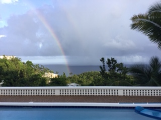
- Lucky Rainbow
By Jane Higgins <jhigginswear at gmail.com>
Date: Tue, 16 Oct 2018 07:17:35 -0400
Thinking of that broken houses sleepy hollow naked forest green muck pool view
we were looking at last year in mid October ;this lucky rainbow today looks
pretty good. We are recovering . At a cool 75 degrees, 91 %humidity after heavy
dawn downpours, looks like more passing showers this morning. Tiny breeze of 4
mph.
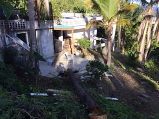
The earthquake.usgs.gov site shows 11 earthquakes over night with a 5.2 in the
DR and 4 north of Tortola, BVI. We heard a big thump in the night and woke up to
one of our Norfolk pine totem poles (stripped by Irma) fallen to within 6
inches of the
generator .wrecking a few potted plants and the top of the tree in the pool. We
were so
lucky it did not fall towards the house. Time to call the arborist and take the
rest
down. Did you feel the quakes? Gorgeous morning , 82 degrees, 79%humidity,
calm seas, bright, clear horizon.
Tropical Depression Eleven Discussion Number 2 NWS National Hurricane Center Miami FL AL112018 500 AM AST Sat Sep 22 2018
Deep convection remains displaced to the east of the depression''s center due to 30-40 kt of westerly shear. Although Dvorak final-T numbers from TAFB and SAB have decreased since yesterday--now a consensus T1.0--the initial intensity is held, perhaps generously, at 30 kt. Strong westerly shear is expected to persist for several days, which at the very least will prevent the depression from getting any better organized. Since the global models show the depression opening up into a trough in about 24 hours, the new NHC intensity forecast brings down the winds a little faster, shows the system becoming a remnant low by 36 hours, and dissipates the low entirely by 48 hours well east of the Windward Islands. This evolution could certainly occur more quickly than indicated by the official forecast.
The center of the depression has not been moving much, and it''s possible the sheared convection is trying to pull it back toward the east. However, the average motion over the past 12 hours is westward, or 270/4 kt. The track guidance insists that the depression should move slowly west-northwestward over the next couple of days, but given that the system has not made any northward progress, I elected to skirt the southern edge of the guidance envelope. This new forecast is a little south of the previous NHC track prediction.
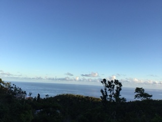
Facing NorthEast Atlantic side from the West End of St Thomas 76 degrees
(brrr) 93%humidity, 3mph wind, just the way we like it on the anniversary
of Hurricane Marilyn 1995. We are SO LUCKY today. How is it for you?
7:30 am, that familiar whining sound as Isaac cruises by 130 miles due south of
us ,77 degrees with 91%humidity, gusts up to 19 from our low lying wind
catcher, windier at higher levels, carwash rains. Glad the lightweight deck
items were stowed last night. A few orchids took a tumble. We are SO LUCKY.
Looks like solar batteries will need a generator boost today. How are you doing?
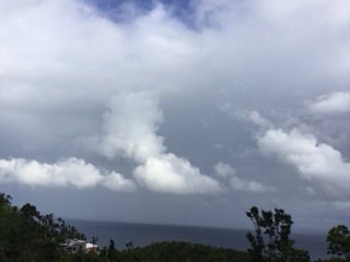
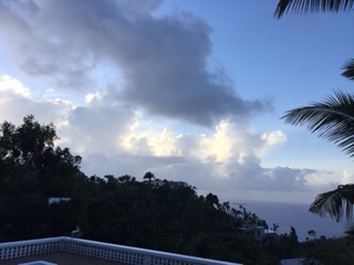
- September Wind
By Jane Higgins <jhigginswear at gmail.com>
Date: Thu, 13 Sep 2018 18:00:26 -0400
We are the windiest we've been since Christmas winds. Seas are picking up on
South and North sides. We have watched this cloud bank build very quickly
in a few minutes from SE to NW. 80 degrees 82%humidity
- San Juan Radar | Weather Underground
By Jane Higgins <jhigginswear at gmail.com>
Date: Wed, 12 Sep 2018 13:15:46 -0400
Radar is back up...good news...I would suggest that the passing showers to the
SE
of St Croix on this map are coming from way out moisture from Isaac being
sucked up to fat Florence. Looking at the whole picture do you see moisture
bands coming up thru Jamaica and Cuba and as far East to the VI being sucked up
by Freaky Florence?
Dominica , we are all sending you our best vibes, we will be here to help you.
Please let us know how you are doing?
https://www.wunderground.com/weather-radar/united-states/pr/san-juan/jua/
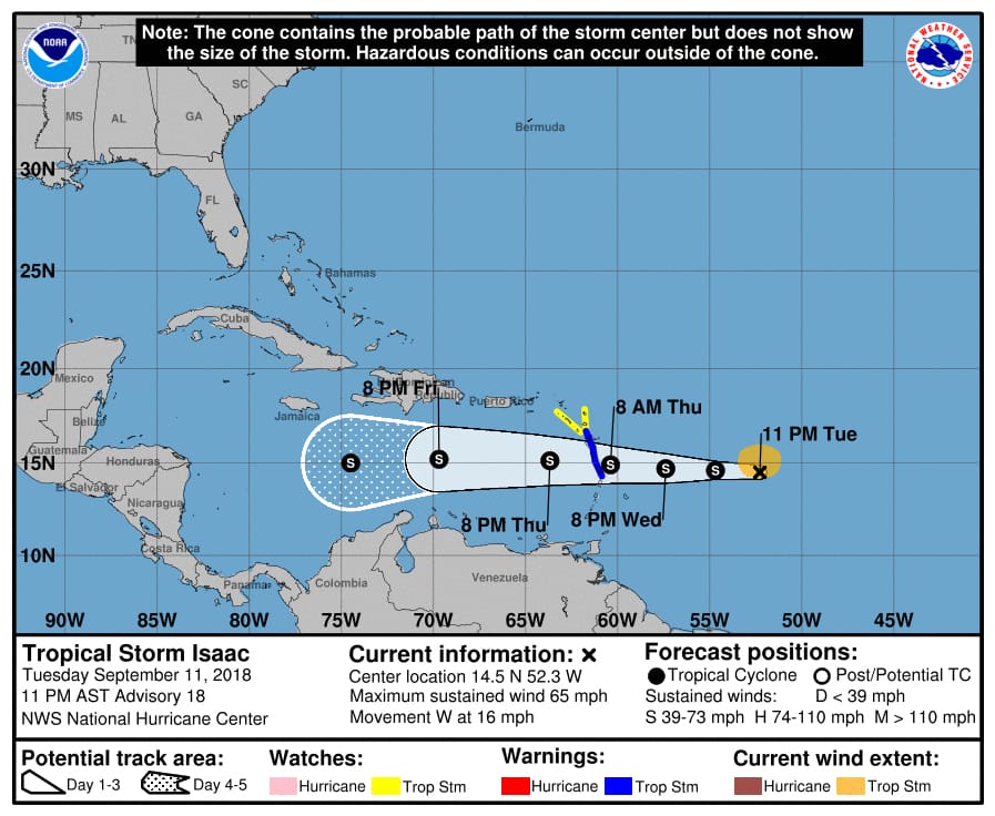
- Isaac Likely to Make Closest Pass to V.I. Early Friday | St. Thomas Source
By Jane Higgins <jhigginswear at gmail.com>
Date: Wed, 12 Sep 2018 07:56:54 -0400
Title: Isaac Likely to Make Closest Pass to V.I. Early Friday | St. Thomas Source
Isaac Likely to Make Closest Pass to V.I. Early Friday
Hurricane and tropical storm watches have been posted for several Caribbean islands as a weakening Tropical Storm Isaac continues its trek toward the Leeward and Windward Islands.
Tropical storm warnings have been issued for Martinique, Dominica, and Guadeloupe. Tropical storm watches are in effect for Montserrat, St. Kitts and Nevis, Antigua, and Saba and St. Eustatius.
According to the National Hurricane Center’s 11 p.m. Tuesday update, Isaac has weakened somewhat in the previous 24 hours and is now expected to enter the Caribbean Thursday evening as a tropical storm, rather than a hurricane.
At 5 p.m. Tuesday, the center of the tropical storm was located approximately 916 miles east-southeast of St. Croix near 14.6 degrees North, 51.3 west. The storm is packing top winds of 70 miles per hour while tracking to the west at 17 miles per hour. Tropical-storm force winds extend outward to 105 miles from the center.
The NHC expects Isaac to move near or over the central Lesser Antilles on Thursday, move into the Eastern Caribbean Sea Thursday night, and move into the central Caribbean Sea by the weekend. Current estimates have Isaac passing almost 150 miles south of St. Croix early Friday morning. At that time, Isaac will be a strong tropical storm with top winds of 60 miles per hour. The winds of Isaac are not expected to affect the Virgin Islands.
But that hasn’t stopped the territory from preparing for the worst. Effective at 8 p.m. Tuesday, the Coast Guard Sector San Juan captain of the port set port condition X-ray for the USVI and Puerto Rico due to the expectation of sustained gale force winds of 25 mph and gusts up to 40 mph generated by tropical storm Isaac that may arrive within 48 hours.
Under Port Condition X-Ray, ports and facilities are open to all commercial traffic and all transfer operations may continue.
Varlack Ventures announced Tuesday evening that it anticipates the ports will be closed at 8 a.m. Thursday, and said it will announce the last runs between Cruz Bay and Red Hook after Wednesday’s 1 p.m. advisories.
According to the NHC 11 p.m. Tuesday update, Tropical Storm Isaac’s center is “outrunning” the deep convection by about a degree due to strengthening westerly shear. Vertical shear is expected to increase and turn more northwesterly during the next 36 hours, and Isaac’s structure could degrade further over the next day or two.
Shared content for Virgin Islands Source and St. John Tradewinds.
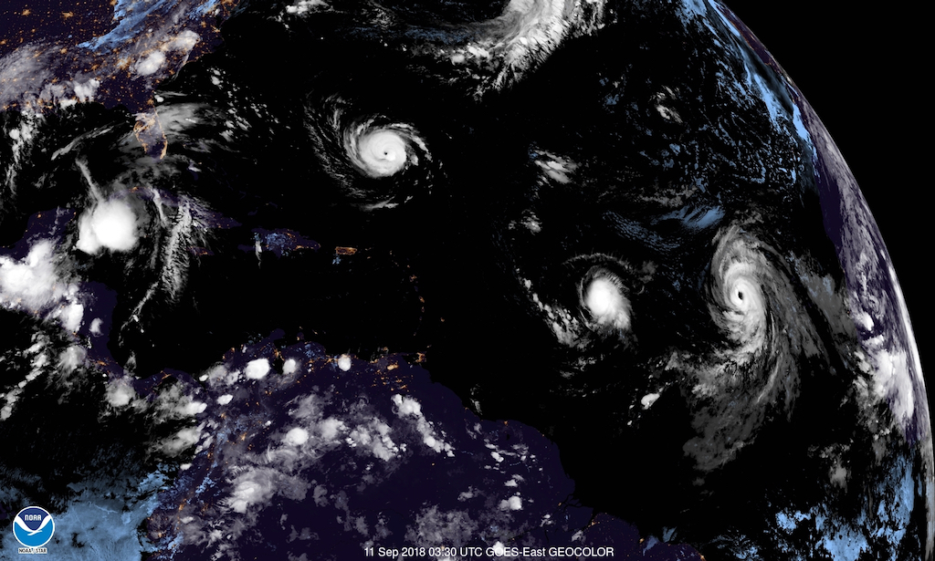
- Coast Guard Sets Port Condition Whiskey as Issac Approaches | St. Thomas Source
By Jane Higgins <jhigginswear at gmail.com>
Date: Tue, 11 Sep 2018 08:06:15 -0400
Title: Coast Guard Sets Port Condition Whiskey as Issac Approaches | St. Thomas Source
Coast Guard Sets Port Condition Whiskey as Issac Approaches
Satellite photo from 11:30 p.m. Monday shows Hurricane Florence north of Puerto Rico and the Antilles (outlined in red,) with Tropical Storm Issac to the right, and Hurricane Helene following it to the far right. (NOAA photo)
The U.S. Coast Guard Captain of the Port San Juan set port condition Whiskey effective at 8 p.m. Monday for the the U.S. Virgins Islands and Puerto Rico, which weakened slightly Monday evening but is still expected to be at or near hurricane force as it passes through the region later this week.
Port conditions are used to alert the maritime community to changes in port operations needed to prepare for the arrival of a tropical storm or hurricane.
The port conditions established by the U.S. Coast Guard, are:
Whiskey: Gale force winds (34 knots or 39 mph) are predicted to arrive within 72 hours. X-Ray: Gale force winds are predicted to arrive within 48 hours. Yankee: Gale force winds are predicted to arrive within 24 hours. Ports status: Closed to inbound traffic and vessel traffic control measures in effect on vessel movements within the port. Zulu: Gale force winds are predicted to arrive within 12 hours. Port closed to all inbound and outbound traffic. Recovery: The storm is no longer a threat to the area, however some damage may have occurred and response and recovery operations are in progress.
During port condition Whiskey, port facilities are open to all commercial traffic and all transfer operations may continue while Whiskey remains in effect. Pleasure craft are advised to seek safe harbor. Maritime and port facilities are reminded to review and update their heavy weather response plans and make any additional preparations needed to adequately prepare in case of a potential impact to the area.
Mariners are advised there are no safe havens in these facilities, and ports are safest when the inventory of vessels is at a minimum. All ocean-going commercial vessels 500 gross tons and above should make plans for departing the port.
Coast Guard Captain of the Port San Juan anticipates setting port condition X-Ray at 8 p.m. Tuesday.
While most of the nation’s attention is on Hurricane Florence, which on Monday blew up into a Category 4 hurricane that is threatening the U.S. east coast, in the Caribbean all eyes are on Tropical Storm Issac.
In its 11 p.m. update, the National Hurricane Center reported that Issac had weakened slightly during the evening, but cautioned that it is still likely to be at or near hurricane strength when it passes through the regions. Several microwave images that arrived at the NHC after the 5 p.m. update revealed that the low-level center of Isaac had raced ahead of the main convective mass.
“The system is poorly vertically aligned,” the NHC reported at 11 p.m. “The system also recently passed very near NOAA buoy 41041, which confirmed that the center is on the western side of the central dense overcast. The maximum winds observed by the buoy were only about 30 knots.”
The NHC’s forecasters retained high confidence in the track forecast, which predicts Isaac will move westward into the Caribbean within the next 72 hour (or Thursday evening.) The NHC track forecast continues to favor “the typically more reliable global models” and shows a steady westward motion.
The hurricane experts cautioned: “Interests in the Lesser Antilles should continue to monitor Isaac during the next few days. Watches will likely be required for portions of the Lesser Antilles” on Tuesday.
The Coast Guard is warning the public of these safety messages:
– Stay off the water. The Coast Guard’s search and rescue capabilities degrade as storm conditions strengthen. This means help could be delayed. Boaters should heed weather watches, warnings, and small craft advisories.
– Evacuate as necessary. If mandatory evacuations are set for an area, the public should evacuate without delay. Coast Guard personnel and other emergency responders may not be able to evacuate or rescue those in danger during the storm.
– Secure belongings. Owners of large boats are urged to move their vessels to inland marinas where they will be less vulnerable to breaking free of their moorings or to sustaining damage. Trailer-able boats should be pulled from the water and stored in a place that is not prone to flooding. Those who are leaving their boats in the water are reminded to remove EPIRBs and to secure life rings, lifejackets and small boats. These items, if not properly secured, can break free and require valuable search and rescue resources be diverted to ensure people are not in distress.
– Stay clear of beaches. Wave heights and currents typically increase before a storm makes landfall. Even the best swimmers can fall victim to the strong waves and rip currents caused by hurricanes. Swimmers should stay clear of beaches until local lifeguards and law enforcement officials say the water is safe.
– Be prepared. Area residents should be prepared by developing a family plan, creating a disaster supply kit, having a place to go, securing their home and having a plan for pets. Information can be found at the National Hurricane Center’s webpage.
– Stay informed. The public should monitor the progress and strength of the storm through local television, radio and internet. Boaters can monitor its progress on VHF radio channel 16. Information can also be obtained on small craft advisories and warnings on VHF radio channel 16.
– Don’t rely on social media. People in distress should use 911 to request assistance whenever possible. Social media should not be used to report life-threatening distress due to limited resources to monitor the dozens of social media platforms during a hurricane or large-scale rescue event.
Shared content for Virgin Islands Source and St. John Tradewinds.
The Atlantic side , Fortuna, St Thomas; sea so flat you could skate on it,
but watch out you might run into that big chunk of sargassum floating in.
Zero wind, gusts to 1 , at 6:45 am 74 degrees F and 94% humidity. A little
soggy. Pressure at 29.85. Mother Nature is in a deep inhale.
- Sept 6
By Jane Higgins <jhigginswear at gmail.com>
Date: Thu, 6 Sep 2018 18:42:18 -0400
We are thrilled with our progress from 1 yr ago today.
79 F degrees now, 80% humidity,
GRATEFUL is the word.
LOVE SAHARA DUST,
We will rise
be ready, think about those in need around you....please
We know what we were doing last year on this date. We did not know what we were
in
for. We still had TV, Weather Channel, Wifi, and confidence. We were beginning
to
hear reports from down island, then fear and panic started to set in. This is
the
last picture we took at Brewers Beach on the SW side of St Thomas before coming
up into the hills of Fortuna with the hurricane supplies from the last chance
shopping
trip.
By 2:30 pm friends had gathered to help us take down our 20 old time pretty
heavy solar panels. We live off the grid, we were dismantling our own
electricity.
With battery bank and generator to charge those batteries we thought we were
set.
The arrogance of humankind, facing the rage of Mother Nature never ceases to
astonish.
Less than 24 hrs later the rage and wind and Irmabomb was on us.
Our memories are connected to Sept 6 2017 forever.
Our fears are connected too. Friends and neighbors talk it out. We will fill
the pantry
now before paying a bill. We will check on each other .The sounds
of our island under demolition and construction have been going on for so much
longer than a year and a day.
The nail pounding in the air makes us wonder? Does our neighbor know something
we don't or is that just the new roof going on?
No doubt we will face more weather for the rest of our Caribbean life. We will
face it
with the most resilient people we know.
We still know why we live here.
PAY ATTENTION now but let's not let fear guide us. Let's be as ready as we
can and help those that aren't.
Today is a gorgeous day, we are 84 degrees now with 71%humidity. Cooler than
last Sept 5.
Jane Higgins, St Thomas
- Hurricane Maria Death Toll Estimate Climbs To Nearly 3,000: Study | HuffPost
By Jane Higgins <jhigginswear at gmail.com>
Date: Tue, 28 Aug 2018 15:33:26 -0400
Title: Hurricane Maria Death Toll Estimate Climbs To Nearly 3,000: Study | HuffPost
We know why these numbers are so high, we lived thru Irma and Maria and saw the obituaries in the USVirgin Islands explode during and after the storms to this day.
We have no true numbers of the dead from Hugo, Marilyn, Irma or Maria. Why do
governments downplay the number of dead during disasters ?
The good news is....the flocks of parakeets are chatting away in the starfruit trees
Just weeks after officials in Puerto Rico conceded that Hurricane Maria killed more than 1,400 people on the island last year ― over 20 times the official death toll ― a new analysis suggests the number of casualties was even greater.
An independent analysis commissioned by the governor of Puerto Rico and published Tuesday by researchers at George Washington University’s Milken Institute School of Public Health estimated the hurricane killed 2,975 people. That would make it the deadliest U.S. natural disaster in over 100 years.
The new analysis offered a more modest estimate than a Harvard study published in May, which reported roughly 4,645 people died in the aftermath of Maria. But both studies confirm what many experts have suspected ― that the hurricane’s death toll was likely in the thousands, far greater than the 64 deaths officially acknowledged by the government.
The study analyzed hurricane-caused deaths from September 2017 through the end of February 2018. Researchers identified several factors that may have caused confusion about the death toll, including a lack of communication, guidelines and training for physicians to certify deaths resulting from disasters. That led to an undercounting of deaths, the researchers suggested.
“The official government estimate of 64 deaths from the hurricane is low primarily because the conventions used for causal attribution only allowed for classification of deaths attributable directly to the storm, e.g., those caused by structural collapse, flying debris, floods and drownings,” the report stated. “During our broader study, we found that many physicians were not oriented in the appropriate certification protocol. This translated into an inadequate indicator for monitoring mortality in the hurricane’s aftermath.”
Researchers also looked at which communities were hardest-hit by the hurricane, which could inform how the island prepares for future disasters.
The study found the risk of death was 45 percent higher for populations living in poorer municipalities.
“The results of our epidemiological study suggest that, tragically, Hurricane Maria led to a large number of excess deaths throughout the island. Certain groups ― those in lower income areas and the elderly ― faced the highest risk,” said Carlos Santos-Burgoa, the study’s principal investigator, in a statement.
He added: “We hope this report and its recommendations will help build the island’s resilience and pave the way toward a plan that will protect all sectors of society in times of natural disasters.”
In an interview in Spanish with El Nuevo Día responding to the report, Puerto Rican Gov. Ricardo Roselló acknowledged his government’s failings in establishing an effective protocol for measuring the death toll.
“We didn’t realize until a little later that it was totally insufficient, and this is all due to the fact that the doctors were responsible for determining the cause of death, but unfortunately, there was no formal process to prepare them for the devastation,” he said.
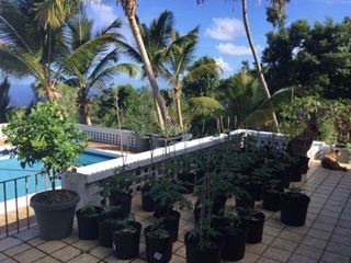
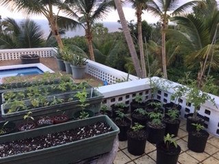
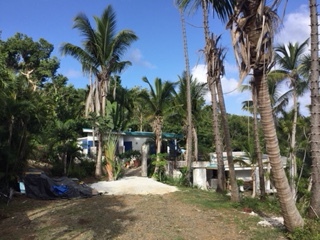
- From Sleepy Hollow to Palm Garden
By Jane Higgins <jhigginswear at gmail.com>
Date: Thu, 23 Aug 2018 08:43:54 -0400
We are still under construction as Mother Nature continues to enrich us with
fully formed palm fronds. Cutting down the naked Norwegian Pine
totem poles is on the list. We are grateful for the ripening starfruit, plenty
of passion fruit, and a few cucumbers on the vine. A bit of Sahara dust is
coming back to
give us a security blanket. Hoping for some luck for Hawaii. We will be ready
for what the next few months may bring.
- Why the Atlantic Hurricane Season Is So Different Right Now Compared to a Year Ago | The Weather Channel
By Jane Higgins <jhigginswear at gmail.com>
Date: Sat, 18 Aug 2018 07:14:41 -0400
Title: Why the Atlantic Hurricane Season Is So Different Right Now Compared to a Year Ago | The Weather Channel
Why the Atlantic Hurricane Season Is So Different Right Now Compared to a Year Ago
At a Glance
The Atlantic basin is different than it was a year ago to begin August.
Tropical disturbances are not well organized.
Sea-surface temperatures are cooler and wind shear is stronger.
Conditions in the atmosphere and ocean waters of the tropical Atlantic basin are different now compared to a year ago, providing a potential signal for what forecasters expect to be a less active hurricane season.
In mid-August last year, we were in the beginning stages of a period that would yield 10 consecutive hurricanes in the Atlantic basin and last until mid-October. Fast-forward a year later and the Atlantic is mostly quiet, devoid of any major areas of stormy weather.
Here are three ways the Atlantic looks different than it did a year ago.
We can assess the difference in the Atlantic between mid-August 2017 and 2018 by looking at one of the most basic tools meteorologists use: satellite imagery.
A year ago Thursday, Aug. 16, Hurricane Gert was well off the U.S. East Coast and several other tropical disturbances were lined up across the Atlantic. One of those disturbances would become Hurricane Harvey several days later.
In its tropical weather outlook issued on the afternoon of Aug. 16, 2017, the National Hurricane Center was tracking Gert and was monitoring three other systems for development.
Satellite image comparison of the Atlantic basin Aug. 12, 2018 versus Aug. 16, 2017. The image from this year shows the Atlantic is mostly quiet. A year ago this Thursday there was a hurricane and several other tropical disturbances to track.
This year, the tropical Atlantic couldn't look much quieter on satellite imagery.
There are some seeds for tropical storm development called tropical waves in the Atlantic now, but they are poorly organized and not producing much shower and thunderstorm activity.
A moist atmosphere is needed for tropical waves to have concentrated shower and thunderstorm activity, which helps them perk up and become organized tropical storms or hurricanes.
Instead, dry air has been abundant recently from portions of the Caribbean into the tropical Atlantic, putting a lid on the ability of the tropical waves to produce persistent stormy weather.
Cooler Sea-Surface Temperatures
Sea-surface temperatures (SSTs) in the tropical Atlantic are colder now compared to a year ago.
In early August 2017, the SSTs in the Atlantic were solidly above average, providing a boost for tropical disturbances to grow into tropical storms and hurricanes.
This year, water temperatures in the tropical Atlantic are cooler overall, with some areas running a bit below average for the first part of August. Cooler waters can deter the development of tropical storms and hurricanes.
The animation below compares widespread above-average water temperatures in the Atlantic Aug. 10, 2017, to near or even below-average water temperatures Aug. 9, 2018.
Sea-surface temperature anomaly comparison of Aug. 9, 2018 versus Aug. 10, 2017 in the Atlantic. Areas shaded blue are cooler-than-average while orange areas are warmer-than-average. (NOAA)
When wind shear is strong, it can keep tropical storms from forming and can rip apart existing storms. Strong wind shear means winds strongly change with height, either in speed and/or direction.
In the first 10 days of August 2017, wind shear was below average in a swath from the western Gulf of Mexico through the Caribbean and into parts of the tropical Atlantic. The lower wind shear helped aid in the active 2017 hurricane season.
Wind shear comparison of the Atlantic Aug. 1-10, 2018 versus Aug. 1-10, 2017. Wind shear this year is stronger than average (yellow, orange shadings) from the Gulf of Mexico to the Caribbean and the tropical Atlantic.
In the first 10 days of August this year, there's been a greater than average amount of wind shear from the Gulf of Mexico to the Caribbean and the tropical Atlantic. Stronger wind shear in combination with dry air can be detrimental to the formation of tropical storms.
Of course, all of this does not mean we are off the hook for an impactful tropical storm or hurricane in the Caribbean or the United States in the peak of the season. It takes only one storm to produce major impacts and a memorable hurricane season.
Residents of coastal locations should have a hurricane preparedness plan in place every year no matter how active a season is projected to be.
- Puerto Rico Spent 11 Months Turning the Power Back On. They Finally Got to Her. - The New York Times
By Jane Higgins <jhigginswear at gmail.com>
Date: Tue, 14 Aug 2018 20:35:37 -0400
Title: Puerto Rico Spent 11 Months Turning the Power Back On. They Finally Got to Her. - The New York Times
read this carefully, we know how to survive, we know to always boil our drinking water,
Puerto Rico Spent 11 Months Turning the Power Back On. They Finally Got to Her.
Jazmín Méndez’s home in Ponce, P.R. Ms. Méndez was among the last residential customers of the Puerto Rico Electric Power Authority to have service restored after Hurricane Maria.Erika P. Rodriguez for The New York Times
PONCE, P.R. — Jazmín Méndez has lived much of the last year in the dark. No light to read by. No food cooled in the fridge. No television for her three children.
Work crews have repaired storm-damaged Puerto Rico’s electricity grid in fits and starts over the last 11 months, but they had never managed to light up Ms. Méndez’s mountaintop home — until Tuesday, when she became among the last residential customers of the Puerto Rico Electric Power Authority to have service restored.
“The first thing I will do is give thanks to God,” she said, sitting in her living room surrounded by beach coolers, water jugs and gas cans. “At first, I fell into a depression. Now we’ve gotten so used to it, that I’m sure if another hurricane comes, we’ll pass the test.”
It has been a long wait for Ms. Méndez, 44, who has experienced firsthand the many woes that the island’s population suffered after Hurricane Maria.
The storm washed out the pipes that brought fresh water to her home in the rural neighborhood of Real Anón. Her generator was stolen last year, and she did not get a new one from a local church until two weeks ago. Parts of her zinc roof blew off, and now it leaks, but problems with her deed disqualified her for Federal Emergency Management Agency assistance. Using rainwater out of barrels gave Ms. Méndez a waterborne kidney infection that landed her in the hospital for nearly three months.
Left, Charlie Colón, Ms. Méndez’s partner, poured water for her children’s baths; Ms. Méndez prepared for her children’s first day of school.Erika P. Rodriguez for The New York Times
Mr. Colón tried to turn on the generator outside the home. “At first, I fell into a depression,” Ms. Méndez said. “Now we’ve gotten so used to it, that I’m sure if another hurricane comes, we’ll pass the test.”Erika P. Rodriguez for The New York Times.
After spending $3.2 billion, erecting some 52,000 new electrical poles and stringing 6,000 miles of wire from the federal government alone, the Puerto Rico electricity system is not in much better condition now than it was before Maria cut power to every home and business on the island.
Even as some of the last customers are reconnected, many billions of dollars more must still be spent to reconstruct the system and fortify the transmission lines that have been so tattered and poorly maintained that when a mishap occurs, the lights can go out on the entire island.
The new head of the electric utility estimates that up to one-quarter of the work done hurriedly to illuminate Puerto Rico after the storm will have to be redone.
“There are many patches — too many patches — developed just to bring power to the people,” said José Ortiz, the new chief executive of the power authority, known as Prepa. “Now we have to redo that thing.”
He acknowledged that repairs were stalled because the bankrupt utility’s inventory of supplies like electrical poles was too low to begin with and then was depleted by Irma, the hurricane that struck the Caribbean two weeks before Maria. He said the challenges now are to add more solar energy generation so the island will rely less on expensive oil, and to make its high-voltage transmission lines less failure-prone.
“This looks like a mess, really, from the outside,” he said. “Once you are inside, you see it is even worse.”
Prepa still needs to complete repairs to five critical transmission lines, 12 substations and three transmission centers.Erika P. Rodriguez for The New York Times
Workers in the Barrio Real Anón neighborhood of Ponce.Erika P. Rodriguez for The New York Times
Mr. Ortiz has been on the job for just three weeks. His immediate predecessor came and went in about 24 hours, and the director before that lasted four months. The authority’s entire board of directors quit last month in a dispute over salaries for the new executives and political meddling by elected officials.
Prepa still needs to complete repairs to five critical transmission lines, 12 damaged substations and three transmission centers that are needed for grid stability and redundancy, said Gil Quiniones, the chief executive of the New York Power Authority, which has helped in Puerto Rico’s recovery.
“The No. 1 goal was to get electricity back as quickly as possible,” Mr. Quiniones said. “On the one hand, there’s lots of new stuff. On the other hand, the crews and other contractors really rushed the work to put it back together.”
Michael Byrne, the federal disaster recovery coordinator for Puerto Rico, said the utility’s task now is to design and build a resilient distribution and transmission system that can better withstand problems large and small.
“We’ve been flying helicopters all over this island for 11 months now, stringing new lines and putting new towers in,” Mr. Byrne said. “So the level of effort has been historic. But that was just to patch back together what was there.”
Just after the governor of Puerto Rico announced in November that the power authority had gotten back to 50 percent of its former electricity generation, the island suddenly went dark, in one of what would be a series of wide blackouts in the months following the Sept. 20 storm. Just last week, the power went out again in large swaths of San Juan.
Asked to describe the island’s power grid, Mr. Byrne said, “It’s stable, but fragile.”
The single lightbulb connected to the power generator at Ms. Méndez’s home.Erika P. Rodriguez for The New York Times
The long haul of repairs involved thousands of electrical workers from around the country, including crews from three companies that were sent home early. One was dismissed in a scandal over inflated prices; another amid accusations that it had accomplished too little for the $1 billion it was paid. The third had accidentally caused a major power outage.
The most contentious of the three was Whitefish Energy, a small Montana firm that appeared to get a major contract out of nowhere, with few employees and very little experience of large-scale work. The fact that the secretary of the interior’s son had been an intern at the company prompted accusations of insider dealing, and the company was criticized for charging more than $300 an hour for each lineman it deployed.
Mr. Ortiz said that Prepa was waiting for an opinion from FEMA’s inspector general before paying $104 million in outstanding bills the company has submitted.
The company said it feels vindicated, because Prepa records posted online show that Whitefish fixed five transmission lines and completed other tasks for a total of $140 million. The Prepa records indicate that other companies billed far more and took longer to complete their projects.
Earlier this year, a FEMA official publicly praised the work Whitefish had done. By contrast, Prepa has grumbled about the slow pace of work done by Fluor, a major contractor brought in by the Army Corps of Engineers.
Things went just as badly for the local companies that worked on the grid, several of which went out of business.
“It bankrupted us,” said Francisco Lasanta, the owner of SM Electrical, a Ponce company that estimates it is owed about $2.3 million from both Prepa and contractors who were also not paid. “The company is going to disappear.”
Records filed in federal court show at least 20 local companies were not paid for their work.
Mr. Ortiz said a number of problems had delayed the payment of $18 million owed to local businesses, but that a special task force has been assembled to expedite the payments.
Prepa said that Ms. Méndez was the last of its residential customers to get power who was able to — meaning that some homes are still too damaged to be reconnected. FEMA generators are still powering the islands of Vieques and Culebra. And a few houses in Luquillo, which are not Prepa clients, require special permits, because they are very close to El Yunque National Forest, the only tropical rain forest in the United States forest system.
For the Méndez family, the chance to have electric service again mostly means not having to spend $50 a week on fuel for their generator, an expense that Jazmín Méndez, a stay-at-home mother who relies on public assistance, can hardly afford.
Left, Ms. Méndez filled out paperwork for her children’s first day of school. The drive from her home into town passes landslides that frequently cause flat tires.Erika P. Rodriguez for The New York TimesLuana, Ms. Méndez's daughter, after the power was restored to their home on Tuesday.Erika P. Rodriguez for The New York Times
The government installed a new water cistern for her, but FEMA denied her the money she needed to install the required new pipes. So, even with the power back on, she will still have to get water every day by traveling down the mountain, past the landslides that frequently cause flat tires.
She cannot afford cable TV any more, she said, but at least the children can use their PlayStation again, and will not have to go to bed as soon as the sun goes down.
“At first, a lot of agencies came, giving water and food,” Ms. Méndez said. “But that ended, so now you really have to do everything yourself. I don’t know where Puerto Rico is going to end up. It seems everything went from bad to worse.”
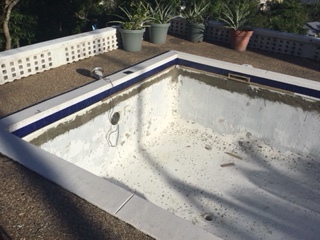
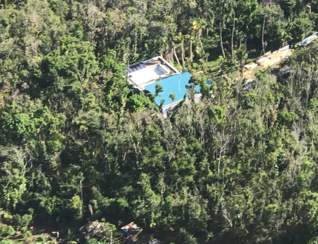
- Pool Soon Come
By Jane Higgins <jhigginswear at gmail.com>
Date: Tue, 14 Aug 2018 10:19:43 -0400
It was 76 degrees at 4:30am, a nice cool start to another day of rebuilding.
We see a clear horizon, feeling the lack of protection from Sahara dust. We welcomed the showers that passed over last night.
How is your rebuilding coming along? Our neighborhood sounds like a construction
zone everyday. We are constantly jockeying cars and trucks on our little dirt road.
The pool tile guy came yesterday and did the pool trim between rain
showers and finding broken tiles. I did remember to order about 30 more tiles than needed so we squeaked by without needing to reorder.
I realized this morning that since about Oct 12 when the first architectural engineer came to assess our damage we have had adjusters, estimators, inspectors, contractors, roofers, gutter guys, trash haulers, bushworkers,painters, caulkers, etc, coming to our property probably at least every third day since . We figure it will be about another year to finish the retaining wall, hidey hole , electrical, and painting. The pool should be done in about 2 weeks and we will need 3 truckloads of water to fill it.
We are grateful to live here in our house with a new roof. So many people including neighbors and friends are displaced waiting for roof rebuilds.
When you think of the devastating fires stateside, we feel so lucky. Our friend Nancy in S. California had to evacuate with her cat and returned to her cottage that was covered in fire retardant, a very dangerous chemical.
And here comes another water truck to our driveway, Looks like we have a window of safety for a while ; we all know that Sept 6 is coming again to remind us of our survival skills.
Jane Higgins Northwest End St Thomas
- Monday Morning
By Jane Higgins <jhigginswear at gmail.com>
Date: Mon, 9 Jul 2018 09:17:12 -0400
We’ve had several bands loaded with rain. Some thunder. Gusts here at home up
to 18 mph. Our Governor just told radio audience that gusts of up to 50 mph
have been recorded at St Thomas and St Croix airports. Non essential employees
ordered to stay home. Everyone is assuming weather will be clear by 1:00pm.
Those under tarps and with compromised housing are facing the reality of what
bad squalls can do.
We are facing storm season with approximately 10,600 folks living under tarps
in the USVI.
Now the solar engineer has turned on the generator to beef up the battery bank.
We have lived off the grid now for 3 1/2 years.
- Red Dawn Is Breaking
By Jane Higgins <jhigginswear at gmail.com>
Date: Mon, 9 Jul 2018 05:43:11 -0400
The hushing whispers of wind startled me awake. The memories kicked in. Up at
5 to recheck every window and door. Car wash rain just for a while. Then as
dawn breaks this pink, red, mauvish message came..... “red sky in the
morn........”, you
know the rest. Dominica post is filled with relief and so are all the island
notes.
We are all in this season together. I would like to time travel to
Thanksgiving, but
Mother Nature still needs us to do our homework.
Let us know how it goes .
Grateful and awed, Jane in St. Thomas
Looking East over the totem poles that used to be huge pines.
- Saharan Air Layer (SAL) - Split Window - MET-9 - Latest Available
SJU radar is working, good ting, we have little gusts of up to 12 knots right
now, and misting. 79 degrees F and 86% humidity. From our deck facing northwest
side Atlantic we see short white caps and from 650ft up the hill we can hear
surf. The aviator is going back to airport to tie some planes down. The hangars
are still missing doors from Irma, so wide open.
Even 12 knots clenches the muscle memories. The distance of winds has
tightened to a
100 miles. Prepare for a sloppy Monday.
https://www.wunderground.com/weather-radar/united-states/pr/san-juan/jua/
- Marine Forecast | Weather Underground
By Jane Higgins <jhigginswear at gmail.com>
Date: Sun, 8 Jul 2018 08:17:59 -0400
Title: Marine Forecast | Weather Underground
Boaters beware , scroll down for English, up to 11 ft seas on Monday
Los operadores de embarcaciones pequenas deben ejercer precaucion
Advertencia para los operadores de embarcaciones pequenas en efecto desde bien tarde esta noche hasta bien tarde lunes en la noche
Aguas Costeras Del Norte De Puerto Rico Hasta 10 Millas Nauticas Mar
Afuera-
Hoy
Vientos del este de 15 a 20 nudos. Oleaje de 4 a 6 pies con oleaje ocasional hasta 8 pies. Periodo dominante de 7 segundos. Aguaceros dispersos.
Esta Noche
Vientos del este de 15 a 20 nudos. Oleaje de 4 a 6 pies con oleaje ocasional hasta 8 pies. Periodo dominante de 7 segundos. Aguaceros dispersos al anochecer. Tronadas aisladas durante la noche.
Lunes
Vientos del este de 20 a 25 nudos. Oleaje de 6 a 8 pies con oleaje ocasional hasta 10 pies. Periodo dominante de 7 segundos. Marejadas del noreste a alrededor de 4 pies en la tarde. Aguaceros y tronadas dispersas.
Lunes En La Noche
Vientos del este de 15 a 20 nudos. Oleaje de 6 a 8 pies con oleaje ocasional hasta 10 pies. Periodo dominante de 8 segundos. Marejadas del noreste a alrededor de 4 pies. Aguaceros numerosos y tronadas dispersas.
Martes
Vientos del este de 15 a 20 nudos. Oleaje de 4 a 6 pies con oleaje ocasional hasta 8 pies. Periodo dominante de 8 segundos. Tronadas aisladas, luego aguaceros aislados.
Miercoles
Vientos del este de 15 a 20 nudos. Oleaje de 3 a 5 pies con oleaje ocasional hasta 6 pies. Periodo dominante de 8 segundos. Aguaceros aislados.
Jueves
Vientos del este de 10 a 15 nudos. Oleaje de 2 a 4 pies con oleaje ocasional hasta 5 pies. Periodo dominante de 10 segundos. Aguaceros aislados.
- Caribbean Anxiety Disorder
By Jane Higgins <jhigginswear at gmail.com>
Date: Sat, 7 Jul 2018 17:53:04 -0400
Do you have the symptoms of Caribbean Anxiety Disorder, aka CAD?
Did your symptoms start around June 1 , approximately 9 months after
Irmaria scared the crap out of you?✅
Did you find 4 ATM cash machines out of order on Friday? ✅and finally
stand in line to write a check for cash ?✅ Did you then see that the ATM was
working on your way out of the bank and take out more cash ?✅
You might be suffering from Caribbean Anxiety Disorder. I know I am.
Did you just get the solar panels put back up on the new roof 2 days ago?✅
Did you buy beer, wine, gin and tequila? Just in case ? ✅
Did you finally look at expire dates on the relief food from Irmaria in your storm pantry?
The instant mashed spuds, ramen, bags of dehydrated soups and sardines that
are still there just might need a date check, I know , I found some old food✅.
Did you check the cistern , the propane tank and generator in the last 24 hours? ✅
Are you doing every piece of laundry in the backed up baskets thinking more
rain soon come?✅
Did you hug the very nervous old lady in the post office line and assure her that every ting is gonna be alright?✅
You too might be suffering from Caribbean Anxiety Disorder.
As long as we suffer together and treat our symptoms by being prepared and offer
to take in our friends and neighbors we will get thru this season .We are so
deep in this now. We know why we live here. We are still standing.
Let us know how you are doing? How is the weather on your island right now?
We are 82 degrees F and 76%humidity, perfect tropical weather.
From the Northwest side ,Fortuna, St Thomas US VIRGIN ISLANDS
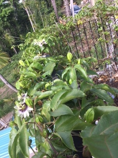
- Passion Fruit Hopes
By Jane Higgins <jhigginswear at gmail.com>
Date: Thu, 5 Jul 2018 17:31:00 -0400
We finally have solar panels back up on new roof today while we watch that
thing traveling across the Atlantic. Our Passion Fruit is re-blooming ,bringing
us
hopes for passing showers and a calmer season. Everyday is a rebuilding day.
We are 84 degrees with 75%humidity here around 5:30 tonight.
- If A Hurricane Were To Threaten The USVI, Evacuation Of Residents Would Be Among Considerations, FEMA Administrator, Mona Barnes, Say ‹
By Jane Higgins <jhigginswear at gmail.com>
Date: Tue, 26 Jun 2018 07:32:31 -0400
Title: If A Hurricane Were To Threaten The USVI, Evacuation Of Residents Would Be Among Considerations, FEMA Administrator, Mona Barnes, Say ‹
If A Hurricane Were To Threaten The USVI, Evacuation Of Residents Would Be Among Considerations, FEMA Administrator, Mona Barnes, Say
ST. CROIX — During a press conference held at the Federal Emergency Management Agency’s offices in Sunny Isle here on Wednesday, F.E.M.A. Administrator William Long said the federal agency has been making preparations to ensure an immediate response for the U.S. Virgin Islands in case of a hurricane. Mr. Long, joined at the press event by F.E.M.A. Coordinating Officer for Region II William Vogel, and Mona Barnes, the Virgin Islands Territorial Emergency Management Agency (V.I.T.E.M.A.) director, had met with the governor a day before where the teams discussed contingency plans for the 2018 Hurricane Season — among them what would happen if another major storm were to affect the U.S.V.I.
What would happen if a hurricane were to threaten the U S.V.I. in the coming days? The Consortium posed the question to Mr. Long in light of the over 10,600 residents who have sought help from F.E.M.A.’s Emergency VI Home Repair Program and most of whom have yet to see their homes repaired. The slow progress on the program can be attributed to a snag in the VI government’s ability to access the funds; F.E.M.A. requires the local government to pay upfront for the projects’ costs, while F.E.M.A. reimburses the full cost thereafter. The U.S. Treasury has allocated $186 million so far for the work with more to come, but only $13.6 million had been received by the local government as of Tuesday to pay contractors, according to Mr. Vogel.
Further more, according to Ms. Barnes, V.I.T.E.M.A. had inspected 20 facilities in the territory, and “maybe two or three” were ready to serve as shelters. “We know that’s not going to work,” Ms. Barnes said. “One of the things we’re going to have to start thinking about is evacuation prior to [a storm]. When we usually plan for a storm, it’s 72 hours before a storm; we now have to look at a 120 days because, as Mr. Long said, if we got to move not only patients, we might have to move residents and so we now have to start thinking about the 10,600 people who are part of the emergency program. If they don’t get a roof on and they’re under a blue roof, and we have to move them, we now have to start to think of making decisions.”
Ms. Barnes said the vulnerability of residents whose homes have on blue roofs meant part of the consideration must include evacuation. Pressed by The Consortium to give a concise answer on the evacuation option, Ms. Barnes said, “I’m saying it’s something that we would have to look at.” Mr. Long added, “Evacuation off an island is never optimal. The goal is shelter in place first, and then to be able to maximize the shelter and capacity, and that’s what we’re here doing everyday.”
Still, if a storm were to threaten the territory in the next few days, there would not be enough shelters to house residents, and Virgin Islanders would most likely have to be evacuated.
From left: William Vogel, FEMA Coordinating Officer for Region II, and William “Brock” Long, FEMA administrator (Credit: Ernice Gilbert, VIC)
To that end and with no major storms currently forecast, Mr. Vogel said F.E.M.A. has been assisting the territory in finding ways to expedite release of the $186 million for the home repairs program so that residents’ homes could be repaired before potential hurricanes. Asked directly whether the local government, even in light of its inability to cover the upfront costs, would receive the hundreds of millions allocated to the territory for the repairs, Mr. Vogel said “we have no concerns” that the monies will be released.
“We can write certain projects where we do what they call expedited project worksheets. And in that project worksheet for that project, we can take some of the money and we can obligate it to the territory as soon as we understand exactly what the entire project is going to look like,” Mr. Vogel explained. “We can take 50 percent of the total amount of money for that project, write this expedited project worksheet, the territory agrees with what it is that we have come up with on this project worksheet, and then obligate the money to the territory — and that money is available in the territory’s smartlink account for them to be able to use towards recovery or restoration.”
In a letter to Mr. Long on Tuesday, Mr. Mapp said, “I am imploring you to act now and help us to pre-position immediate sheltering options for the people of the Virgin Islands as we brace for what is expected to be another busy hurricane season. We are asking you to consider all possibilities, including preparing to provide aircraft and cruise ships in advance of a storm to evacuate as many people as feasible to safety until the storm passes.”
During the press briefing, Mr. Long lauded the Mapp administration and its efforts following the two Category 5 hurricanes in 2017, and the government’s continued work in preparing the U.S.V.I. for the current season. He said F.E.M.A. had provided over $20 billion in federal funding around the U.S. and its territories following last year’s hurricanes and other natural disasters — including the California fires — with $1.6 billion already provided to the U.S. Virgin Islands.
The administrator also committed F.E.M.A.’s presence in the territory for additional years to facilitate the recovery.
Ernice Gilbert
I wear many hats, I suppose, but the one which fits me best would be journalism, second to that would be radio personality, thirdly singer/songwriter and down the line. I've been the Editor-In-Chief at my videogames website, Gamesthirst, for over 5 years, writing over 7,000 articles and more than 2 million words.
I'm also very passionate about where I live, the United States Virgin Islands, and I'm intent on making it a better place by being resourceful and keeping our leaders honest. VI Consortium was birthed out of said desire, hopefully my efforts bear fruit. Reach me at ernice at viconsortium.com.
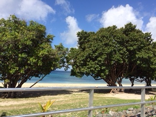
- Sargassum: The Good, the Bad and the Smelly | St. Thomas Source
By Jane Higgins <jhigginswear at gmail.com>
Date: Sun, 24 Jun 2018 07:54:43 -0400
Title: Sargassum: The Good, the Bad and the Smelly | St. Thomas Source
Sargassum is breaking down near Coki Point, seen above, and Margaritaville, and creating a serious smell. (Photo by Alain M. Brin, Blue Glass Photography)
You don’t have to see it to know it’s here. The brown sea grass called Sargassum has made a grand entrance into the territory. And it smells.
It started as a nuisance in 2011 when the volume grew considerably. Seven years later, the combination of global warming, pollution and hurricanes formed the perfect conditions for it to grow and prosper. When it gets to land and decomposes, the sulfur-like stench can be overwhelming.
Like many other scientists, Tyler Smith, a marine biologist at the University of the Virgin Islands, is eager to find out the secrets of these floating islands.
“The tremendous amount of grass that has entered our waters seems to have come up from the coast of Brazil and from the Sargasso Sea, a two-million square mile area at the Bermuda Triangle,” Smith said.
This sea without borders is confined by the North Atlantic Gyre, a set of currents that move water around the ocean.
“An estimated 10 million tons of grass, sometimes three to five feet thick, is gathered in this location,” Smith said, adding that scientists believes “the trifecta of warmer waters, pollution and storms conspired to increase the volume and send much of it our way. It is the most we’ve ever seen.”
Sargassum is nothing new. Christopher Columbus is said to have sailed through the thick of it in 1492. Until recently, it was simply a minor feature among the flotsam of the sea.
The situation today gives marine biologists the opportunity to study the grasses in depth and its effect on coral.
“Our post-hurricane monitoring is ongoing at 32 sites from 19 to 220 feet (in depth) and it is our best look at coral ever. The good news is that it is unlikely to harm our corals, perhaps excepting some small, shallow coves,” Smith said. “Our colonies at 100 plus feet are surprisingly healthy. The large reef we study in Brewers Bay is thriving. The storms have lowered the deep water temperatures and that will hopefully be a boost to the coral and a bust to hurricane formation.”
Marine scientist Blair Worthington compared the sargassum and ocean to their seeming opposite.
“The open sea is like a desert and Sargassum is an oasis in that desert,” Worthington said.
The grass provides food, refuge and breeding grounds for turtles, sea birds and crabs and is a nursery for Mahi-Mahi. This habitat available because it floats at the surface thanks to the small, gas-filled “berries” that adorn the branches.
Another benefit is its use in pharmaceutical research (it has been used in Chinese medicine since the 8th Century) and as an important ingredient in biofuel. The grass also helps in the formation of dunes by catching and holding blowing sand.
On the negative side, Sargassum often carries bacteria that can cause irritation in allergic humans, and might be a support system for the invasive species of lionfish. The prolific intruders decimate the local reef fish. Their population is being held in check by the human harvesters who target the species and offer them for sale to restaurants. The lionfish is gaining repute as a delicacy for its tasty white flesh, similar to the butterfish.
The grass should have no effect on ciguatera, the toxin found in small reef fish. Incidents of fish poisoning in the territory have remained at approximately 12 cases per thousand for several years.
Finally, the last but not least negative is its dizzying smell of rotting fish.
- Red, pink, purple sunset
By Jane Higgins <jhigginswear at gmail.com>
Date: Thu, 21 Jun 2018 19:33:45 -0400
This really was very colorful a few minutes ago but iPad only caught this. More
moisture
soon come.
- Mother Nature
By Jane Higgins <jhigginswear at gmail.com>
Date: Wed, 20 Jun 2018 09:09:55 -0400
Her gifts are all around us. Today’s catch.
- Coral Bay Survey Finds Two Thirds of Respondents Feel Unprepared for 2018 Storm Season | St. Thomas Source
By Jane Higgins <jhigginswear at gmail.com>
Date: Wed, 20 Jun 2018 08:31:30 -0400
Title: Coral Bay Survey Finds Two Thirds of Respondents Feel Unprepared for 2018 Storm Season | St. Thomas Source
Coral Bay Survey Finds Two Thirds of Respondents Feel Unprepared for 2018 Storm Season
Emmaus Moravian Church in Coral Bay after Hurricanes Irma and Maria.
A full two thirds of respondents to an online survey conducted by the Coral Bay Community Council say they don’t feel prepared for the 2018 hurricane season that began at the start of June.
Coral Bay, St. John, was one of the areas of the areas in the Virgin Islands hardest hit by Hurricane Irma in September 2017. With predictions calling for an average to active 2018 storm season, the CBCC created its 24-question survey in May with the goal of finding out where things stand with Coral Bay residents, many of whom said they felt neglected in the aftermath of Irma and Maria.
The survey included questions about homes and infrastructure, priorities, ratings of assistance and insurance, and personal situations and long-term goals.
“We wanted to get the complete results out as fast as possible,” said CBCC’s president Sharon Coldren. “We hope the information will be useful and inspiring to government agencies, relief organizations and individuals in prioritizing actions we can take.”
More than 60 percent of the survey’s 178 respondents were full time residents of St. John, with the rest a mixture of winter residents, repeat visitors, and vacation rental owners.
According to the most recent U.S. census of the Virgin Islands, 634 people resided in the Coral Bay subdistrict in 2010, with another 51 people residing on the island’s east end, where residents were also invited to participate in the CBCC survey.
More than 70 percent of respondents to the CBCC survey were over the age of 55.
A news release from the CBCC said the survey results were divided into full time residents, vacation rental owners and business owners to see if there was a difference in perspectives on the recovery among those groups.
“There are some differences in perspectives, but overall people have the same priorities,” the release states.
Unsurprisingly, the survey found that almost all respondents suffered some damage to their homes and business in 2017’s back-to-back category 5 storms. But, while only 33 percent said they feel prepared to face down another storm, nearly 70 percent reported they are making steady recovery progress, and only 12 percent say they have no safe place to stay during any storms that might arrive in 2018.
However, 36 percent of respondents said they have no reliable way to reach 911 today due to lack of any reliable communications at their home – cell, internet or landline. According to the CBCC this is also making rental owners nervous for their visitors, who cannot use their cell phones due to currently limited service areas.
The survey found that debris removal remains a pressing concern in the Coral Bay area – both to avoid the debris causing damage in future storms, and to put on a good face for tourism. About 88 percent of respondents said removal of debris piles from roadsides is still an immediate need nine months after the hurricanes, while 76 percent said removal of debris from private property is an immediate need.
Respondents did not rank their experiences with the Federal Emergency Management Agency (FEMA) highly. Over half ranked their FEMA experiences as poor, partially OK, or OK, while only 23 percent ranked their experiences as pretty good or excellent.
CBCC itself received high marks from respondents for its efforts to help in Coral Bay’s recovery. More than 85 percent rated the assistance given by CBCC after the hurricanes as pretty good or excellent.
“More analysis and the open-ended comments may be added to the website and in future reports later, and we are happy to discuss detailed responses with anyone trying to assist in our overall recovery,” Coldren said.
El Niño Watch Issued: Chance of El Niño Conditions Developing Increases During Upcoming Fall, Winter
At a Glance
NOAA has issued an El Niño watch.
This means that conditions are favorable for the development of El Nino conditions within the next six months.
This could impact the Atlantic hurricane season and weather in the U.S. this winter.
An El Niño watch was issued in the latest outlook from NOAA, indicating an increasing chance for El Niño conditions to develop later this year.
NOAA indicates that ENSO-neutral conditions (neither La Niña or El Niño) will likely last through this summer, with the chance of an El Niño increasing to 50 percent during the fall and 65 percent during winter 2018-19.
ENSO-neutral conditions have been in place this spring, meaning sea-surface temperatures across the central and eastern equatorial Pacific have been close to average, and as mentioned, are expected to remain in place into this summer.
Areas in yellow indicate where water temperatures are warmer than average and areas in blue are indicate colder-than-average temperatures.
As a reminder, the criteria for El Niño conditions are that the average sea-surface temperatures in a region of the central and eastern equatorial Pacific known as Niño 3.4 need to be at least 0.5 degrees Celsius warmer than average in the preceding month and the anomaly has persisted or is expected to persist for three consecutive months. In addition, the atmosphere over the tropical Pacific also needs to exhibit certain characteristics.
Over the past four weeks equatorial water temperatures were near average across most of the Pacific Ocean, with the exception of the western Pacific, which has continued to have above-average water temperatures.
Water temperatures in the far eastern equatorial Pacific remain slightly cooler-than-average, but as shown in the map below, the change from early May to early June has been an increase in temperature.
Changes in water temperature anomalies are shown from May 9, 2018, to June 6, 2018. Areas in orange and red are where sea-surface temperature anomalies have increased and areas in blue are where the sea-surface temperatures have decreased over this period.
In addition, positive subsurface temperature anomalies have strengthened and expanded across the equatorial Pacific over the past two months, the NOAA report notes.
The majority of computer models indicate that El Niño conditions become most likely during the upcoming fall and winter.
The probability of El Niño conditions developing increase during the fall and winter, as shown by the red bars.
(NOAA)
What Does This Mean For U.S. Weather?
If El Niño conditions were to develop, there are implications to the weather in the U.S.
First, if an El Niño pattern were to emerge this fall during the Atlantic hurricane season the number of tropical cyclones that develop could be suppressed.
When El Niño is in place during hurricane season, stronger-than-average upper-level winds develop over portions of the Atlantic Ocean. As a result, possible tropical cyclones are torn apart.
However, there are other factors that contribute to the number of named storms that develop, so a developing El Niño does not mean there will be fewer storms.
El Niño conditions can result in an increase in wind shear over portions of the tropical Atlantic, impacting tropical cyclone formation.
If El Niño conditions are present during the winter, the jet stream pattern over the U.S. shifts and can result in a wetter-than-average winter across the southern tier of the U.S., including portions of California.
During an El Niño winter temperatures are also typically cooler-than-average from the southern Plains into the Southeast and warmer-than-average from eastern Alaska into western and central Canada and into the Pacific Northwest, northern Plains and Midwest.
The strength of the El Niño plays an important role in impacts across the U.S., including in the tropical Atlantic. At this point, it is too early to know when an El Niño pattern may develop and how strong it might be.
- We Have Horizon
By Jane Higgins <jhigginswear at gmail.com>
Date: Fri, 15 Jun 2018 08:12:38 -0400
Good Gorgeous Morning,
A bit of rain cleared some Sahara dust and we have the crispest horizon line in
a week.
The solar panels are still deck side making energy and waiting for the solar
guy and
circuits to be reinstalled rooftop. Being off the grid reminds us that we can
collect sun
anywhere any daytime, not necessarily always on a roof. The roofers in the
neighborhood are racing Mother Nature to finish.
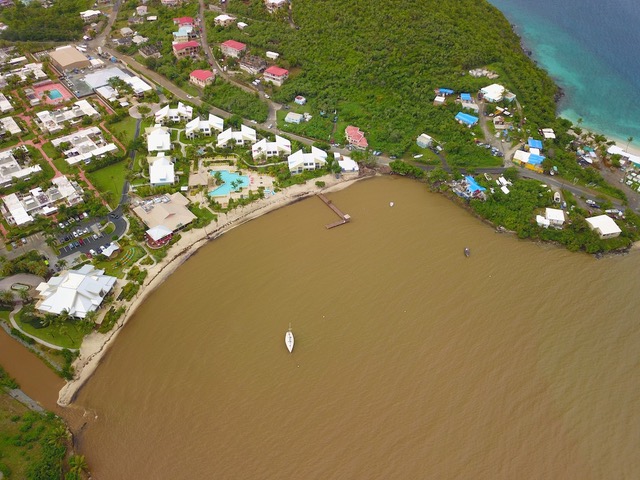
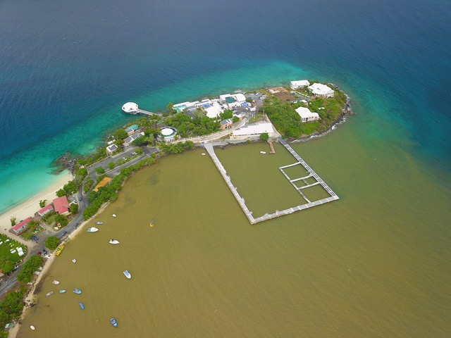
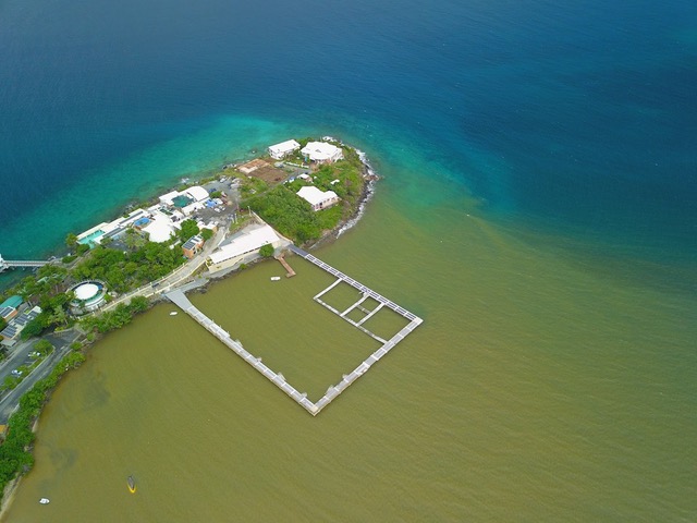
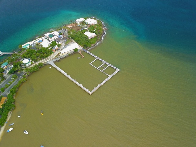
- Current : Dolphinarium Site Picture of Water Bay
By Jane Higgins <jhigginswear at islands.vi>
Date: Fri, 8 Jun 2018 11:12:09 -0400
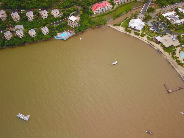
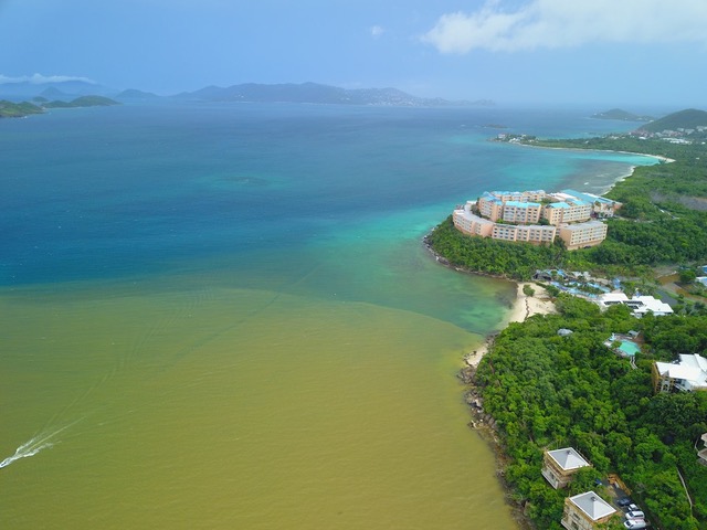
Sargassum devastation on East End of St Thomas
Here is a current picture of the site where dolphinarium is being built, not fit for dolphins or humans....
June 1 brought the beginning of storm season and wiring to our house after
more than 8 months of using extension cords from our solar inverter. We have
been lucky
enough to have a fridge ,fan , a few lights, pump and washer since a week after
the storms.
Now we have a new roof and can flip a switch . We all have a long way to go .
Being prepared to
survive the next storm is the necessity now. Making sure we take care of our
neighbors will make
us better islanders.
- Dumpsite fire is VI’s biggest ever, DWM says - BVI Beacon
By Jane Higgins <jhigginswear at gmail.com>
Date: Fri, 18 May 2018 08:53:45 -0400
My throat has been burning since Monday night. We smell something like burning
tires. Sure enough the article says the smoke is reaching western St Thomas.
Last night was coughing til about 3 am. Now laryngitis, can't talk. Those with asthma
need to stay inside.
Hoping the rain will tamp this down . The windy conditions don't help.
Dumpster fires are not new after the storms. Most of the islands have experienced
them over the years due to mismanagement of debris. The collective mountains
of broken building materials mixed with deadly chemicals and plastics from
our crisis in September have exacerbated the problem.
This is all about human imprints, weather, non sustainable consumer waste.
Our tourism departments need to pressure our governments to face this issue.
Subject:Dumpsite fire is VI’s biggest ever, DWM says - BVI Beacon
After months of waiting for the cement truck to be in our road, the heavy rains
came.
Can't have everything you want all the time. Glad we finally got gutters.
- Pissarro Morning in St Thomas
By Jane Higgins <jhigginswear at islands.vi>
Date: Mon, 7 May 2018 06:18:49 -0400
This morning's Mother Nature show would have surely inspired our own Camille
Pissarro .
We are 74 degrees and 87% humidity, a typical tropical Monday.
- Seagulls and Thunder
By Jane Higgins <jhigginswear at islands.vi>
Date: Fri, 4 May 2018 18:26:43 -0400
Seagulls were a month early and Thunder barking started this week.
Look at Western Africa tossing a wave our way.
- Morning Showers Energize 2018 J’ouvert | St. Thomas Source
No need for that water truck. Road March song competition in full swing.
Cool and overcast, perfect Carnival weather on the Waterfront in St Thomas
>
>
>
- Sargasso weed
By Jane Higgins <jhigginswear at islands.vi>
Date: Wed, 25 Apr 2018 20:38:24 -0400
Yes to Grenada post, more sargasso weed showing up everyday.
It is hot today. Must be summer.
Happy Carnival to all.
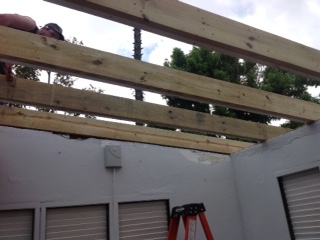
- Aqua Roof Is On
By Jane Higgins <jhigginswear at islands.vi>
Date: Sun, 22 Apr 2018 17:14:17 -0400
It took less then 12 days for our roofing crew from the states to tear down
and retrofit
our roof. It took almost 6 months to line up materials, the plan and the crew.
Now with double rafters , mega beams tied into everything and four
roofing layers we are sleeping soundly. As you can see the curly cue trees are
making a big comeback. Next is rewiring the house, getting the solar panels
back on the roof,
reconditioning the pool and rebuilding the retaining wall. We are the lucky
ones, as
many are still living in uninhabitable homes.
Have a Happy and safe Carnival. We are cool now with a passing shower.
From the northwest side of St Thomas in Fortuna.
>
>
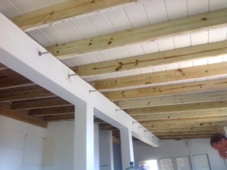
- The Roof is On!
By Jane Higgins <jhigginswear at islands.vi>
Date: Tue, 17 Apr 2018 08:53:28 -0400
We have a crew from the USA putting up galvalume today .
We have lived in the house during entire process. Yesterday around 5:30pm very
heavy cold showers, almost felt like hail was next. I see Martinique really did
have hail. We are so grateful to
have the blue tarp gone. From very green Fortuna on the NorthWest side of St
Thomas