|
|
- - - 2017 Hurricane Season - - -
|
- HAPPY EASTER (from Tomorrow) -
|
- By Ian Martin Borde <readkrox51 at gmail.com>
- Date: Sat, 31 Mar 2018 05:28:55 -0400
|
Saturday 31st March 2018
Happy Easter People of Paradise,
I say 'Happy Easter' from Tomorrow, because there is the likelihood that from tomorrow and Monday, Seas will be; Manageable if not Pleasurable, Once, "Caution is NOT thrown to the wind"!!!
I will like to be 'patriotic' and try to coin a phrase, Copied from America, but seems true and pertinent? "When Trinidadians are sunbathing, business is good".
Being associated with para-military service, I will also
like to speculate that when the historical data comes in. Either last year or this year, there will have been a 'marginal' drop in the upward curve of 'serious crimes' and beneficial associated data. Eg. Detection, Rehabilitation, of course Prevention, etc, ....
With Pride, let us work together to Congratulate our first female Head-of-State,
- President Weekes -
Generation 'Y' (I guess for Youth), is the source and answer to create SOLUTIONS to all Trinidad and Tobago's problems, ....
God Bless Attachment:
MARACAS on a Sunday.jpg
Description: JPEG image
|
|
- The Best Thing to Do is Become a Volunteer -
|
- By Ian Martin Borde <readkrox51 at gmail.com>
- Date: Sat, 24 Mar 2018 08:31:57 -0400
|
Good People of Paradise,
In Trinidad, specifically the north-west, Wednesday, Yesterday and a close call today, (maybe tomorrow), we are having early morning rain on the mountaintops and also heavier around 10:00am.
The beaches are inching and ebbing to be a pleasant source of recreation and respite. If not a meeting place of minds.
And boy oh boy! The temperatures and humidity in the night are most romantic and may have beneficial consequences 9 months from now, ....
Rainy Season Wise: There are a lot of things that the average man and lady are not aware of, that affect the operations of first responders, ...
A small example in the first instance is; There must be: Actualization, Verification and Confirmation!!! You can't just cry and bawl, " H e l p ! " Eg. Where it happened, What happened and Who is able to help and communicate, can place the first responder and the victims life in either a life or death situation. There are countless examples of undertones in EMERGENCY WORK.
If all you do is help old ladies and children cross the street. Becoming a Volunteer is NOT A BAD IDEA, .... !!!!!!!
I will be posting again, God-willing before Easter. But can we all take this opportunity to wish each and everyone, ... ..., a Happy and Holy Easter Season, ... ! Attachment:
On Duty.jpg
Description: JPEG image
Attachment:
- Servant of Church and State -.jpg
Description: JPEG image
Attachment:
- sunset -.jpg
Description: JPEG image
|
|
- Early Detection - New Graphics
|
- By Ian Martin Borde <readkrox51 at gmail.com>
- Date: Mon, 19 Mar 2018 21:59:35 -0400
|
Glencoe, Carenage, Diego Martin, T & T, W.I. 2018-03-19th. 9:45pm.
As per NHC:
...MONSOON TROUGH/ITCZ...

The ITCZ continues from 03N21W to 02N25W 03N40W,
to 03N51W at the coast of Brazil. Precipitation: isolated moderate to locally strong rainshowers, in
a disorganized pattern, are from 08N southward from 60W eastward.
If the new 'Graphic Imagery from NASA & NOAA' holds true. This disorganized belt of the ITCZ, will bring 'showers' early Wednesday morning.
Further to this: "If that happens and is the case. Then 3 - 5 weeks from Wednesday, the rainy season will start."
Also from NHC, (I did not say it.)
Undersea volcano Kick em Jenny, north of Grenada near 12.18N
61.38W, is in a state of unrest. The government of Grenada advises
mariners to observe a 5 km or 3.1 nm exclusion zone around Kick
em Jenny. Please see www.nadma.gd for additional information.
Thomas Jefferson said, (something like this), "You can't be wealthy and free. If you remain ignorant." Please read, ...
God bless
Attachment:
- 2015 - 'Exody' - 2016 - edit.jpg
Description: JPEG image
Attachment:
- 'Liberty' - Peter & Marian - May 2016.jpg
Description: JPEG image
|
|
- The dry Season is Here (and Now) ! -
|
- By Ian Martin Borde <readkrox51 at gmail.com>
- Date: Wed, 14 Mar 2018 10:05:36 -0400
|
Glencoe, Carenage, Diego Martin, T & T, W.I. 2018-03-14th. Wed. 09:50 a.m.
The dry season is here.
At least as far as I'm concerned. All the telltale signs are here and now present ! (These have persisted for more than three days consistently with intervals before).
The biggest 'Contributor' to GDP (National Income). Is 'Home and Family Life' with fidelity for more than 15 years.
Build and 'Re-Build' homes, businesses, infrastructure and waterways. Not before Friday 1st
June. 2018 but during the month of May 2018. Leave two weeks to dry run emergency restoration before 1st. June.
Besides the usual Britain and USA, Germany and China are Investment Giants. Grants, Loans and Technology will cause an Economic Boom.
Just what we need.
In Fellowship Attachment:
antiquity to be saved.jpg
Description: JPEG image
|
|
- Addendum, ...
|
- By Ian Martin Borde <readkrox51 at gmail.com>
- Date: Tue, 6 Mar 2018 05:44:45 -0400
|
2018-03-06 Tue. 05:35am.
Really, I can't understand why people want my opinion (for free) and not the remedies.
Weatherwise: The high seas, high winds and heavy rainfall WILL CONTINUE TODAY !
It will die down to a manageable extent tomorrow evening.
It will still be unmanageable for the INEXPERIENCED tomorrow evening when it dies down.
Out of region but within context photos are attached. (In others words, some people have it worse.)
God Bless Attachment:
GettyImages-926399458-835px.jpg
Description: JPEG image
Attachment:
GettyImages-927686166.jpg
Description: JPEG image
Attachment:
high-tide-scituate-3.4.18-swenson-835px.jpg
Description: JPEG image
Attachment:
riley-mar3.jpg
Description: JPEG image
Attachment:
riley-wave.jpeg
Description: JPEG image
|
|
- Three-Layered Vegetation (Combustible Soil Farming)
|
- By Ian Martin Borde <readkrox51 at gmail.com>
- Date: Thu, 1 Mar 2018 03:48:10 -0400
|
Glencoe, Carenage, Diego Martin, T&T, W.I.
2018-03-01st Thursday 03:25 a.m.
This post may be a lil longer than usual and definitely boring.
Now I am no agricultural scientist. I am a decorated analyst. (Mainly in the field of rehabilitation.)
But it seems that the knowledge our forefathers had of planting, should be remembered when without first responders fatalities due to hurricanes were fewer.
If you were to plant a 'sandbox or silk cotton' tree. (Canoe Material). Then below it, citrus or cocoa. Or alternately and more modern, 'Breadfruit/Ground Nut/ Tamarind', and below this pigeon peas or bananas.
Then there is still the possibility of planting below all this, 'grass' for goats or cows. Underground bulbs like dasheen or even, ochroes or tomatoes. (depending on moisture). (Which the three-layer would provide as well as fertilizer.)
There are other advantages to this, but there is no room for that now. Eg. Wind-Break, Temperature control, Ozone Reservation, et al, ...
Just a thought !!!?
Weatherwise: Happy 1st of March and the rainy, cold season is still here. (So too I think is the scissors-tail bird). To make a joke in these extremes, "Maybe the Sahara will flood".
Use God's blessings wisely, because you have less than 90 days to prepare for the 'wet' season, ...
God Bless Attachment:
IMG_20180120_1.jpg
Description: JPEG image
Attachment:
IMG_20180120_103226.jpg
Description: JPEG image
Attachment:
IMG_20180120_132137.jpg
Description: JPEG image
Attachment:
IMG_20180120_154222.jpg
Description: JPEG image
Attachment:
IMG_20180120_155829.jpg
Description: JPEG image
|
|
- Unfavorable Conditions being Thwarted (Well Managed, ... )
|
- By Ian Martin Borde <readkrox51 at gmail.com>
- Date: Mon, 12 Feb 2018 04:26:16 -0400
|
My Dear, People of Paradise,
It is Carnival Monday !
Congratulations and Be Safe, ... !
Unfavorable Conditions, (Eg. Precipitation, Temps & Humidity, High Winds, Dangerous Seas, Human Predators, ...) these all exists. (Maybe even more than usual???) But !!!!!
But, In my estimation, ... 1) Due to SAL (Dry Air), 2) The High Pressure Gradient, 3) Competent Human Management,
If you listen to the AUTHORITIES:
You should have a safe and dry Carnival !
(Venturing into the waters is a different story.)
I attach some images that will help you understand and please, while it is all about drama and bacchanal, PLEASE DON'T TRY TO GRAB THE STAGE AND BE DRAMATIC !
JUST BE Y O U R S E L F . Attachment:
Carnival Monday.gif
Description: GIF image
Attachment:
Carnival 2018 - Peter Minshall's Pegasus.jpg
Description: JPEG image
|
|
- Heavy & Long Spell of Convective Precipitation -
|
- By Ian Martin Borde <readkrox51 at gmail.com>
- Date: Mon, 29 Jan 2018 01:32:46 -0400
|
Happy Carnival Season, People of Paradise,
Just when I thought that the glare from the sun and body perspiration due to humidity was a beckoning of 'the dry season' (which we need to recover).
I come across this graphic and decide to post. It is not life-threatening. But it is not welcome, ... !!!!!
Winds = around and over 20 mph. Seas are dangerous the further north you go. Precipitation will be more than one inch and last slightly longer than a day and a half. Nighttime temps = less than 24 C. (Monday and Tuesday).
It is better to post and be criticized and save a life. So if specially anyone needs help, please post, ...
God Bless Attachment:
2018-01-28th 1100pm.jpg
Description: JPEG image
Attachment:
atlsea_latestBW.gif
Description: GIF image
Attachment:
Capture 2018-01-29th Monday 0030am.JPG
Description: JPEG image
Attachment:
2018-01-28th Sunday - 100's lbs shark - off Guyaguyare.jpg
Description: JPEG image
|
|
- Cold Nights
|
- By Stephen Abouhamad <stephen_abouhamad at hotmail.com>
- Date: Tue, 23 Jan 2018 04:54:30 +0000
|
Trinidad and Tobago
22.02.18
Good Morning to all the readers of StormCarib. Hope everyone is blessed and enjoying the cool relaxing weather we have been having these days. One of the biggest things to note are these extremely cold nights. The cold
night breeze is allot to deal with as it nips across your face and body. So if you all are going to be out during the late hours and the early hours of the morning remember to bundle up.
Regards,
S Abouhamad
|
|
|
- ??? The Dry season ??? -
|
- By Ian Martin Borde <readkrox51 at gmail.com>
- Date: Sun, 14 Jan 2018 12:56:33 -0400
|
Hearty good day to all People of Paradise,
Yesterday and today we in Trinidad had a fairly good downpour more in the morning hours. (In keeping with the 'rainy' season). To make a long story (and analysis) short it has rained practically everyday.
The dry season is not going to start. Until before that, when the clouds are high altitude moving at high speeds to South America. With no rain falling in The eastern Caribbean.
By the way, many atmospheric analysts that I am reading predict a very 'dry' season. (March). There could be an increase in Drought, volcanoes and earthquakes, ...
Also by the way, Global Warming means = Extreme circumstances and swings in Conditions.
President Theodore Roosevelt said, Do what you can, with what you have, where you are.
It is also a staple of military training, ....
God Bless Attachment:
- - Castara - Tobago - Monday 19th September - Sunshine and Rain - -.jpg
Description: JPEG image
Attachment:
- - Maracas - -.jpg
Description: JPEG image
Attachment:
20621820_1301491743297550_2254592863851224913_n.jpg
Description: JPEG image
Attachment:
North Coast - 'Matelot' - Trinidad & Tobago.jpg
Description: JPEG image
Attachment:
PoS from a different angle.jpg
Description: JPEG image
|
|
- W A R N I N G, ... !!!!!!!
|
- By Ian Martin Borde <readkrox51 at gmail.com>
- Date: Wed, 10 Jan 2018 04:29:20 -0400
|
EARTHQUAKE AND TSUNAMIS
off Honduras (7.6) 10 kilometers deep 10 o'clock last night (TT) time.
GET OUT OF THE WATERS
AWAY FROM THE COASTS
This is the OFFICIAL Statement for The Caribbean:
Tsunamis less than one (01') Foot. |
|
- Out of Timing -
|
- By Ian Martin Borde <readkrox51 at gmail.com>
- Date: Thu, 4 Jan 2018 07:41:54 -0400
|
Happy New Year, once again, People of Paradise,
The posts from St. Maarten are really bringing in the new year. An island devastated not so long ago. I saw on Facebook that Cuba recovered instantly.
We can easily say the boat is not sinking on our end of the Eastern Caribbean, but, There is 'Ava' off Spain and France, There are two LP's off North Carolina and Virginia, converging after 'Grayson' a record-breaking Winter storm.
Then of interest to the Western and Northern Caribbean is the aftermath of the deluge T'dad & T'bgo just experienced. An image is attached. It cannot beat the wind-shear. But it's an 'out-of-time' Depression. NHC has it well covered.
Keep Good, Keep Well, Keep On,
Peace
Attachment:
2018-01-04th Thu (Post T'dad Deluge).JPG
Description: JPEG image
|
|
- Happy New Year
|
- By Buffalo Soldier <kellykerr68 at gmail.com>
- Date: Mon, 1 Jan 2018 20:27:56 -0400
|
Hi all
I know that it has been a long time since I last posted. I believe that it was since Bret. But I have been reading blogs and keeping abreast of the site.
The weather of late has been quite rainy. Actually on Saturday here in Tobago we had several landslides and fallen trees and the main town Scarborough was flooded along with other areas. This weather is quite strange for this time of the year but today there were just a few showers and the sun actually appeared for the first time in two days.
I hope that everyone had a happy Christmas and I wish everyone peace, success, prosperity, good health and happiness for the year 2018. May the weather be kind to us all this year.
I uploaded a pic of my homemade pumpkin garlic and shadow beni bread which I baked yesterday. It's a family tradition of ours to always start off the new year with bread and cooked black eyed peas.
To everyone all the best for the new year. From my family to yours.
Kelly Mills-Kerr😀
Attachment:
IMG_20171231_175943.jpg
Description: JPEG image
|
|
- In two (02) hours the worst of 4 - 5 days of precipitation
|
- By Ian Martin Borde <readkrox51 at gmail.com>
- Date: Sun, 31 Dec 2017 02:45:35 -0400
|
Happy New Year and New Year's Eve, People of paradise,
T'dad & T'bgo has had two days of rain already ! In two hours and continuing for 4 - 6 hours will be the worst part of the trough lasting four days, (after effects make it five (05) days). Ending Tuesday, ...!!!!!
One can thank God that the upper level jet stream or wind shear off the south american mainland is stopping it from being cyclonic.
[A Note of Warning] : "One cannot pigeonhole weather and atmosphere".
My stance and my writing on stormcarib has always been because of my ability to mobilize, coupled with the Haitian Earthquake. It was so surprising we were helpless to help ! That must never happen again.
Global Warming is taking place. There is no one season, strategy or science to remedy it!
It is a question of 'Survival'. Attachment:
2017-12-29th Fri 0415am.jpg
Description: JPEG image
Attachment:
2017-12-31st Sun 0100am - after 2 days of rain -.JPG
Description: JPEG image
Attachment:
2017-12-31st Sun 0115am.jpg
Description: JPEG image
|
|
- All The Best, (of a Bad Situation) !
|
- By Ian Martin Borde <readkrox51 at gmail.com>
- Date: Mon, 25 Dec 2017 10:44:11 -0400
|
To: All People of Paradise,
The Spirit and The Way, Caribbean People are celebrating The Christ Child now are the very reasons we will always have tourism.
It is our virginal, survival 'Spirit' to live well in 'Grace' & 'Pristine Purity', that allows, The Restoration of Love to The Soul.
All the best for a happy and Holy Season, ... Attachment:
2017-12-25th Mon 715am.jpg
Description: JPEG image
Attachment:
Magic Puzzles. Genny Small – Adkins, TX.jpg
Description: JPEG image
|
|
- First and Last -
|
- By Ian Martin Borde <readkrox51 at gmail.com>
- Date: Wed, 29 Nov 2017 01:54:51 -0400
|
Happy Festive Season to all Good People of Paradise,
The last Tropical wave of The Hurricane season seems to be drawing an allegory to the first Tropical Wave of the season.
It is a weak system that should shower, Trinidad and Tobago, with Blessings, ...
Permit me to say, " Thank God ! "
Side Note: [In my reading]: Three USA universities analysed that 2018 will have increased earthquake activity!
May each and everyone have
A 'Great' Christmas Season
God Bless Attachment:
2017-11-29th Wed 0115am.jpg
Description: JPEG image
Attachment:
- Peace - Perfect Peace -.jpg
Description: JPEG image
|
|
- Sing Lady, Sing !
|
- By Ian Martin Borde <readkrox51 at gmail.com>
- Date: Mon, 20 Nov 2017 03:54:06 -0400
|
La Horquette Valley Road Glencoe, Carenage, T'dad & T'bgo, W.I. 2017-11-20th.Mon. 03:30 a.m.
Happy Thanksgiving/Black Friday/Cyber Monday ie. The People of Paradise itself.
NWS National Hurricane Center Miami FL
100 AM EST Mon Nov 20 2017

For the North Atlantic...Caribbean Sea and the Gulf of Mexico:

Tropical cyclone formation is not expected during the next 5 days.

$$
Forecaster Beven
( Thought we could do with this. Phew ! )
[2nd. Thought] "The individual and individualism is not the Unit of Society. ' People Need People ! ' The 'Family' is The Unit of Society!"
May G O D Bless each and every one of us, each and every minute, each and every day, for the rest of our Life, .... Amen !
Attachment:
2017-11-20th Mon 0200am.jpg
Description: JPEG image
Attachment:
Sharlene Flores and San Jose Serenaders Parang Group - Back in Times.jpg
Description: JPEG image
Attachment:
13626954 _ Humming Bird Nest.jpg
Description: JPEG image
Attachment:
13645127 _ Parrot Strolling.jpg
Description: JPEG image
Attachment:
20799125 _ Hummingbird.jpg
Description: JPEG image
|
|
- Sunny (Winter) Side-up -
|
- By Ian Martin Borde <readkrox51 at gmail.com>
- Date: Wed, 15 Nov 2017 03:56:07 -0400
|
Just a note to say:
The trough system I indicated earlier, is passing through the southern Bahamas today. (Moving north-eastern towards the central north Atlantic.) Just marginally short of a LPS.
Meanwhile the Eastern Caribbean will see fine and fair conditions persisting long enough for the conduct of the tasks at hand. Please make good of it, Collectively, ....
Remember/Recall; "It is the virgin survival spirit of The Caribbean that attracts the perennial tourist trade and foreign exchange".
CONGRATULATIONS to All ! On the resumption of flights and ships to our islands, ...
God Bless You
Attachment:
- Maracas -.jpg
Description: JPEG image
Attachment:
Port-of-Spain.jpg
Description: JPEG image
Attachment:
- - Castara - Tobago - Monday 19th September - Sunshine and Rain - -.jpg
Description: JPEG image
Attachment:
- old and new - Caribbean Cruise Ship -.jpg
Description: JPEG image
|
|
- Veterans Day/Memorial Day
|
- By Ian Martin Borde <readkrox51 at gmail.com>
- Date: Sat, 11 Nov 2017 13:21:33 -0400
|
|
|
|
- Something worth watching !
|
- By Ian Martin Borde <readkrox51 at gmail.com>
- Date: Wed, 8 Nov 2017 17:59:49 -0400
|
Good People of Paradise,
Recovering from Mother Nature's Fury, we all in solidarity, wish you Long-Life and Happiness, ... ..., as YOU have already accumulated a lot of Wisdom to impart on US. (Climate Change or Otherwise)?
With tongue in cheek, I mention [ref: NHC] a trough located over eastern Cuba tonight worth watching.
CARIBBEAN SEA...

A surface trough extends across the central Caribbean with
scattered moderate convection between 68W-77W, affecting
Hispaniola, Puerto Rico, and surrounded waters. This trough is
supported by an upper-level low centered over east Cuba. Moderate
to fresh southeast winds are depicted in scatterometer data to
the east of the trough, while gentle to moderate northeasterly
winds prevail west of the trough.
..., expect the eastern Cuba upper-level low to slowly lift
northeast over the southern Bahamas during the next 24 hours,
supporting showers and thunderstorms north of the Leeward Islands. That is all for now. Except to rally some more support based on information provided by stormcarib's able correspondents, ... (I hope you're smiling!)
God Bless
Attachment:
2017-11-08th Wed 345pm.jpg
Description: JPEG image
|
|
- T & T can expect More Rain !!!!
|
- By Ian Martin Borde <readkrox51 at gmail.com>
- Date: Sun, 22 Oct 2017 15:11:59 -0400
|
It's so good, ... !
We're Alive ! Alive, Fighting and Much Wiser !!!!!!!
While Trinidad and Tobago only had Storm 'Bret'. (And a Major Flood after !) We can't count any Blessings as yet. Just give, "Praise!"
For another TW with, Winds - in excess of 20 mph. Seas - averaging 8' feet. Plenty UNNEEDED PRECIPITATION. Is going to affect us, (no veering north this time), anytime after 36 hrs.
These are not Glory Days, ...
So Dig in, and Dig out, ...
God Bless Attachment:
2017-10-22nd 200pm.jpg
Description: JPEG image
|
|
- More Rain in 2 - 6 hours
|
- By Ian Martin Borde <readkrox51 at gmail.com>
- Date: Wed, 18 Oct 2017 20:10:42 -0400
|
It practically rained whole day today. Leaving the south land in a hazardous way.
It gives the impression of easing up. But this is a vain hope. It was mentioned if the East-West Corridor would be involved, I will post.
I maintain that Sangre Grande, Toco, Arima, and Tobago in that order are most susceptible. Though they have not been affected yet. The East - West Corridor now has a 50% - 50% chance. In a few hours S o u t h will need first-responders.
All because, MORE RAIN IS COMING, ....
Standing by God Bless Attachment:
2017-10-18th Wed 715pm.jpg
Description: JPEG image
|
|
- Last - Minute Escalation of TW Blob
|
- By Ian Martin Borde <readkrox51 at gmail.com>
- Date: Wed, 18 Oct 2017 02:58:10 -0400
|
My dear People of Paradise,
I am glad to say this web page should be dedicated to tourism and the flora and fauna, and all things pristine, natural and virginal of the Divine-Preserved, but catastrophe-susceptible Caribbean.
However, IT HAS GROWN BEYOND , ... Some correspondents posts are as necessary as the morning meal.
Let me not waste any more time and say in 4 - 6 hours from 02:00 a.m. Divali Wednesday. (It is already affecting south.) We will have a Tropical Wave with more than hazardous conditions in T&T.
Tobago and Toco have to be very careful. Not forgetting south. If the east - West corridor will require an alert I will do my best to post again.
I am led to say. "You are not trained for this". So stay calm and report as best you can when assistance is needed?
Happy Divali Celebrations and Devotions, ... Attachment:
2017-10-18th Wed 0115am - Divali.jpg
Description: JPEG image
Attachment:
Capture borderline TD at 0200am 2017-10-18th Wed - Divali.JPG
Description: JPEG image
|
|
- Do NOT Disturb
|
- By Ian Martin Borde <readkrox51 at gmail.com>
- Date: Tue, 17 Oct 2017 05:02:55 -0400
|
- REST -
People of Paradise,
" The most IMPORTANT Thing in Recovery is R E S T ! "
The saying in 'Life-Saving' is, "Don't compound the danger." Also, " Don't condemn and criticize but COMPLY". YOU ARE NOT TRAINED FOR THIS, ... !!!!!!!!
Your nerves (and third parties nerves) ARE SHATTERED, ... !!! Men, (even teenage men) are amazing animals. One will be surprised how they thrive in these circumstances. THEY WILL GET IT DONE ! You have to respect 'The Nothing Box', though ! It is REAL !!!!!!!
Weatherwise; (Continued Precipitation, ... )
...TROPICAL WAVES...
A tropical wave extends from 06N53W to 14N51W moving W at 15-20
kt. The wave coincides with shortwave 700 mb troughing between
50W-56W and a maximum in 850 mb relative vorticity along the wave
axis near 09N. Isolated moderate convection is from 07N-13N
between 50W-55W.

A tropical wave extends from 06N59W to 14N59W moving W at 10-15
kt. The wave coincides with shortwave 700 mb troughing between
58W-62W and a maximum in 850 mb relative vorticity along the wave
axis near 13N. Isolated moderate convection is from 11N-18N
between 55W-62W.
God Bless Attachment:
- - Taking the Pledge-Oath - -.jpg
Description: JPEG image
Attachment:
IMG_20160925_101319.jpg
Description: JPEG image
Attachment:
- Servant of Church and State -.jpg
Description: JPEG image
|
|
- C'mon, ..., Sylvestre Stallone Style, ....
|
- By Ian Martin Borde <readkrox51 at gmail.com>
- Date: Thu, 12 Oct 2017 06:22:06 -0400
|
People of Paradise, and All Good People,
I noticed something two days ago. The very solution to the problem!! I was guilty of being apprehensive about?
How can I say, "Sylvestre Stallone Style!!" When I myself am afraid of every grey cloud.
Anyway good people, there is a PTC forming east of Trinidad and Tobago (50 West 11 North) 06:00 a.m. with; Seas 9' feet Winds 20 mph. High-Top Rain for 75 - 100 miles from the center.
Why I am writing, Besides the Will-to-Live, Is because the wind-shear will not break it up. However it does not seem to follow the historical models of this season and the wind-shear might push it north very, very soon?
Peace Love Bliss
Attachment:
Capture PTC 2017-10-12th Thursday 0600am..JPG
Description: JPEG image
|
|
- WOW ! (Phew) ! God Bless !
|
- By Ian Martin Borde <readkrox51 at gmail.com>
- Date: Sun, 1 Oct 2017 16:17:02 -0400
|
It is ssooo beautifully WONDERFUL that correspondents and loved ones are beginning to communicate again. (Some have been rescued, ... )
Please don't ever stop !
(I can't describe now good this feels, ....)
Weatherwise; There is a Tropical Blob at the distinctive 40 West Longitude, (10 N.) Good News is that; The 'Winter' pressure gradient is not conducive to Cabo Verde Storms. Or so it seems, ... The Bad News is that, In the absence of SAL anything can happen.
So keep, keeping on, ... ! (Sylvester Stallone Style) Attachment:
2017-10-01 Sun 200pm.jpg
Description: JPEG image
Attachment:
PoS from a different angle.jpg
Description: JPEG image
|
|
- 100 Artists
|
- By lisa poliah <natalie45.lp at gmail.com>
- Date: Mon, 25 Sep 2017 00:31:56 -0400
|
Trinidad and Tobago celebrated Republic Day on Sunday, 24th September. By my clock that was a mere 20 minutes ago.
I can think of no other way that was more suitable to mark the day than One Island the Concert, held in aid of the islands ravaged by Irma and Maria.
100 artists came together at the Queen's Park Oval for a concert and telethon.
..."T&T had to come together to help our brothers and sisters as we are all One Island." - Errol Fabien, media personality.
I couldn't agree more. One love to all.
Lisa.
Attachment:
jFCHfqKL1x.jpg
Description: JPEG image
|
|
- Surprise or Not Surprised (!!! or ???)
|
- By Ian Martin Borde <readkrox51 at gmail.com>
- Date: Sun, 24 Sep 2017 09:24:42 -0400
|
Is it any surprise really?
Now ask yourselves?
If it isn't finished, "What should I do?"
God Bless Attachment:
2017-09-24th Sunday 0845am.jpg
Description: JPEG image
|
|
- Plea for Help with Infants
|
- By Ian Martin Borde <readkrox51 at gmail.com>
- Date: Fri, 22 Sep 2017 07:42:45 -0400
|
I Am sad to inform that Stephan and Sara Oulette are NOT entirely fine. They are waiting to be rescued the place is unlivable. Beyond Vitality Nature Camp, Belle Fille, Castle Bruce - latitud: 15.413678 l Longitud: -61.291995 DOMINICA We need a rescue team to head there ASAP!!!
some of their guests walked out 11hours to Roseau
They couldn't make that walk with the infants  😞 unsure if there were any roads... 😞 unsure if there were any roads... We are asking any rescue support to please help!! |
|
- Education for Dominica now, instead of St. Martin and Barbuda
|
- By Ian Martin Borde <readkrox51 at gmail.com>
- Date: Thu, 21 Sep 2017 01:41:01 -0400
|
Dear Dave and Gert,
I am very emotional so ask if you not clear what I am writing, ...
I have invited a male teenager form Barbuda before to finish his education in Trinidad and live by me. There has been no response. Maybe that is well! Because the logistics and culture will have been difficult!
I went to school at CaveHill Campus of UWI, Barbados and a lot of Dominicans know me and were friends and acquaintances. They know. And I know. It will be a easy and smooth transition to finish studying in Trinidad. Logistically and Culturally ! [ref's: The Georges Family and The Sorhainhdo Family]
So please let me know if anyone can and will be interested, ....
In case you don't know, I have endless education system contacts. Trinidad's education, (lifestyle) is guaranteed to end up making money.
Yah or Nay, let me know, please
Ian Attachment:
- Alma Mater - (01).png
Description: PNG image
Attachment:
- New Home (01) post-card size.jpg
Description: JPEG image
Attachment:
Ian 1 (post-card size) edit 2.jpg
Description: JPEG image
Attachment:
- - #1 Ian - -.JPG
Description: JPEG image
Attachment:
- Servant of Church and State -.jpg
Description: JPEG image
|
|
- "You cannot give up now!"
|
- By Ian Martin Borde <readkrox51 at gmail.com>
- Date: Wed, 20 Sep 2017 05:03:13 -0400
|
People of Paradise,
I hope you can remember Sylvester Stallone Movies with affection. Between Him and Stevie Wonder, (Quincy Jones to a lesser extent), I don't know how I will have had inspiration to keep fighting, .... Mine is not a nice story.
Like yourselves, maybe the end will make a good story. "Just ask Sylvester Stallone".
I am writing to say, "I am FULLY Standing By!!!!!!!" Believe me, That means something !
Also, It is - H E A R T - W R E N C H I N G -
WHEN AN ISLAND GOES 'QUIET'.
Please post Attachment:
GOES02152017262SxkXQr.jpg
Description: JPEG image
Attachment:
'Maria' - Dominica 0000am to 0600am Tuesday 19th September 2017.JPG
Description: JPEG image
|
|
- Help is on it's way
|
- By lisa poliah <natalie45.lp at gmail.com>
- Date: Tue, 19 Sep 2017 16:47:00 -0400
|
Good afternoon,
The government of Trinidad and Tobago has dispatched 2 emergency helicopters and crews to assist the government and people of Dominica with the search and rescue efforts.
A medical ship with supplies and food is also on it's way.
One Love to all.
Lisa.
|
|
- Outer bands
|
- By lisa poliah <natalie45.lp at gmail.com>
- Date: Tue, 19 Sep 2017 02:38:08 -0400
|
We are beginning to feel the effects of the outer bands as Maria barrels through the Leeward Isles.
I'm on the southwestern side of Trinidad, minutes away from the Gulf of Paria.
The winds are kicking in and the smell of the sea is distinct. Here comes the downpour. Residents in several parts of the North west and South west are reporting via social media, moderate to heavy showers, winds and thunder. I have no doubt flooding will occur in some places.
I am left to wonder, in sorrow, what Dominica and the other islands in Maria's path have to helplessly endure this morning in September. It is moments like these that aptly tell what can hurt a heart. |
|
- Ferocious Tail, (when it's over) -
|
- By Ian Martin Borde <readkrox51 at gmail.com>
- Date: Mon, 18 Sep 2017 03:47:41 -0400
|
Included in stocked items for prone areas, ... Based on my own experience with a tail like this. Keep buckets and wheelbarrows and shovels in the house along with rubber boots, ....
For things on the ground, water-soaked or dead; Don't eat or drink anything until given an all clear ! Don't touch food, fruits and animals after until the all clear.
STORE WATER IN THE HOUSE Palatable or Otherwise, ...
Importantly for the USA; I found a map FINALLY that explains my interest and forecasts so far. [attached]
Jesus! I Trust in YOU ! Have mercy! God and Lord! Have Mercy! Please, to the Greatest of The Most High ! Amen! Please, God! Amen ! Attachment:
2017-09-18th Monday 0245am.jpg
Description: JPEG image
Attachment:
170ML'~1.JPG
Description: JPEG image
Attachment:
2017 Tracks.gif
Description: GIF image
|
|
- Within six (06) hours, ... ! (11:30 p.m. now)
|
- By Ian Martin Borde <readkrox51 at gmail.com>
- Date: Sun, 17 Sep 2017 23:49:31 -0400
|
Gee !
NHC has just given their 12:00am. (8:00pm. T&T time) Update. At least the ones I read and analyse, ..., (while standing by, ... ). It just gets worse.
'Maria' has stalled. AND ALL THAT GOES WITH THAT !!!!!
24' FT. WAVES. almost 3' FT. STORM SURGE. WINDS 50 knts - GUSTING 75 knts. Storm (35 mph.) DIAMETER < 250 miles.
In words, At 18/0000 UTC, Hurricane Maria is located about 108 nm east-
northeast of Barbados near 14.0N 57.9W, moving west-northwest at
13 kt. The estimated minimum central pressure is 982 mb. Maximum
sustained winds are 70 kt with gusts to 85 kt. Numerous strong
convection is from 12N-15N between 57W-59W. Scattered moderate
convection is elsewhere from 11N-17N between 51W-60W. Hurricane
warnings have been issued for several islands in the Leeward
Islands. Maria is forecast to further intensify over the next 48
hours. Please see the latest NHC Intermediate Advisory under
AWIPS/WMO headers MIATCPAT5/WTNT35 KNHC for more details.
"Why write and say what is being said?"
Ans. "Because Tobago, the North coast and East coast will be affected within 6 hours". (T'dad & T'bgo).
Barbados and Dominica (English Isles) can expect just less than a Cat 2 Impact !!!!!!!
(so too Martinique and Guadeloupe.)
Overnight we have to do more than stand by, ... BUT REMAIN CALM AND RESOLUTE !!!
Attachment:
2017-09-17th 945pm - 67 miles (B'ds) 210 miles (D'ca).JPG
Description: JPEG image
Attachment:
Capture at 745pm Sunday 17th September 2017.JPG
Description: JPEG image
Attachment:
Valid 1200am - 1200pm Monday 18th September 2017 (min 6.gif
Description: GIF image
Attachment:
Valid Forecast 2017-09-18th Monday 800pm.gif
Description: GIF image
|
|
- Maria makes her entrance.
|
- By lisa poliah <natalie45.lp at gmail.com>
- Date: Sun, 17 Sep 2017 20:33:41 -0400
|
Goodnight to everyone at Stormcarib especially those in the islands affected by Irma. Please know that you are not alone tonight although things seem so daunting as Maria intensifies. We are with you in spirit from T&T.
Many Trinis are following the updates from NHC and the T&T Met Office.We're keeping our fingers crossed that Maria will not delay or jeopardize the relief efforts for too long or severely. Sometimes the hardest thing to do is to 'wait and see'...
At this point in time we are not under any watch, however, we're giving Maria the 'side eye' with concern.
Take care of yourselves and please be safe.
Lisa
Lisa |
|
- Hurricane tonight - Barbados Landfall already -
|
- By Ian Martin Borde <readkrox51 at gmail.com>
- Date: Sun, 17 Sep 2017 16:32:59 -0400
|
Dear Stormcarib Friends and Followers,
Please listen to Dave !
Does not come from a satellite, book or university campus.
It comes from a heart, head and hands that are clean yet experienced, ...
(just to joke, by the way),
Trinidad is very much a part of The Lesser Antilles.
We all as 'ONE' are standing by, ...
Attachment:
2017-09-17th Sunday 0200am 'SAL'.jpg
Description: JPEG image
Attachment:
CAPTUR~1.JPG
Description: JPEG image
|
|
- Heavy Precipitation TW - Monday - T'dad & Grenada
|
- By Ian Martin Borde <readkrox51 at gmail.com>
- Date: Fri, 15 Sep 2017 03:15:53 -0400
|
I and all that concern me will like to THANK DAVE & GERT and STORMCARIB and ALMIGHTY GOD + LORD ! First and FOREMOST !
What I am posting about is well covered in terms of preparedness information. Just because of my many, many years of experience I see it will affect Trinidad directly and people have become dependent on me that's why I am posting. By the way if any , any thing goes wrong now.
One can only blame themselves and apologize, ...
It has begun to move too fast for cyclonic winds. It is going to go through heavy wind shear. It might still be a trough when it reaches. Because it is still embedded in the ITCZ.
But it is going to have more than 1.5" inches of rain!
I am really busy with limited resources and health. I hope to turn my efforts over to younger ones, ... ?
God Bless
Attachment:
Choir 2009 1st Communion 1 (5) 002.jpg
Description: JPEG image
|
|
- The most tragic thing of all...
|
- By lisa poliah <natalie45.lp at gmail.com>
- Date: Tue, 12 Sep 2017 22:06:44 -0400
|
As the people of the affected islands begin the arduous task of literally picking up the pieces of lives, the toll of those who are gone begins to rise. This, more than anything else for a distraught country is the saddest thing of all.
Trinidad and Tobago lost one of it's citizens in St. Maarten. Condolences to the family of Milan Salvary. May her soul rest in peace.
<<< text/html; charset="UTF-8"; name="irma-claims-life-trini-visiting-st-maarten.htm": Unrecognized >>>
|
|
- Hurricane Season, June -to- December, ...
|
- By Ian Martin Borde <readkrox51 at gmail.com>
- Date: Mon, 11 Sep 2017 09:23:24 -0400
|
Glencoe, Pt. Cumana, T'dad & T'bgo, W.I. 2017-09-11th. Mon. 09:05 a.m.
It amazes me!
When I think of Montserrat (after the volcano). Haiti, (after the Earthquake and Tsunamis). And NOW ! St. Martin and Barbuda and Virgin Islands, (after 'Irma' and 'Jose').
How anyone can continue to, Politically: Jost for Power. Economically: Be money-hungry. Socially: Make derogatory comments.
Congratulations to the residents who have stayed!!!!!!!
For the evacuees, "You did not run, You are welcome! Home by me as well".
Trinidad & Tobago Weatherwise:
A tropical wave extends from 19N58W to 08N59W, moving W at 15 kt.
This wave coincides with moderate troughing in 700 mb wind
fields.
Scattered moderate isolated strong convection is from 10N-13N
between 55W-62W.
The spaghetti plots are coming out about 'Jose'.
And I concur that I see DC. and New York in the picture.
CONGRATULATIONS: Once again, to the residents who have stayed so far.
Quote: "What doesn't kill you, strengthens you".
Attachment:
2017-09-11th Monday 0800am.JPG
Description: JPEG image
Attachment:
2017-09-11th Monday 0815am.jpg
Description: JPEG image
|
|
- Irma her trek forward and the destruction left behind.
|
- By lisa poliah <natalie45.lp at gmail.com>
- Date: Sun, 10 Sep 2017 15:20:29 -0400
|
Hello all,
As the Caribbean reels from the chaos in it's midst, Florida takes a battering which is likely to make the damage left by Andrew pale in comparison. Keeping family, friends and all Floridians in our thoughts.
Trinidad and Tobago continues it's efforts for assistance. Word coming out via the Trinidad Guardian today states that Guardian Media Ltd (GML) is partnering with the American Chamber of Commerce of T&T (AMCHAM) and the Pan American Development Foundation (PADF)
Numerous registered NGO'S and businesses have been pressing on over the weekend and continue to do so. I hope to speak with several this week to do our best in providing the most immediate resources to the islands.
Unfortunately we are all hearing reports of looting and unrest coming out of St. Maarten and the BVI. I am hoping this unease is quelled very soon.
There are several T&T nationals stranded on the islands, particularly St. Maarten and Tortola. The number is unclear at this time.
The following contact information has been released from T&T's MINISTRY OF FOREIGN AND CARICOM AFFAIRS.
phone: 868-715-2154
Best regards,
Lisa
Contact info:
whatsapp: 868-361-7370
|
|
- Irma's aftermath
|
- By lisa poliah <natalie45.lp at gmail.com>
- Date: Sat, 9 Sep 2017 12:38:27 -0400
|
Hello and good afternoon to each and every Stormcarib correspondent.
Our hearts are heavy in Trinidad and Tobago as we see the images and videos emerging of Irma's destruction. She has wrecked havoc on such beautiful islands made even more so by the warmth of the people.
Trinidad and Tobago has come together swiftly to assist with supplies. I am in touch with organisations and businesses already coordinating efforts. The response is comforting to those of us who feel helpless at a distance.
Any information which can be given via Stormcarib can help us perhaps channel and direct supplies being sent, to get there as quickly as possible and in the hands of those in need at the most critical period. Donors are liaising with the ODPM (Office of Disaster Preparedness and Management of T&T.
Whatever assistance I can provide via the communication channels please feel free to contact me at the following,
Lisa Poliah
whatsapp: 1-868-361-7370
Warm Regards,
Lisa
|
|
- In Shock + Lost for Words
|
- By Ian Martin Borde <readkrox51 at gmail.com>
- Date: Wed, 6 Sep 2017 20:57:29 -0400
|
My Condolences, My Support, My Solidarity, MY T OT A L SYMPATHY !
(My 'friends' are busier than me helping, ...)
Attached is imagery of 'The Tail' Believe in YOURSELF, Because,
IT'S NOT OVER ! Attachment:
Capture 'Irma's Tail & 'Jose' - (life-threatening).JPG
Description: JPEG image
Attachment:
CAPTUR~4.JPG
Description: JPEG image
|
|
- In Shock & Lost for Words
|
- By Ian Martin Borde <readkrox51 at gmail.com>
- Date: Wed, 6 Sep 2017 20:49:27 -0400
|
|
My Condolences,
|
|
- Counting Time - (During Direct Trauma) -
|
- By Ian Martin Borde <readkrox51 at gmail.com>
- Date: Tue, 5 Sep 2017 02:32:04 -0400
|
Good People of Paradise,
Omni-Religious Quote:
"Counting Time brings Wisdom!"
[ref: All Time Famous Sacred Saying inc. Moses]
Sounds stupid, but counting time (finding Peace) may be the best thing to do now. In whatever form you believe in, ....
It could be chanting mantras, reciting affirmations and prayers, meditation, Yoga, Zen (most appropriate, while doing housekeeping and maintenance, on a minute by minute basis, counting each step of the process on its way), or lying down with your eyes closed and repeatedly relaxing your BODY & MIND!!!
Lastly Music, Handed down from the Greeks, Romans, Europeans and British,
Singing without accompaniment specially what is called rounds, (When one line is finished another repeats the line, while the original singer continues on to the second line!) This is different from 'call and echo', which is JUST as EFFECTIVE.
Finish it off with a good united contra-burst, ...
Peace Attachment:
- sunset -.jpg
Description: JPEG image
|
|
- Be calm – Be Resolute –
|
- By Ian Martin Borde <readkrox51 at gmail.com>
- Date: Sun, 3 Sep 2017 05:50:57 -0400
|
SEEK ADVICE &
CALL for H E L P !
“Since June we
knew we will have gotten HIT by at least one (01)”!
WITHIN 24-36 HRS.
From Guyana to The Virgin Islands, …
We will have rain and 25 mph. gusts for 5 days, …
Waves will be no less than eight (08)’ feet!!!!!
NOTHING SHOULD BE IN THE WATERS (instant!).
There should be no loose or rotten debris and foliage
220 yards from personal safety.
People living 220 yards from river and sea flows
should seek authority-approved shelter.
SEEK ADVICE &
CALL for H E L P !
FAMILIARIZE YOUR DEPENDANTS WITH EMERGENCY NUMBERS, …
KNOW WHERE SHELTERS AND SAFE HAVENS ARE???
FAMILIARIZE YOUR DEPENDANTS WITH EMERGENCY PROCEDURES, …
SEEK ADVICE &
CALL for H E L P !
Be
calm – Be Resolute
[attached: Graphics (Forecast, southerly dip, reasons for
foresaid, …]
Stay Safe and Sound !
May God have Mercy on us, … Attachment:
'Irma' foecast winds (Saturday 02nd September 2017).jpg
Description: JPEG image
Attachment:
- - Valid 800pm Tuesday 05th September 2017 - -.gif
Description: GIF image
Attachment:
2017-09-03rd 0415am.jpg
Description: JPEG image
Attachment:
2017-09-03rd Sunday 0200am.jpg
Description: JPEG image
Attachment:
2017-09-03rd Sunday 0300am.jpg
Description: JPEG image
|
|
- Major hurricane approaching!
|
- By adeshcnanan <adeshcnanan at gmail.com>
- Date: Thu, 31 Aug 2017 10:16:00 -0400
|
|
Dear Gert I believe that this is the first time a major hurricane will be approaching the islands.The track of Irma takes a sw dip and due to its diameter from the centre all islands , including Trinidad and northward should be on alert. At this time Irma is still a tropical storm but forecasted for rapid development to become a major hurricane before landfall. I believe that the public should be made aware since the models have been very accurate to date in the Atlantic.
Dr Adesh Nanan
Sent from my Samsung Galaxy smartphone. |
|
- 220 Yards -
|
- By Ian Martin Borde <readkrox51 at gmail.com>
- Date: Thu, 31 Aug 2017 05:52:01 -0400
|
Lovely People of Paradise,
LET'S FACE IT, WITH RESTRAINT AND RESOLVE, ...
If, Corroborated evidence proves to be The TRUTH !
We need to clean foliage and drains 220 yards clear of our properties, ... !!!!!!!
For; Winds greater than 35 mph. Storm Surge of more than 2' feet. Waves 6' feet minimum. & Rainfall in excess of 2" inches.
To quote my inspiration: "Early next week, when Irma will be approaching the Lesser Antilles Islands, SSTs will warm considerably with a major increase in total heat content. The atmosphere is also predicted to be moister with low shear, so increased strengthening is likely. Three of our most reliable intensity models, the HWRF, LGEM, and DSHIPS, predicted in their 12Z and 18Z Wednesday runs that Irma would be a major Category 3 hurricane with 115 mph winds by Monday, and I think this is a reasonable forecast". [ref: Dr. Jeff Masters and Bob Henson]
May God and Lord bless and guide you.
|
|
- Intrusion of (weak) Tropical Waves
|
- By Ian Martin Borde <readkrox51 at gmail.com>
- Date: Tue, 29 Aug 2017 07:20:28 -0400
|
Good Morning, People of Paradise,
Slightly above average wind and rain is in the forecast (my forecast) for The Eastern Caribbean. Yesterday Montserrat had heavy rain from a different system.
God Bless |
|
- My Heart aches, ... !!!!!
|
- By Ian Martin Borde <readkrox51 at gmail.com>
- Date: Sat, 26 Aug 2017 10:55:13 -0400
|
Glencoe, Pt. Cumana, T'dad & T'bgo, W.I. 2017-08-26th. Saturday 10:35 am.
Dear Fellow, People of Paradise,
Words can't describe what Americans are going through. First Bush, then Obama, now Trump. CATACLYSMIC, ... First Sept. 11th., then Afghanistan, (another Vietnam), then, Al Queda, then ISIS, now Korea. First Invest 92L and others before, now Harvey, ... Then if we think crime is bad. Places like Chicago have insurmountable problems and poverty.
Back home weatherwise;
A tropical wave extends from 11N44W to 17N46W to 23N47W moving W
at 5-10 kt. A weak 1011 mb low is analyzed along the wave axis
near 15N and is providing focus for widely scattered moderate
convection from 15N-18N between 45W-51W.
When this reaches it will have winds of 25 mph in gusts.
also, (for T'dad & T'bgo);
...a weak surface trough currently along 60W/61W is expected to move westward across the Lesser Antilles this morning and into the eastern
Caribbean with isolated showers occurring E of 69W.
The attached graphics describe what I am trying to say. Note: In the absence of SAL. BE VERY CAREFUL for surprises, ...
God Bless
Attachment:
2017-08-25th 800pm SAL.jpg
Description: JPEG image
Attachment:
2017-08-26th Sat 1000am Capture at 850 miles away due east.JPG
Description: JPEG image
Attachment:
- - QRC & Savannah - -.jpg
Description: JPEG image
Attachment:
North Coast - 'Matelot' - Trinidad & Tobago.jpg
Description: JPEG image
|
|
- ..., window closes, door opens, ...
|
- By Ian Martin Borde <readkrox51 at gmail.com>
- Date: Tue, 22 Aug 2017 02:58:48 -0400
|
Good People of Paradise,
We here in The Windward and Leeward Islands (Eastern Caribbean), are going thru a period of quiet. A time of Restoration, ....
However there are four systems out there. That will affect other brothers and sisters. And they need monitoring.
Quote: If you were to ask me how I made it? I would say, "Using what I went thru, to help others."
God Bless Attachment:
Manzanilla Milky Way - East coast Trinidad - Five Layer.jpg
Description: JPEG image
|
|
- Good Rallying & Reports on all sides
|
- By Ian Martin Borde <readkrox51 at gmail.com>
- Date: Fri, 18 Aug 2017 22:09:18 -0400
|
Thanks,
To God and The adequate Reports!
Help has been and is on the way, ....
But I have to go to sleep now for the second time since day before.
NHC you are doing a fantastic job!!!!!!!!
God bless |
|
- Five (05) hours of Rain and Wind and Waves -
|
- By Ian Martin Borde <readkrox51 at gmail.com>
- Date: Fri, 18 Aug 2017 01:55:46 -0400
|
I have been up since 9:50 p.m.
I got a little more than 3 hours sleep and will not be going to sleep till, ...
An eye is forming north of St. Peter's, Barbados as at 01:15 a.m.
Barbados, St. Lucia and St. Vincent have had 5 hours of rain and it's only now north of Barbados.
Believe me, I can go on, ....
PRAYING !!! IN JESUS NAME, .... Attachment:
2017-08-18th 00.jpg
Description: JPEG image
Attachment:
GANIMF00veV.jpg
Description: JPEG image
|
|
- Standing By !!!!!
|
- By Ian Martin Borde <readkrox51 at gmail.com>
- Date: Thu, 17 Aug 2017 05:48:37 -0400
|
To all People of Paradise,
May God Bless us, ... !!!
From this evening:
Possible; Storm Surge of much less than 2' feet. Waves will be 5' - 11' feet. Winds will be 25 - 35 mph. (Gusting in excess of this.) Precipitation indeterminate yet. But in excess of one a half inches, ....
[ref: NHC, this is until The Hurricane Hunters Reconnaissance]
Standing By
Yours
(ex-RC51) |
|
- Be Calm!!!!!!! ..., but prepare, ... !
|
- By Ian Martin Borde <readkrox51 at gmail.com>
- Date: Wed, 16 Aug 2017 02:43:26 -0400
|
There are two LPS systems
less than (04) days away. Possible PTC's (Tropical Depressions or Storms).
I don't know how else to put this across!
God Bless |
|
- Let's Control Ourselves in The Face of Danger -
|
- By Ian Martin Borde <readkrox51 at gmail.com>
- Date: Wed, 9 Aug 2017 04:52:08 -0400
|
People of Paradise,
The following copy and paste from NHC is going to affect Trinidad today. This includes minor flooding.
A tropical wave extends from 10N55W to 24N49W moving W at 10-15
kt. A 1012 mb low is centered along the wave axis near 16N53W
providing focus for scattered moderate convection from 15N-21N
between 47W-54W.
In case you don't understand what has been said and is going on in weather and emergency circles.?.
WE ARE GOING TO BE HIT ! (It's just when?)
PREPARE YOURSELF !!!!!!!! Attachment:
2017-08-08th Tuesday's full moon from TYC Bayshore (courtesy Steve.jpg
Description: JPEG image
Attachment:
2017-08-09th Wednesday 0415am.jpg
Description: JPEG image
Attachment:
2017-08-08th tuesday.gif
Description: GIF image
|
|
- Being the devil's advocate with a bottom line !!
|
- By Ian Martin Borde <readkrox51 at gmail.com>
- Date: Sat, 5 Aug 2017 01:28:58 -0400
|
Glencoe, T&T, W.I. 2017-08-05th Sat. 01:05 a.m.
My dear People of Paradise,
It behooved me to write and warn Haiti (and the eastern Caribbean) earlier. It's such bad news I delayed it as long as possible ! Tonight is apparently the deadline.
I mean there is the sun, sand, rivers and streams, as memories of true love and romance even when things turn gory?
THERE ARE THREE SYSTEMS: Two within 24 hours;
- I always felt that while the last tropical wave will careen into south America, Haiti was in the path of 'its northern element'. [Whether it be 'trough, TW, LPS, or PTC']
[By the way, it is my understanding that a trough winds run parallel not circular.]
- Trinidad (and Tobago), yes, Trinidad will have more than an inch of rain from early this morning. 1) It is possible it might continue raining until the next system to be warned about, reaches. 2) No one can say if it will be windy. But it's definitely possible!
- The system to be warned about !!!!! Is at 30 degrees West Longitude. Tonight it stared trekking north. Since this post is a worst case scenario. It might not be trekking north but just separating from the ITCZ. (And will impact south of Guadeloupe the hardest.)
Just another rant from just another storm-chaser.
God Bless
|
|
- Good Morning !
|
- By Ian Martin Borde <readkrox51 at gmail.com>
- Date: Sun, 30 Jul 2017 07:59:05 -0400
|
Good Morning, People of Paradise,
If you go to the beach early.
You will avoid the showers attached with less than an inch of rain this evening and tonight till midday tomorrow.
God Bless Attachment:
2017-07-30th Sunday 0645am.jpg
Description: JPEG image
Attachment:
Maracas Beach.jpg
Description: JPEG image
|
|
- Bonne Soiree !!?
|
- By Ian Martin Borde <readkrox51 at gmail.com>
- Date: Wed, 26 Jul 2017 20:40:39 -0400
|
Hello to all People of Paradise,
Qu'y a-t-il arrive maintenant en Haiti ?
Il ensemble que il faut necesaire de rester enleves cette nuite? Oui ?
Ditez-moi !
For the rest of The Windward Islands and Eastern Caribbean. It doesn't seem so, it's actually happening! The Tropical Wave that had on and off potential has stalled and is going to stall over us. From tonight !
Time to dust off the boots and maybe put them on early tomorrow.
God Bless Attachment:
2017-07-26th Wednesday 745pm.jpg
Description: JPEG image
|
|
- Posture + Prayer - If you save one (01) life! YOU are complete.
|
- By Ian Martin Borde <readkrox51 at gmail.com>
- Date: Tue, 25 Jul 2017 04:13:37 -0400
|
Good Night, Good Day, Good Everything, People of Paradise,
"Time, Love and God heals all wounds, ... "
I am going to post something similar to what my third post
Seas: - If the waves, (whether high or low tide), push past the high tide mark. Which will be obvious from the sand. There is storm surge. - If one in every five waves or less is greater than 2 - 3 feet (Usually accompanied by a rip current.) Then within 8 hours if not immediately, Seas will be unmanageable. Winds: 25 - 30 mph. Leaves and twigs will break off. 35 - 40 mph. Small branches will break. Top of trees will bend. Rain: More than 1" in. but less than 2" ins. of rain will cause puddles, where there were none. 2" - 4" of rain will cause your shoes and clothes to get wet while walking outdoors. Initial Emergency: Call for Help ! Survey the scene and remove the danger or person, IF QUALIFIED - Otherwise, don't make the situation get worse. Call for Help ! Examine the ABC's of the person without touching! THERE MUST BE NO RAPID OR PANICKED MOMENTS ! THE PERSON IS IN SHOCK AND WILL DIE ! Call for Help ! Identify; Names, Location, and Nature of Injury or Illness. NEVER be ashamed or egotistical about this. That will affect the response of the first responders, ...
Weather wise: A tropical wave is approaching the Lesser Antilles, with its axis
extending from near 18N55W to 11N56W to the coast of South America
at 06N56W. It is moving westward at 10-15 kt. Broad 700 mb
troughing is indicated by the models to be present over the
northern and central portions of the wave, however, the presence
of dry air aloft as noted in water vapor imagery is only allowing
for isolated showers and weak isolated thunderstorms near those
portions of the wave. A diffluent flow aloft provided by an upper
trough that exists across the northern part of the wave, and
ridging across the southern part of the wave is helping to
support increasing scattered shower and thunderstorm activity
within an area from 11N-14N between 53W-61W. The wave will cross
the Lesser Antilles tonight, and move across the eastern Caribbean
on Wednesday. Moisture associated with this wave is forecast
to bring increasing chances for scattered showers and
thunderstorms to the the eastern Caribbean on Wednesday, however,
before the wave arrives there scattered showers and thunderstorms
ahead of it will move across portions of mainly the Leeward
Islands today. Some of this activity may be attendant by gusty
winds. God Bless Attachment:
2017-07-25th Tuesday 0245am.jpg
Description: JPEG image
|
|
- As per NHC, ... -
|
- By Ian Martin Borde <readkrox51 at gmail.com>
- Date: Sun, 23 Jul 2017 17:53:47 -0400
|
Glencoe, T & T, W.I. 2017-07-23rd. Sunday
Brethren in Paradise,
There was a trough, Not a Tropical Wave that just created havoc in Trinidad. (As I mentioned before. It resembled early 'Bret'). It's Gone !
The system that exited Africa before (developed). Can now safely be said to be headed north of Anguilla. (If it survives the SAL.) There is another potent one exiting Africa as I write.
There is one a little past 50 West. While it will affect the southern Windwards It is the first 'hazard' more north than the others previously. According to NHC:
A tropical wave is in the central Atlc with axis extending from
16N49W to 06N50W, moving W at 15-20 kt within the last 24 hours.
The wave is in a region of favorable vertical shear S of 14N,
however it continues being severely affected by intrusion of
Saharan dry air dust to its northern environment. Middle to upper
level diffluence and shallow moisture as seen in CIRA LPW support
scattered to isolated showers from 10N to 13.5N between 48W and
53W.
The graphics attached should be taken very seriously but not panicked over, ....
Stay Safe and Sound
God Bless
Attachment:
48 hrs forecast valid for midnight 2017-07-25th tuesday.gif
Description: GIF image
Attachment:
Sea Swells midnight 2017-07-23rd Sunday.gif
Description: GIF image
|
|
- Is there a little spinner leaving the African coast?
|
- By Adesh Nanan <adeshcnanan at gmail.com>
- Date: Sat, 22 Jul 2017 04:23:59 -0700
|
|
Dear Gert My eyes may be playing tricks on me , but is there a little spinner out there making it's way towards the lesser Antilles. If this is correct then with any gradual formation this could be another cyclone heading our way.
Dr Adesh Nanan
|
|
- Thank You, My Lord and God !
|
- By Ian Martin Borde <readkrox51 at gmail.com>
- Date: Fri, 21 Jul 2017 04:27:49 -0400
|
Phew ! (Timeout was needed, ...!)
What was it people say, "Once bitten, Twice shy."
I guess it will be to the chagrin of some people. I believe in persistence and that, "To know everything, is to forgive Everything."
So, here goes, ...
1) Tonight the wind-shear moved west and SAL east while simultaneously cropping the top off of (pre-Emily). NHC says it better: A large amplitude tropical wave is over the central Atlantic with
axis from 24N52W to 08N53W, moving west at 15 kt. The Total
Precipitable Water imagery animation depicts deep moisture south
of 24N between 47W-58W. Scattered moderate to isolated strong
convection is from 03N-12N between 41W-49W. A portion of this
wave is forecast to move across the eastern Caribbean during the
upcoming weekend, bringing increasing moisture and probabilities
for scattered showers and thunderstorms with gusty winds. 2) (On the humorous side): 'Bret' (to me) seems to have an identical twin sister that he left behind in Africa and in the ITCZ (approx. = 10 North 45 West). (When I place the graphical attachments I will try to prove this.) It's no secret that from the 2nd week in August things are expected to be more prone to atmospheric hazards. It also is no secret that July comes before August. The third week in July ! 3) There is a clearly forming Tropical Wave, by all models, exiting the Monsoon area. As well as the ITCZ! It is definitely too early to say it will go north (like pre-Emily), ....
Thank You, Lord
Attachment:
2017-06-19th Monday 1245pm.jpg
Description: JPEG image
Attachment:
2017-07-17th Monday 0115am Formidable 'PTC#5'.JPG
Description: JPEG image
Attachment:
2017-07-21st 0200am.jpg
Description: JPEG image
Attachment:
2017-07-21st Friday 0245am.jpg
Description: JPEG image
|
|
- Back to Normal
|
- By Buffalo Soldier <kellykerr68 at gmail.com>
- Date: Wed, 19 Jul 2017 17:15:03 -0300
|
Hi stormcarib family,
Well TS Don is gone and everything is alright here in Tobago.
The storm passed north of Tobago and there was little impact. Yesterday from around 3-5pm there was just light showers and then at around 10 last night there was a very heavy downpour with strong winds. That shower lasted for about 5mins and that was all we got from Don.
Today stared off overcast but as the day progressed the sun peeped out. There was just a couple of daytime showers but overall it was a normal day.
All these weather systems are reminders that we are in the hurricane season and you never can tell where or when something serious might happen. Whoever though that there would be 4 storms already and 2 passing very close to home. My eyes are stuck to the east for the next happening.
I was looking in the garden and found 2 Jack Spaniard nests one in the lemon tree and the other under a banana leaf. These wasps surely give a painful sting if there nest is disturbed. They love to hide in the trees and it is only when you start getting stung you realise that they were there. I took two pics of them.
Stay safe everyone.
Kelly Attachment:
IMG_20170719_153126.jpg
Description: JPEG image
Attachment:
IMG_20170719_153005.jpg
Description: JPEG image
|
|
- Hhmmmm, ....
|
- By Ian Martin Borde <readkrox51 at gmail.com>
- Date: Tue, 18 Jul 2017 11:46:48 -0400
|
What can I say?
"I told you so." Would be most inappropriate!!!
Graphics are attached.
(If I can still have the weight I had when I was younger and 'distinguished'. We need to put a condition red and monitoring to: Tobago & Toco East-West Corridor Port of Spain Diego Martin because Dr. Masters and all eminent minds says it will dip into north western Venezuela after.)
God Bless & Learn from Your Mistakes, .... Attachment:
2017-07-18th Tuesday 1015am.jpg
Description: JPEG image
Attachment:
2017-0718th Tuesday 1100am.png
Description: PNG image
Attachment:
Capture 'Don' 250 miles away 2017-07-18th Tuesday 1100am.JPG
Description: JPEG image
|
|
- NO WOBBLES PLEASE!
|
- By Adesh Nanan <adeshcnanan at gmail.com>
- Date: Mon, 17 Jul 2017 17:20:11 -0700
|
|
Dear Gert, The newly named tropical storm Don is forecasted to pass North of Trinidad and Tobago hence no advisory .The storm has favorable conditions ahead and is expected to intensify. Due to its small center of circulation, the expected winds from the center decreases exponentially .However if there is any shift to the south , the island of Tobago could become a target. Always be prepared!
Dr Adesh Nanan
|
|
- Formidable 36 hrs. -
|
- By Ian Martin Borde <readkrox51 at gmail.com>
- Date: Mon, 17 Jul 2017 03:03:00 -0400
|
My Dear People of Paradise,
Let's get the facts.
770 miles away at 01:15 a.m. Monday moving at approx. = 12 mph. due west. Gives you 770 / 12 = 64 hours (or 48+16=64). Following on from 01:15 a.m. Monday to 01:15 a.m. Wednesday + 16 hrs.
The Centre should be over us at 5:15 p.m. Wednesday.
Now, If it is 270 miles wide, (and the centre is near the middle), minus 135 / 12 = (approx.) 11 hrs.
Meaning Impact will commence at 06:00 a.m. Wednesday.
I also attach graphics. (NHC)
God Bless Attachment:
2017-07-17th Monday 0115am Formidable 'PTC#5'.JPG
Description: JPEG image
Attachment:
Forecast Valid for 2017-07-19th Tuesday Night 0000am.gif
Description: GIF image
|
|
- Every Storm has an Element of Surprise -
|
- By Ian Martin Borde <readkrox51 at gmail.com>
- Date: Sat, 15 Jul 2017 05:09:41 -0400
|
My Dear People of Paradise,
Please assist me and yourselves, by monitoring The Tropical Wave I am going to copy and paste from NHC.
For the simple reason that; "If and When it evolves, It will be too late to prepare."
...TROPICAL WAVES...

A central Atlantic tropical wave has its axis from 15N44W to
02N44W, moving westward 20 knots. The wave is surrounded by dry
Saharan air as depicted in the latest METEOSAT-9 Saharan Air Layer
imagery. Only convection noted with this wave is south of 10N to
the ITCZ region between 43W-48W.
God Bless
|
|
- Meanwhile, In The Atlantic, ....
|
- By Ian Martin Borde <readkrox51 at gmail.com>
- Date: Fri, 14 Jul 2017 03:29:19 -0400
|
My Dear People of Paradise,
Careful you get run over by a landing plane. Seriously! How can this take place in Paradise, .... ?
Anyway, While - One (ex-TD #4) TW is on its way to Florida.
- The present One is giving Martinique trouble.
- There is something, something big, out at 40 W. There is not much time to prepare if it turns, ... !!!!
This overnight phenomenon needs for EVERYONE TO PAY CLOSE ATTENTION !!!!
Standing by, God Bless |
|
- Former Menace has reached !!
|
- By Ian Martin Borde <readkrox51 at gmail.com>
- Date: Thu, 13 Jul 2017 16:34:15 -0400
|
Good People of Paradise,
As St. Lucia wrote,
CONDITIONS ARE NORMAL
Tonight by far will be the worst of the last 3 - 5 days. Yet hazard conditions for Tobago, Grenada, St. Vincent, & St. Lucia and Barbados are nothing higher than a yellow A l e r t !!
Seas will be normal. Winds will be non-existent. Rain, if prepared, nothing higher than 2.5" ins.
There is no SAL or Wind-Shear over the islands. However there is SAL and Wind-Shear directly West that air currents will blow over the island tonight as well.
While it will be foolish to drive more than 4 - 7 miles tonight away from home. UNLESS YOU DID NOT PREPARE, ..., There is nothing un-normal about the weather tonight for the normal rainy season.
God Bless Standing By Attachment:
Capture at 315pm Thursday 13th July 2017.JPG
Description: JPEG image
|
|
- More accurate satellite pic showing cluster of thunderstorms in the Central Atlantic at 40 w
|
- By Adesh Nanan <adeshcnanan at gmail.com>
- Date: Wed, 12 Jul 2017 14:34:39 -0700
|
|
Attachment:
image.jpg
Description: JPEG image
|
|
- Satellite pic update
|
- By Adesh Nanan <adeshcnanan at gmail.com>
- Date: Wed, 12 Jul 2017 14:28:19 -0700
|
|
Attachment:
image.jpg
Description: JPEG image
|
|
- Fwd: Approaching Atlantic System
|
- By Adesh Nanan <adeshcnanan at gmail.com>
- Date: Wed, 12 Jul 2017 16:38:21 -0400
|
Sent from my iPad
Begin forwarded message:
The latest loop shows a cluster of thunderstorms dipping below the Sahara dust by drifting more south.This cluster of thunder showers will soon be developing a low and as the environment becomes more favorable could develop rapidly and be on our doorstep in no time at all. We have already experienced the damaging effect of Bret and sustained flooding. Our watercourses have not been cleared and it is a high possibility that severe flooding could occur again. The winds that emanated from Bret were around 45 miles per hour and led to roofs being blown off. The entire island felt the effect and I shudder to think if this was a hurricane what would have been the result. We are so helpless with natural disasters and must continue to follow Jesus Christ as our North Star!
|
|
|
- In Reply
|
- By Ian Martin Borde <readkrox51 at gmail.com>
- Date: Tue, 11 Jul 2017 05:34:21 -0400
|
Good Day, Good Everything, People of Paradise,
How are things in this neck of the seas?
I think we had enough hazards since March that everyone knows the drills and realize being prepared and managing during an emergency. Has nothing to do with shopping, ... !
For my part ever since 'Bret' the retaining wall on my property is caving in. Ad Hoc gov't systems and a planning process that only puts placebo plaster after the wound has been cut. Is the order of the day. Since Independence ! That also is NOT how to prepare.
Weatherwise, people have been asking me why I am not posting about the three TW's semi-threatening in the seas surrounding us?
35 W. is a long way off !!!!! Stay calm ! Also I attach an image that shows, "Everywhere the TW's threaten, SAL is overriding!"
So while preparing for the 'next one', please enjoy life, ....
Preparedness is developing 'survival skills', not paranoia and marketing !
God Bless
Attachment:
2017-07-11th Tuesday 0200am.jpg
Description: JPEG image
Attachment:
August 2016 - Dindial - Sea Lots.png
Description: PNG image
Attachment:
- Metropolitan Trinidad -.jpg
Description: JPEG image
Attachment:
Port of Port of Spain.jpg
Description: JPEG image
|
|
- There! You have it! (Accurately !!!)
|
- By Ian Martin Borde <readkrox51 at gmail.com>
- Date: Sat, 8 Jul 2017 10:33:25 -0400
|
Good Morning, Good Day, Good Everything ! People of Paradise,
Quite accurately, NHC has covered the possibility of gusty conditions and moisture in the atmosphere for the Northern Leeward Islands.
A tropical wave, remnants of Tropical Depression Four, is over
the central Atlantic with its axis extending from near 22N54W to
19N54W to 13N55W. It is moving west-northwest around 18 kt. The
atmospheric environment surrounding the wave is very moist as
observed on the Total Precipitable Water (TPW) loop series. Also,
the CIRA moisture analysis reveals the presence of deep layer
moisture over and near the wave. Deep convection is pulsing along
the wave axis. This convection is observed as a large cluster of
the scattered moderate type intensity from 17N-19N between 54W-
56W. Scattered moderate convection is ahead of the wave within 30
nm of 20N58W. An Ascat pass from 0110Z last night nicely depicted
a northeast to southeast wind shift across the wave axis, with
fresh to strong east to southeast winds east of the axis from 17N-
20N between the wave and 50W. The wave is forecast to pass to the
northeast of the Leeward Islands by Sunday evening attendant with
possible brief gusty winds and squalls over portions of the
northeast Caribbean. It is then forecast to approach the SE
Bahamas on Monday.
Have a great weekend, everyone !
God Bless
Attachment:
Td #4 Remnants.png
Description: PNG image
|
|
- Tropical Depression ? 'Don' ?
|
- By Ian Martin Borde <readkrox51 at gmail.com>
- Date: Thu, 6 Jul 2017 20:06:12 -0400
|
Good People,
Tropical Storm 'Don', "Yes!", no matter what, It's gonna be called 'Don'.
Tropical Storm 'Don' is less than three (03) days away, ... !!!!!
Please, Prepare, Pray, Plan, and Procure ! To save Personnel and Property !
|
|
- Approaching TW (not PTC or LPS) with less Impact than previous - 24 hrs. -
|
- By Ian Martin Borde <readkrox51 at gmail.com>
- Date: Fri, 30 Jun 2017 11:46:54 -0400
|
People of Paradise,
We are recovering from TS 'Bret' and the TW after that is still dumping rain.
There is another TW approaching and due by midday tomorrow. Except for land slippage due to rain logged soil. It will pose the least of all hazards so far.
A central Atlantic tropical wave has its axis from 16N48W to
03N49W, moving westward at about 15 knots. A plume of Saharan
African dust is observed to the north of this wave. This appears
to be suppressing deep convection from developing along and near
the wave axis at this time. An area of isolated moderate
convection is observed from 09N-12N between 48W-52W. This wave is
forecast to enter the eastern Caribbean by Saturday.
I will continue (with the new designation of PTC's) for NHC to advise you.
God bless
|
|
- Down South !
|
- By Ian Martin Borde <readkrox51 at gmail.com>
- Date: Tue, 27 Jun 2017 04:09:50 -0400
|
Brothers and Sisters in Paradise,
Trinidad and Tobago, and all areas in The Eastern caribbean where land-slippage is possible should be cautious of this TW that (like others before) dramtically became hazardous at 55 W. Longitude.
A tropical wave extends over the central Atlantic with axis from
11N48W to 04N52W, moving westward at 10-15 kt. The wave is in an
area of moderate moisture and a diffluent flow aloft. These
features are supporting scattered showers and thunderstorms north
of 06N between 45W-57W.
Winds are manageable. Seas need experience. But, Precipitation is Hazardous, ....
God bless
Attachment:
2017-06-27th Tuesday 0345am.jpg
Description: JPEG image
|
|
- PTC # 4 (?) - 3 days away -
|
- By Ian Martin Borde <readkrox51 at gmail.com>
- Date: Fri, 23 Jun 2017 03:09:16 -0400
|
Fellow People of Paradise,
It is amazing what a lil sleep can do!
My feet can stand me up once again. Our hands are joined together in prayer and work!!!! My brain and eyes are continuing to contribute, ...
(At times however my heart and soul aches, ....)
With the new analysis and development of Potential Tropical Cyclones (PTC's), my contribution will be to quote those in authority and more equipped than I am.
I, (and all who concern me), are really, really, really happy about this PTC development.
A tropical wave is in the central Atlc with axis extending from
15N41W to a 1009 mb low near 08N42W to 04N42W, moving W at 5 kt
within the last 24 hours. The wave is in a region of favorable
wind shear, is mainly in a very moist environment with some
patches of dry air according to CIRA LPW, and is under a region of
upper level divergence. These factors support scattered heavy
showers and tstms from 0N to 04N between 41W and 50W, and
scattered showers within 250 nm of the low center.
God Bless
Attachment:
2017-06-23RD FRI 0200AM.jpg
Description: JPEG image
|
|
- Phew !
|
- By Ian Martin Borde <readkrox51 at gmail.com>
- Date: Tue, 20 Jun 2017 22:59:53 -0400
|
# 08 Holder Drive, WestVale Park La Horquette Valley Road Carenage, T'dad & T'bgo. 2017-06-20th. 10:55pm.
My dear brothers and sisters in Paradise,
To God be The Dominion, Praise and Glory !
There are times in Life when words don't come easy or simple. You have to give a lot of thought about God to continue edifying, educating and exemplifying what are the list of priorities that you are most concerned and worried about to the next and younger generations, .... !!!!!!
This is one of those times when, "One feels to sit and put clenched hands between their knees. Bow down ones' head and cry!"
NOW, for a normal post: - My studio apartment had no electricity for the whole day since before 6:00 a.m. - I had breakfast at 02:15 a.m. knowing with 'some' experience the day would unfurl as it did. I had bread and sausage for lunch. Thank God ! - Living alone, I had to mop up the effects of two leaks in the roof, all doorway entrances, (upstairs and downstairs), and one window that was closed but facing south. The channel below the windows (not the window) fed water through a space wind created to run through at the end of the last window. - I had to go to a commercial centre in the suburbs, (St. James), to get cash and groceries. I left home in drizzle and the car I got a drop with was not starting and idling properly ! - We fixed two cars today. One a VW 'Love Bug'. - I fell asleep in stress and frustration at 4:00 p.m. (With no phone and electricity!) - Mind you, besides The Almighty, people are rallying and support is forthcoming islandwide, .... - Reports are coming in, but in certain places one can expect the worst !!!
Later and May God Bless You !
|
|
- In the light of Tuesday morning
|
- By Christine Westmaas <chrisalis1003 at yahoo.co.uk>
- Date: Tue, 20 Jun 2017 14:16:43 +0000 (UTC)
|
We had a night of wild wind and furious rain with just a couple of flashes of lightning, literally. We were safe and snug in our home and have suffered no damage to property at all. I tried to send a post to Stormcarib but it just would not go. I don't understand why. We did not lose electricity although we had one or two low voltage happenings. I was able to stay in touch with family and colleagues from school through most of the night via Whatsapp. That was very comforting and helped us all to feel strong and positive. In my neighbourhood there has been some flooding, especially in the low lying area close to the Cipero River. I understand that the river burst its banks and created flooding headaches for residents in Gulf View too. I suspect that Green Acres may have been affected too. The Creek (leading to Fyzabad, Point Fortin, etc) has been flooded but that's not surprising as that road can become flooded at high tide, storm or no storm. The Maritine Plaza in Barataria was completely surrounded by water up to daylight. I don't know what it is like as I write but I do not think it is worth trying to pass along the road abutting that plaza at all. Tragic flooding for so many residents of Penal and Barrackpore. It is painful just to look at the extent of the damage. Some homes are covered to a depth of at least 5 feet. In other areas, Cedros included, the electricity went during the night and has not yet been restored. Schools and banks are closed today and many people have either been told to work from home or have opted to take a day off and stay in the safety of their homes. We expect more rain today and a tropical wave comes through on Friday. I will post again later with more information as it becomes available. God be with our neighbours in the path of this storm. Thank God that this was not a hurricane. We appreciate all the blessings that have been so generously bestowed upon us. |
|
- Safe and Sound
|
- By Buffalo Soldier <kellykerr68 at gmail.com>
- Date: Tue, 20 Jun 2017 09:39:50 -0300
|
As of 5am the TS Warning has been discontinued.
Last night, I wanted to keep the stormcarib family updated as the night progressed but my electricity went at around 6:30pm and never returned until around 4:00am.
Tobago was spared the brunt of the storm but in Trinidad there are reports of flooding, fallen trees and lost roofs.
In Tobago we experienced mostly wind with a few heavy showers, there was no thunder or lightning. The wind really blew and those trees danced . It is a miracle that no trees went down in my neighborhood.
The only reports in Tobago so far are of fallen trees and one house that collapsed entirely. I have my ears on the ground for any further information.
Well no school today so my son and I are at home and all government offices are closed so my husband is also home. More rain expected throughout the day so I am just going to chill out and relax. The weather right now is windy and the sun is peeping through.
My prayers go out to those affected and to those in the storm's path. Be safe.
Kelly
|
|
- 'Bret' exits. Rain starts! -
|
- By Ian Martin Borde <readkrox51 at gmail.com>
- Date: Tue, 20 Jun 2017 02:21:25 -0400
|
( PHEW !!! )
2017-06-20th. Tuesday
People of Paradise,
Tonight, Monday Night! The winds woke me up !
I fell asleep at around 7:30 - 8:00 p.m. Monday (yesterday) evening. Somewhere around midnight the winds woke me up! Violently ! My guess is that winds were around 35 - 50 mph. If one wants to talk about dying down, The winds died down for minute seconds to about 22 mph. Big branches were breaking every few seconds, .... Even though it seems to have been raining for a week. The river at that time was flowing normally. And only now at 02:15 a.m. I see lightning, ...
I attach a few pictures but, Really, I have a lot of work to do and welcome contributions from my brothers and sisters.
SAN FERNANDO SEEMS TO HAVE BEEN HIT HARD !
To work is To pray,
God Bless Attachment:
2017-06-19th Monday Night 1015pm.jpg
Description: JPEG image
Attachment:
2017-06-19th Monday Night 1115pm.jpg
Description: JPEG image
Attachment:
2017-06-19th Monday Night 1145pm.jpg
Description: JPEG image
Attachment:
2017-06-20th Tuesday 0115am.jpg
Description: JPEG image
Attachment:
2017-06-20th Tuesday Midnight 1215am.jpg
Description: JPEG image
Attachment:
2017-06-20th Tuesday Morning-Midnight 1245am.jpg
Description: JPEG image
|
|
- Tropical Storm Bret
|
- By Stephen Abouhamad <stephen_abouhamad at hotmail.com>
- Date: Tue, 20 Jun 2017 06:02:46 +0000
|
20/06/17
San Juan
Trinidad
Good Morning to all,
Well its a few minutes to 2am and all i can hear is the rain falling on my rooftop here in San Juan. We had a constant strong shower from since 7pm with gusts of high winds. As Bret passes slowly over we wait to see what the morning will bring. Several areas
in Trinidad are already out of electricity and there are reports of some houses being damaged by the high wind. With the hours of constant rain I;m sure we will hear reports of flooding. Lets continue to pray for the best.
Regards,
S Abouhamad
|
|
|
- Tropical Storm Bret
|
- By Stephen Abouhamad <stephen_abouhamad at hotmail.com>
- Date: Tue, 20 Jun 2017 01:46:34 +0000
|
19/06/17
San Juan Trinidad
Good Night to all,
At presently here in Trinidad it is raining with gusts of winds. Tobago has already suffered damage and we trust that everyone is safe within Trinidad and Tobago. Hello to the folks in Grenada. Keep safe and God bless. Next post will be tomorrow please God.
Regards,
M Abouhamad
|
|
|
- Waiting patiently as Tropical Storm Bret approaches
|
- By Adesh Nanan <adeshcnanan at gmail.com>
- Date: Mon, 19 Jun 2017 18:32:39 -0700
|
|
There is sporadic wind gusts followed by an eerie calm. Right now I can hear the pitter patter of rain drops as we await the arrival of the storm. It is very very cold outside and the lights have flickered . The storm is on the projected path and from all reports can have a disastrous effect in the southern part of the island. The storm is moving at 25mph at this time and about two hours away . It is at this point that you realize how vulnerable mankind is to a natural disaster.
|
|
- Landfall at 12:45 p.m. Galeota
|
- By Ian Martin Borde <readkrox51 at gmail.com>
- Date: Mon, 19 Jun 2017 13:47:24 -0400
|
TPC #2 Has made landfall at 12:45 p.m. just West and including - 'Galeota' -.
By now interests in Tobago, The East Coast and South Coast, should consider moving further inland or stay at home if they have communication devices for Emergencies handy and have personnel or themselves equipped to deal with waves over 10 feet and winds for three hours averaging 35 mph.!
I suggest Cedros be put on a higher degree of alertness.
The reason being the time of landfall and the climax of misfortune are delayed until late evening and overnight !!!!!!!
Stay Safe and Sound Attachment:
2017-06-19th Monday 1245pm.jpg
Description: JPEG image
|
|
- Fwd: 24 Years Later...Bret may be on our doorstep again!
|
- By Adesh Nanan <adeshcnanan at gmail.com>
- Date: Sun, 18 Jun 2017 21:48:28 -0700
|
---------- Forwarded message ----------
From: Adesh Nanan <adeshcnanan at gmail.com>
Date: Monday, June 19, 2017
Subject: 24 Years Later...Bret may be on our doorstep again!
To: gert at stormcarib.net
I remember the very heavy rainfall and severe flooding associated with Bret.Some parts of the island were cut off completely and their was loss of livestock. In certain areas in Penal , the entire community was under water.At present our soil is waterlogged due to persistent and heavy rainfall leading to isolated land slippage. This is a recipe for disaster and even though all precautions are being taken at this time, I believe that prayers could shift the trajectory of this system so sparing us the brunt of heavy rainfall and avert any disaster
Dr Adesh Nanan
|
|
- Crescendo
|
- By Ian Martin Borde <readkrox51 at gmail.com>
- Date: Sun, 18 Jun 2017 23:34:50 -0400
|
Good Night, Good Day, People of Paradise,
The 'inclement' weather persisting over T&T, is coming as someone indicated to an expected Crescendo.
The first ever - Potential Tropical Cyclone - Advisory #1 was issued at 5:00 p.m. today Sunday. 800 miles from Tobago and Barbados.
NHC said: “Under previous longstanding NWS policy, it has not been permitted to issue a hurricane or tropical storm watch or warning until after a tropical cyclone had formed. Advances in forecasting over the past decade or so, however, now allow the confident prediction of tropical cyclone impacts while these systems are still in the developmental stage. For these land-threatening ‘potential tropical cyclones’, NHC will now issue the full suite of text, graphical, and watch/warning products that previously has only been issued for ongoing tropical cyclones.”
Further,
Models are in close agreement taking PTC 2 toward the west or west-northwest toward the Windward Islands by late Monday or Tuesday. The government of Barbados has issued a Tropical Storm Warning for Barbados, St. Vincent, and the Grenadines. NHC is predicting peak winds of 50 mph. With the highly favorable conditions ahead of PTC 2, I would not be shocked to see it intensify a bit more—especially if its eventual center of circulation ends up on the compact side. The 12Z Sunday run of the HWRF model, among our most reliable for predicting short-range intensity, brings PTC 2 to Category 1 hurricane strength as it passes near Tobago and Barbados.
First of all; 1) Let's give thanks that what Haiti and Dominica have raged and campaigned about has come to pass.
2) With the new PTC's Advisories, The Onus of: Any loss of personnel or property can now be placed firmly in the hands of unprepared and unaccommodating victims. Unless they were forced to do otherwise.
3) The information is, WAY MORE ACCURATE ! (And that is the original intent of PTC's Advisories !)
We are our brothers' keepers, God Bless
Attachment:
- - Advisory 1 - - track-ptc1-21Z-6.18.17-418px.jpg
Description: JPEG image
|
|
- Tropical storm warning, not watch
|
- By Christine Westmaas <chrisalis1003 at yahoo.co.uk>
- Date: Mon, 19 Jun 2017 02:58:05 +0000 (UTC)
|
Trinidad and Tobago is under tropical storm warning and not tropical storm watch. As I type this message, there is heavy rain in my area. I also hear thunder from time to time. Tomorrow morning, one of our popular annual road races, the OWTU Butler 20K, takes place from San Fernando to Fyzabad. I hope that the weather is kind to the runners and that all stay safe on the course. In the light of the expected impact of Potential Tropical Cyclone Two by tomorrow afternoon, I expect that participants and officials alike will be anxious to be home long before the system hits. |
|
- Storm watch for Trinidad and Tobago and southern Windwards
|
- By Christine Westmaas <chrisalis1003 at yahoo.co.uk>
- Date: Mon, 19 Jun 2017 02:34:04 +0000 (UTC)
|
At 6.00 p.m. today, Trinidad and Tobago and the southern Windwards were put on tropical storm watch. We have had a lot of rain this morning but the afternoon was bright and clear though somewhat damp underfoot. A few showers are expected in places tonight. The system making its way towards us, designated Potential Tropical Cyclone two, is forecast to begin affecting us in earnest on Monday afternoon and into the early hours of Tuesday morning. A rough seas bulletin has already been issued. The latest track takes the storm between Tobago and Barbados but the system will most likely bring widespread flooding, landslides and some damage to roofs in both islands. We should all be taking the precautions necessary for ensuring that we remain safe and dry over the next few days. Grenada and its dependencies are also under tropical storm watch. The Government of Barbados has also issued warnings to its citizens. |
|
- Tropical Storm Warning
|
- By Buffalo Soldier <kellykerr68 at gmail.com>
- Date: Sun, 18 Jun 2017 22:41:37 -0300
|
Hi everyone,
Well it's official Tobago is under TS Warning. I have had my eyes on this system from inception.
Tomorrow is Labour Day. It's a public holiday but I am going to get some supplies, prepare and pray for the best.
Today there was rain with very strong winds and a tree went down in the west of Tobago which made the road impassable. I wonder if this is a sign of things to come.
Anyway stay safe and have a good night. Keeping my eyes closely on the weather.
Kelly |
|
- On the lookout
|
- By Christine Westmaas <chrisalis1003 at yahoo.co.uk>
- Date: Sat, 17 Jun 2017 13:55:34 +0000 (UTC)
|
Yesterday, Friday, saw heavy, continuous showers in south Trinidad that, coming on the heels of a public holiday (Thursday's Corpus Christi) and preceding another public holiday on Monday (Labour Day), kept many school children away from classes. By early afternoon, the sun had come out and we had no more rain despite the still lingering cloudiness. There was no rain here in San Fernando last night and this morning we have had just a light shower to start the day. Meanwhile, the radio and television stations are advising that we are on the lookout for the approaching invest 92L which should begin impacting on us by Monday or Tuesday. Regardless of storm development, heavy rainfall can and will probably cause widespread flooding. Not good news for farmers, home and business owners and commuters who have to bear what is, at the very least, awful inconvenience and is, in practice, crop and property loss and even sometimes loss of life. Clogged drains and waterways and irresponsible and illegal re-routing of rivulets and building-related earth removals as well as deforestation play havoc with us every year. Public awareness of these issues is increasing and there have been moves to clear drains in flood-prone areas but we will continue to pay for our environmental sins for some time in the future. On the bright side, the plants are loving the rain and Nature is lavishing her loveliness and her bounty upon us. May we truly appreciate the roles we are called upon to play in the wonder of creation. |
|
- Crescendo Impact - 12 hrs. - 72 hrs. -
|
- By Ian Martin Borde <readkrox51 at gmail.com>
- Date: Fri, 9 Jun 2017 05:15:17 -0400
|
Good People of Paradise,
There is, as Isabel (and others ) noted a tendency now for Tropical Waves to rise after 50 West Longitude and strike us with little notice with heavy rain.
Another three TW's are on the way ! Depending on (as usual) wind-shear and SAL, one of the next TW's 'may form into an LPS', over The Eastern Caribbean.
Note: A TW or LPS is not a 'graphical traveler', it's 'hot ocean temperatures boiling'. And finding right conditions. Circular or Cyclonic Convection can happen anywhere and at any time in summer. It is not a pigeon-hole hazard.
Will the vulnerable nations please take note and prepare. Highly-trained personnel and animals risk their lifes to save lifes.
God Bless Attachment:
2017-06-09 0200am.jpg
Description: JPEG image
Attachment:
2017-06-09th Fri 0415am.jpg
Description: JPEG image
|
|
- Grey skies
|
- By Christine Westmaas <chrisalis1003 at yahoo.co.uk>
- Date: Tue, 6 Jun 2017 02:57:12 +0000 (UTC)
|
Grey skies all of today. Rain intermittent. Looks like we may have some more rain tonight. |
|
- Tropical wave (Impacting) not an LPS
|
- By Ian Martin Borde <readkrox51 at gmail.com>
- Date: Mon, 5 Jun 2017 18:02:26 -0400
|
Trinidadians/Tobagonians, &/People of Paradise,
I am sorry to be late in forecasting this more than inclement weather we had last night and whole day today. (For some probably political reason, my normal feed wasn't working.)
IT'S GOING TO CONTINUE, ....
Tropical wave extends from 06N57W to 13N55W moving W 10-15 kt.
This weak has become more convectively active during the past 24
hours as it moves beneath the western periphery of an upper level
anticyclone centered near 10N43W. This is providing for enhanced
upper level diffluence and scattered moderate convection from
06N-12N between 52W-63W...influencing Trinidad and Tobago...and
also the southern Windward Islands.
IT IS NOT A LOW PRESSURE SYSTEM, so, Waves will be no more than six feet. Winds (even gusts) will not be more than 22 - 27 mph. Precipitation However ! (Barring what has transpired so far (until 6:00 p.m. Monday) ) Will be in excess of two (02) inches!!! That two inches will NOT be localized or 'scattered' as they like to say !!!!
Let's pray some sobriety returns to weather resources, ....
Until then, Praying
Attachment:
2017-06-05th Mon 515pm.jpg
Description: JPEG image
|
|
- Dry and hot start to hurricane season in Trinidad
|
- By Christine Westmaas <chrisalis1003 at yahoo.co.uk>
- Date: Fri, 2 Jun 2017 00:50:35 +0000 (UTC)
|
Today was very hot and dry. We have had a few showers off and on over the past few days but the start of the hurricane season here has been quite unremarkable apart from the heat. |
|
- Potent LPS Forming - 3 days away -
|
- By Ian Martin Borde <readkrox51 at gmail.com>
- Date: Fri, 26 May 2017 02:41:11 -0400
|
Glencoe, Carenage, Diego Martin, T&T, W.I. 2017-05-26th. Friday
Dear People of Paradise,
The Spring Semester has been completed and graduation if not already taken place, is on our minds. There is a whole beautiful world out there!
Weatherwise:
A tropical wave located in the W Atlc has an axis extending from
11N47W to 03N50W. The wave is moving W 20 to 25 kt. The wave is
located in an area of moderate wind shear. TPW imagery shows the
wave is situated in an area of deep layer moisture. Scattered
moderate and isolated strong convection is present from 07N to 11n
between 46W and 50W.
With some experience under my belt, I will say, "This one is the first one with signs of 'trouble'." (If only because of its strength and singularity in slightly above normal inhibiting circumstances.) I assure you the animated graphics will make this quite evident by Sunday night.
Once again, to use the word, 'Synchronicity'. Miracles, Phenomenae and Lucky Coincidences are not part of First Responders Lifes. There is no shortcuts in 'Emergencies'. There is a 'time and place, reason and season', for everything under the sun.
Now at graduation time and summer holidays. Let's synchronize our plans and preparations. (For whether we each realize it nor not). Each of us have a part to play in the 'Formation of The next National Budget'.
God Bless
Attachment:
2017-05-26th Fri 0115am.jpg
Description: JPEG image
Attachment:
Thu 25th May 1100pm.jpg
Description: JPEG image
|
|
- Haitian Solidarity
|
- By Ian Martin Borde <readkrox51 at gmail.com>
- Date: Tue, 16 May 2017 21:31:00 -0400
|
Qu'a-t-il arrive en Haiti?
Je ne comprends pas aucune!
Ditez-nous, ..., s'il est necesaire Nous sommes prets, ....
Dieu Vous Benisse !!!!! Attachment:
2017-05-16th Tuesday 845pm.jpg
Description: JPEG image
|
|
- TW, not an LPS -
|
- By Ian Martin Borde <readkrox51 at gmail.com>
- Date: Sun, 14 May 2017 06:35:47 -0400
|
So far, So good, People of Paradise,
If you would allow me to pat myself on the shoulder, "Everything went as said (at the bottom level)." Things went better than expected.
We now have an imminent Tropical Wave. This is not an LPS. (I will prefer not to say it, but seems to have more rain and less wind.)
Stay Safe and Sound,
God Bless Attachment:
2017-05-14TH SUNDAY 0545AM.jpg
Description: JPEG image
|
|
- 1st Eastern Caribbean Impact - 1 1/2 Days -
|
- By Ian Martin Borde <readkrox51 at gmail.com>
- Date: Thu, 11 May 2017 06:00:27 -0400
|
Fellow People of Paradise,
One saw the 'scissors-tail' bird of North America, (during winter, the largest in The Caribbean) going into the third week of April.
As sure as science, This meant we had a late 'Spring'. In my new location, I can spot anything in the sky between the North Coast and The Gulf of Paria. However I am pitted between two 400' ft. plus hills. Running North to South.
Weather-wise, - T'dad & T'bgo can expect Impact of a LPS in 36 hrs. - At 05:00 a.m. it was approx. = 10 N. and 55 W. - Formerly guided by North - West Wind Flow 15 - 25 mph. - In the last two hours, more guided by South West Wind Flow and dissipation of SAL. (land to sea breeze). - Winds are higher than its strength. 15 - 25 mph. (gusting to possible 32mph.) - Waves will on average peak at 08' ft. - Precipitation is too early to tell as it has now exited The ITCZ. (SAL is present.) - It would not hurt Guadeloupe, Dominica and Martinique to include themselves.
Stay Safe and Sound God Bless
Attachment:
2017-05-11th Thursday 0415am.jpg
Description: JPEG image
|
|
- Agree! 1st. TW intransit, ... -
|
- By Ian Martin Borde <readkrox51 at gmail.com>
- Date: Mon, 8 May 2017 11:30:04 -0400
|
I agree with all forecasts and think that there is something out there in The Central Atlantic.
I don't know and nobody knows.
But my guess is; "It will pummel into South America not even affecting Grenada."
- More than 3 days away -
God Bless |
|
- Forecast for Trinidad & Tobago
|
- By Ian Martin Borde <readkrox51 at gmail.com>
- Date: Thu, 4 May 2017 05:38:04 -0400
|
Good People of Paradise,
More due to a High-Pressure Ridge than SAL (in the wind-flow that hazardous precipitation comes from). The possible beginning of the wet-season I predicted to happen yesterday Wednesday. Has turned out to be a non-event of heavy rain for less than three minutes once in a day.
According to NHC, Any hazardous precipitation would begin Saturday morning. THAT IS IF ANY AT ALL !
Once again, That does not mean rain will not fall or We should not be prepared, ....
God Bless and pray for the young adults doing exams, .... Attachment:
St Francois Girls.jpg
Description: JPEG image
Attachment:
standpipe water during school.jpg
Description: JPEG image
|
|
- Steady, Set and Get Ready -
|
- By Ian Martin Borde <readkrox51 at gmail.com>
- Date: Sun, 30 Apr 2017 00:34:18 -0400
|
Hello, to all People of Paradise,
This 'post' may be long and ambiguous. Nothing about Flora and Fauna, sun, sand and surf, in it. (Phew) ! Based on: Low-Level and High-Level, Clouds Dark/Grey and White, Clouds The pattern of breezes and winds (over the so-called 'dry-season'.)
"I was going to post that indications are that the 'wet-season' will start in earnest, BY Wednesday morning." (At least for Trinidad.) Then I did my research and have attached scientific proof of same.
Then there's also NHC,
Widely scattered moderate convection is along the ITCZ from 04S-05N
between 30W-54W.
This is not a last-minute call to action!
Get ready to put on your boots and put your shoulders to the wheel.
To emphasize, "That was no normal dry season."
Stay safe and sound.
Attachment:
29th April 1045pm.jpg
Description: JPEG image
Attachment:
29th April 1100pm.jpg
Description: JPEG image
Attachment:
30th April 2017 - 72hr forecast - valid for May 2nd.gif
Description: GIF image
|
|
- Happy Easter -
|
- By Ian Martin Borde <readkrox51 at gmail.com>
- Date: Fri, 14 Apr 2017 06:12:15 -0400
|
I think this is VERY accurate.
Have a Happy Easter in Paradise, Everyone , . . . !
(The ITCZ has reached the Caribbean and 10 N. Latitude.) = 'Rain'.
An area of low pressure of 1011 mb resides south of
the occluded front near 25N69W with a surface trough that extends
from the low to 24N64W to the Virgin Islands near 18N64W.
Scattered showers and thunderstorms are from 23N to 28N between
63W and 71W, and from 19N to 30N between 53W and 62W. Scattered
showers are elsewhere within 90 nm of the stationary front. Fresh
to strong east to northeast winds are occurring north of the
occluded front. Dissipating high pressure centered near 35N14W
covers the eastern Atlantic. Over the next 24 hours new low
pressure will develop to the northeast of the current low, and the
current low will become absorbed by the new low as the entire
system moves northeast over the central Atlantic early this
weekend. Scattered to numerous showers and thunderstorms will
accompany this broad system.
Happy Easter
Attachment:
antiquity to be saved.jpg
Description: JPEG image
Attachment:
Mako and Kaiden courtesy Marc and Michelle.jpg
Description: JPEG image
Attachment:
- 'Liberty' - Peter & Marian - May 2016.jpg
Description: JPEG image
Attachment:
- New Home (01) post-card size.jpg
Description: JPEG image
Attachment:
IMG_20161223_062334.jpg
Description: JPEG image
Attachment:
IMG_20170115_141821.jpg
Description: JPEG image
Attachment:
IMG_20170115_141932.jpg
Description: JPEG image
Attachment:
IMG_20170115_145434.jpg
Description: JPEG image
Attachment:
IMG_20170213_125812.jpg
Description: JPEG image
Attachment:
IMG_20170223_122226.jpg
Description: JPEG image
Attachment:
IMG_20170223_122247.jpg
Description: JPEG image
|
|
- Feeling the dry season
|
- By Buffalo Soldier <kellykerr68 at gmail.com>
- Date: Sun, 26 Mar 2017 21:52:25 -0300
|
Hi everyone
Well here in Tobago it appears that the dry season has now began to show itself. The last significant rainfall experienced was on the 10th of March. It rained light to moderately for about 6 hours. Since then rain showers have been few and when they occur they are very light.
As a result the grasses are beginning to die and trees are losing their leaves. All the greenery around is limp and looks quite thirsty. We have even started sprinkling the garden.
The days are hot and the nights are warm. There was a 50/50 chance of precipitation this weekend but last night there was just a sprinkle. At present its currently about 25 degrees and the night is clear with lots of stars out.
I have included a couple of pics. The mango tree behind the kitchen is flourishing despite the weather and I intend to make good use of them and the other is just a pic of today's hot weather.
I'm off and I wish everyone a pleasant night.
By the way, my name no longer appears next to my email because my husband has without my permission made changes to my account. Sorry about that.
Bye.🤗 Attachment:
IMG_20170325_072042.jpg
Description: JPEG image
Attachment:
IMG_20170326_163455.jpg
Description: JPEG image
|
|
- Eternal Vigilance -
|
- By Ian Martin Borde <readkrox51 at gmail.com>
- Date: Sun, 26 Mar 2017 03:23:17 -0400
|
Dear People of Paradise,
This morning, (tonight), Sunday 26th March 2017 we have a distinctly sub-tropical low-pressure system evolving, ....
It's located somewhere around 25 N. and 71 W.
As usual for this writer, ..., let's not see if it will be - the first named storm - sub-tropical or tropical - plot its trek (with apathy and denial).
"Let's be our brothers' keeper."
Continuing, ... My take is, - It will dip about three (03) degrees south in its passage eastward for about 36 - 48 hours before veering off into the Atlantic. (This based on Barometric pressures and wind-flow).
My (minimum low point) view takes it: Affecting Bahamas, most of all, Hispaniola (already), and close contact with the tip of Cuba. I DON'T SEE NEW YORK AND FLORIDA IN THE PICTURE.
It's not a guessing game, but the fact is we know little or nothing.
Pray and Watch for The 2017 Season Attachment:
Sub-Tropical-(Tropical Cyclone) Formation 26th (Sun) March 2017 at 1200am.JPG
Description: JPEG image
|
|
- At Ease -
|
- By Ian Martin Borde <readkrox51 at gmail.com>
- Date: Tue, 21 Mar 2017 01:41:28 -0400
|
Fair Friends of Paradise,
Yesterday, Monday 20th March 2017 marked the beginning of Spring!
Weather is Lovely !
(It is not March weather but plain and simple), The weather yesterday was Lovely !
If you check the graphics, (animated or otherwise), today, Tuesday's Precipitation is the first time in its northward voyage the ITCZ bears waters on the Caribbean.
Nothing significant, only recorded for the sake of 'Prosperity'.
One can 'hazard' a guess that Easter will be fair-weather! Start planning your vacation, .....
God Bless Attachment:
- Maracas -.jpg
Description: JPEG image
|
|
- Perilous vs Pretty
|
- By Ian Martin Borde <readkrox51 at gmail.com>
- Date: Fri, 17 Mar 2017 05:54:40 -0400
|
People of Paradise,
Quote: "There is a fine line between 'perilous and pretty'."
I am leaving other more reliable evidence of how to treat this weekend. One is the written word. The other a graphic (attach'd.).
It will be remiss of me to not mention that we are actively 'our brother's keeper' in the case of Dominica and The Caribbean. We therefore urge you to do likewise.
Here goes, ... CARIBBEAN SEA...
An upper-level anticyclonic circulation is centered over NW Venezuela
near 09N68W providing much of the basin with southwesterly to
westerly flow aloft. An upper-level trough over the western
Atlantic supports a frontal system that enters the the western
Caribbean as a stationary front from the Windward Passage near
20N74W to the coast of Nicaragua near 15N83W. Isolated showers
are occurring within 100 nm on either side of the front. Moderate
to fresh trades are expected through the overnight hours into
Friday east of the front, while fresh to strong northeast winds
will prevail across the northwest Caribbean west of the front. The
overall pressure gradient supporting these winds is expected to
relax by Sunday.
...HISPANIOLA...
Southwesterly flow aloft over the island in addition to a
stationary front analyzed across the Windward Passage region is
providing for isolated showers across the island and the adjacent
coastal waters. The front is expected to drift very slowly eastward
through Friday night with isolated showers accompanying fresh to
strong northeast winds to the west of the boundary.
Fare Well, ...
God Bless
Attachment:
17th (fri) March 0200am - 36hr forecast - as per 1200pm 18th March.gif
Description: GIF image
|
|
- Wet Wet Wet
|
- By Buffalo Soldier <kellykerr68 at gmail.com>
- Date: Tue, 7 Mar 2017 21:26:09 -0400
|
Hi all
It has been a while. The weather of late according to my husband can only be described as a farmer's paradise. It has been unseasonably wet.
Usually at this time of the year we find ourselves struggling to find grass for the sheep and having to sprinkle the garden but so far the grass remains fresh and green and the garden is holding up well on its own. Even those trees that would lose their leaves are still full of leaves.
It seems that for this week trade winds are responsible for that moisture that is triggering the rain. It is expected to produce light to moderate showers at intervals up until Friday. The winds are also whipping up the seas. A rough seas bulletin is also in effect until Friday. From where I live you can imagine how that sea roars and tumbles.
Are we in for a wetter than normal dry season? Well so far it's panning out that way but we will wait and see.
This year our pigeon peas crop is truly flourishing. We have picked and shelled so much and yet there is more. This peas is great stewed with coconut along with some dumplings. Which my family had on Carnival Tuesday. In Trinidad and Tobago around carnival time one must have pigeon peas. I have included a couple pics of our pigeon peas.
I am off so everyone have a safe and restful night and enjoy the wet weather. I certainly am.😀
Attachment:
IMG_20170228_093604.jpg
Description: JPEG image
Attachment:
IMG_20170228_093501.jpg
Description: JPEG image
|
|
- More of the Same
|
- By Ian Martin Borde <readkrox51 at gmail.com>
- Date: Mon, 6 Mar 2017 02:52:54 -0400
|
Hello to all the People of Paradise,
It's Monday morning and Saturday gone, and partly Friday and Sunday, yesterday, we had unusual RAIN. Unusual for the season. But not unusual for the year so far and Global Warming.
I would like to say at this graveyard hour with evidence to back it up.
There will be more of the same today and tomorrow.
"It will only be hazardous, if you allow it to be."
God Bless |
|
- Festivity and Flowers (The Joy of Pro-Creation)
|
- By Ian Martin Borde <readkrox51 at gmail.com>
- Date: Sat, 25 Feb 2017 07:58:20 -0400
|
Happy Festivity, People of Paradise,
Let's take a break-off of Hazard Preparation, Prevention, Management and Amelioration to celebrate
Pro - Creation
Pictures attached ( I don't have to pluck them and bring them in the new house). They are everywhere.
Everything in Moderation, ....
God Bless, No Man can curse! Attachment:
IMG_20170115_145434.jpg
Description: JPEG image
Attachment:
IMG_20170213_125812.jpg
Description: JPEG image
Attachment:
IMG_20170223_122226.jpg
Description: JPEG image
Attachment:
IMG_20170223_122247.jpg
Description: JPEG image
Attachment:
- - 2017 Moko Jumbie - -.jpg
Description: JPEG image
|
|
- Valentine's Day
|
- By Kelly Kerr <kellykerr68 at gmail.com>
- Date: Tue, 14 Feb 2017 22:27:28 -0400
|
Hi all Just a quick post to wish the entire stormcarib family and all those who visit the site a happy Valentine's Day.
I hope that everyone enjoyed a day full of love and I hope that this love lasts for the rest of the year.
Bye and enjoy what is left of this day of love. Stay safe.😍
Attachment:
IMG_20170214_202126.jpg
Description: JPEG image
|
|
- Re: Precipitation, Wave Heights (Avg.), Tidal Levels, Wind Speeds and Gusts, ...
|
- By Ian Martin Borde <readkrox51 at gmail.com>
- Date: Thu, 9 Feb 2017 04:28:10 -0400
|
Glencoe, T&T, W.I. 2017-02-09th. Thu. 04 : 10 a.m.
Good Morning, Good Day, Good Night, People of Paradise,
WOW ! "Are you enjoying the Carnival 2017 build-up?" - AWESOME - !
(This weekend is Steel Orchestras Semi-Finals !!!!!) { For those who don't know this is a district war of dance, rhythm, and music, sex and debauchery }
May the best loser enjoy themselves, .... EVERYBODY WINS !
Weatherwise; While precipitation may not be hazardous, because of low barometric pressures that hamper cyclonic travel. The distance of the ITCZ. The Overwhelming presence of SAL.
Wave Height averages and 'd odd roller' or 'bomb', and, Definitely, WINDS, (which we have already had to deal with), are going to increase. (20 - 25 kts. gusting to 45 kts.). {Great help to pick early fruits and produce!} By the way, Dry season winds help fertilize and plant the land.
(this time, when I predict a 'hazard', I have included scientific evidence.)
God Bless Attachment:
09th feb 2017 - 0200am.jpg
Description: JPEG image
Attachment:
09th feb 2017 atlsea_latestBW.gif
Description: GIF image
Attachment:
graphicast_at_latest.png
Description: PNG image
|
|
- The dry season begins
|
- By Kelly Kerr <kellykerr68 at gmail.com>
- Date: Sun, 5 Feb 2017 21:13:05 -0400
|
Hi all, It has been a while. Well the dry season officially began on Tuesday 31st January. I got this info from the local met office. The dry season is expected to have normal rainfall and some record breaking hi temps are also expected.
Here in Tobago we have been affected all week long by trade winds. As a result seas have been choppy to very rough and bulletins have been issued. At present there is a fisherman missing at sea and there is a massive search on. I pray for his safe return.
The trade winds have also given us light to moderate showers every afternoon for the past week . On Thursday afternoon after a light shower I saw three snails. Two large ones and a very small baby that I have never seen before. Later that night we experienced heavy rains and gusty winds overnight.
The weather is fine so far and the days are beginning to get really hot and the nights are definitely getting warmer. I have included a few pics.
1. A wildflower _ the sheep do not even eat this plant. 2. The bay leaf tree in our front yard _ it's one of about three and it's probably about 12 feet tall 3. Rough lemons from the tree in the back yard_ they make an excellent drink
Well I am off for the night and I hope that everyone has a safe and restful night.
Attachment:
IMG_20170129_170108.jpg
Description: JPEG image
Attachment:
IMG_20170129_164838.jpg
Description: JPEG image
Attachment:
IMG_20170129_170013.jpg
Description: JPEG image
|
|
- Wet January
|
- By Kelly Kerr <kellykerr68 at gmail.com>
- Date: Sun, 22 Jan 2017 20:57:55 -0400
|
Hi all, Another week begins and soon we say goodbye to January . How time flies. This past week weather-wise has been quite fine and fair. No rain to shout about and the bitter cold has been abating a bit.
This morning it rained for almost half of the day. It rained so much that the weep holes on the back wall were actually weeping. This only happens when the earth is really saturated. This has been quite a wet January and I heard on the weather news that the dry season has not officially stated as yet. It has also been predicted that this is going to be a wet dry season so I wait to see what will actually happen.
Schools are all closed in Tobago tomorrow due to the THA elections. The THA is the body that governs the island of the Tobago. I am actually going to be working tomorrow as an election official at a polling station. So my day starts from 4am and ends when the last vote is counted and all ends tied up. It's a lot of work but I love the volunteer work. It gives me a chance to do something besides teaching. I have been working as a teacher since leaving school at 18. I have been teaching all my life.
I have included some pics of the rains today. I saw a snail last night so I should have known it would rain . I am off for the night as tomorrow is indeed going to be a long day. Have a safe and wonderful night.
Attachment:
IMG_20170122_074253.jpg
Description: JPEG image
Attachment:
IMG_20170122_074449.jpg
Description: JPEG image
Attachment:
IMG_20170122_074801.jpg
Description: JPEG image
|
|
- Off the beaten track, ...
|
- By Ian Martin Borde <readkrox51 at gmail.com>
- Date: Tue, 17 Jan 2017 03:58:44 -0400
|
Glencoe, T&T, W.I. 2017-01-17th Tue.
Good Morning, Good Day, Good Everything, People of Paradise,
The pools and rapids of the river in my new location keep calling me. The beauty and healing can't be matched by the dangers everyone seems concerned about.
I have tried my best to capture in photos. But it is a big 'fail'. Because one cannot capture a white butterfly like a moth playing with you and landing on your shoulder twice and the feelings it provokes. (Attached).
In the meantime, I missed my mark, (weatherwise). First, there was a low-pressure system, (to make a joke), "that started mid-Atlantic, off the Bahamas and worked its way to the Caribbean". (I know, not funny.) Then we had precipitation in 'my' dry spell. Night - time precipitation, day- time precipitation. Haphazard precipitation, haphazard weather ! Thirdly, I don't know if its because there is so little cloud cover but, IT HAS BEEN COLD ! Colder than usual ! Complete with mozzies. (So still need the fan). (Sweater & Comforter) !
Usually, the images attached show there will be heavy rain within 36 hours.
But its 2017, and anything can happen.
God Bless
Attachment:
17th Jan 215am.jpg
Description: JPEG image
Attachment:
17th Jan 2017.jpg
Description: JPEG image
Attachment:
IMG_20161223_062313.jpg
Description: JPEG image
Attachment:
IMG_20161223_074641.jpg
Description: JPEG image
Attachment:
IMG_20161223_074842.jpg
Description: JPEG image
Attachment:
IMG_20170113_153233.jpg
Description: JPEG image
Attachment:
IMG_20170113_153253.jpg
Description: JPEG image
Attachment:
IMG_20170115_141910.jpg
Description: JPEG image
Attachment:
IMG_20170115_145434.jpg
Description: JPEG image
|
|
- Cool days and cold nights
|
- By Kelly Kerr <kellykerr68 at gmail.com>
- Date: Sun, 15 Jan 2017 21:40:15 -0400
|
Hi all I haven't written for about a week. I have been quite busy this week as school reopened on Monday. I am a teacher by profession so I have just been trying to settle back into the routine. Even after 20 years it's tough going back to work after the holidays.
Anyway the weather for this past week was very wet here in Tobago . From Monday right through to Wednesday it rained a lot and the days were so cold. No dry spells as talked about by Ian or probably not yet.
There have been some record low temps in Trinidad but Tobago has also been freezing at night but no records have been broken. I have to say that I grew up in the neighbouring village called Mt. St. George and my home was next to the river and this time of the year was very cold. There was always heavy dew on the cars and you could see the mist coming up from the river early morning. I have been married and living here in Studley Park for 10 years and this is the coldest weather I have ever experienced. It reminds me of being back home. My husband made the comment that there is winter in Tobago this year. Everyone is feeling the chill.
This Christmas was also the wettest I can remember experiencing. There is a cold front to pass over Tobago which is suppose to cause a few showers but so far none has shown up. This entire weekend was fine and clear but cool during the day. There is also a rough seas bulletin in effect but here on the Atlantic side for the past four days including today the sea has looked like a lake. The tide is high because the entire beach is covered but you can hardly hear the waves breaking . The sea is just so calm it looks like blue glass. Not a whitecap in sight. The Caribbean side is always calmer but I haven't visited so I do not know the conditions.
Well this weekend I washed and as usual made bread. I have included a couple pics one is a view of the ocean from my front yard on one of the calm days. The other is of the sunset and if you look closely you can see one of our sheep. He is our latest addition we bought him about a month ago.
I am off to relax before going to bed, work beckons in the morning and it is so hard to wake up for school when at 5:45am it is cold and pitch black outside. Well as the seasons change the sun shows itself earlier. Anyway I wish you all a peaceful and restful night. Attachment:
IMG_20170113_170718.jpg
Description: JPEG image
Attachment:
IMG_20170113_170444.jpg
Description: JPEG image
|
|
- Plenty room for discussion
|
- By Ian Martin Borde <readkrox51 at gmail.com>
- Date: Mon, 9 Jan 2017 02:42:59 -0400
|
Mon 09th Jan 2017 Glencoe, T&T, W.I.
I am putting out for speculation and discussion.
There seems to be the hint of a 'dry-spell' for about 9 days beginning tomorrow Tuesday.
(If I am wrong and there is precipitation, what have we got to lose?) If after drawing this to meteorologists/climatologists attention it turns out to be so in the Western Tropics.
It would not hurt to conserve WATER.
(Last year was the third consecutive year on all-time record it was the hottest globally !!!)
God Bless Attachment:
SUN 08TH JAN 1100PM.jpg
Description: JPEG image
|
|
- Mixed Weather
|
- By Kelly Kerr <kellykerr68 at gmail.com>
- Date: Fri, 6 Jan 2017 22:38:19 -0400
|
Hi all
Today started out very warm and sunny but from midday to present it has been raining off and on. These showers are very brisk and heavy. I even heard a slight rumble of thunder. I understand that the wind is bringing in moisture from Guyana which is causing this rain.
I must say that December was the wettest that I can remember experiencing. I understand that this dry season is expected to be wetter than normal but we will see.
Tomorrow is expected to follow as today with those brisk showers showing up from noon in varying localities. This wet trend is not forecast to continue as high pressure is building.
In between the showers today I saw a couple of my garden snails crawling about. These snails are not the African Snails that are currently wreaking havoc in Trinidad. These are snails that are indigenous to Tobago. They are harmless as they feed on dead vegetation and plants, we often see them in the garden but they never seem to harm the crops. They are poisonous, so eating them is not an option. They are very common in the backyard and at times you have to be careful how you walk. There can be half a dozen of them out a time. All different sizes, so we have to be careful not to step on one.
As usual I have included a few pics. The first two are my families dinner tonight. I made fried bake and smoke herring. The others show the rainfall today and my garden snails.
I'm off so have a restful night.
Attachment:
IMG_20170106_181720.jpg
Description: JPEG image
Attachment:
IMG_20170106_173720.jpg
Description: JPEG image
Attachment:
IMG_20170106_120031.jpg
Description: JPEG image
Attachment:
IMG_20170106_115905.jpg
Description: JPEG image
Attachment:
IMG_20170106_144352.jpg
Description: JPEG image
Attachment:
IMG_20170106_144540.jpg
Description: JPEG image
|
|
- Rain Rain Rain
|
- By Stephen Abouhamad <stephen_abouhamad at hotmail.com>
- Date: Fri, 6 Jan 2017 05:01:27 +0000
|
Trinidad Tobago
05/01/16
Good Morning and Happy New Year to all my StormCarib family. I pray that you all are well and dry and safe. It has been a wet start to the year in Trinidad. With rain due to the ITCZ system that has drifted more north than expected for this time of the year.
Today for example we had strong showers with gusty winds throughout majority of Trinidad. The rains came down suddenly that I got soaked while at the airport today. Please don't forget to walk with your umbrellas and be blessed.
Regards,
S Abouhamad
|
|
|
- Cold and Wet
|
- By Kelly Kerr <kellykerr68 at gmail.com>
- Date: Thu, 5 Jan 2017 21:11:58 -0400
|
Hi everyone today was overcast all day without any rain, but at around 5:00pm the heavens opened and in Tobago we received two brisk but heavy showers. Those couple of showers has made the night very cold and there is a slight breeze, which just adds to the chill of the night. I am sure tonight I am going to need covers.
When I went outside after the rain I saw two of my garden snails. So we might be in for some more showers.
The weather for tomorrow is expected to be just as today so we will see what happens.
I have included a couple pics .The first is of a lizard I saw resting on one of my flowers. In local parlance we call that lizard a "goung-goh-la-la". I do not know the scientific name. That is what my parents called it and I am just going by what I know. They are very common around homes here in the countryside.
The last pic is of bananas from my husband's garden. There are two different varieties. I am not even going to try to spell there local parlance names.
Off to do some reading, so have a goodnight all. Attachment:
IMG_20170104_155408.jpg
Description: JPEG image
Attachment:
IMG_20170105_094137.jpg
Description: JPEG image
|
|
- A beautiful day
|
- By Kelly Kerr <kellykerr68 at gmail.com>
- Date: Tue, 3 Jan 2017 20:55:26 -0400
|
Well hi all, today was a very beautiful day. In my part of Tobago it was sunny , only blue skies all around, there wasn't even a cloud in the sky. It was breezy also so it helped to keep the temps down. I live on the Atlantic coastline of the island I am just 3 mins away from a bathable (not sure if that is a word) beach.
So I can see the sea from my house and it was just slightly choppy because of the wind action. Tomorrow is expected to be similar to today but there may be a few showers in the afternoon period.
Well I made use of the fine weather today and did some laundry and I also baked some bread. I learnt how from watching my mom, she always baked and hardly ever bought store made bread and I am just continuing the tradition.
I am off to do some reading and I have included a few pics of my freshly baked bread and also a view of the Atlantic from my front yard and a pic of the sun going down also from my front yard.
I wish everyone a restful and safe night.
Attachment:
IMG_20170102_134452.jpg
Description: JPEG image
Attachment:
IMG_20170102_180652.jpg
Description: JPEG image
Attachment:
IMG_20170102_163323.jpg
Description: JPEG image
Attachment:
IMG_20170102_163114.jpg
Description: JPEG image
|
|
- Low-Moving Cold Front
|
- By Ian Martin Borde <readkrox51 at gmail.com>
- Date: Tue, 3 Jan 2017 03:21:29 -0400
|
2017-01-03rd Tuesday
People of Paradise,
Welcome to the New Year, New Spirit, New Successes, Filled with Life, Love and Laughter!
There is a possibility later today and definitely tomorrow of inclement or Hazardous weather!!
There is not much scientific evidence to support this however. Except a low (60 W. and 18 N.) cold-front edging closer. And an ITCZ closest since the hurricane season.
SEAS ARE UNFRIENDLY !!!!!
Welcome Everyone and God Bless
Attachment:
03rd January 2017 - Seas -.gif
Description: GIF image
|
|
- First Day of 2017
|
- By Kelly Kerr <kellykerr68 at gmail.com>
- Date: Sun, 1 Jan 2017 21:03:25 -0400
|
Well here in Tobago it was a mostly sunny day. There were a few times when it seemed that it would rain but it just cleared away. Today, my husband, son and myself took the opportunity to drive around the countryside of Tobago.
We started from home in Studley Park and headed east through the rainforest . Of course with the merriment of the Christmas season still in the air we made a few stops to family and friends along the way.
We were back by 4:30 to feed the dogs and our many sheep. I attached a few pictures that I took along the way.
Weather wise tomorrow in Tobago is expected to be mostly sunny but at times breezy . There maybe predawn or morning showers and the temp is expected to be around 31 degrees Celsius.
Well I haven't seen any of my garden snails lately so I guess there will be no rain. Whenever I see a garden snail at night or early morning, it always rains after. Trust me they are my meteorologist. I will share some pics of them at a later time.
I wish you all a restful and peaceful night.
Attachment:
IMG_20170101_135348.jpg
Description: JPEG image
Attachment:
IMG_20170101_140954.jpg
Description: JPEG image
Attachment:
IMG_20170101_151847.jpg
Description: JPEG image
|
|


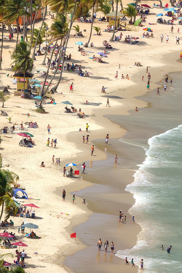
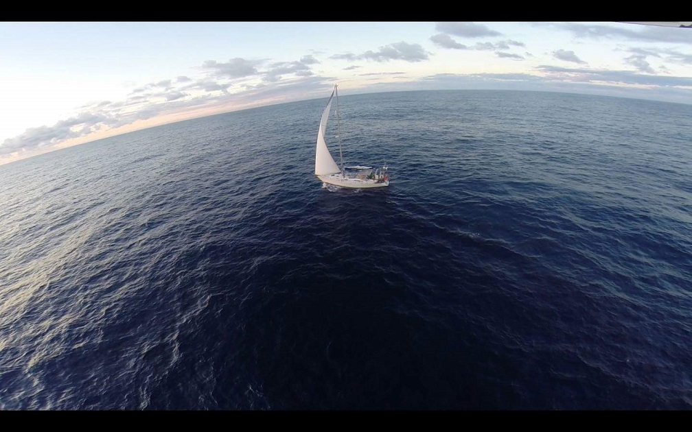
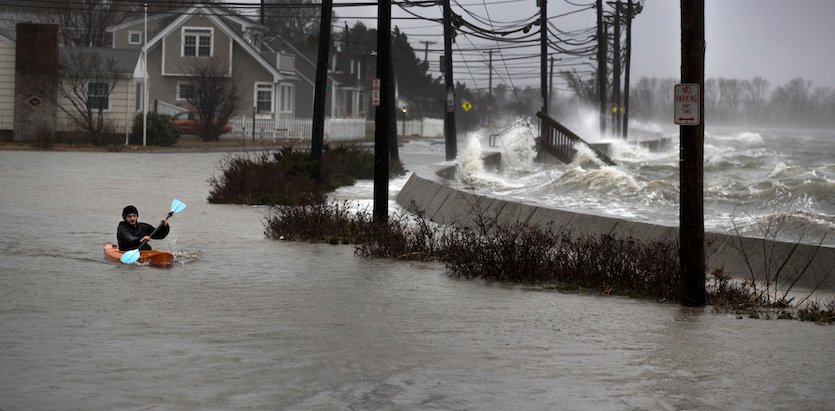
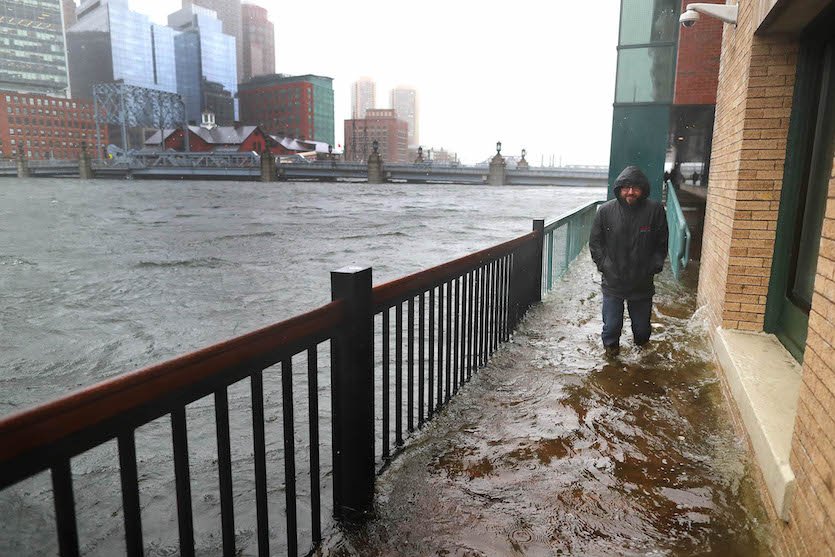
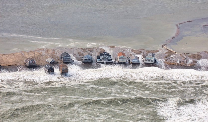
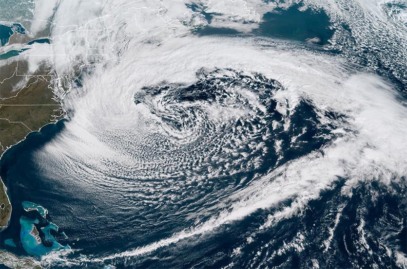
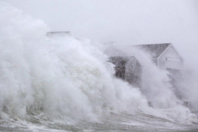
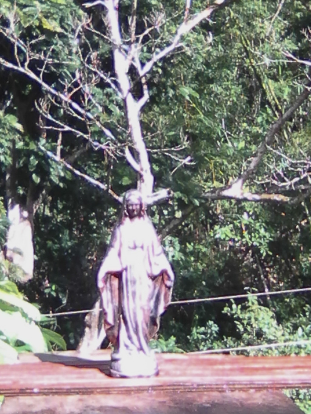
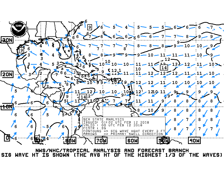
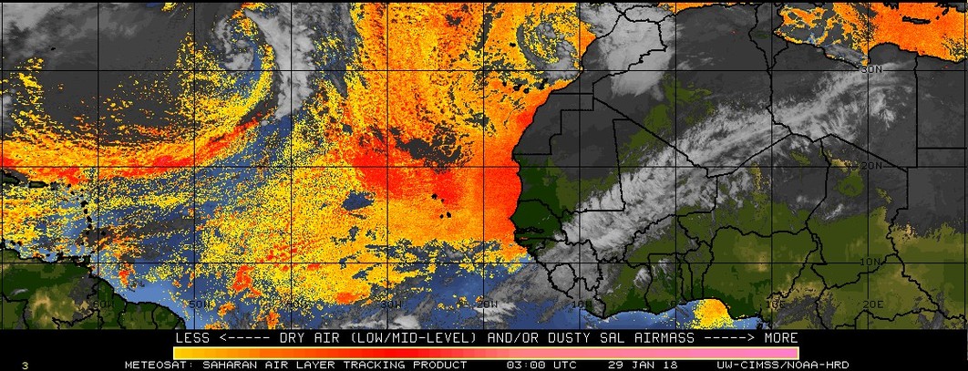
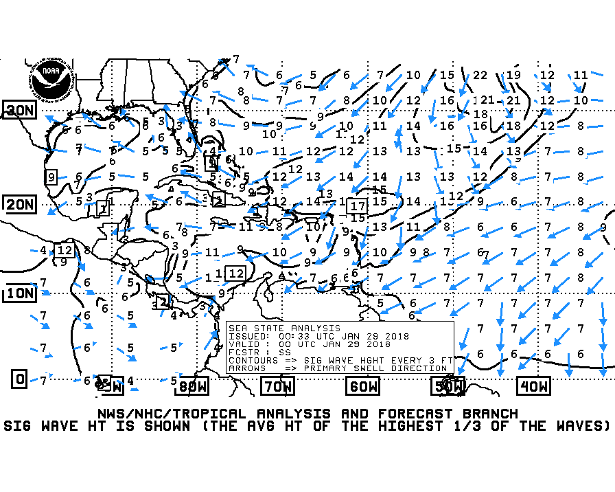
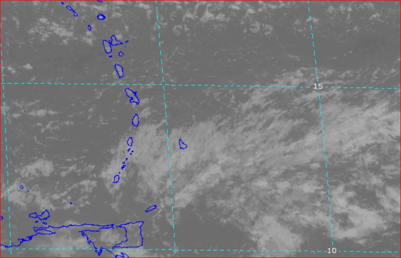
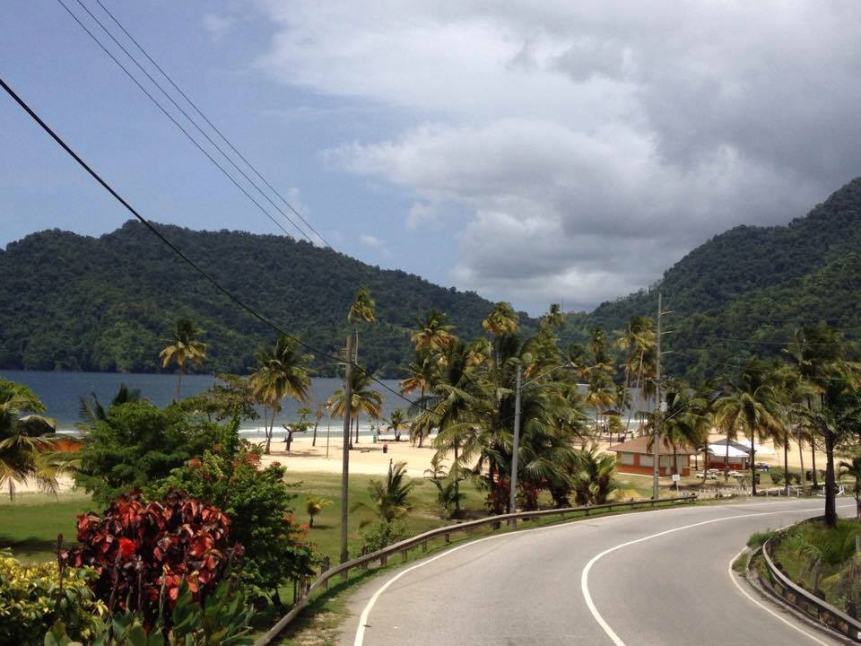
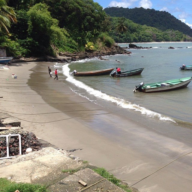
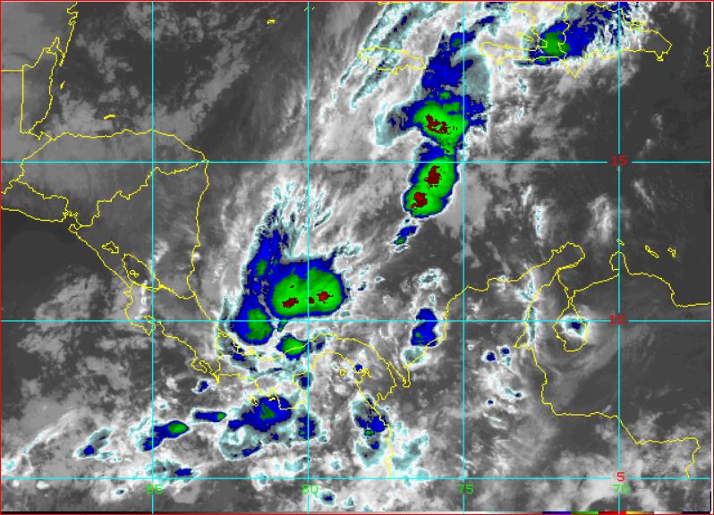
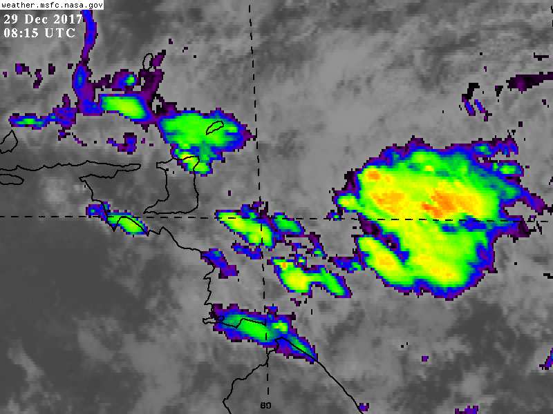
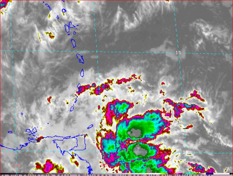
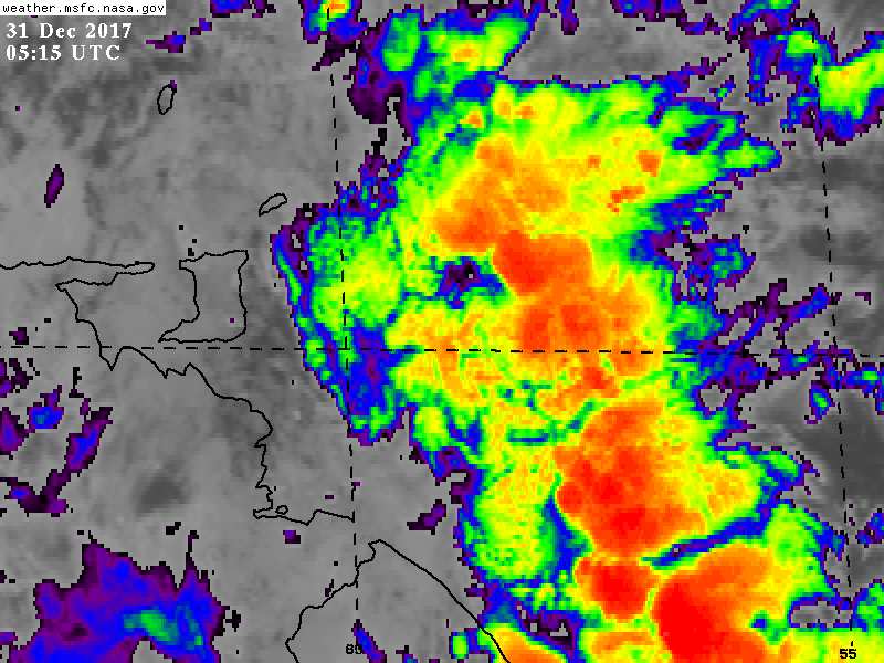
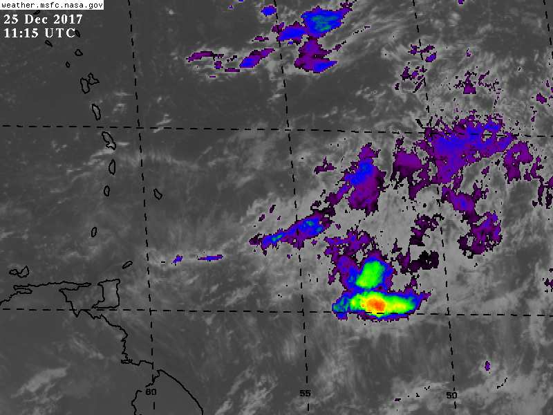
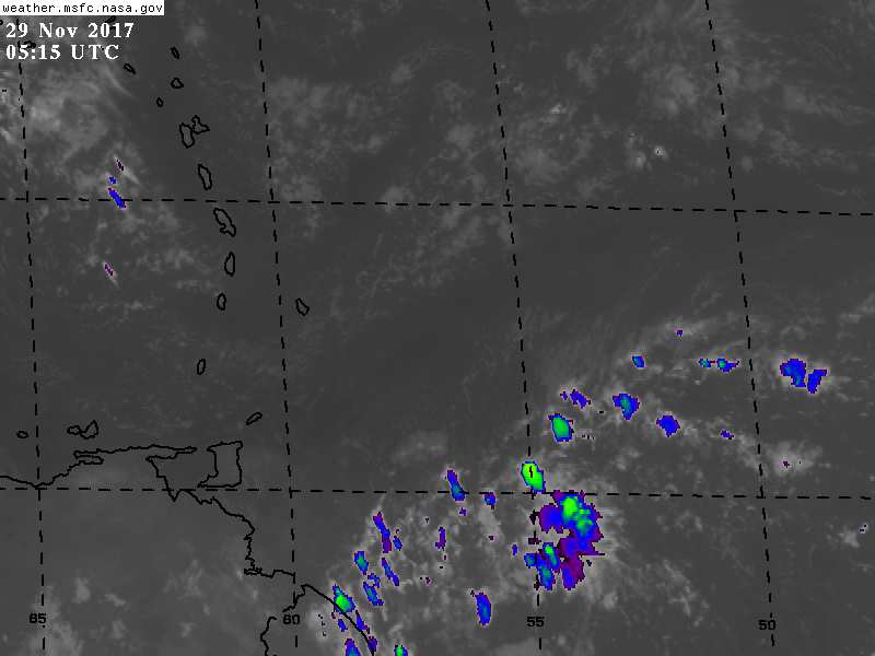
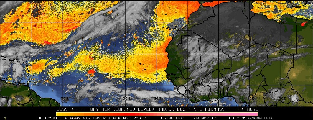
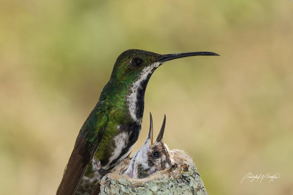
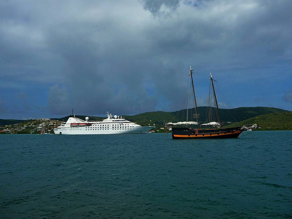
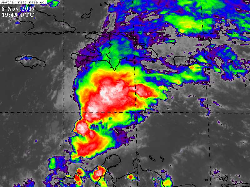
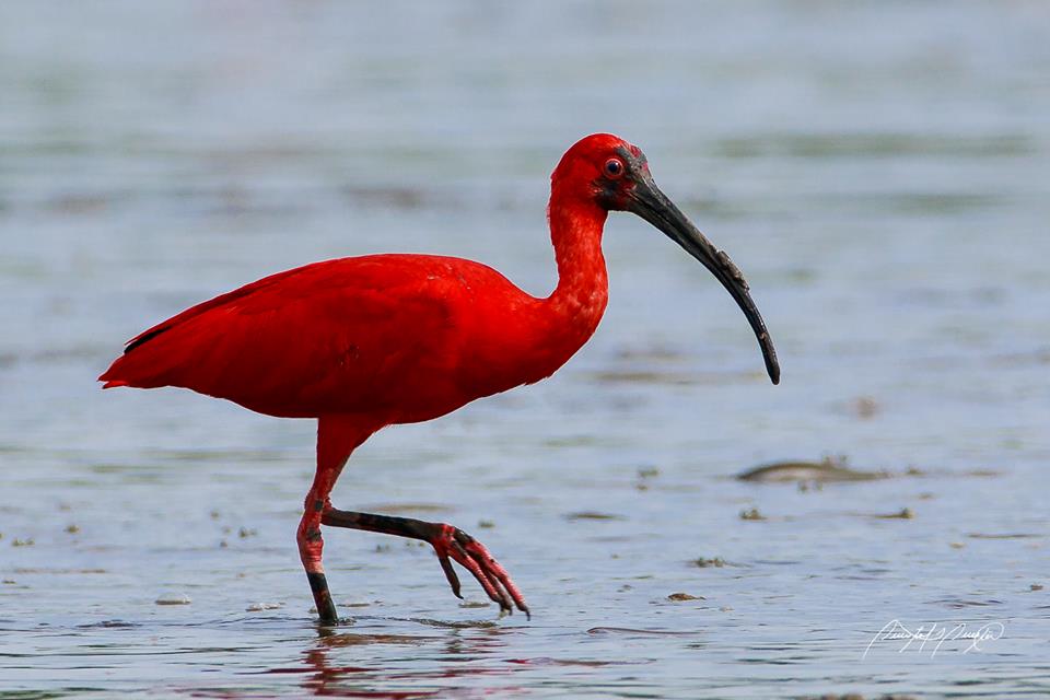
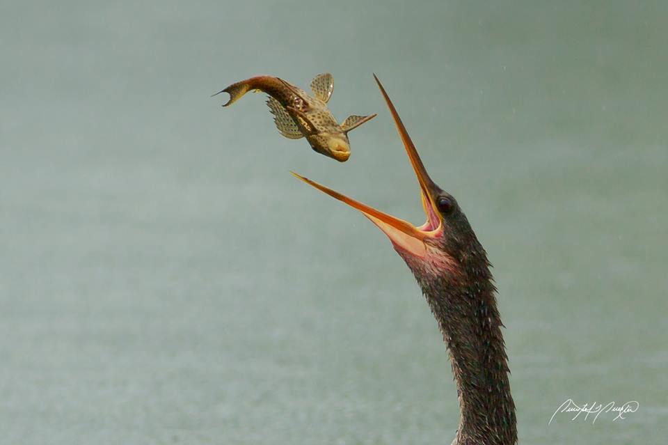
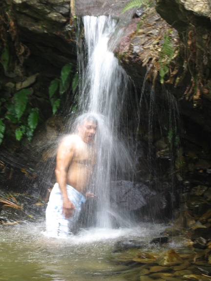
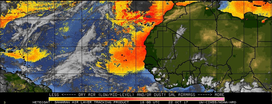
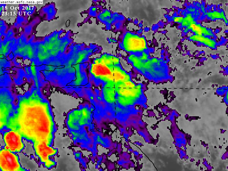
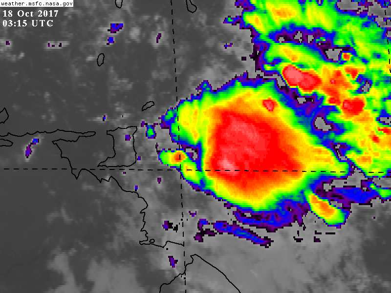
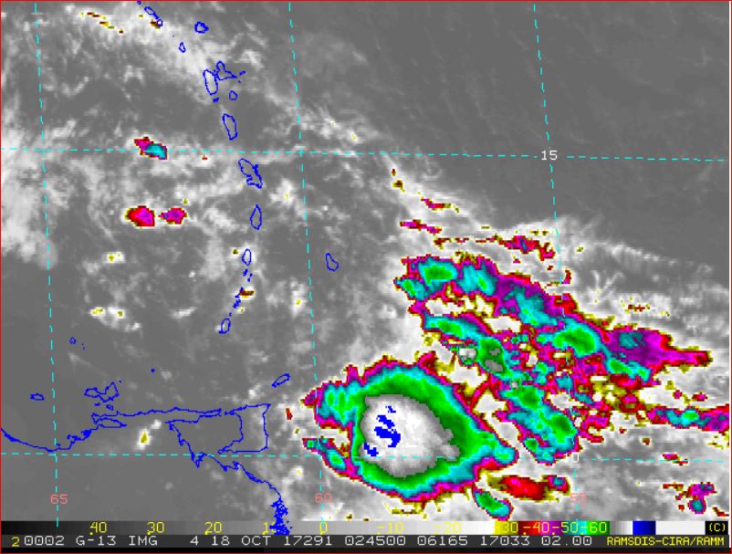
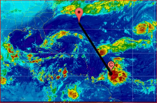
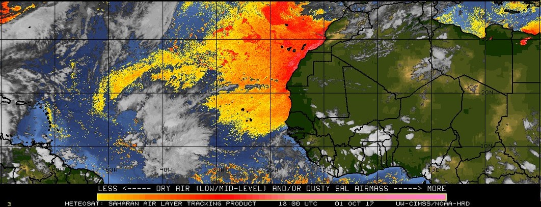
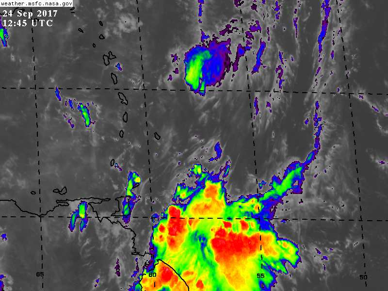
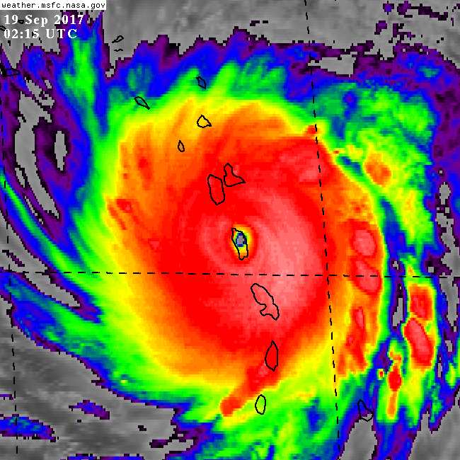
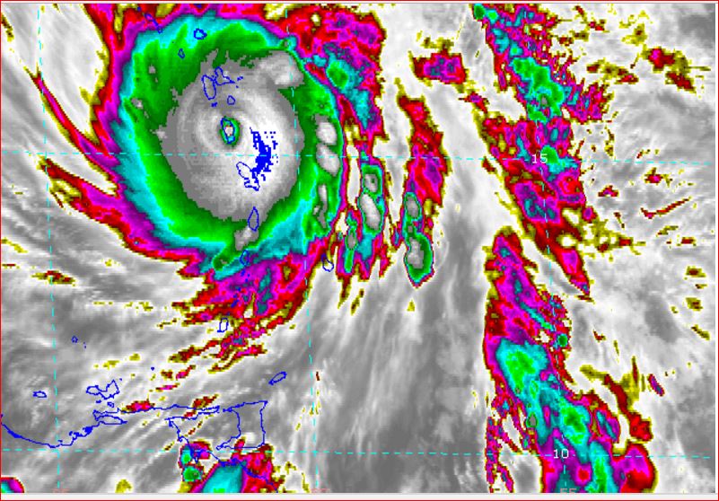
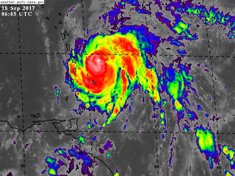
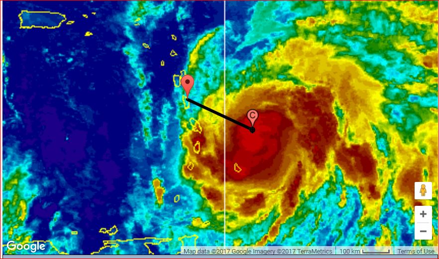
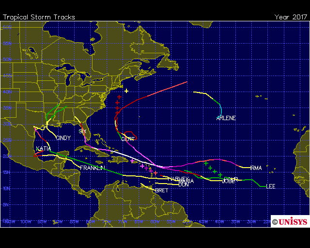
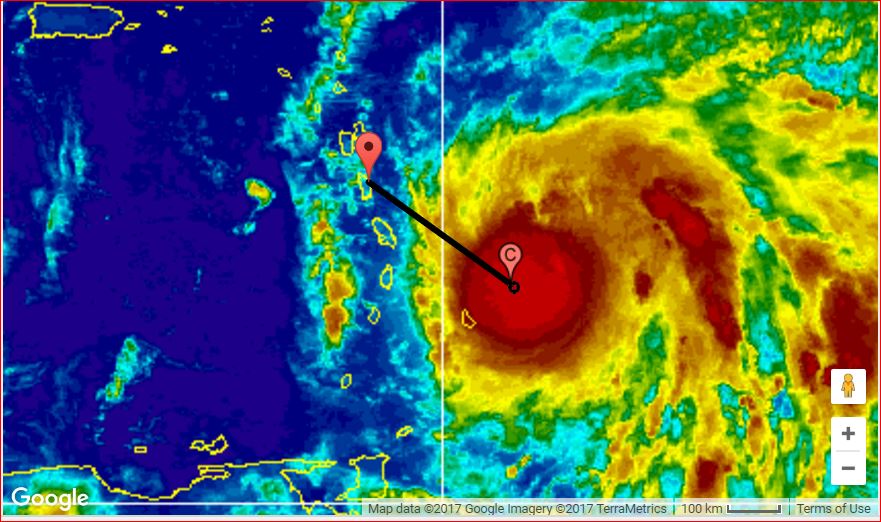
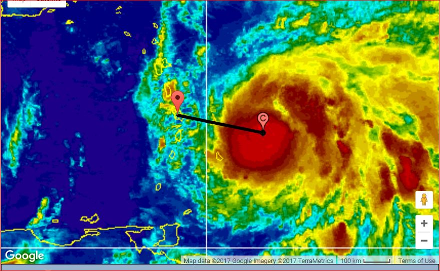
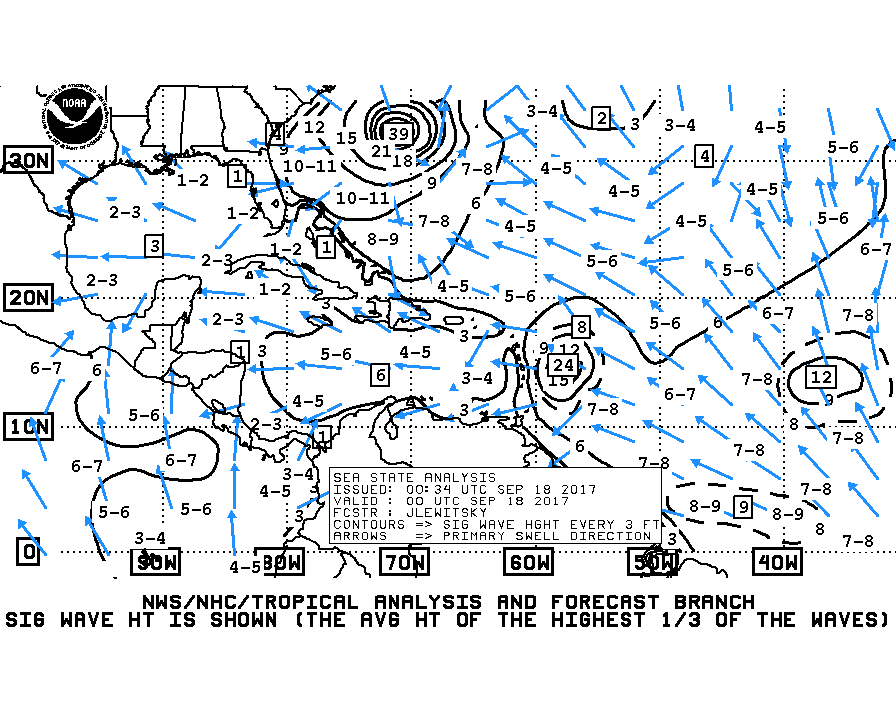
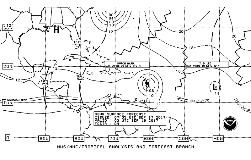
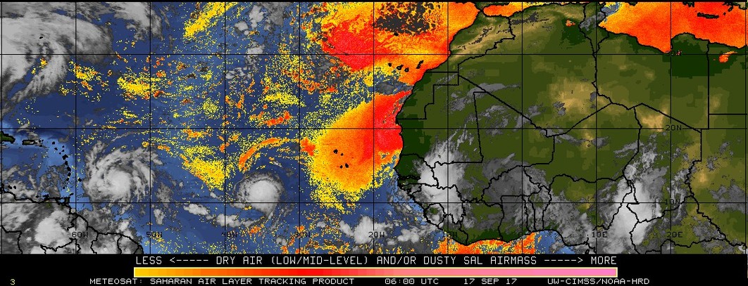
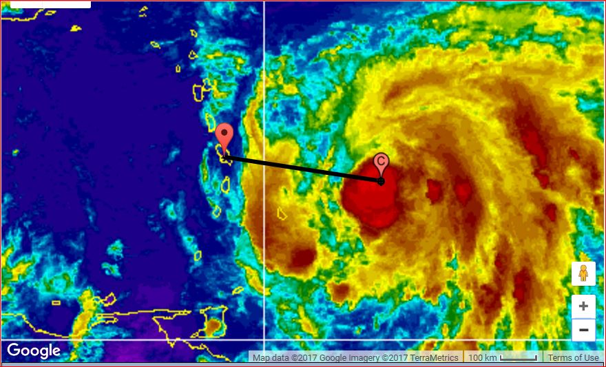
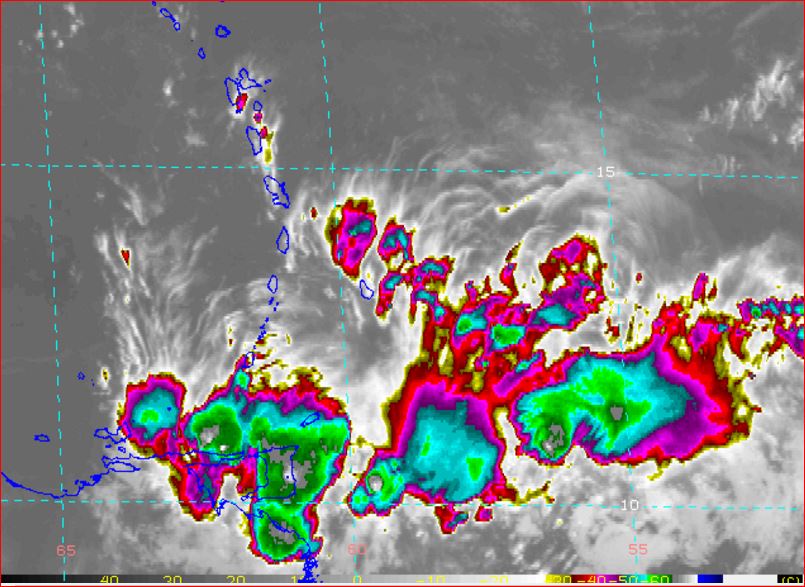
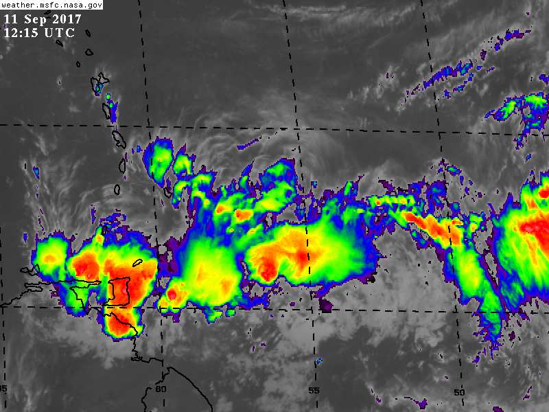
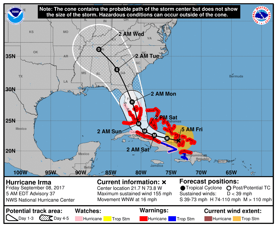
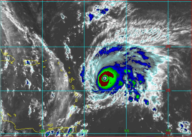
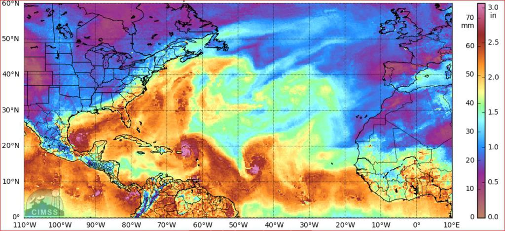
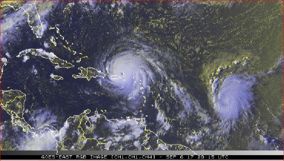
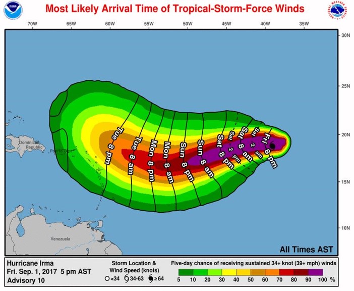
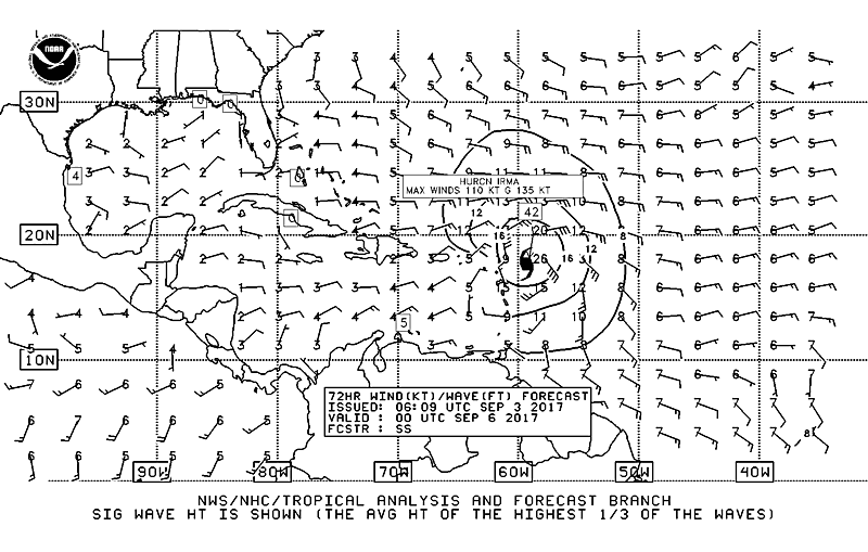
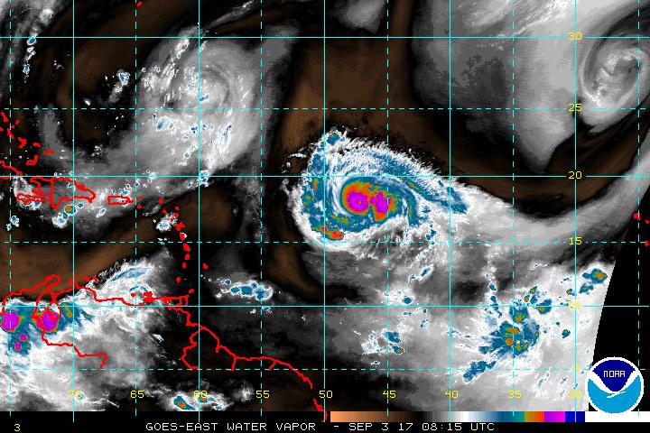
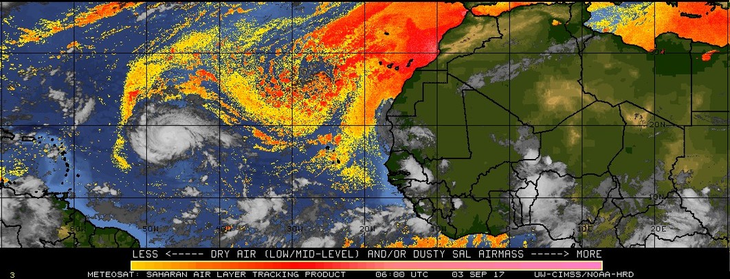
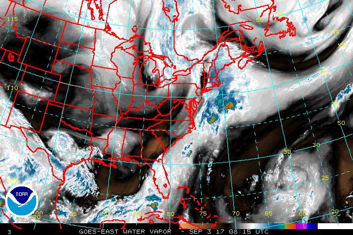
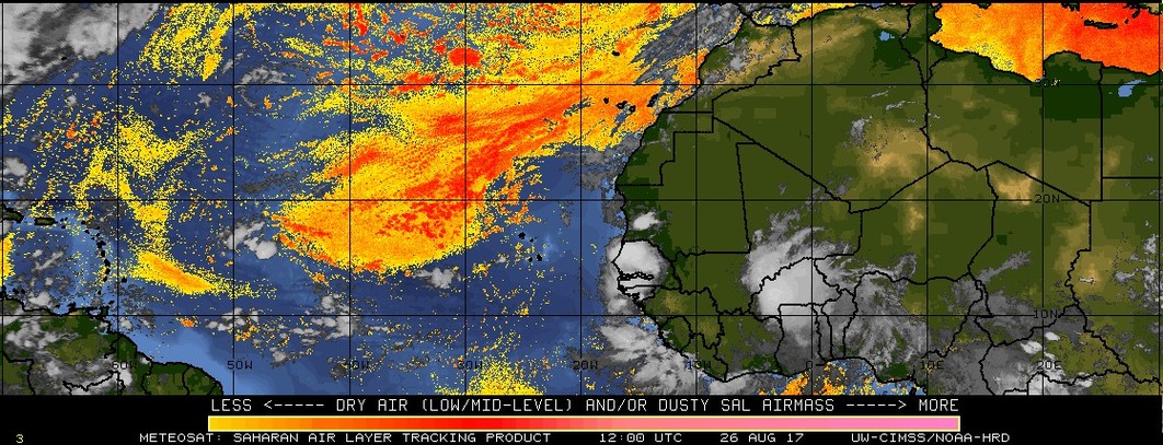
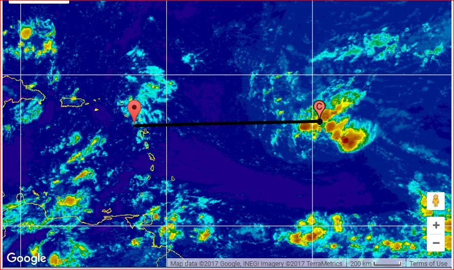
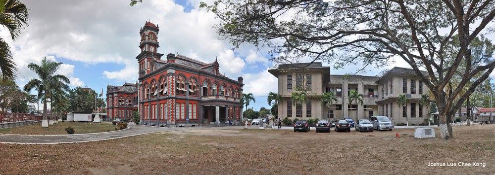
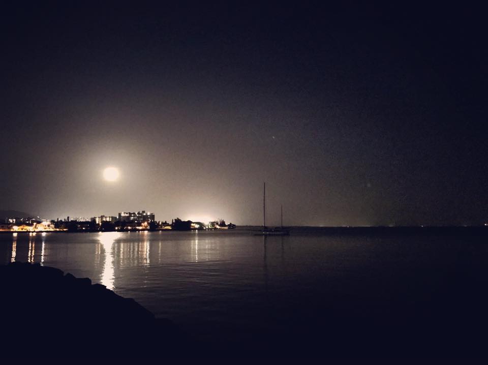
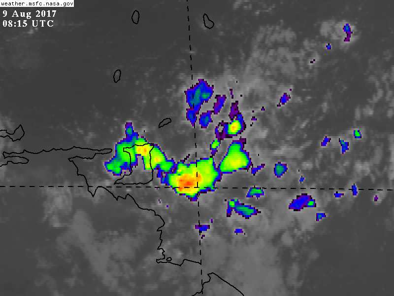
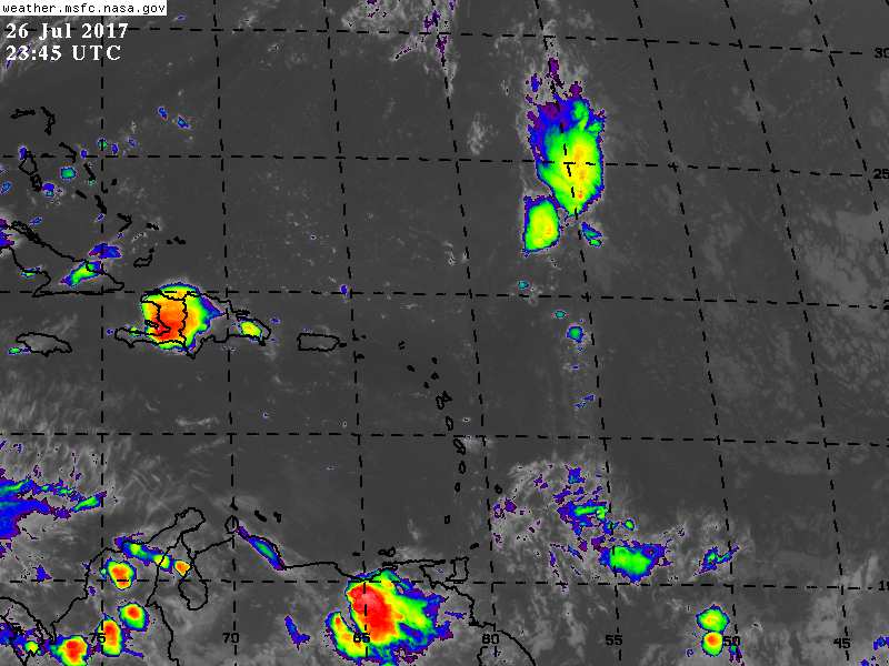
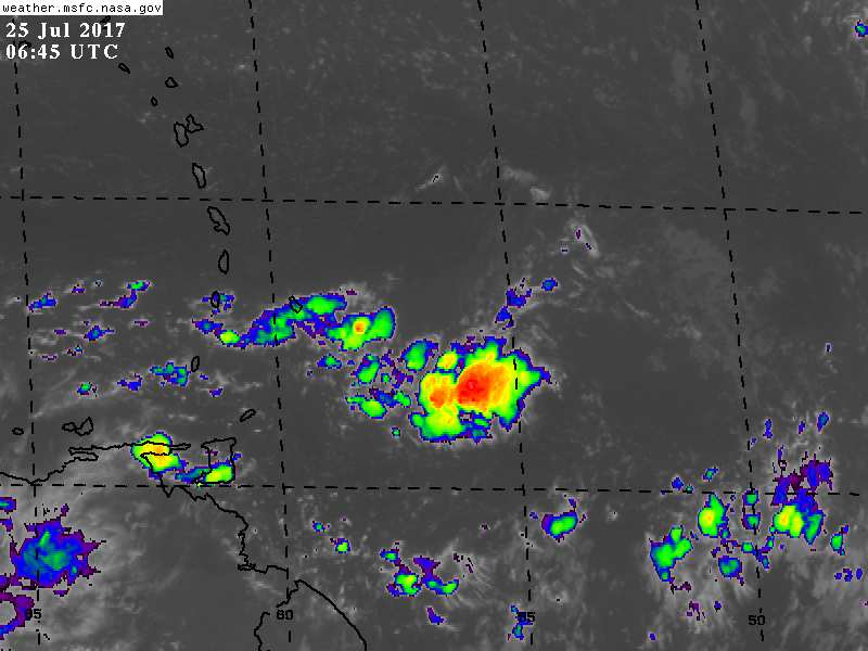
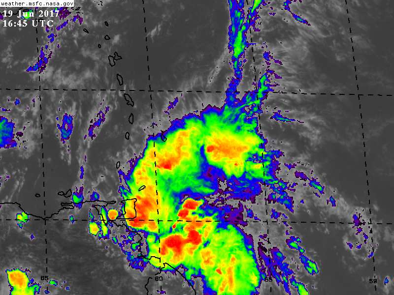
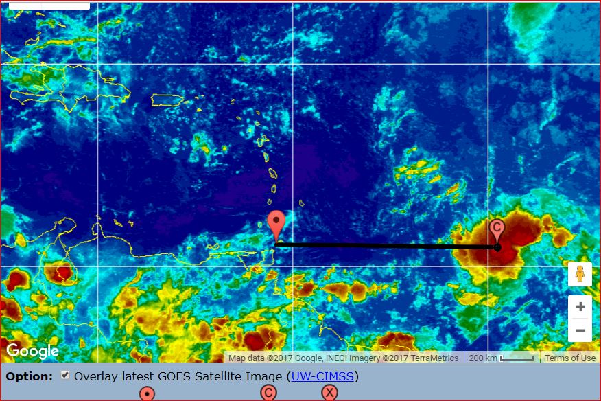
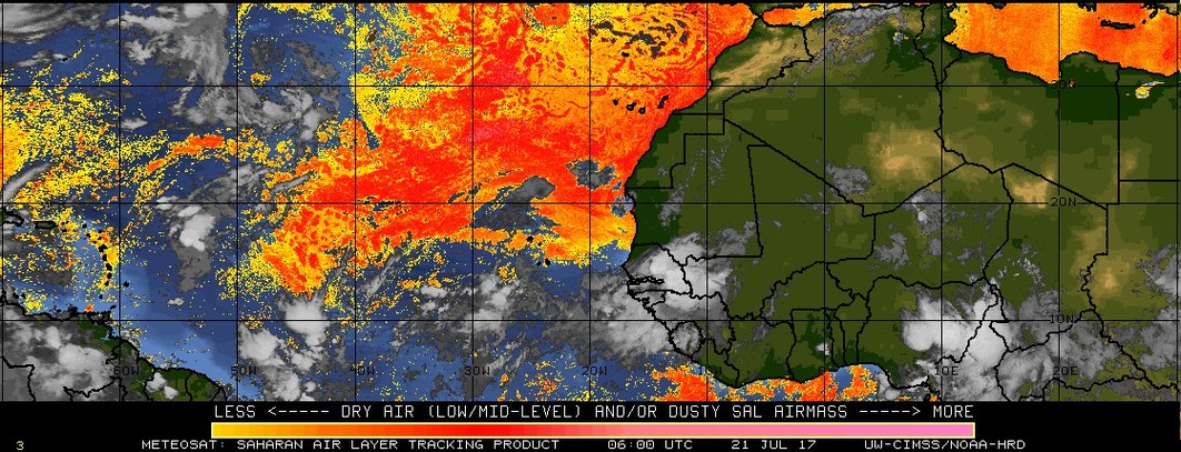
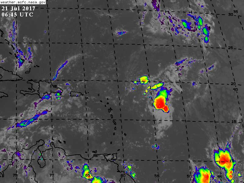
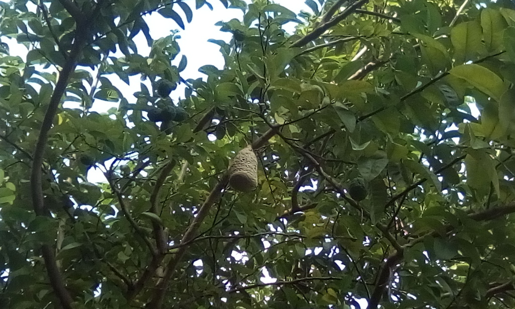
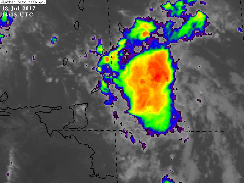
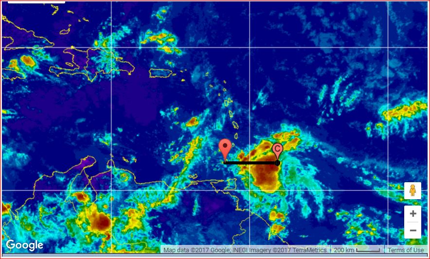
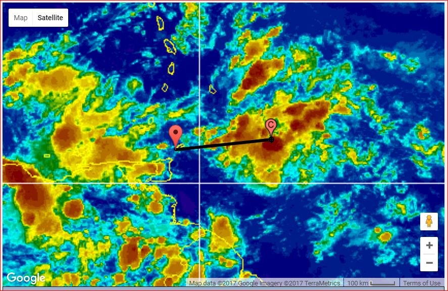
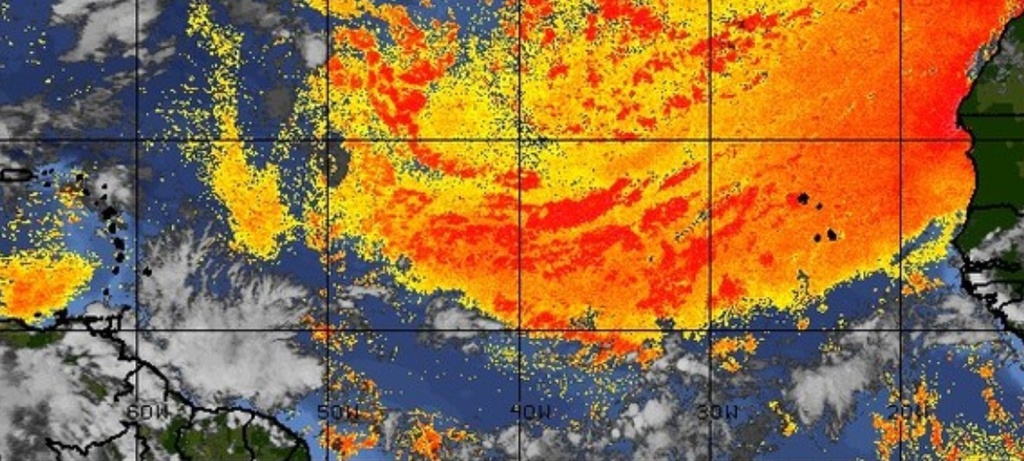
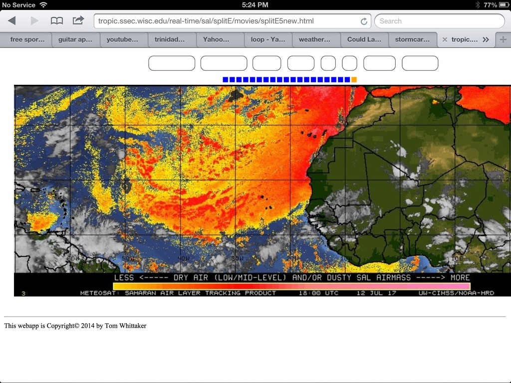
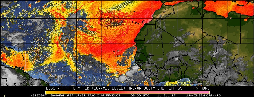
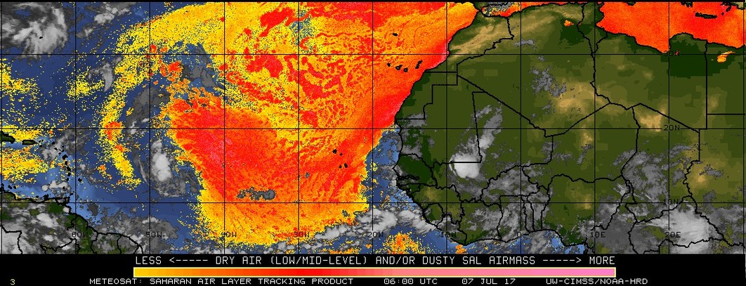
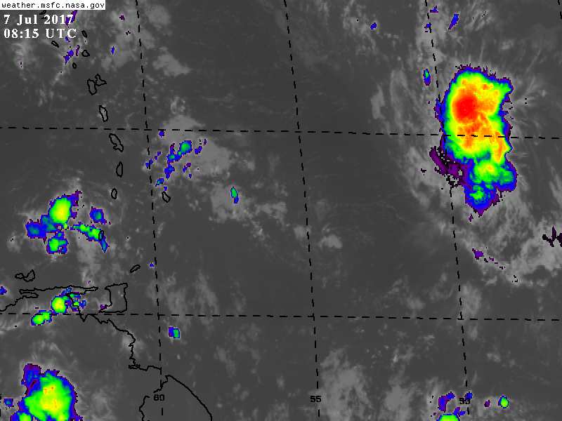
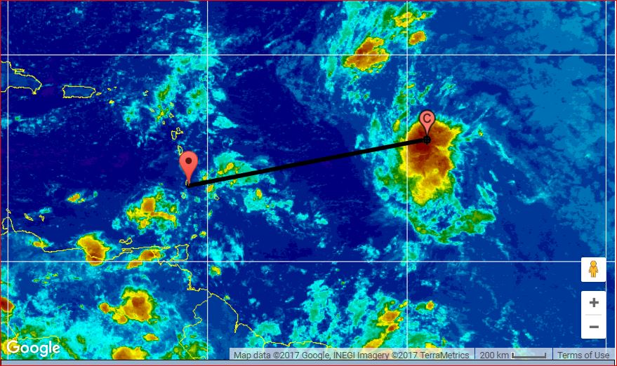
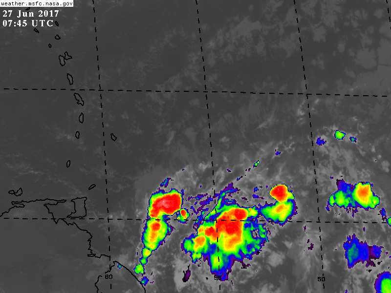
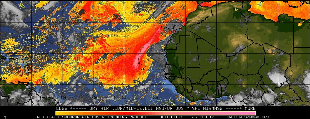
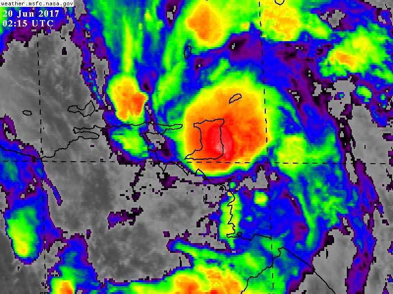
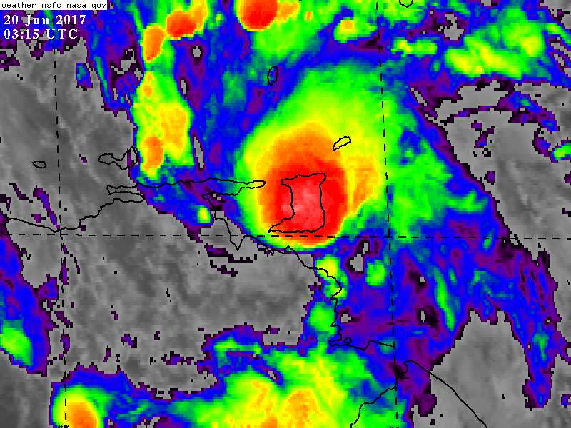
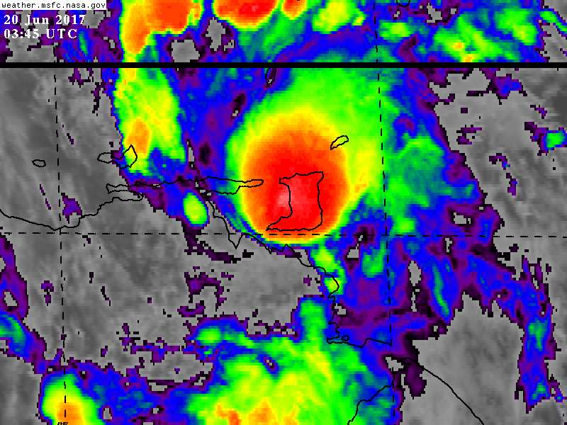
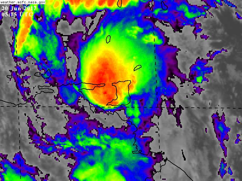
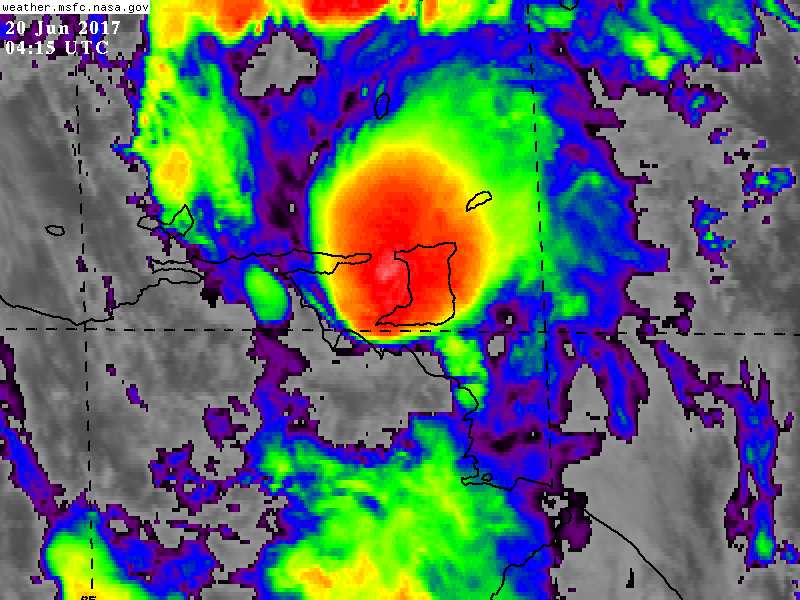
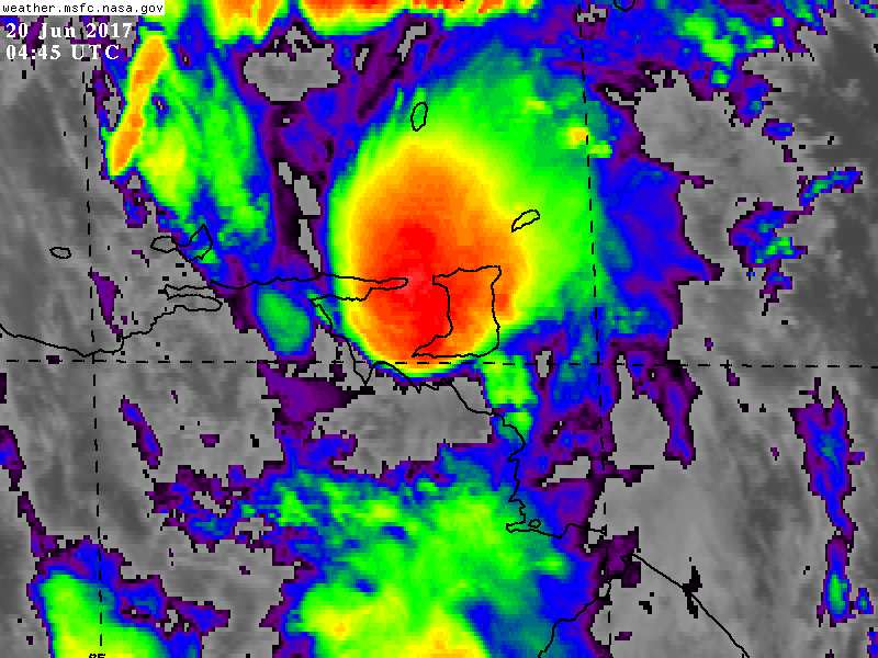
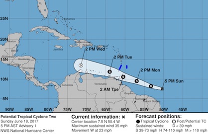
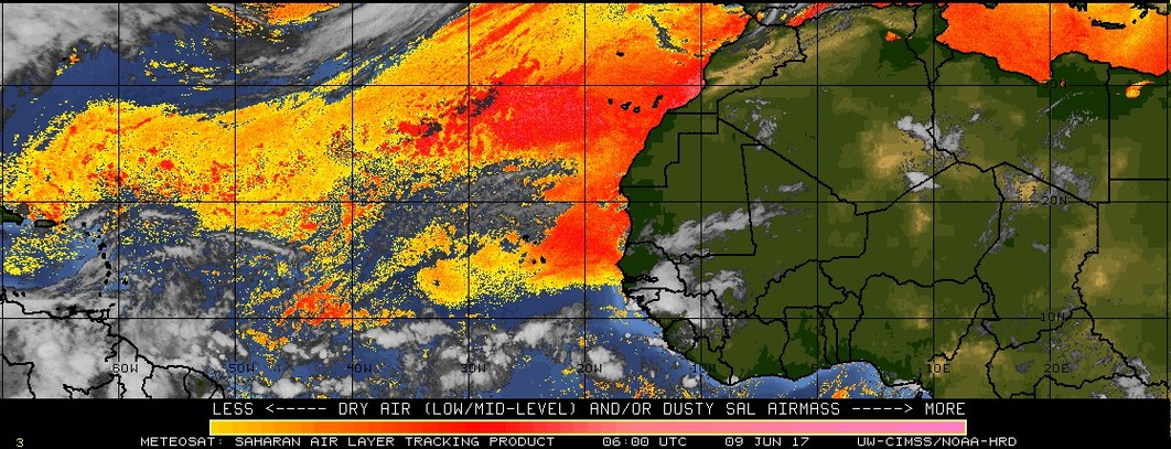
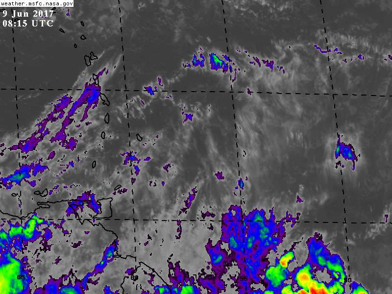
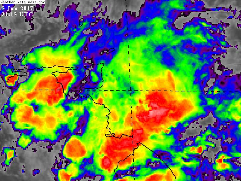
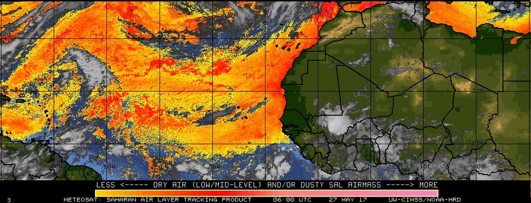
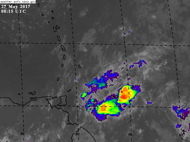
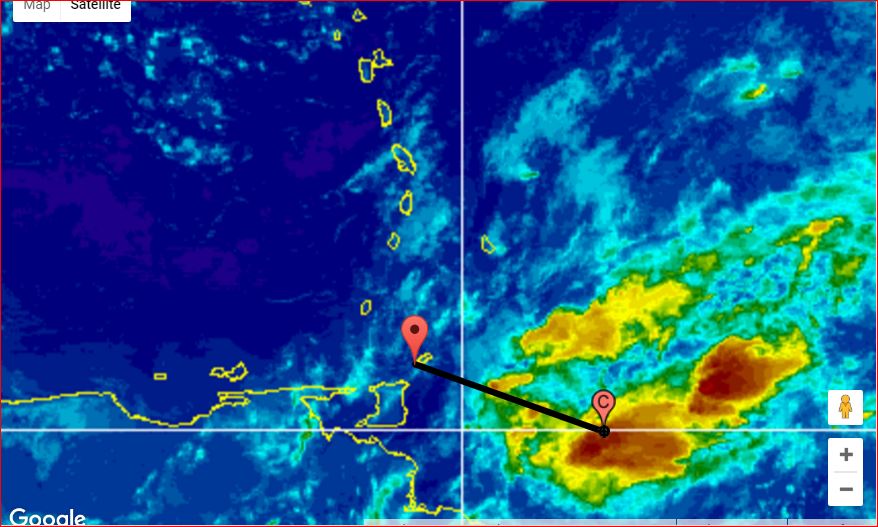
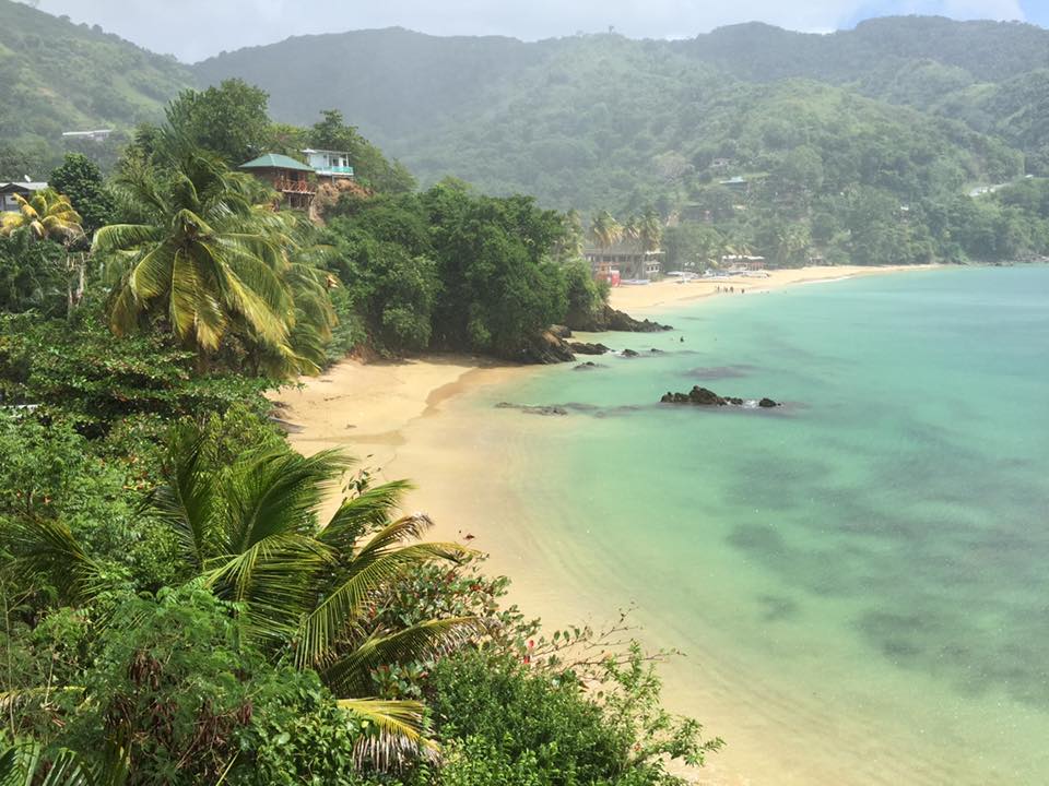
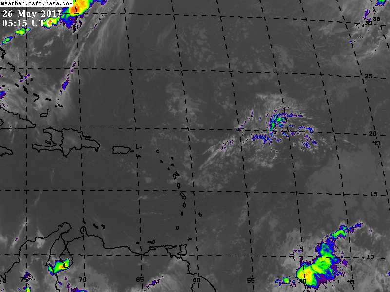
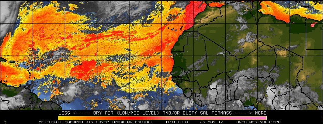
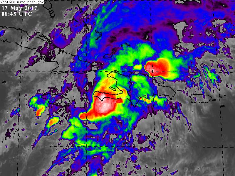
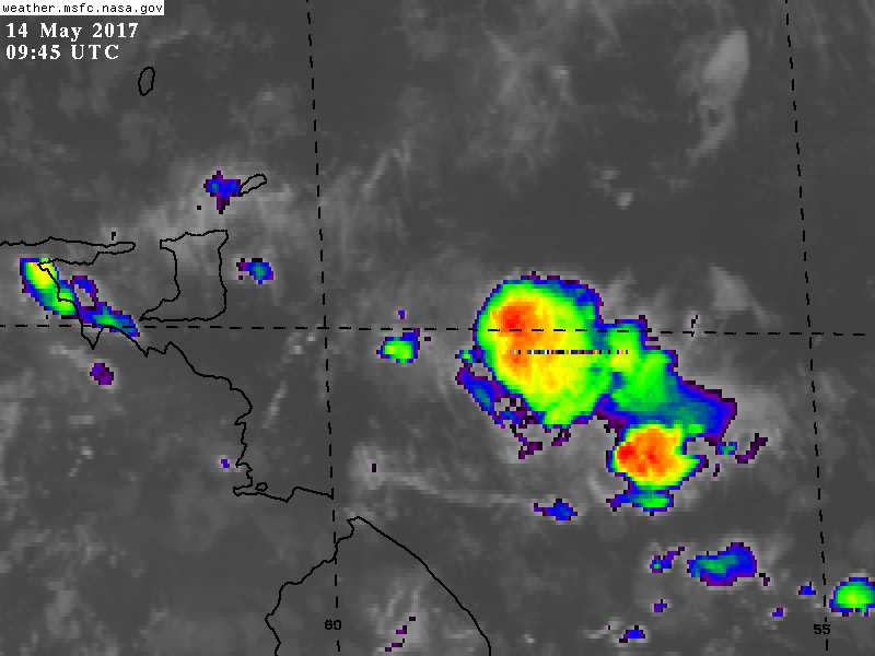
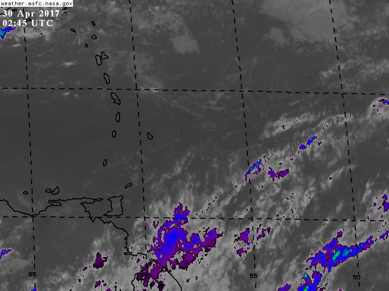
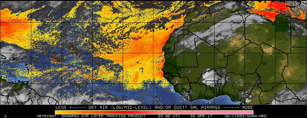
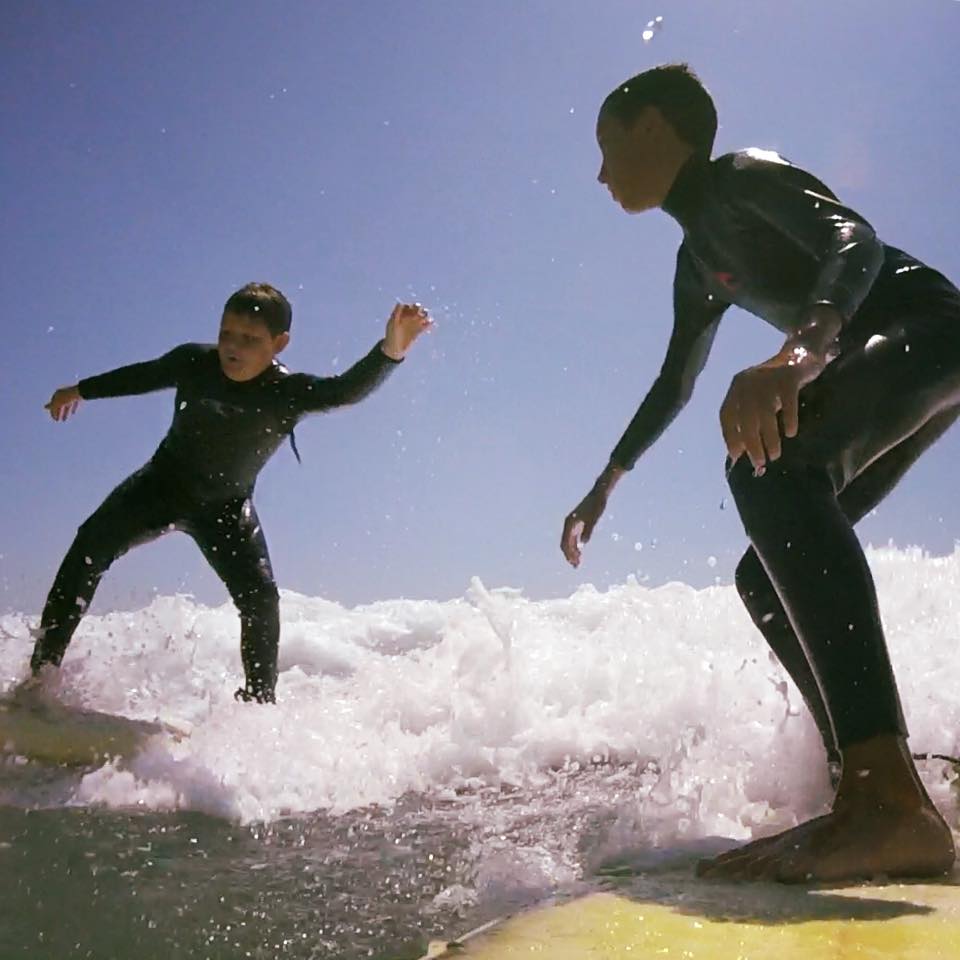
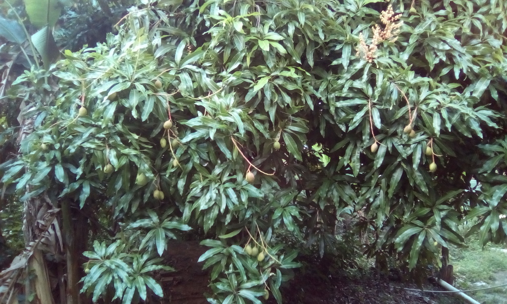
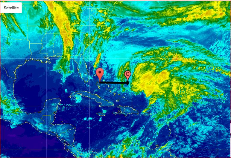
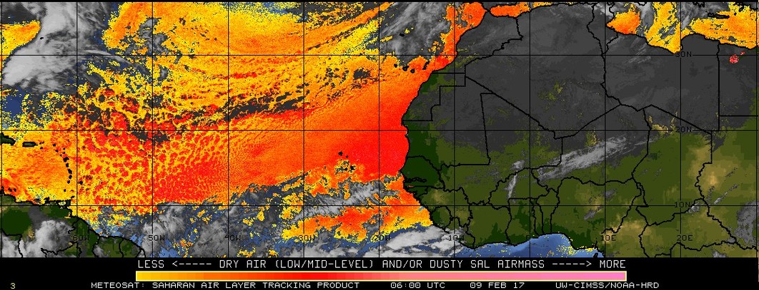
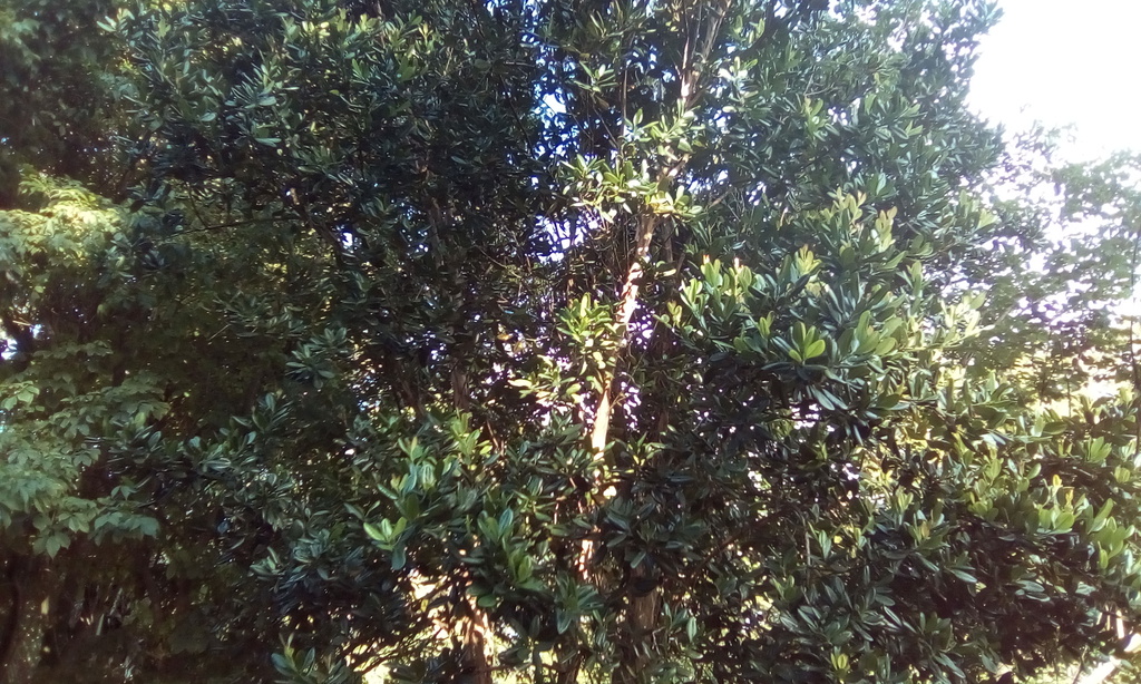
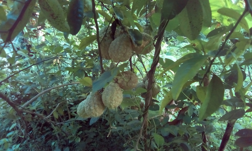
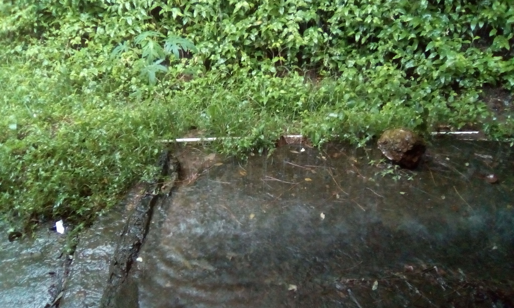
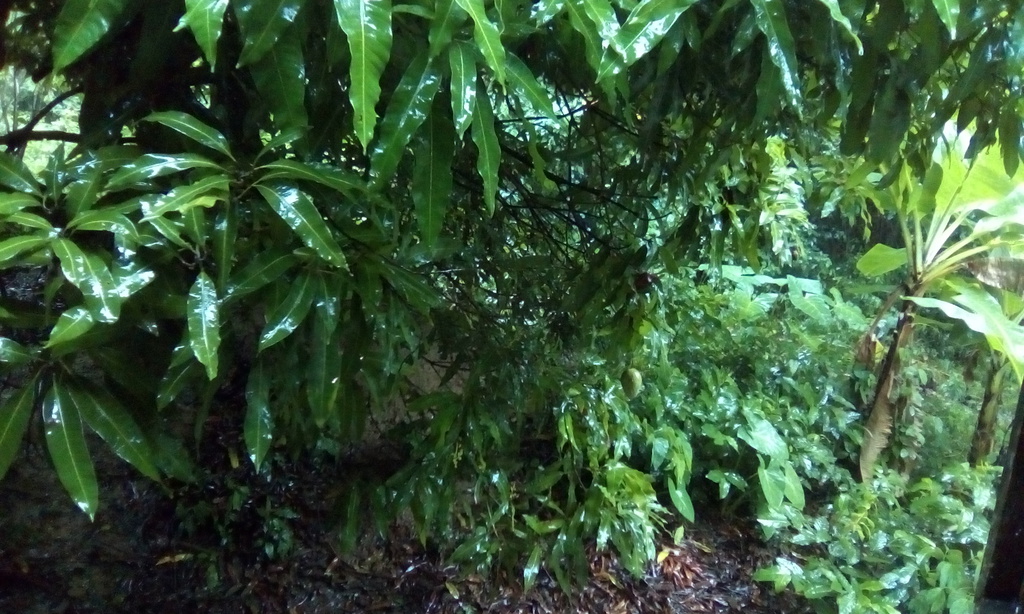
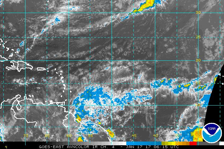
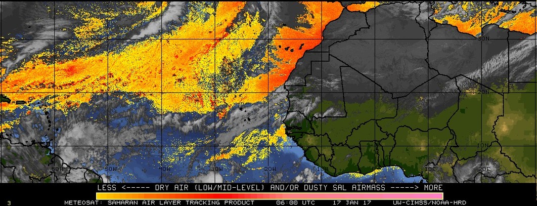
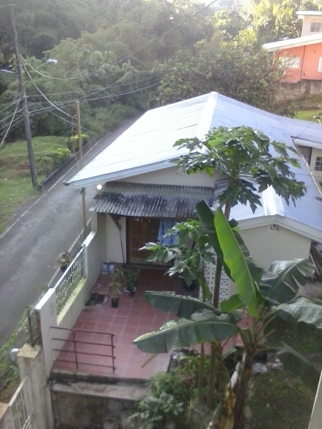
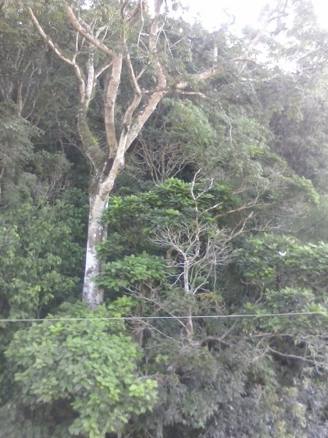
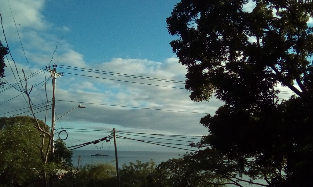
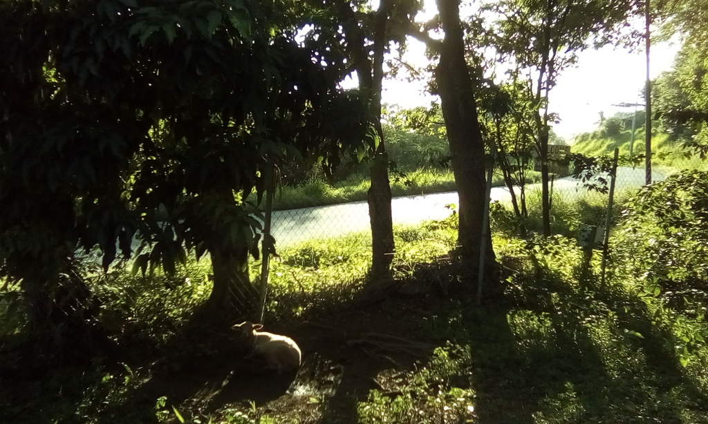
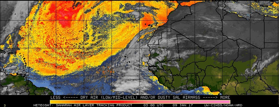
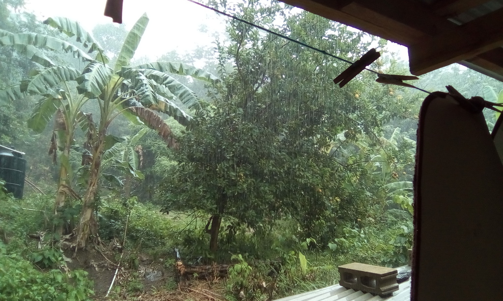
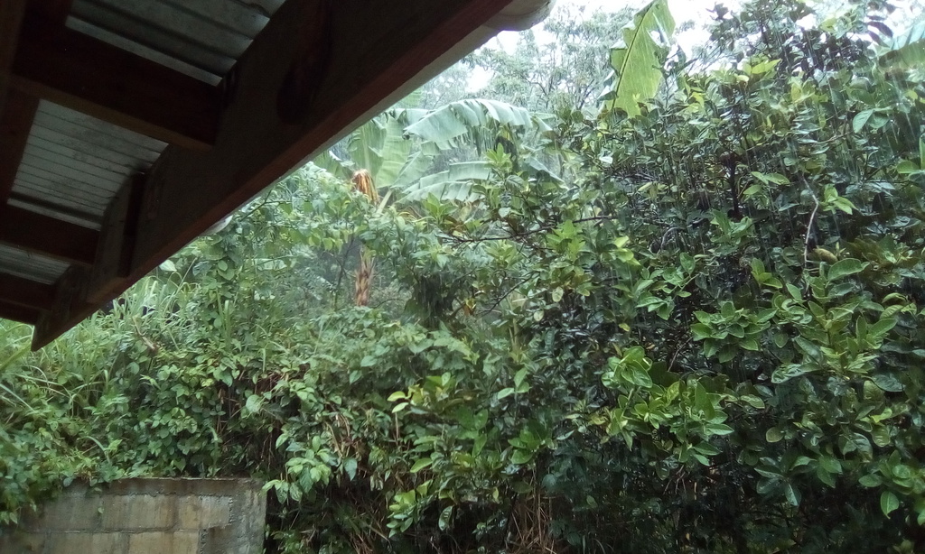
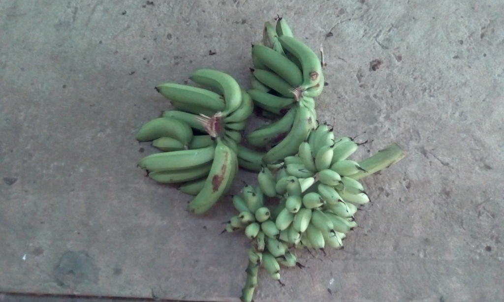
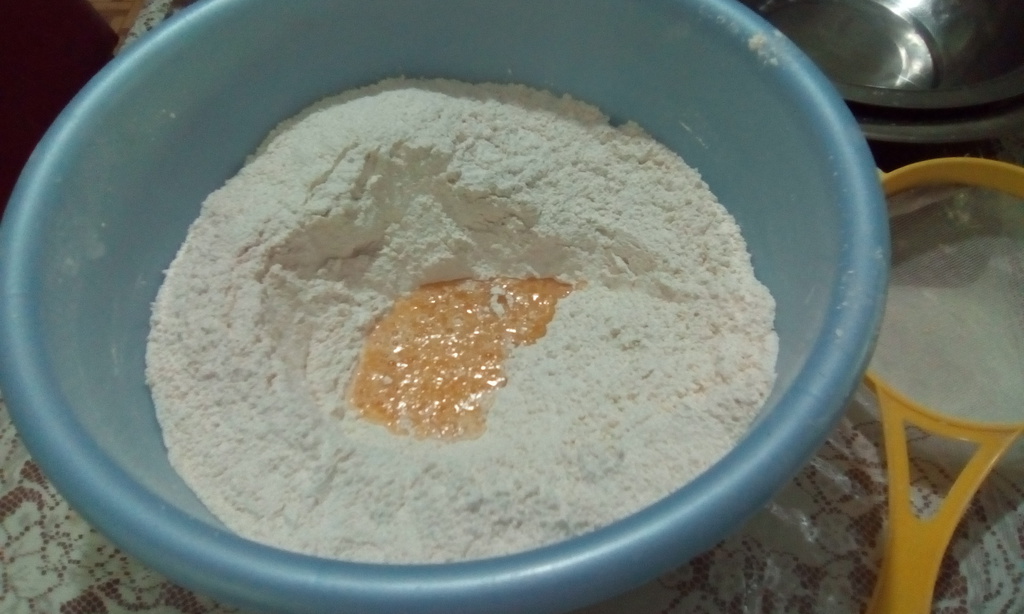
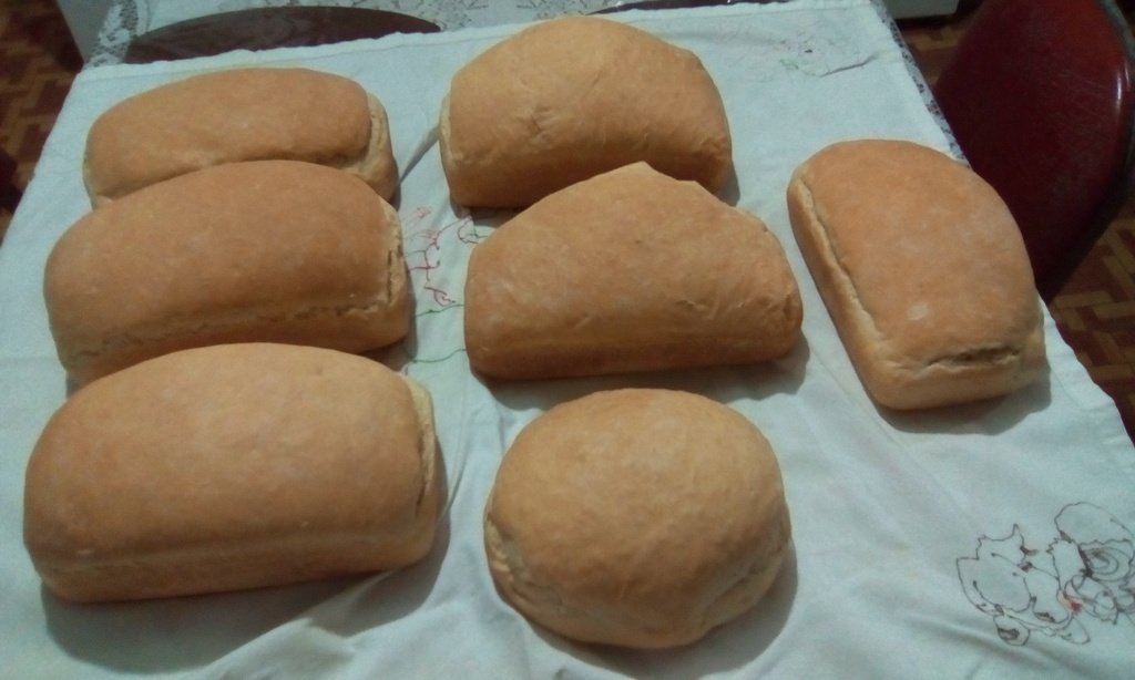
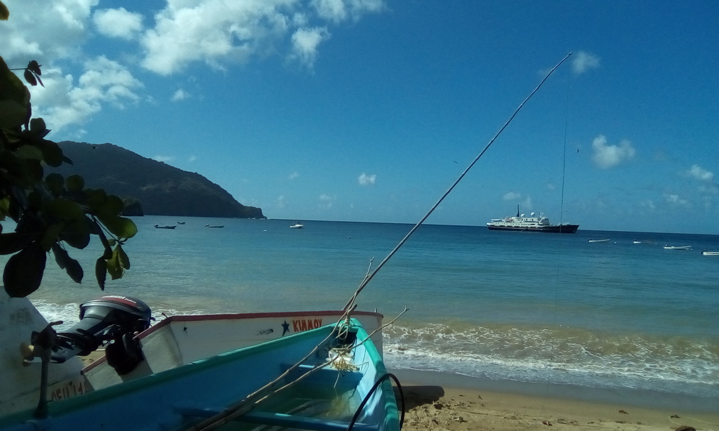