
|
|
- Updates from the Islands -- - St.Croix (USVI) - - |
|
|
For the most recent reports from St.Croix see this page.
| - Watching IRMA! |
|
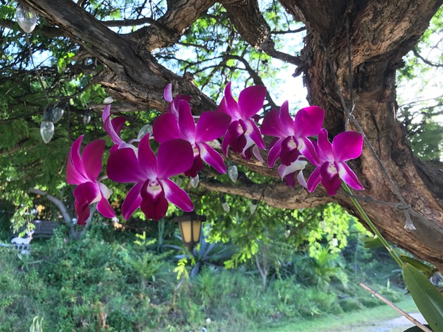
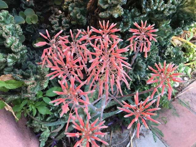
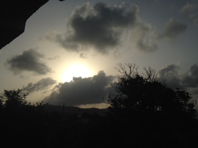
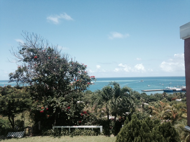
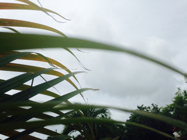
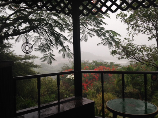
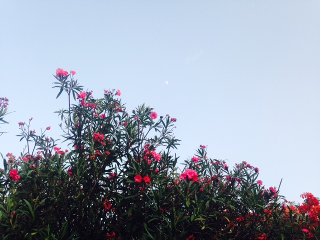
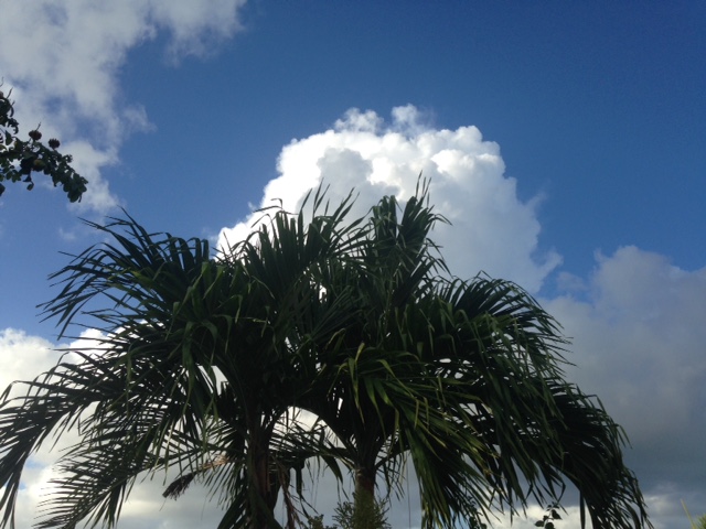
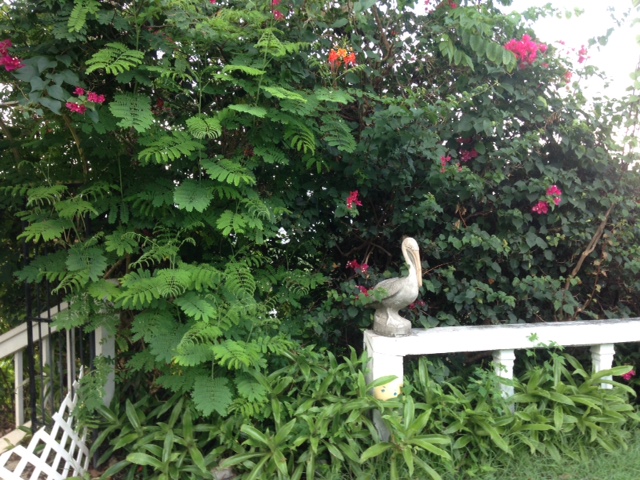
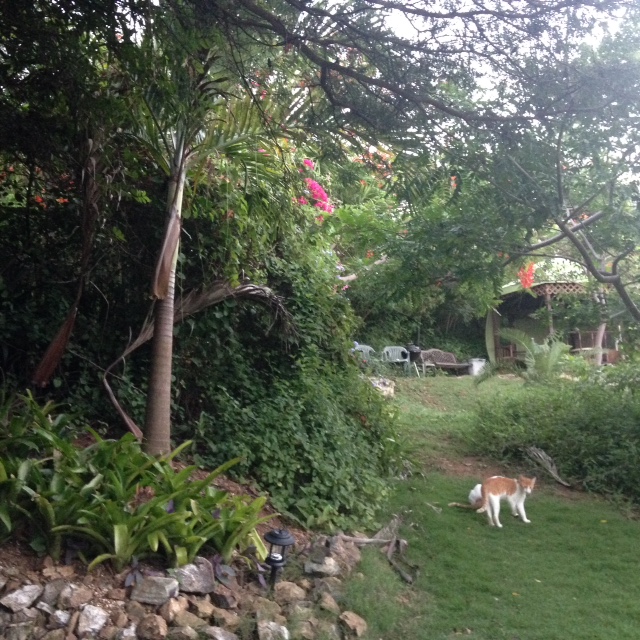
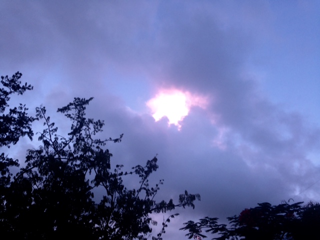
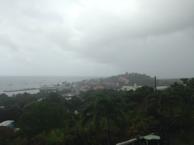
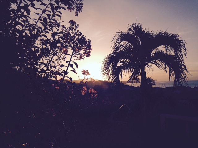
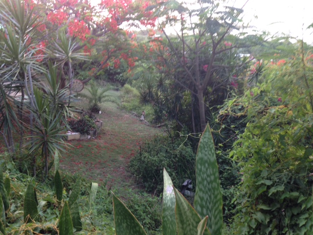
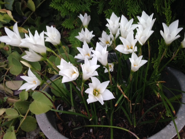
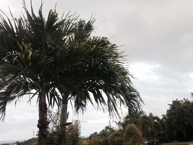
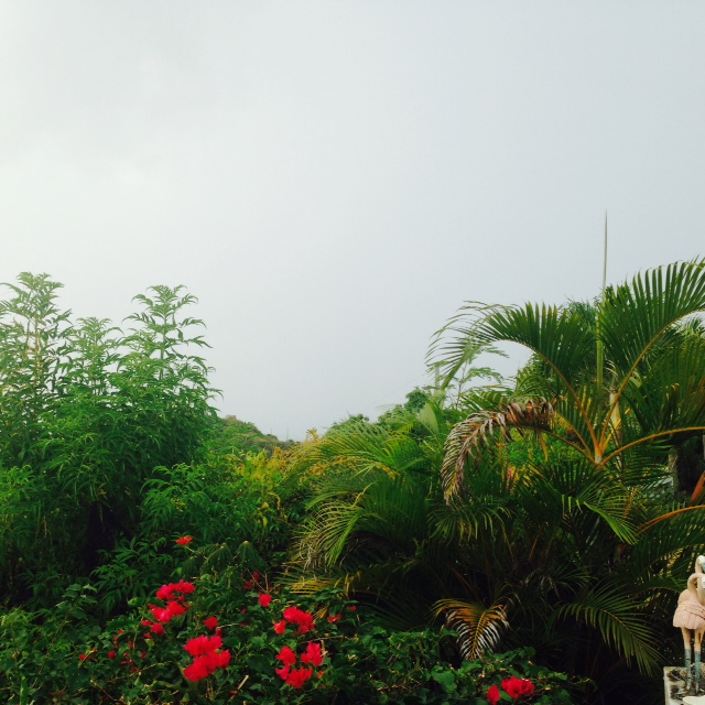
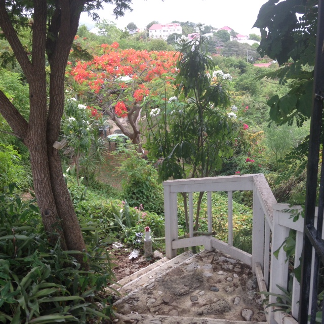
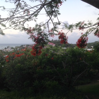
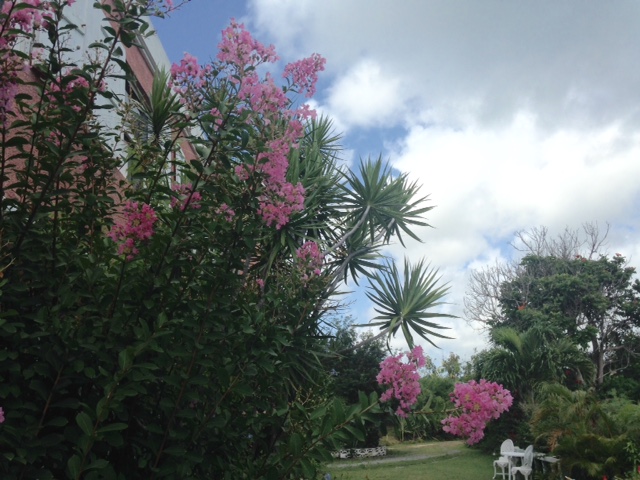
Sept. 4  - She is LARGE! And she has her EYE on us! The surf has been building
and the sea is choppy, fewer boats. We should start feeling IRMA's presence in
the Caribbean on Tuesday night. All around houses are being shuttered,
including ours. Everyone is busy. The homeless will be sheltered and anyone
else who does not feel safe in their house, or don't want to be alone.
OMAR's spray of orchids survived 130mph winds. Let's see if IRMA's orchids,
same place (see photo) will do the same at 140! Will post later if possible.
Be safe everyone! We know the rules! May God bless us all.

Isabel
Sent from my iPhone |
| - Hurricane Watch ! |
|
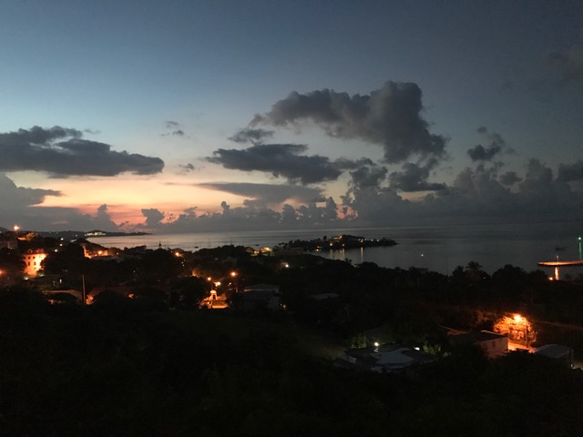
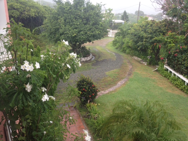
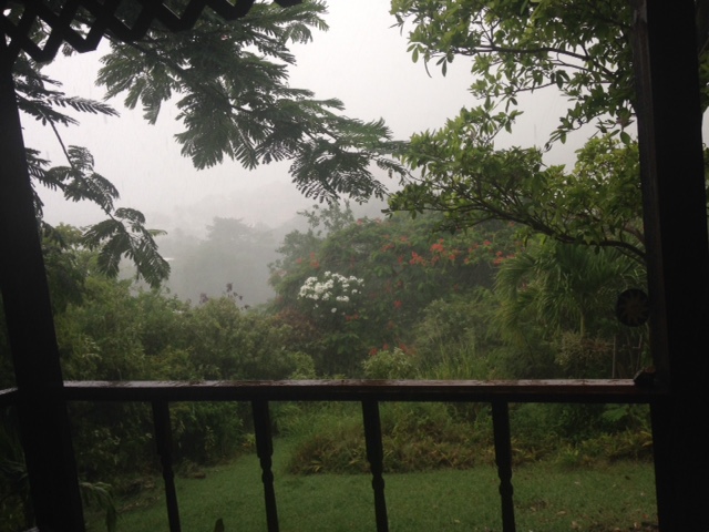
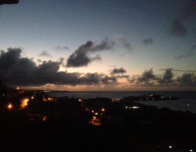
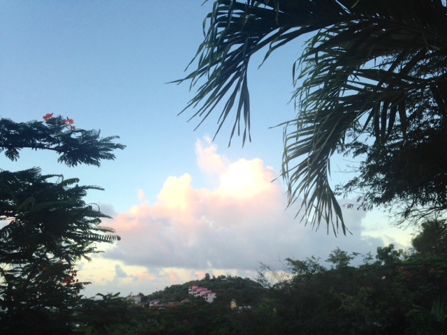
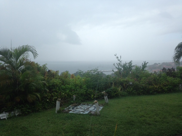
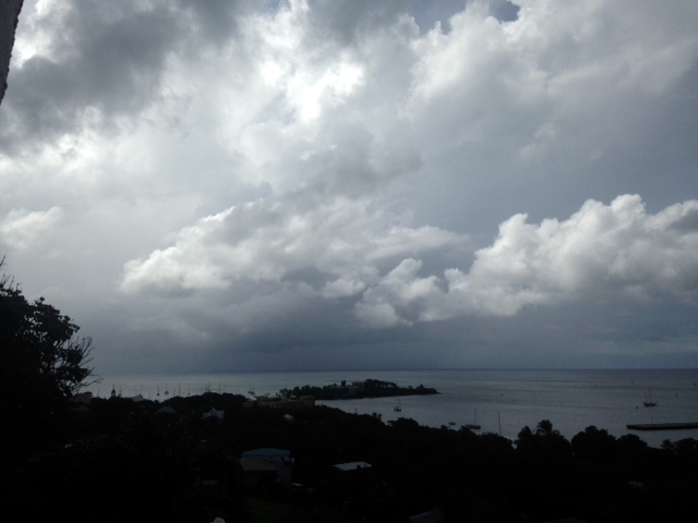
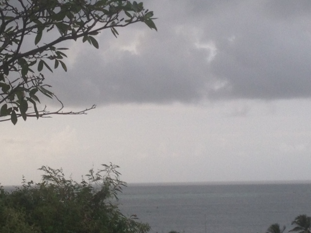
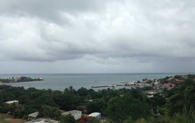
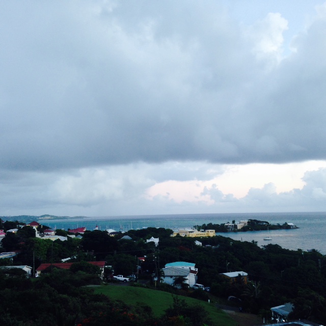
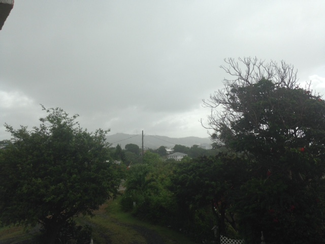
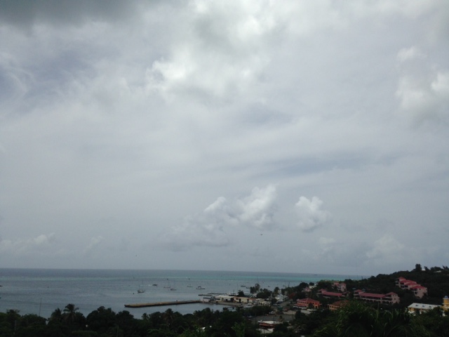
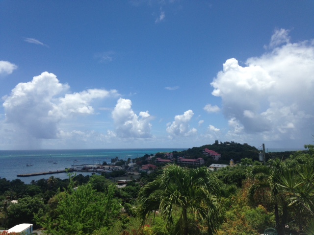
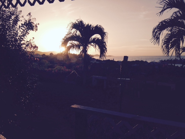
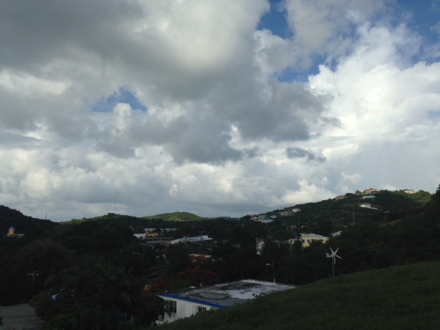
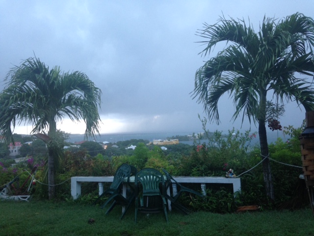
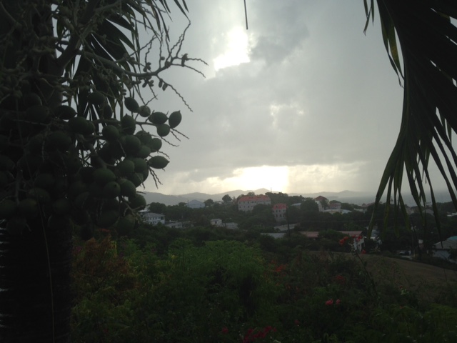
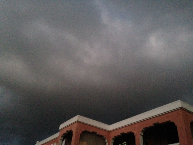
Sept.4 - V.I. Alert just issued a hurricane watch. This beautiful weather will
be changing with the ticking of the clock. I will use this view to show
deterioration of the weather. We expect to get a beating, however. We are
trying to do all we can to get ready and others as well to be safe during this
unusual dip south. We hope and pray that everyone on all the islands most
affected will take all the precautions necessary.  May God bless and protect us
all. We have to cooperate by following the instructions of the Civil
Authorities. Be ready!

Isabel
Sent from my iPhone |
| - Cat 3 IRMA - Around the Corner? |
|
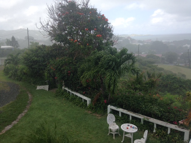
Aug. 3 - So far no watches/warnings have been issued for the US Virgin Islands,
nor Puerto Rico. Until then, everyone is going to continue as is. My nephew is
frustrated because the sandbags have not been distributed as yet. Tomorrow is
going to be quite another day. I will try to keep sending updates for as long
as possible. If the Sprint towers hold firm all should go well. I do expect we
will have interruption of service as we have had with other weather systems. I
pray that all the folks on the neighboring islands will be safe during this
time of tribulation. And our thoughts and prayers continue to pour out to those
suffering from the horrors of HARVEY. May God bless us all.

Isabel
     Sunday evening photo


Sent from my iPhone
|
| - IRMA Aims to Come Closer |
|
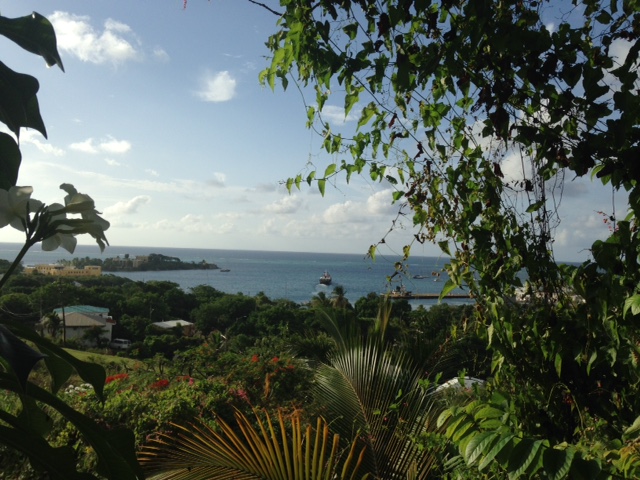
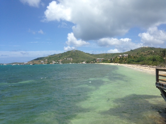
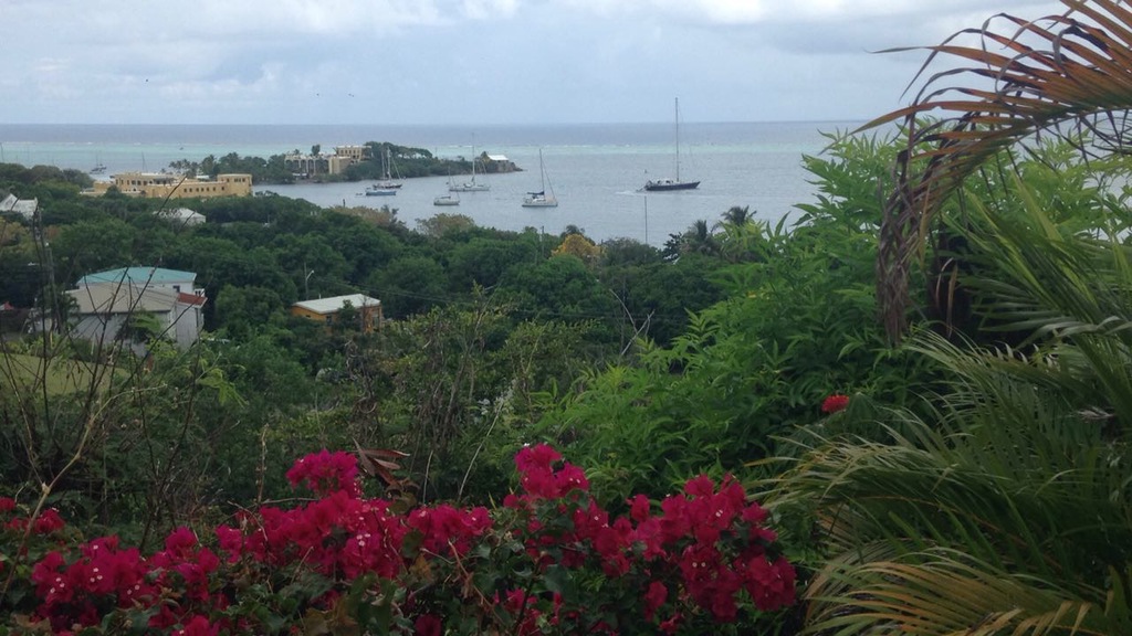
Aug. 3 - Hello, dear friends and neighbors, in the Leeward Islands! That's us!
The 11:00 a.m. update was NOT GOOD for us. IRMA is now moving WSW and on Monday
it takes a turn to the West, NOT WNW as we hoped. It is going to be right in
our midst by Wed. Whether to our south, or on top of us, or closer to the
northern islands we shall find out. For those of us most threatened, I suggest
you use the CPA - Closest Point of Approach on StormCarib to track this
dangerous hurricane. The coordinates for St. Croix are 17.7N. 64.8W. While we
are in this mode it was be nice to send a donation for this most noteworthy
service. I will send another post later. Stay safe! May God bless and protect
us (we have to do our part, of course.)

Isabel
     Sunday Morning photo

Sent from my iPhone
|
| - Can We Trust IRMA TO TURN? |
|
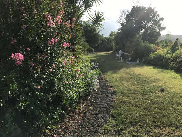
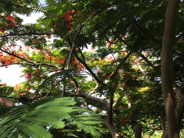
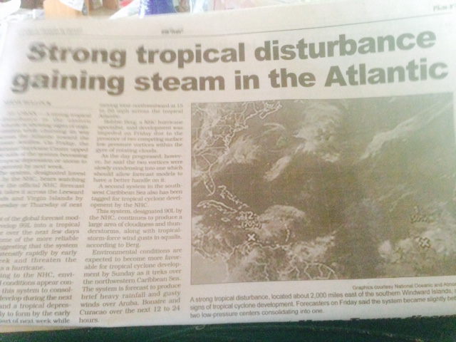
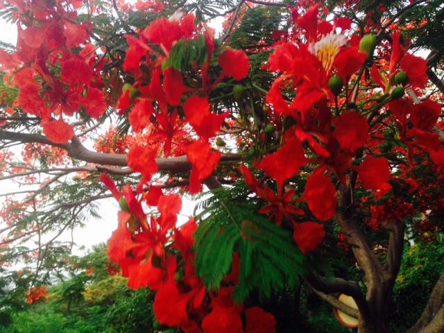
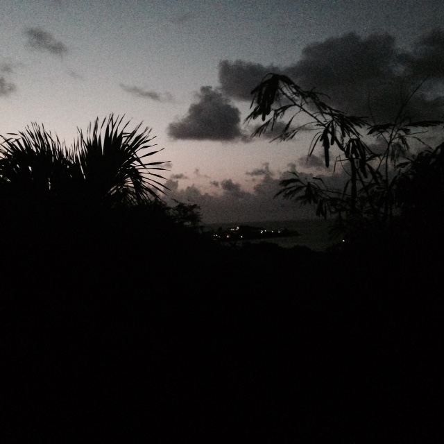
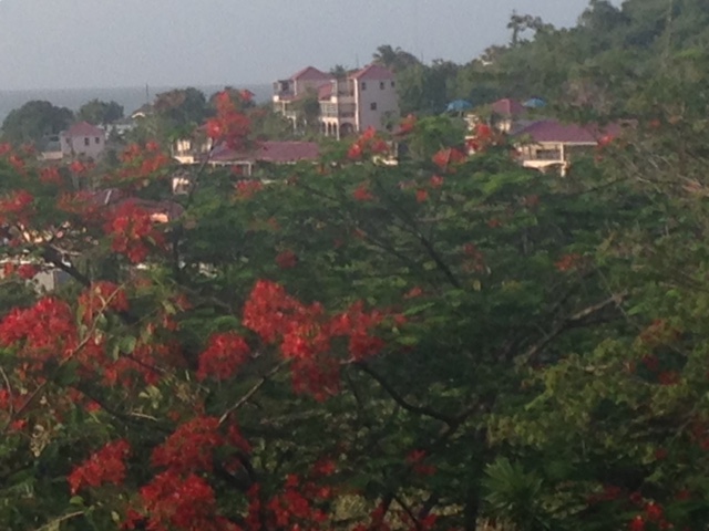
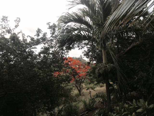
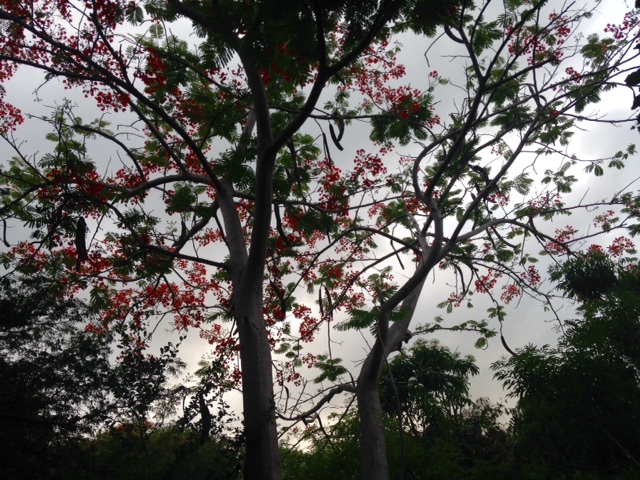
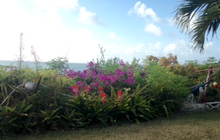
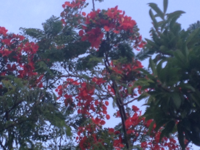
Sept 2 - After Hurricane OMAR we were left with weeks of garden debris to clear
and pile into a bin for removal. I look around at our garden now, so many
flowers,  flamboyant trees still in bloom, fruit trees almost at their peak,
and I can only sigh. C'est la vie! Then I see the images of Texas and
Louisiana, and realize that garden debris is much more preferable. My heart
breaks at the sight and the thought of so much suffering. Yet we come out
stronger. Then I look at the images of IRMA and I have the same concern as
Dave. When it drops to 16.8N 53.0W in 48 hrs, will it make the expected WNW
turn?? Let's watch and pray! May God bless us all.

Isabel
Sent from my iPhone |
| - Super Major Hurricane IRMA |
|
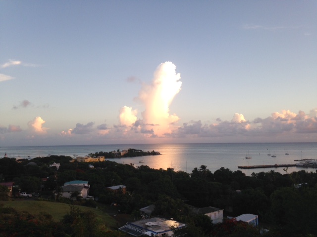
Day 92 - It has been very hot, getting hotter it feels; with tomorrow's showers
it should cool down. IRMA is barreling towards us. Like a bowling ball; gone
does not know for sure which pin will be struck. We will have a clearer picture
by Monday. When IRMA dips to the WSW it will be nearer to us; The CPA (closest
point of approac  h)
when the eye of the storm makes the turn to the WNW it will be more than 200
miles away, we hope and pray. May God bless and protect us all.

Isabel
Sent from my iPhone |
| - Watching Cat 3 iRMA |
|
Aug 31 - After three years of slumber, we now have dangerous IRMA at our
doorstep. She will be a Cat 4 (or higher?) at the approach to the island chain
on Tuesday afternoon. How close will it get to St.Croix? I shall find out later
when I get to the computer. I hope not too close. There are memories of HUGO:
maybe this is his twin sister. Preparations are being made to gather those who
need shelter; people are out shopping for hurricane essentials, and then there
are those who have no clue, "Hurricane....??" May God bless all of you and us
as we celebrate our 54th wedding anniversary tomorrow!

Isabel
Sent from my iPhone |
| - TS I R M A on the Way! |
|
Aug. 30- We are keeping a close eye on Tropical Storm IRMA, especially after
she wobbled a bit to the south. If this is going to be the same track as HUGO
in '89, it will go through Guadeloupe then veer NW to St.Croix. We shall be
completing whatever still needs to be done; those are usually the last things
before a hurricane arrives. This will be a major hurricane. I pray for the
safety of everyone along it's path, and for all those along the Gulf Coast. May
God bless and protect us all.

Isabel
Sent from my iPhone |
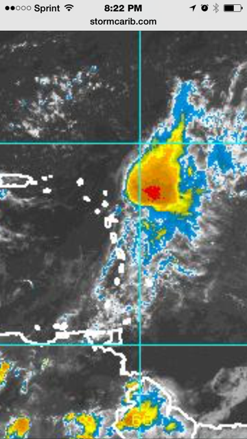
| - Potential Danger! |
|
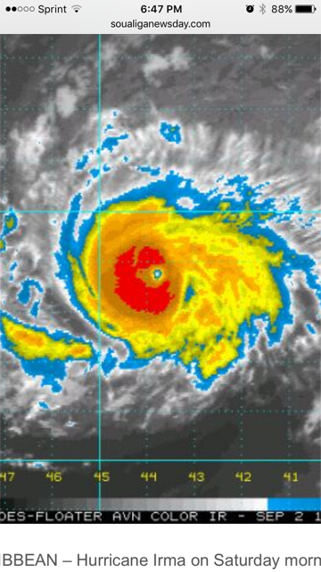
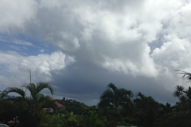
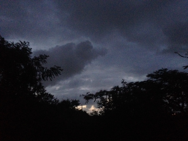
Day 89 - Way out to the East there is Trouble brewing. Attached is a Satellite
image . It's BIG!  We have to monitor this closely and be sure to have
everything in hurricane mode.
May God bless us all.

Isabel
Sent from my iPhone |
| - Such Tranquility....will it last? |
|
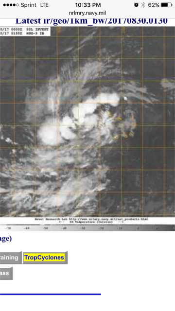
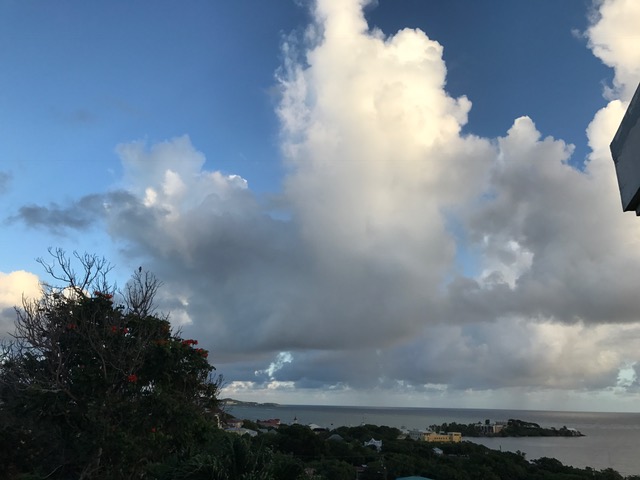
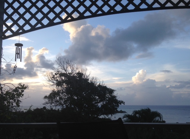
Aug. 28 - I wish I can share this this beautiful weather with the folks in the
devastated areas. We sympathize with then. Certainly, their HARVEY, like our
HUGO, will be forever remembered for their monstrous legacies. Are there others
down the road, or around the corner? Unfortunately, we have 93L to our east. A
monster!
Already at such a distance it is close to becoming a Depression in 5 days,
moving W, in our general direction. We have to prepare well and be ready for
whatever comes. We cannot do anything to stop it but hope and pray that it
evaporates. May God bless us all.

Isabel
Sent from my iPhone |
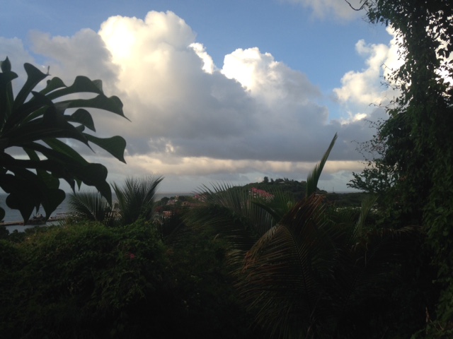
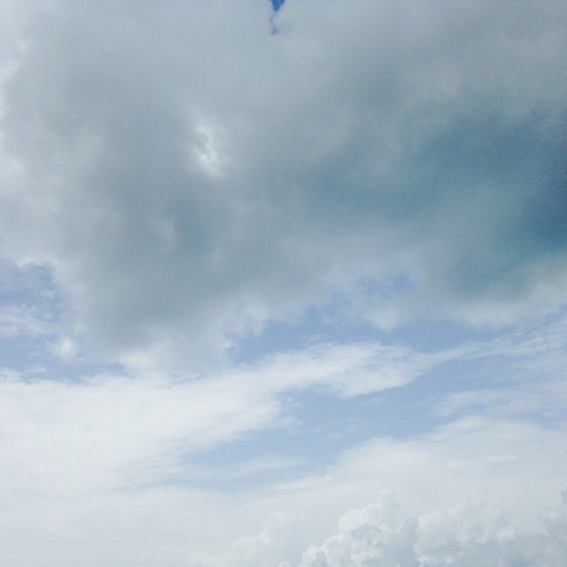
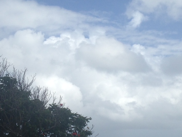
| - Harmless Clouds |
|
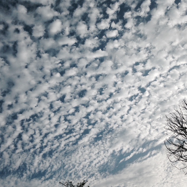
Aug 27- These clouds (photos) are interesting to watch, but storm clouds are
dangerous. They can dump feet of rain as with HARVEY. The Carolina coast could
be experiencing the next name storm, which already has a 90% chance of forming.
Closer to us there's a tropical wave arriving  Monday night into Tuesday
according to NOAA weather Radio. The one to watch will be approaching the
Leeward Islands as a "potential tropical storm or hurricane" by Sept. 5th,
according to the correspondent. from Sint Marten. Hurricane LUIS devastated
that island several years ago. We must pray and keep watch and be ready! May
God bless us all,

Isabel
Sent from my iPhone |
| - Cat 4 H A R V E Y ! |
|
Aug. 25 - As we enjoyed a tranquil evening, our thoughts and prayers went out
to all the folks along the Gulf Coast affected by what is now s monstrous cat 4
hurricane. So sorry for them. Those who refuse to leave never make it. I hope
they changed their minds, we are not sure if our friends evacuated Corpus
Christi. RAIN is expected in feet!  I am tracking all the tropical waves coming
off the coast of Africa, if it wasn't for the SAL we would've hand some
hurricanes. May God bless us all.

Isabel
Attachment:
IMG_20170825_190051.jpg |
| - Watching East TW |
|
Aug. 23 - The TW in the Atlantic, which bears watching, will be looking
interesting in the next few
days according to Dave. We are having great weather. Have a good night. May God
bless us all.

Isabel
Sent from my iPhone |
| - The Quiet Before the Next Storm |
|
Aug. 23 -We have approximately 11 name storms to go according to the latest
predictions. Perhaps the SAL will not allow any major storms to develop in our
area. 92 L could become a cyclone
as it approaches the coast of Southeast Florida. That would be Irma. HARVEY was
done and now it's on the verge of reappearing  as it heads to the Gulf Coast of
Texas and Louisiana, packing rain with a capital R! We keep getting brief
showers. There's a TW between Africa and here. I'm tracking it. Have a good
night and may God bless us all..

Isabel
Sent from my iPhone |
| - Solar Eclipse 2017 |
|
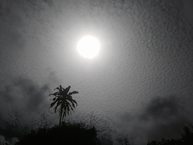
Aug. 21 - Many places experienced a total blackout, but for us it was only a
partial eclipse.  so unless one had those special glasses it could not be
appreciated. I had a meeting to attend; as I went out it was a fuzzy SAL-type
sky. The photo was taken a few hours later when the sun was about to set for
the day. Hope it was a good one for you. May God bless us all.

Isabel
Sent from my iPhone |
| - Looking Ahead to East Africa |
|
Day 81 - Tropical Waves are coming through quite regularly; the dark clouds
roll in, and before long, whiteout ! Lightnings and thunder!  Heavy, short,
drenching showers, then sunshine! And so it goes, but what is that off the
coast of Africa? A 1008 mb
Wave. The lowest pressure so far out there. Hopefully it will be choked with
the Saharan Air Layer (SAL) or we can have a troublemaker coming across the
Atlantic. May God bless us all.

Isabel
Sent from my iPhone |
| - Weather Drama on Both Sides |
|
Aug. 19 - today we had.a system below us and one above us. there is  no other
wave of concern to the NHC at the moment. Meteorologists are in awe of the
total solar eclipse which will occur on Monday afternoon during the eclipse.
Everyone be safe. Have a good night. May God bless us all.

Isabel
Sent from my iPhone |
| - Very Breezy! |
|
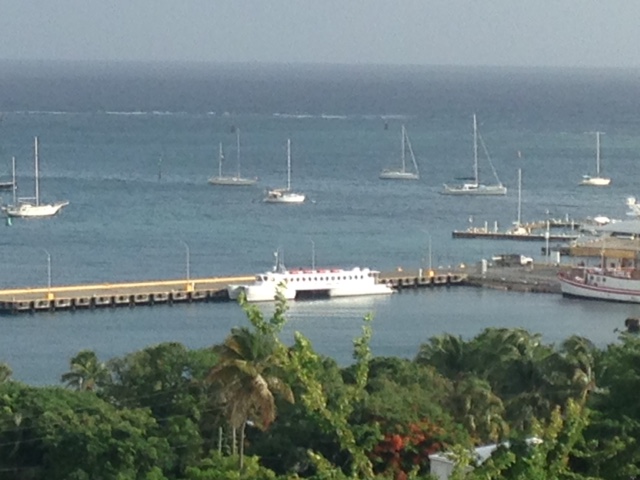
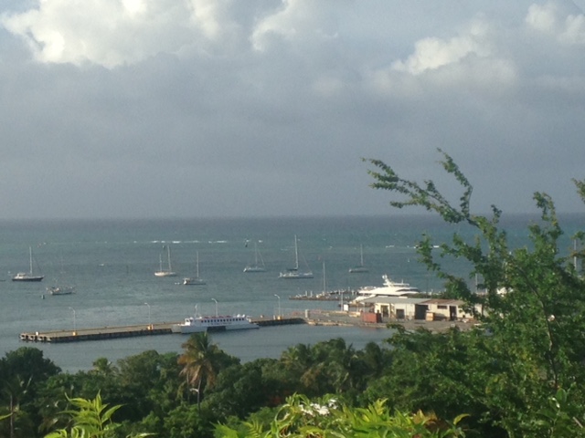
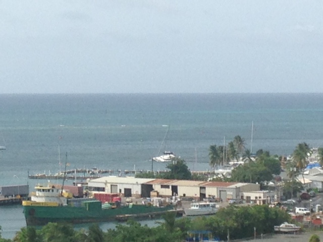
Day 79 - It seems we're getting something from both systems. A strong breeze. I
keep hearing "rain" in the forecast, but I'm not sure it's meant for us. The
Ferry has not been able to cross ove to St. Thomas because of the high waves to
9 ft at times and a small craft advisory  in effect.The photos from the
correspondent in St. Vincent are very dramatic ,my thoughts and prayers go out
to them and to the other Windward Islands, which must have suffered a similar
blow. This season is truly a very active one. I hope and pray there are no
fatalities. Let's prepare well. May God bless us all!

Isabel
The ferry
Sent from my iPhone |
| - T. S. HARVEY |
|
Aug. 17 - Parts of St. Croix, some 14,000 people were left without electricity
yesterday for almost six hours from early evening to midnight. It apparently
had nothing to do with the storm itself. That had barely started when the
lights went out. We implemented someone's truly bright idea and brought in some
of our solar path lights to provide light indoors. It worked! The tropical wave
played itself out with the usual fanfare ending by morning after which we had a
sunny day. In the meanwhile, T S HARVEY ( 91L ) formed east of Barbados and is
looking to become a hurricane before arriving at the Windward islands . We are
now in suspense about 92L. And what about the next one which, has had it's eye
on us from the time it splashed down into the Atlantic. We shall soon see. May
God bless us all.

Isabel
Sent from my iPhone |
| - Tropical Wave Causing "Significant Electrical Interruptions" |
|
Aug. 16 - We received an alert from WAPA more than an hour after the outage.
According to NOAA Weather Radio, torrential rain and frequent lightning are
expected overnight until the morning. At the moment it is quiet, except for the
chorus of happy little night creatures all around us. We are still watching
91L, which should arrive in the vicinity Friday into Saturday. 92 L seems to be
developing an outflow like a spinning wheel. It could very well be the next
name storm. We pray and hope that they will be gentle. May God bless us all.

Isabel
Sent from my iPhone |
| - Will 91L be Our Name Storm? |
|
Aug. 14/15 - it is definitely heading towards us in the Lesser Antilles. Not
only can it become a hurricane by Monday, but it will coincide with the total
solar eclipse and it would have the Hname! That's three strikes right there. We
don't have much time to complete any preparations for this triple whammy. It's
time to get moving! May God bless us all.

Isabel
Sunrise
TW passing Sent from my iPhone |
| - 99 L was named GERT today..... |
|
Aug. 13 - AND 91L is on the move in the far Eastern Atlantic. It can pose a
serious threat to us by the weekend of 18/19! Not only that, but behind it is a
Tropical Wave that can
become another named storm by the Tues.22nd.!  That being the case, it seems as
if the H season is finally living up to its predictions. We have another 13
storms waiting to make an appearance somewhere in the Atlantic Basin.. Are we
ready? May God bless us all.

Isabel
Sent from my iPhone |
| - So far, so quiet! |
|
Day 73 - With the exception of last Monday's double whammy, it has been very
quiet and hot. There is talk now of a disruption on Friday next week by a TW
that splashed off the African coast. We shall see how that goes, or comes. May
God bless us all.

Isabel
,
Sent from my iPhone |
| - A Hot Hurricane Season Day |
|
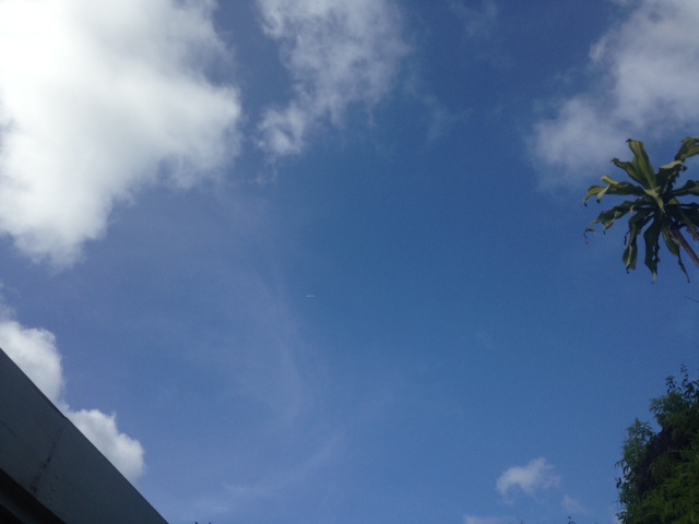
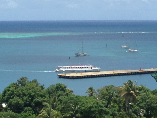
Aug 11 - A typical Summer day in paradise. I like Gert's response to NOAA's
upgrade for the hurricane season. Read both. It's s matter of time and we shall
see if the predictions turn out true or not. If we go to the full 19 storms
then we still have 14 to go. Keep track and see the total on Nov 30. Right now
we need to watch and keep track of a 1011 low pressure system fresh off the
coast of Africa. It could mean trouble for us by next Friday. May God bless us
all.

Isabel

Find the airliner:
Sent from my iPhone |
| - An Intense Hurricane Season! |
|
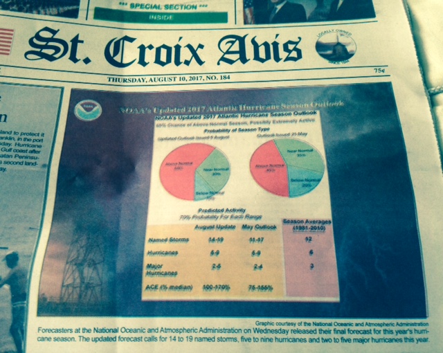
Aug. 10 - I must say I was very surprised that NOAA increased the number of
storms. It's up to 14-19 named storms, 5 - 9 hurricanes, 2 - 5 major
hurricanes! And just when I thought it's looking rather quiet in the Atlantic.
I remember one year we had 19 storms. Nerve-wrecking! That must have been in
2010 mentioned in the AVIS article. So, this is going to be the most active
season since then.
The Saharan dust has been keeping the waves from developing, thank God! Let's
pray that the numbers go down. 99L
Is forecast to bring us some rain Friday into Saturday. Have a good night and
may God bless us all.

Isabel
-
Sent from my iPhone |
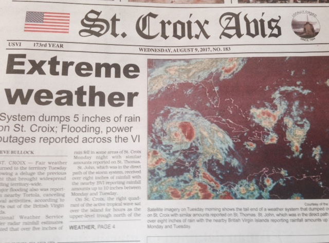
| - "EXTREME WEATHER" |
|
Aug 10.- Today's headline in our local newspaper AVIS was right on target. The
mini tropical storm with wind gusts of 40 mph was a total surprise in its
intensity. I'm afraid to think  of anything bigger passing
through. According to the same article, the NWS said that we should be feeling
the effects of 99L with a taste of the same, this Friday evening into Saturday
as it passes to the north. Today the sky to the north looked as if we were in
for some of the same. We did get a good rain shower later on. Our puppy not
only sleeps through thunderstorms,  he enjoys playing ball on a soggy lawn, and
roll around in it. Let's hang it there we have a lot of H season to go. May God
bless us all.

Isabel
Sent from my iPhone |
| - Unexpected |
|
Aug 8 - What a wallop we received last night! The combination of the two
systems produced thunderstorms with strobe lightning, heavy rain, very strong
wind gusts, and even hail in parts. We certainly were not prepared for that! It
was unexpected! Our puppy was not scared, unlike other reports I heard. He
slept through it. Today was a glorious day. The rain ended in the morning. The
last Flood Advisory ended at 9:15 a.m. There is a casualty in the harbor.  A
catamaran took on a lot of water and was slowly sinking. 99L may not affect us
too much. We shall see in the next few days ahead. May God bless us all.

Isabel
Sent from my iPhone |
| - Stormy Night |
|
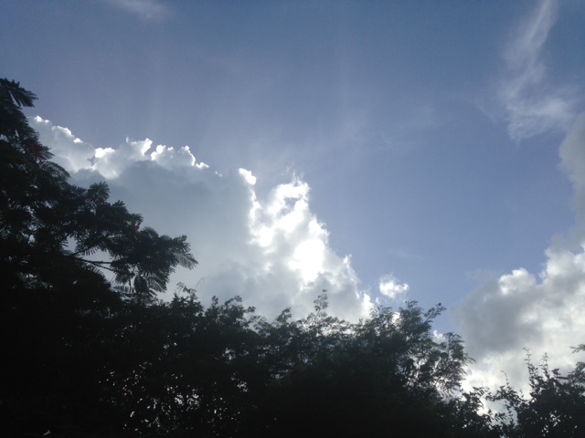
Aug. 7-This morning I took a photo of puffy little clouds on a blue background
and I got an eerie scene with the morning sun and stormy looking conditions.
The
2nd photo towards St. Thomas/St. John shows the kind of weather they were
having while we continued with sunny skies
until late afternoon when the sky to east was looking rather ugly. To the north
lightning flashes were becoming more frequent and easy to capture in the 3rd
photo.
Our part of the storm started in ernest around 8 p.m. with heavy rain and winds
gusting to 40 mph and felt like It. Cold air with hail being tracked in the
tropical wave/  tropospheric trough. For the last three hours and counting it's
been raining, thundering and lightening. A flooding alert was issued earlier. A
second tropical wave designated 99L will be arriving on Thursday late
afternoon. That one should be stronger than this one. May God bless us all.

Isabel
Sent from my iPhone |
| - 99 L - A Seesaw ? |
|
Aug. 6 - This system should be monitored. It goes from 1012 to 1010 and back...
So what is that little monster in the photo? It must be the TUTT mentioned by
Dave. Or? A tropospheric trough can bring lots of rain combined with 99L to
make for a rainy week. In the meanwhile we had a very nice, beautiful, tranquil
day. Hope you did too. May God bless us all.

Isabel
Sent from my iPhone |
| - A "More Active Season.." |
|
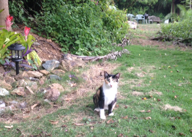
Day 67 - The final word for this hurricane season is that it is above average
with one more storm added. Now it's 16 ! One of them is in the southern
Caribbean, the other could very well come straight at us. The Atlantic is full
of spaghetti; model guidance galore. One way or the other we are going to be
impacted. The second page in today's AVIS newspaper should make everyone take
this seriously and prepare well.
Among other things, I'm preparing a shelter in the tool shed for our garden
pets like "Mimi" in photo.
May God bless us all.

Isabel
Sent from my iPhone |
| - Invest 99 L - A Major H ? |
|
August 4 - Will 99L be a major headache for us? Let's prepare for the worse,
while hoping and praying for the best outcome. In the meanwhile, let's make
sure we have everything we need, just in case. 99L is showing all the signs
becoming a very strong storm. This should be approaching by the middle of next
week in whatever form. We certainly will keep both eyes on it. Our weather
continues mostly gray, however, the sun was able to break through and shine
brightly for a spell. Let's do our " H " homework and help those who need it.
May God bless us all.

Isabel
Sent from my iPhone |
| - Very Beeezy, Rough Seas |
|
Day 64 - As the TW leaves our area we're getting patches of moisture now and
then, and very breezy conditions. The sea was continues  rough. The ferry
remained docked for the third day. I heard on the weather radio that the waves
were up to 9 ft. There is a 1010 low just off the coast of Africa that will
probably be monitored by the NHC very soon. Have a good night and may God bless
us all.

Isabel
Sent from my iPhone |
| - TW in the Area |
|
Day 63 - We finally got a good soaking from this TW late this afternoon. We
should get more before it's completely out of the area. I took a noon photo and
an evening one from the gazebo where I had to run for cover. I have not seen
anything threatening on our side of the Atlantic. Are we keeping track of the
number of storms? We have 10 to go. And then, maybe not. May God bless us all.

Isabel
Sent from my iPhone |
| - WINDY |
|
August 1 - The sea was so rough today that the ferry did not leave. On
Wednesday it should be even rougher with the arrival of a tropical wave. The
SAL has been a great help in keeping the storms from forming, but as Dave said
the other day, it will lift to the north leaving the passage free. If we aren't
ready as yet, are we ever going to be? May God bless us all.

Isabel
Sent from my iPhone |
| - EMILY |
|
JULY 31- Our weather continues fairly dry with the occasional passing shower. I
just had to take a photo of the blue sky. Florida, on the other hand got
torrential rain from T.S. EMILY, which crossed the State. The NHC is watching a
system in the middle of the Atlantic. Would be good to get some rain. From
August onward we could get more than we like. Let's not be caught unprepared.
May God bless us all.

Isabel
.
Sent from my i Phone |
| - Invest 98 L in the GOM |
|
Day 60 - Good Sunday Night, all! Looks like the Gulf is the next trouble spot.
It's been soggy in the South for some time.
 This is just not the kind of
Weather they need. As for us, the photos can speak for the weather. We had one
brief shower today and some drizzle. Currently there are 4 tropical waves in
the Atlantic. Suspense !  May God bless us all

Isabel
O
Sent from my iPhone |
| - "A dearth of activity..." |
|
JULY 29 - You may have read Dave's update this afternoon. I'm trying to figure
out what he meant by "a dearth of activity.."
In the meanwhile, there is a lot of activity in the East Atlantic, everything
heading this way. The days are hot, hot, hot and the sea is getting warmer. The
MJO is kicking in. What does August hold for us? We'll soon find out. Hope it's
not going to be too rough for any of the islands and beyond. May God bless us
all.

Isabel

"dearth" is pronounced "dirth". Funny!
Sent from my iPhone |
| - A Close Call |
|
July 28 - For a brief moment today we had 97L which had the potential to become
a tropical storm coming through or very near to us by next Friday.
Soon after, the next report said that it was no longer an Invest. However,
looking at the satellite imagery, it seems to have been called off too soon.
The one behind it is huge. I won't be surprised if that one will soon be
investigated. We are entering a very dangerous time in the Atlantic with the
MJO becoming active. It can increase a small storm into a monster. Be prepared,
be safe. May God bless us all.

Isabel
Sent from my iPhone |
| - Watching the African Coast |
|
JULY 27 - Based on the last two reports I read these past days it seems that
everything that comes off the coast of Africa will be a potential storm/
hurricane. There's a wave halfway across with a 30%
chance of developing. If it does, it would be the first of several storms
predicted for August. We must monitor this system for sure and be ready. Have a
good night. May God bless us all.

Isabel
Sent from my iPhone |
| - Busy August Ahead |
|
Day 56 - today there was no tropical wave, that must have been the weather the
day before. Thursday is now in the forecast for rain. // August is right around
the corner. Here is a quote from the SOUALIGA NEWSDAY courtesy of the St
Maarten
update. " A very strong upward motion of the Madden Julian Oscillation    (the
strongest pulse so far this Summer) is forecast to
push into the Atlantic during the first 10 days of August. I strongly believe
that the lid will come off in terms of tropical development across the Atlantic
Basin beginning the week of August 7th." Please read the entire report for
further information. May God bless us all.

Isabel
Morning Glory
Sent from my iPhone |
| - Will The MJO Affect Us This Year |
|
Day 55 spilled over to July 26. G'night folks, it's been a long day. Please
read Dave's letter of the 25th and Brian Donegan's report on the Madden-Julian
Oscillation (MJO) in Weather Underground News. Very  important to know in case
it'll be a part of our hurricane season.
The two photos attached show our thunder fearless 6-mon old puppy's pride at
being able to carry two toys at a time. The other shows the face of Tuesday. A
tropical wave is forecast to pass through on Wednesday. May God bless us all.
Isabel
Sent from my iPhone |
| - So Far, So Good... |
|
Day 54 - It's also too early in the season for our neck of the woods. I suspect
that August will bring its own surprises. In the meanwhile, it can be hot and
humid, otherwise, we do get some refreshing breezes. Passing showers keep the
green greener, the ground cover in photo covers areas to reduce mowing,
trimming, on slopes it prevents erosion. Very good to have. We have given away
large quantities of it. We're moving along gently from one little tropical wave
to another. NOAA Radio announced one for Wednesday. May God bless us all.

Isabel
Sent from my iPhone |
| - Rain Showers Mix |
|
Day 53 - A very humid Sunday was "enjoyed"! We can't complain. It could be
worse. The fact of the matter is that we really have to prepare for the worse
this hurricane season, while praying and hoping for the best. We definitely
have to make a list of hurricane supplies and check it twice, if not more. One
thing we should do, if there's any fun in that, is to keep track of the 15 "up
coming" named storms in the Atlantic, " 8" hurricanes, "3" major hurricanes
among the eight, and see at the end how accurate or far off the folks in
Colorado were in their upgrade of this season. May God bless all the sick and
us all.

Isabel
Sent from my iPhone |
| - 15 Named Storms for 2017! |
|
July 22 - yes, dear reader, here and beyond, the upgrade includes 8 hurricanes
in the Atlantic with 3 of those being a Cat 3 or more. What does that tell us?
We'd better get ready.! I must say our weather has been very kind to visitors,
so far. Cannot guarantee it as we enter August, especially with such an upgrade
in storms. Are we really going to reach all the way to Ophelia?? Stay tuned. Be
informed. Be prepared.
May God bless us all.

Isabel
Sent from my iPhone |
| - RAINY Night |
|
Day- 51.  Well, it did RAIN big during the night and I missed it. I was sound
asleep and only heard about it, plus the telltale minor flooding through the
south side door.  Dark clouds hung heavy in the pre-dawn hours, rained some,
and then the sun took over. One wave passed, another is expected on Saturday
according to the weather radio. I'm in suspense as to the train of waves
heading across the Atlantic. Let's keep an eye to the East. May God bless us
all.

Isabel
Sent from my iPhone |
| - B R E E Z Y |
|
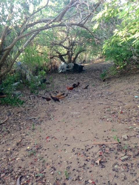
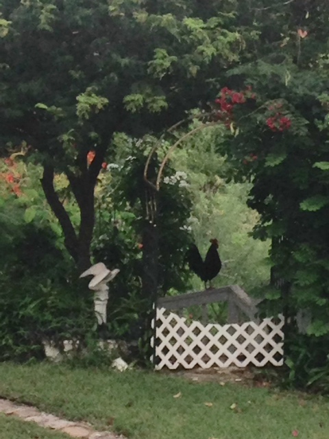
July 20 - It was a perfect day, well, at least part of it,
for training the chicken to clear a path. By spreading  chicken feed, instead
of me raking, the chicken scratch away to find the feed clearing the path of
small stones and leaves at the same time.(see photo)
St. Croix is being watered every now and then, one spot at a time. We would
like to see a soaking rain where we live. I look towards the East to the many
waves leaving Africa and hope that they only bring rain, no storms. We are
happy for the visitors
who have been enjoying really nice weather. The picture can change next week.
Last, but not least. Congratulations to my son who traveled cross country and
back to NY- 7000+ miles in 19 days with many great stops along the way. May God
bless him and us all.

Isabel
Sent from my iPhone |
| - 96 L - No Threat to Anyone |
|
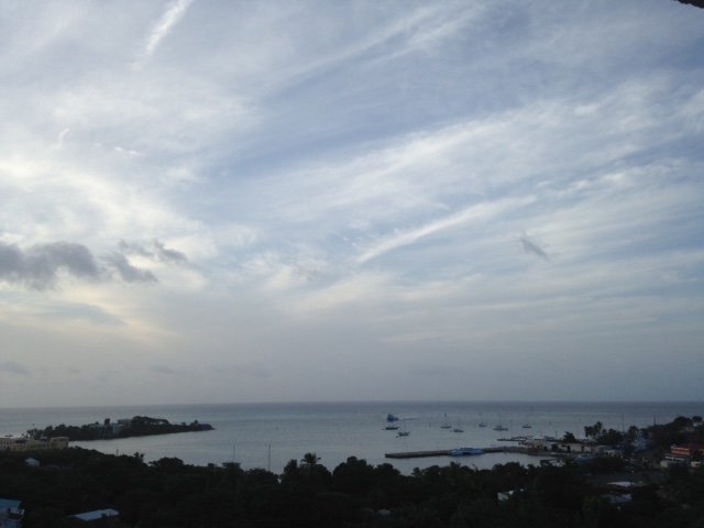
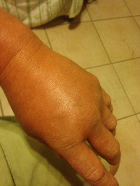
Day 49 -  TS DON had a short- lived tour of the Windward islands, and 96 L is
no longer an invest as it's expected to be stifled by the SAL. Thank God for
the Dust that protects us. Even those who suffer as a result of the dust are
grateful. Dave said we would've had 4 named storms and one hurricane "if we did
not have the dust in place." He also noticed two contenders that splashed into
the Atlantic. And the dust will be lifting soon. Folks! I think we're in for a
rough ride. And be careful with wasps! I got stung on Tuesday evening. What
PAIN! This was a yellow/blk one which I believe is the one that Kelly in Tobago
wrote about. If you are semi allergic the area swells, like in the photo, feels
hot and itchy after the initial bad pain passes. Now if you are allergic it
becomes a hospital emergency. You definitely need medical assistance. Those of
you who read my Hurricane LENNY story perhaps remember that I got stung on the
eve before and had to battle the storm with one arm. The other arm was swollen
to the elbow. Let's prepare well and may God bless us all.

Isabel
Dust and clouds
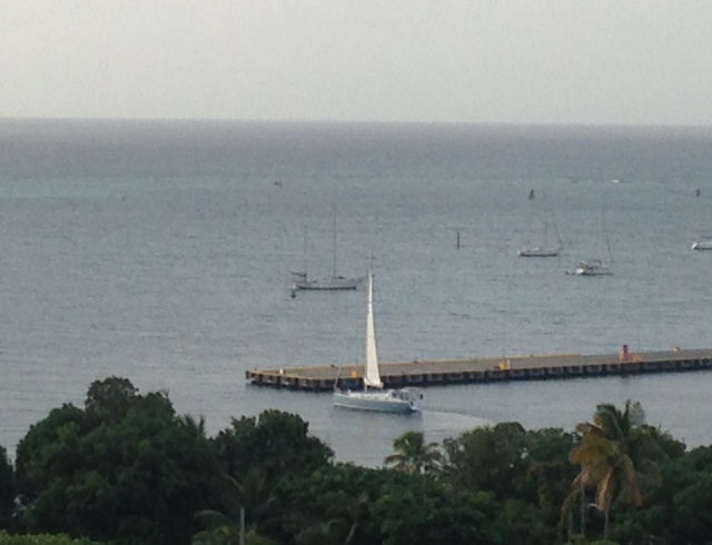
Another view of the ferry
Left hand stung by a wasp. Sent from my iPhone |
| - A Bit of Weather |
|
July 18/19  Been thinking a lot about our brothers and sisters in the
Windwards. Must have been rough in some places. Been also troubled by the flash
flooding in Arizona that took away members of an extended family. Think about
it. You plan the event, family members come from far and near, and the
celebration ends in tragedy. Sad! The weather is a terrible thing with which to
contend. We have to be a step ahead in taking precautions. Never try to
outsmart the weather. May God protect and bless us all.

Isabel
Sent from my iPhone |
| - T.S. DON !! |
|
Day 47 - The birth of TS  Don.! Be ready, be careful those of you living in the
area of impact. Do the right thing. Stay indoors!
Dave said the tropics are heating up and as we approach the busiest time in the
season we must be hurricane ready whether one impacts us or not. May God bless
us all, especially you in the southern Lesser Antilles.

Isabel
Sent from my iPhone |
| - Monsoon Trof on the Way? |
|
JULY 16 - A good Sunday night to all. We're halfway through the month without
any disturbance since Tropical Depression 4. That one did not bother us in the
least. I'm keeping an eye on the Monsoon Trough (Trof) in the Atlantic. Hope
that does not become a menace. Our weather has been rather tranquil, with
'spotty" showers now and then. Let's not become complacent though. The reality
of the season does not sink in until Aug/Sept.
May tranquility prevail. God bless us all.

Isabel
Sent from my iPhone |
| - A Great 45th |
|
July 15 - This morning Mr. Rooster came around to respond to his friend's
crowing down the hill at the usual time. Annoying for those who want to sleep
longer. The morning hours were cloudy and threatening but nothing much came of
it. Gradually the afternoon looked better and I thought of the family who
almost canceled. For the next days there's only a 20% chance of rain, and then
there is the BLOB! What is to become of that down the road! It seems massive!
Hopefully it gets sheared apart. May God bless us all.

Isabel
Sent from my iPhone |
| - A Fine Day |
|
Day- 44 - The wave passing to our south dropped a quick shower, this evening,
almost at the announced time. That was that. However, Ian's blob in the
Atlantic is quite a worrisome sight. I hope it's not going to mess with a
visiting family's first visit to St. Croix. They almost canceled when they
heard there would be non-stop rain from tomorrow when they arrive for a whole
week. That system looks as if it could, but where is it going? We shall soon
find out. Have a good night and may God bless us all.

Isabel
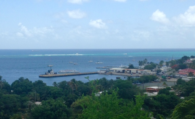
The St. Croix Ferry returning from St. Thomas
Sent from my iPhone |
| - Mixed Bag Wearher |
|
Day 43 - It was as mixed as the bright salad and the cloudy/rainy skies.
Towards the end of the day the salad won. The high and low chances of rain
continue for the next several days. It is unlikely that we will have several
days in a row without rain. There are many waves out there. What I find curious
is that deer are roaming dangerously close to populated areas with so much
water in the hills where they live. Have a good night and may God bless us all.

Isabel
Sent from my iPhone |
| - "Above Average Hurricane Season" |
|
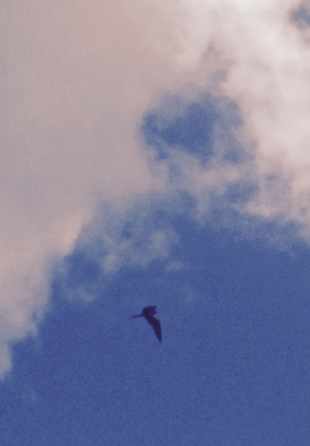
Day 42- Are we ready for a possible landfalling hurricane somewhere within the
next four and a half months? Judging from past seasons, we usually wait until a
storm forms to race around getting things done. In the meanwhile, I am enjoying
the cloud formations. Today we had a giant white, puffy bear looking down from
the sky. The Frigate or weather bird flying around in a circle heralded RAIN!
It did, on the road to Frederiksted as I experienced later with a lot of
ponding from a recent rain. Chances are we can have a lot of activity in the
near future. Be ready and pray! May God bless us all!

Isabel
Sent from my iPhone |
| - Revival of TD 4 |
|
Day 41 - The clouds, the periodic showers, the intense humidity today were part
of TD 4. It's back on the map! It has been just above us to the north. Now it
has a chance to develop further as it moves away from us. Other waves are
crossing the Atlantic eventually arriving to our south, to our north, perhaps
right over us in some cases. We just hope and pray that nothing catastrophic
develops during this season. May God bless us all.

Isabel
Sent from my iPhone |
| - Temp. Real Feel 106 degrees |
|
Day 39  - It was HOT today! We have to stop saying "warm". It was downright
HOT! Scary when we know that the Cyclones depend on a very warm ocean for fuel!
Even the little clusters of clouds today looked sinister. See photo. The system
that was under scrutiny by the NHC seems to have disintegrated for now. Great!
Now another big blob was moving off the coast, so that could also mean trouble.
The next days will tell. Be prepared for anything, anytime. May God bless us
all.

Isabel
Sent from my iPhone |
| - A Glorious Sunday |
|
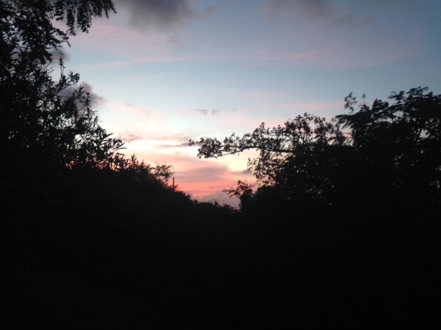
Day 39 - Sunny and quite warm with a soothing Caribbean breeze. Many visitors
in town. Weather has been terrific. We were not affected by the remnants of TD
4. "No cyclone formation for the next 5 days", according to NOAA Radio. The
TW/Monsoon Trof off the coast of Africa is too far away at the moment for
concern; the coming days will tell if it means business. We should watch and
pray with each hurricane season day. May God bless us all.

Isabel
Morning
             Evening


Sent from my iPhone
|
| - Remnants? |
|
Day 38 - the remnants of  TD 4 have consolidated into a "fireball" by the looks
of the Satellite Imagery. According to the forecast we could have windy
conditions and even squally weather as it passes on Sunday evening. We are also
keeping an eye on the next possible candidate of the season, however, nothing
to worry about at this moment, and it can very well disintegrate like the
previous one. We just have to be prepared and hope for the best. May God bless
us all.

Isabel
SPEEDY AND BENJI
Sent from my iPhone |
| - Remnants of TD 4 |
|
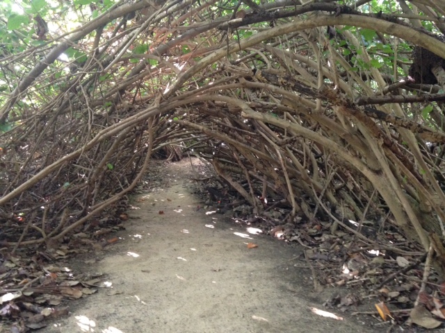
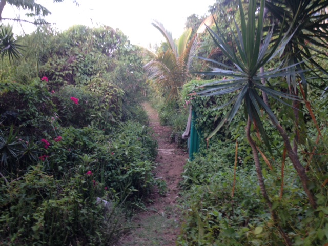
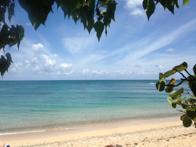
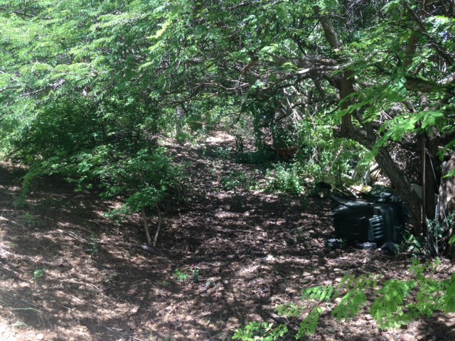
Day 37 - Suddenly Friday turned into Saturday and here I am. Some days are
long. Days seem to be getting hotter. We made it to the beach to cool off
late in the day. A tropical wave was forecast to arrive on Friday evening, but
just a few menacing clouds, some drizzle was the result. Perhaps it rained
somewhere else. We saw a stunning rainbow while in the water, but could not
take a picture. Missed photo opp! There is, however, a cave-like walkway formed
by the branches of the trees on both sides to get to
 the beach, and the clouds of the TW. It passed without much ado and the days
festivities topped by the famous JUMP UP was spared the rain and was enjoyed by
many visitors and locals. Have a restful night. May God bless us all.

Isabel
Sent from my iPhone |
| - T D ? Or T S ? |
|
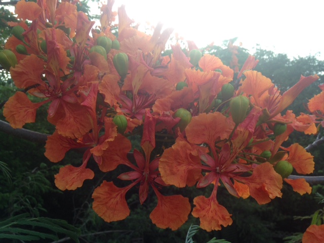
Day 36 - In whatever shape or form, the closest it will come to us would be on
Sunday at 1 p.m. some 213 miles to our north. I think our Flamboyant flowers
will survive. So, the Mango Melee (annual festival) should not have any rain
issues. Interesting that both FOX and NBC will be covering it. Have a good
night. May God bless us all.

Isabel
Sent from my iPhone |
| - Nature Waits and Wonders |
|
Day 35 - Sometimes what suffer most during a storm, are the trees, big and
small. I look around at all our aged trees, flowering trees, fruit trees and
wonder if they can survive a hurricane. The answer from past experience is
garden debris collection for three weeks after. Looks like invest 94L could
become at most a Depression passing to our north, but then, that can change.
NOAA Radio forecasts a wave coming through on Friday. If so, that will surely
dampen the festivities at the Jump Up.
 Let's continue to monitor this system and may God bless us all.

Isabel
Sent from my iPhone |
| - A Rainy/Sunny Fourth |
|
Day 34 - Awesome clouds in the morning and nature's own fireworks and rain as
we sat outside under the covered veranda in the early evening for a grilled
dinner. Our 17 yr old grandson was the chef.  Delicious! The Tropical Wave soon
went on it's way and it has been quiet ever since. We are in suspense as to
what's going to happen this weekend. The European model guidance takes the
Atlantic storm over us, while the GFS takes it to the north. My fear it that
European one has always been the more accurate of the two in the past. Hope
those of you celebrating the 4th had a very happy one. May God bless us and the
good ole U. S of A !!!

Isabel
Sent from my iPhone |
| - A Medium Chance.. |
|
June 2 - after midnight

The system to the East already has an orange cone, which means it has a medium
chance ( 40 - 60%) of becoming a storm.
It has a few challenges ahead, so unless those obstacles are not over-  powered
we can be dealing with a challenge ourselves by the next weekend. Are we ready?
May God bless us all.

Isabel

"What do you think, Skypee,  asks Benji . "are we going to have a storm?"
Sent from my iPhone |
| - Keeping Track |
|
June 30-July 1   Somehow these two days fused into one! Time is always short
when life is busy. However, I am keeping track of the many TWs crossing the
Atlantic. There is a "feeling" that something could develop by mid July!
Something cyclonic? We always hope the experts are wrong, but it does look like
a busy rest of hurricane season ahead. Unfortunately, all the TWs are heading
this way, which means the Cyclones will follow that pattern. Rain is in the
forecast for Sunday/Monday with the next Wave. Have a good night and may God
bless us all.

Isabel
Sent from my iPhone |
| - R A I N ! |
|
June 29 - It started early in fits and starts with the arrival of the Tropical
Wave. Later it poured in ernest, always with quiet spells in between. Heavy
rain in the late afternoon. NOAA RADIO has more of the same in their forecast
for tomorrow. As I write, the tree frogs are having their greatest concert.
Everyone is keeping an eye on the huge wave coming off the coast of
Africa. If it does not disintegrate it should be here in a week or more
depending. By then it could be a full fledge hurricane.  We shall watch and
pray! May God bless us all.

Isabel
Sent from my iPhone |
| - Hot & Cool |
|
June 28 - the tropical wave moving through Thursday into Friday seems rather
weak, so it should not be too disruptive for the events ahead. We are hoping,
though, for cooler weather with this system. To the folks in Arizona this must
be very cool already compared to their heat wave. Several people have died as a
result. There is a possibility that we are going to experience heat waves this
hurricane season. I get the "gut" feeling that this season is going to be
"something else again". Computer models are beginning to toy with the waves
coming off the coast of Africa. By mid July it can get serious. The potential
cyclones are forecast to track in our general direction. The number of storms
was increased to 17; three have passed already. DON is waiting in the wings
somewhere. We have to do what we have to do, prepare while we can. Stay cool,
like our pooch, Benji, who finds resting in the ground cover real cool! Pray
and hope for the best. May God bless us all.
Sent from my iPhone |
| - Three TWs- What are they up to! |
|
June 27 - The first tropical wave in line looks to increase our chance of
showers and thunderstorms Thursday into Friday. Not sure where the second one
is headed, nor the third for that matter. I like this pattern of a few days
rain free, few days dry, it gives the visitors a chance to taste both sides of
the tropical weather. JULY could become very dramatic, or be surprisingly
still. Suspense! Just always be ready in case of a storm. May God bless us all.

Isabel
Sent from my iPhone |
| - Tropical Wave Coming |
|
June 26 - the tropical wave in the Atlantic is becoming rather dramatic. That
could be what is going to increase our rain towards the end of the week.
Perhaps it will not affect us  100%. This last wave passed more to our south.
We did not get as much as we could have. With a beach wedding and a funeral
coming up any rain would be inconvenient. We wish them well. May God bless us
all.

Isabel
Sent from my iPhone |
| - TW Passing Through |
|
June 25 - Good evening! Sorry about the wet weather for those folks visiting
the island. This is the time of year when we typically get Tropical Waves from
Africa. The current one is passing mostly to our south; we are getting the
fringes, yet NOAA talks about thunderstorms after midnight. ( the photos were
taken shortly before the rain arrived .) There are a couple other waves
crossing the Atlantic, but the one that is of most concern is just coming off
the coast of Africa with a Low 1003 mb. It's a bit higher than the others. I am
sure the NHC has also noticed. May God bless them and us all.

Isabel
Sent from my iPhone |
| - Temps Rising |
|
June 24- it sure felt hotter today! Up in the 90s already in June. By August,
if not sooner, we can hit 100 easily at mid afternoon which is the hottest time
of the day. Fortunately, it cools down in the evening. ( Photos reflect the end
of another day.) Tomorrow night into Monday thunderstorms are forecast to roll
in with the TW affecting the region. That definitely will keep the temp down.
More and more waves should be coming as we get deeper into the hurricane season.
Somehow the season does not scare some people off. There's a bridal party
arriving tomorrow, staying at our friend's rental. Hope the wedding day itself
will be friendly. Have s good night and may God bless us all.

Isabel
Sent from my iPhone |
| - From Blue Skies to Drenching RAIN |
|
June 24 - Only TWs behave like today late afternoon. A heavy shower then a
pause, then another heavy shower, then a pause, and so on. I had not heard of a
TW in the area, however, rain is always welcome as long as it does not stick
around too long. NOAA Radio does forecast a TW for this Sunday into Monday.  I
hope my friends in Arizona
are managing to keep cool. May God bless you and all of us.

Isabel
Sent from my iPhone |
| - Showery |
|
June 22 - lots of celebrating these days. And we are so blessed. The one day we
could not have rain was on Tuesday and it didn't. Ask and you shall receive. It
has been raining on and off since then. The air is cool. The showers are in the
forecast for Friday as well. BRETT and CINDY have played havoc in the Caribbean
and on the Mainland. What will the D storm do, where, and when? It's a matter
of Time. Let's be prepared and may God bless us all.

Isabel
Sent from my iPhone |
| - Beautiful Day |
|
June 21- the photos speak for themselves. I'm keeping an eye on that huge wave
in the middle if the Atlantic. Sure looks active out there. Our friends along
the Gulf Coast took a beating from
TS CINDY. Hope everyone was safe. Sorry about the boy who lost his life in
Alabama, hit by debris. The safest place is indoors. It's so important to take
precautions. We have a long way to go.
Certainly Ian in Trinidad will remember this recent experience with TS BRETT.
We have to look towards Africa earlier than usual. Be careful out there. Be
prepared! May God bless us all.

Isabel
Sent from my iPhone |
| - Remnants Welcomed! |
|
June 20 - we had a wonderful day for our festivities. The weather was great,
though, quite dusty with Saharan dust, and a bit cloudy with dark, dry clouds.
I wish for some of the remnants of BRETT to give us a good soaking. The lawn is
getting crunchier underfoot everyday. Perhaps the next wave or storm will do
the job. I thank God that we did not have any weather disruption during the
celebration. May God bless us all, always!

Isabel
Sent from my iPhone |
| - TS Brett |
|
June 19- Wow! This is real early for a Tropical Storm!
Lucky for us it's on a very low latitude, over 433 miles to our south, with a
westward course. It does not seem to be moving up. That will come later when
the Tropical Waves emerge higher off the coast of Africa.  We've had very
pleasant weather today. It threatened. but never rained. Tomorrow is going to
be more crucial because of the graduation party. We hope for the best. May God
bless us all.

Isabel
Sent from my iPhone |
| - Bad Weather to Our South |
|
June 18 - looks like 92L is staying a few hundred miles to our south, but could
be impacted on Monday by a TW higher up. We have a 40% chance of rain in the
forecast. That could be the very Wave that has brought lots of rain to the
island chain. We are hoping for the best on Tuesday. However, further down the
road, there's a heftier TW off the coast of Africa which bears watching. Stay
tuned. Have a good night and may God bless us all.

Isabel
Sent from my iPhone |
| - Weather at Shoys Beach |
|
June 17 - beautiful morning for a Father's Day picnic at Shoys Beach. We like
Saturday mornings and this one was especially nice. The Dad in our family
wished a family picnic and he got it. What a lovely gift of sea, sand, and sky!
Happy Father's Day to all the nice dads out there! May God bless you and us all.

Isabel

P.S. Correction:

The second disturbance is in the Western Gulf of Mexico. It has a 60% chance of
becoming a name storm.
SHOYS BEACH
UNDER A SHADY TREE Sent from my iPhone |
| - Mango Face & Invest 92 L |
|
June 16 - many years ago, as a child I enjoyed making Mango Seed Faces with
very "hairy" mangos. Well, recently I received two of these very special mangos
and I could not resist creating  a face, we can call him "Sun Man".
But on to more serious matters. A disturbance in the deep tropical Atlantic designated as 92 L has the potential to develop by the weekend into a tropical storm. It would pass far to our south, as of now, yet it can bring an increase of showers and thunder storms to our area on Monday or Tuesday. It so happens that a party tent is going to be set up for my grandson's Graduation party. It's going to be an indoor/outdoor party but either way stormy weather often keep people away. Potential storm #2 can form in the Western Caribbean. So, at this early stage of the hurricane season we have the potential of two storms developing. A very active start, I must say. May God bless us all. Isabel Sent from my iPhone |
| - Two Areas of Interest |
|
June 15 - Did I hear a hint of excitement in the Weather Lady's voice? Sure
did! There are two areas being monitored. The one in the Gulf of Mexico has a
50% chance of developing; the one in the Western Caribbean has a 20%. This is
the time of the season when the storms form over there. Our weather has been
hot. Today we had 91 for the high. Not as hot as Phoenix, which is going up to
120! I wonder how that feels! The photo today is of the Georg Stage ( Sta-geh
), a Danish school ship that visited us in April. What a delightful Caribbean
treat for them!
Let's stay tuned in and focused, keep cool, and prepared. May God bless us all.

Isabel
Sent from my iPhone |
| - CALI, our garden pet |
|
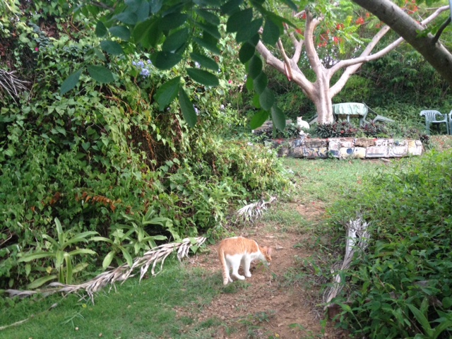
June 14 - our days are beautiful; perfect for grads activities. It's been a
whirlwind! I make sure I spend enough quiet time in the lower garden each day.
There, a hungry calico cat appeared one day and never left'. She gave birth to
a litter of kittens during a very rainy pattern. She has weathered many a storm
in her life. She, and two remaining kittens are our garden pets. They are
therapeutic. Living in the wild, they know how to protect themselves, however,
we have to find a way to encourage the use of the tool shed in case of a storm.
The gazebo is too open. See? I'm thinking ahead. May God bless us all,
including the pets.

Isabel
Sent from my iPhone |
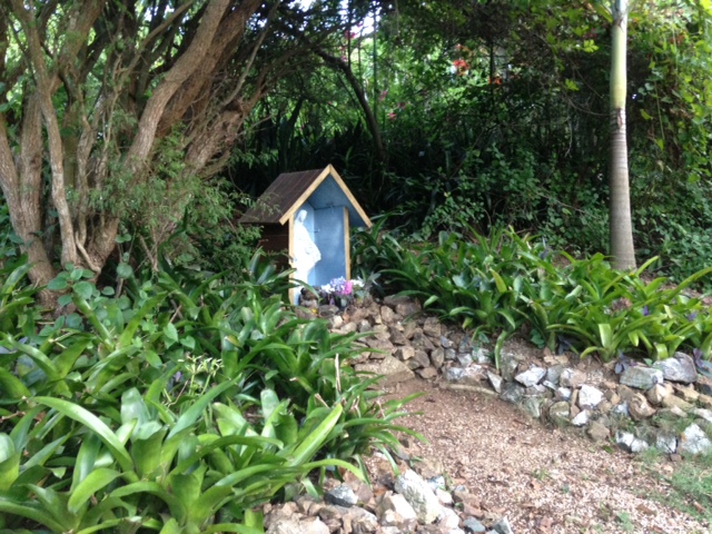
| - Bromelias, Crepe myrtles, and clouds |
|
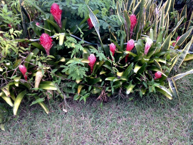
June 13 - I'm grateful to those of you who have sent greetings and welcomed me
back. I shall reply asap. Also, I would like to add that we've been having
tsunami siren drills. In case of such an emergency everyone has to run to the
hills. I'm sure  that VING will be out in full force if it came to that to make
sure that people get away on time. Many "donkey years" ago a tsunami came in
just below our hill. I must look it up for the details. There's been an
increase in seismic activity all over the world and the Caribbean with it. The
plants have been blooming and the clouds have been gathering, but no serious
rain as yet. One day at a time. May God bless us all.

Isabel

PS - if you have never experienced a tsunami, see the movie  IMPOSSIBLE - true
story of how a family survived that horrific tsunami which took over 300,000
lives. Believe me, you will feel as if you are in it.
Sent from my iPhone |
| - Same evening, two Faces |
|
June 12 - it is early in the season. No need to worry. Our season does not
begin until August. That's always the mind set at this time. To top it off the
civil authorities, new people in place, have no clue what to do; how to prepare
for a hurricane, or any other emergency for that matter. Sounds as if we're in
big trouble. Today's photos were taken minutes apart. One facing northwest and
the other facing south east. What a difference! Let's hope and pray it will be
quiet around here. May God bless us all.

Isabel
Sent from my iPhone |
| - Sea and Foam? |
|
June 11 - we were at Dugan's Reef, across from Buck Island, for Brunch today,
and snapped a few photos. We noticed that the sea was very choppy even at the
wharf and that the ferry did not go out at 1:00 p.m. It was very breezy at the
restaurant. We keep getting those quick showers. I like that. The day was just
lovely, can't complain. Later in the afternoon I looked up at the sky and it
was all "foamy" with cotton ball clouds. Amazing! Praise the Lord! May He bless
us all!

Isabel
Sent from my iPhone |
| - 20% at Noon |
|
June 10 - From now on conversations will turn to the season as at a brunch my
husband and I attended this past week. The hostess celebrating her birthday was
concerned about the increase in activity this season; one guest wanted nothing
of it. She was totally positive that we will not have a storm. I added that
that was a good attitude but we still have to prepare as if one will come down
the road, plus, we are going to have heat waves in addition.  I put in my 5
cents worth and we turned to the subject of generators and air-conditioners.
Today we got a refreshing shower, but looking towards Africa I see lots of
activity approaching the coast. It's never too early to prepare. Good night,
and may God bless us all.

Isabel
Sent from my iPhone |
| - The Jungle Garden |
|
June 9 - today as I was walking through the lower garden looking for photo
opts. I came upon the "jungle" part. A large Manjack Tree merged with a Divi
Divi to form a cave- like passage. Very shady and cool. I thought of the hot
weather ahead and could see myself seeking refuge there whenever I did garden
work. That being my favorite hobby I plan to be out there regardless. As for
the three tropical waves coming, according to Ian one of them could develop.
May God bless us all.

Isabel
Sent from my iPhoneq |
| - Rainy/Sunny Day |
|
Day 8 - Since last night we've been having on and off showers. By checking the
website I noticed that the waves from Africa are turning up from the south in
our direction. This rainy pattern is most probably going to continue. We are
happy for the rain.  It was looking kind of dry around here. Our new pooch
prefers to play soccer on dry ground. Be well, be happy, and may God bless us
all.

Isabel
Sent from my iPhone |
| - Surprise Rain |
|
We haven't had this much rain in a while.  I noticed many waves from Africa
crossing the Atlantic, this rain may very well be one of them. It came just when
we needed it. I like to see visitors coming at this time; it is really the best
time with so many bright, flaming colors and mangos galore. The sea is also
calmer. Sure makes it easier for the ferry to cross to St.Thomas.let's pray and
hope for a safe hurricane season. May God bless us all.

Isabel
Sent from my iPhone |
| - Heat Waves..? |
|
Day 6 - According to the St. Martin post we are in for some heat waves during
this hurricane season. How bad would that be? I know that in big cities there
are usually many fatalities, especially among the very young, elderly, and
homeless, wherever the air is hot and stagnant. An island is totally exposed to
the sun's rays and if there's no breeze, it can be a trial unless you can be in
an air-conditioned place all day and all night. Definitely, both
air-conditioners and water will be most important, at the top of the list. To
keep hydrated and cool is essential during a heat wave. This is going to be a
challenge in addition to the increase in hurricane activity. We have to make it
a point to prepare well. May God bless us all.

Isabel
Sent from my iPhone |
| - NOAA PREDICTS 11 - 17 STORMS |
|
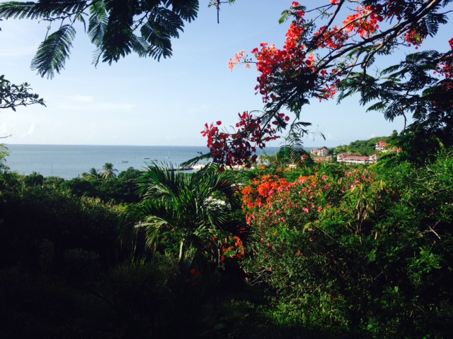
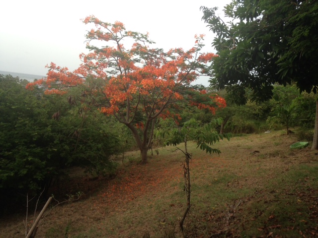
June 5th - our Flamboyants, or Flaming trees are finally blooming. It's the
tree that keeps on giving those gorgeous clusters of flowers for months. This
hurricane season can very well do lots of tree damage especially if we
experience a strong landfall or even just a passer by. We have six Flamboyant
trees in the lower garden. I just hope they make it through this season. The
photo was taken late evening. Let's hope, pray, and prepare well. May God bless
us all.

Isabel
Sent from my iPhone |
| - Mango Season is also in! |
|
June 4th- the trees are heavy laden and we're getting the fruit from various
sources. Our Red-footed tortoises really enjoy them. I must make a correction
on the storms, the 2nd named storm was not for us. Our 2nd storm when it forms
will be named BRET. It's just a matter of time. We need to prepare early. When
the weather is quiet I like to cook and photograph hurricane "seasoned" food
like the one below. Occasionally I will send such photos. Eat well, be well,
and may God bless you and I.

Isabel
Speedy eating a mango Sent from my iPhone |
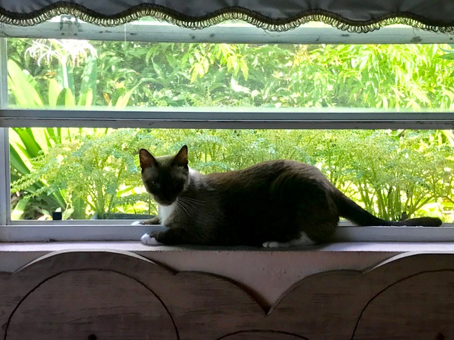
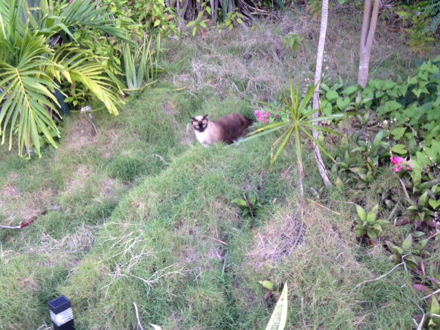
| - Above Average Hurricane Season..? |
|
G'night, folks! Yes, I just listened to a report on Weather Underground about
NOAA's predictions for this season. It's certainly a change from earlier
predictions of a below average season. By the look on our Siamese cat's face on
one his first outdoor expeditions, he seems to be concerned about those
predictions as well. We just have to be prepared in case there's a lone wolf or
wolferine like MATTHEW, which caused so many deaths and damage. May God bless
us all, and may the Holy Spirit renew the face of the earth.

Isabel
Sent from my iPhone |
| - African Tulips |
|
June 2- G'night all! A beautiful day was had by us here. Our grandson graduated
from high school this evening and the weather was just perfect. Even though a
tropical wave was in the area it did not bring the rain in the forecast. Truly
blessed. Because of the rain we've had so far, the African Tulip Tree has had
the most flowers ever. May God bless us all!

Isabel
Sent from my iPhone |
| - Second Storm Named Today |
|
Greetings to all the correspondents in the Caribbean and followers of this
website everywhere! It's good to be back! Hope it's going to be a quiet
hurricane season. Today BEATRIZ was named. It crossed over to the Gulf but not
expected to develop further. It's packing a lot of rain and I'm sure our
friends in drought stricken Florida are hoping it comes their way. As for us,
we've been having rain quite frequently and as a result fruits and vegetables
are in abundance. So, we know the rules. Hurricane preparedness! Goodnight and
may God bless us all.

Isabel
Sent from my iPhone |
| Back to top |


