|
|
- - - 2016 Hurricane Season - - -
|
- Happy New Year
|
- By Kelly Kerr <kellykerr68 at gmail.com>
- Date: Sat, 31 Dec 2016 22:24:43 -0400
|
Hello to the stormcarib family. This is my first posting and I would like to use this opportunity to send greetings to everyone.
From my family here in Tobago to yours, we wish all the best for the New Year 2017 and may God richly bless you and may you get your heart's desire.
Here in the countryside of Tobago at present it is a cool and calm night and for the first time in as many days there was absolutely no rain in Studley Park where I live.
Stay safe and enjoy the remainder of 2016. |
|
- New and Enriching and Well-Deserved Movements
|
- By Ian Martin Borde <readkrox51 at gmail.com>
- Date: Fri, 16 Dec 2016 03:14:01 -0400
|
#08 Holder Drive La Horquette, Glencoe, Diego Martin T'dad & T'bgo, W.I. 2016-12-16th Fri. Today, Here & Now
My Dear Friends and Family in Paradise,
My one and only daughter and I have moved!!! She is going to Lebanon, Pennsylvania. [Harrisburg Community College] I have moved more West and closer to Venezuela. The main road at the top of my street is Western Main Road. The Yatch Club is at the top of the street on Western Main Road. We are less than 3 miles from The main Army, Coast Guard and Air Transport Base.
The house itself is closer to the North Coast than Gulf of Paria (PoS.). It lays at the foothills of The Northern Range and the tributary that feeds The Diego Martin River begins its journey on the flat in front the front gate. Most of all (except for transportation costs), it is easier to maintain.
Weather and Hazard - Wise: Today and Tomorrow besides cold, wet roads and nights, one can expect gusts of wind in excess of 35 mph.
The front is expected to continue skirting
the waters along 30N between 55W-65W through Friday as strong
high pressure builds in across the region W of the front. The
resulting strong pressure gradient will generate fresh to strong
NE to E winds across much of the southern periphery of the
ridging as the ridge moves off the mid-Atlc coast. Farther
east...the central and eastern Atlc remain under the influence of
a surface ridge anchored by a 1035 mb high centered near 32N28W.
PLEASE:
I would like EVERYONE to remember 'Hurricane Otto' !!!!!
IT IS/WAS 'ULTRA-RECORD-BREAKING' !!!!!
Climate Change is PEAKING, not Stopping, ....
May God, ..., forgive us and transform us for the better in 2017.
Have a Happy and Holy Holiday Season, ... !!
Attachment:
16th dec 215am.jpg
Description: JPEG image
Attachment:
Castara - Tobago - Monday 19th September - Sunshine and Rain -.jpg
Description: JPEG image
Attachment:
Icacos Lagoon (5) Panaroma 28th August 2016.jpg
Description: JPEG image
|
|
- Out of The Blue
|
- By Ian Martin Borde <readkrox51 at gmail.com>
- Date: Mon, 28 Nov 2016 22:11:33 -0400
|
People of Paradise,
Trinidad can expect a dose of what Dominica got at sunset time today Monday, within two hours. ( I have to post quickly but other regions will also be affected). St. Lucia's post will give you an idea that it has strong wind besides precipitation.
Quoting: A surface trough is moving through the east Caribbean and
extends from 19N67W across Puerto Rico along 15N67W to the coast
of Venezuela near 12N70W. Numerous showers and scattered
thunderstorms are within 90/120 nm of a line from 17N60W across
the Leeward Islands to 14N66W then narrows to within 45 nm of a
line to 12N68W. Scattered showers and possible isolated
thunderstorms can be found across the remainder of the east
Caribbean east of the surface trough. A surface trough is to the south extending from 26N59W to the northern
Leeward islands near 18N64W. An upper ridge is along 50W
providing difflunce aloft to generate scattered to numerous
showers and possible isolated thunderstorms south of 26N to over
the Leeward Islands, Virgin Islands, and Puerto Rico between 57W-
66W. Please be aware, ....
Attachment:
Capture at 930pm 28th nov 2016 410 mile from DRep.JPG
Description: JPEG image
|
|
- We getting Somewhere, ..., Somewhere Rewarding, ....
|
- By Ian Martin Borde <readkrox51 at gmail.com>
- Date: Sun, 20 Nov 2016 05:41:31 -0400
|
Praise God ! People of Paradise,
For we are getting somewhere nice and comfortable to deal with!!!!!!!
Stepping out of my depth, (Only for others to follow), ....
Winds in Central America and the Greater Antilles in the proximity of 90L are; 20 - 25 mph. Seas are over 6' feet, averaging 8 feet. Moisture and Precipitation are more organised and this is the significant threat to the same interests? So much so, that Forecasts look to Tuesday for a named 'Depression'.
I would not say that it is heading West, It is unbelievably unique and erratic, ... !!!!!
Significantly, for The Eastern Caribbean; For experienced sea-bathers, sun-tanners, and those who obey the Life-Guards, We are under a time of 'Repreive' ! Enjoy it !
I give God, all the Thanks and Praise !!!!!!!! Attachment:
20th nov 2016 - 36 hours forecast.gif
Description: GIF image
Attachment:
20th nov 2016 - above normal sea temperatures into winter.gif
Description: GIF image
Attachment:
- - Maracas - -.jpg
Description: JPEG image
|
|
- Cuba + Haiti should brace for a 2nd Hit -
|
- By Ian Martin Borde <readkrox51 at gmail.com>
- Date: Thu, 17 Nov 2016 02:52:52 -0400
|
Trinidad & Tobago, West Indies 2016-11-17th Thursday, 02:35 a.m.
People of Paradise,
Engaging our attention this graveyard hour of contemplation, is a well-developed LPS with an 80% chance of becoming a Tropical Depression after tomorrow late evening?
There are two others. As a fellow correspondent has written. One is taking shape from the stationary systems that plagued us for two weeks now, just in the vicinity north or south of Puerto Rico. (Or as the master (Dr. Jeff Masters), has pointed out). It is not really stationary but how cyclones are formed. High sea Temperatures !!!!! Then the incongruence of moisture and heat and cold East of Bahamas, depending on 'Otto' will do nothing 'good' !!
Let's put all misunderstanding aside.
Haiti is going to be compressed by three systems with erratic behaviour because of steering currents !!!
It's that Simple !
God Bless Attachment:
Capture 'Otto' at 660 miles from Haiti - thu 17th nov 2016 0200am.JPG
Description: JPEG image
|
|
- Onward and Upward, ...
|
- By Ian Martin Borde <readkrox51 at gmail.com>
- Date: Sat, 12 Nov 2016 06:14:07 -0400
|
[Quote: English Poetry - Suggested Readings; paraphrased] I continued working onward and upward thru the night While others slept and counted sheep.
Good Morning, People of Paradise,
There are a few things I bring to the table, ....
- There will be a 'Supermoon' Sunday night peaking at 06:15 a.m. Monday morning, (local time).
- "We remember the 'slain' and dead."
- There was an earthquake (mild) in Haiti this morning, 02:47 a.m. Exactly the same area there were catastrophic floods.
- 'Gert and Dave', [God Bless Them], gave me this indirectly / accidentally.
"It is remarkably useful !!!"
It says the weather will continue to be hazardous, but in the time span indicated we are over the worst. But remember, complacency kills, ....
God Bless, (uplifting literature), and everything else, ...
|
|
- Interesting -
|
- By Ian Martin Borde <readkrox51 at gmail.com>
- Date: Mon, 7 Nov 2016 20:53:53 -0400
|
People of Paradise,
[Recall:] I write from the standpoint of remedies and recovery. In other words, counteracting the after effects. By forewarning with a bottom-line.
This is important in the face of 'Unpredictable Extremes' as an effect of Global Warming and Climate Change.
What affected us (and what is now affecting us) will dissipate.
In the meantime, The former is going to go thru the border of Haiti and the Dominican Republic. The latter or present wave caused flooding in Trinidad last night. It's now moving northward. But fairly stationery.
I have said what others have said. I have twisted it to save lifes. Now read it a second time and even if 'my take' is wrong. Need I say more ?
Was it 'Alice in Wonderland' that said, "I sit and I wonder."
God Bless |
|
- NOT, by the way, ...
|
- By Ian Martin Borde <readkrox51 at gmail.com>
- Date: Mon, 7 Nov 2016 05:03:33 -0400
|
People of Paradise,
On another platform I told them the same thing except that this hazardous weather will last 4 - 5 days.
What is coming today and tomorrow for the south Eastern Caribbean will be worse.
Stay safe and Sound |
|
- I told you so
|
- By Ian Martin Borde <readkrox51 at gmail.com>
- Date: Sat, 5 Nov 2016 10:35:42 -0400
|
Standing by,
People of Paradise !
Call for Help ! Definitely call for Help.
We are willing to serve, ...
|
|
- Out of The Blue
|
- By Ian Martin Borde <readkrox51 at gmail.com>
- Date: Sat, 5 Nov 2016 01:49:16 -0400
|
Fellow People of Paradise,
The blob has reached. (Gave Tobago quite a soaking).
If you wake up before dawn and see this post. Work as if it is becoming a LPS !!? Before the sunrise hours.
Furthermore it is not a one day affair!!! and, Moreover, the soil is absolutely soaked already!!
There is always a good side: There is no wind.
Leaving I guess once again. This morning will be actually dangerous.
God Bless Attachment:
5th nov 1245am.jpg
Description: JPEG image
|
|
- Hazardous vs. Healing
|
- By Ian Martin Borde <readkrox51 at gmail.com>
- Date: Thu, 3 Nov 2016 14:01:51 -0400
|
Happy November, People of Paradise,
November, November ! The month we remember the departed and elections and fallen and wounded soldiers.
May we, as well as God continue to bless them, ... !!! Amen!
Democracy doesn't come easily.
This link is now under observation and even though I believe it will dissipate. Or rather gravitate to the Low Pressure System, soon to be named. (In the Central Atlantic). IT IS HAZARDOUS ! (At the moment)!
Of more concern, (why I'm posting), there is a blob 36 hours away. It is not a LPS! I, least of all, am not throwing caution to the wind, but there is reason to believe we are not threatened by Cabo Verde storms anymore.
Imagine: (Cases in Point) !!!! This blob 36 hours away, becomes a LPS between the Cayman's and Belize??? You don't need to imagine. It has happened already.
God Bless
Attachment:
- 'Liberty' - Peter & Marian - May 2016.jpg
Description: JPEG image
Attachment:
Attachment-1.jpeg
Description: JPEG image
Attachment:
Mako and Kaiden courtesy Marc and Michelle.jpg
Description: JPEG image
|
|
- Where the trough is Tuesday morning
|
- By Ian Martin Borde <readkrox51 at gmail.com>
- Date: Tue, 25 Oct 2016 03:50:47 -0400
|
Good Morning, People of Paradise,
Happily, the seas are quiet. The wind is refreshing. And, The precipitation is not hazardous. At least, that is this morning and expected during the day as well. May I add, during winter, the seas have life-threatening currents, and migratory marine life. (Good for fishing)!
The LPS/Trough took his turn northward, became more defined, and spun off some dwarfs, affecting Dominica, Martinique, St. Lucia, Barbados, St. Vincent and Trinidad. Conditions are as written above and the little wind the dwarfs have will make good compost of dry leaves and nothing more.
This lovely morning, I leave with a quote: "Patience, is the best catalyst for change."
God Bless Attachment:
25th oct 0245am.jpg
Description: JPEG image
Attachment:
Capture at 0245am 25th Oct 2016 - more defined.JPG
Description: JPEG image
Attachment:
Three (03) Sisters - off Trinidad South Coast - Saturday 27th August 2016.jpg
Description: JPEG image
|
|
- Where the TW is from tonight !
|
- By Ian Martin Borde <readkrox51 at gmail.com>
- Date: Sun, 23 Oct 2016 16:52:00 -0400
|
People of Paradise,
Obscured in 'Wind-Shear', I have tried to show that factors weight in the vicinity of 'hazardous' for this TW/LPS.
BECAUSE:
a) It is too south. (Broke ITCZ, 2016 systems have broken predictability records). b) Forgive me but the pattern is strikingly similar to a nameless one before. (Not the intensity, however). c) ALL SYSTEMS this year have beaten wind shear predictions and let's not talk about 'rapid intensification'.
Besides, "Haven't we had enough heavy precipitation?"
450 miles is a long way off however and its estimated Impact even by me is Monday night / Tuesday morning and day.
Procure what remains to be attended to, ....
God Bless Attachment:
Capture at 450 miles 315pm Sun 23rd Oct 2016 - breaking shear -.JPG
Description: JPEG image
Attachment:
Sun 23rd Oct 2016 - SAL.jpg
Description: JPEG image
Attachment:
La Pastora Estate Great House 1880.jpg
Description: JPEG image
Attachment:
Photo0094.jpg
Description: JPEG image
Attachment:
- Metropolitan Trinidad -.jpg
Description: JPEG image
Attachment:
South Quay Lighthouse in yesteryear.jpg
Description: JPEG image
|
|
- T'dad already affected
|
- By Ian Martin Borde <readkrox51 at gmail.com>
- Date: Sat, 22 Oct 2016 17:13:32 -0400
|
People of Paradise,
Trinidad and Tobago is already affected by the TW / LPS / Trough.
We can expect after these midday showers to have a night/early morning of un-convective heavy rain giving way to flash flooding.
The other islands are told from more reliable forecasters than myself that it will veer north of the Eastern Caribbean Tuesday morning.
My take / Bottom Line is, Dominica, St. Vincent, St. Lucia, Martinique, Bahamas, Haiti, and Virgin Islands should start taking it seriously.
God Bless Attachment:
22nd oct 345pm.jpg
Description: JPEG image
|
|
- It's not too early to prognosticate ?
|
- By Ian Martin Borde <readkrox51 at gmail.com>
- Date: Thu, 20 Oct 2016 02:56:14 -0400
|
My fellow islanders of Paradise,
One wonders if; There can be no trauma and hysteria, (without blatant lies and apathy to facts), when the modern-day 'manager' is 'in absentia'.
The answer to this opening is ' Please teach people to teach others without any form of jealousy. '
There is a LPS 1,500 miles away that I agree with all forecasters will not be here for another three (03) days. It however should be here in five (05) days. What I disagree with is "It is too early to prognosticate." So here goes: Waves; are 8' - 9' feet. (Rising to ten.) Winds; are 10 - 20 mph. ( < 300 miles wide) Moisture and Tropical Features; abundant and circulating.
I think I am wrong, but it is 'out of the ITCZ'. It is slow-moving, consistent, and well south. (Unusual feature like (? a nameless ?) one before). It is already late October. We already had our quota of predicted activity. (Which in itself is above normal) !!!
(Just look at the position we have found ourselves in?)
God Bless Attachment:
19th Oct 1100pm.jpg
Description: JPEG image
Attachment:
20th Oct 0200am.JPG
Description: JPEG image
Attachment:
Capture at 1,500 miles - 20th Oct 2016 - 0145am.JPG
Description: JPEG image
|
|
- PRAISES, ..., Reprieve, Clean-Up and Restoration, ....
|
- By Ian Martin Borde <readkrox51 at gmail.com>
- Date: Fri, 14 Oct 2016 00:10:29 -0400
|
Trinidad & Tobago, W.I. 2016-10-13th Thu. 11 : 50 p.m.
Finally ! Give Praises, ... Thank YOU, Lord !
People of Paradise, I did not have to spend more than 3 minutes of research, to know that there will be normal sunshine for a while!!! That does not mean there will not be drizzle or localized rain. Neither does it mean the Cabo Verde Storms have stopped.
Besides, Clean-Up and Restoration, what the research means is that The First Responders Lifes are no longer in danger!!!!!!
Work NOW will be (or at least should be) REWARDING ! Under pleasant conditions, ....
(Phew) ! Let's give ourselves a round of Praise and support, ....
God is Blessing us NOW
Attachment:
Pierre La Borde's Art.jpg
Description: JPEG image
Attachment:
'Lord Nelson'.jpg
Description: JPEG image
|
|
- Direct Hit
|
- By Ian Martin Borde <readkrox51 at gmail.com>
- Date: Thu, 13 Oct 2016 09:03:09 -0400
|
Let's pray, ...
The massive eye is now over Bermuda !
Let us pray, ... !!!
Thanks God, (in His Mercy) !!! |
|
- One Caribbean !
|
- By Ian Martin Borde <readkrox51 at gmail.com>
- Date: Thu, 13 Oct 2016 02:41:19 -0400
|
Bermudian People of Paradise,
I have not forgotten you, ....
One will exonerate me for resting during the inclement weather even after 'Matthew'.
I have no plans to go out today. As a matter of fact some important stuff is happening right here at home during the day. So I am on standby, (with whatever entourage I have that I can't live without).
Complacency Kills
So when looking out for others please if necessary, enforce it !
CATEGORY 3 - 4, is NOTHING TO PLAY WITH.
Standing by God Bless Attachment:
13th oct 0145am - 'Nicole'.jpg
Description: JPEG image
|
|
- Convective TW - 12 - 24 hrs. -
|
- By Ian Martin Borde <readkrox51 at gmail.com>
- Date: Tue, 11 Oct 2016 05:10:49 -0400
|
Hard-Working People of Paradise,
We have a TW, that is NOT a LPS, 12 - 24 hrs. away from Trinidad & Tobago.
One never knows but after this, There may be some Reprieve, ....
Not taking away from this slow - moving TW which most likely will prove hazardous, if not for the amount of time it will spend over the islands. Also it is the third right after 'Matthew'!!!!!
I have included some back-in-times photos with the weather.
God Bless Attachment:
11th oct 415am.jpg
Description: JPEG image
Attachment:
St Francois Girls.jpg
Description: JPEG image
Attachment:
standpipe water during school.jpg
Description: JPEG image
|
|
- No Reprieve, ..., Work must continue, in spite of this!!!
|
- By Ian Martin Borde <readkrox51 at gmail.com>
- Date: Sun, 9 Oct 2016 04:36:47 -0400
|
My Dear, People of Paradise,
We have grown accustomed to a reprieve after perilous weather. This is not the case NOW.
We just had a tropical wave and two more back to back are coming, .... (I think everybody knows what happened in Trinidad.)
Not that they are extra, particularly hazardous. It's just whether it's raining, whether there is mud, whether there's complete devastation and an air of hopelessness, ...
..., THE WORK MUST GO ON !
Restoring a proper standard of living might just maybe be more important than the Presidential Elections.
God Bless (and don't forget Cuba)
Attachment:
- - haiti - matthew-damage - sw haiti jeremie - -.jpg
Description: JPEG image
|
|
- Pale in Comparison
|
- By Ian Martin Borde <readkrox51 at gmail.com>
- Date: Thu, 6 Oct 2016 13:19:02 -0400
|
Just for the records,
see attached, ...
(For those tonight, you know the drill, ...)!!
Bless us, Merciful Father ! Attachment:
06th oct 1215pm.jpg
Description: JPEG image
Attachment:
Thu 06th Oct 445am.jpg
Description: JPEG image
|
|
- TW today Eastern Caribbean
|
- By Ian Martin Borde <readkrox51 at gmail.com>
- Date: Wed, 5 Oct 2016 03:48:40 -0400
|
Good Morning, to all, People of Paradise,
There is mention of 8 foot waves and 15 - 20 mph. breezes in the Tropical Wave bearing down on the Eastern Caribbean.
I agree, But !
They say impact is tomorrow and maybe tonight. I disagree and one can expect midday showers. (Particularly in the southern islands), ... This is scientific. [ref: Precipitable Water Imagery]
Thank God for this morning !
May The Departed souls, Rest In Peace, ....
We pray for them and Continue to pray for all of US affected, ....
Good Job, Santo Domingo ! Bien Hacido ! |
|
- When will it end, ... ?!! Qu'est-il doit finir?
|
- By Ian Martin Borde <readkrox51 at gmail.com>
- Date: Tue, 4 Oct 2016 19:21:27 -0400
|
Officially; There is news of Aid from Trinidad and Tobago, from the highest levels.
The attachments speak for themselves, (without any written sensationalisation).
In 2 - 6 hours it will be over for Haiti! Pas plus de six heures, .... Attachment:
4th oct 645pm.jpg
Description: JPEG image
Attachment:
matthew-landfall-haiti-wu.jpg
Description: JPEG image
Attachment:
NacComp200Km.gif
Description: GIF image
|
|
- Three (03) LPS'es with a Haiti Landfall - Monday Midnight -
|
- By Ian Martin Borde <readkrox51 at gmail.com>
- Date: Tue, 4 Oct 2016 01:42:56 -0400
|
Petit Valley, Diego Martin, Trinidad & Tobago, W.I. 2016 - 10 - 04th Tue. 01 : 30 a.m.
I am still here, ....
Je suis toujours ici, ....
Bless Us, Merciful Father ! Dieu Misericordieux Nous Benisse !
Attachment:
- - 3 LPS'es and a Haiti Landfall at 1115pm Monday 3rd Oct - -.JPG
Description: JPEG image
|
|
- Standing by, ....
|
- By Ian Martin Borde <readkrox51 at gmail.com>
- Date: Mon, 3 Oct 2016 19:34:24 -0400
|
It's gonna be a long night, ....
La nuit viendra longue, et avec peur.
Remain Calm ! Restez Calmes !
Personnes d'assistance ne se dormiront pas aussi, ... Standing by, ..... Attachment:
carbin-rainfall-10.2.16-800px.jpg
Description: JPEG image
Attachment:
'Matthew' Sunday 02nd October 2016.png
Description: PNG image
|
|
- Do Not Speak Ill/Arettez La Mauvaise Langue
|
- By Ian Martin Borde <readkrox51 at gmail.com>
- Date: Mon, 3 Oct 2016 05:21:56 -0400
|
I am very, very, very GLAD almost everyone has decided to choose to go to shelters!!!!!!
Because the worst is yet to come, ... !!!!!!
Do not speak ill of anyone or anything !
Bless Everyone !
Il me fait Joyeau, que tout le monde a choisi, La Evacuacion !!!!!
Tres Joyeau !!!!
Parce que la tempete ne vient pas prope!
Arettez la mauvaise langue!
Benisse, Benisse, Benisse !
Attachment:
3rd Oct 445am.gif
Description: GIF image
|
|
- Impact started, ...
|
- By Ian Martin Borde <readkrox51 at gmail.com>
- Date: Sun, 2 Oct 2016 18:37:28 -0400
|
The Impact to Jamaica and Haiti has started.
Everybody knows what to do.
Anything different to that, (wait and watch), --- ! GET HELP ! ---
La tempete a commencee.
L'On connoissait bien ce que faire. A l'hors de rester calmes,
Si vous avez le besoin, "Apellez l'assistance!"
God Bless Dieu Vous Benisse Attachment:
- Impact started 385 miles from Guantanemo Cuba at 515 pm Sun 2nd Oct -.PNG
Description: PNG image
Attachment:
2nd October 515pm.jpg
Description: JPEG image
|
|
- Unity and Peace and Love
|
- By Ian Martin Borde <readkrox51 at gmail.com>
- Date: Sun, 2 Oct 2016 01:49:42 -0400
|
La Unité et La
Paz aux Iles De Le Dieu
Unity and Peace to all People of Paradise
Il fait nécessaire
que je me dormirais a moins de deux fois
avant la
approchement du ´Matthew´ sur la République de l´Haïti.
Mais depuis de
l’instante maintenant, je suis prêt a vous servir.
L’ouragan ´Matthew´
aura,
Les ventes
plus fortes a cote de Jamaïque qu’Haïti.
Les ondes et
la pluie en Haïti pourront mettre a morts.
(Aussi Santo
Domingo). Et plus grave que Jamaïque.
Ce passera
parce que l’ouragan approche Jamaïque.
Autre fois, je
suis prêt a vous servir, ….
Bonne Chance
While I have to sleep at least twice before Sunday night,
And land fall in Haiti, I am on standby ready to serve
you.
Hurricane ´Matthew´ will have,
Stronger winds in Jamaica than in Haiti.
However waves and rain will be deadlier in Haiti and
Santo Domingo.
This is because it turned north when I started writing
and is heading Jamaica and Cuba.
Once again I am on standby,
Good Luck
Dieu vous benisse
God Bless |
|
- Category 2 Hurricane 'Matthew'
|
- By Ian Martin Borde <readkrox51 at gmail.com>
- Date: Fri, 30 Sep 2016 04:54:27 -0400
|
There is nothing 'New' under the sun.
There is a time and season and reason for Everything on The face of The Earth, and God's Creation !
"IF YOU NOT ON THE SAME PAGE" - START READING THE WRITING -
Please be Proactive? Because (most likely), Haiti is going to get a Category 2 Hurricane.
So too, Jamaica, Cuba, and the East Coast, ...
In Life and Death situations, we say "It's better to be late, than SORRY!"
God Bless Attachment:
CATEGORY 2 'MATTHEW' AT 0400AM FRIDAY 30TH SEPT 2016.PNG
Description: PNG image
|
|
- Help is on the way, ....
|
- By Ian Martin Borde <readkrox51 at gmail.com>
- Date: Thu, 29 Sep 2016 13:20:57 -0400
|
I got back from Port of Spain on personal business an hour and a half ago. (I have seen no posts from St. Vincent as per the request on returning.) Other islands have written succinct posts and they will be included.
While I was around the city suburbs, it came to my attention that, ... ..., HELP IS ON THE WAY!
Even though I have some influence in these matters, I DO NOT COLLECT MONEY OR DONATIONS.
They simply ask me, "What to do?"
Sincerely,
Ian (God Bless) |
|
- From: Ian, (Retired) Red Cross 51, T'dad & T'bgo
|
- By Ian Martin Borde <readkrox51 at gmail.com>
- Date: Thu, 29 Sep 2016 08:33:26 -0400
|
thanks for your update,
The Centre went over St. Vincent's North Coast and it will be very enriching to you all for us to know how the rest of St. Vincent is faring, ....
Standing by, ..., (with a lot of support) !!!!!
Stay Safe and Sound, God Bless
Ian and Madonna |
|
- ???
|
- By Ian Martin Borde <readkrox51 at gmail.com>
- Date: Thu, 29 Sep 2016 05:22:32 -0400
|
Anybody knows what's going on in St. Vincent ?
Praying, .... Ian
Standing by !!! |
|
- It's far from Over, ....
|
- By Ian Martin Borde <readkrox51 at gmail.com>
- Date: Wed, 28 Sep 2016 18:00:58 -0400
|
Petit Valley, Diego Martin, Trinidad and Tobago, W.I. Wed. 28th Sept. 2016 5:50 p.m.
People of Paradise, "Phew!"
Breathe a sigh of relief !!!!!
For remedial disaster reasons, if not for the reason that TS 'Matthew' has exited the coast of St. Vincent, ....
FORGET THE GRAPHICS
"Let's move on, ...."
Following up, - After the wind there's the rain - Rest Assured
You still need to stay indoors and there is still wind.
But now those who are able to do so, can extend themselves AND HELP OTHERS, ....
God Bless! Thanks, God!
Attachment:
Capture at 430pm 'Mattthew' aftermath - Wednesday 28th September 2016.PNG
Description: PNG image
|
|
- From San Fernando
|
- By Christine Westmaas <chrisalis1003 at yahoo.co.uk>
- Date: Wed, 28 Sep 2016 14:58:13 -0400
|
We have not had a drop of rain or a gust of wind! I don't know if other parts
of Trinidad have experienced any indications of stormy weather. As of almost
3.00 p.m., it is hot and sunny in San Fernando. My thoughts are with the
islands in the path of the storm. May you all be safe.
|
|
- Full Impact underway of TS 'Matthew' -
|
- By Ian Martin Borde <readkrox51 at gmail.com>
- Date: Wed, 28 Sep 2016 12:41:49 -0400
|
People of Paradise,
I don't have to say it!
We are all being affected, ... !
From 'Precipitable Water Imagery', All the Graphics of Plots, and, What the best heads are indicating, ... ..., TS 'Matthew's centre is currently off the east coast of St. Vincent, passing in half hour over, ( not off, nor north of, but) is passing OVER the north coast of St. Vincent!
(Please excuse me, if I am wrong.)
In the graphic attached, the centre is really 100 miles south-east of where I plotted it at approx. 11:30 a.m.
Attachment:
- - 'Matthew' at 1115am Wednesday 28th September 2016 - -.jpg
Description: JPEG image
Attachment:
- Capture at 1130am 'Matthew's centre and Impact on St Vincent and St lucia -.PNG
Description: PNG image
|
|
- No News is Bad News
|
- By Ian Martin Borde <readkrox51 at gmail.com>
- Date: Wed, 28 Sep 2016 09:13:05 -0400
|
Please pray for the islands that are not posting. Because most likely no news is bad news.
Grenada, St. Vincent and St. Lucia are in the picture. Right now, Barbados is getting winds over 35 mph. (maybe under 60 mph.) and the centre (yes, centre) is yet to go over them !!!!!
Haiti, has to watch out in the future and start getting prepared! If after Barbados, Tobago is threatened, I will post before - hand !! (Even though I have to see about my family first!)
This is exactly what NHC and Dr. Jeff Masters said will happen! Which means the effects will not stop until 2:00 p.m. tomorrow, Thursday.
Pray and if needed call for HELP !
God Bless
|
|
- Overcast skies but no rain yet
|
- By Christine Westmaas <chrisalis1003 at yahoo.co.uk>
- Date: Wed, 28 Sep 2016 11:53:57 +0000 (UTC)
|
We have had no rain or wind here overnight but this morning we have mostly overcast skies with patches of wispy clouds in otherwise clear blue parts of the sky. There is just a slight breeze beginning now and I expect that we will get the expected showers later this morning. It takes very little to create flooding in parts of Port-of-Spain, Debe and central Trinidad so i hope that any heavy or significant rainfall will alert parents and employers to getting children/employees home before there is the chaos of lack of transport because of flooded streets and bumper-to-bumper traffic jams. Schools have not been closed but some direction in this regard may well come in the course of the morning, dependent on what the Met. office advises. Have a good day, everyone, and stay safe. |
|
- PRAY! Rest and Pray, ....
|
- By Ian Martin Borde <readkrox51 at gmail.com>
- Date: Wed, 28 Sep 2016 02:04:49 -0400
|
From Trinidad to the Lesser Antilles are being affected as I write or are going to be affected, by both wind and rain. Seas are going to be as high as 13' feet. Prone areas should evacuate now if they haven't before as the centre or eye is not going to impact until after 7:00 this morning just below Hurricane strength!
I was so stressed out! I burnt lunch yesterday and was put to sleep after my last post until 12:40 a.m.
I could imagine how you all feel. (Trinidad is being affected.)
There is very bad news. Everything that stopped it from being called a Depression earlier has been reversed by 97L and it is going to move over us slowly just below hurricane force, ....
PRAY ! Attachment:
1100pm tue 27th sept - thunderstorm wall between SAL and eye 250 .jpg
Description: JPEG image
Attachment:
Capture at 0115am wed 28th sept 2016 - 350 miles from st vincent (stat 01 hr).PNG
Description: PNG image
|
|
- A quiet night so far
|
- By Christine Westmaas <chrisalis1003 at yahoo.co.uk>
- Date: Tue, 27 Sep 2016 22:05:05 -0400
|
Here in San Fernando it is very still and warm, with no indication of rain or
stormy weather. The stars are out and the night is quiet. The system seems to
be moving away from us and poses a real threat to our more northerly
neighbours. I suspect that we may not have as much rain as we initially
expected. Nevertheless, it is wise to expect the heavy showers forecast and to
take sensible precautions.
|
|
- Stay Indoors
|
- By Ian Martin Borde <readkrox51 at gmail.com>
- Date: Tue, 27 Sep 2016 18:47:16 -0400
|
Folks, Impact has started, and there will be dangerous winds in two hours, all of us. That is between 7:30 - 9:00 p.m.
My concern is that, (Negatively): We are no longer interested in track, intensity, ..., wind, seas, rain, ... (Proactively): I am interested in Hurricane Supplies and Shelters, ... The Disadvantaged, Children and Animals, Emergency Personnel and Equipment and Location !
STAY INDOORS
Attachment:
Capture at 545pm EDT tue 27th sept - Impact started (midday) -.PNG
Description: PNG image
|
|
- Real-Time Impact Online
|
- By Ian Martin Borde <readkrox51 at gmail.com>
- Date: Tue, 27 Sep 2016 04:50:17 -0400
|
|
|
|
- Impact from - 14:00 (2:00) p.m. - Centre 02:00 a.m. Wednesday !!!!!
|
- By Ian Martin Borde <readkrox51 at gmail.com>
- Date: Tue, 27 Sep 2016 04:33:52 -0400
|
People of Paradise,
Soon-to-be, 'Matthew', has exited the ITCZ. ANYTHING (unpredictable) can happen now !!!!! In terms of formation, strength, intensity and track !
A hypothetical graphic is attached, ... IT MUST NOT BE RELIED UPON! However I will explain what it means and the best heads are also saying, ....
Winds: Will be >30 mph. Seas: Will be over 9' feet from Montserrat to Grenada at around 02:00 a.m. Wednesday, tomorrow morning/night!!!
Impact from outer spiral bands will commence from 2:00 p.m. today, ....
NHC says, Please monitor the progress of this weather system if you have
any interests that are in the eastern and central Caribbean Sea,
including the northern coast of South America. Heavy rains and
strong gusty winds, possibly to tropical storm force, are
expected to spread across the Windward Islands and sections of
the southern Lesser Antilles beginning late Tuesday or
Wednesday. An Air Force Hurricane Hunter aircraft is scheduled
to investigate this disturbance on Tuesday afternoon. The chance
of formation during the next 48 hours is high. Gale wind
conditions are forecast in 24 hours, within 120 NM N semicircle
of the low center, and sea heights are forecast to range from 10
feet to 14 feet. Stay Safe and Sound
God Bless
Attachment:
Capture AT 0200AM TUES 27th sept 2016 - 475 miles away from st lucia.PNG
Description: PNG image
|
|
- Invest 97L
|
- By Stephen Abouhamad <stephen_abouhamad at hotmail.com>
- Date: Tue, 27 Sep 2016 05:30:37 +0000
|
A Good night to all readers of StormCarib. Hope you all through the Caribbean are taking note of the tropical disturbance in the Atlantic. It is slowly developing and from 22:00 invest 97L was noted to have a 90% chance to develop into a Tropical Depression
during the next 24 hours. We all need to keep our eyes on this system as it moves west-northwest at a rapid pace. Trinidad and Tobago is expected to have showers and thunderstorms with gusty winds from Tuesday night leading into Wednesday. Liat has already
issued a statement so for all those who are traveling to please lace with the airline for updates on flights coming in and out of Trinidad over the next few days . Hope you all stay safe and keeping your eyes out for updates.
S Abouhamad
|
|
|
- Counting Down, ....
|
- By Ian Martin Borde <readkrox51 at gmail.com>
- Date: Mon, 26 Sep 2016 18:08:00 -0400
|
Forecast for 97LInvest 97L will continue west to west-northwest at 15 - 20 mph through Tuesday, reaching a latitude of about 12°N by Tuesday afternoon. This is far enough away from the equator to give 97L an extra boost of spin that may allow it to become a tropical depression on Tuesday. With the SHIPS model predicting wind shear remaining low, mid-level moisture staying high at 65 - 70%, SSTs remaining a very warm 29 - 30°C (84 - 86°F), and 97L slowing its forward speed to about 10 - 15 mph, conditions will be ripe on Tuesday for 97L to become a tropical depression or tropical storm before it reaches the Lesser Antilles Islands. By Tuesday night, the outer spiral bands of 97L will begin spreading over the Lesser Antilles, bringing high winds and heavy rains. The core of the storm will pass through the islands on Wednesday afternoon. It is unlikely that 97L will have time to intensify into a hurricane by then, though a strong tropical storm with 60 - 70 mph winds is quite possible.
[Dr. Jeff Masters]
God Bless, ....
Attachment:
26th sept 345pm - eastern caribbean.jpg
Description: JPEG image
Attachment:
26th sept 500pm - NHC - spagetti plots -.png
Description: PNG image
Attachment:
72hrs forecast showing Thursday 200pm.gif
Description: GIF image
Attachment:
euro-sep26.png
Description: PNG image
Attachment:
gfs-sep26.png
Description: PNG image
|
|
- Powerful tropical wave approaching!
|
- By adesh nanan <adeshcnanan at hotmail.com>
- Date: Mon, 26 Sep 2016 09:59:05 +0000
|
This tropical wave can be a rain maker and is much needed by the islands
however the models are predicting development to a tropical storm and some even
to a major hurricane. The rains are welcomed but not the high winds.....if we
could be spared the high winds and dangerous lightning ,this would be ideal.
Trinidad and Tobago is in the cone at this time and all precautions should be
taken to prevent a last minute dash to the supermarkets....stay safe all!

Dr Adesh Nanan

Sent from my iPad
|
|
- 'Matthew'-to-be - 36hrs -
|
- By Ian Martin Borde <readkrox51 at gmail.com>
- Date: Mon, 26 Sep 2016 05:43:16 -0400
|
P/Vly, D'go M'rtn, T'dad & T'bgo, W.I. 2016-09-26th Monday 04:45 a.m.
From Tobago to Dominica - Impact > 25 mph. Winds -
Soon-to-be, Tropical Depression 'Matthew',
already has winds over 20 mph. extending out more than 200 miles! already seas are reaching eight (08') ft. 50 miles from the centre. already there is discernible low-level circulation and there is moisture in the centre. in addition, middle-level clouds in the western and northerly quadrant are not dispersing before (approximately) 45 mins.
IN MY VIEW; Areas affected by the Centre will be Impacted between one a half (1 1/2) hours to seven (07) hours.
Getting a better view on 'track and intensity', Dominica is going to be affected !!
Areas: Coastal areas Landslide Prone areas and Low-Lying areas near rivers and streams, (400 yards), ARE MOST PRONE. Other areas must prepare, plan and procure to preserve property and persons before-hand.
Stay Safe and Sound !!!!!
Attachment:
Capture at 0200am mon 26th sept 2016.PNG
Description: PNG image
|
|
- Heat, heat and more heat!
|
- By Christine Westmaas <chrisalis1003 at yahoo.co.uk>
- Date: Sat, 24 Sep 2016 14:42:09 -0400
|
Both Trinidad and Tobago are almost unbearably hot today. I suspect it's
another 35 Celsius day today.
|
|
- Weekend Repreive
|
- By Ian Martin Borde <readkrox51 at gmail.com>
- Date: Sat, 24 Sep 2016 08:28:31 -0400
|
Beautiful People of Paradise,
This year, (Thank God), I have more time to be pleasant and simple.
So this post is for this weekend alone and not even for Monday morning, ...
I suspect; Seas will be very friendly this weekend !!!
In Trinidad we had three drownings for the week. Phew ! That's not usual !
If you remember, I deliberately included that non-experienced swimmers should stay out of the water here and an other forum!
(But I guess it's like Donations for this website! It may have fallen on deaf ears.)
Have a good 'Republic Day' weekend, ...
Attachment:
Castara - Tobago - Monday 19th September - Sunshine and Rain -.jpg
Description: JPEG image
|
|
- This is what we are dealing with, ... ?
|
- By Ian Martin Borde <readkrox51 at gmail.com>
- Date: Wed, 21 Sep 2016 11:21:42 -0400
|
Hi, to all, People of Paradise,
The copy and paste from NHC, yesterday as well as the attachments show exactly what we are dealing with. Re: TD 'Karl'
Karl is moving westward, or 275 degrees, 15 knots. The
estimated minimum central pressure is 1006 mb. The maximum
sustained wind speeds are 35 knots with gusts to 45 knots.
Convective precipitation: scattered moderate to isolated strong
within 315 nm of the center in the NE semicircle.
Please believe me, "I could be more dramatic." Eg. In the 24 hour forecast attachment you will see that winds will be circulatory and about 12 mph. consistently from Puerto Rico to off Mayaro on the East Coast of Trinidad.
God Bless
Attachment:
21st sept 0241am - 24 hour forecast.gif
Description: GIF image
Attachment:
Capture at 0900am Wed 21st sept 2016 - 'Karl' - 350 miles from Barbuda.PNG
Description: PNG image
Attachment:
tues 20th sept 855pm.gif
Description: GIF image
|
|
- There will be Impact ! -
|
- By Ian Martin Borde <readkrox51 at gmail.com>
- Date: Tue, 20 Sep 2016 02:24:31 -0400
|
Good Night, Good Day, Good Everything, People of Paradise,
There will be Impact. In some form or fashion, there will be Impact Thursday morning/Wednesday night till Saturday morning!!!
In small island states, any wave above three feet and tidal levels above one (01") inch, is above normal and that's why we are called Paradise, .....
Even if 'Karl' stays away more than 750 miles, (safe zone), at the closest point of approach', the resultant dryness, humidity and SAL and oppressive pressure, the hyperthermic dryness and 'stress' is an Impact !!!
That does not mean that 'Karl' is a cause of panic. Or that anybody got it all wrong.
It means in 'life and death' situations; - Complacency leads to Fatalities. - There are no shortcuts and Sensationalism is just as bad.
Attached are two graphics that work out the hazard mathematics in pics.
Plan, Pray and Prepare God Bless Attachment:
19th sept 842pm - 'Karl' - 900 miles from.gif
Description: GIF image
Attachment:
19th sept 2016 1100pm - 'Karl' - SAL.jpg
Description: JPEG image
|
|
- High-Level Centre of Circulation - 12 - 36 hours -
|
- By Ian Martin Borde <readkrox51 at gmail.com>
- Date: Fri, 16 Sep 2016 05:25:34 -0400
|
My Dear, People of Paradise,
At about 51.5 West and 16 North at 0900 GMT (0500 EDT) there is a Centre of High Level Circulation.
It is not Low Level Circulation (thus precipitable moisture) because Ian, Julia and Karl, have thrown Sal into it (nascent).
The last time I identified High Level Circulation, it was made out as a false alarm as no rain fell. However Jamaica and Haiti and now advised by NHC when there is High Level Circulation. (So there might be something there.)
What do I do? Ans. "I went back to the sea."
When you check the winds (not wave heights) in the graphic attached you will see (at low level) the normal spiral arrows of a cyclonic feature.
Maybe it wouldn't hurt to prepare for 15 mph. consistent wind for 5 - 7 mins. every 20 mins. and rainfall in the night that can cause some small type of flooding.
Then again, who knows?
God Bless
Attachment:
Sea & Trade Winds - fri 16th sept 2016.gif
Description: GIF image
|
|
- Fatalities and Complacencies
|
- By Ian Martin Borde <readkrox51 at gmail.com>
- Date: Wed, 7 Sep 2016 02:05:59 -0400
|
Good Night, Good Day, People of Paradise,
I'd luv to wait four (04) more hours. But what good would that do? In fact, I'll like to pray and go to sleep (again).
1) The greatest city in The World is getting hit by Hurricane 'Hermine ' tonight !!?
2) Hopefully mistakenly, 92L has just survived the mountains of Santo Domingo and (even if it's a breakaway cluster to be subject to SAL and Shear) that can only mean 'trouble'. (Good word 'trouble') (Not 'complacency').
3) Within 36 hrs. the Eastern Caribbean will feel the effects of an LPS that is close-knit and has circulation at 50 W. 'Close-Knit' is never 'good'.
Maybe I should have forgotten all that and just say we had fatalities and it is the height of the season and none were category II or more (as yet)?
God bless
Attachment:
Capture 0100am 07th sept - 24hrs away.PNG
Description: PNG image
Attachment:
Capture at 0100am Wed 07th Sept - Grand Turk - north swing.PNG
Description: PNG image
|
|
- Dominica (support, ...)
|
- By Ian Martin Borde <readkrox51 at gmail.com>
- Date: Mon, 5 Sep 2016 01:23:24 -0400
|
Michael in Dominica,
I always agreed with you.
Dominica (and Haiti) are not informed well enough. And that is not just in 'preparation'. "Yes!", a depression is forming over Dominica tonight! And like you said, "It is not designated."
Can I go back three steps? (Maybe more?) I woke up (first sleep) at 12:05 this morning. That's why I write posts here. A lot of remedial work during 'Climate Change' starts off as volunteer work. What you are having tonight Trinidad has at least twice a month from June to November.
Having taken a step back, I keep to my forecast before, and say;
"By morning it will all be over!!!!!"
Hope you understand
God Bless Attachment:
5th sept 1215am.jpg
Description: JPEG image
|
|
- 92L
|
- By Ian Martin Borde <readkrox51 at gmail.com>
- Date: Sun, 4 Sep 2016 03:36:32 -0400
|
Good Night People of Paradise,
I am awake.
For my own reasons of SAL and wind shear and 92L track history; I don't see storm conditions except for an hour and a half wherever the centre passes, ....
At the centre winds will or should be sustained over 25 mph. for an hour and a half.
Also it's moving very fast.
Everybody is going to get over 1 1/2 ins. of rain just short of 3 ins.
I see St. Lucia, Grenada in the picture and Dominica getting a second hit.
Have been and am on standby Stay safe and sound. Attachment:
3rd sept 1100pm.jpg
Description: JPEG image
Attachment:
4th sept 0145am.jpg
Description: JPEG image
Attachment:
4th sept 0245am.jpg
Description: JPEG image
Attachment:
Capture at 245am 04th sept 300 miles from st lucy.PNG
Description: PNG image
|
|
- Post-Hermine & 92L
|
- By Ian Martin Borde <readkrox51 at gmail.com>
- Date: Fri, 2 Sep 2016 18:51:35 -0400
|
Phew,
I don't know what to say about 'Hermine'.?.
May the soul of the fatality in Florida, Rest in Eternal Peace. (3' ft. storm surge / winds to fell trees / first in 11 years) Phew !
92L, Is 12 hours away, but officially 36 hours away!! It will not last a full 3 days! (It's moving fast, ...) SAL (not just to 92L) is oppressive !!! Waves are already 6' - 7 '. Nothing scientific about wind. (Won't be Storm!) Rain however, as a life-saver, can reach 3" ins. As a bottom line of worst case scenario. One last thing is, - In my thinking - It will veer a bit north about 75 - 125 miles before Barbados. Phew !
God bless YOU Attachment:
92L - 2nd sept 2016.png
Description: PNG image
Attachment:
2nd sept 515pm.jpg
Description: JPEG image
|
|
- WOW -
|
- By Ian Martin Borde <readkrox51 at gmail.com>
- Date: Sun, 28 Aug 2016 19:08:48 -0400
|
Good Evening and Good Night, People of Paradise,
Pre-Hermine is now TD #9. The Carolinas apparently were lost for attention. 🤔
Back to TD #9, "To me" it looks like, It took a drastic dip south of South Florida. I don't know! But, I tried to express myself by the graphic attached.
In my admiration for Dr. Jeff Masters, I admire and follow Bob Henson as well.
He has provided a very interesting forecast in the other graphic.
Last Note: I hope I am wrong but the LPS coming out of Africa, will be between 40 - 50 W. Longitude in 72 hours.
May Almighty God Bless US
Attachment:
Capture TD 9 at 620pm sun28th aug 2016 - dipped south of south Florida -.PNG
Description: PNG image
Attachment:
wpc-5-day-8.28.16 Bob Henson Report - Sun 28th Aug.jpg
Description: JPEG image
|
|
- Pre-Hermine
|
- By Ian Martin Borde <readkrox51 at gmail.com>
- Date: Sat, 27 Aug 2016 03:58:37 -0400
|
My God and My Lord, People of Paradise,
This Atlantic 'El Nino' 2016 is awe-inspiring, ... !
The 'Advisory' Charts are like checker boards (ie. tic, tac, toe) with lots of X's and O's, ... The satellite images are a lot of swirls, (the closest imagery I can use in English) like a hawk or falcon or eagle pouncing on a dove and creating a swirl of feathers!
High-Level, Low-Level, Surface Circulation, Cyclonic System, they are all there everyday, .... (Since January as a matter of fact.)
For this one and only time, I am going to be totally superstitious.
"If you can't see the relationship between: Humanity, Nature, God, Prayer, and Fasting (hard-work and selflessness), then I will eat the dog food and cook my lunch for the dog and strays."
Whatever about religion and superstition, Pre-Hermine and a few others have been 'Phenomenally Merciful' !
God Bless
Attachment:
27th August (Saturday) 2016 - NHC.png
Description: PNG image
|
|
- Praise God -
|
- By Ian Martin Borde <readkrox51 at gmail.com>
- Date: Thu, 25 Aug 2016 02:35:53 -0400
|
Hearty and Cherry Good Morning, To The Eastern Side of Paradise,
(Yawn) (I finally got some sleep.)
Thank God we got over it !
Now: Now ! Now, let join hearts and hands to wish The Turks and Caicos and Bahamas THE SAME REPRIEVE !!!
Talking about Mercy, I wonder if Louisiana knows something worse can hit them.
Thank God, (every minute) ! |
|
- I know trouble is coming towards us this time
|
- By Andrea Sorrillo <andrea_tt at hotmail.com>
- Date: Wed, 24 Aug 2016 10:34:33 +0000
|
The placed was cold and suddenly got dark.
|
|
|
- 5:00 a.m. - Full Impact -
|
- By Ian Martin Borde <readkrox51 at gmail.com>
- Date: Wed, 24 Aug 2016 05:14:43 -0400
|
The LPS is not going to let up for another 2 - 6 hours !!!!!
Stay in a safe place and keep calm !!!
You are hurt and injured, even if it's only your nerves, but, 1) There are people less fortunate than you. 2) Anything else will be worse, ... !!!!!
If it keeps a centre in the hot sun, Puerto Rico and its Dependencies are in for trouble ! 6 - 8 hours of Trouble ! It is determined to form a centre between Guadeloupe and Montserrat.
There are a lot of things you can do during a storm: Draughts Checkers Dominos Cards Read Cell Phones Learn Survival Skills first-hand.
But maybe the best thing to do and bond with children for along time is 'keep a diary', an ongoing diary.
I have been, I am and I will be standing by, .... |
|
- 12:30 a.m. - Antigua - 12:30 a.m.
|
- By Ian Martin Borde <readkrox51 at gmail.com>
- Date: Wed, 24 Aug 2016 00:58:18 -0400
|
A N T I G U A
STAY INDOORS & CALL FOR HELP !
Antigua, Barbuda, Montserrat, St. Kitts, Nevis, St. Barts, Anguilla, British and US Virgin Islands and all others, North and West of Guadeloupe, ....
Stay Indoors and Call for HELP !
DO NOT PANIC for identifiable, trained and Equipped personnel will HELP YOU.
If you are unsafe,
Call the authorities for HELP, NO ONE ELSE ! In the meantime stay Indoors.
If you are indoors and your life is threatened, Stay Indoors, and wait there till help comes, Or, Is brought to YOU.
THE AUTHORITIES WILL BE IDENTIFIABLE !
No one else !
If you are safe but uncomfortable and need advice, CALL FOR HELP, But not the emergency numbers.
Eg. Local/Community Aldermen Hospitals, Fire Services, Approved Organisations.
If you can't communicate, CALL FOR HELP, anyway possible in the form of a chain or bucket brigade, ....
Standing by
|
|
- Standby -
|
- By Ian Martin Borde <readkrox51 at gmail.com>
- Date: Tue, 23 Aug 2016 15:13:36 -0400
|
People of Paradise,
I had lunch one hour ago and while eating bananas and oranges for dessert brought in the dry clothes off the lines. (Baked Food).
I haven't a clue what the Hurricane Hunters found. But if, as they should be, 'devil's advocates on pronouncements'. they will not pronounce 'Depression'.
My take is, Winds: 20 mph. in the centre extending out 125 miles. Seas: 7' - 11' From 350 miles moving inwards. Precipitation: VARIABLE 'specially during the night', BUT NO LESS THAN 1 1/2" INS. FROM 350 - 500 MILES OUT. A centre of Depression may form north or south of Puerto Rico. From 2:30 p.m. today Tuesday, it will last three (03) days.
My point is; I am on standby and awake for the next probable 48 hours.
G o d B l e s s Attachment:
Capture at 230pm 23rd august.PNG
Description: PNG image
|
|
- Let's keep it SIMPLE !!?
|
- By Ian Martin Borde <readkrox51 at gmail.com>
- Date: Sun, 21 Aug 2016 11:37:40 -0400
|
The attached graphic is my 'take' or forecast as regards minimum preparedness, ...
The Characteristics of 99L (at present) is as follows; - Winds 15 - 25 mph. consistently. - Waves 7' - 9' Ft. - Diameter of 20 mph. winds := = From 75 miles north of Guadeloupe to 200 miles west of Guyana coast. - Barometric pressure at current status at landfall. 1009 millibars. 'Storm'.
You have to get prepared and pray like last year for SAL, Wind-Shear, and God's Intercession as seen in the role of Authorities and Life - Savers.
Stay Safe and Sound God bless Attachment:
21st aug 72 hour forecast (Tuesday Night).gif
Description: GIF image
|
|
- ITCZ/Tropical Wave with Impact upon T&T
|
- By Ian Martin Borde <readkrox51 at gmail.com>
- Date: Thu, 18 Aug 2016 14:29:30 -0400
|
People of Paradise,
By tonight, early tonight, Trinidad and Tobago will feel the persistent fall of rain, first in heavy spurts, then rough seas, and gusts between 25 - 35 mph.
I don't know for the other islands.
My guess, I repeat, my guess is; "Whatever conditions greet us tomorrow foreday morning, will persist for the next two weeks."
My guess, once again, is that; As a blanket statement for the Eastern Caribbean, seas will be un-friendly, from tomorrow morning, .... 6' - 7' ft. waves will be the order of the day. Sometimes even in the West Coasts. (3' - 4' ft.)
I strongly urge everyone to start their preparation from now for a train of events, ....
Stay Safe and Sound !!!!
Attachment:
17th aug 0200am.GIF
Description: GIF image
Attachment:
17th aug 2016 (0400am).PNG
Description: PNG image
Attachment:
18th aug 115pm.jpg
Description: JPEG image
|
|
- Prepare! Rather than Panic Purchase, ....!!!!!!
|
- By Ian Martin Borde <readkrox51 at gmail.com>
- Date: Tue, 16 Aug 2016 15:08:12 -0400
|
1) There is a weak Tropical Wave upon us now !!
2) This image is a distinct possibility.
Whether or Not !!!! 3) The attached picture of SAL shows a Train of LPS's heading this way, ....
Pray and Prepare, ....
Attachment:
16th aug 200pm.jpg
Description: JPEG image
|
|
- Impact tonight south of Guadeloupe
|
- By Ian Martin Borde <readkrox51 at gmail.com>
- Date: Sat, 13 Aug 2016 16:55:46 -0400
|
Pleasant Pleasantries, People of Paradise,
Tropical wave axis extends from 07N52W to 14N52W moving W at 10-15 kt.
The wave coincides with subtle 700 mb troughing between 51W-57W
and a maximum in 850 mb relative vorticity in the vicinity of
the wave axis near 10N as depicted in the global models. An
upper trough associated with an upper low at 20N55W is helping
to enhance moderate to isolated strong convection from 09N-11N
within 120 nm west of the wave axis.
This wave is well expressed above.
Added to that, Because it is slow moving, THE BOTTOM LINE is, - less than 2' ins. of rain south of Guadeloupe (until Monday morning). - No breeze - gusting not over 22mph. - To describe the seas - CALM -
Attached you will see no wind shear till it reaches us. Copious SAL (Dry Air). The next wave is a killer. (see SAL). But may end up in The Atlantic.
God Bless
Attachment:
13th aug 200pm.jpg
Description: JPEG image
Attachment:
13th aug 345pm.jpg
Description: JPEG image
|
|
- Hope is on The Horizon -
|
- By Ian Martin Borde <readkrox51 at gmail.com>
- Date: Thu, 11 Aug 2016 16:32:39 -0400
|
Tomorrow morning, where St. Lucia is concerned. IT WILL ALL BE OVER !!!
GOD BLESS ! |
|
- Latest, ...
|
- By Ian Martin Borde <readkrox51 at gmail.com>
- Date: Thu, 11 Aug 2016 12:31:12 -0400
|
Attached is the system's position at 11:30 a.m.
"We started having thunder and rain in Diego Martin, Trinidad."
(that is between 12:00 - 12:20 p.m.)
Attachment:
Capture at 1130am Thursday 11th August 2016 (8hrs rain-St Lucia).PNG
Description: PNG image
|
|
- It's Not Over !!!!!
|
- By Ian Martin Borde <readkrox51 at gmail.com>
- Date: Thu, 11 Aug 2016 10:13:44 -0400
|
Included are graphics to show what can happen!
In other words,
It is not over !!!
EXPECT IT TO CONTINUE, ....
Boil Water !!!!!!
(Even bathing your skin might scratch in severe cases.)
Don't eat fallen fruit and food (animals) and BOIL WATER ! In an emergency, as a quick solution, put chlorine (bleach) in the water.
LISTEN TO THE AUTHORITIES, .... !!!!!!! Attachment:
Thursday 11th August 2016 - 0915am - (Lingering Nature) - (Commencement 445a.jpg
Description: JPEG image
Attachment:
Capture 0915am St Lucia Thu 11th Aug.PNG
Description: PNG image
|
|
- First Response
|
- By Ian Martin Borde <readkrox51 at gmail.com>
- Date: Thu, 11 Aug 2016 08:38:47 -0400
|
Thanks, Humble Thanks Mrs. Beckwith, for informing us of ongoing conditions.
What you describe is 'hurricane wetness'. MINUS THE BREEZE When everything is said and done, EVERYTHING IS GOING TO BE MOIST Even what you have in plastic. For people less fortunate than you, They would not be able to catch a nap Without dry blankets.
About napping, ....
One cannot describe the amount of work that has to be done after!!
BUT, - ,NAPPING IS JUST AS IMPORTANT !!!! Not just for the nerves.
Standing by, .... God Bless |
|
- St. Lucia & Martinique
|
- By Ian Martin Borde <readkrox51 at gmail.com>
- Date: Thu, 11 Aug 2016 04:34:32 -0400
|
I am not sleeping.
We are standing by, ....
God be with YOU All ! |
|
- Not so soon !
|
- By Ian Martin Borde <readkrox51 at gmail.com>
- Date: Mon, 8 Aug 2016 20:35:43 -0400
|
Good Day, Good Night, People of Paradise,
I am here to report that everything is safe and sound and we don't only wish all those affected well but standby in readiness.
I prognosed at least a week of reprieve, .... And whether the chicken came first or the egg, so did a lot of other people.
Well! There is something with an Impact time of Thursday morning / Wednesday night.
Just like the typical secondary stage of a tropical blob it flared up out of nowhere. It seems to be exiting the ITCZ (at 50 W.). It's circular and sizable. It's origin and exit is circumstantial proof. (To be wary)!
One thing I know, I am not missing tonight's sleep over it !
God Bless |
|
- One more (98L) to go, then REPRIEVE !!!
|
- By Ian Martin Borde <readkrox51 at gmail.com>
- Date: Fri, 5 Aug 2016 03:20:11 -0400
|
Non-highlighted 98L has started to impact south Trinidad.
Ex-96L as I hope you recognized and heeded is exiting Guadeloupe.
In less than 24 hours if it maintains character 98L will have 35 mph. wind gusts but less rain than ex-96 L. The problem with this last one is, It has been so strong and thru difficult circumstances, It can change (intensify) (specially in localized areas), in the puff of a breath !
I AM NOT A DESIGNATED AUTHORITY:
Due to; - Inundation from three back to back - Lack of SAL and Wind Shear - Character sustained thus far.
If the authorities concur with standby first responders, some type of VOLUNTARY evacuation to safer areas should be provided.
Eg. Dominica, Grenada, / Moruga, Toco and Tobago in Trinidad.
Then Reprieve, ....
Stay safe and sound, ... |
|
- ex-96L - 48 hrs.
|
- By Ian Martin Borde <readkrox51 at gmail.com>
- Date: Wed, 3 Aug 2016 00:35:35 -0400
|
My Dear People of Paradise,
There are three Tropical Low-Pressure-Systems in the picture!!! WE HAVE NOT DODGED THE BULLET ! TS 'Earl' is the very first (1st.) Invest from Cabo Verde for 2016 ! And boy oh boy, has he done some amazing things, .... Once again we express full support where needed, ...
Ex-96L is not what you see in graphical images. As soon as she comes out of wind shear 200 miles from the Eastern Caribbean you will see what I mean?
Ex-96L is much more organized and stronger and fought rigorous SAL (Dry Air). It is also more south. Where as Earl exited the ITCZ at 38 - 40 W. Longitude, Ex-96L is still partly in the ITCZ at 46 - 48 W. Longitude.
It's circulation in time lapse has always been more pronounced than 'Earl'.
Then again, who knows!
God Bless
Attachment:
2nd aug 800pm.jpg
Description: JPEG image
Attachment:
2nd aug 816pm.gif
Description: GIF image
Attachment:
'Earl' - 96L.jpg
Description: JPEG image
|
|
- Solidarity and Support, ....
|
- By Ian Martin Borde <readkrox51 at gmail.com>
- Date: Wed, 3 Aug 2016 00:12:43 -0400
|
This humble correspondent, will like to join his brothers and sisters of 'what-we-call Paradise' in expressing full and uncompromising support to all those affected and that may be affected in the future by TS 'Earl'!
To those who lost their lifes, ..., I wish you Peace, Perfect Peace, in a Land where you will worry no more, ....
May Their Souls and The Souls of The Faithful Departed,
Rest In Peace, ..... |
|
- Good Morning, ..., Praise God !
|
- By Ian Martin Borde <readkrox51 at gmail.com>
- Date: Sun, 31 Jul 2016 08:45:01 -0400
|
P/Vly, D'go M'rtn, T'dad & T'bgo, W.I. 2016/07/31st-08:35a.m.
The ole man is not what he used to be. I am not as strong as before, ...! I fell asleep at about 3:50 a.m. Just as Martinique was getting a serious pounding, ...??? And I got up half hour ago when it exited Dominica and posed itself as a Depression west of Martinique!!!
Thank God Anguilla and the other drought - stricken areas got rain, ...
And will continue to get.
God Bless Thank YOU, LORD ! Attachment:
30TH JULY 1145PM.jpg
Description: JPEG image
Attachment:
31st July 0145am.jpg
Description: JPEG image
Attachment:
31st july 515am.jpg
Description: JPEG image
Attachment:
31st july 1245am.jpg
Description: JPEG image
Attachment:
Capture at 0015 (1215) am 31st July 2016.jpg
Description: JPEG image
Attachment:
Capture at 0045 (1245) am 31st July 2016.jpg
Description: JPEG image
Attachment:
Capture at 0145am 31st july 2016.PNG
Description: PNG image
|
|
- Attention, Dominica !!!!!
|
- By Ian Martin Borde <readkrox51 at gmail.com>
- Date: Sat, 30 Jul 2016 23:29:41 -0400
|
The latest:
There is a breakaway from the cluster affecting just north and east of Barbuda.
This cluster appears to be breaking up, (to feed the lower pressure formed approx. 200 miles east of Martinique!!!) and is forming part of the inward spiral!!!
The Impact time is more or less the same!!! Between 01:30 a.m. and 04:00 a.m. , ..., That is the touchdown of the Centre as NHC always said, DUE WEST!
BESIDES HEAVY SEAS, THERE IS W I N D !!!
"I hope to God, I am wrong and it goes north of Barbuda."
WHATEVER HAPPENS, DOMINICA TREAT THIS AS A TROPICAL DEPRESSION IN TWO (02) HOURS !
GOD BLESS Attachment:
Capture at 1005pm.jpg
Description: JPEG image
Attachment:
30th July 1015pm.jpg
Description: JPEG image
|
|
- Two points of Update and a 8:10 p.m Image
|
- By Ian Martin Borde <readkrox51 at gmail.com>
- Date: Sat, 30 Jul 2016 20:35:43 -0400
|
Everybody seems to be correlating, ....
There are two recent, as in the last half hour, updates that have become more obvious as Impact approaches at about 02:30 a.m. tomorrow, Sunday!
One, is that a 'discernible or visible' cyclonic formation shape will be evident any time now !
Two, is that the track is no longer ?Westward?, but North-Westward, not even exact, west, north-west!
The Image attached was done at 20:10 (8:10) p.m. tonight.
Follow The Authorities! Comply, don't Complain, Stay Indoors!
God Bless Attachment:
Capture approximate Centre.jpg
Description: JPEG image
|
|
- Northerly Impact Ongoing, ..., Climaxing 12 - 48 hrs.
|
- By Ian Martin Borde <readkrox51 at gmail.com>
- Date: Sat, 30 Jul 2016 12:45:10 -0400
|
Be Prepared, People of Paradise,
Ceteris Paribus: "I assume those involved have been following and prepared themselves."
My take: "Is what everyone else is saying." Apart from that, It is outside of Trinidad's portfolio as a primary, direct affect. (Even though we stand by.)
This is a separate and non-low pressure wave affecting us now. The real one or the first one is behind. (12hrs.) Then there's a more potent one behind that.
(My take cont'd): The only bad part to the actual low pressure wave is that we will be on the bad side of the circulation!
At best (and quite possible); The center or rather axis will pass 25 miles north or south from Anguilla.
Winds; should occasionally be 17 - 25 mph. Very, very seldom gusting to a little above 35 mph. (Worst case scenario!) Waves; will be higher than usual and dangerous!!! (Blanket!) Some will have waves higher than 2 metres from the west coasts.!.!. Precipitation; will be in localized areas no more than 2.5 ins. (If Dominica (Martinique and Guadeloupe) are involved 4" inches max.
Finishing my take: "I don't see Dominica and Puerto Rico in the life-threatening picture!"
IF ANY ISLANDS SOUTH OF GUADELOUPE ARE INVOLVED I WILL BE UP ALL NIGHT !
STAY SAFE AND SOUND !!!!!
Attachment:
29th july 2000 (800) pm.jpg
Description: JPEG image
Attachment:
30th July 1115am.jpg
Description: JPEG image
|
|
- North of South -
|
- By Ian Martin Borde <readkrox51 at gmail.com>
- Date: Mon, 25 Jul 2016 05:38:20 -0400
|
Summer greetings to all the People of Paradise,
I was praying and praying. I prayed that last year is not like this year.
Who knows?
But just maybe, it will be better. As at least one of the scourges, 'drought', has not been reported way into August! (Like last year?) (Thanks, aunty Jane).
My posts have been like me last year. Forceful and to the point! Let's have a better year, please? (These posts are generalizations and a good one-on-one email doesn't hurt?)
Attached; Is the pedantic stuff, .... 🤔
...TROPICAL WAVES...

A 1011 mb low is centered over the eastern Tropical Atlantic
near 13N28W, moving west at 5 kt. The low is in a very moist
area as seen on the SSMI Total Precipitable Water imagery. A 700
Mb low is also noted at the same location. Scattered showers are
within 120 nm of the center.

A tropical wave is over the western Tropical Atlantic with axis
from 20N51W to 10N51W, moving west at 25 kt.  The wave coincides
with a well defined 700 mb trough as depicted in the global
models and is within a surge of moisture as seen on the SSMI
Total Precipitable Water Imagery.  No deep convection is
observed at this time as Saharan dust is located north of 15N.
(Apparently, the weather is good for sailing back to safe harbour.)
Attachment:
25th july 0200am.jpg
Description: JPEG image
Attachment:
25th july 0223am - 72 hoour forecast.gif
Description: GIF image
Attachment:
25th july 415am.jpg
Description: JPEG image
Attachment:
25th july 2016 - midnight -.gif
Description: GIF image
Attachment:
- Exody - New York - 2016.jpg
Description: JPEG image
Attachment:
- Skipper in New York -.jpg
Description: JPEG image
|
|
- Welcome Rain
|
- By Ian Martin Borde <readkrox51 at gmail.com>
- Date: Wed, 20 Jul 2016 01:57:47 -0400
|
Hi everyone,
What a relief! Some welcome rain is going to affect the entire Eastern Caribbean (and soon)!
For most it will be more than a 24 hour event!
My take, (bottom-line of preparation), is that there is 13% - 33% chance It may either slow down, Dip south, (meaning westward), or linger to become something more substantive.
It's all in the run of things as this one is the most northerly so far.
God Bless Attachment:
19th july 1100pm.jpg
Description: JPEG image
Attachment:
standpipe water during school.jpg
Description: JPEG image
|
|
- Rain Rain and More Rain
|
- By Stephen Abouhamad <stephen_abouhamad at hotmail.com>
- Date: Sat, 16 Jul 2016 06:10:21 +0000
|
Good Morning to all,
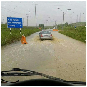
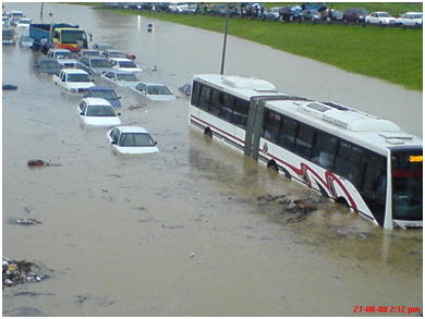
As I sit at home enjoying the temperature of the atmosphere I reflect on the amount of rain that I witnessed first hand today at work. I left home yesterday in rain, I got soaked at work in the rain and I made my way home during the rain tonight. Today in
Trinidad we had rain throughout the country with flash flooding being recorded in the South and Central districts. Most of our flights at the airport were delayed due to the weather conditions which hampered our operations.
Looking at the upcoming weather we are seeing that the ITCZ has dipped back south so weather conditions should settle over the next few hours. Below are a few pictures of the flooding in Trinidad.
Regards,
S Abouhamad
|
|
|
- Protracted Precipitation, .....
|
- By Ian Martin Borde <readkrox51 at gmail.com>
- Date: Fri, 15 Jul 2016 06:03:43 -0400
|
Hi everyone,
Trinidad (and Tobago), had rain consistently for the last two days. Just nice refreshing rain that will make some envious.
However, today and tomorrow, the weather pattern may prove to be more hazardous than beneficial.
All possible factors taken into account.
God bless Attachment:
15th july 0400am.jpg
Description: JPEG image
Attachment:
15th july 515am.jpg
Description: JPEG image
|
|
- HEAVY RAIN IN TRINIDAD
|
- By Stephen Abouhamad <stephen_abouhamad at hotmail.com>
- Date: Fri, 15 Jul 2016 00:59:40 +0000
|
TRINIDAD AND TOBAGO
14/7/16
Good Evening to all readers of StormCarib. Well today was a day of rain in Trinidad. Early morning rain that was caused by the ITCZ which climbed north this morning. This heavy rainfall caused flooding in some areas.
Regards,
S Abouhamad
|
|
|
- Rainy Season
|
- By Stephen Abouhamad <stephen_abouhamad at hotmail.com>
- Date: Tue, 12 Jul 2016 19:51:25 +0000
|
Trinidad and Tobago
12/07/16
Good afternoon to all the readers of StormCarib. The rainy season is here and i am loving it. Love the sound of rain falling of the roof top as it brings a well deserved cool from the day time heating. Hope you all are getting all those hurricane supplies
in order as a precaution. We gotta be ready for any threat that comes our way this year. Ensure that all water courses are cleared of all garbage cause some of these day time showers can be pretty heavy. You all be safe and enjoy.
Regards,
S Abouhamad
|
|
|
- Upper level vs. Lower level Circulation, and DUST !
|
- By Ian Martin Borde <readkrox51 at gmail.com>
- Date: Sat, 9 Jul 2016 18:56:57 -0400
|
Good Day, My fair friends of Paradise,
Apparently in my last post I panicked over upper-level winds. Not so apparent (to me) was the circular motion was not precipitation. Can I hear it, for Sahara Dust!
Having gotten over that apology, I repost NHC so there is no mistake but support.
An Atlantic Ocean tropical wave is along 45W, from 16N-05N,
moving westward at 20 knots. Broad inverted troughing at 700 mb
is noted along 50W. Abundant Saharan dust and dry air continues
to surround this wave. Isolated moderate convection is from 10N-
12N between 43W-48W.
As Isabel said the wave tonight and tomorrow early is two part and we have the first (broken up once again by SAL) over us now and should have but did not give the Leewards precipitation.
This wave is not hazardous and if it was it's moving too fast to be !
Pray for China,
Thanks, God bless
Attachment:
9th july 500pm.jpg
Description: JPEG image
Attachment:
9th july 545pm.jpg
Description: JPEG image
|
|
- I don't Understand !
|
- By Ian Martin Borde <readkrox51 at gmail.com>
- Date: Sun, 3 Jul 2016 08:41:42 -0400
|
P/Vly, D'go M'rtn, T'dad. & T'bgo. Eastern Caribbean 2016-07-03rd. Sun. 08:35 a.m.
People of Paradise,
I would love to bow out to this one. I really would. For the simple reason I can't understand. Secondly nobody else is saying anything! It will affect others more than T & T.
I ask you have I ever been one to be 'negligent'?
Inserted in this post is a link to make obvious, the obvious, ...
I really don't understand??
God Bless (Put on YOUR Boots !) |
|
- Surviving, close-knit and Formative system 12 - 36 hrs.
|
- By Ian Martin Borde <readkrox51 at gmail.com>
- Date: Fri, 1 Jul 2016 05:31:42 -0400
|
Good morning, good day, good night, Fair Friends of Paradise,
The weather one person remarked was 'heavenly'. First time in the rainy season, for over a week, for the last three years, have we seen such 'heavenly' weather with a prospect to continue.
Almost everybody is going to Tobago, the sister isle, to enjoy the vacation. (The Recession Vacation) ? Cool dawn periods, midday breezes, dry afternoon and night time highways, always reminded practically everyday, with a short burst of heavy rain, that we are in the rainy season.
'Paradise' !
(Good for servicing property, plant and equipment).
The dry-air (SAL) has been omnipresent!! Not even 'The La Nina' wind shear can compete. Our sentiments and actual support go out to drier territories.
In the midst of all this dry air and fine weather is an approaching system. Rather, not a system but a formative system. (12 hrs. away). I can see why they say the Western Caribbean after July 5th may have some activity. This one is a 'fighter'.
Now let me see how much colors I can spot in the sky during sunrise. While the birds sing me back to sleep.
God Bless Attachment:
29th june 1100pm.jpg
Description: JPEG image
Attachment:
1st July 145am.jpg
Description: JPEG image
Attachment:
1st july 0200am.jpg
Description: JPEG image
Attachment:
- Maracas -.jpg
Description: JPEG image
Attachment:
- qrc -.jpg
Description: JPEG image
|
|
- Simple but Heavy Convection
|
- By Ian Martin Borde <readkrox51 at gmail.com>
- Date: Wed, 22 Jun 2016 03:54:31 -0400
|
Good Day, Good Night, Fair Weather Friends & People of Paradise,
That wasn't all that bad, was it? In addition, it is the reason we can have the beautiful flora and fauna we have on a perennial basis.
For south Trinidad in particular, we can expect localized heavy convection today. This will widen and spread to the possibility of flash flooding in 12 - 36 hours. Not only down south but up north, then to islands north of Trinidad and Tobago.
Nothing cyclonic about it! Just simple convection, ....
Attached is the north breakaway from what was over us and another of the imminent convection.
Exercise caution in marine waters.
God Bless
Attachment:
22nd june 245am.jpg
Description: JPEG image
Attachment:
Wed 22nd June 245am.jpg
Description: JPEG image
|
|
- Minor Impact - Ongoing - Peaking 12 - 24 hrs. -
|
- By Ian Martin Borde <readkrox51 at gmail.com>
- Date: Sun, 19 Jun 2016 02:55:15 -0400
|
Happy Father's Day, People of Paradise,
For the Eastern Caribbean, (not just T&T),
There is an area of precipitation that started yesterday and runs from Trinidad to Guadeloupe and moving further north. The moisture mass has it's main axis 12 hrs. away. Both the facts that, Wind shear yesterday continued to dissipate it. and, The axis exited the ITCZ after 50 W. Longitude. mean, "There's absolutely no reason this should be a mortal threat." Just like the weather, seas are manageable if you exercise caution.
It is still early and this is a slow moving system, so it is not advisable to let our guards down till Tuesday morning.
Now to enjoy Father's day, children are the most precious, rewarding and spiritually uplifting thing that God has allowed us to procreate, ....
God Bless
Attachment:
18th june 315pm.jpg
Description: JPEG image
Attachment:
19th june 145am.jpg
Description: JPEG image
Attachment:
Sat 18th June 2016 - 1515 (315) pm.jpg
Description: JPEG image
Attachment:
- 2015 - 'Exody' - 2016 - July 2014 to March 2016.jpg
Description: JPEG image
Attachment:
- 'Liberty' - Peter & Marian - May 2016.jpg
Description: JPEG image
|
|
- Precautions in Place, for next 4 - 5 days time, ...
|
- By Ian Martin Borde <readkrox51 at gmail.com>
- Date: Wed, 15 Jun 2016 20:28:16 -0400
|
People of Paradise,
We have the following in NHC words not mine.
How you react and what you do is 'Do a dry run and prepare! (and Pray)!' It is not 'Paranoia'.
My forecast is The eastern Caribbean will have some sort of moderate to heavy Impact in 4 - 5 days.
...TROPICAL WAVES...

Tropical wave in the east Tropical Atlantic extends along 26W
from 2N-10N moving west 20 TO 25 kt over the past 24 hours. Wave
coincides with a 700 mb trough noted in the global models and is
embedded within a surge of moisture as seen on the SSMI Total
Precipitable Water imagery. Isolated moderate convection is from
1N-6N between 26W-32W.

Tropical wave in the central Tropical Atlantic extends from
12N43W to 5N47W moving west near 15 kt over the past 24 hours.
Wave coincides with a low amplitude 700 mb trough noted in the
global models and a surge of moisture as seen on the SSMI Total
Precipitable Water imagery. No associated deep convection.

Tropical wave is inland over South America along 70W moving west
near 25 kt over the past 24 hours. Wave coincides with a weak
surge of moisture as seen on the SSMI Total Precipitable Water
imagery. No associated deep convection in the Caribbean waters.

Tropical wave in the western Caribbean extends along 82W/83W
south of 15N across Panama into the east Pacific region moving
west near 15 kt over the past 24 hours. Wave coincides with a
700 mb trough noted in the global models and is embedded within
a broad area of moisture as seen on the SSMI Total Precipitable
Water imagery. Scattered moderate to strong convection is south
of 16N west of 82W to inland over Central America.
God Bless
|
|
- Rally, ... !
|
- By Ian Martin Borde <readkrox51 at gmail.com>
- Date: Thu, 26 May 2016 15:46:36 -0400
|
Let's say a prayer of reprieve, for The Bahamas, recovering from last year.
(North, South Carolina and Georgia).
God Bless ! |
|
- Reprieve - 36 hrs.
|
- By Ian Martin Borde <readkrox51 at gmail.com>
- Date: Mon, 16 May 2016 11:55:37 -0400
|
Good Day, Good Everything, People of Paradise,
The branches of the vine never gets more than it could bear. In like manner, we have a 36 hour reprieve before something similar to the last three days reoccur.
Listen, I really don't want to know if I am right or whatever? Because it's not for money or to help me personally. And I think you should do the same.
We have enough trouble procuring tools and equipment and keeping them working. So let's work on that instead.
God Bless
Attachment:
- Maracas -.jpg
Description: JPEG image
Attachment:
Matelot catch 2016-04-04.jpg
Description: JPEG image
|
|
- Consistent Convection
|
- By Ian Martin Borde <readkrox51 at gmail.com>
- Date: Thu, 12 May 2016 03:20:42 -0400
|
Good Day, Good Everything, People of Paradise
One can safely say,
"Today is a day to take out your boots."
God Bless
Attachment:
12th may 2016 - 0145am.gif
Description: GIF image
Attachment:
12th may 2016 - Atl_Tropics.gif
Description: GIF image
|
|
- First True Event
|
- By Ian Martin Borde <readkrox51 at gmail.com>
- Date: Sat, 7 May 2016 08:10:58 -0400
|
People of Paradise,
Within a few hours, specially for Trinidad and Tobago first of all, We will have a system that resembles the rainy season of June and July and August.
The good part is it will be short - lived. That is the intensity will be short-lived.
Reason: This one will have breeze at times below 32 mph. And seas will be un-friendly.
The above forecast is over 50% probable and endorsed by others. Less forecasted and could prove dangerous, is if after initial impact it spreads and lingers. This is hardly likely !
God bless
Attachment:
7th may 715am.jpg
Description: JPEG image
Attachment:
7th may 2016.jpg
Description: JPEG image
|
|

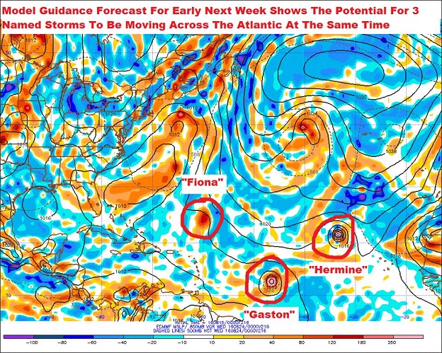
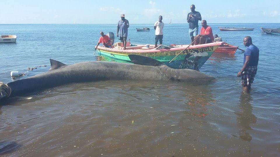
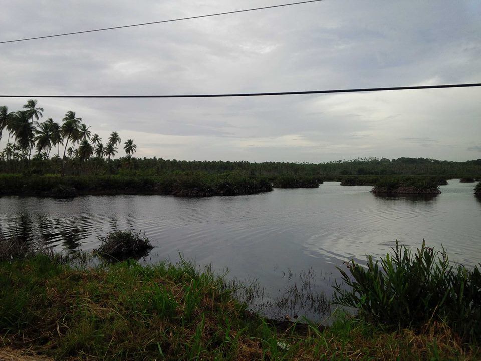
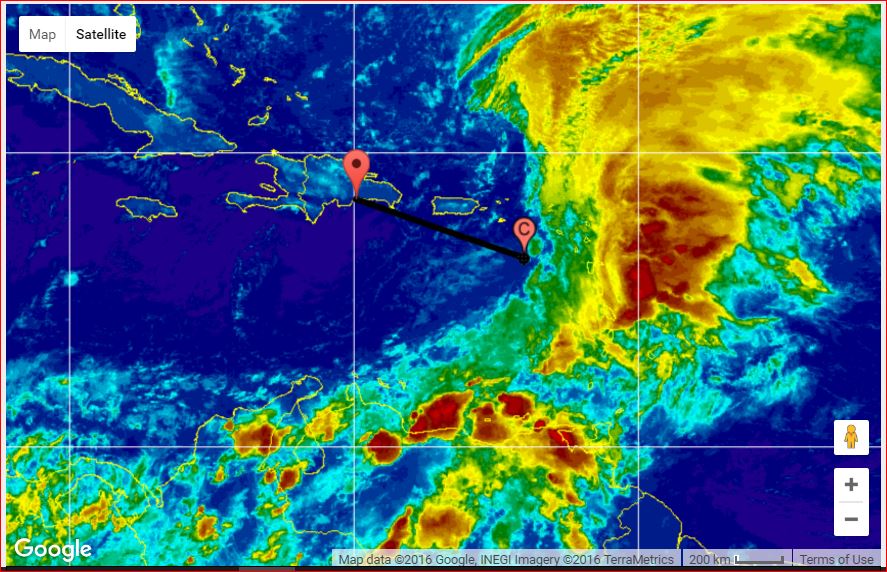
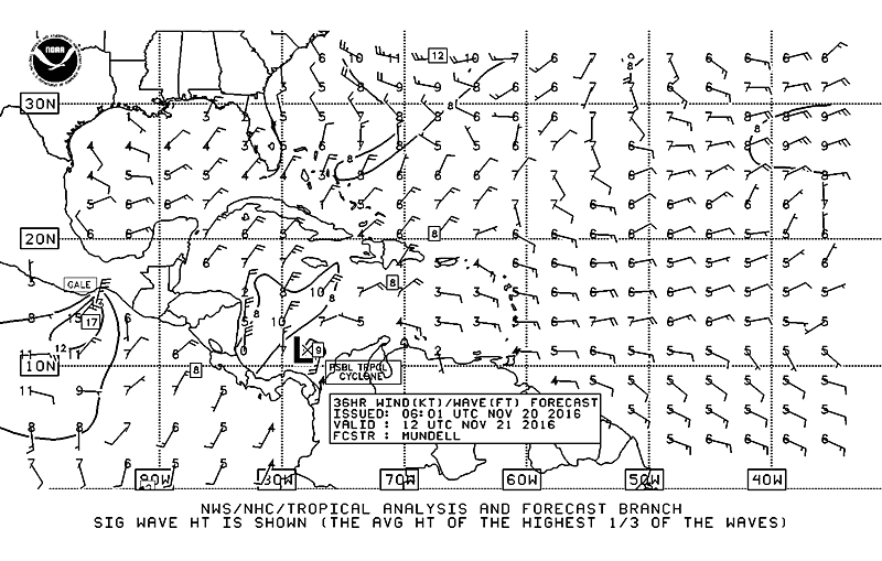
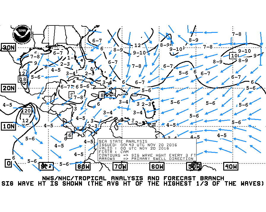
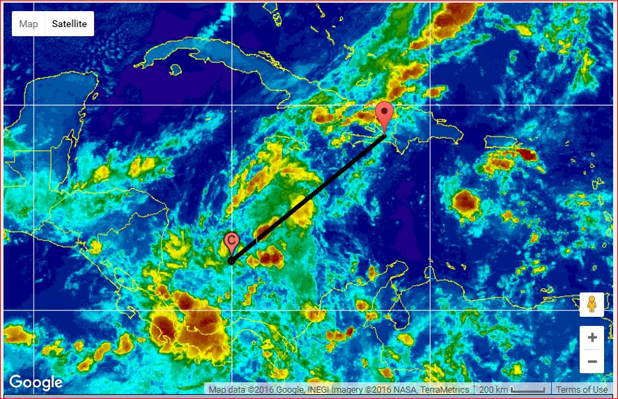
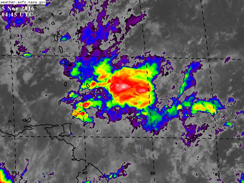
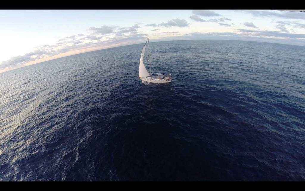
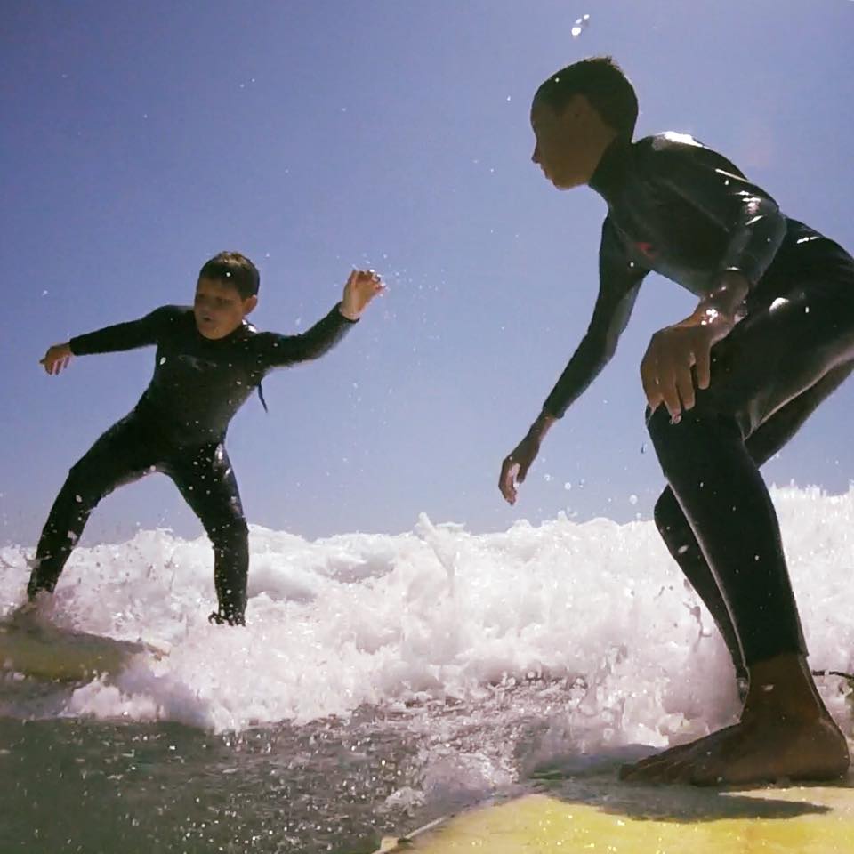
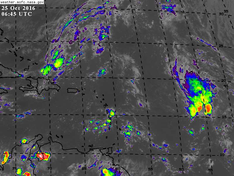
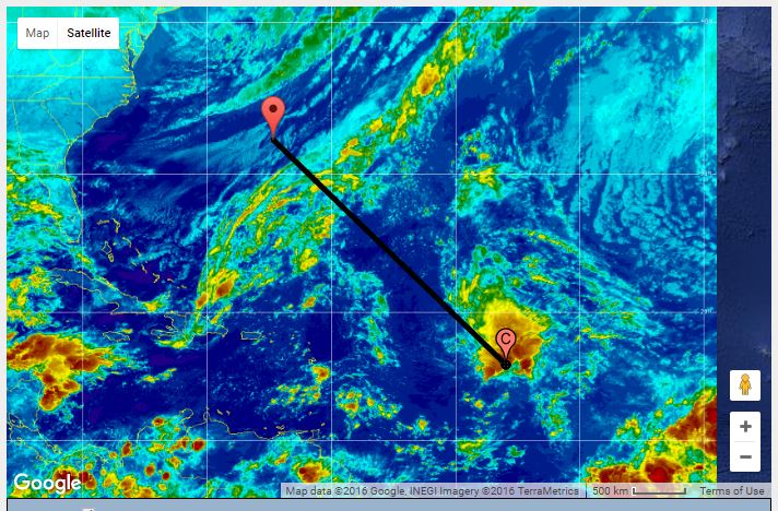
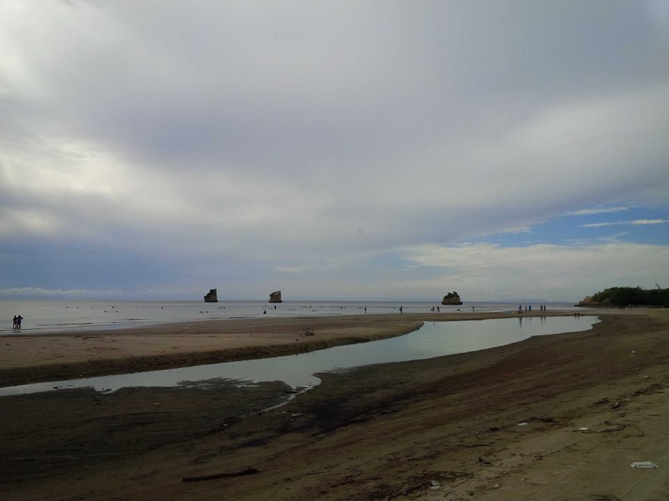
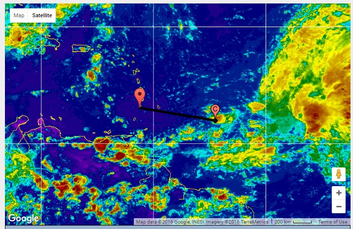
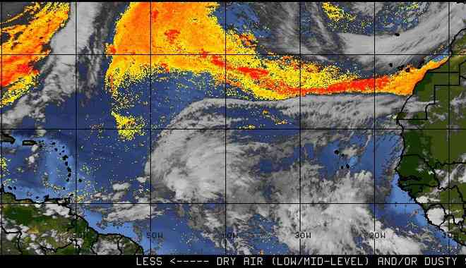
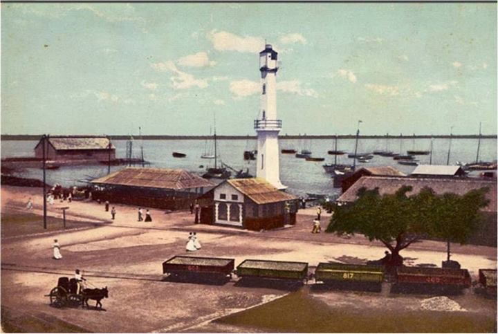
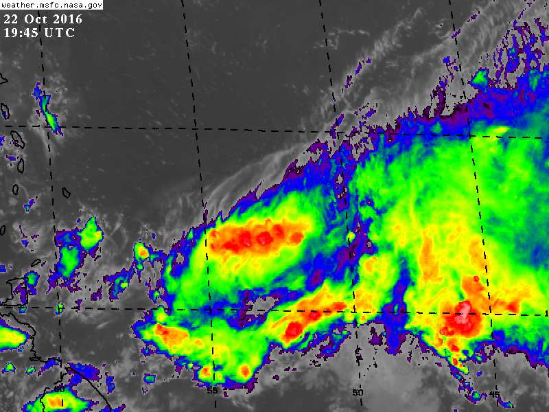
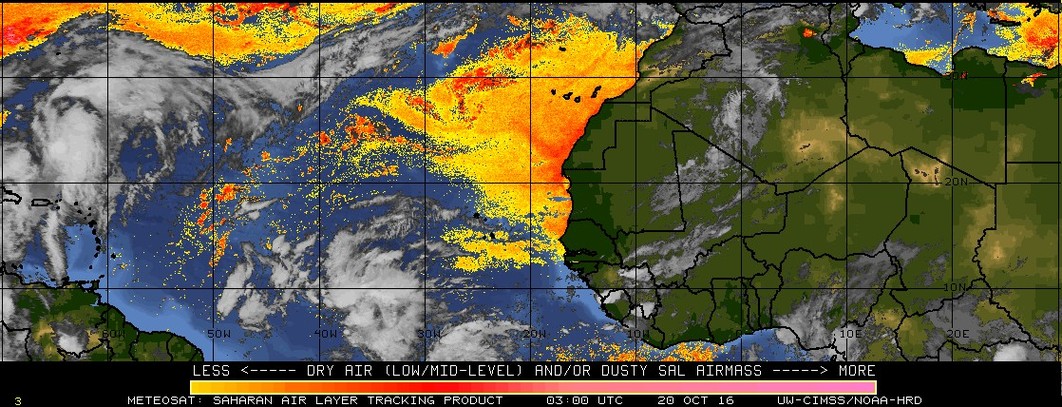
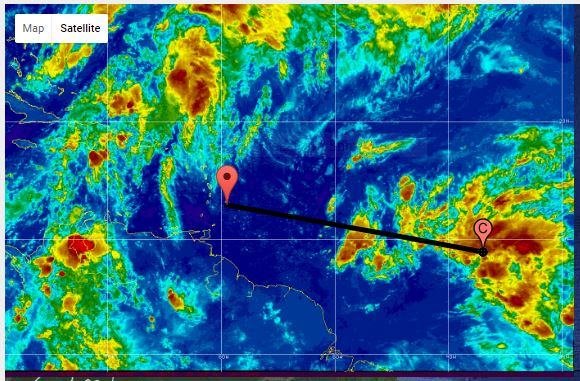
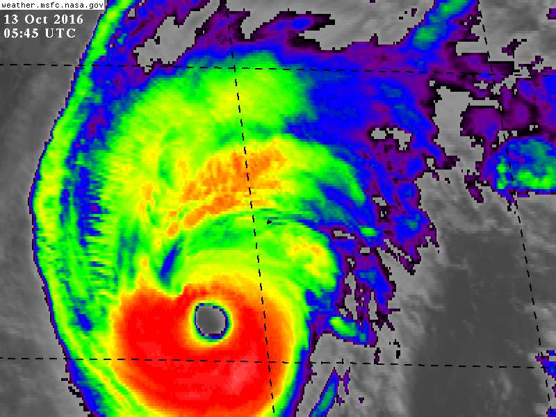
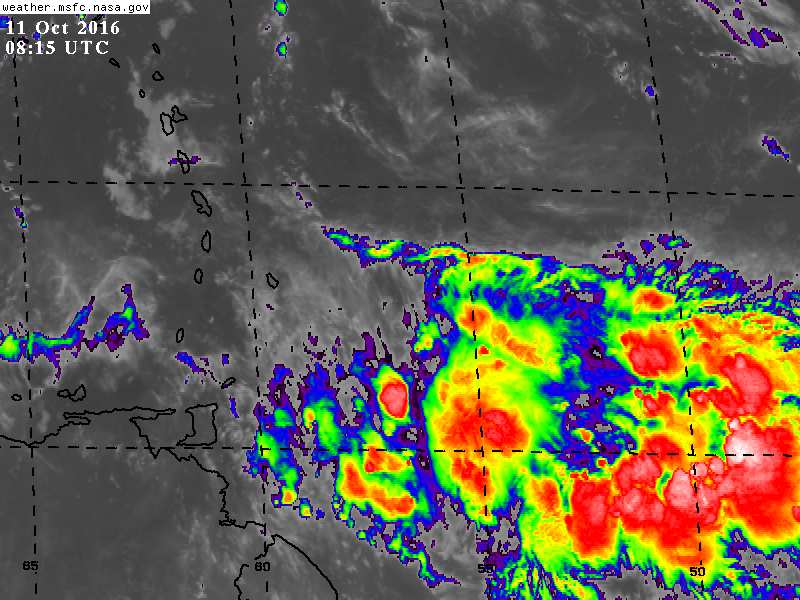
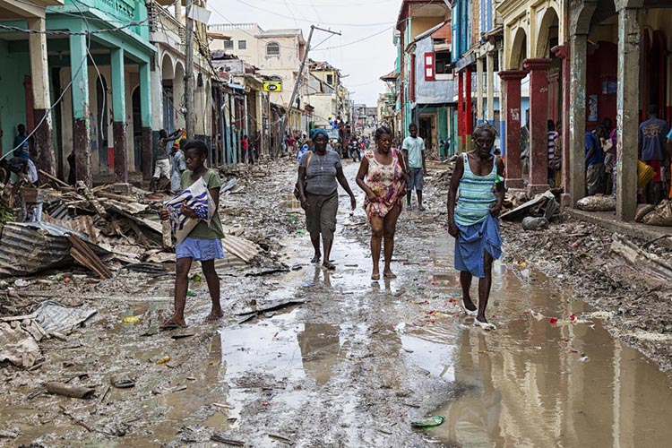
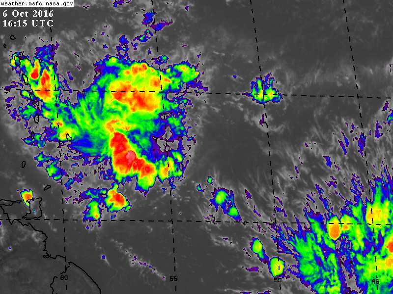
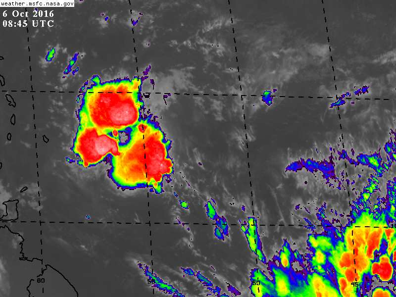
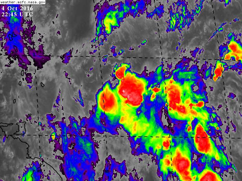
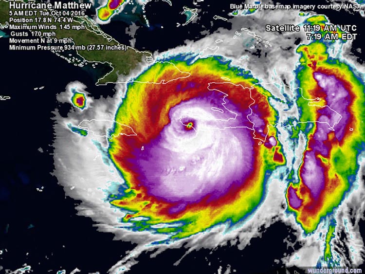
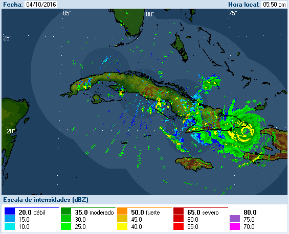
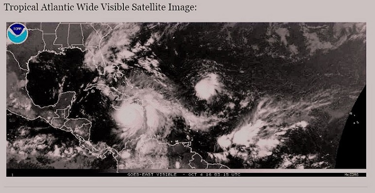
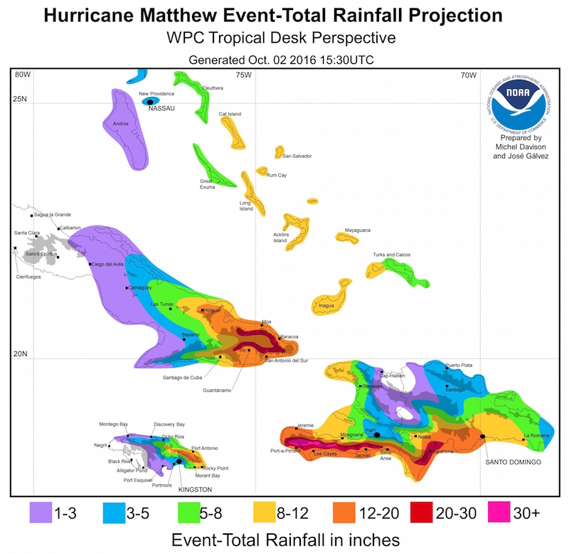
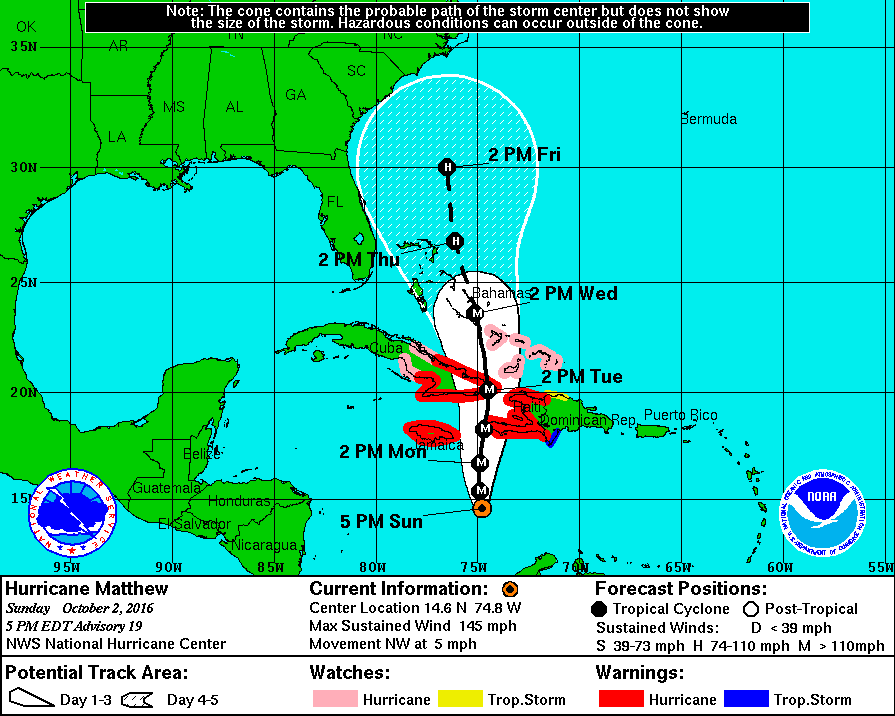
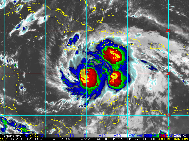
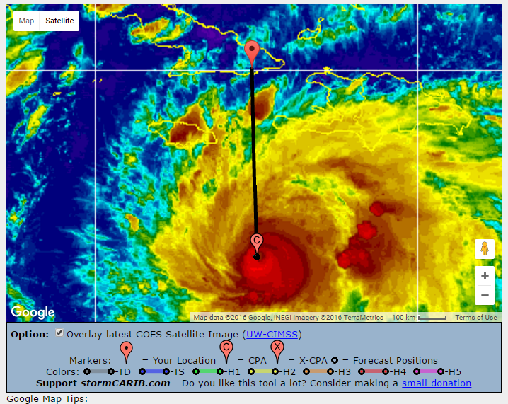
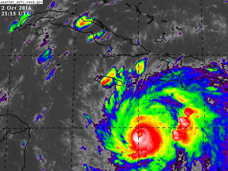
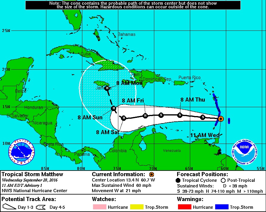
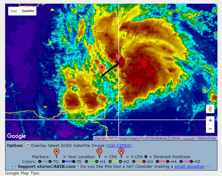
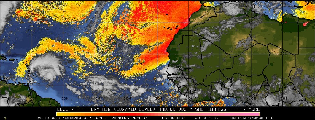
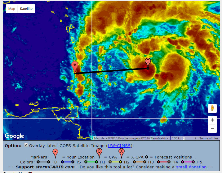
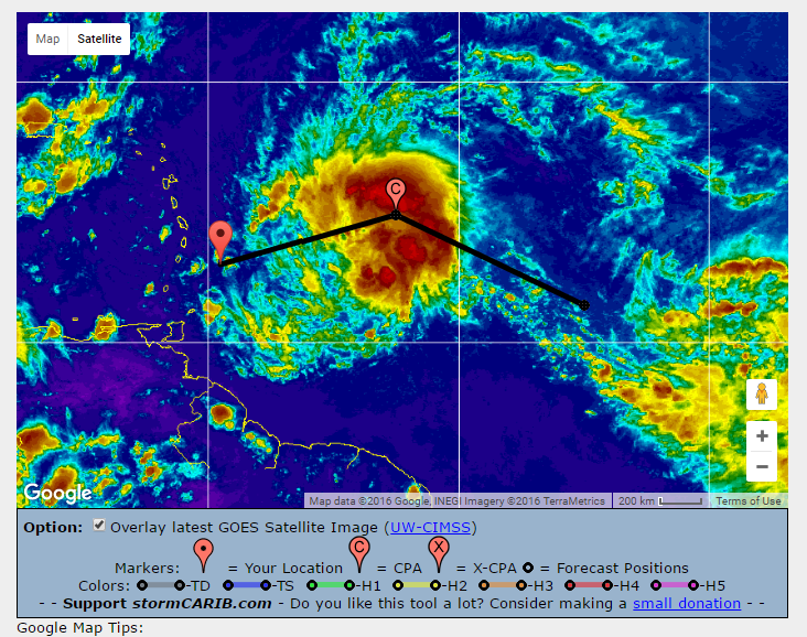
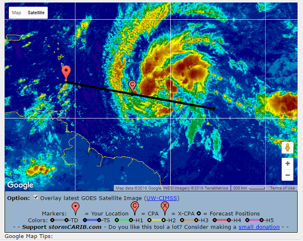
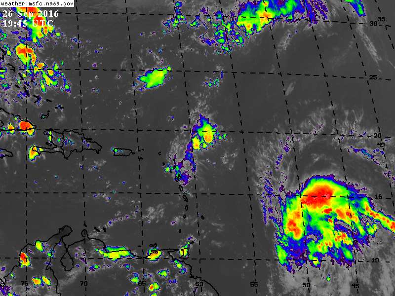
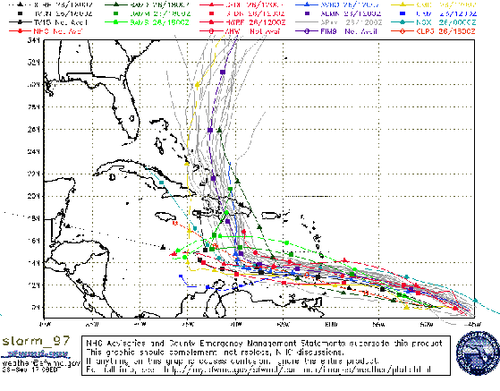
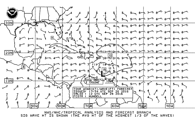
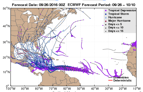
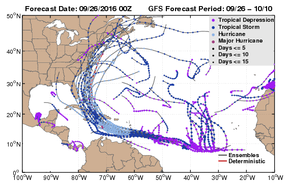
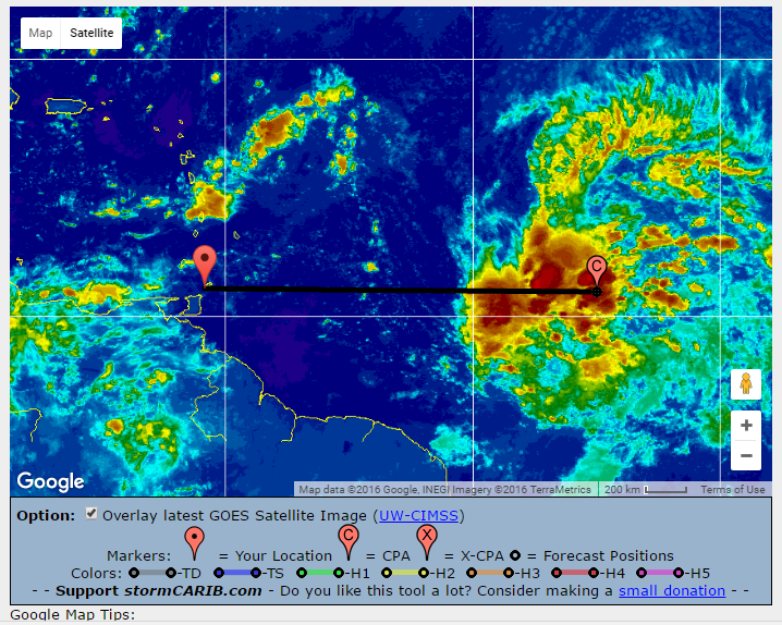
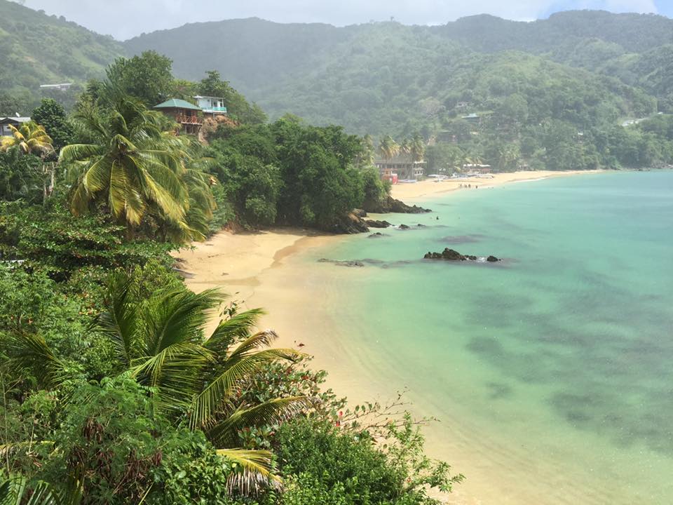
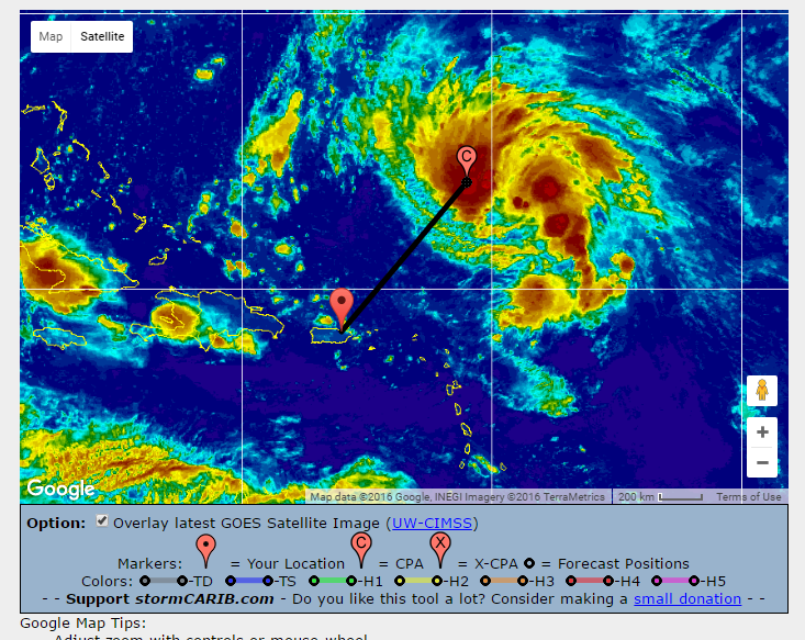
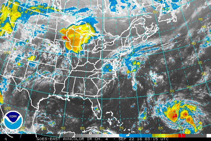
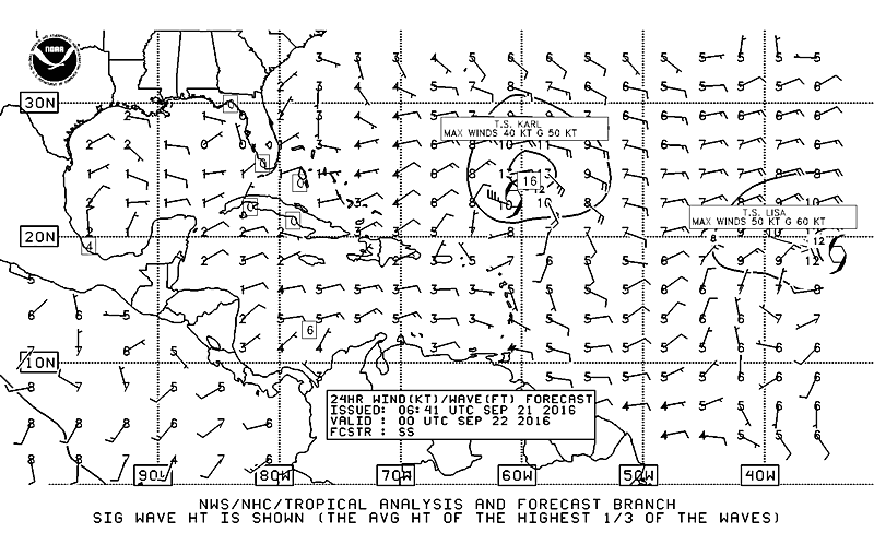
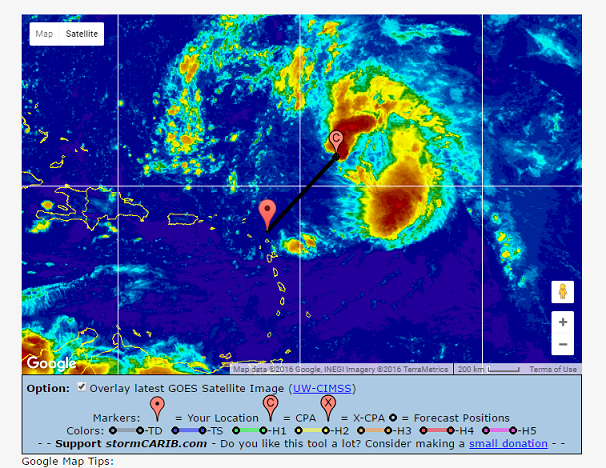
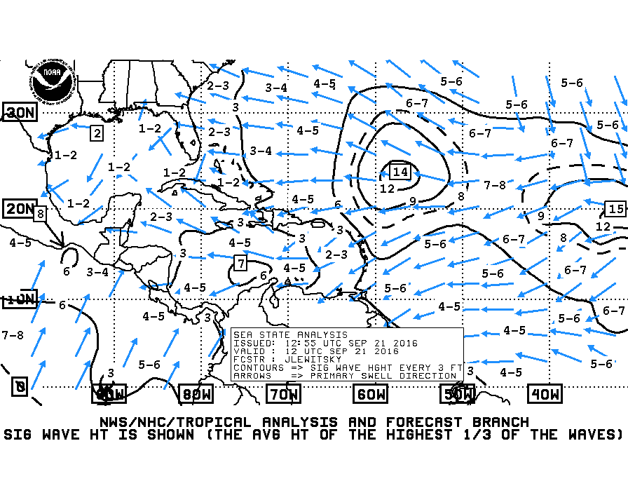
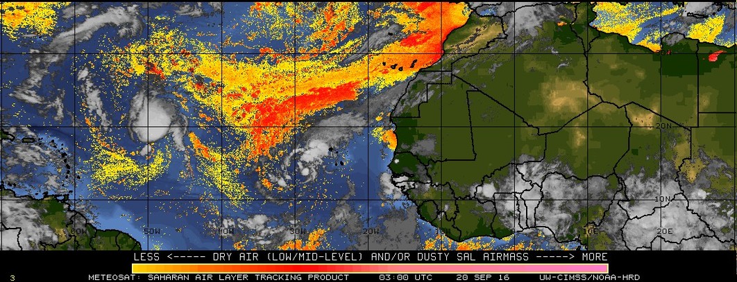
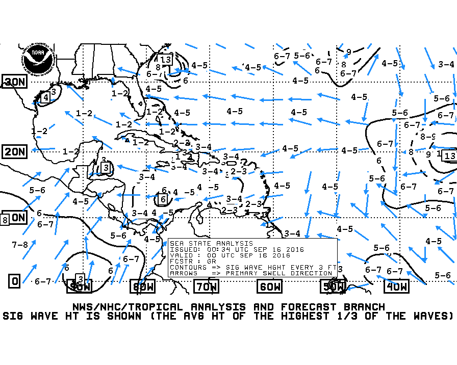
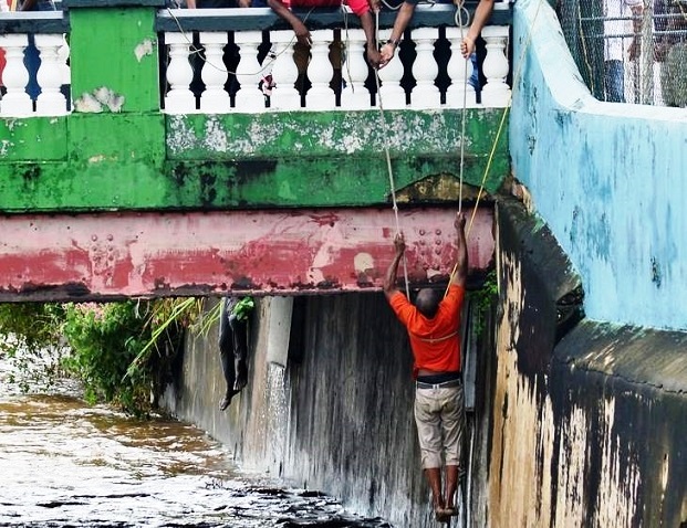
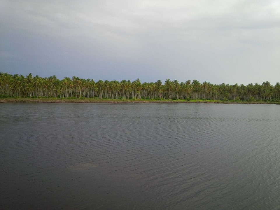
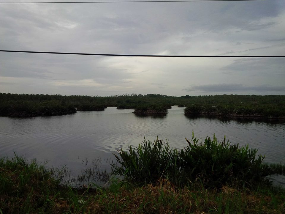
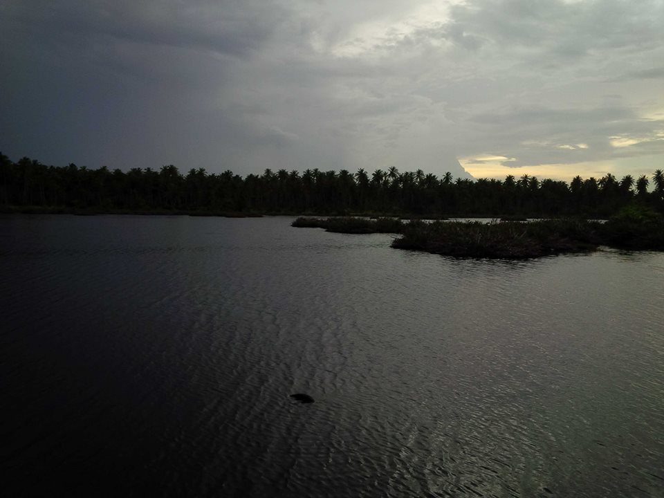
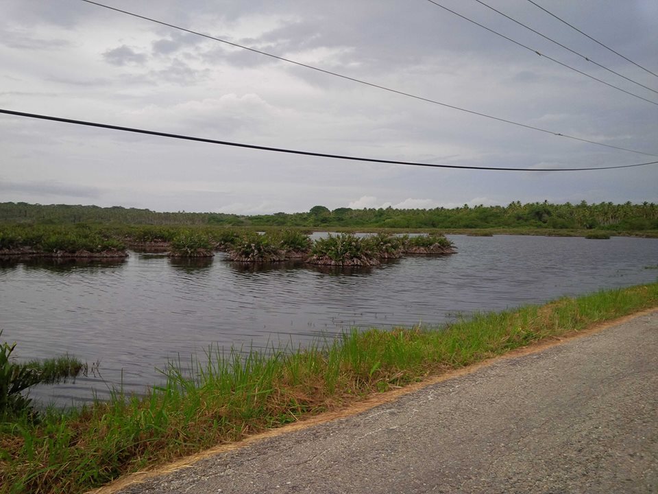
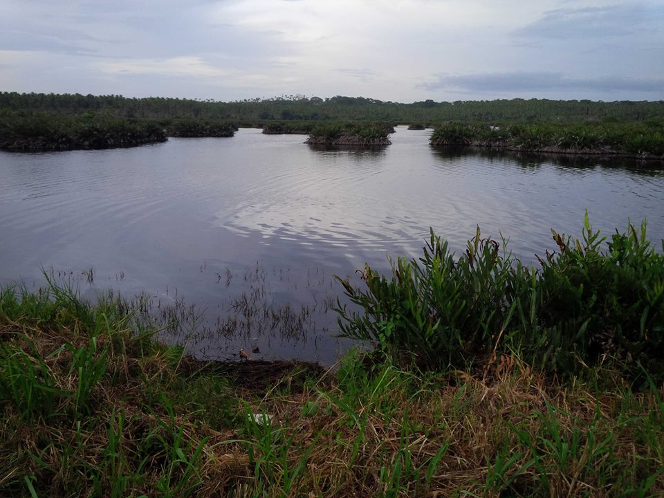
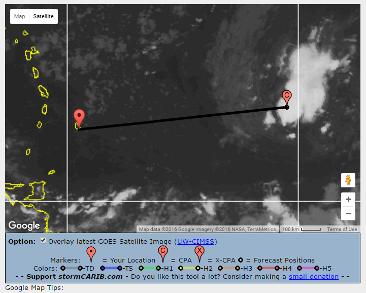
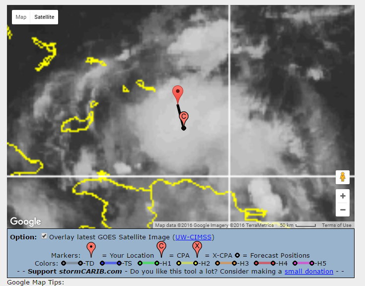
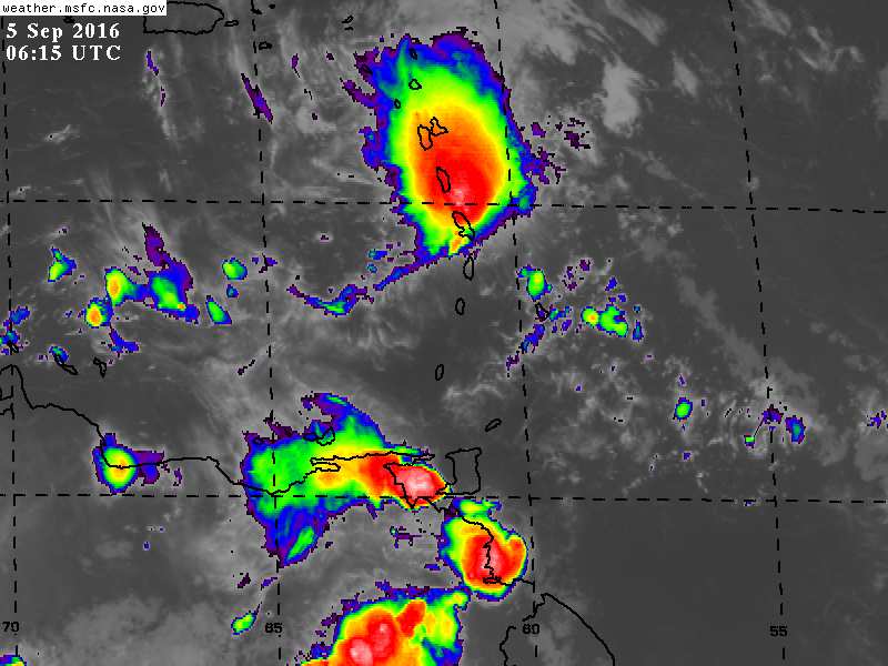
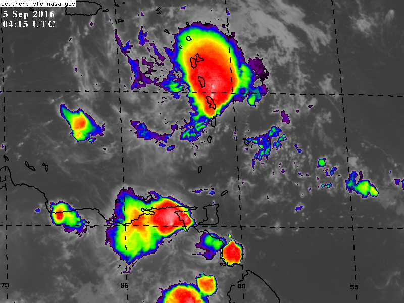
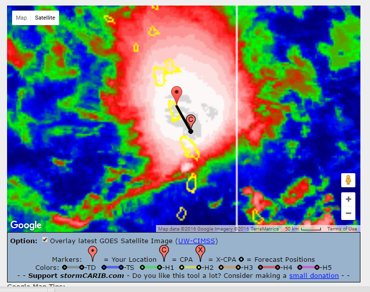
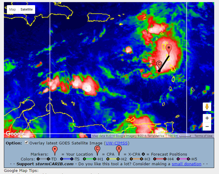
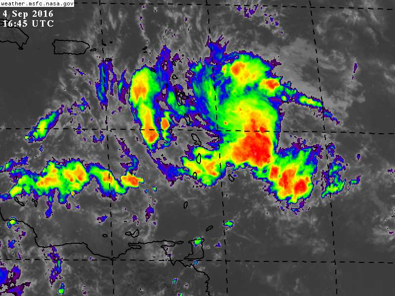
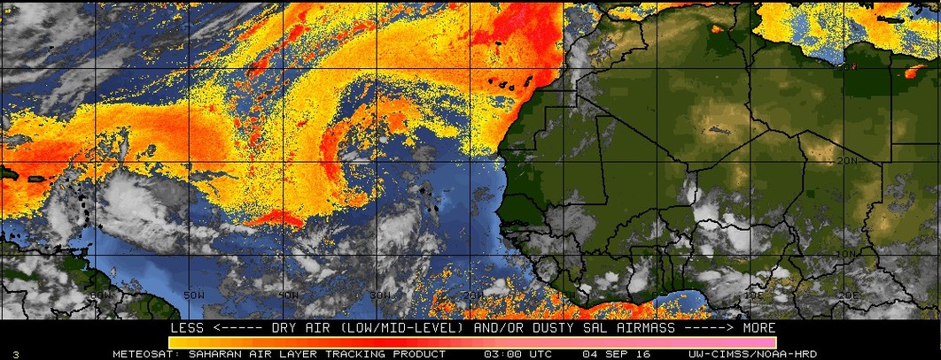
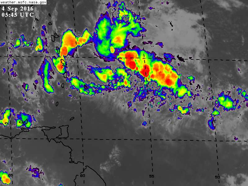
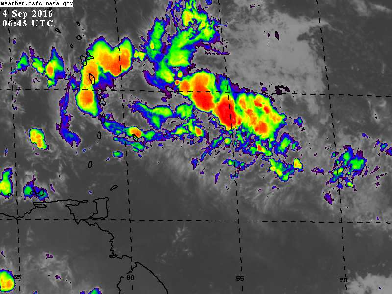
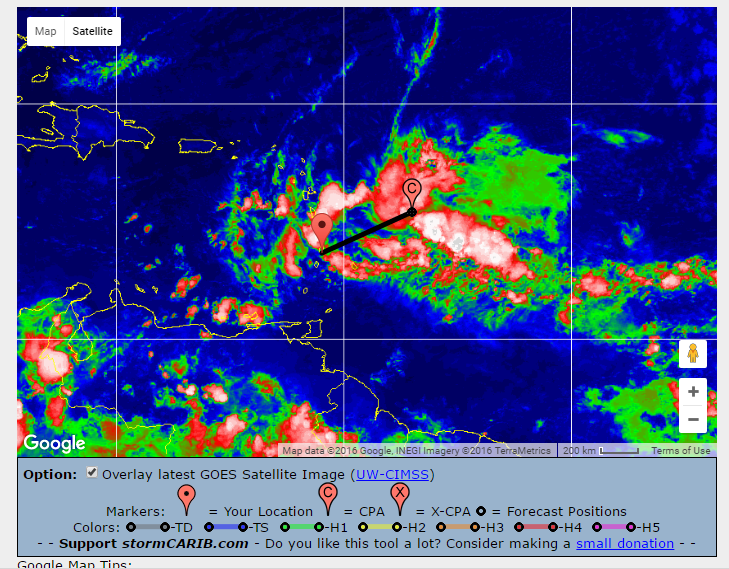
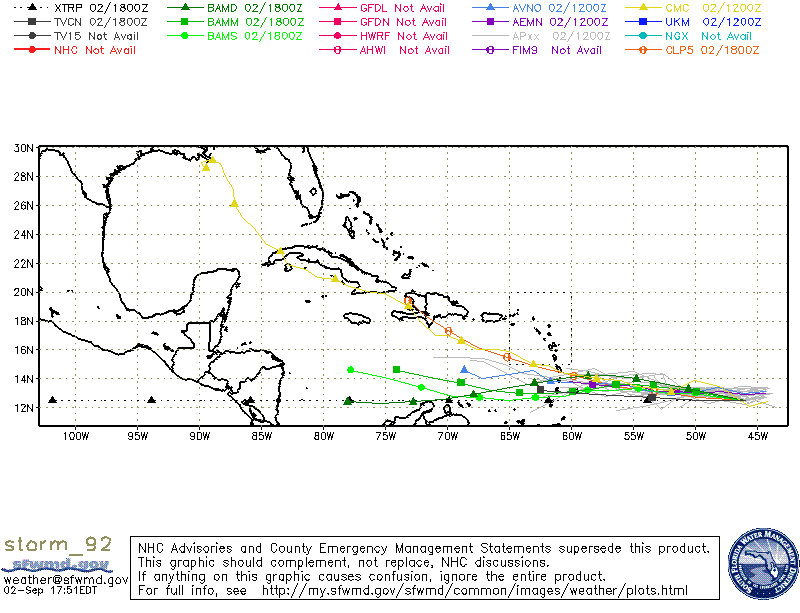
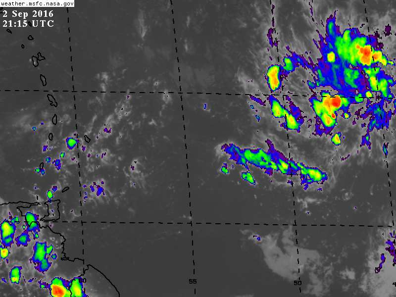
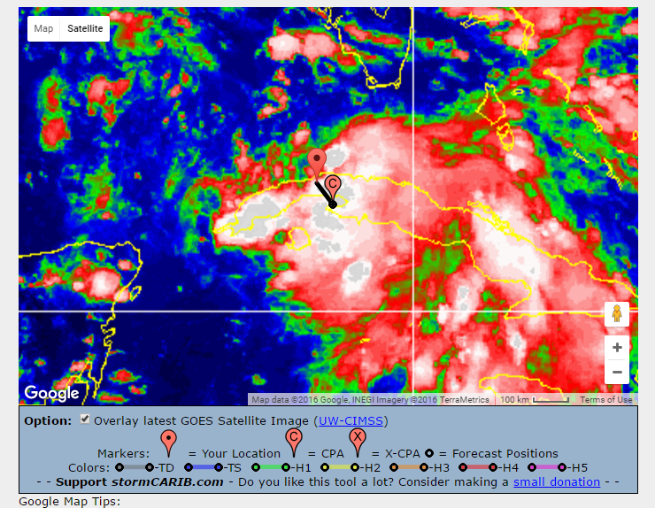
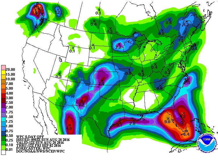
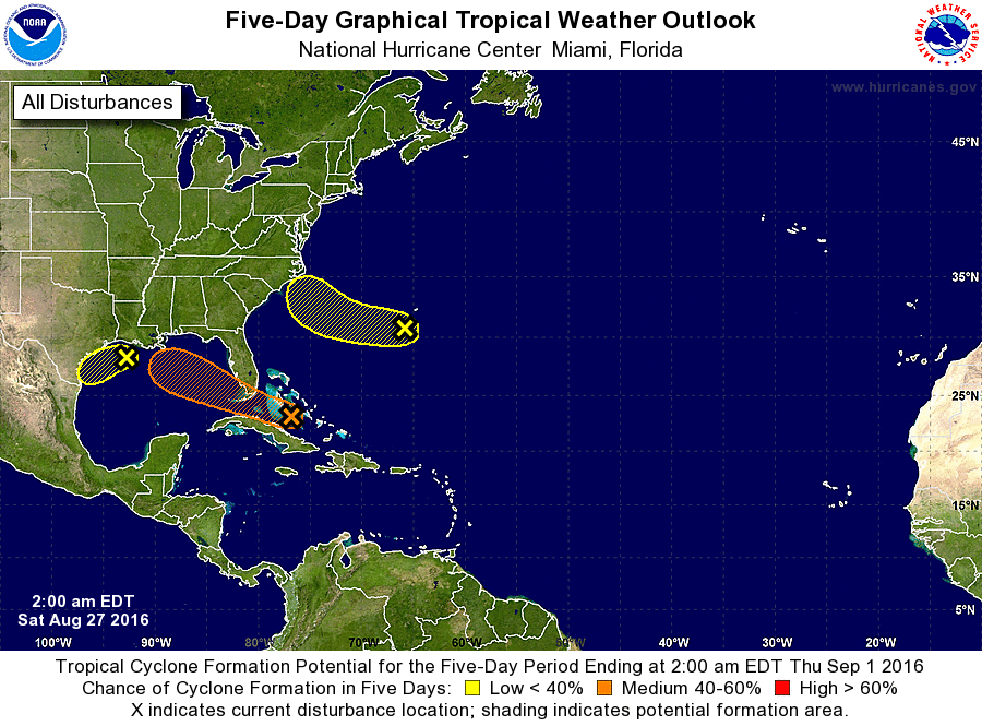
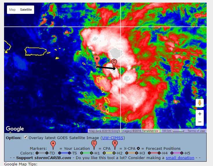
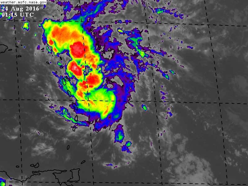
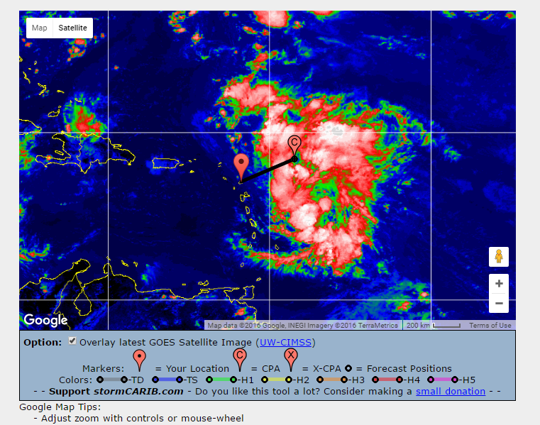
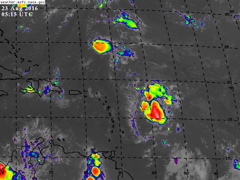
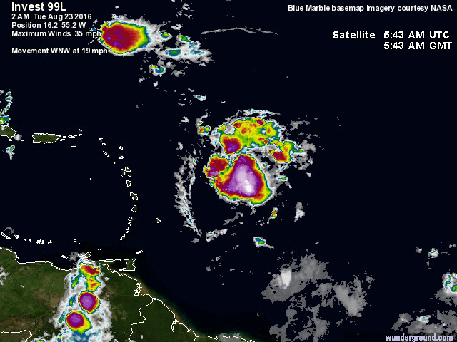
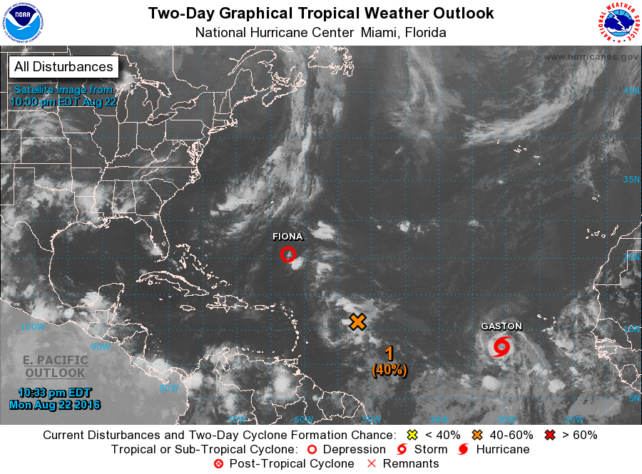
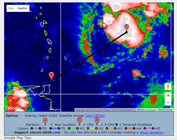
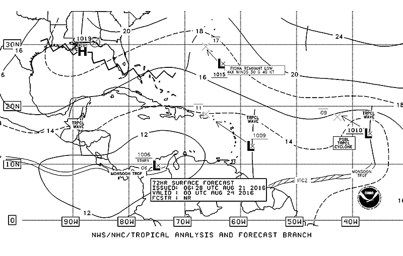
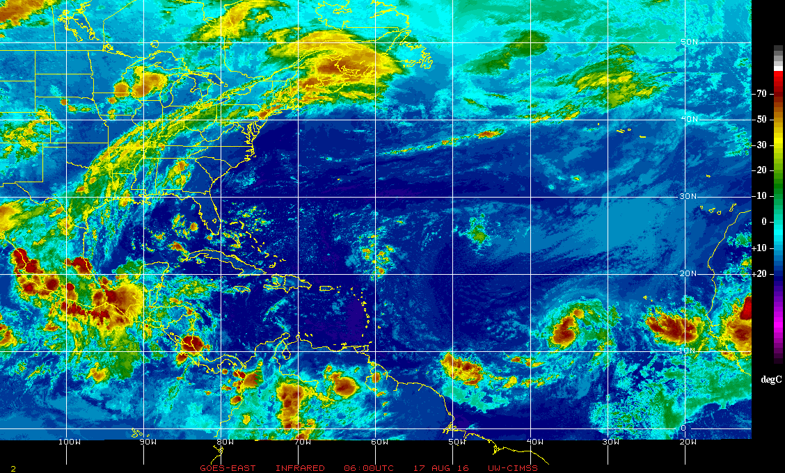
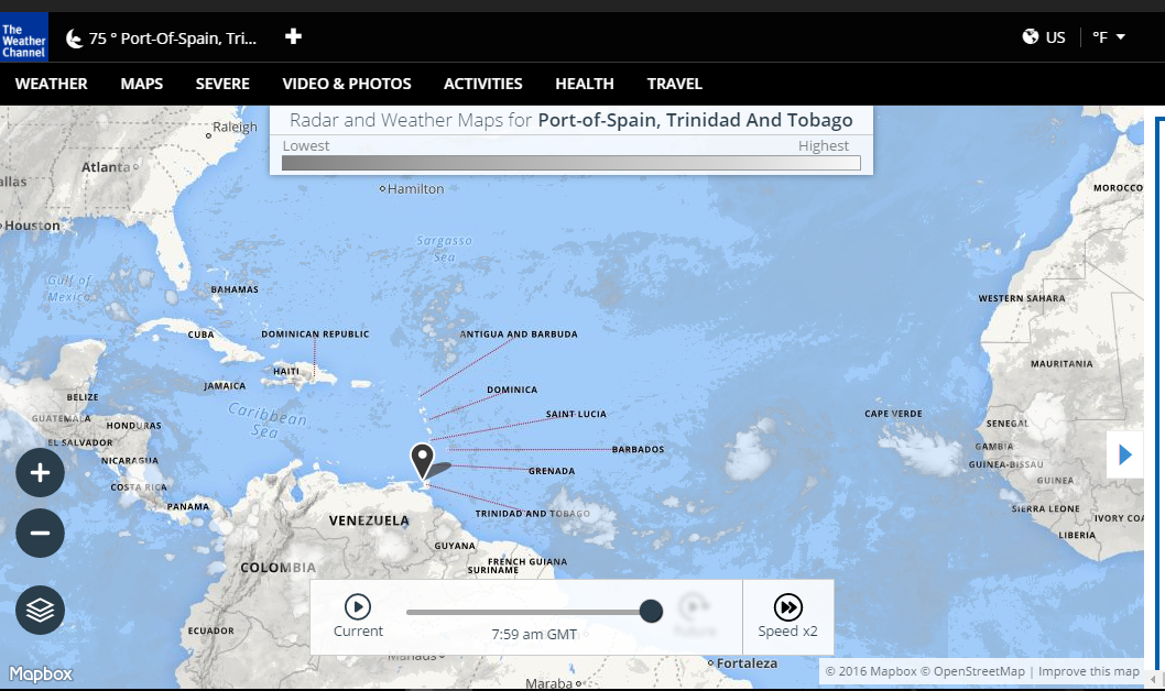
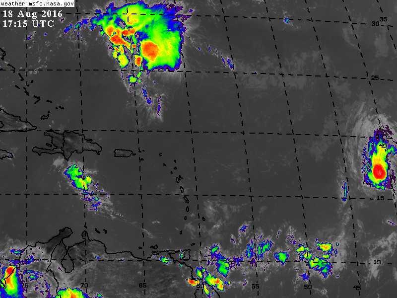
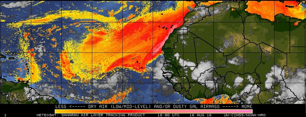
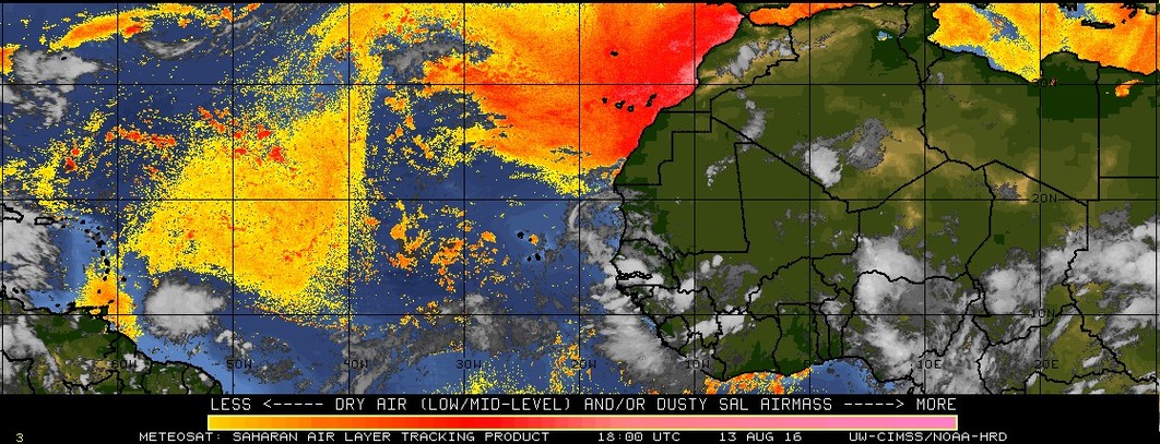
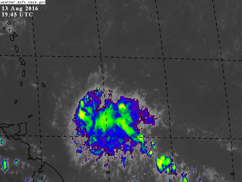
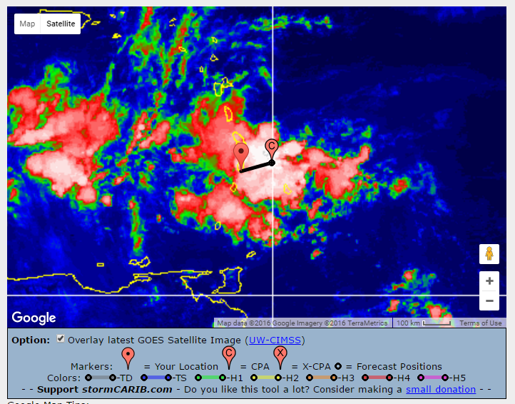
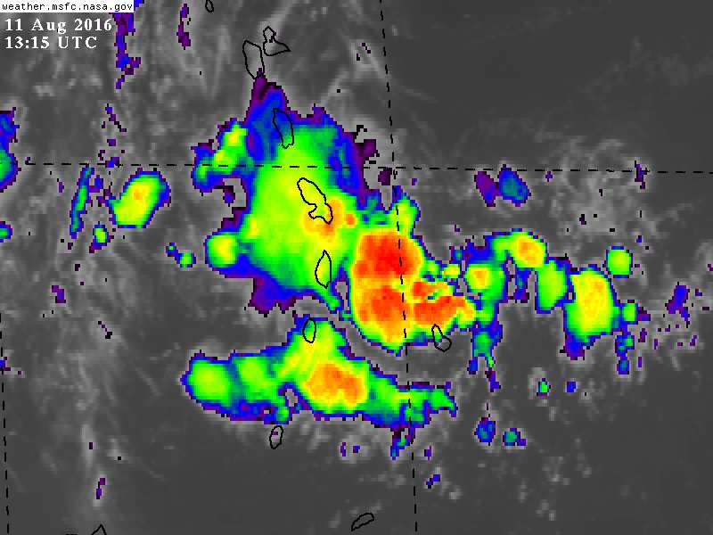
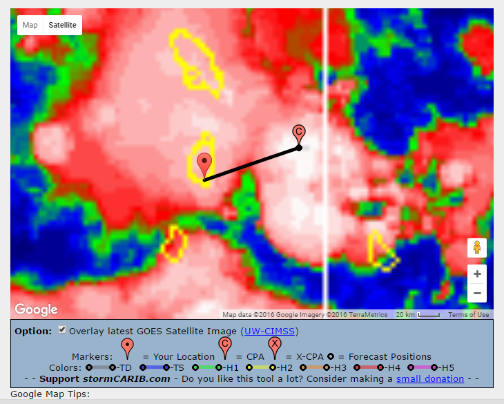
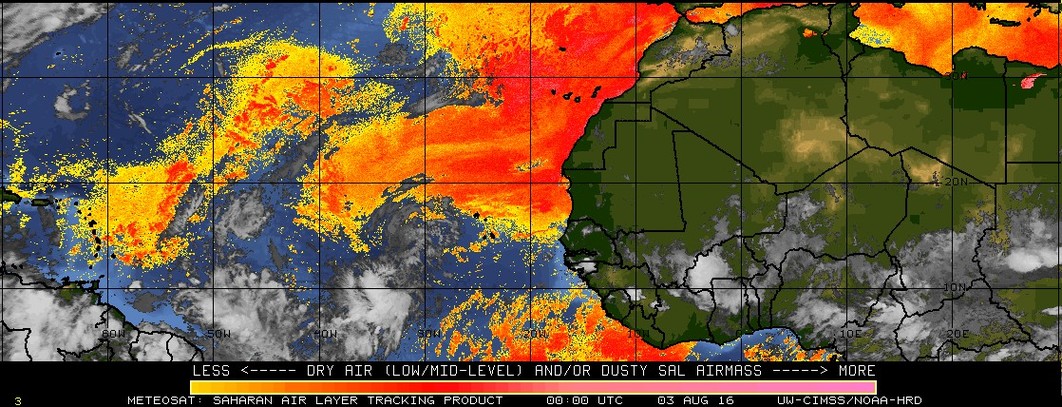
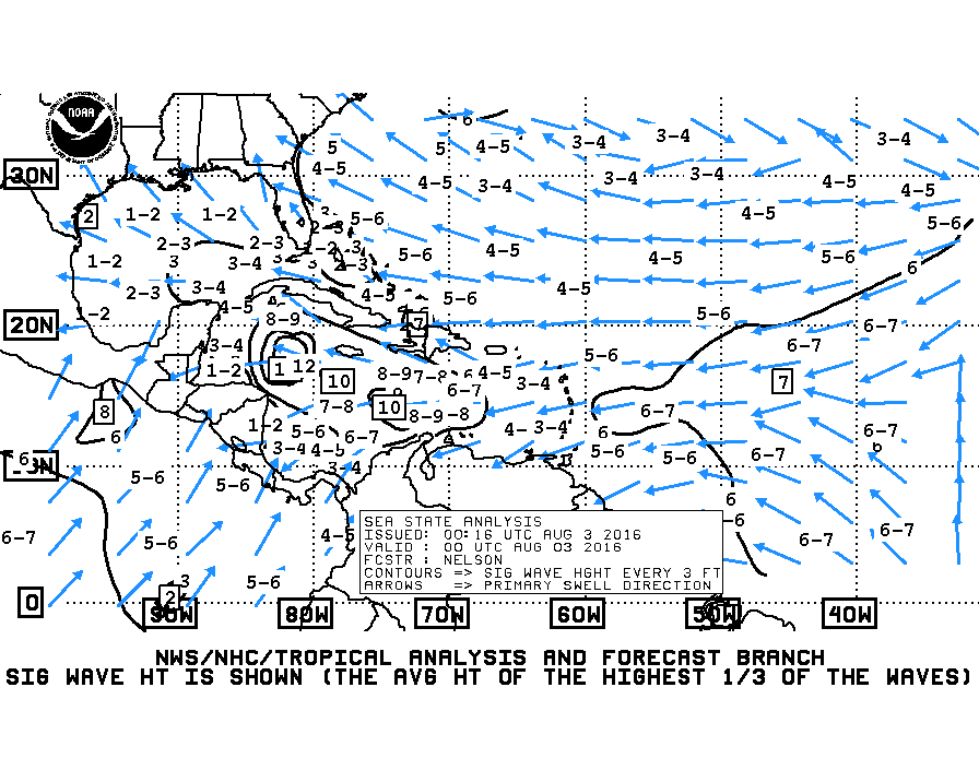
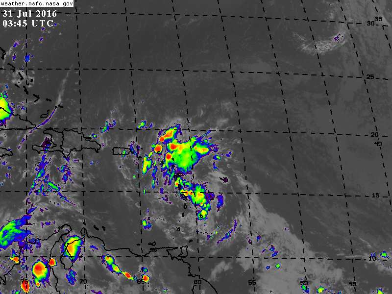
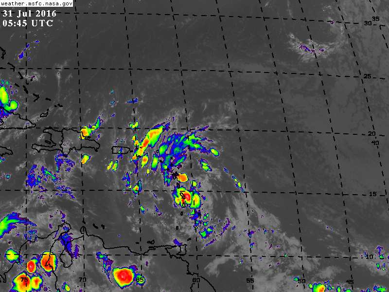
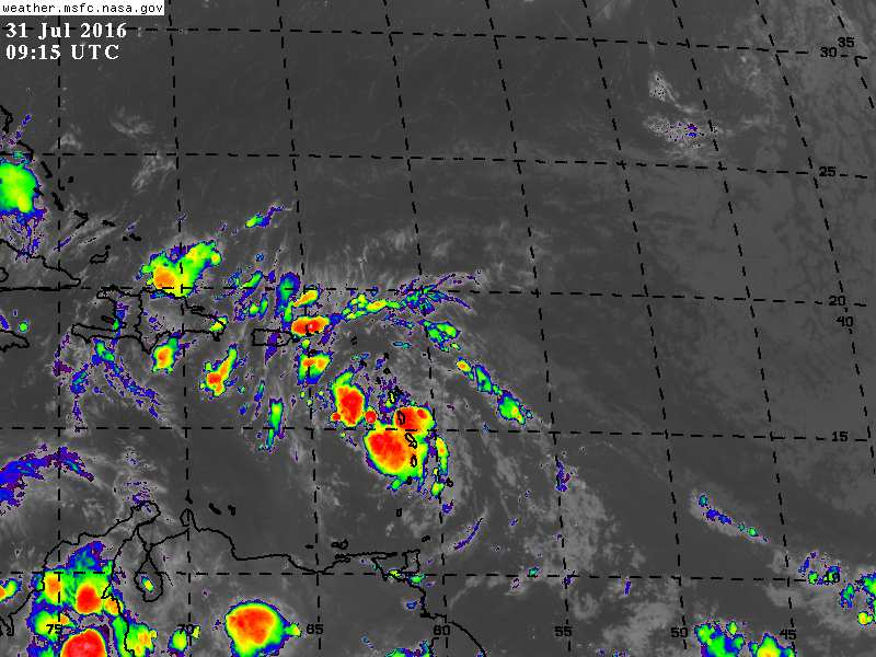
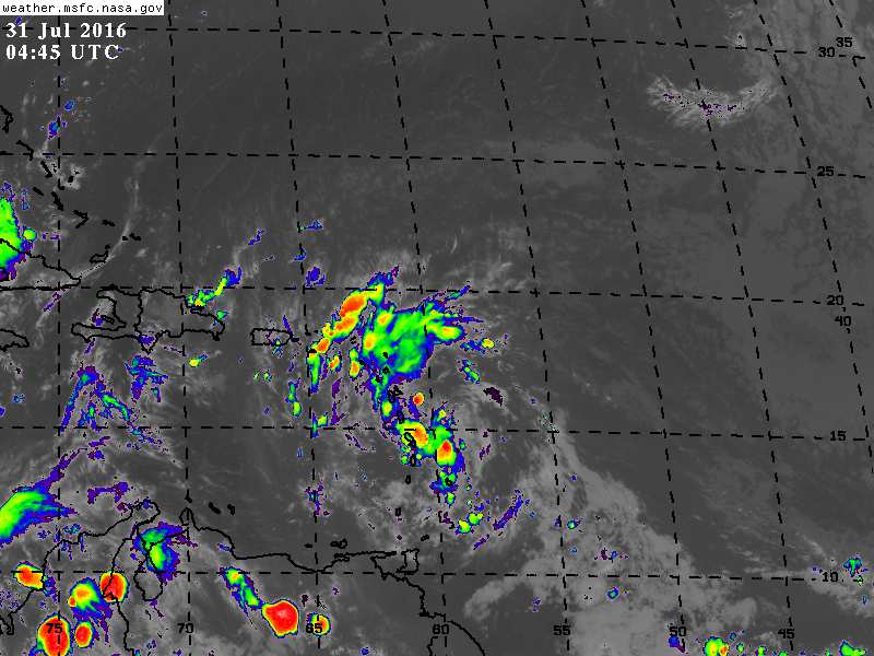
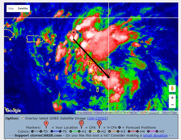
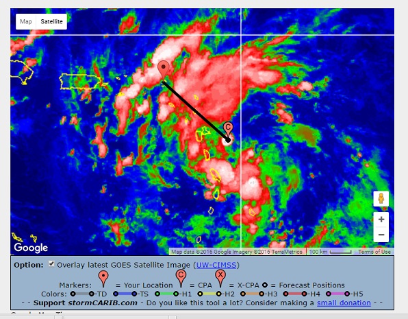
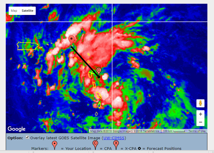
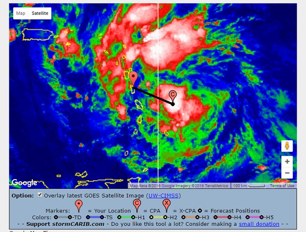
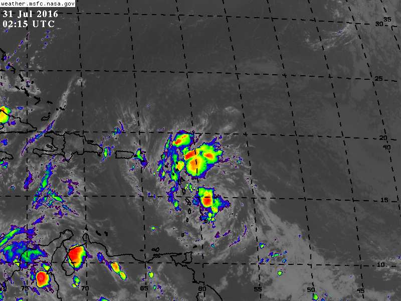
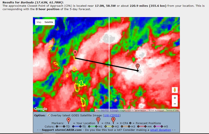
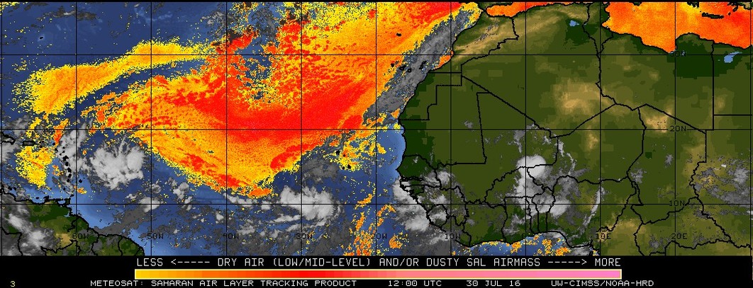
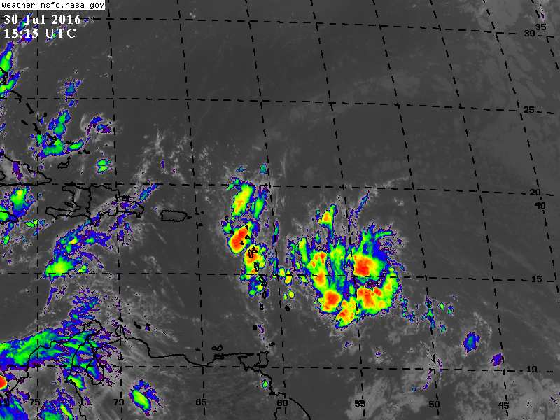
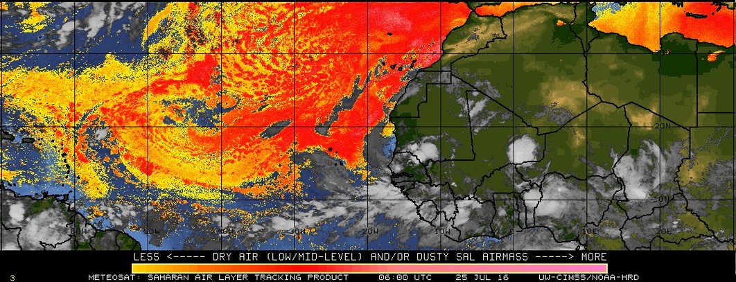
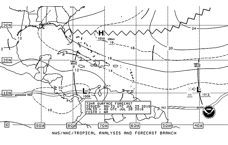
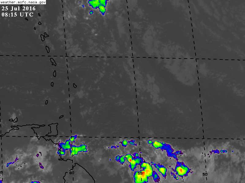
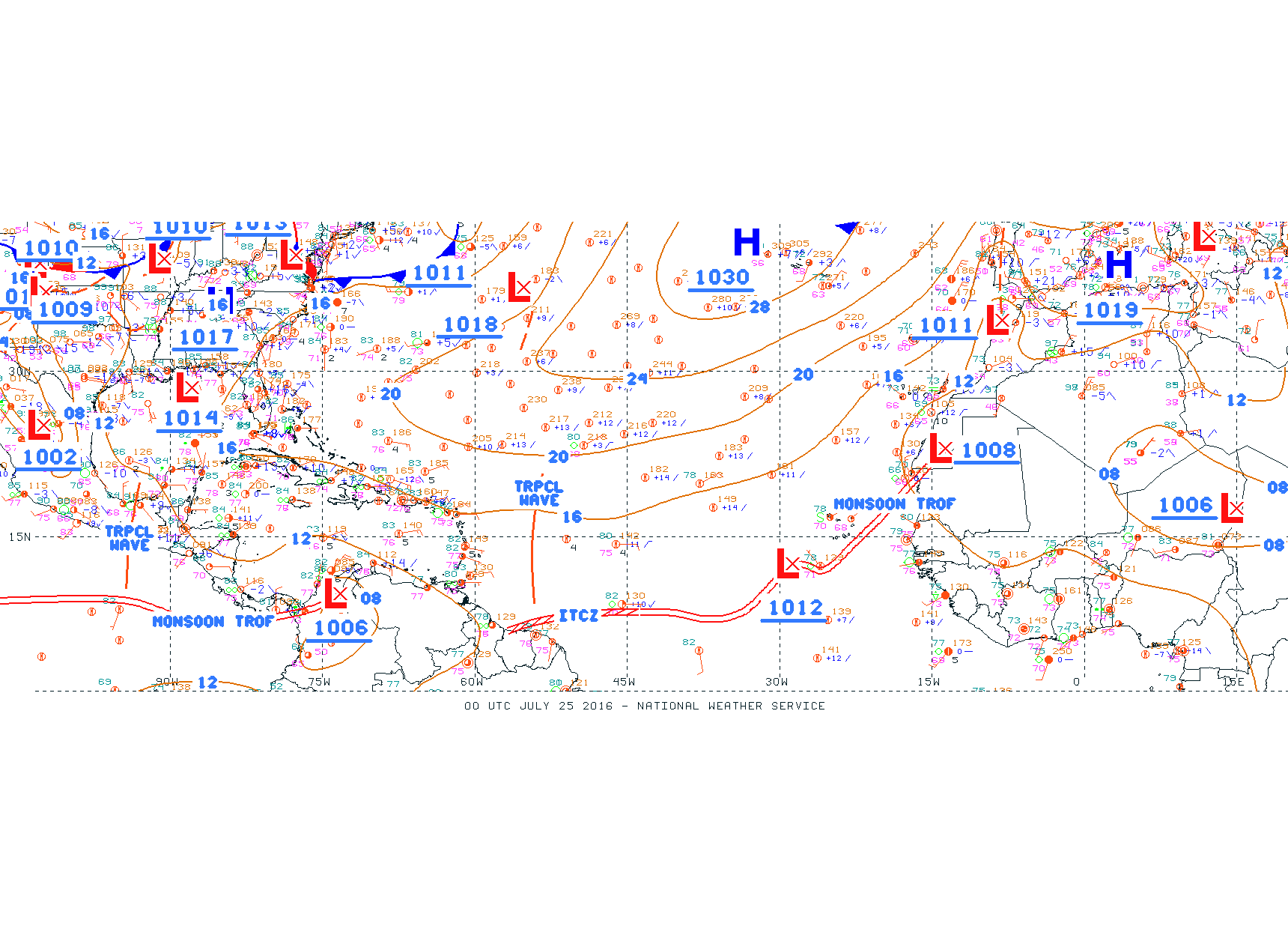
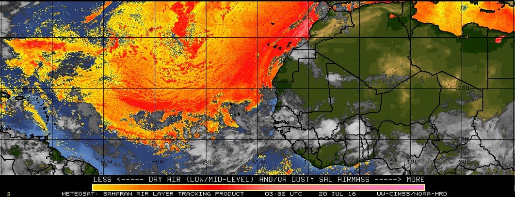
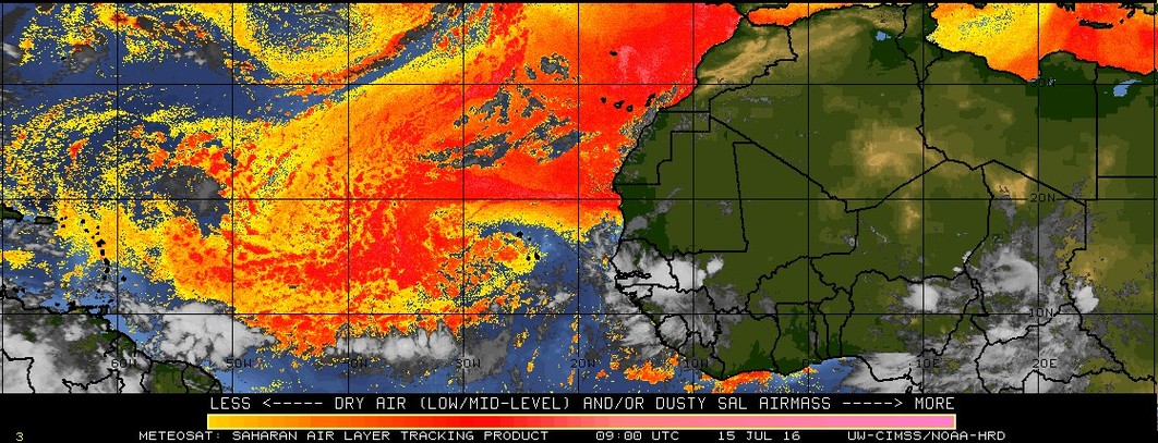
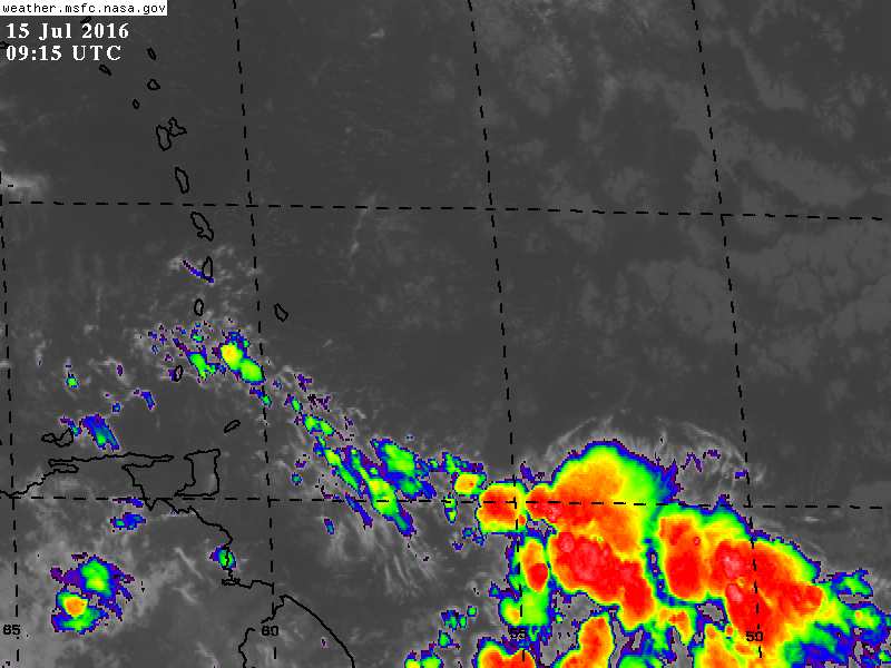
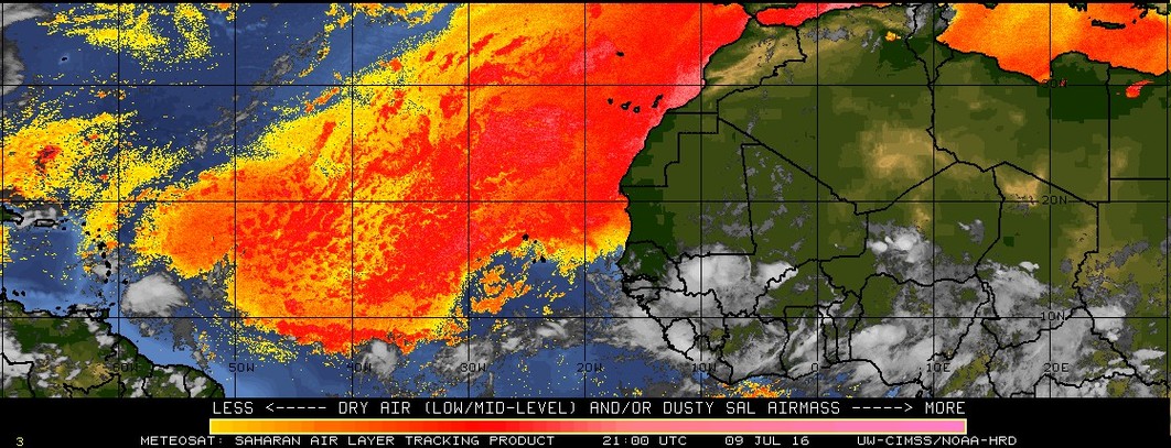
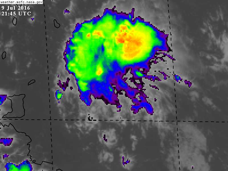
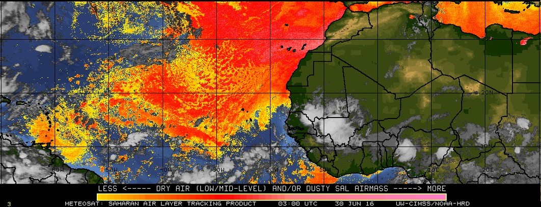
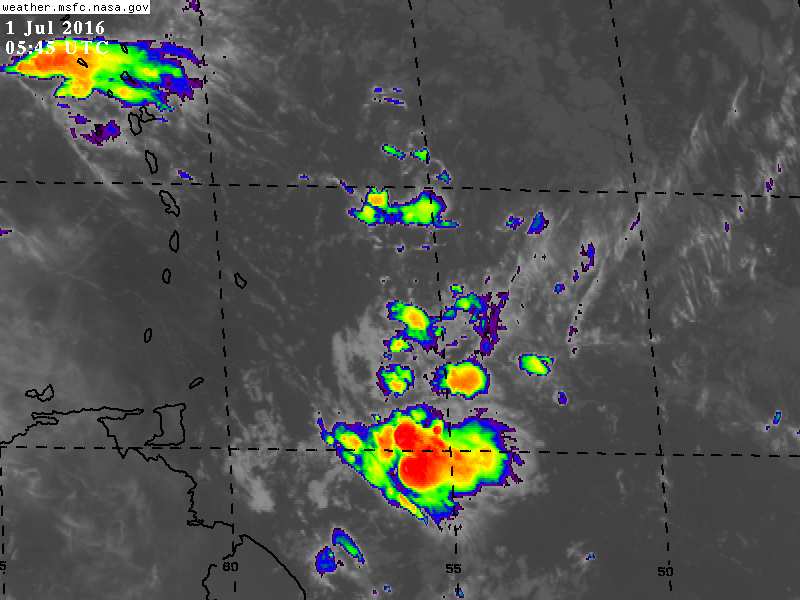
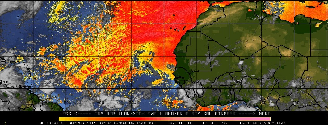
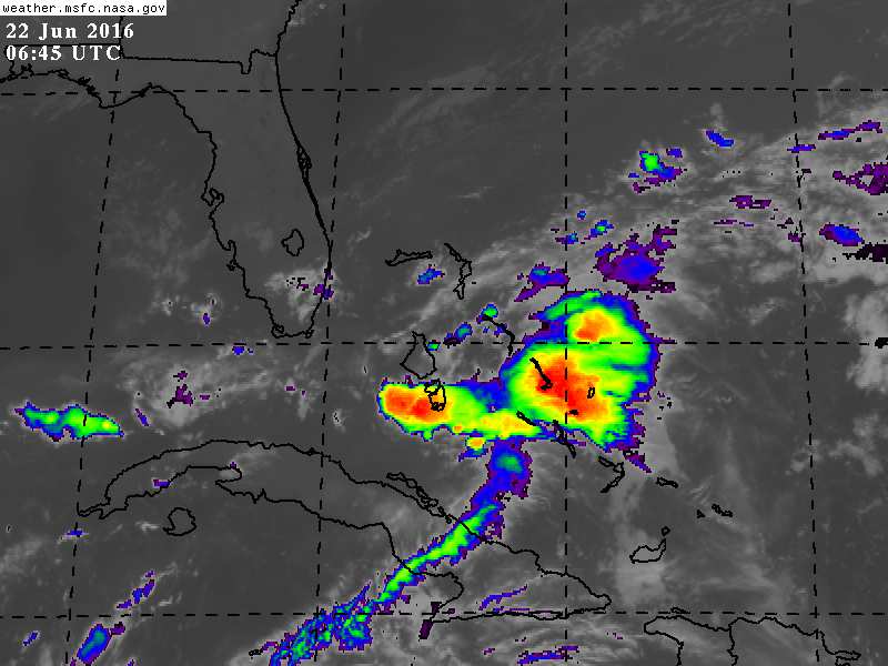
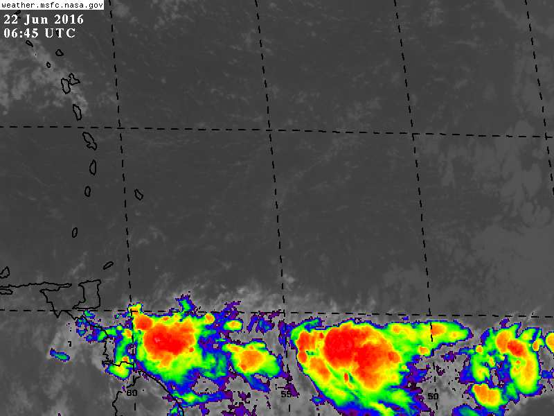
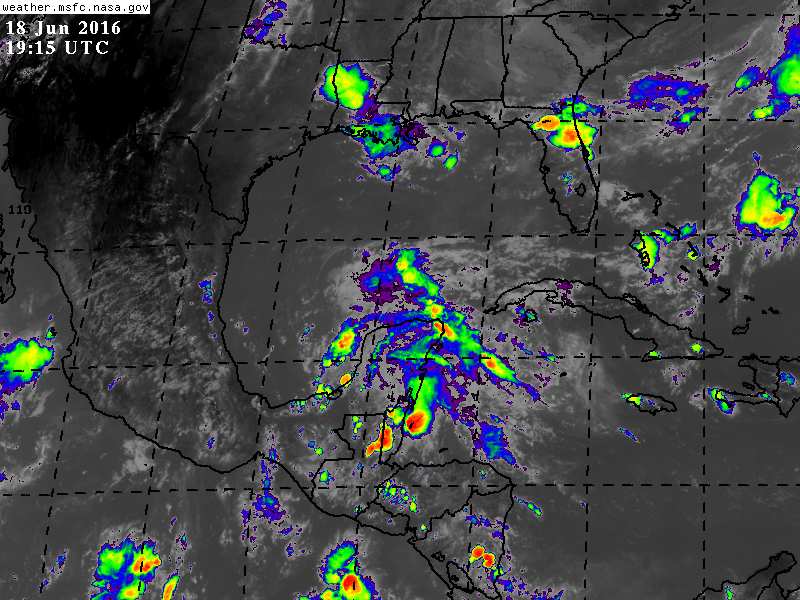
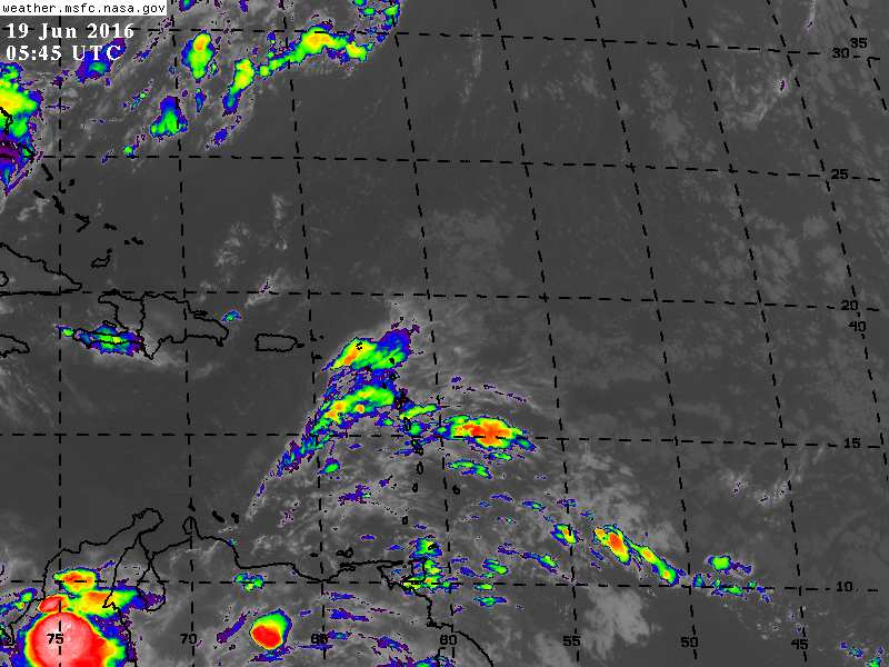
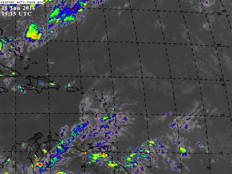
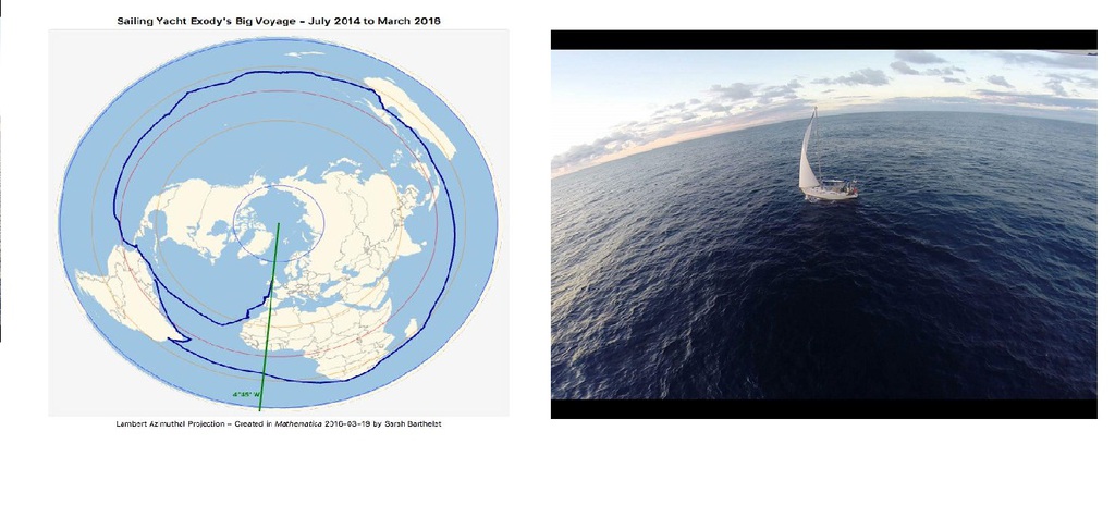
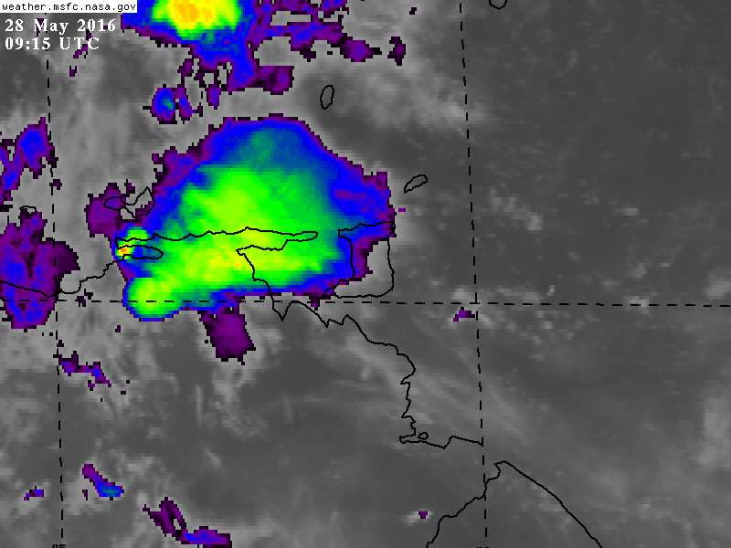
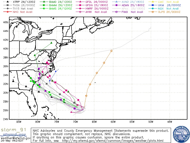
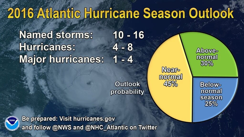
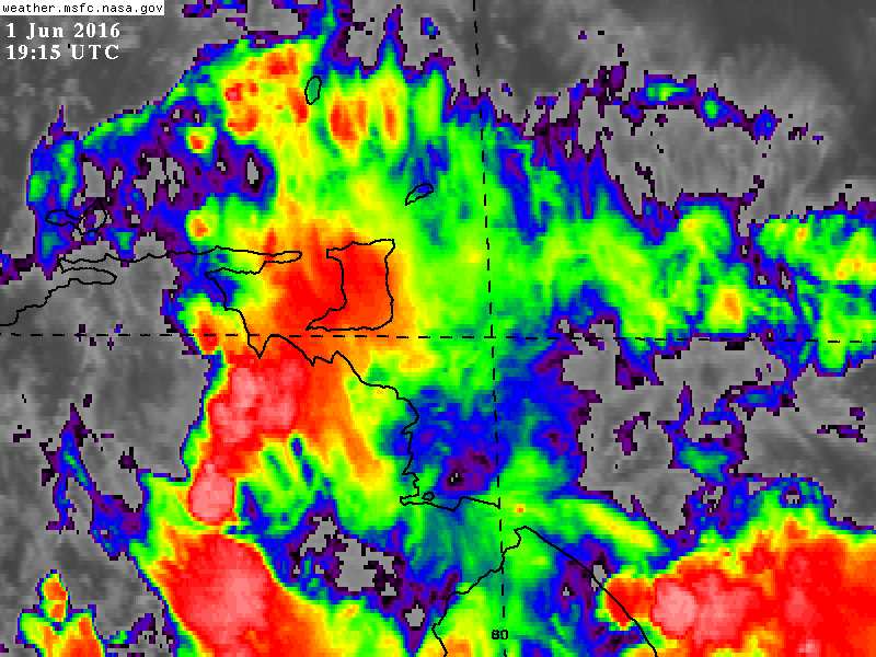
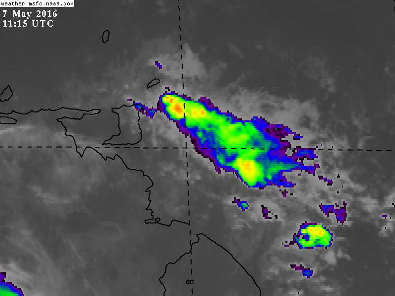
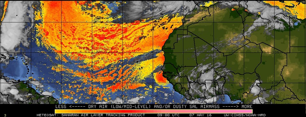