|
|
- - - 2011 Hurricane Season - - -
|
- rain and 3 m waves
|
- By marcus at dushicuracao.net
- Date: 21 Dec 2011 12:09:01 -0000
|
Bon dia, good morning,

the seasonal rain, winds and waves have arrived:
44 km/h E 97 degrees winds are producing waves up to 3 meters in the open sea
and near the shore in the shallows these waves can reach 4 meters. Boaters,
shore divers, and visitors at Boca Tabla National Park at the north side of
Curacao should especially be very cautious near the northern shoreline.

At the southern shore the sea is rough but the beaches with breakwaters at Sea
Aquarium Beach and Maripampoen and the hotels are safe for recreational
snorkeling and swimming. Boaters in small vessels are advised to not go out to
sea due to the poor visibility produced by the rain and the big waves.

This morning at 6 am 4 mm rain was measured at Brievengat, and currently it is
still raining. The outlook for today is isolated heavy showers with 90 percent
overcast sky.

According to the forecast it will be sunny again tomorrow, but the wind will be
stronger and the waves in open sea can reach up to 3.8 meters

Better be safe than sorry y'all.

Godspeed to all


TeamCARE
Curacao Animal Rescue and Education
http://www.curacaowildlife.com
Like us and interact with us at http://www.facebook.com/curacao.animal.rescue
|
|
- rain? rain? rain? Curacao are you ready??
|
- By marcus at dushicuracao.net
- Date: 4 Dec 2011 04:42:45 -0000
|
Hello folks,

IU hope that everyone has followed up on the warning to make preparations for
possible flooding in the usual places in Curacao starting in the AM today on
December 4th 2011.

From the end of the hurricane season till about February 2012 is an exciting
time of Curacao with allot of cat tails coming down from the clouds these days
with just one having touched ground so far.

A waterspout is inevitable it seems. The last one in Curacao was in 2008. Aruba
had 3 last year as you can find out on youtube.

If you haven't done so already, please make sure that your pets, domesticated
animals, and farm animals have adequate shelter.

Also check with your elderly friends and family if they have what they need in
their domicle, so that they dont have to venture on the possibly flooded roads
in the next 16 hours or so...


<P>
with sunny, green redards,

<P>Marcus DeMaaijer

<P><STRONG>TeamCARE
</STRONG>(Curacao Animal Rescue & Education )
Email: marcus -at- dushicuracao.net.com
Phone: +(599-9) 668-3500 ext. n/a
<A href="http://www.curacaowildlife.com";>http://www.curacaowildlife.com</A>
<A href="http://www.dushikorsou.net";>http://www.dushikorsou.net</A>
<A
href="http://www.facebook.com/Curacao.Animal.Rescue";>http://www.facebook.com/Curacao.Animal.Rescue</A>

<P><STRONG>Help TeamCARE help wild animals.
Donations:
</STRONG>Swiftcode: MCBKCWCU
Bank name: Maduro & Curiels Bank
Bank Address: Plaza Jojo Corea z/n, Willemstad, Curacao.
Account number: 130721400
To: Curacao Sunchild Foundation

<P>Thank you for your continuing support of Curacao Animal Rescue and Education
(TeamCARE ) When you spot wild animals (not cats and dogs) in danger and/or
orphaned wild birds, deer, rabbits you can contact the wildlife rescue
volunteers of  TeamCARE  via SMS text messaging at 5999-6683500. For livestock,
domesticated animals and pets you can call the Animal Ambulance at 5999-4651616

<P>Please Help To Save Paper, Trees and the Oxygen Producing Oceans & Seas..
Instead of printing, store this email in a network folder, on a harddrive or an
external flashdrive.

<P>
<STRONG>Copyright © 1988-2011 Curacao Sunchild Foundation
</STRONG>
|
|
- widely scattered showers
|
- By Natalie U <stormreporter at yahoo.com>
- Date: Wed, 23 Nov 2011 06:26:25 -0800 (PST)
|
A blob has been developing over the ABC islands since early this morning and brought plenty of rain since. We just had torrential rains coming down for some time and heavy thunder, I am sure things were hit and flooded. It's amazing that our local weather service calls this 'widely scattered showers'...
Oh, it seems like more thunder is coming right up!
Regards and stay dry!
|
|
- bad weather
|
- By Robert Candelaria <robertcandelaria at rocketmail.com>
- Date: Sat, 5 Nov 2011 14:42:51 -0700 (PDT)
|
Hi folks At the moment it's getting darker and darker on our island due to a bad weather approaching from the south. Soon we can expect some rain thunder and lightning will keep you inform and hope everybody stay safe Robert |
|
- thunder
|
- By Natalie U <stormreporter at yahoo.com>
- Date: Sat, 5 Nov 2011 08:24:46 -0700 (PDT)
|
Goodmorning,
there is a heavy thunderstorm organizing above us and literally going around the island. I think it already visited all the outskirts of the island and now finally it is coming towards us at salinja area. My son had soccer practice in Brievengat area this morning where we had to leave early because we were washed away by heavy rain. Only to find out that half-way home it was sunny and dry. But finally it is catching up with us and now I am going to turn off the computer because it is really coming close now.
have a nice weekend! |
|
- Eet ees zee blob!
|
- By tim.reijnaert at gmail.com
- Date: Fri, 4 Nov 2011 15:07:32 +0000
|
There is a blob moving north from Venezuela towards us. I hope she makes the
passage and give us a nice show.
And yezz eet eez FRIDAY!
|
|
- bye bye Invest
|
- By marcus at dushicuracao.net
- Date: 25 Oct 2011 05:15:10 -0000
|
As I am heading to my sleepingbag here is the final report for tonight...

The Invest missed Curacao and passed by due north...see attachment below

there is a very slight chance for some rain after sunrise as a little system of
bad weather is still heading to Curacao and may arrive in 5 to 6 hours and
could produce tiny isolated showers,


zzzzzee ya laterzzzzzzzz

Godspeed to all living beings

Marcus

TeamCARE
Curacao Animal Rescue and Education
http://www.curacaowildlife.com
Like us and interact with us at http://www.facebook.com/curacao.animal.rescue
Attachment:
wow_bye_bye.jpg
Description: JPEG image
|
|
- it is very quiet...
|
- By marcus at dushicuracao.net
- Date: 25 Oct 2011 00:04:00 -0000
|
Hello Folks,

it is very quiet inland...at the north shore however the sea is getting rough.
But there is no danger for the volunteers of TeamCARE on duty during this
year's Turtle Watch.

aside from a little sprinkle here and there, there are no thunderstorms and no
significant wind.

it is rather strange especially when you look at the satellite images :) like
this one that is attached.

Now let's hope that Hurricane Rina will stay away and not head towards the east
towards Curacao as predicted now by 3 out of 9 long range weather forecast
computer models. If it does head east, we may see a repeat event like Hurricane
Lenny and Hurricane Omar...so let's keep an eye on Hurricane Rina for the next
9 days.


Godspeed to all living beings


TeamCARE
Curacao Animal Rescue and Education
http://www.curacaowildlife.com
Like us and interact with us at http://www.facebook.com/curacao.animal.rescue
Attachment:
nada.jpg
Description: JPEG image
|
|
- it looks ugly, but nothing is going on so far
|
- By marcus at dushicuracao.net
- Date: 24 Oct 2011 20:30:17 -0000
|
Hey folks,

it may look real ugly on the satellite images, but in Curacao right now there
is zero wind, zero waves, and zero blue skies, and a beautiful red sunset.

To all the volunteers at the turtle watch. You can go home if you want, but at
this time it doesn't look like anything more than just some rain and some
lightning here and there.

Between 7 and 9 pm the wind can pick up a bit and the waves could get a wee bit
rough, but there is no way to be sure due to lack of data.

Be safe and use your head...

regards,

Marcus
|
|
- Bad weather on the way
|
- By tim reijnaert <tim.reijnaert at gmail.com>
- Date: Mon, 24 Oct 2011 10:37:20 -0400
|
Bad weather associated with strong tropical wave (invest 97) is on its way.
See attached satellite and radar images.
Local met office issued an official warning:
(warning for heavy rain, thunder and lightning and strong winds between now and 20:00 for Curacao and Bonaire. The ground is already saturated due to previous rains so flooding is possible.)
Fecha: djaluna 24 di òktober 2011
Ora: 08:30 A.M.
UN VIGILANSHA PA MAL TEMPU TA NA VIGOR PA KÒRSOU i BONEIRU
Un
vigilansha pa áwaseru fuerte, kompañá pa welek
ku bos i posiblemente bientu fuerte ta na vigor entre di awóraki i 20:00’or awenochi pa Kòrsou i Boneiru.
Pa motibu di
presensia di un ola tropikal hopi aktivo ost di nos islanan ta spera,
kuminsando den oranan di awe tardi, por bai kousa
momentonan ku basta áwaseru. Lokalmente esakinan por ta pisa i kompaña pa bientu fuerte i welek ku bos.
Debi ku ya e
suela ta bastante saturá, por spera ku lo por tin molèster di awa na e
sitionan akustumbra. Laman por bira brutu durante desaroyo di yobidanan.
Den kaso ku welek ta hopi serka di kaminda ku Bo ta (bos hopi duru ku ta zona
ménos ku tres sekònde despues ku welek kòrta), saka waya di aparatonan elektróniko
delikado for di stòpkòntakt i deskonektá liña di telefon tambe for di
kòmpiuter.
Attachment:
Satellite.JPG
Description: JPEG image
Attachment:
Radar.JPG
Description: JPEG image
|
|
- Potential repeat of Omar-like waves
|
- By marcus at dushicuracao.net
- Date: 21 Oct 2011 20:11:25 -0000
|
The long range forecast shows a potetntial repeat of Omar-like waves heading
towards Curacao on the 28th thru 31st of October 2011.

The wave period can be approx 10 thru 14 seconds and the sea height can be
approx 8 to 14 feet.

Once more this is one of 9 potential outcomes of the GFS long range forecast
computed by an HP Pavilion of Infotrans and servers only as a heads up that we
need to start picking/cleaning up debris and fasten/secure materials at the
piers, coves, inlets, and beaches along the southern shoreline.

Better be safe than sorry y'all.

Godspeed to all living beings


TeamCARE
Curacao Animal Rescue and Education
http://www.curacaowildlife.com
Like us and interact with us at http://www.facebook.com/curacao.animal.rescue
|
|
- Curacao in the center of two developing storms
|
- By marcus at dushicuracao.net
- Date: 21 Oct 2011 19:44:49 -0000
|
East of Curacao we have a storm developing at 9.0N  56.2W  which now has 30 mph
sustained winds and it is heading towards Curacao

now West of Curacao at 13.0N  80.5W we have a second storm developing with 25
mph sustained winds and it is also heading towards Curacao but does not yet
have the power to produce the effects similar to what Lenny did in 1999 and
Omar in 2008.

Starting at 1am it has been raining on and off all day. Right now a tree was
struck by lightning in Brievengat and 3 minutes before a lightpole in
Schelpwijk was struck.

All day since yesterday I did not have internet because Scarlet was down. Right
now I am online via UTS.

It doesn't look like this weather will let up soon...so get ready to evacuate
the elderly, the sick, and don't forget about pets and farm animals.in low areas


Godspeed to all living beings


TeamCARE
Curacao Animal Rescue and Education
http://www.curacaowildlife.com
Like us and interact with us at http://www.facebook.com/curacao.animal.rescue
|
|
- smokin'
|
- By Natalie U <stormreporter at yahoo.com>
- Date: Fri, 21 Oct 2011 06:30:59 -0700 (PDT)
|
Yesterday morning and today again at approx. 6am I was woken by heavy rain fall. When I went outside a wall of stench from the local oil refinery 'Isla' hit me. We live in Salinja area, so this means the winds have really shifted and are now coming from an unusual direction. Yesterday the winds turned back to normal pretty soon, but today at 9.30 am it is still sort of like that. Also the clouds are coming from that direction (I am no weather guru, so I cannot give you specifics, just my basic observations) which is totally out of the ordinary.
Every time when we smell these smokes from the Isla in unusual moments like these I feel extra sorry for the poor people living in this horrible smell every single day 24/7. This absolutely cannot be good for you and I really hope that there will be proper and
serious solutions soon.
Good day to all.
|
|
- Its HOT
|
- By tim reijnaert <tim.reijnaert at gmail.com>
- Date: Fri, 30 Sep 2011 08:46:22 -0400
|
Dry air inhibits significant cloud or shower
development over our island
Very warm and dry weather conditions
will prevailduring the next 24 hours especially during midday and the afternoon hours.
Also, a small area of disturbed weather near 9N 47W moving wnw. Some cyclonic turning is noted in the lower cloud field.
TGIF
|
|
- Swell period
|
- By tim reijnaert <tim.reijnaert at gmail.com>
- Date: Fri, 23 Sep 2011 13:12:53 -0400
|
Ahh yess........5.9 at 13.
Hey Marcus could you please post some pics of the waves?
I want to add one thing. The longer the swell period, the better organized and powerful the waves will be.
Have a great weekend!
|
|
- taking pictures of satellite crashing to earth
|
- By marcus at dushicuracao.net
- Date: 23 Sep 2011 16:00:35 -0000
|
Hello photography enthusiasts,

I am tracking the satellite that is crashing back towards earth today on
www.n2yo.com and you will be wanting to gaze up at the sky in the Eastern
direction between 6pm and 9pm to try to get a glimpse of the debris that is
breaking off as the satellite re-enters our atmosphere. You may see streaks of
light and even tiny explosions way up in the sky as the satellite breaks into
parts and due to the intense friction starts burning up. It is believed by NASA
that of the 6.5 Ton weight of the satellite, only 0.5 Ton will reach the
surface of the Earth.

Set byour camera to bulb and aperture of 5.6 to 8 and mount your camera on a
tripod or on a cushion on the roof of your car or other elevated solid thing.

Let us hope this debris comes down on land and not in sea, because on land the
parts contaminated with nuclear energy can be recovered and rendered harmless.
In the sea it cannot.

Godspeed to all living beings


TeamCARE
Curacao Animal Rescue and Education
http://www.curacaowildlife.com
Like us and interact with us at http://www.facebook.com/curacao.animal.rescue

(Sent from my Blackberry Torch Mobile Phone)
|
|
- Tropical Storm Ophelia is sending max 1.8 m at 13 sec waves
|
- By marcus at dushicuracao.net
- Date: 23 Sep 2011 15:41:49 -0000
|
This is what we the local surfers of Curacao have been expecting for a couple
of days now. All computer models have confirmed that Tropical Storm Ophelia is
sending 1.8 m  at  13 sec waves towards Curacao.

The average sea height will be 1.6m to 2.5 m on Friday and Saturday with a wave
period of 7 seconds. These are little waves also known as "Chop" compared what
is coming on Sunday and Monday: Starting on Sunday September 25th Ophelia will
be sending us 1.5 m to 1.8 m sea waves in the shallows of Playa Canoa, East
Point, Boca Tabla, Boca Pistol, Boca Braun, and Klein Curacao with wave periods
peaking to 13 seconds at 1 am on Sunday and continuing all day with wave period
of 11 seonds and then with 10 seconds all day on Monday. These waves ought to
crest at 2.8 to 3.3 meters at Canoa.

For non surfers allow me to explain what the above means. A wave with a small
wave period has little energy behind it, whereas a bigger wave period has allot
more energy and causing bigger wave crests in the shallows.How high a wave will
rise, depends on its wave length (period) and the beach slope. It has been
observed that a swell of 6-7m height in open sea, with a period of 21 seconds,
rose to 16m height off Manihiki Atoll, Cooks Islands, on 2 June, 1967. Such
swell could have arisen from a 60 knot storm. In Curacao we experienced with
Lenny waves with a 2.4 m height in open sea that rose to 30 feet in the
shallows. At canoa we had on a few occasions waves with a sea height of 1.2
meters with wave period of 20 rise to 3.5 meters.

Godspeed to all living beings


TeamCARE
Curacao Animal Rescue and Education
http://www.curacaowildlife.com
Like us and interact with us at http://www.facebook.com/curacao.animal.rescue

(Sent from my Blackberry Torch Mobile Phone)
|
|
- weather phenomenon
|
- By Natalie U <stormreporter at yahoo.com>
- Date: Wed, 21 Sep 2011 04:32:01 -0700 (PDT)
|
Good morning,
We have just been experiencing an unusual weather phenomenon at Curacao: a giant flying rabbit. Just wanted to share this with you. I was taking pictures of this high cloud when I recognized what it really was...
Glad Ophelia is not coming towards us, as some models were showing, however we will probably notice her. When a storm passes by on that distance it seems the breathing air is sucked away from us and the winds totally die. But still glad it is not coming at us. Wish all those who encounter her well.
Have a nice day.
Attachment:
giant rabbit.jpg
Description: JPEG image
|
|
- 98L
|
- By tim reijnaert <tim.reijnaert at gmail.com>
- Date: Tue, 20 Sep 2011 07:59:10 -0400
|
Morning everyone.
Woke up to the sound of thunder at around 3am I guesstimate. I did not check to see what time it was. Too tired.
About 98L
Most of the models are steering 98L well away from Curacao. Some models keep her totally clear and far away from the entire Caribbean. Others say she will enter the lesser Caribbean and turn north toward Puerto Rico.
She will also not be strong, models predict. Wind shear, troughs and all that kind of stuff will be thrown at her. Conditions not very favorable. Things she will not like. Probably a strong tropical wave.
I like rain though. Hope she dumps some on us.
But keep an eye.
They do whatever they please and very often p!$# on the computer models.
Greetz
|
|
- more rain coming until 1 pm today
|
- By marcus at dushicuracao.net
- Date: 20 Sep 2011 11:08:51 -0000
|
Tracking Info For Invest 98. Current heading is South East

 Time             Lat   Lon    Wind(mph)    Pressure      Storm type
-------------------------------------------------------------
06 GMT 09/18/11  10.7N  35.2W     25        1009       Invest
06 GMT 09/18/11  10.7N  35.2W     25        1009       Invest
12 GMT 09/18/11  11.0N  35.2W     25        1009       Invest
18 GMT 09/18/11  11.3N  35.8W     25        1009       Invest
00 GMT 09/19/11  11.9N  37.1W     25        1008       Invest
06 GMT 09/19/11  11.7N  37.2W     25        1008       Invest
12 GMT 09/19/11  11.7N  37.6W     25        1008       Invest
12 GMT 09/19/11  11.7N  37.7W     25        1008       Invest
18 GMT 09/19/11  11.7N  38.7W     25        1008       Invest
00 GMT 09/20/11  11.3N  37.2W     25        1008       Invest


==

Tracking Info For Invest 99. Current heading is North West

 Time             Lat   Lon    Wind(mph)    Pressure      Storm type
-------------------------------------------------------------
06 GMT 09/18/11  17.3N  43.3W     20        1010       Invest
12 GMT 09/18/11  17.3N  43.9W     20        1010       Invest
18 GMT 09/18/11  16.9N  45.0W     25        1010       Invest
00 GMT 09/19/11  16.9N  45.9W     25        1010       Invest
12 GMT 09/19/11  17.6N  48.3W     25        1010       Invest


Yesterday on September 19 2011 Curacao got lucky when the thundershowers moved
offshore. But still there were many isolated showers with rain accumulation
ranging from 6mm in Klein Curacao and 42 mm in Westpoint. The rain came down on
midnight and ended around 2pm with partial clouded blue skies thereafter. One
lightning strike in a power utility center caused a temporary power outage in
Bandabou whereas Bandariba was okay with no lightning strikes reported.

Today on September 20th the computer models indicate a high chance for rain
with scattered showers producing a maximum of 23 mm rain, In some parts the
thundershowers have started at approx 1 am and according to the computer models
the precipitation should stop around 1pm today.

Today the wind started blowing from the SE direction towards NW around 4 am and
ought to blow from East to West around 1pm. This means that the wind can bring
the stinging marine organisms called Blue Button and Portuguese man of  war to
the southern shores. If you spot them on the beach, please use latex gloves, a
plastic bag and a bucket to collect them and bring them back to open sea. These
organisms are very important because they hunt and eat lionfish eggs, larvae
and even adults LFs.


Tim check your models please and post your findings please about how close
invest 98 and 99 will pass Curacao.


Godspeed to all living beings


TeamCARE
Curacao Animal Rescue and Education
http://www.curacaowildlife.com
Like us and interact with us at http://www.facebook.com/curacao.animal.rescue

(Sent from my Blackberry Torch Mobile Phone)
|
|
- 3 waves of thunderstorms are converging on top of Curacao
|
- By marcus at dushicuracao.net
- Date: 19 Sep 2011 06:34:15 -0000
|
The weather radar and satellite maps ( see image below for latter) show that 3
waves of thunderstorms are converging on top of Curacao in the next 46 hours.


Godspeed to all living beings under the cloak of the night sky


TeamCARE
Curacao Animal Rescue and Education
http://www.curacaowildlife.com
Like us and interact with us at http://www.facebook.com/curacao.animal.rescue

(Sent from my Blackberry Torch Mobile Phone)
Attachment: 20110919.jpg
Description: JPEG image
Attachment:
20110919b.jpg
Description: JPEG image
|
|
- 3 waves of thunderstorms are converging on top of Curacao
|
- By marcus at dushicuracao.net
- Date: 19 Sep 2011 06:32:58 -0000
|
The weather radar and satellite maps ( see image below for latter) show that 3
waves of thunderstorms are converging on top of Curacao in the next 46 hours.


Godspeed to all living beings under the cloak of the night sky


TeamCARE
Curacao Animal Rescue and Education
http://www.curacaowildlife.com
Like us and interact with us at http://www.facebook.com/curacao.animal.rescue

(Sent from my Blackberry Torch Mobile Phone)
Attachment: 20110919.jpg
Description: JPEG image
|
|
- thunder woke me up :(
|
- By marcus at dushicuracao.net
- Date: 19 Sep 2011 06:21:34 -0000
|
Heavy rain is currently coming down in Curacao in Bandabou, In Bandariba we are
just hearing the thunder and no rain over here yet. The attached image shows
that the thunderstorm has arrived from SW and is heading NW. The total rain
accumulation for today can peak to approx 22 mm with the majority of the
precipitation coming down in open sea. In Bandariba and Bandabouthe heaviests
rain will come down between approx 7am and 11am.

Godspeed to all living beings under the cloak of the night sky


TeamCARE
Curacao Animal Rescue and Education
http://www.curacaowildlife.com
Like us and interact with us at http://www.facebook.com/curacao.animal.rescue

(Sent from my Blackberry Torch Mobile Phone)
Attachment:
20110919.jpg
Description: JPEG image
|
|
- oh....crap it IS heading towards us
|
- By marcus at dushicuracao.net
- Date: 17 Sep 2011 13:49:35 -0000
|
Hello Folks,

in the long range computer models 4 out of 6 models show that invest 97 is
coming too close to Curacao...it may even hit us.

Tim check your models please and post your findings please.


Godspeed to all living beings


TeamCARE
Curacao Animal Rescue and Education
http://www.curacaowildlife.com
Like us and interact with us at http://www.facebook.com/curacao.animal.rescue

(Sent from my Blackberry Torch Mobile Phone)
|
|
- ummm
|
- By marcus at dushicuracao.net
- Date: 17 Sep 2011 03:01:02 -0000
|
Hey folks,

one out of 6 computer models shows Invest 97 heading straight for Curacao..so
let's keep a good eye on this storm

Godspeed to all living beings under the cloak of the night sky


TeamCARE
Curacao Animal Rescue and Education
http://www.curacaowildlife.com
Like us and interact with us at http://www.facebook.com/curacao.animal.rescue

(Sent from my Blackberry Torch Mobile Phone)
|
|
- het beestje heeft een naam gekregen
|
- By marcus at dushicuracao.net
- Date: 17 Sep 2011 02:57:04 -0000
|
Hey Tim,

NHC found it too and named it Invest 97

Time             Lat   Lon    Wind(mph)    Pressure      Storm type
-------------------------------------------------------------
00 GMT 09/17/11  10.7N  21.0W     20        1009       Invest

Godspeed to all living beings under the cloak of the night sky


TeamCARE
Curacao Animal Rescue and Education
http://www.curacaowildlife.com
Like us and interact with us at http://www.facebook.com/curacao.animal.rescue

(Sent from my Blackberry Torch Mobile Phone)
|
|
- rain or just overcast sky after the 18, 19 and 20 sept in Curacao??
|
- By marcus at dushicuracao.net
- Date: 16 Sep 2011 05:12:11 -0000
|
On Wednesday night Sept 14-th the computer models showed forty-five to seventy
yes 45 to 70 mm of rain accumulation on 18, 19, 20 September 2011. And tonight
on Sept 16-th the models show that the majority of the rain will be in open sea
and not onshore. That is a huge difference in both forecasts... so it is not
unwise to lift everything 50 higher off the ground in Salinja in the areas that
flooded during Tomas last year...

better be cautious and safe than be sorry and broke, folks.

ps: can anyone email me or call me at 6683500 to let me know where I can
purchase 200 sandbags in Curacao on Friday the 16th or Saturday the 17th. Let's
just say I have a project for a school....so let me know the soonest possible,
please?

Godspeed to all living beings under the cloak of the night sky


TeamCARE
Curacao Animal Rescue and Education
http://www.curacaowildlife.com
Like us and interact with us at http://www.facebook.com/curacao.animal.rescue

(Sent from my Blackberry Torch Mobile Phone)
|
|
- Tim found it again...
|
- By marcus at dushicuracao.net
- Date: 16 Sep 2011 04:58:19 -0000
|
Hello Folks,

it looks like Tim found the invest that  I mentioned on sept 11th and then lost
on my computer models the next day. I just ran my models again tonight and
shonuff like Arnold would say "aajul bie bak"...it IS back...but with a more
westerly location. Instead of 9N 28W and heading W it is now showing up at
approx 9N 36 W on Tuesday Sept 20th with surface level pressure of approx 1007
mbs. And yes it is lowwww and heading W, and looks like it will stay lowwww
until on the 22nd of September 2011 and then moving WNW towards Puerto Rico.

Hey Tim this means we will have wave periods of 18 seconds with 1.6 M waves
that can mean huge waves in shallow areas along the northern shore and at Klein
Curacao during the workweek (grin)

it is definitely going be a September to remember.

Sure glad it was not a computer glitch after all... thanks Tim!


Godspeed to all living beings under the cloak of the night sky


TeamCARE
Curacao Animal Rescue and Education
http://www.curacaowildlife.com
Like us and interact with us at http://www.facebook.com/curacao.animal.rescue

(Sent from my Blackberry Torch Mobile Phone)
|
|
- To avoid confusion
|
- By tim.reijnaert at gmail.com
- Date: Fri, 16 Sep 2011 01:48:30 +0000
|
To avoid any confusion: the tropical feature I mentioned is next friday (23rd).
And i was saying: its almost friday (weekend).
|
|
- Rain this weekend. And....
|
- By tim.reijnaert at gmail.com
- Date: Fri, 16 Sep 2011 01:43:08 +0000
|
Hello everybody.
Haven't posted for a while.
GFS (global forecasting system) is forecasting rain for Curacao the coming days.
And.
GFS is forecasting a tropical feature next friday close to, and east of the
lesser antilles. And with a very southerly position.
Computer models always have a certain margin of error, but its a heads up. No
eyes shut in prime time hurricane season.
Greets.
And its almost friday!!!!
|
|
- petchi portuges
|
- By marcus at dushicuracao.net
- Date: 14 Sep 2011 11:35:53 -0000
|
11:34am UTC (7:34am local) September 14 2011


PAPIAMENTU (native language)
awe tin chens grandi ku petchi portuges i otro bestia di laman ku ta pika ..ta
bini kantu di zuid pasombra bientu por a trese nan foi laman grandi di zuid
ultimo 3 dianan aunke awe lo tin kasi niun bientu...

por fabor tene kuenta ku esaki ora ta bai laman of ora bo ta tarha kant'i laman
na zuid

e temperatura awe lo por subi te ke 38 graden celsius, soru pa bo bebe hopi awa
i keda den fresku mas tantu ku posibel.

ENGLISH (non-native language)

today there is a high chance for Portuguese-man-of-war arriving at the southern
coastline after the wind had brought them during the past 3 days from open sea
to the southern coastline of Curacao. Today there is hardly any wind. The
temperature can rise to 38 degrees celsius today just like yesterday. Try to
stay in a cool shady area as much as possible and drink plenty of water and
avoid coffee, tea and energy drinks.


Saludos kordial i te otro biaha ku Dios ke / Godspeed to all living beings
under the sunny, cloudless sky

Marcus DeMaaijer
TeamCARE
Curacao Animal Rescue and Education
http://www.curacaowildlife.com AND http://www.dushikorsou.net
Like TeamCARE and interact with us at
http://www.facebook.com/curacao.animal.rescue

(Sent from my Blackberry Torch Mobile Phone)
|
|
- the wave with rain vapor has not arrived yet...
|
- By marcus at dushicuracao.net
- Date: 12 Sep 2011 11:34:49 -0000
|
see attached image below that was created via the stormcarib.com my satellite
app

the rather small wave of rain that is heading straight for Curacao and Bonaire
has not arrived yet...chance for precipitation in isolated locations is 20%


Godspeed to all living beings under the cloak of the night sky


TeamCARE
Curacao Animal Rescue and Education
http://www.curacaowildlife.com
Like us and interact with us at http://www.facebook.com/curacao.animal.rescue

(Sent from my Blackberry Torch Mobile Phone)
Attachment:
morning-rain2.jpg
Description: JPEG image
|
|
- morning rain heading our way
|
- By marcus at dushicuracao.net
- Date: 12 Sep 2011 04:45:56 -0000
|
see attached image below that was created via the stormcarib.com my satellite
app

a small wave of rain is heading straight for Curacao and Bonaire and the looks
of it right now indicates that it may miss Aruba.

Chance for rain between 2 and 7 am. on Monday 12 September 2011


Godspeed to all living beings under the cloak of the night sky


TeamCARE
Curacao Animal Rescue and Education
http://www.curacaowildlife.com
Like us and interact with us at http://www.facebook.com/curacao.animal.rescue

(Sent from my Blackberry Torch Mobile Phone)
Attachment:
morning-rain.jpg
Description: JPEG image
|
|
- loco typo
|
- By marcus at dushicuracao.net
- Date: 12 Sep 2011 04:30:17 -0000
|
I need caffeine or a half pound of carrots at this moment.

Septicemic - September.

heh...


Godspeed to all living beings under the cloak of the night sky


TeamCARE
Curacao Animal Rescue and Education
http://www.curacaowildlife.com
Like us and interact with us at http://www.facebook.com/curacao.animal.rescue

(Sent from my Blackberry Torch Mobile Phone)
|
|
- rain or just overcast sky after the 15th in Curacao??
|
- By marcus at dushicuracao.net
- Date: 12 Sep 2011 04:25:04 -0000
|
Hello folks,

There is no tropical storm in our area at the moment. So the conditions are
very different compared to last year.

However, the long range computer models do indicate a high probability of
clouds with plenty of moisture on the 15th, 16th, 17th, and the 18th of
Septicemic 2011

My friend RoRo over here in Brievengat just received (right on time)
comfortable, strong and rugged 100% PVC vinyl clothing to keep you dry in all
types of rain conditions. 25 florin for a set. These are great if you need to
endure standing in the rain just like me for long periods of time and stay dry
from head to ankles.

by the way that invest I was referring to last night...it has disappeared from
my long range computer models at the moment. Sure hope it is not a computer
glitch. :p


Godspeed to all living beings under the cloak of the night sky


TeamCARE
Curacao Animal Rescue and Education
http://www.curacaowildlife.com
Like us and interact with us at http://www.facebook.com/curacao.animal.rescue

(Sent from my Blackberry Torch Mobile Phone)
|
|
- Dave... this is next
|
- By marcus at dushicuracao.net
- Date: 11 Sep 2011 01:35:13 -0000
|
On September 10th 2011 Dave wrote: "What next?"

This is next:

There is a 60 percent chance that a wave of thunderstorms will become an invest
a month from my birthday on September 17th. at 9N 28W and heading W.


ps: a reminder to all who are in close vicinity of wild animals. If it got a
sharp mouth with super strong jaw muscles, watch out where your fingers
are...especially if the animals has quicker reflexes than humans.


Godspeed to all living beings under the cloak of the night sky


TeamCARE
Curacao Animal Rescue and Education
http://www.curacaowildlife.com
Like us and interact with us at http://www.facebook.com/curacao.animal.rescue

(Sent from my Blackberry Torch Mobile Phone)
|
|
- Maria
|
- By marcus at dushicuracao.net
- Date: 10 Sep 2011 12:39:14 -0000
|
Maria,

in the long range forecast there is a 40% chance of rain similar to Tomas in
the tail of Maria on Friday to Saturday next week. So I wish to suggest to
start sandbagging the doors at all low level locations where flooding has been
a problem since Tomas due to clogged pipes and other problems. At Albert S. we
can do this after 1pm on Thursday while Theodora and I figure out a longterm
solution :)

Hey, I hear thunder... so I'm logging off so that I can get the raincover for
our team so that we can continue the turtle egg laying footage recording taking
place right now at East Point...
|
|
- high waves today at 10 pm until 8pm on Sunday
|
- By marcus at dushicuracao.net
- Date: 10 Sep 2011 12:14:17 -0000
|
Good morning folks,

during the past 2 days and currently Curacao's wildlife and flora is enjoying
the sky water that is coming down on isolated areas which means that some parts
are receiving a few millimeters of rain and some parts remain dust dry. In
Curacao you can be standing in across Anna Bay in Otrobanda in dry weather and
right across from the bay about 20 meters away you witness a curtain of rain
that is coming down hard and fast and stays in one place. These isolated
showers have been taking place for the 3rd day in a row which makes it quite
difficult in forecasting rain showers in an area of 60 kilometers length and
max 10 kilometers width.

Last Thursday for example the street in front of Albert S. College, just below
Prime Minister Schotte's house, was a river and in Brievengat at the house of
Andrew Jones' parents it was dust dry. And on Friday the same fate was feared
for Albert S. College and the rain showers missed the school by just 40
meters... see attached picture below.

Isolated showers with a heavy downpour will remain in our area on Saturday and
Sunday but I can't tell you exactly where it will occur as explained in the
aforementioned text :)

Last week on Saturday evening and during the day on Sunday Curacao experienced
high surf along the eastern and Northeastern shoreline. These waves were
brought by Hurricane Katia and moved from ENE towards us. Tonight we will
experience the same again and this time the waves come straight from the North
and are also produced by Katia. Last week the wave periode was 17 and this time
it is 13 tonight and a wave period of 10 to 11 on Sunday. All in all great
surfing conditions at Pistol and Canoa so come over even if you don't surf and
watch the local surfer boys and gals in action. (ps at pistol there is a 5
guilder fee to pass through the gate)

All in all it has turned out to be a busy September...and we have 3 weeks left
to go in the month.

Godspeed to all living beings under the overcast sky.


TeamCARE
Curacao Animal Rescue and Education
http://www.curacaowildlife.com
Like us and interact with us at http://www.facebook.com/curacao.animal.rescue

(Sent from my Blackberry Torch Mobile Phone)
Attachment:
albert-s-college-at-right.jpg
Description: JPEG image
|
|
- big waves between Boca Tabla and East Point on Sept 3 approx 2pm
|
- By marcus at dushicuracao.net
- Date: 3 Sep 2011 02:25:36 -0000
|
WARNING

70 percent chance of huge waves in shallow areas between North and North-East
Curacao and Klein Curacao around approximately 2pm on Saturday 3 September.
Waves can possibly arrive earlier.


In Curacao we normally have waves with a wave period of 5 to 6 seconds. This
saturday they will be
arriving with a wave period of 17 seconds.

These waves are caused by Hurricane Katia and in the open sea you will hardly
notice anything, but in shallow areas of coastal areas there is a great chance
of waves of several meters height.

Fortunately, these waves arrive at the north and the northeast coastal areas of
Curacao which is mostly uninhabited and has steep high cliffs, so there is no
repeat of waves causing widespread destructions such as was sent by Hurricanes
Omar and Lenny

But Klein Curacao, a mile long island just a few miles due East of Curacao,
that is often visited by boaters and tourists has no protection against the
high waves. In playa Canoa and the other bays on the north coast of the bigger
island Curacao, this is also potentially very dangerous. For example, while
visiting the partially submerged cave of Boca Tabla please be extra vigilant
for these waves which can possible drag a person through the underwater cave of
Boca Tabla out to open sea.


According to the enclosed map these huge waves could possible arrive around 2
pm on Saturday, it is possible that they arrive earlier ...

All in all it is gonna be a busy September...

Godspeed to all living beings under the cloak of the night sky


TeamCARE
Curacao Animal Rescue and Education
http://www.curacaowildlife.com
Like us and interact with us at http://www.facebook.com/curacao.animal.rescue

(Sent from my Blackberry Torch Mobile Phone)
|
|
- hoge golven vanaf 2pm tussen N en Noordoost kustgebied op 3 Sept
|
- By marcus at dushicuracao.net
- Date: 3 Sep 2011 01:56:12 -0000
|
WAARSCHUWING

70 PROCENT KANS op hoge golven in het ondiepe tussen Noord- en Noord-Oost
kustgebieden Curacao en Klein Curacao omstreeks plusminus 2pm op zaterdag 3
september. Golven kunnen mogelijk eerder arriveren.


normaliter arriveren er op Curacao golven met een wave period (golf lengte) van
5 a 6 secondes.

aanstaande zaterdag arriveren er golven met een wave period van 17 secondes

deze golven zijn ontstaan door weerinvloed van Orkaan Katia op golfslag in
Caribisch gebied

in open zee merkt men hier nauwelijks iets van, maar in ondiepe gedeeltes van
kustgebieden is er een groot kans op golven van enkele meters hoogte

gelukkig arriveren deze golven tussen de noordkust en de noordoostelijke
kustgebieden van Curacao, zodat er op Curacao geen herhaling is van golven die
gestuurd waren door Orkanen Omar en Lenny


Maar op Klein Curacao is er geen bescherming tegen deze hoge golven. Bij playa
canoa en de monding van overige baaien aan de noordkust kan dit OOK erg
gevaarlijk zijn. Bij Boca Tabla dus extra oppassen voor deze hoge golven die
mogelijk mensen mee naar zee kan slepen via de onderzeese grot van Boca Tabla

Volgens de bijgesloten kaart arriveren deze enorme golven omstreeks 2 pm op
zaterdag, het is mogelijk dat ze eerder arriveren...


TeamCARE
Curacao Animal Rescue and Education
http://www.curacaowildlife.com
Like us and interact with us at http://www.facebook.com/curacao.animal.rescue

(Sent from my Blackberry Torch Mobile Phone)
Attachment:
wave-period-17-sec.jpg
Description: JPEG image
|
|
- Western heading of Katia was expected
|
- By marcus at dushicuracao.net
- Date: 1 Sep 2011 23:48:41 -0000
|
The current heading of Katia in the Western direction was expected, otherwise
it would not be able to curve into the Outer Banks. Pretty soon it will move in
the NW direction again according to the computer models.

In the Long Range computer forecast it appears that two more invests will pop
up soon on the radar in the wake of Katia.

All in all it is gonna be a busy September...

Godspeed to all living beings under the cloak of the night sky


TeamCARE
Curacao Animal Rescue and Education
http://www.curacaowildlife.com
Like us and interact with us at http://www.facebook.com/curacao.animal.rescue

(Sent from UTS sponsored Blackberry Torch Mobile Phone)
|
|
- get your BOL set up before TSHTF!!
|
- By marcus at dushicuracao.net
- Date: 1 Sep 2011 04:28:14 -0000
|
Right now is a good times for my friends in Kill Devil Hills, Morehead City,
Nags Head, and the Outer Banks to set up a BOL and get packing. Fo' sure Ziggy
is gonna continue to sit on his porch with his coon dog by his side and spit
chewing tobacco at Katia as she comes knocking just like he did when Irene
passed by. Well, let's not test fate by taunting Katia to inherit the legacy of
her predecessor six years ago. Unlike Irene, Katia has only open sea and will
only continue to strengthen with nothing to weaken her on her path straight
towards the Carolinas.

Its best to be safe and prepared. Go get your BOL set up before TSHTF!!
|
|
- letter K and L ??
|
- By marcus at dushicuracao.net
- Date: 30 Aug 2011 05:42:27 -0000
|
23N 62W could be the location of the Cat. 3 hurricane on Tuesday Sept 6th as it
possibly heads towards Outer Banks, NC, and right on its heels there is yet
another one forming at 12N 27W right off the African coast...

September and October is when things get hairy for Aruba, Curacao, Bonaire, so
let's keep focused on what the Atlantic sends our way henceforth.
|
|
- Cat 3 ??
|
- By marcus at dushicuracao.net
- Date: 30 Aug 2011 05:32:52 -0000
|
This new storm that seems to be a threat to the Northern Caribbean is currently
heading on a western track. Even though in the various computer models that I
ran it appears to miss us and head straight towards the Outer Banks of North
Carolina as a Category 3 hurricane, let's still get our BOL set up just in case.


BOL = bug out location

ps: I've been a little under the weather in case y'all were wondering why I've
not been posting.
|
|
- for comparison
|
- By Natalie U <stormreporter at yahoo.com>
- Date: Sun, 28 Aug 2011 06:41:32 -0700 (PDT)
|
Here is a picture of the normal sea view for comparison...
Attachment:
regular sea view.jpg
Description: JPEG image
|
|
- good morning thunder
|
- By Natalie U <stormreporter at yahoo.com>
- Date: Sun, 28 Aug 2011 06:37:21 -0700 (PDT)
|
Marcus was right: this morning we were just up and about when a huge black front was approaching at about 7.30am. It brought a wall of rain and a lot of thunder & lightning. At least in the Habitat area. Not sure about other parts on the island, although it seemed to cover most of it. Normally there is a wide view across the sea, but now just a rain curtain to look at... not yet aware of the Irene updates, I'll check on it later. But sure glad we didn't encounter her, it cannot be good news.
Good luck and safety for all those in the path of Irene. Attachment:
thunder clouds.jpg
Description: JPEG image
Attachment:
rain curtain.jpg
Description: JPEG image
|
|
- Lady Loggerhead has arrived and bad weather in Bonaire right now
|
- By marcus at dushicuracao.net
- Date: 28 Aug 2011 01:41:33 -0000
|
Sunday Aug 27th, 21:40 hrs (UTC = 0140 hrs Aug 28th)
Location: somewhere on the northern shoreline of Curacao.

Error in previous email: the time was 1 to 3 am when lightning storm passed by.
We ought to consume carrots instead of caffeine tonight for better eyes instead
of better alertness :)

ps: Lady Loggerhead has just now been spotted near the sea surface inside the
Boca and should arrive onshore any minute now.

Cool !!! This is her 8-th year in a row in the same spot on exactly a year
later...how do they do that, huh???

See attached image for the bad weather which isd over Bonaire at the monet and
is heading towards Curacao as well. We now also spot one sea surface to air
strike so far...


For More info about the loggerhead sea turtle please view:
http://en.wikipedia.org/wiki/Loggerhead_sea_turtle


Godspeed to all living beings under the cloak of the night sky


TeamCARE
Curacao Animal Rescue and Education
http://www.curacaowildlife.com
Like us and interact with us at http://www.facebook.com/curacao.animal.rescue

(Sent from UTS sponsored Blackberry Torch Mobile Phone)
Attachment:
aug27.jpg
Description: JPEG image
|
|
- 6-9 am rain on Monday Tuesday and Wednesday
|
- By marcus at dushicuracao.net
- Date: 28 Aug 2011 01:16:48 -0000
|
Early this sunday morning we were busy monitoring a leatherback sea turtle
(Dermochelys coriacea) that came ashore to lay its eggs when all of the sudden
lightning crackled very close to us and made contact with the surface of the
sea. Looking towards the shore we it appeared that 3 more earth to sky strikes
took place in Brievengat, Sunset Heights and Santa Catharina or in their
immediate vincinity. The newspapers were silence about this, so hopefully no
human and no animal sustained any material nor bodily harm. The lightning and
subsequent rain came heavily down between 1 and 3 pm. We came prepared so we
were dry throughout the entire thunderstorm.

For more info about leatherback see:
http://en.wikipedia.org/wiki/Leatherback_sea_turtle

We currently are spotting a large thundercloud cell racing towards us, with
allot of intra cloud lightning. We haven't spotted any turtles yet, but we hope
that the female loggerhead that has been burying her eggs on the same date for
the past 7 years will make it back again this year.

On the long range forecast models we see that there is a 0 to 40 percent chance
of rain around 6 to 9 am on Sunday, Monday and Wednesday mornings.

ps: if you want to volunteer during the turtle egg monitoring project of
TeamCARE for the next 3 months, contact us via our Facebook page please.


Godspeed to all living beings under the soon to arrive pouring rain :)

Marcus DeMaaijer
TeamCARE
Curacao Animal Rescue and Education
http://www.curacaowildlife.com
Like us and interact with us at http://www.facebook.com/curacao.animal.rescue

(Sent from UTS sponsored Blackberry Torch Mobile Phone)
|
|
- Update
|
- By Natalie U <stormreporter at yahoo.com>
- Date: Thu, 25 Aug 2011 18:10:45 -0700 (PDT)
|
at approx. 8pm the winds really picked up and brought much appreciated cold air flow. There was a lot of lightning and distant thunder, it seemed there was a huge thunderstorm coming in. But now it is staying in the distance over sea it seems and it is as if nothing ever happened. The winds are down to normal (breeze) and we had no rainfall at all all evening so far...
|
|
- sept 2 long range forecast
|
- By marcus at dushicuracao.net
- Date: 25 Aug 2011 23:40:48 -0000
|
As Irene continuous the move along the Easter coast of USA towards Greenland,
we may see something popping up on 10N 40W and on 14N 28W. Both appear to be
heading W. So let's keep a watchful eye out for the next 7 days.

Godspeed to all living beings under the cloak of the night sky


TeamCARE
Curacao Animal Rescue and Education
http://www.curacaowildlife.com
Like us and interact with us at http://www.facebook.com/curacao.animal.rescue
|
|
- rain has arrived
|
- By marcus at dushicuracao.net
- Date: 25 Aug 2011 22:52:36 -0000
|
Just as predicted, cooling rain has just now arrived in Curacao after a
blistering day of heat soaring up to 38 Celsius.

Curacao escaped the forecasted funnel clouds on the 23rd and the 24th, but
Aruba was less lucky. The fast rising wind during hot temperatures caused
entire roof sections from a church to be blown off in Aruba.

Godspeed to all living beings under the pouring rain :)

Marcus DeMaaijer
TeamCARE
Curacao Animal Rescue and Education
http://www.curacaowildlife.com
Like us and interact with us at http://www.facebook.com/curacao.animal.rescue
|
|
- wind blowing from SE towards NW all day on Thursday
|
- By marcus at dushicuracao.net
- Date: 25 Aug 2011 04:52:23 -0000
|
OMG.... at first it appeared that IRene was going to make landfall in North
Carolina, and now there is a 40 to 60% probability that Irene will skid along
the coastlines of Florida, Georgia, South Carolina, North Carolina, and
Virginia and race towards the Big Apple...this is an interesting, dangerous
hurricane to monitor, but please not at the coastlines, move inland if you
can....


Down here in Curacao...

Wind forecast
Tomorrow there is a high chance of the wind blowing from southeast towards
northwest all day long. This can cause all kinds of marine animals that float
in the surface to head towards shore. So watch out for that if you are diving
and snorkeling in the shallows. If you spot Portuguese man of war, please avoid
its tentacles and try to capture it with a bucket and take it offshore. This
animal is a valuable asset because it hunts, kills and eats lionfish eggs and
juveniles.

Temp forecast
For the fourth day in a row the heat index predicts a high chance of the
mercury
rising to 37 degrees Celsius. Drink plenty of water and try to stay in cool
places


Rain forecast.
There is a 0 to 20% chance of rain arriving in the morning hours and also after
sunset at approx 7pm onwards


Migrating mammals
Boaters please be aware of 20 ft whales that will be migrating to Curacao in
the next 2 1/2 weeks. They will be in the shallows to forage squid between
Caracasbaai all the way to Groot Santa Martha. If you spot marine animals that
need assistance please call TeamCARE at 6683500 and/or the police at 911.


Godspeed to all living beings under the sun or in this case the moon... :)


TeamCARE
Curacao Animal Rescue and Education
http://www.curacaowildlife.com
Like us and interact with us at http://www.facebook.com/curacao.animal.rescue
|
|
- hotuesday Aug 23rd 2011
|
- By marcus at dushicuracao.net
- Date: 23 Aug 2011 05:25:06 -0000
|
Surf forecast

Even though the sea height is less than 4 feet, waves with a peak wave period
of 10 seconds will arrive at Boca Pistol and Playa Canoa till Tuesday morning
hours on Aug 23nd 2011. These waves were generated by Irene when it still was a
minor TS. Have fun and be safe.

Wind forecast
At the south side of the island the sea will be quite flat as there is zero to
very light wind all day on Tuesday Aug 23nd 2011 from East to West all over the
island. This is one of the few times a year you will notice that there are no
Makuakus in the air, and that they will be perched on high places such as a
mast of a flagpole or a sailboat. If you can take a picture of this unique
situation for these avians, please email me one.

Temp forecast
For the third day in a row the heat index predicts a high chance of the mercury
rising to 38 degrees Celsius. In this hot temperature please keep hydrated and
try to stay in a cool place most of the time. To find out if you are gulping
down enough fluids, check the color of your urine. If it is clear, and
colorless, then you are okay. If it is dark yellow, then you are dehydrated, so
drink at least 500 cc right away. A light yellow coloration is fine too, but
once it starts to darken, increase your fluid intake right away. Try to shy
away from coffee, energy drinks, and anything else that contains caffeine.
Caffeine and some teas will dehydrate you. So stick to bottled water,
especially if you live West of Tera Cora. A dive medic told me that a banana
contains a chemical that aids in keeping your body hydrated. So eat one banana
next to drinking plenty of water. For extra electrolytes, munch down on just
one single "pruimchines" from Moo on Caracasbaaiweg.


Warwaru warning
Tuesday's hot temperature and almost zero wind is perfect weather for a
"warwaru", so if you see a pillar of dust, go find a solid structure to stand
under because whatever goes up, eventually will come down. This weather
phenomenon is poorly recorded because it occurs fast and is usually
short-lived. If you are able to capture on on photo or video while being at a
safe distance or inside a safe structure, please let me know via email.


Rain forecast.
On Monday night between 7 and 9pm a heavy downpour soaked Curacao from Souax
towards the eastern part whereas the remainder part stayed dust dry. The rains
lasted one and off for about an hour with 6 confirmed cloud to earth (actually
from earth to cloud) lightning strikes and then moved off shore towards
Bonaire. The chance for rain today on Tuesday is about 30% to zero. The clouds
with allot of rain vapor could pass over between 4 and 10 am, or miss us
completely and rain into the sea offshore. If it does rain onshore during the
morning hours it will cause the temperature to rise faster and hotter. I stood
4 and 1/5 hours in the blistering heat on Monday, so I know what a "poporeshi"
experiences inside an oven. I was standing in a puddle of water and it didn't
rain :)


Fishermen please watch out for the following:
From Sunday Aug 21 till Thursday Aug 25th the wind will be almost gone and the
temperatures will soar. Hot water has a very low oxygen level. The oxygen is
therefore quickly depleted by a large group of air breathing animals below the
sea surface when they are confined to a small area in shallow water. In deep
water the water is cooler and contains a much higher oxygen level.


Migrating mammals
Boaters please be aware of 20 ft whales that will be migrating to Curacao in
the next 3 weeks. They will be in the shallows to forage squid between
Caracasbaai all the way to Groot Santa Martha. Captain Goodlife has some nice
pics of them. I have some too. Email me if you want some if you live in Curacao
and often use the boat as your means of transportation to avoid inland traffic.
(smart choice) My friend at Ultimo korant has a set too. Pitopolo said he has a
few too. They can do a lot of damage to your sea-vessel's hull if you
accidentally strike them while heading home or to the harbour at full throttle.
They will shows up in the shallows when the air is cool between sunset and
sunrise. There will also be small, medium and large sea turtles close to shore
at dusk which will be seeking a place to lay their eggs. If you spot a turtle
coming ashore, you can help the animal to find its way back to see by throwing
a dark piece of clothing or towel over any lighting on the beac
 h, or ask the beach manager to turn the lights off. Believe me, it takes at
least 20 strong men to guide a leatherback back to sea. So let them do it on
their own. If you still need help call TeamCARE at 6683500 and/or the police at
911.


Godspeed to all living beings under the sun or in this case the moon... :)


TeamCARE
Curacao Animal Rescue and Education
http://www.curacaowildlife.com
Like us and interact with us at http://www.facebook.com/curacao.animal.rescue
|
|
- Update
|
- By Natalie U <stormreporter at yahoo.com>
- Date: Mon, 22 Aug 2011 17:56:25 -0700 (PDT)
|
At about 5.30 pm clouds started coming in from all directions (Salinja area) and I noticed that on other parts of the island it must have been raining really hard already at that time. First we had a little rain and then it stopped, but there was thunder coming in from all around us and we smelled the Isla, which usually isn't a good sign. Later in the evening rain started pouring (finally!) and we didn't get the thunder directly over us but all around us there was continuous lightening and thunder rolls. It has now calmed down, however there is still some thunder passing us by. Glad that we finally had rain after this really hot hot hot day.
Best wishes to all in the path of Irene.
|
|
- Whoa
|
- By tim reijnaert <tim.reijnaert at gmail.com>
- Date: Mon, 22 Aug 2011 20:50:37 -0400
|
So the eastern part of the island got hit by a powerful thunderstorm complex which developed at around 18:30 noon. It was a VERY active south-north oriented squall line, drifting north. The house of my girlfriend who lives on that part of the island is inundated. And she lives ON a hill! No power on great parts of eastern Curacao. Constant thunder & lightning.
Whoa.
And the western part of the island is most probably bone-dry!
Mother nature's pissed off!
Take Care.
|
|
- watch out for large mammals the next 3 weeks.
|
- By marcus at dushicuracao.net
- Date: 22 Aug 2011 04:50:41 -0000
|
Surf forecast

Even though the sea height is less than 4 feet, waves with a peak wave period
of 11 seconds will arrive at Boca Pistol and Playa Canoa approx 2 pm today on
Monday Aug 22nd 2011. These waves were generated by TS Irene. A "galinja di
awa" told me that Alex will be out there, and possibly Martijn too. So you can
check with them as they will be on the scene before you head out. Have fun and
be safe.

Wind forecast
At the south side of the island the sea will be quite flat as there is no wind.
There is a high chance that the wind will be gone for the next few days. So get
your large beach parasols, they provide a cool shade and the wind won't blow em
away.

Temp forecast
With high humidity the heat index can hit the mid thirties. See ya at the beach
after work? Try to shy away from coffee, energy drinks, and anything else that
contains caffeine. A dive medic told me that eating a banana can aid in keeping
your body hydrated next to drinking cool water and fresh squeezed/mixed batido
juice drinks that are available all along the roads of Seroeloraweg, dr.
Maalweg, Caracasbaaiweg, Martin Luther King Blvd, "Curacao Sea Aquarium Blvd"
and so on... For extra electrolytes, munch down on just one single
"pruimchines".

Rain forecast.
On Sunday afternoon a heavy downpour soaked the southern part of Curacao
whereas the norther part stayed dust dry. The rains lasted for about 20 minutes
and then moved off shore towards Aruba. The chance for rain on Monday is about
10% to zero.


Fishermen please watch out for the following:
From Sunday Aug 21 till Thursday Aug 25th the wind will be almost gone and the
temperatures will soar. Hot water has a very low oxygen level. The oxygen is
therefore quickly depleted by a large group of air breathing animals below the
sea surface when they are confined to a small area in shallow water. In deep
water the water is cooler and contains a much higher oxygen level.


Migrating mammals
Boaters please be aware of 20 ft whales that will be migrating to Curacao in
the next 3 weeks. They will be in the shallows to forage squid between
Caracasbaai all the way to Groot Santa Martha. Captain Goodlife has some nice
pics of them. I have some too. Email me if you want some. My friend at Ultimo
korant has a set too. They can do a lot of damage to your sea-vessel's hull if
you accidentally strike them while heading home or to the harbour at full
throttle. There will also be small, medium and large sea turtles close to shore
at dusk that seek a place to lay their eggs.


Godspeed to all living beings under the sun or in this case the moon... :)


TeamCARE
Curacao Animal Rescue and Education
http://www.curacaowildlife.com
Like us and interact with us at http://www.facebook.com/curacao.animal.rescue
|
|
- Started to rain
|
- By Herald Martis <martis at gmail.com>
- Date: Sun, 21 Aug 2011 00:57:39 -0400
|
The outer extremities of Irene reached us, light rains just started. Hopefully will be getting some more, nature really needs it.
Greetsz
|
|
- Category 1 hurricane possibly for Haiti
|
- By marcus at dushicuracao.net
- Date: 21 Aug 2011 04:33:17 -0000
|
OMG. !!!

The forecast predicts a high chance that Haiti will face a weak Category 1
hurricane, but still it has the potential to wreck havoc in Haiti which has not
yet recovered from the devastating earthquake. The pouring rain can cause allot
of health problems, flash flodds and mudslides.

Godspeed to the people of Haiti. I will pray for you before I go catch some
zzzzz's tonight.

If I didn't have to work tomorrow I'd be up all night to monitor the outer
bands of TS Irene as they move closer towards us.

Godspeed to all living beings under the sun or in this case the moon...


TeamCARE
Curacao Animal Rescue and Education
http://www.curacaowildlife.com
Like us and interact with us at http://www.facebook.com/curacao.animal.rescue
|
|
- oh no...this looks like Tomas...
|
- By marcus at dushicuracao.net
- Date: 21 Aug 2011 04:16:14 -0000
|
Oh no...

 Just like TS Tomas that surprised us while everyone was asleep, here comes an
outer band of Tropical Storm Irene that is heading towards us.

See satellite image that is attached below.

Godspeed to all living beings under the sun or in this case the moon...


TeamCARE
Curacao Animal Rescue and Education
http://www.curacaowildlife.com
Like us and interact with us at http://www.facebook.com/curacao.animal.rescue
Attachment:
20110821_TS_Irene.jpg
Description: JPEG image
|
|
- Ghost93 aka Invest97 is now TS Irene
|
- By marcus at dushicuracao.net
- Date: 21 Aug 2011 03:59:29 -0000
|
Time             Lat   Lon   Wind(km/h)  Pressure  Storm type
------------------------------------------------------------------------
23 GMT 08/20/11  14.9N 58.5W     80       1006     Tropical Storm
03 GMT 08/21/11  15.3N 59.9W     80       1006     Tropical Storm
|
|
- coordinates Ghost93 aka Invest97 and weather types explained
|
- By marcus at dushicuracao.net
- Date: 20 Aug 2011 19:35:42 -0000
|
The latest update was at 3pm today Saturday August 20th 2011

Time             Lat   Lon    Wind(km/h)    Pressure      Storm type
-------------------------------------------------------------
12 GMT 08/18/11  13.5N  37.9W     40        1009       Invest
18 GMT 08/18/11  13.6N  39.4W     40        1008       Invest
00 GMT 08/19/11  13.6N  41.4W     40        1008       Invest
06 GMT 08/19/11  13.5N  44.2W     40        1007       Invest
12 GMT 08/19/11  13.5N  47.3W     40        1006       Invest
18 GMT 08/19/11  13.6N  49.3W     40        1007       Invest
00 GMT 08/20/11  13.9N  51.8W     40        1007       Invest
06 GMT 08/20/11  14.3N  53.0W     48        1007       Invest
12 GMT 08/20/11  14.3N  54.9W     48        1007       Invest
18 GMT 08/20/11  14.5N  56.5W     48        1006       Invest


Invest:
Unorganized mass of thunderstorms, with none to hardly any organized wind
circulation. Sustained winds from 0-19 knots (0 - 36 km/h).
The designation of a system as an invest does not necessarily correspond to any
particular likelihood of development of the system into a tropical cyclone.
Invests are numbered from 90 to 99, followed by L in the Atlantic, E and C in
the East and Central Pacific respectively, or W in the West Pacific.

Tropical depression:
Some wind circulation around a center with sustained winds from 20-34 knots
(37-63 km/h).

Tropical storm:
Maximum sustained winds are from 35-64 knots (64.8 -118.5 km/h). The storm
receives a name.

Hurricane:
Maximum sustained winds exceed 64 knots (137 km/h).(to be continued when one
comes near us)


Have a wonderful day today!!

Godspeed to all living beings under the sun.
TeamCARE
Curacao Animal Rescue and Education
http://www.curacaowildlife.com
http://www.facebook.com/curacao.animal.rescue
|
|
- ghost93 aka invest 97 heading to Haiti
|
- By marcus at dushicuracao.net
- Date: 20 Aug 2011 17:59:36 -0000
|
Good morning folks,

Current weather on Saturday Aug 20th, 2011 at 1300 hrs (1 pm) UTC -4

Temp.            31 °C (rising)
Heat Index      37.6 °C (rising)
Humidity        70% (rising)
Pressure        1011 hPa (dropping)
Visibility         10.0 km
Wind Dir         E
Wind Speed    20.4 km/h / 5.7 m/s

This morning at approx 9 - 11 am intra cloud thunder was heard the areas of
Playa Canoa, Brievengat, Sun Valley, Sunset Heights, and Schelpwijk.

Below is a map showing bad weather:
- in the Eastern Caribbean with Ghost93 now having been named Invest97 which is
currently heading towards Haiti (see image attached below)
- in SW over the South American continent in Eastern Colombia and
Western Venezuela that is currently heading West
- in Western Venezuela that is heading NNE

Except for some grey clouds here and there it is overall sunny skies in Curacao
at this moment.

On Tuesday we're going to wax up our surfboards and head to either playa canoa
(beginners -- advanced surfers) or boca pistol (only experienced big wave
riders please)  Even though the sea height will be max 4 feet you can still get
a big wave at the shallows because big waves will arrive with a wave period of
8 -9 secs. With almost no significant wind this is perfect weather for novice
surfers. Since there will be lots of egg-laying turtles in the area this time
of the year, please don't park your vehicles on the beach, especially if you
spot tracks of a turtles having laid their eggs. Keep in mind that a turtle
with lotsa eggs on board attracts large predators. So keep an eye out for large
grey shadows under your boards. If you spot these shadows any time of the day
and/or turtles coming onshore at dawn or sunset please send an SMS to (500-0)
6683500 and/or post a message at http://www.facebook.com/Curacao.Animal.Rescue
so that TeamCARE can videograph these wonderful creatu
 res under/above water.

Fishermen please watch out for the following:
From Sunday Aug 21 till Thursday Aug 25th the wind will be almost gone and the
temperatures will soar. In science class back in a day at the HAVO Frater
Geerlings taught me that oxygen bubbles will rise out of hot water causing hot
water to have a low oxygen level and that cold water is oxygen rich because it
absorbs oxygen. So please watch out if you have a net full of fish in the
shallows in hot seawater with no wind.

Godspeed to all living beings under the sun.
Attachment:
20110820_clear_skies.jpg
Description: JPEG image
|
|
- sunny skies
|
- By marcus at dushicuracao.net
- Date: 19 Aug 2011 11:19:32 -0000
|
Good morning folks,

Current weather on Friday Aug 19th, 2011 at 0718 am UTC -4

Temp.   28.3 °C (rising)
Heat Index      32.8 °C (rising)
Humidity        84% (stable)
Pressure        1010 hPa (rising)
Visibility      10.0 km
Wind Dir         ESE (sea wind is blowing towards southern coastline
Wind Speed 16.7 km/h / 4.6 m/s

This morning at approx 5-6am a light rainfall came down in the areas of Playa
Canoa, Brievengat, and Schelpwijk. Below is a map showing bad weather with
heavy rain towards SW over the South American continent in Eastern Colombia and
Western Venezuela that is heading NNE.

Except for some grey clouds here and there it is overall sunny skies in Curacao
at this moment.
Attachment:
20110819_clear_skies.jpg
Description: JPEG image
|
|
- Invest 97L
|
- By tim.reijnaert at gmail.com
- Date: Thu, 18 Aug 2011 15:13:40 +0000
|
Invest 97L. Its official. Models: northern caribbean end of this weekend.
Florida end of next week. Keep watchin.
|
|
- chance of sea organisms arriving due to no Tradewind
|
- By marcus at dushicuracao.net
- Date: 18 Aug 2011 04:33:51 -0000
|
In the past 28 hours the NE tradewind has been absent in Curacao. Instead the
wind has been blowing 73.7 % of the time from the ESE direction. This wind
direction change can cause marine organisms that are normally found navigating
the open sea surface between Curacao and Venezuela to be blown towards the
southern coast of Curacao. Some may beach themselves but most will float along
the coast and then find their way back to open sea.

You may think that this is bad news, especially if you are in the water along
the southern coastline. Actually it is good news because these marine organisms
hunt and eat eggs of Lionfish.

So what do these lionfish egg hunters look like? Please see attachment below.

The first 2 images are of the Porpita porpita. It is also known as the blue
button. It is not a jellyfish, it is actually a marine organism consisting of a
colony of hydroids that work together for one purpose: harvest food.

The blue button lives on the surface of the sea and consists of two main parts:
the float and the hydroid colony. The float is round, almost flat, is most
times white or brown colored. The hydroid colony is blue colored and resembles
tentacles like those of the jellyfish. Each strand has numerous branchlets,
each of which ends in knobs of stinging cells called nematocysts. The blue
button sting is not dangerous for a human. Most people however will feel a
slight sting and others have no reaction at all. I've picked them up a few
times and did not feel a thing. Some people have thin sensitive skin, and some
just the contrary. So I guess I am blessed to be able to touch these amazing
sea organisms. Most people will not even know they are nearby since they are
flat, float on the surface and are quite small and measure no bigger than 6 cm
and most times are just 2 or 3 cm.

The second lion-fish egg hunter is the Portuguese man-of-war. Unlike the blue
button this animal is easy to spot due to the fact it has a big air filled
float at the surface that can be bright pink colored to purple and sometimes
blue. This animal you ought to avoid at all cost. Just like the blue-button it
is not a jellyfish, but a group of together working organisms. It hunts,
paralyzes and eats small lionfish, eggs of lionfish and other small sea
organisms with its tentacles that can grow up to 10 ft and eats them. If you
accidentally get in contact with this passive animal that floats on the surface
or washes up on the beach you ought to immerse the area that got  stung with
non-scalding hot water of about 40 - 45 Celsius for at least 30 minutes. The
heat neutralizes the venom, removes the pain, and then your body breaks it down
naturally. Vinager only works on the exterior of your skin and will not
neutralize the venom underneath the skin.

To figure out if the wind is blowing from the sea is to watch the flags of
(dive) boats. You can also do the finger test. Moisten your clean finger in
your mouth and stick it up in the air, if the side that is turning cold is
facing the sea, the wind is blowing towards shore. A third way which I
recommend is to watch posts on this weather blog :)

Until August 21 there is a high chance of sea organisms arriving due to no
Tradewind blowing from NE and that the wind is blowing from the direction of E,
SE and ESE towards shore

Have a wonderful day tomorrow.

Godspeed.
Attachment:
bluebutton+porpita.jpg
Description: JPEG image
Attachment:
bluebutton+porpita2.jpg
Description: JPEG image
Attachment:
portuguese.jpg
Description: JPEG image
Attachment:
portuguese2.jpg
Description: JPEG image
|
|
- GOOS and Ghost93
|
- By marcus at dushicuracao.net
- Date: 18 Aug 2011 03:07:38 -0000
|
Those who read my previous post and have question marks floating above their
heads ought to check out what is being done with similar software on a much
larger scale and with a few billion Euro budgets at
http://www.ioc-goos.org/index.php?option=com_content&view=article&id=12&Itemid=26&lang=en

By the way, Ghost93 is being swallowed up by a new weather system and once
integrated it has a high probability of heading straight for Sint Maarten,
Puerto Rico, Santo Domingo, and the Turks and Caicos within the next four days.
|
|
- Ghost 93, sea wind and 53 celsius
|
- By marcus at dushicuracao.net
- Date: 17 Aug 2011 05:51:00 -0000
|
A few days ago there was a weather system called invest 93 which dissipated and
was off the radar and off the list of storms. Then some squally thunderstorms
popped up on the radar and this was named Invest 93.

Folks, it is not the same weather system.

Believe it or not, the old invest 93 is actually still in the Atlantic Ocean
and nowhere near the Caribbean and it has no name. In order to have a reference
let's call it Ghost 93 :)

There is a good reason why developing storms are named invest. Personally I
believe once you downgraded Invest 93, you should retire the name for the
remainder of the season and not give another weather system the same name. The
reason is that people who don't track the weather nor run computer forecast
models will get confused when they pick up the paper or check an interactive
satellite map online.

Currently Ghost93 is still in the Atlantic, it is very weak and disorganized
and it is now heading ENE towards the African continent.

Believe it or not but Ghost93 will curve NE, then ESE, then E, then S en then
SW and then head West towards the Caribbean again.

There are allot of seavessels and oil/gas drilling platforms near or in the
Caribbean, and far away from landmasses in open sea in the Atlantic that take
measurements of the weather in their location and broadcast this. By plugging
their measured weather data in the online software engine that is being
developed through an open source collaboration by individuals in South America
and the Caribbean, you can generate different weather forecast models via a
computer. One of these models predicts what Ghost 93 is doing and where it is
heading.

The weather forecast computer model predicts that Ghost 93's center of
circulation will be in an area somewhere between 61.4W 11.7N and 58.4W 12.5 N
next week on Monday Aug 22 and heading W or WSW.

Computer generated weather forecast models are the product/interpretation of
hundreds of weather data measurements, and may contain a few errors, but they
still serve as a valuable too by being great "heads up" warning tools. No more
and no less.

 One famous prediction was in 2008 when it was predicted that Omar would head
NW and then go N, NE, E, SE, S, SW, W and then continute heading NW. This route
deviation brought big waves. At that time others said that Omar would not
deviate from its NW track at that time in history. As a result a small group of
people knew what was coming and made preparations ahead of time. And history
proved that the open source computer model was right.


Tim, it may seem as a weird weather season this year. Whatever happens now has
actually happened before. Something else that occurred 6 times in the past 11
years is extreme hot weather all over the world.

Did you know that two weeks ago on August 3, 2011 the temperatures soared to
53.3°C (127.9°F) at Mitrabah, Kuwait and to 53.0°C (127.4°F) at Tallil, Iraq.
And right here in Curacao the heat index on that sa me date was 34 degrees
Celsius. Do you remember what else happened on that date in Curacao? If not,
ask Marvin Leito of AVB. Back in a day while attending the HAVO I learned in
science class that when you boil water, the oxygen bubbles out of it. Cold
water on the other hand is rich with oxygen. By continuously adding cold water
to hot water you replenish the oxygen supply. But if the hot water stays in one
place and the cold water can't get to it because there is no current and no
wind to cool the hot water. The oxygen is depleted really quick by the
organisms in it.


Around the 22nd of August this event could repeat and take place again because
the wind will die and the temperatures will soar to the mid thirties.


Here below is second scenario where sea organisms and weather will interact:

This whole coming week the NE Tradewind (Passaat) will not blow faithfully from
the NE, but will shift and blow from SE. This means that a seawind will blow
from the South East towards land and bring all kinds of sea organisms that are
normally found in open water between the coastlines of Curacao and Venezuelan.
So please be on the alert of what is floating near you if you are in the water
on the south side of Curacao. If you see something pinkish or purplish in color
floating at the surface, get out of the water until it floats away away from
you. If you get stung, in most cases the best thing to do is just to immerse
the stung area in nonscalding hot water for at least a half hour and the
stinging sensation will cease. If it doesn't then go see your house doctor. In
most cases the 40 - 45 Celsius water will suffice.


Godspeed to all this coming week !!
|
|
- Invest 93.....
|
- By tim reijnaert <tim.reijnaert at gmail.com>
- Date: Mon, 15 Aug 2011 08:23:21 -0400
|
And there she is. Invest 93 reappeared. All of the sudden she blossomed westward and looks like an active tropical wave now. IVCN is predicting her being a hurricane in 96 hours. But these are computer models. The computer models give her a WNW track. Well north of Curacao. But i am still waiting for the GFS models which gave better predictions for Emily, and a more southerly course.
Of course she may be pulling her disappearing act as she did before.
Meanwhile its dry and hot here on our rock in the Caribbean sea.
Of course, Marcus, keeping an eye on her!
Have a great week all!
|
|
- hmm...
|
- By marcus at dushicuracao.net
- Date: 15 Aug 2011 02:45:20 -0000
|
Whatever remains of invest 93 has a compact area with high amount of water
vapor...

see image below.

Let's see if another 24 hours will produce another surprise.. :)
Attachment:
what_remains_of_invest_93b.jpg
Description: JPEG image
|
|
- remains of invest 93???
|
- By marcus at dushicuracao.net
- Date: 15 Aug 2011 02:28:57 -0000
|
In the latest satellite image attached below you can see whatever remains of
invest 93...which is not much...

Hopefully within ten years from now we will have 3D weather images instead of
from "space to earth" satellite views.

Tim, let's keep an eye on this weird turn of events...
Attachment:
what_remains_of_invest_93.jpg
Description: JPEG image
|
|
- waiting for sat image update
|
- By marcus at dushicuracao.net
- Date: 15 Aug 2011 01:51:54 -0000
|
I'm waiting to receive the satellite image updates via email so that I can
upload an image of the area
|
|
- invest 93 dropped off the list, but... I found it.
|
- By marcus at dushicuracao.net
- Date: 15 Aug 2011 01:35:02 -0000
|
Time                        Lat   Lon    Wind(mph)    Pressure      Storm type
-------------------------------------------------------------
18 GMT 08/10/11   9.7N  15.7W     20        1010       Invest
06 GMT 08/11/11  10.2N  21.0W     20        1011       Invest
12 GMT 08/11/11  10.3N  21.5W     25        1011       Invest
18 GMT 08/11/11  10.8N  24.0W     25        1011       Invest
00 GMT 08/12/11  11.0N  25.6W     25        1011       Invest
06 GMT 08/12/11  11.2N  28.4W     25        1011       Invest
12 GMT 08/12/11  11.3N  30.3W     25        1011       Invest
18 GMT 08/12/11  11.3N  31.5W     25        1010       Invest
00 GMT 08/13/11  11.6N  32.6W     25        1011       Invest
06 GMT 08/13/11  11.7N  33.9W     25        1011       Invest
12 GMT 08/14/11  11.5N  38.6W     0 - 14    1012          ---
18 GMT 08/14/11  11.0N  43.1W     0 - 14    1012          ---

it still shows up on the computer model as a weak area of disturbance in the
Atlantic Ocean with a very small chance of regaining its strength and its
current position is 11.0 N 43.1 W
|
|
- is it a code glitch or is invest 83 really gone???
|
- By marcus at dushicuracao.net
- Date: 15 Aug 2011 01:15:59 -0000
|
NHC, NOAA, and others have downgraded Invest 93 so that it is off the list.

Houston..., do I really have a code glitch???

Because it still shows up in my extended forecast computer model. And there
is/was nothing in the path of Invest 93 that could have caused its demise.

I can't believe it!!

Just to be sure I am starting software debugging process now,... smurf it.
|
|
- Whoa where did i93 go?
|
- By tim.reijnaert at gmail.com
- Date: Sat, 13 Aug 2011 23:27:05 +0000
|
Invest 93 gone? I think its a case of saharan dust ingestion.
So much for computer models. As I said, it's a strange hurricane season. I was
quietly hoping I93 would come close enoug to Curacao to give us some rain.
But.
NHC still puts I93 in their map as 10% possible cyclone in next 48 hours. So
don't let your guard down.

Greets
|
|
- Storm 93 still heading towards Curacao
|
- By marcus at dushicuracao.net
- Date: 13 Aug 2011 23:22:14 -0000
|
Time                        Lat   Lon    Wind(mph)    Pressure      Storm type
-------------------------------------------------------------
18 GMT 08/10/11   9.7N  15.7W     20        1010       Invest
06 GMT 08/11/11  10.2N  21.0W     20        1011       Invest
12 GMT 08/11/11  10.3N  21.5W     25        1011       Invest
18 GMT 08/11/11  10.8N  24.0W     25        1011       Invest
00 GMT 08/12/11  11.0N  25.6W     25        1011       Invest
06 GMT 08/12/11  11.2N  28.4W     25        1011       Invest
12 GMT 08/12/11  11.3N  30.3W     25        1011       Invest
18 GMT 08/12/11  11.3N  31.5W     25        1010       Invest
00 GMT 08/13/11  11.6N  32.6W     25        1011       Invest
06 GMT 08/13/11  11.7N  33.9W     25        1011       Invest

Curacao is located at Lat/Lon: 12.2° N 69.0° W. Right now the storm is heading
straight for Curacao. However the storm's track is expected to curve more
northwards. How far away the eye and it's outer bands that can bring heavy
rains, will be from Curacao is difficult to determine at this moment. So let's
keep tracking its progress.


This is something new for you storm enthusiasts: you can track Storm Franklin
via Google Maps at http://stormadvisory.org/map/atlantic/
|
|
- chance of heavy rain from Invest 93
|
- By marcus at dushicuracao.net
- Date: 13 Aug 2011 04:34:20 -0000
|
On 11 August I wasn't sure but now on August 13th I see in my extended forecast
that next week we will possibly get some heavy rain as the eye of the storm
passes far north of Curacao. One of its outer bands has the potential the
produce heavy rains. At this time it is too early to figure out if the rain
will be over land or only over sea. In any case the rain will be heavy and last
for hours.

It looks like the rain will be the heaviest on Thursday the 18th and Friday the
19th, so this is a heads up for Ryzal, Vesta, and Michiel, and other
parents....dust off your umbrellas and raincoats and be prepared ahead of time
as you plan to go after work to the parent and teacher conferences next week.
Everyone else on the roads, please slow down as we haven't had rain in a while
and the roads will be slick and slippery.

In any case let's keep a watchful eye out for this storm during the next 7 days
and keep monitoring the outer bands with the potential of heavy rain.

Last year Tomas took as by surprise.

This time we won't get caught by surprise anymore.
|
|
- Spectacular rain clouds and 4 storms today
|
- By marcus at dushicuracao.net
- Date: 13 Aug 2011 04:18:07 -0000
|
This morning between 6:45 am and 7:00 am a brief local rainshower came down on
the neighborhoods Chobolobo, Zeelandia, Salinja, Mari Pampoen, Kustbatterij,
Seri Domi, Punda and Otrobanda.

The towering rainclouds were spectacular and you can one of many photographs
that I took in attachment.

Currently next to the storm I have been tracking called Invest 93... three more
have popped up, which are:

Tropical Depression Six
Wind: Movement: ENE

Tracking Info For Tropical Depression Six
 Time             Lat   Lon   Wind(mph)  Pressure  Storm type
------------------------------------------------------------------------
21 GMT 08/12/11  36.0N 63.9W     35       1011     Tropical Depression
03 GMT 08/13/11  36.6N 61.3W     35       1010     Tropical Depression


Invest 92 Movement: WNW

 Time             Lat   Lon    Wind(mph)    Pressure      Storm type
-------------------------------------------------------------
12 GMT 08/12/11  16.8N  43.7W     25        1011       Invest
12 GMT 08/12/11  17.8N  45.3W     25        1011       Invest
18 GMT 08/12/11  18.6N  46.9W     30        1011       Invest
00 GMT 08/13/11  19.1N  48.7W     25        1013       Invest


Invest 94 Movement: WNW

 Time             Lat   Lon    Wind(mph)    Pressure      Storm type
-------------------------------------------------------------
06 GMT 08/12/11  25.0N  53.6W     25        1013       Invest
12 GMT 08/12/11  24.7N  54.7W     25        1013       Invest
18 GMT 08/12/11  24.6N  55.5W     25        1013       Invest
00 GMT 08/13/11  25.7N  57.1W     25        1013       Invest
Attachment:
20110812_rainclouds_nubia.jpg
Description: JPEG image
|
|
- Some rain.
|
- By tim reijnaert <tim.reijnaert at gmail.com>
- Date: Fri, 12 Aug 2011 08:08:15 -0400
|
Hello.
We got some rain this morning (see attached radar animation). Not huge quantities. The main shower passed to the south of Curacao. But at least we got some rain.
Yes, we are obsessed with rain here on Curacao. It's really dry on the ABC islands because they lie in the southern Caribbean dry zone. I think the Venezuelan mainland sucks away all our moisture because almost every afternoon i can see the thunderstorms about 60 kms to our south. So close yet so far. Hey but at least once in a while one of these thunderstorms makes a visit.
Interesting picture on NHC website (see attached image). Lets keep a close look and hope they stay far away.
Greets, and lets all be grateful, because its Friday!!!
Attachment:
Radar Image.gif
Description: GIF image
Attachment:
NHC Image.JPG
Description: JPEG image
|
|
- storm in the Atlantic heading our way is no threat for Curacao
|
- By marcus at dushicuracao.net
- Date: 12 Aug 2011 04:16:19 -0000
|
At this moment the extended forecast of the storm in the Atlantic that is
heading into our direction indicates that the storm is possibly no threat for
Curacao as the eye will be too far North of Curacao. At this time it is
uncertain of we will get rain. So let's keep watching it day by day from now on.

below are 3 attachments:

1. Forecast of where the storm could be next week: forecast_20110817.jpg.
2. Current satellite map: current-position_20110812.jpg
3. The Forecast of Aug 11 that was predicted on Aug 4: forecast_20110811.jpg

sunny greetings

Marcus DeMaaijer
marcus - at - dushikorsou.net
http://www.dushikorsou.net/
Curacao Sunchild Foundation
Attachment:
forecast_20110817.jpg
Description: JPEG image
Attachment:
current-position_20110812.jpg
Description: JPEG image
Attachment:
forecast_20110811.jpg
Description: JPEG image
|
|
- Aug 3 forecasted storm is now visible
|
- By marcus at dushicuracao.net
- Date: 10 Aug 2011 05:28:00 -0000
|
The weather system that I forecasted on August 3 ( scroll down on this page) is
now visible on the satellite maps and here are the coordinates:

 Time             Lat   Lon    Wind(mph)    Pressure      Storm type
-------------------------------------------------------------
00 GMT 08/10/11  12.1N  28.5W     25        1010       Invest
00 GMT 08/10/11  12.1N  28.5W     25        1010       Invest
00 GMT 08/10/11  12.1N  28.5W     25        1010       Invest
00 GMT 08/10/11  12.2N  28.5W     25        1010       Invest
|
|
- Bon siman
|
- By tim.reijnaert at gmail.com
- Date: Mon, 8 Aug 2011 00:12:01 +0000
|
Hi,

we had a nice, brief but heavy downpour here last night, at around 1:00.
Another Venezuelan bomb crossed over and visited us from the south, giving us
much needed rain. Nice rumbling also.
They seem to come out of nowhere, these single cells. Most of the time they are
very active thunderstorms. I like!

It has been a strange year in terms of cyclonic activity. A lot of potential;
really hot seas, a lot of active waves leaving the African mainland. Nothing
really scary..... yet.

I hope nothing changes.

Well I wish you all a great new week: "bon siman" from Curacao.
|
|
- lightning watching and/or photography
|
- By marcus at dushicuracao.net
- Date: 4 Aug 2011 01:53:06 -0000
|
Hello folks,

the low pressure that rolled off the coast of Venezuela which lies due south of
us, is heading NNE and is currently over Aruba, Curacao and Bonaire. It is
producing light rain here and there in different areas of short duration. The
intra cloud lightning is awesome when viewing from a safe location. I've packed
my photo gear and I'm heading towards Fort Nassau. Cya there? Bring a tripod, a
(folding) stool, and set your camera to Bulb with Aperture of F. 5.6 to F11 and
at 400 - 800 ISO

ps: the road up and down Fort Nassau is wet, steap and slippery, so  lease make
sure your tires have a good thread before going in either direction up or
downhill.

In attachment:
 an "My Satellite - GOES-13 / METEOSAT-8" image
 a webcam image from the top of the plaza hotel
 a forecast for the next possible system on the heels of Emily which could
develop a week from today and is forecasted by two seperate computermodels to
go W or WNW. In either case it does not look like it is heading towards Curacao
(knocks on wood 3 times)

sunny greetings

Marcus DeMaaijer
marcus - at - dushikorsou.net
http://www.dushikorsou.net/
Curacao Sunchild Foundation
Attachment:
20110803_2115_hrs.jpg
Description: JPEG image
Attachment:
current.jpg
Description: JPEG image
Attachment:
forecast_20110811.jpg
Description: JPEG image
|
|
- lightning watching and/or photography
|
- By marcus at dushicuracao.net
- Date: 4 Aug 2011 01:52:39 -0000
|
Hello folks,

the low pressure that rolled off the coast of Venezuela which lies due south of
us, is heading NNE and is currently over Aruba, Curacao and Bonaire. It is
producing light rain here and there in different areas of short duration. The
intra cloud lightning is awesome when viewing from a safe location. I've packed
my photo gear and I'm heading towards Fort Nassau. Cya there? Bring a tripod, a
(folding) stool, and set your camera to Bulb with Aperture of F. 5.6 to F11 and
at 400 - 800 ISO

ps: the road up and down Fort Nassau is wet, steap and slippery, so  lease make
sure your tires have a good thread before going in either direction up or
downhill.

In attachment:
 an "My Satellite - GOES-13 / METEOSAT-8" image
 a webcam image from the top of the plaza hotel
 a forecast for the next possible system on the heels of Emily which could
develop a week from today and is forecasted by two seperate computermodels to
go W or WNW. In either case it does not look like it is heading towards Curacao
(knocks on wood 3 times)
Attachment:
20110803_2115_hrs.jpg
Description: JPEG image
Attachment:
current.jpg
Description: JPEG image
Attachment:
forecast_20110811.jpg
Description: JPEG image
|
|
- rain after dry weather
|
- By Robert Candelaria <robertcandelaria at rocketmail.com>
- Date: Wed, 3 Aug 2011 18:15:04 -0700 (PDT)
|
After a long period of dry weather at last some rain. Emily moved some clouds from the north coast of Venezuela over us, cool and breezy. Hope the rain won't leave us for long. God spare Haiti and the rest Robert
|
|
- Ze blob
|
- By tim.reijnaert at gmail.com
- Date: Thu, 4 Aug 2011 00:26:52 +0000
|
A huge blob (see attached satellite image) came over from Venezuela to attack
us. Almost no rain (see attached radar image) but constant cloud-cloud
lightning. Nice show!

Still prayin for the people of Haiti. God have mercy on them. May Emily be kind
for the people of the Dominican Republic too.

Greetz.
Attachment:
vScreenshot_1312416950399.jpg
Description: JPEG image
Attachment:
vScreenshot_1312416923905.jpg
Description: JPEG image
|
|
- What is she doing?
|
- By tim reijnaert <tim.reijnaert at gmail.com>
- Date: Tue, 2 Aug 2011 08:11:35 -0400
|
Good morning.
I am glad to hear everyone is okay.
Now looking at what Emily is up to now. Most tracks take her straight over Haiti. I am praying for her to take the GFS track south of Hispaniola. And I don't pray that often!!!
Haiti is 95% deforested, the people are some of the poorest on earth. There is no place for the rainwater to go except to take all that mud and slide it down some mountain slope and straight into.......
Meanwhile here on Curacao. No wind. I hope Emily will bring us some rain. But nothing more than that!
ps. at Marcus DeMaaijer, as you should know, living here on Curacao, rain is a very localized thing here. I too read Harold Martis' post in disbelief till I drove to work and saw puddles on the Nieuwe Havenweg. For an example of such a localized shower look at the image attached to my post on Thu, 28 Jul 2011 14:35:23 -0400.
Cheers
|
|
- Emily no threat for Curacao
|
- By marcus at dushicuracao.net
- Date: 2 Aug 2011 05:13:53 -0000
|
Invest 91 turned into TS Emily and is no threat for Curacao as it is curving
towards the North and heading in the opposite direction away from Curacao.

ps: all you guys reporting rain...show some pics please cuz it has been dry and
sunny in my experience in Curacao for two weeks straight.

sunny greetings

Marcus DeMaaijer
marcus - at - dushikorsou.net
http://www.dushikorsou.net/
Curacao Sunchild Foundation
|
|
- Squalls
|
- By Herald Martis <martis at gmail.com>
- Date: Mon, 1 Aug 2011 12:09:41 -0400
|
The T-wave that is at the leading edge of the shower activity associated with the elongated low L91 just produces some strong squalls and light rain in the Eastern part of the Island. Easterly winds picked up again. Seems like the T-wave we are experiencing is inhibiting L91 to develop its low level westerly influx (for now).
Cheers
|
|
- No wind
|
- By tim reijnaert <tim.reijnaert at gmail.com>
- Date: Mon, 1 Aug 2011 07:41:32 -0400
|
91L about 760 miles east of Curacao. Any impact on Curacao HIGHLY unlikely. No significant weather here on the island. Very calm wind though. Local weather service forecast: "Partly cloudy, occasionally mostly
cloudy with a few local showers and a risk of thunder." so chance on rain, and rain is always welcome.
91L does not look that impressive BUT DON'T LET THAT FOOL YOU!
Stay safe.
|
|
- Raining
|
- By Herald Martis <martis at gmail.com>
- Date: Mon, 1 Aug 2011 01:05:30 -0400
|
The few ours turned out to be minutes. It started to rain and there is a more than welcome cooling effect. We will see of we have a named storm tomorrow.
Cheers
Herald
|
|
- All quiet
|
- By Herald Martis <martis at gmail.com>
- Date: Mon, 1 Aug 2011 00:45:31 -0400
|
We just entered the month of August in a quiet fasion here in Curaçao. It's a very peaceful night ,the trade-winds eased and are more inconsitent than usual. There is no change in wind direction, so I ques L91 hasn't strengthen significantly yet. We should start to feel the effects of the tropical wave in a few ours. No one on the Island is worried, we rarely do.
Jah bless,
Herald
|
|
- And another one
|
- By tim.reijnaert at gmail.com
- Date: Sun, 31 Jul 2011 13:56:02 +0000
|
And another nasty wave just leaving the african continent.
|
|
- how Curacao fared in the past hurricane seasons
|
- By marcus at dushicuracao.net
- Date: 31 Jul 2011 05:30:11 -0000
|
This is just to let you know that I am not asleep. As always I am silent when
there is nothing significant going on in the region of Curacao.
I am just vigilant and waiting to report anything significant heading our
direction.

So here is Invest 91 which at this time is no threat for Curacao

 Time             Lat   Lon    Wind(mph)    Pressure      Storm type
-------------------------------------------------------------
00 GMT 07/29/11   8.3N  39.5W     20        1009       Invest
06 GMT 07/29/11   8.5N  41.0W     25        1008       Invest
12 GMT 07/29/11   9.2N  40.6W     25        1008       Invest
12 GMT 07/29/11   9.2N  40.6W     25        1008       Invest
12 GMT 07/29/11   9.2N  40.6W     25        1008       Invest
18 GMT 07/29/11   9.5N  41.6W     25        1007       Invest
00 GMT 07/30/11  10.0N  43.1W     25        1007       Invest
06 GMT 07/30/11  11.0N  46.0W     30        1007       Invest
12 GMT 07/30/11  12.0N  48.9W     30        1007       Invest
18 GMT 07/30/11  12.8N  47.8W     30        1008       Invest

While something noteworthy develops. Check out this link below to view how
Curacao fared in the past hurricane seasons:

http://stormcarib.com/climatology/TNCC_dec_isl.htm


sunny greetings

Marcus DeMaaijer
marcus - at - dushikorsou.net
http://www.dushikorsou.net/
Curacao Sunchild Foundation
|
|
- We are all watchin
|
- By tim.reijnaert at gmail.com
- Date: Sat, 30 Jul 2011 11:24:28 +0000
|
Woke up at six to the sound of rain. Finally. Now the sun is shining and there
is no wind. The Spanish Water looks like a mirror. Really beautiful.

But we are all watching the developments to our east. I hope she will behave!

Greets from Curacao.
|
|
- Woke up dis mornin......
|
- By tim reijnaert <tim.reijnaert at gmail.com>
- Date: Fri, 29 Jul 2011 07:54:09 -0400
|
Woke up this morning to the sound of thunder. I thought: finally! Rain! But no, it was a thunderstorm drifting by to the north of the island (see attachment ). It was a nice show though, with a lot of discharges. Next time better. We need rain!
Oh well. Thank god its Friday!
Ha a nice day everybody.
Radar image courtesy of
INAMEH.
Attachment:
JerembaMax.gif
Description: GIF image
|
|
- Raindance
|
- By tim reijnaert <tim.reijnaert at gmail.com>
- Date: Thu, 28 Jul 2011 14:35:23 -0400
|
Hello everyone,
Well it has been dry the last few weeks. We have had a tiny little shower (see attached image) this morning. But it was of little significance.
Every afternoon starting at around 13:00 I can see towering thunderstorms developing over the South American mainland. Wishing one of them would come over and give my garden something to drink and cool us all down. But they won't listen.
So i will take some dancing lessons. Rain dancing that is.
Then again, I should be careful what I wish for and just let nature take its course.
Take care.
Imagery credits NASA/GSFC, Rapid Response
Attachment:
NASA GSFC Rapid Response.JPG
Description: JPEG image
|
|
- Introducing myself
|
- By tim reijnaert <tim.reijnaert at gmail.com>
- Date: Thu, 28 Jul 2011 07:57:39 -0400
|
Hello everyone.
This is my first post here on Stormcarib. As you see I will be keeping you up to date from the island of Curacao.
Sunny dry island. Nothing much to report, most of the time.
But when interesting features arrive in our vicinity, I will be keeping you all posted.
Remember, official messages from sources such as National Hurricane Center or local sources such as Meteorological Department Curacao and Local Officials always supersede my postings.
Lets hope for an uneventful hurricane season.
As they say, Stay Safe!
|
|
- best surfing conditions are at Megapier
|
- By marcus at dushicuracao.net
- Date: 13 Jun 2011 14:51:59 -0000
|
|
Bon dia bon siman (= good day and good week in native language Papiamentu),
as expected the waves are just a wee bit smaller today than yesterday, we got partial sunny skies, and a nice strong, cool breeze in a 29 degrees celsius temperature. The sailing competition is welcoming this wind with open sails.
The forecast calls for the wind to die done a wee bit more on Tuesday and Wednesday and on Thursday the wind is forecasted to pick up again. On Friday and Saturday the waves are forecasted to peak to 11 feet and then go down to 5 - 6 ft on Sunday.
The word is that the best surfing conditions are at Megapier, yes even better than at Playa Canoa.
sunny greetings,
Marcus DeMaaijer
Curacao Animal Rescue and Education
http://www.facebook.com/Curacao.Animal.Rescue
http:www.dushicuracao.net
==============
Curacao Animal Rescue and Education (TeamCARE) is a non-profit, non-government, volunteer, organisation in the Caribbean island Curacao. We rescue, rehabilitate, & release wild, indigenous animals back into natural habitats and remove invasive species. If possible the non-indigenous wild animals will be returned alive to habitat of origin. TeamCARE is implementing a Lionfish Elimination Strategy (LES) to reduce the approx 1.2 million Lionfish in an underwater area of 2700 hectares to a foodchain sustainable level. Please email Marcus for a copy to implement any part of the LES without restriction in your area. Alone as one maribomba we are weak, united together as a swarm of maribombas we become one massive fist to smash the invasive Lionfish.
*Maribomba = wasp in native Papiamentu Language.
The lionfish can be made scarce, as long as a set of actions are initiated and continued without faltering. It will take time, it will take determination, it will require a commitment by all organzations and people along shores in the Caribbean Sea. It can be done, and we will succeed.
|
|
- bigger waves on thursday
|
- By marcus at dushicuracao.net
- Date: 12 Jun 2011 18:12:21 -0000
|
Right now 8 to 10 ft waves pushed by 40-51 km/h winds along the shores of
Curacao with wave periods of 7 seconds. This weather will continue on Monday.

Furthermore the forecast predicts 6 to 7 ft waves on Tuesday and Wednesday.

On Thursday and Friday the forecast predicts stronger waves and wind from 10 to
11 ft waves with wave periods of 7 to 8 seconds and winds up to 52 Km/h.

And not one single drop of rain...


Owners of small children, and seavessels beware!!!

Also stay on the alert for large petchi portuges (potuguese man of war). Please
don't kill these creatures because they eat Lionfish!! If you get stung, you
can immerse the stung area as soon as possible after being stung with hot water
(just like you do when you get stung by Lionfish), but not water that will burn
your skin. And keep submerged in the hot water for at least 30 minutes
straight. This will neutralize the venom of the petchi portuges. Some people
may get allergic to the proteine base venom and suffer a Histamine attack which
can cause irregular heartbeat, fainting, and difficulty breathing. Please
consult a medic asap for an antihistamine injection or a 10 mg micronized
loratadine, an antihistamine, to be administered orally (just like you would do
with Lionfish sting if allergy prevails.)

sunny greetings,

Marcus DeMaaijer
Curacao Animal Rescue and Education
http://www.facebook.com/Curacao.Animal.Rescue
http:www.dushicuracao.net


==============
Curacao Animal Rescue and Education (TeamCARE) is a non-profit, non-government,
volunteer, organisation in the Caribbean island Curacao. We rescue,
rehabilitate, & release wild, indigenous animals back into natural habitats and
remove invasive species. If possible the non-indigenous wild animals will be
returned alive to habitat of origin.  TeamCARE is implementing a Lionfish
Elimination Strategy (LES) to reduce the approx 1.2 million Lionfish in an
underwater area of 2700 hectares to a foodchain sustainable level. Please email
Marcus for a copy to implement in your area. Alone as one maribomba we are
weak, united together as a swarm of maribombas we become one massive fist to
smash Lionfish.

*Maribomba = wasp in native Papiamentu Language.
|
|
- windy plus nice waves
|
- By marcus at dushicuracao.net
- Date: 12 Jun 2011 16:13:08 -0000
|
The strong continuous wind and the huge waves look like a gift from God for the
participants of the sailing competition currently taking place in Curacao. The
huge waves up to 10 feet are great for kite surfing in Sint  Joris Bay and for
the surfers at Playa Canoa. A note of caution for the land-sharks at
Canoa...park your car topside and not below at the beach, otherwise your car
will go surfing as well :)


sunny greetings,

Marcus DeMaaijer
Curacao Animal Rescue and Education
http://www.facebook.com/Curacao.Animal.Rescue
http:www.dushicuracao.net


==============
Curacao Animal Rescue and Education (TeamCARE) is a non-profit, non-government,
volunteer, organisation in the Caribbean island Curacao. We rescue,
rehabilitate, & release wild, indigenous animals back into natural habitats and
remove invasive species. If possible the non-indigenous wild animals will be
returned alive to habitat of origin.  TeamCARE is implementing a Lionfish
Elimination Strategy (LES) to reduce the approx 1.2 million Lionfish in an
underwater area of 2700 hectares to a foodchain sustainable level. Please email
Marcus for a copy to implement in your area. Alone as one maribomba we are
weak, united together as a swarm of maribombas we become one massive fist to
smash Lionfish.

*Maribomba = wasp in native Papiamentu Language.
|
|
- strong winds, big waves, no rain
|
- By marcus at dushicuracao.net
- Date: 11 Jun 2011 00:49:32 -0000
|
Hello folks,

if you are going to the beach, going diving, snorkeling and lionfish hunting,
please take caution because there will be strong winds with gusts up to 50 Km/h
and huge waves that will arrive tonight and stay active for a whole week and
some...

At this time rain is not in the forecast for the coming week.


sunny greetings,

Curacao Animal Rescue and Education
http://www.facebook.com/Curacao.Animal.Rescue
http:www.dushicuracao.net


==============
Curacao Animal Rescue and Education (TeamCARE) is a non-profit, volunteer,
organisation in the Caribbean island Curacao. We rescue, rehabilitate, &
release wild, indigenous animals back into natural habitats and remove invasive
species. If possible the non-indigenous wild animals will be returned to
habitat of origin.  TeamCARE has developed a Lionfish Elimination Strategy
(LES) to reduce the 700.000 to 1.100.000 Lionfish in an underwater area of 2700
hectares to a foodchain sustainable level. Please email Marcus for a copy to
implement in your area. Alone as one maribomba we are weak, united together as
a swarm of maribombas we become one massive fist to smash Lionfish.
|
|
- A sign of what's to come?
|
- By Devin Balentina <blue13x at hotmail.com>
- Date: Tue, 7 Jun 2011 21:00:46 +0100
|
I've been watching some dark clouds forming since 12 PM and with high temperature, high humidity and almost no wind, we usually know what this means. At about 3PM
a funnel cloud could be seen West of the Otrobanda area (down town) moving West. At around the same time the meteorological service of Curacao and Bonaire issued a watch noting that conditions were right for the formation of funnel clouds, waterspouts and or tornadoes. This is the second time this has happened, is this a sign of what's to come? Please see more info below.
This watch is in effect till 5 PM June 7th:
BOLETIN SPESIAL NO.2
Fecha: djamars, 7 di juni 2011 Ora: 3:00 P.M.
E ALERTA PA HOS PA KÒRSOU, BONEIRU.
Servisio Meteorológiko di Kòrsou ta pone un alerta pa hos i ta keda na vigor te 5 :00 P.M ora lokal
Un Boletin Spesial ta ser emití pa eventonan di wer ku ta kousa inkonveniensia general òf preokupashon den pueblo (ku ta rekerí atenshon i akshon di outoridatnan di brantwer i polis) i ku no por ser deskribí na un manera adekuá den un pronóstiko di tempu regular.
Un Alerta pa Hos ta un anunsio pa ora ku kondishonnan por kondusí na desaroyo di warwarú riba laman òf tera
Un Atvertensha pa Hos ta un anunsio pa ora ku tin desaroyo di warwarú ta tumando lugá kaba òf esaki lo forma sigur.
|
|
|
- sunny and cool
|
- By marcus at dushicuracao.net
- Date: 2 Jun 2011 20:09:47 -0000
|
Hello folks,

other than a big blob on the radar right above us, we experienced nothing other
than a few clouds in the morning and now it is sunny and cool as the whole
island enjoy Ascencion holiday at the beaches.


Team CARE
Mobile Phone: +(599-9) 6683500
http://www.facebook.com/Curacao.Animal.Rescue
http://www.curacaowildlife.com

Curacao Animal Rescue and Education (Team CARE) is a non-profit, charitable,
volunteer, organisation based in the Dutch Caribbean island Curacao. We rescue,
rehabilitate, and release wild, indigenous animals back into natural habitats
and/or return non-indigenous wild animals to habitat of origin. Recently we
were asked to join the effort to remove invasive lionfish in the sea
surrounding of Curacao. Please click here to read our Lionfish Elimination
Strategy (LES) which you may copy and redistribute in the effort to combat the
lionfish in the entire Caribbean.
|
|
- first invest before season starts on june 1 2011
|
- By marcus at dushicuracao.net
- Date: 24 May 2011 02:58:22 -0000
|
Tracking Info For Invest 92
 Time             Lat   Lon    Wind(mph)    Pressure      Storm type
-------------------------------------------------------------
12 GMT 05/23/11  28.1N  56.5W     20        1009       Invest
|
|
- Tornado, Lightning, Low hanging clouds and rain
|
- By Devin Balentina <blue13x at hotmail.com>
- Date: Tue, 17 May 2011 19:20:31 -0400
|
It’s been a while since I wrote something, but I guess today’s weather is
newsworthy. The current weather on the ABC islands is something you’d typically
find in September: high humidity and no wind, ingredients that usually lead to
“Warwarus” (Small tornadoes, large dust devils or landspouts) or “Hos”
(Tornadoes). Knowing this, a large part of the islands were expecting this and
in fact it did on Aruba. At around 11:45 AM the meteorological service of
Curacao issued a tornado watch, indicating that the conditions were right for a
possible tornado. I think it wasn’t just the right weather conditions, but also
this HUGE low-hanging Cumulonimbus cloud sitting right on top of the center
island, moving uncharacteristically from West to East. Below are a few
pictures of the impressively low-hanging cloud of what seems to be a wall-cloud
(?) Nothing formed, but lot’s of rain followed.
It’s also important to know that conditions are still right for the
formation of more tornadoes, especially between 10 AM and 3 PM.
Devin Balentina
|
Attachment:
05172011166.jpg
Description: JPEG image
Attachment:
05172011167.jpg
Description: JPEG image
Attachment:
05172011171.jpg
Description: JPEG image
Attachment:
05172011172.jpg
Description: JPEG image
Attachment:
05172011173.jpg
Description: JPEG image
Attachment:
Capture.JPG
Description: JPEG image
|
|
- Update
|
- By Natalie U <stormreporter at yahoo.com>
- Date: Mon, 2 May 2011 04:03:41 -0700 (PDT)
|
Just returned yesterday afternoon from vacation in Europe (we had 10 days great weather: sunny and around 20 °C
, which is warm for the time of year) only to wake up to thunder & lightning and heavy rains this morning!
Which is great because the island was getting really dry and loosing its green, but it is sad for all those who expected a nice day off today (for labor day) at the beach and / or barbeque.
Take care during 2011 hurricane season.
|
|

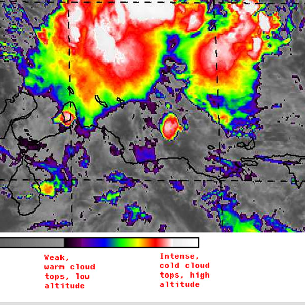
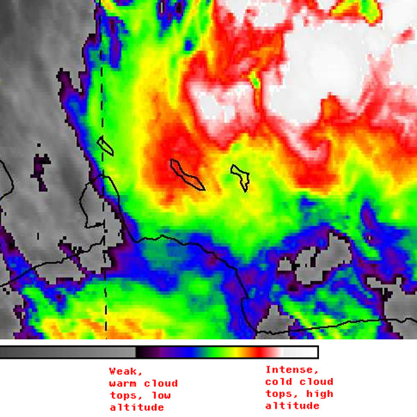
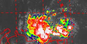
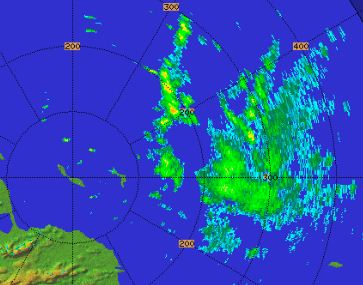
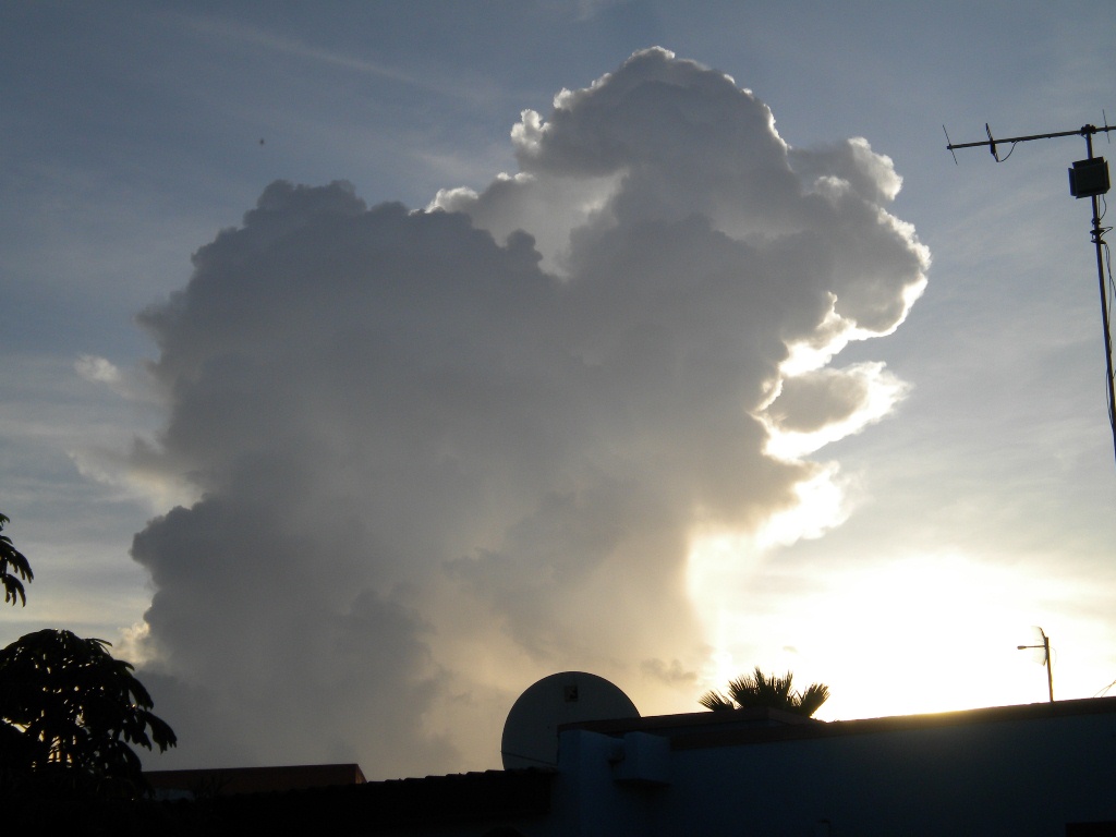
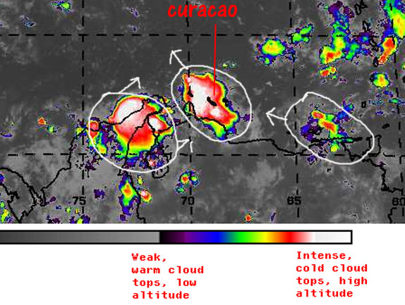
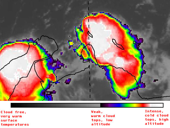
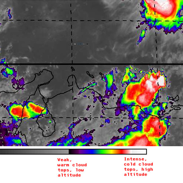
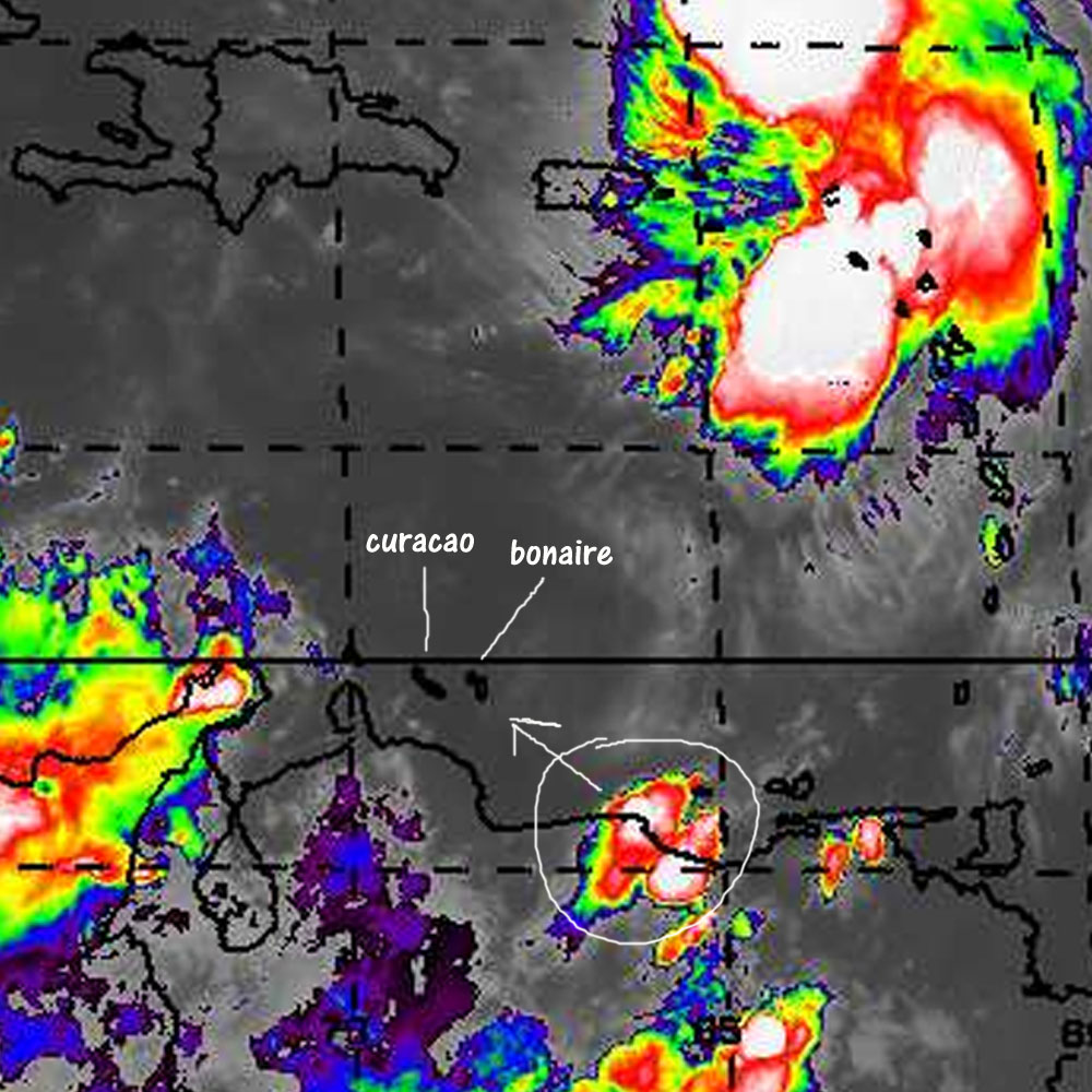
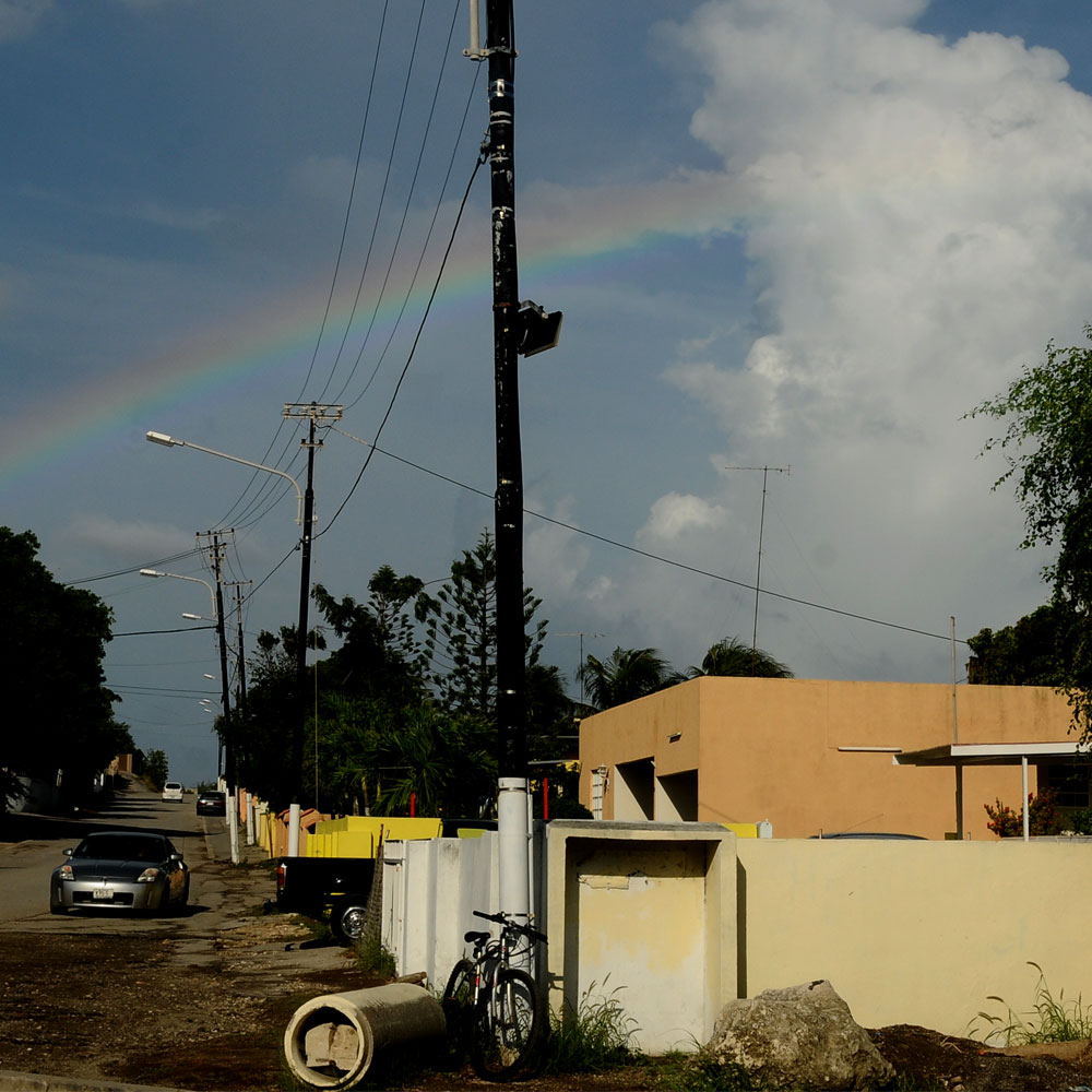
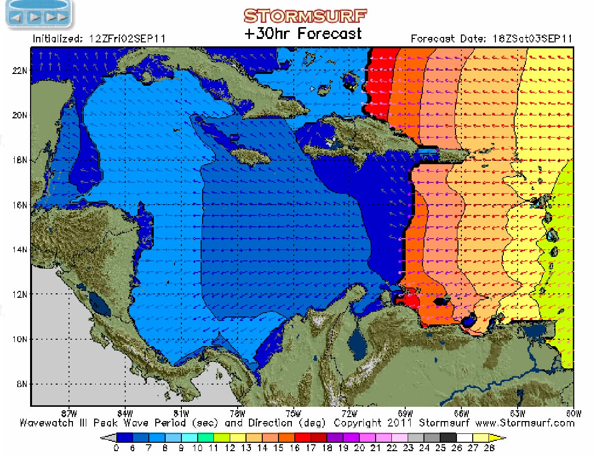
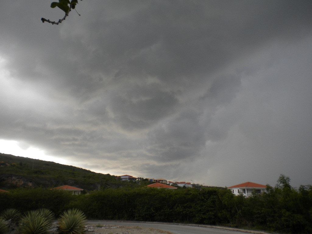
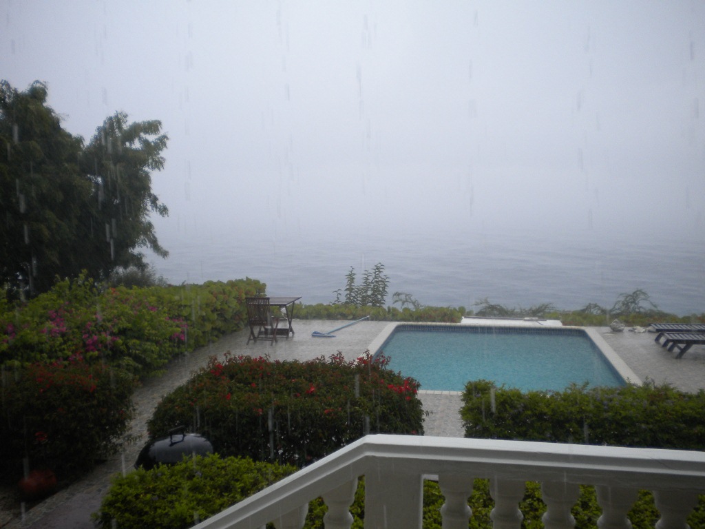
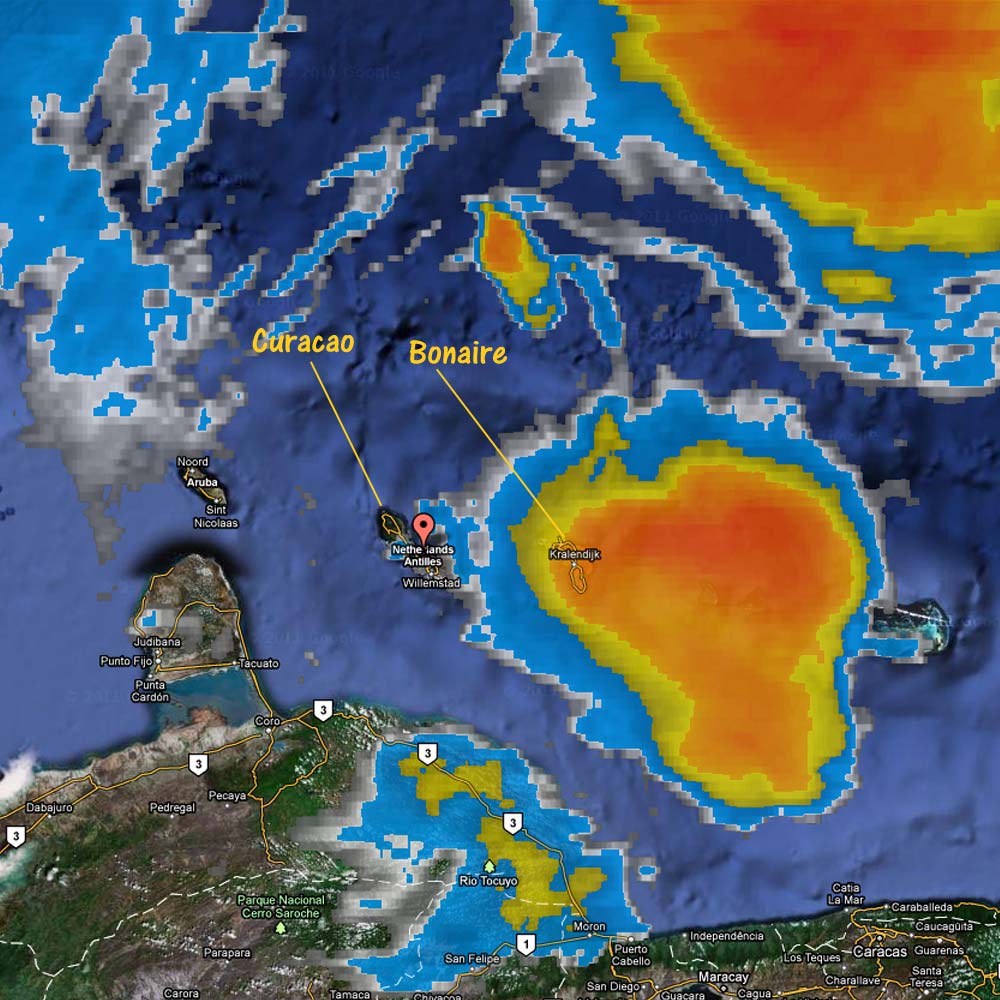
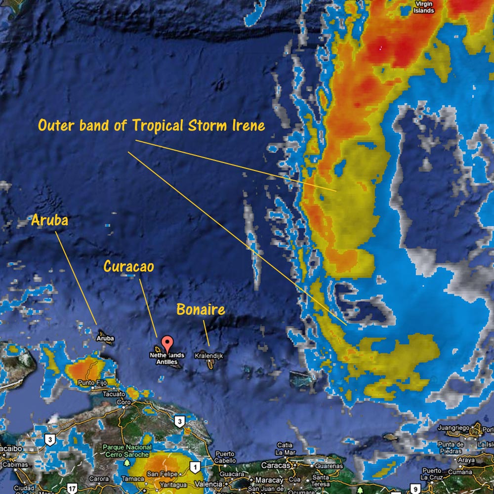
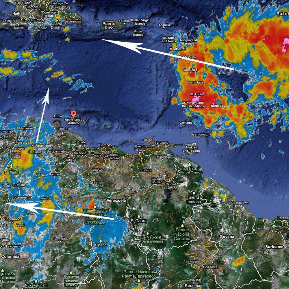
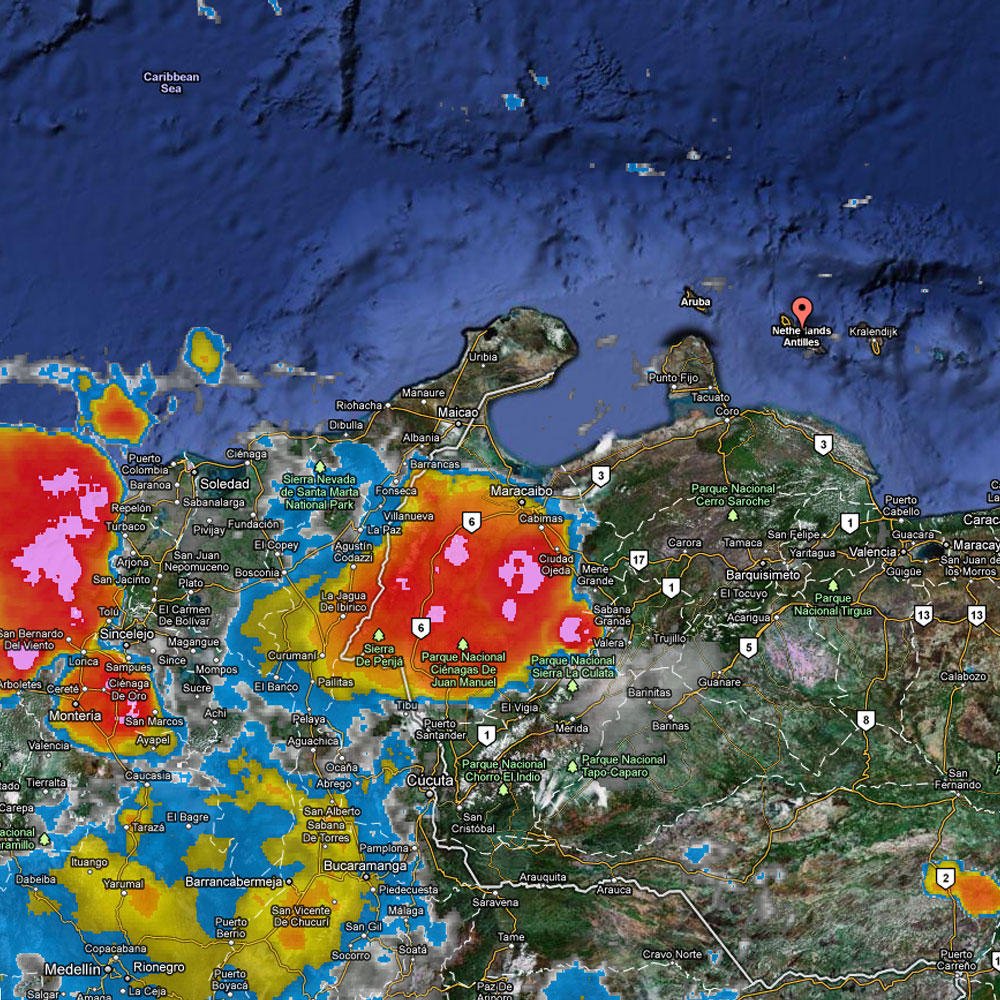
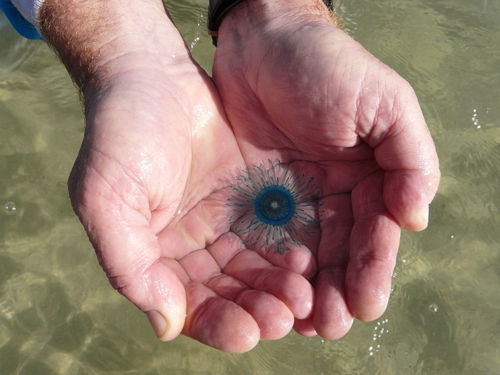
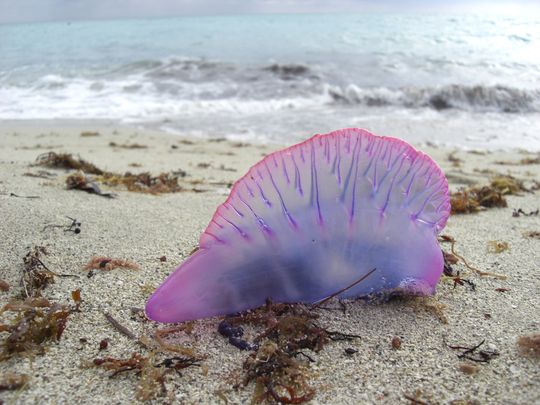
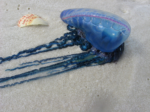
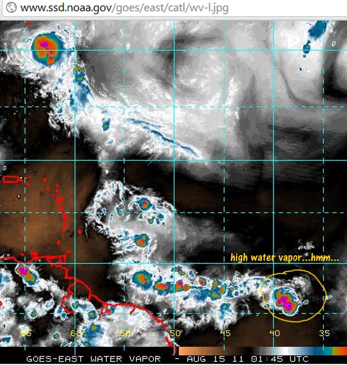
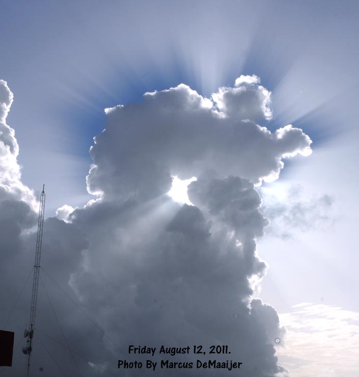
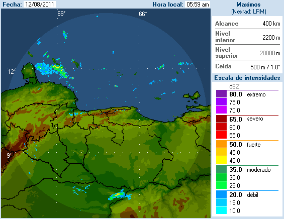
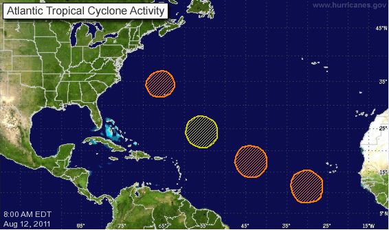
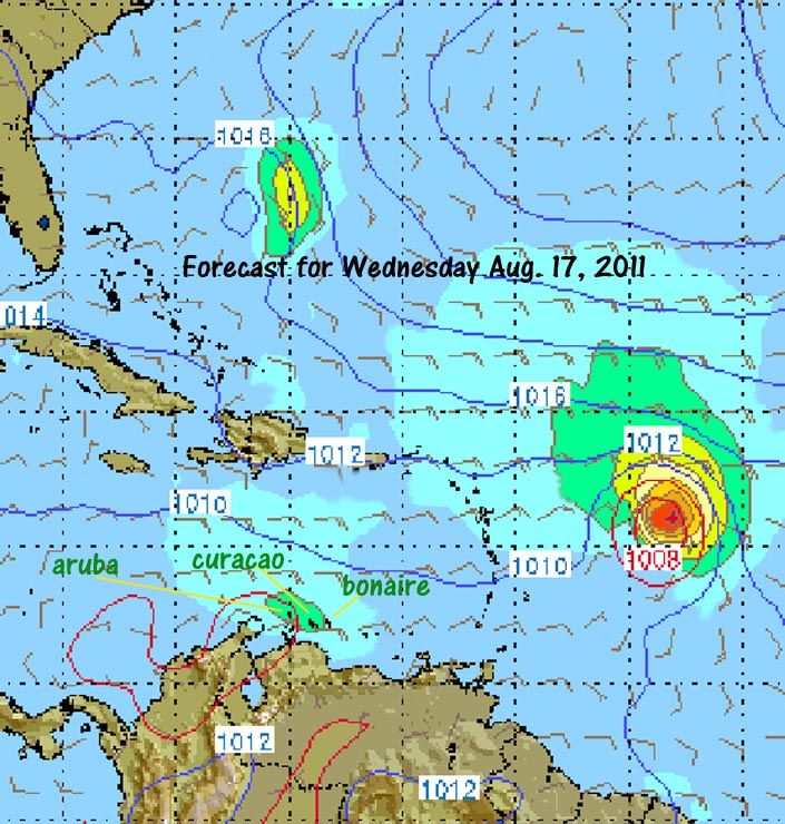
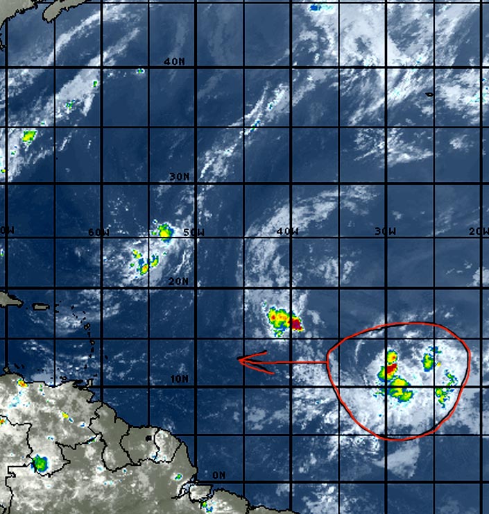
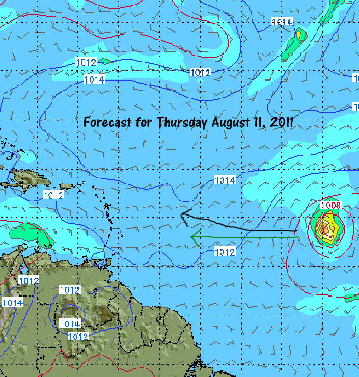
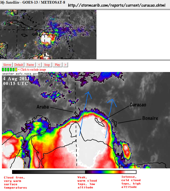
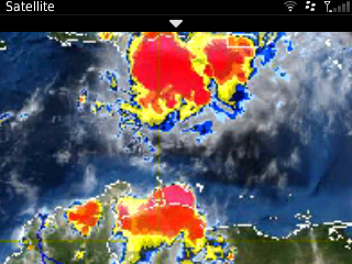
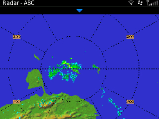
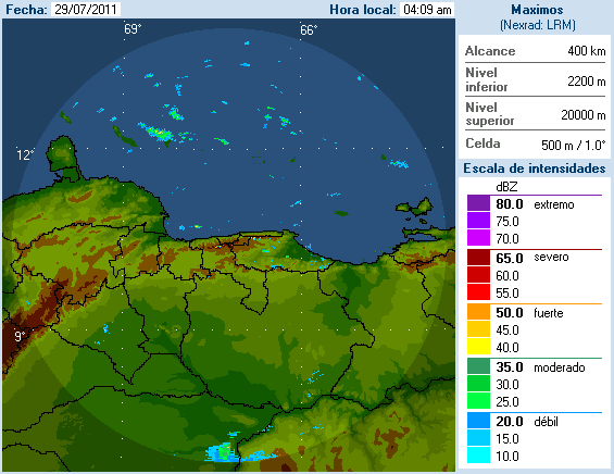
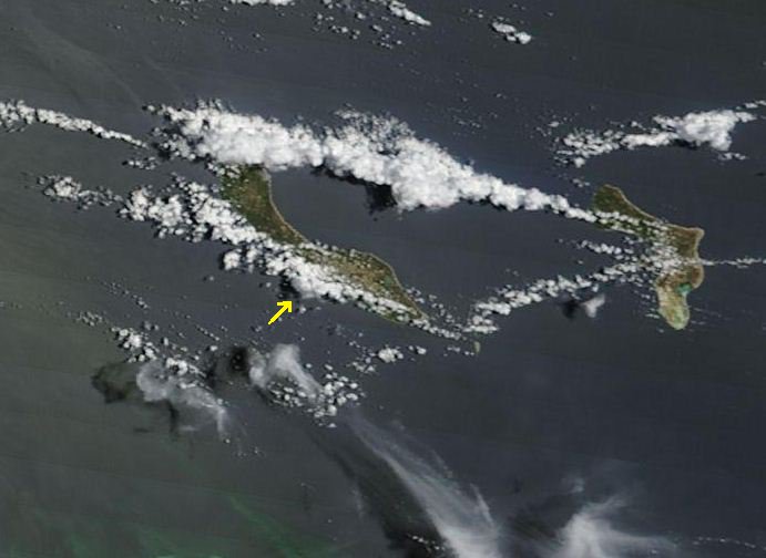
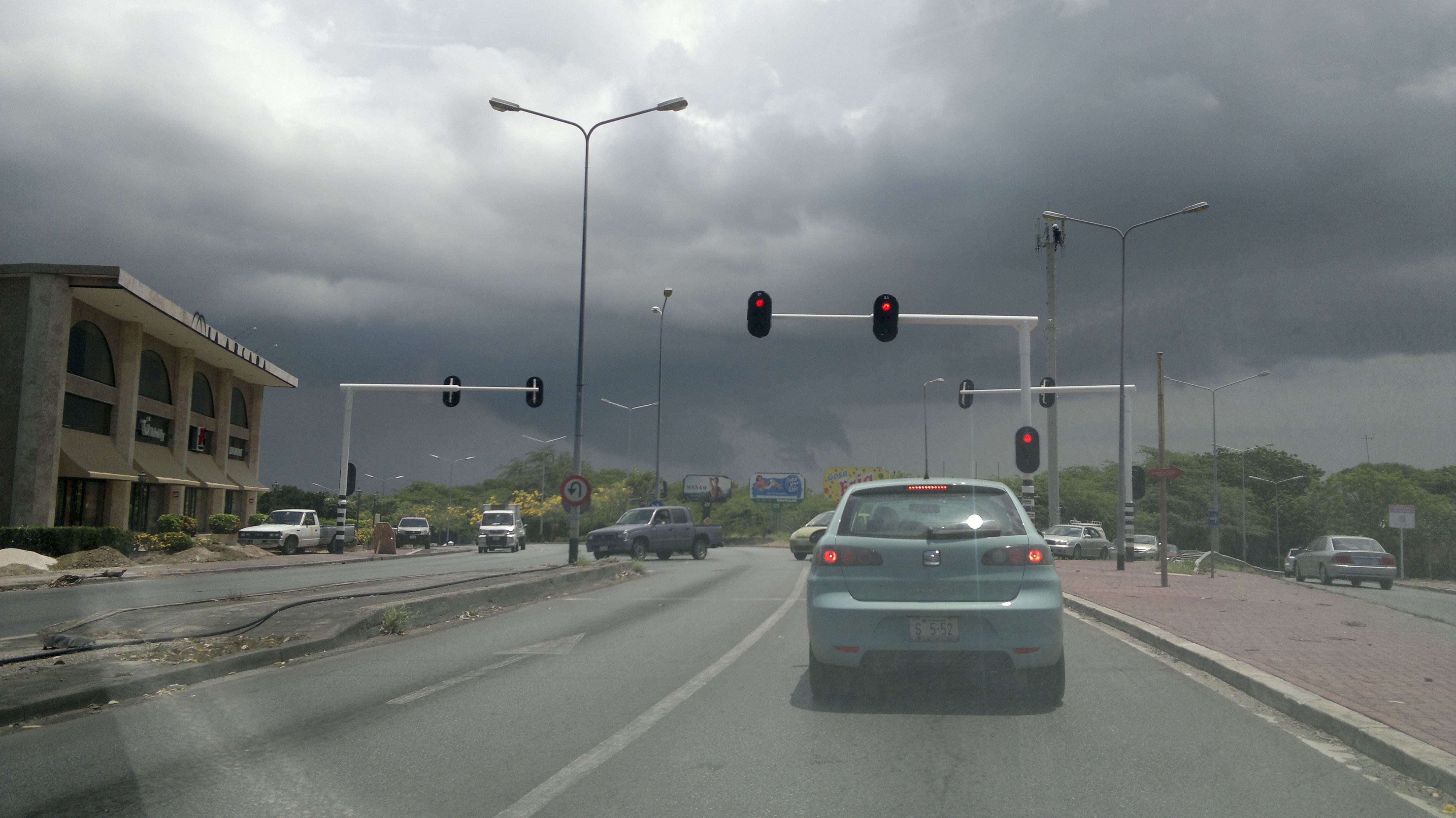
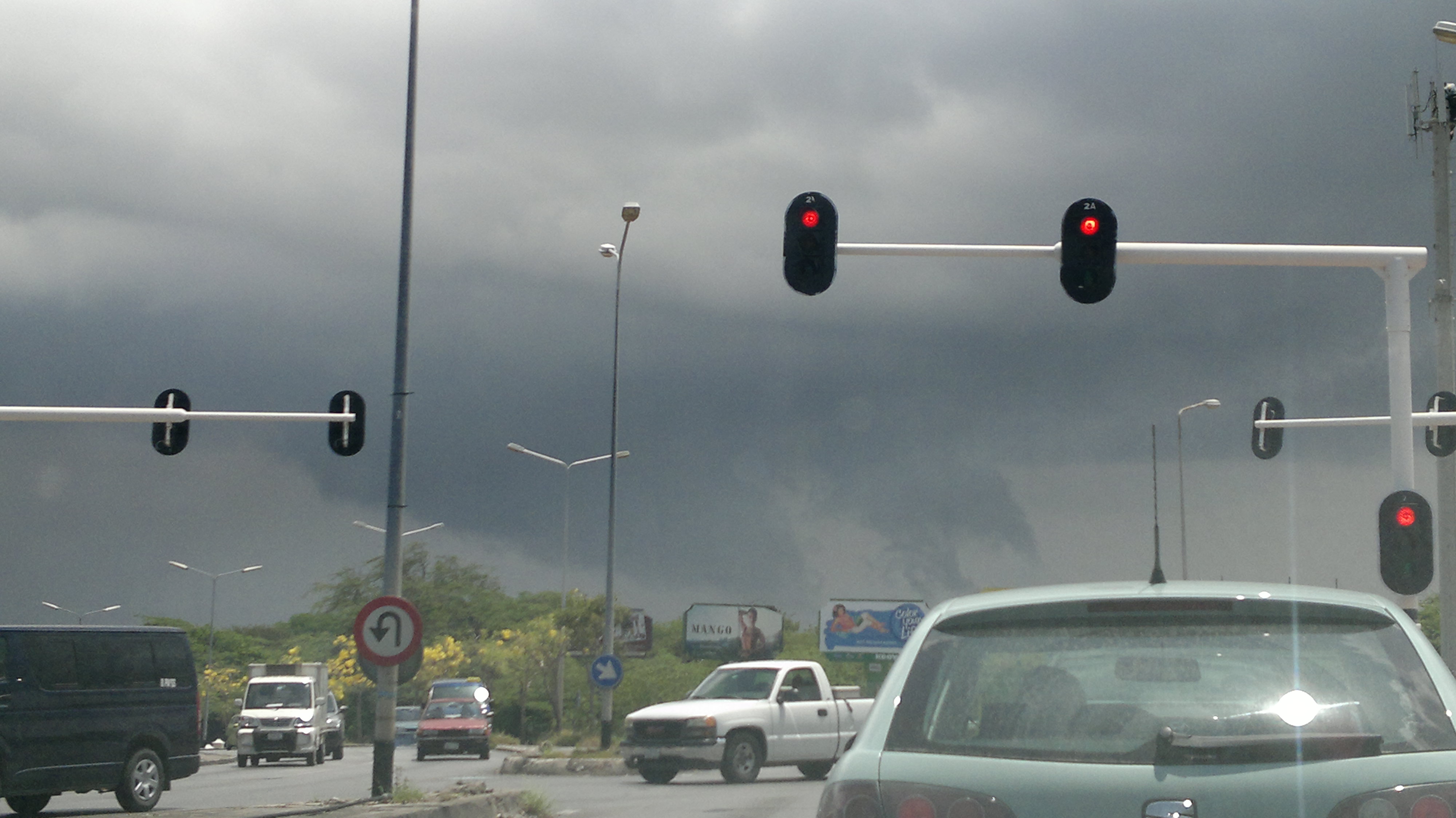
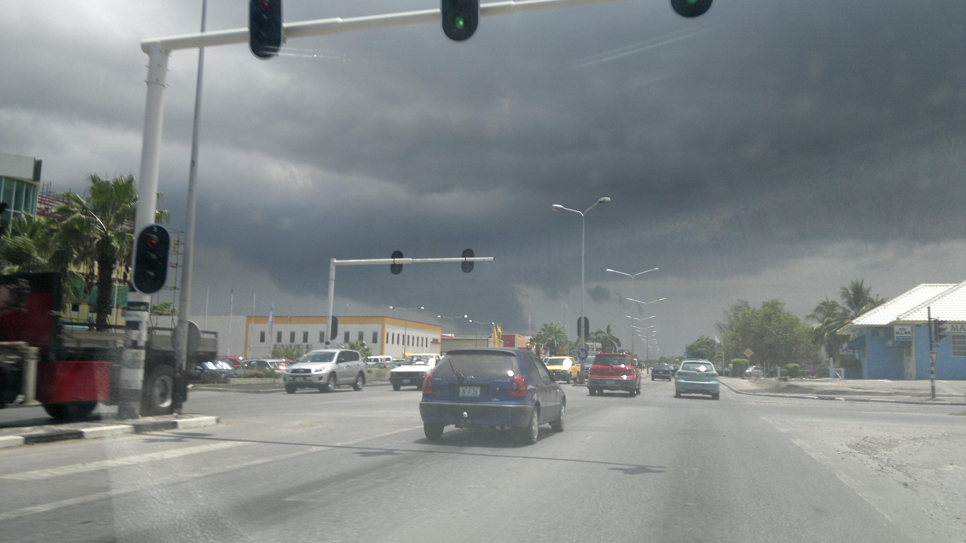
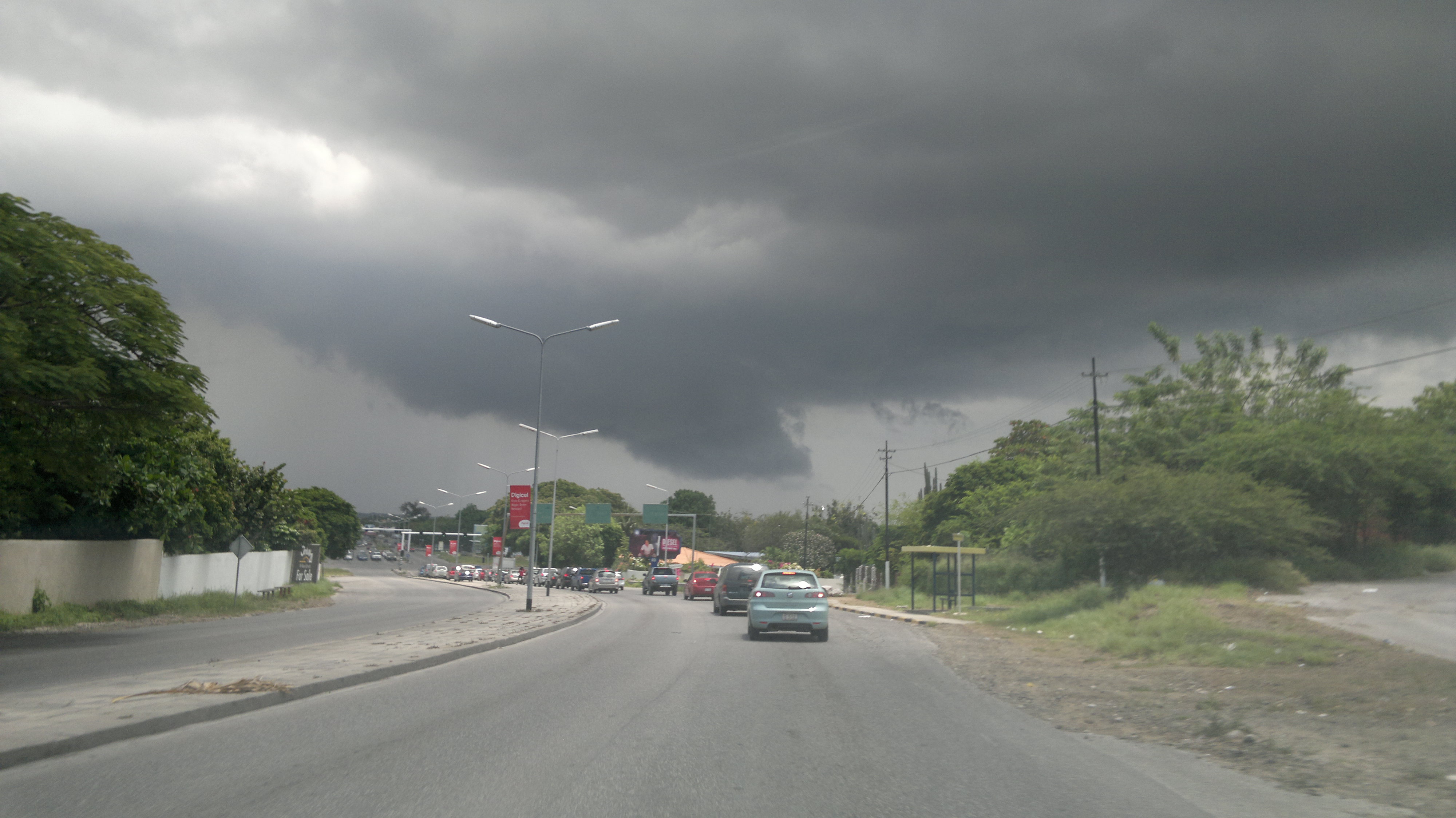