- Updates from the Islands -

- - Antigua - -

| home | tools | pleas for help | QHWRN | guide | climatology | archive

- - - 2012 Hurricane Season - - -

- Update
  • From: John Fuller <johnefuller at gmail.com>
  • Date: Sun, 6 Jan 2013 20:35:09 -0500

Attachment: IMAG0089.jpg
Description: JPEG image


- Nuking
  • From: eli fuller <eliantigua at gmail.com>
  • Date: Sun, 6 Jan 2013 07:42:54 -0400

The next week will be pretty tough for mariners with strong trades and rough seas. Finally, when the winds calm down a huge ground swell rolls in bringing big surf along north and west coast beaches. Got windsurfing and surfing equipment ready.....my business won't be happy though. Boaters beware.

Sent from my S3 mobile phone.
Eli Fuller
www.AdventureAntigua.com
+1 268 725 7263


- Fwd: [Antigua & Barbuda Whale and Dolphin Network] Fishermen and friend Toby Fuchs just was...
  • From: John Fuller <johnefuller at gmail.com>
  • Date: Sat, 27 Oct 2012 18:21:44 -0500

Orcas off Antigua today

---------- Forwarded message ----------
From: "Eli Fuller" <notification+ot=styo6 at facebookmail.com>
Date: 27 Oct 2012 15:22
Subject: [Antigua & Barbuda Whale and Dolphin Network] Fishermen and friend Toby Fuchs just was...
To: "Antigua & Barbuda Whale and Dolphin Network" <322257734488272 at groups.facebook.com>

Fishermen and friend Toby Fuchs just was...
Eli Fuller 3:22pm Oct 27
Fishermen and friend Toby Fuchs just was surrounded by 5 killer whales 20 miles north east of Antigua.

View Post on Facebook · Edit Email Settings · Reply to this email to add a comment.

- BACK TO SUNNY SKIES
  • From: MARTHA WATKINS GILKES <marthawatkinsgilkes at gmail.com>
  • Date: Tue, 16 Oct 2012 10:44:05 -0500
ANTIGUA IS   NOW  BACK IN THE  SUNSHINE AFTER  TROPICAL STORM RAFAEL BROUGHT US   2 DAYS OF  WIND AND RAIN (THANKFUL AS  ALWAYS FOR THE RAIN)...  there were reports of  some flooding but   no other  damage  it seems so  we  got away  once again..    hope this   Hurricane season  comes to a close  very soon...


- Tropical storm conditions passing
  • From: eli fuller <eliantigua at gmail.com>
  • Date: Sun, 14 Oct 2012 06:53:28 -0400

Last night there were reports from the south side of tropical storm conditions. I guess we must have had similar here in the north but since we were in the Lee this time, it didn't feel that windy. Rain is another story. I see that there is a report from jolly harbour of 3 inches from this system where here in the north there has been over 4. Some very heavy rains at times. The strongest winds seemed to come from the south and south west and I imagine some of those beaches which normally are lee side will have gotten some erosion. Hope people saw this coming and moved their boats around. Should be nice tomorrow but today could be another one indoors.

Sent from my S3 mobile phone.
Eli Fuller
www.AdventureAntigua.com
+1 268 725 7263


- Tropical storm Rafael
  • From: "Martha Watkins Gilkes. " <marthawatkinsgilkes at gmail.com>
  • Date: Sun, 14 Oct 2012 06:37:37 -0400

We had a very stormy night especially on the east coast .... My weather station 
is down so unsure on amount of rain or wind speed...still very stormy but our 
met office has discontinued
Tropical storm warnings.  However today will still surely be stormy and not a 
Beach day....but soon going to check out the waves at Half Moon Bay.... 
   Hope the rain has turned round Antigua drought situation and thankful it was 
not a hurricane... 


- VERY STORMY CONDITIONS ON THE EAST COAST Of Antigua with Tropical Storm Rafael
  • From: MARTHA WATKINS GILKES <marthawatkinsgilkes at gmail.com>
  • Date: Sat, 13 Oct 2012 17:30:00 -0500

WE MADE IT THRU  THE  BIG SOCCER MATCH LAST NIGHT..  THE  USA  VS ANTIGUA..  WITH THE  STORMY WEATHER  JUST HOLDING OFF!  
   SEE:  

BUT TODAY  THE  WEATHER  HAS TURNED WICKED..  especially on the  east coast..  we  are  getting  strong gusty winds  and  some hard rain showers..   would like MORE  RAIN ...
BUT THE SYSTEM IS STILL ON TOP OF US LOOKING AT THE  SAT. PHOTO..  It is expected to  be stormy  all night and into tomorrow,  Sunday, as  Tropical Storm Rafael moves  thru the Leeward islands. 


- Storm
  • From: jan farara <janfarara at hotmail.com>
  • Date: Sat, 13 Oct 2012 08:16:18 -0400
We seem to be in the middle of a big rainstorm at the moment, still no thunder 
or lightening or wind. Maybe later as we are under a storm watch. Nice to fill 
up the cistern but hope no serious flooding.

Sent from my iPad

- Storm
  • From: jan farara <janfarara at hotmail.com>
  • Date: Sat, 13 Oct 2012 07:51:18 -0400
Not

Sent from my iPad


- Getting stormy in ANTIGUA
  • From: MARTHA WATKINS GILKES <marthawatkinsgilkes at gmail.com>
  • Date: Fri, 12 Oct 2012 14:40:23 -0500
This is approaching us..  the sky is  very black...


http://www.ssd.noaa.gov/goes/east/carb/flash-avn.html


- WEATHER COMING ?
  • From: MARTHA WATKINS GILKES <marthawatkinsgilkes at gmail.com>
  • Date: Fri, 12 Oct 2012 11:58:01 -0500


This has just  been put out  by our Met Office..  it is  gray and overcast here and  the sea is rough...

TONIGHT IS THE  BIG  SOCCOR MATCH   for  WORLD CUP  QUALIFICATION BETWEEN USA AND  ANTIGUA..   all are hoping  this  does not  cause  problems...


INFORMATION STATEMENT

WHCA31 TAPA
INFORMATION STATEMENT
ANTIGUA AND BARBUDA METEOROLOGICAL SERVICES
11:24 AM ECT FRI, OCT 12, 2012

THIS IS FOR THE LEEWARD ISLANDS AND BRITISH VIRGIN ISLANDS

THE ANTIGUA AND BARBUDA METEOROLOGICAL SERVICE IS FOLLOWING THE PROGRESS OF A BROAD AREA OF LOW PRESSURE CENTERED OVER THE EASTERN CARIBBEAN SEA ABOUT 60 MILES NORTHWEST OF SAINT LUCIA WHICH CONTINUES TO PRODUCE SHOWERS AND THUNDERSTORMS NEAR AND TO THE EAST OF THE LESSER ANTILLES.

SHOWER AND THUNDERSTORM ACTIVITY CONTINUES TO SHOW SOME SIGNS OF ORGANIZATION AND A TROPICAL DEPRESSION OR TROPICAL STORM IS LIKELY TO FORM DURING THE NEXT DAY OR SO. IF SO, A TROPICAL STORM WARNING COULD BE REQUIRED FOR PORTIONS OF THE LEEWARD ISLANDS.

THIS SYSTEM HAS HAS A HIGH CHANCE, 80 PERCENT, OF BECOMING A TROPICAL CYCLONE DURING THE NEXT 48 HOURS AS IT MOVES NORTHWESTWARD OR NORTH-NORTHWESTWARD AT 10 TO 15 MPH.

REGARDLESS OF DEVELOPMENT, STRONG GUSTY WINDS AND LOCALLY HEAVY RAINFALL ARE POSSIBLE ACROSS THE LEEWARDS DURING THE NEXT COUPLE OF DAYS.


- Don't plan any big sailing trips this weekend
  • From: eli fuller <eliantigua at gmail.com>
  • Date: Thu, 11 Oct 2012 07:13:33 -0400

I don't think anyone knows what's going on with this weather to the south east of us. The national hurricane center is saying it could turn into a depression very soon and crown weather says it could turn into a tropical storm. Either way there are plenty squalls out there and this isn't the best time to be planning a weekend camping trip to Barbuda. Keep an eye on it. Notice that windguru is saying we will get around from the west and south west. This often surprises boat owners who anchor on the Lee side of the island. The season isn't over yet.

Sent from my S3 mobile phone.
Eli Fuller
www.AdventureAntigua.com
+1 268 725 7263


- 98 L system...
  • From: MARTHA WATKINS GILKES <marthawatkinsgilkes at gmail.com>
  • Date: Wed, 10 Oct 2012 09:57:48 -0500
We are  watching  this..    hopefully it  will bring us  RAIN  BADLY NEEDED  in Antigua.. we have had some showers the last 
days but more is  always welcome as  we  are  in drought time...


http://www.nhc.noaa.gov/gtwo/gtwo_atl_sub.shtml?area1#contents
SHOWERS AND THUNDERSTORMS HAVE BECOME A LITTLE BETTER ORGANIZED IN
ASSOCIATION WITH A TROPICAL WAVE LOCATED ABOUT 550 MILES EAST OF
THE WINDWARD ISLANDS. SOME GRADUAL DEVELOPMENT OF THIS SYSTEM IS
POSSIBLE DURING THE NEXT COUPLE OF DAYS AS IT MOVES WEST-
NORTHWESTWARD AT AROUND 15 MPH TOWARD THE LESSER ANTILLES. THIS
SYSTEM HAS A MEDIUM CHANCE...30 PERCENT...OF BECOMING A TROPICAL
CYCLONE DURING THE NEXT 48 HOURS. INTERESTS IN THE LESSER ANTILLES
SHOULD MONITOR THE PROGRESS OF THIS SYSTEM.


- System
  • From: "Martha Watkins Gilkes. " <marthawatkinsgilkes at gmail.com>
  • Date: Tue, 2 Oct 2012 05:31:23 -0400

We thought it was all over  although not officially....and now on National hurricane site this is showing....it is far south of us NOW.  But if the north west track is right in about 4 days we could have some weather on us... Keep watching.  


60% Chance of Tropical Cyclone Formation 
THUNDERSTORM ACTIVITY ASSOCIATED WITH A LARGE LOW PRESSURE SYSTEM
LOCATED ABOUT 800 MILES WEST-SOUTHWEST OF THE CAPE VERDE ISLANDS HAS
CHANGED LITTLE IN ORGANIZATION OVER THE PAST FEW HOURS. HOWEVER...
ENVIRONMENTAL CONDITIONS ARE EXPECTED TO BE CONDUCIVE FOR THE
DEVELOPMENT OF A TROPICAL DEPRESSION IN THIS AREA OVER THE NEXT
COUPLE OF DAYS. THIS SYSTEM HAS A HIGH CHANCE...60 PERCENT...OF
BECOMING A TROPICAL CYCLONE DURING THE NEXT 48 HOURS AS IT MOVES
WEST-NORTHWESTWARD AT 10 TO 15 MPH.


Sent from my iPad

- Sept
  • From: John Fuller <johnefuller at gmail.com>
  • Date: Tue, 18 Sep 2012 09:45:27 -0500

Hurricane George was a very very nasty creature and struck us here on Sept 21st 1998. The fat lady hasn't sung yet.


- RAINY WEATHER WE HOPE
  • From: MARTHA WATKINS GILKES <marthawatkinsgilkes at gmail.com>
  • Date: Mon, 17 Sep 2012 09:43:05 -0500
Yesterday we had  some  very  needed  welcome rain..  and    the radar shows    some  patches over us   now  so  we hope  we will get  something during  the  next  day  or  2   as  we are  parched and  need  the rain!    HOPEFULLY  WE  HAVE   DODGED THE  BULLET WITH STORMS  THIS SEASON..   NOT OVER YET  BUT LOOKING GOOD


- : LESLIE and ANtiguas east coast
  • From: "marthawatkinsgilkes at gmail.com" <marthawatkinsgilkes at gmail.com>
  • Date: Mon, 3 Sep 2012 19:48:56 -0400
 
Here on the   east coast of Antigua  yesterday we  had   strong  south winds  ( not our norm... )  and i was   glad  i  still had my   HUGH UGLY HURRICANE SHUTTERS UP  from ISSAC to protect my   open air  home   and  things  BLOWING  AROUND..    Hurricane shutters  can be  a big bore to install  (  big and heavy  and  close up your house   blocking the  breeze and light)... but   necessary to protect  things...  trying to make my  big metal  shutters   less  psychologically  oppressive    when  they have to be installed    so   while they are up  now   a group of  girlfriends coming  on wednesday    for  a  fun  lunch party  and  A MURAL  PAINTING    to  PAINT A MARINE SCENE ON THE SHUTTERS   ...   so    we  can think we  are   UNDER  THE SEA  like the  little  mermaid.. instead of in the middle of a hurricane...  


- Update
  • From: John Fuller <johnefuller at gmail.com>
  • Date: Sat, 1 Sep 2012 12:24:57 -0500

Most westerly band of leslie

Attachment: IMAG0032.jpg
Description: JPEG image


- STORM/HURRICANE ISSAC IN MY LIFE AGAIN
  • From: Martha Watkins Gilkes <gilkesm at me.com>
  • Date: Wed, 29 Aug 2012 18:35:57 -0500
AM IN MISSISSIPPI TO VISIT MY FAMILY... IRONIC  I  HAD ISSAC IN MY LIFE  LAST 
WEEK  when  it was passing near  Antigua (thank goodness only as  a tropical 
storm)  ..... AND  NOW AGAIN  BUT MUCH WORSE here in Mississippi .. THERE ARE 
58,000 PEOPLE IN MY STATE OF MISSISSIPPI WITHOUT POWER RIGHT NOW... thankfully 
i  am not one of  them.... 
Those poor people  in New Orleans...  


- shuttering
  • From: jan farara <janfarara at hotmail.com>
  • Date: Fri, 24 Aug 2012 15:05:02 +0000
Not sure that shuttering is a word but that is what we've been doing. We are now unshuttering ..a bit. Apart from the preparation Isaac was a non-event., thank goodness.  I didn't see much going on in the village of Buckleys  before the supposed arrival  of the storm so I think it was lucky that nothing happened. I think Im leaving all my veranda furniture either upside down or packed up which could be a problem if someone wants to visit the studio. Deal with that when I come to it.  Still a bit breezy and showery but a little bit of sunshine this morning. While we were locked down I painted a beach scene in my studio, the only place in the house with enough light when the shutters are on. I wish everyone many more nonevents  for the rest of the season.Jan

Attachment: 1-DSCN2055.JPG
Description: JPEG image


- Trop storm winds
  • From: eli fuller <eliantigua at gmail.com>
  • Date: Thu, 23 Aug 2012 03:28:55 -0400

Now we are getting them. It must be blowing about 40-45 mph now. Heard a bang a few minutes ago and power went off but still almost no rain. I guess this is good news for Puerto Rico and Hispaniola. I mean as long as rain keeps south off the eye.
Windsurfing at sunset was fun. Each time I look at radar Barbados is getting rain. Hope not too much flooding there.

+1 268 725 7263
www.adventureantigua.com
Sent from mobile


- Very stormy now
  • From: "Martha Watkins Gilkes. " <marthawatkinsgilkes at gmail.com>
  • Date: Thu, 23 Aug 2012 03:10:57 -0400
We were told it has passed but it it very stormy now....3. A.m.  Hard rain and. 
Whipping. Gusts that woke me. Even through hurricane shutters.... Just went. To 
explore outside.....but only for short one !,   Am sure waves at half moon bay 
pounding now...will check first light. Around. 5:20 am ... More after daybreak  
  ;   Feel for poor souls in hati. Next.   

- HALF MOON BAY WAVES during STORM ISSAC
  • From: Martha Watkins Gilkes <gilkesm at candw.ag>
  • Date: Wed, 22 Aug 2012 21:17:30 -0400

- ANTIGUA tonight
  • From: "marthawatkinsgilkes at gmail.com" <marthawatkinsgilkes at gmail.com>
  • Date: Wed, 22 Aug 2012 20:58:28 -0400
 
 TROPICAL STORM ISSAC has  PASSED US.. Hurray...   We  may get some  of the outter bands of  rain and some gusts..but    the main part is  GONE>.    We  dodged another  bullet!!...  Thank goodness. And hope we  can  get  thru this  hurricane season  with  nothing else.. But it  was  a  good  dress rehersal  to   get things    ready....    Have to say   I  was  rather  cross with the  WEATHER  CHANNEL not even MENTIONING ANTIGUA    and also   not  pronouncing  the islands of  DOMINICA or   GUADELOUPE   correctly!!     I   sent them an email and a  tweet  on it  ...  
Onwards  and upwards !   Thanks to all who were in touch and  care about us in our little paradise!  

- Squally with occasional showers...
  • From: Alan B Scholl <scholla at candw.ag>
  • Date: Wed, 22 Aug 2012 16:04:19 -0400
From the McKinnons area in the North West, we have been experiencing gusty 
conditions. There was a recent sustained gust at about 25mph but it died 
shortly after. Many business closed at 12PM to allow for preparation. On my way 
home, Larry's Gas Station had some traffic but nothing compared to previous 
storm preparation. There have been intermittent shower activity but nothing 
significant. As a precaution I boarded up my back door. 

I await Mr. ISAAC's passing.

Alan Scholl

- WEDNESDAY MORN TROPICAL STORM
  • From: "marthawatkinsgilkes at gmail.com" <marthawatkinsgilkes at gmail.com>
  • Date: Wed, 22 Aug 2012 09:23:30 -0400
This morning  we   are  finishing  the preps  for   the  storm coming... ISSAC  NOW NAMED....
        ONLY  A  STORM  thank goodness. But  we  know   50 miles per hour  still does  damage... And our  flights  in and out of island  being  stopped  later  which  is a bummer for those traveling...  It  should only be for  a short time however as the system is moving  quickly....  Expected  to pass to the south of  Antigua  in the next   24 hours... Will keep  those interested  posted...  People are  seriously  getting  prepared which is  a good thing....  Hope we  don't have  a more  serious one later in the  season...


- still a weak tropical storm but antigua prepared for worst
  • From: eli fuller <eliantigua at gmail.com>
  • Date: Wed, 22 Aug 2012 08:06:50 -0400
Yesterday people woke up in frnezie prep mode as the night before they were told that they had one day to prepare for a tropical storm. Many of my friends were surprised at how worried residents seemed this time and it was almost as if people had forgotten the difference between a hurricane (74 mph or greater) and a tropical storm (39 mph to 73 mph). Every fishing and tour boat on the west coast moved into Jolly Harbour last night and petrol stations and supermarkets had lines.
Meanwhile the depression becomes a named storm Isaac barely holding on to that status at sustained 40 mph yesterday. Early this am it seems to have strengthened and we could be expecting gusts of up to 60 mph in squalls. This will do some damage to phone  and power lines as so many are passing through trees around the island, but I don't think this is a dangerous storm at the moment unless you plan on being on a boat in an unprotected harbour. At 4 am there was some beautiful lightning in the east and you could see some very strong squalls in a band to our east on the radar. Again now we have thunder in the east but the winds have been below 20 knots so far and very little rain on the north shore. Almost none actually. I expect it to get nasty later this afternoon and I plan to windsurf at Jabbawock then! Tropical Storm Warning in effect and i think schools and many businesses are closed. Thank goodness last week's forecast on windguru turned out to be wrong. They were forecasting 93 knots at one stage. That would be something to get worried about, but for now I am going to put a few extra lines on the boat and have some fuel ready for the generator.
This is a good warm up and once again Antigua looks like it will not receive hurricane winds. The last time was 1999. Long may the run continue.
Eli

--
+1 268 725 7263
http://www.adventureantigua.com
http://www.sailing-antigua.com
http://www.antiguaisland.blogspot.com
http://www.twitter.com/antigua

- STORM COMING TO ANTIGUA …
  • From: MARTHA WATKINS GILKES <marthawatkinsgilkes at gmail.com>
  • Date: Tue, 21 Aug 2012 20:39:32 -0500

LOTS OF  DIFFERENT  OPINIONS  ON WHAT  IS   GOING TO HAPPEN  BUT  SEEMS    THIS  TROPICAL STORM  NOW NAMED  ISSAC WILL BE  OVER  ANTIGUA  STARTING WITH OUTTER  WIND BANDS TONIGHT..  IT   IS  OVER   500 MILES OF  CLOUD MASS SO THAT IS  A BIG  AREA..   Hurricane Hunters flying the system so  expect  more  accurate  info in the next  reports...            we  expect to get   some  rain  in the   early morn  hours   tomorrow   Wednesday  ..  and  by midnight  it will be  right  over  us  moving on  at  a  quick clip,  thank goodness,   by  late   thursday..... Winds  expected to be  40  to 50  MPH..  not  hurricane  force  thank goodness..  but  enough to trash gardens  and  do  a bit of  a mess up... and  seas  expected to   angry..    pulled  THE  OFFICE  ( the boat)  out of the  water  earlier today  so  she is  tucked away  safely  ....'

Have  battened  down the hatches and  ready for  Mother Nature..      Thank  goodness  we  are  only  facing  a  Tropical storm and not  a  CAT   4  HURRICANE  AS we have in the past.. we are  pretty  hurricane  savvy  in  Antigua...


- Storm coming.
  • From: "Martha Watkins Gilkes. " <marthawatkinsgilkes at gmail.com>
  • Date: Tue, 21 Aug 2012 02:23:16 -0400
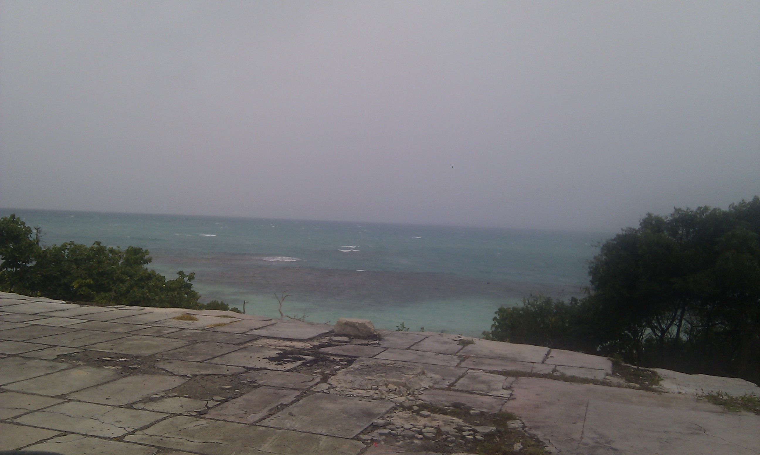
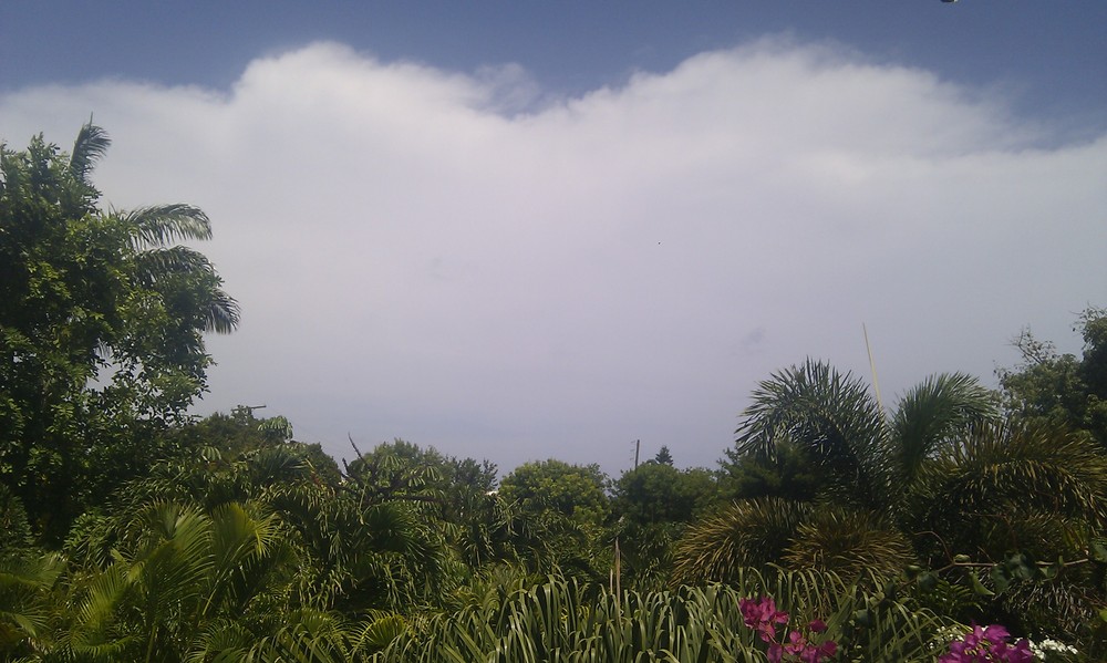
Looks like we will have a storm on our doorstep late Tuesday night early Wed morn.....at least it is not
A hurricane.   

ZCZC MIATWOAT ALL
TTAA00 KNHC DDHHMM

TROPICAL WEATHER OUTLOOK 
NWS NATIONAL HURRICANE CENTER MIAMI FL 
200 AM EDT TUE AUG 21 2012

FOR THE
 NORTH ATLANTIC...CARIBBEAN SEA AND THE GULF OF MEXICO...
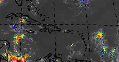
A WELL-DEFINED 
LOW PRESSURE PRESSURE IS LOCATED ABOUT 725 MILES 
EAST OF THE LESSER 
ANTILLES. THUNDERSTORM ACTIVITY HAS INCREASED 
AND BECOME BETTER 
ORGANIZED NEAR THE CENTER DURING THE PAST SEVERAL
HOURS. IF THIS RECENT 
DEVELOPMENT TREND CONTINUES...THEN A TROPICAL
DEPRESSION COULD FORM 
LATER THIS MORNING. THIS SYSTEM HAS A HIGH
CHANCE...NEAR 100 PERCENT...
OF BECOMING A TROPICAL CYCLONE DURING
THE NEXT 48 HOURS AS IT MOVES 
WESTWARD AT 20 TO 25 MPH. THIS LARGE
DISTURBANCE COULD REACH THE LESSER 
ANTILLES BY WEDNESDAY...AND
INTERESTS IN THAT AREA SHOULD CLOSELY 
MONITOR THE PROGRESS OF THIS
SYSTEM SINCE TROPICAL STORM WATCHES 
COULD SOON BE REQUIRED FOR
PORTIONS OF THOSE ISLANDS.

2. A WELL-DEFINED 
LOW PRESSURE SYSTEM ASSOCIATED WITH A TROPICAL WAVE
IS LOCATED ABOUT 
380 MILES SOUTHWEST OF THE CAPE VERDE ISLANDS. 
SHOWERS AND 
THUNDERSTORMS CONTINUE TO SHOW SIGNS OF ORGANIZATION...
AND 
FURTHER DEVELOPMENT OF THIS DISTURBANCE IS POSSIBLE OVER THE
NEXT 
FEW DAYS. THIS SYSTEM HAS A MEDIUM CHANCE...50 PERCENT...OF
BECOMING 
A TROPICAL CYCLONE DURING THE NEXT 48 HOURS AS IT MOVES
WESTWARD 
AT ABOUT 15 MPH. 

3. SHOWER ACTIVITY NEAR AN ELONGATED AREA OF LOW 
PRESSURE LOCATED OVER
THE FAR WESTERN GULF OF MEXICO HAS CHANGED 
LITTLE DURING THE PAST
SEVERAL HOURS. SOME GRADUAL DEVELOPMENT OF 
THIS SYSTEM IS STILL
POSSIBLE IF IT REMAINS OVER WATER DURING THE NEXT 
DAY OR TWO. THIS
SYSTEM HAS A MEDIUM CHANCE...30 PERCENT...OF BECOMING A 
TROPICAL
CYCLONE DURING THE NEXT 48 HOURS AS IT DRIFTS WESTWARD. 
 ELSEWHERE...TROPICAL CYCLONE FORMATION IS NOT EXPECTED DURING THE 
NEXT 48 HOURS.

$$
FORECASTER STEWART
NNNN


- WEATHER coming to Antigua ?
  • From: "marthawatkinsgilkes at gmail.com" <marthawatkinsgilkes at gmail.com>
  • Date: Mon, 20 Aug 2012 17:02:59 -0400
   We have  a  system  out there.. Watching it  closely....  Now  1000 miles to  our  east moving at a fast clip of  20  MPH...  Check out the  photo  showing it..  We  are  just  above  the  "butterfly shaped island "  Guaduloupe .   It is only  "an area of distrubed weather  at this time  and  our  met office is not  saying much..  But  just  had  good chat with one of our forecasters and they  say  STAY ALERT..  It  is pretty  sure it will come  on directly  west and  run into  "Little Antigua".. But  we   are   not sure  as  WHAT..   Now just  a depression.. But  it  will probably  develop into at least  A tropical storm.. Hopefully not  a hurricane....  So we will probably just have  strong winds and  some rain...( always needed)...    Stand by for  more
 

Attachment: hurrirF.jpg
Description: JPEG image


- Computer models in agreement
  • From: eli fuller <eliantigua at gmail.com>
  • Date: Sun, 19 Aug 2012 06:15:44 -0400

It seems as though there is considerably more agreement among the model forecasts that the strong Tropical Wave in the far eastern Atlantic is coming our way. However they don't seem to agree on strength. We could be facing hurricane force winds or considerably less on Wednesday. As usual we have to keep checking while doing some prep work in case a storm does give us some action. Lovely conditions for the past few days and the sunrise is beautiful again now even with the African dust. The poker run today should be great.

+1 268 725 7263
www.adventureantigua.com
Sent from mobile


- Windy but dry
  • From: eli fuller <eliantigua at gmail.com>
  • Date: Sat, 11 Aug 2012 22:08:21 -0400

The winds today probably averaged 20 knots until about 5 pm when it picked up to high twenties. It's 10 pm now and must be close to 30 our even above where I am on the north side. Skies still clear and radar showing all the rain south of us. Dominica looks about to get hit by some real rain in a few. Hope it's not as much as they had in parts of Trinidad today! Tomorrow has a nice forecast. Glad I asked the crew not to put up the awning!
Eli

+1 268 725 7263
www.adventureantigua.com
Sent from mobile


- Watching the Atlantic
  • From: "Martha Watkins Gilkes. " <marthawatkinsgilkes at gmail.com>
  • Date: Tue, 7 Aug 2012 09:14:28 -0400
Don't like to read this below from Dave on the story site!!!   But tis the season...meanwhile enjoying a lovely tropical day on the CARNIVAL TUESDAY.   A holiday here with our carnival in full swing...


There is a low just south of the Cape Verdes which bears mention and a very large and active wave 1/2 way across the African continent. Is this gonna be the one predicted to be a hurricane around the northern islands Aug. 18-19?


- Sunday morn in Antigua
  • From: "Martha Watkins Gilkes. " <marthawatkinsgilkes at gmail.com>
  • Date: Sun, 5 Aug 2012 06:35:52 -0400
http://www.wunderground.com/hurricane/at20126.asp

Happy to see this link showing the next thing out there likely to go north ..

Still gray and overcast this morn... 


- Sat morn Storm gone
  • From: "Martha Watkins Gilkes. " <marthawatkinsgilkes at gmail.com>
  • Date: Sat, 4 Aug 2012 07:39:07 -0400
It is a gray early morning in antigua. But seems most of weather has moved 
on....and happy to hear next one may go north of the islands...but will 
certainly monitor.    


- rain
  • From: eli fuller <eliantigua at gmail.com>
  • Date: Fri, 3 Aug 2012 17:48:28 -0400
today we had winds between 18 and 25 with some very strong gusts during one of those crazy cold air squalls. some downed branches in town. All in all it wasn't that rainy and quite a bit of the day was bathed in brilliant sunshine. The sunset was covered in clouds and now it's raining properly. CARNIVAL may be a bit wet tonight....
Tomorrow better be good because the boating biz isn't doing well in these conditions!
Looks positive though with that storm zooming off into the caribbean sea as i write this. Still quite a bit of a tail on the radar but with luck it will be gone by the time by baby wakes up at dawn. tek it easy....

--
+1 268 725 7263
http://www.adventureantigua.com
http://www.sailing-antigua.com
http://www.antiguaisland.blogspot.com
http://www.twitter.com/antigua

- STORMY LATE AFTERNOON
  • From: MARTHA WATKINS GILKES <marthawatkinsgilkes at gmail.com>
  • Date: Fri, 3 Aug 2012 17:42:06 -0500
Here in  ANTIGUA  it is  very   stormy... lots of hard  rain.. certainly on  the  east  side where i am...  and   very  gusty  winds...   northern tip of  ERNESTO  AM SURE...   MY  AIRLINE  CAPTAIN HUSBNAD HAS  BEEN STUCK IN THE  WINDWARD ISLANDS   AS SEVERAL AIRPORTS  HAVE BEEN CLOSED ..   Liat is  trying to  bring some  flights  north as  I  write but  the weather  is  not  good for that...    at least  we  are  not facing  a strong hurricane.... and the  rain is  very needed..


- TROPICAL STORM ERNESTO IS BORN!
  • From: MARTHA WATKINS GILKES <marthawatkinsgilkes at gmail.com>
  • Date: Thu, 2 Aug 2012 16:48:15 -0500
 We are keeping  a close  eye on this  new system that has  just  been named.... 


 The  "butterfly shape  island  is  just to the  SOUTH OF  ANTIGUA   so we  are   just  BARELY out of the  range for  possible  storm/ hurricane alert.. thank goodness.. no one  wants to  
board up if we  dont have to!!!    but  it  TIS  THE  SEASON!   

see the path below


http://www.nhc.noaa.gov/graphics_at5.shtml?5-daynl%3Flarge#contents

- TROPICAL DREPRESSION
  • From: MARTHA WATKINS GILKES <marthawatkinsgilkes at gmail.com>
  • Date: Thu, 2 Aug 2012 08:11:13 -0500
LOOKS LIKE THE  WINDWARDS  WILL BE  THE PATH  FOR  THIS  DEPRESSION...POSSIBLY TO BECOME A  STORM IN THE NEXT HOURS..  SO THE  LEEWARDS  SHOULD NOT GET ANYTHING.... was not looking forward to  moving furniture  etc  and  to  my   lovely tropical garden being trashed!!!       My   captain   AIRLINE  husband  is    flying  around  down there over the next 2  days  and  thinks   he may be  "grounded"  at some point  as the storm passes  thru..     we will keep watching ... now and  thru  aug and  sep.  as  it probably get more active...

- Very rainy day
  • From: Alan Scholl <scholla at candw.ag>
  • Date: Mon, 30 Jul 2012 19:05:47 -0400
Starting this morning, we were blessed with showers, sometimes quite heavy 
throughout the day. It was subsequently very cool, and is still very much 
overcast.

I am also keeping a keen eye on Invest99L now at 25 mph tracking through the 
Eastern Caribbean early Sunday according to the models.

Alan Scholl


- RAINY DAYS AND INVEST 99
  • From: MARTHA WATKINS GILKES <marthawatkinsgilkes at gmail.com>
  • Date: Mon, 30 Jul 2012 10:57:25 -0500

IT IS  RAINING  RAINING  RAINING.. BEAUTIFUL RAIN... NICE AND  SLOW .. GREAT FOR OUR  DRY GARDENS AND   CISTERNS...

AND  WAY OUT  IN THE ATLANTIC INVEST 99 HAS JUST  DEVELOPED.. SEE LINK...  IT IS  A LONG AWAY OFF AND  WHO KNOWS  WHAT WILL HAPPEN BUT BEST WE  WATCH IT! 


http://www.wunderground.com/tropical/tracking/at201299_ensmodel.html

- Antigua rainshowers
  • By "marthawatkinsgilkes at gmail.com" <marthawatkinsgilkes at gmail.com>
  • Date: Sat, 21 Jul 2012 15:55:31 -0400
Antigua is  FINALLY getting some off and on  showers of blessing....RAIN... Badly needed...  Not enough to  even ruin a day at the beach  but  the odd heavy shower  helps...  Looks like we  will be getting some more,  hopefully....
 

- LOVELY RAIN
  • By MARTHA WATKINS GILKES <marthawatkinsgilkes at gmail.com>
  • Date: Wed, 18 Jul 2012 21:40:44 -0500
antigua is finally  getting  some  much needed  RAIN...     OUR  CISTERNS AND  GARDENS LOVE IT!!    TREE  FROGS ARE  CROCKING!!

- HOT AND DRY
  • By Martha Watkins Gilkes <gilkesm at me.com>
  • Date: Fri, 29 Jun 2012 10:21:10 -0500
It is hot and  dry in  Antigua now..   our met office  predicting  a  drought  over the next  weeks.. hope some  rain comes our way... that is one  good thing from  tropical storms..


- REPOSTING Prime Minister Hon. Baldwin Spencer: Take action now to save Antigua & Barbuda's coral reefs
  • By MARTHA WATKINS GILKES <marthawatkinsgilkes at gmail.com>
  • Date: Tue, 26 Jun 2012 10:29:57 -0500
SORRY   BUT MY LINK IN THE LAST POSTING I  DID  DOES NOT WORK FOR SOME ODD REASON SO  AM REPOSTING WITH THE LINK BELOW..
PLEASE CONSIDER  TAKING  ACTION TO HELP  THIS  CAUSE...
CHEERS
MARTHA 


Hey,

I just signed the petition "Prime Minister Hon. Baldwin Spencer: Take action now to save Antigua & Barbuda's coral reefs" and wanted to see if you could help by adding your name.

Our goal is to reach 2,000 signatures and we need more support. You can read more and sign the petition here:

https://www.change.org/petitions/prime-minister-hon-baldwin-spencer-take-action-now-to-save-antigua-barbuda-s-coral-reefs


To edit the type of notices you get from Change.org, click the link below.
http://www.change.org/account_settings/edit_email_preferences


- CHECKING IN FOR HURRICANE Season
  • By MARTHA WATKINS GILKES <marthawatkinsgilkes at gmail.com>
  • Date: Tue, 26 Jun 2012 10:22:25 -0500
We are  now   26 days  into  "HURRICANE SEASON"...   am personally  doing   my  "check list"  of  being  READY   JUST IN CASE...   RIGHT  NOW  ANTIGUA IS  IN A  DROUGHT  AND  WE NEED RAIN.. 
but  not  hurricane generated  we  hope.... very  early  for   DEBBY to have  formed  so hope that is not a  bad sign....  will be  standing by  to keep those of you who watch antigua happenings   up to date. 
Meanwhile  there  is  a  big push  to  help PROTECT  ANTIGUA MARINE LIFE AND CORAL REEFS  .. PLEASE  SEE THIS LINK AND  CONSIDER  SIGNING ON  TO THIS  EFFORT... 


Back to top | home | tools | pleas for help | QHWRN | guide | climatology | archive